Drapers Field

Settlement in Warwickshire

England

Drapers Field

14 & 15 Spon Street, Coventry Many of the timber-framed buildings on Spon Street were relocated from other streets of old Coventry, where they had got in the way of redevelopment. But this one stands on its original site, like the Old Windmill a little further down the street <a href="https://www.geograph.org.uk/photo/7690209">SP3279 : The Old Windmill, Spon Street, Coventry</a>. It is a Grade II listed building, dated to the 15th or 16th century by the listing at the Historic England site <span class="nowrap"><a title="https://historicengland.org.uk/listing/the-list/list-entry/1076602?section=official-list-entry" rel="nofollow ugc noopener" href="https://historicengland.org.uk/listing/the-list/list-entry/1076602?section=official-list-entry">Link</a><img style="margin-left:2px;" alt="External link" title="External link - shift click to open in new window" src="https://s1.geograph.org.uk/img/external.png" width="10" height="10"/></span> . In the 19th century it was a pub called the Recruiting Sergeant, according to a sign on the building. At present it appears to be disused; plaster is peeling off, revealing the laths underneath.

Coventry is a city of surreal juxtapositions. In the background, its white mosaic tiles gleaming, stands the uncompromisingly modernist Mercia House, 1962-67 by Arthur Ling and the city architect's department; see 'Coventry, the making of a modern city 1939-73', by Jeremy & Caroline Gould, p40, at the Historic England site <span class="nowrap"><a title="https://historicengland.org.uk/images-books/publications/coventry-making-of-modern-city-1939-73/" rel="nofollow ugc noopener" href="https://historicengland.org.uk/images-books/publications/coventry-making-of-modern-city-1939-73/">Link</a><img style="margin-left:2px;" alt="External link" title="External link - shift click to open in new window" src="https://s1.geograph.org.uk/img/external.png" width="10" height="10"/></span> .
14 & 15 Spon Street, Coventry Credit: A J Paxton

Drapers Field is a charming village located in the county of Warwickshire, England. Situated amidst rolling green hills and picturesque landscapes, this quaint settlement offers a tranquil and idyllic setting for its residents and visitors alike. The village is found approximately 10 miles northwest of the county town of Warwick, and is easily accessible via well-connected road networks.

Drapers Field is renowned for its rich historical heritage, with evidence of human habitation dating back to the ancient Roman period. The village is home to several well-preserved historical landmarks, including St. Peter's Church, a beautiful medieval structure that has stood for centuries, and the nearby Drapers Field Manor, a stunning Elizabethan manor house that showcases the architectural splendor of the era.

The village is also blessed with natural beauty, with the surrounding countryside offering ample opportunities for outdoor activities such as hiking, cycling, and nature walks. The nearby Drapers Field Woods is a popular destination for nature enthusiasts, boasting a diverse range of flora and fauna.

In terms of amenities, Drapers Field boasts a vibrant community spirit, with a range of local shops, cafes, and pubs that cater to the needs of residents and visitors alike. The village also benefits from excellent educational facilities, including a well-regarded primary school.

Overall, Drapers Field is a charming village that seamlessly blends history, natural beauty, and community spirit. With its serene atmosphere and abundance of amenities, it is an ideal destination for those seeking a peaceful and picturesque escape in the heart of Warwickshire.

If you have any feedback on the listing, please let us know in the comments section below.

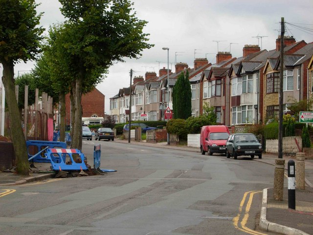
Drapers Field Images

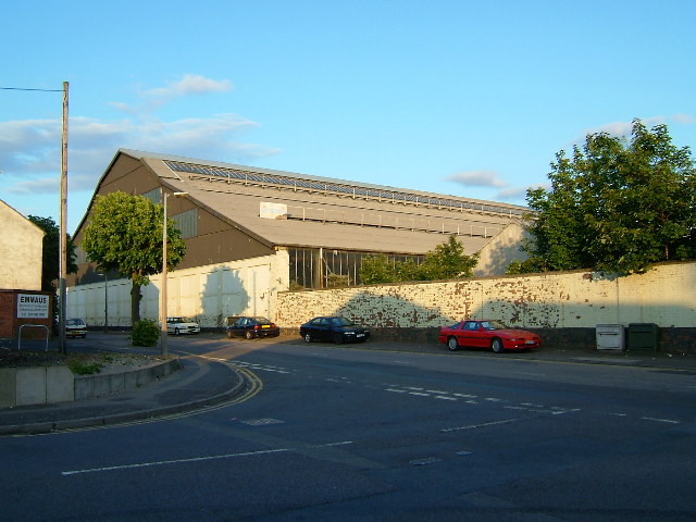
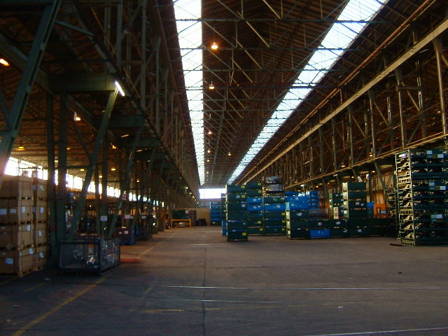
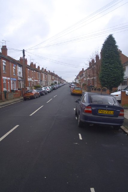
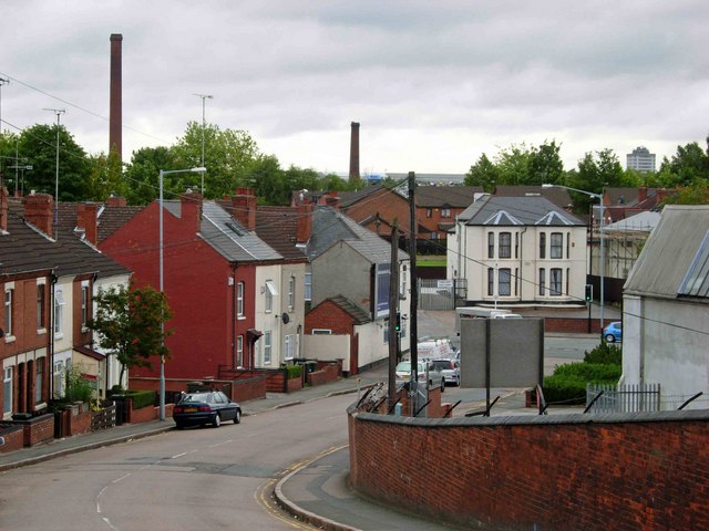
Images are sourced within 2km of 52.414439/-1.511841 or Grid Reference SP3379. Thanks to Geograph Open Source API. All images are credited.

14 & 15 Spon Street, Coventry Many of the timber-framed buildings on Spon Street were relocated from other streets of old Coventry, where they had got in the way of redevelopment. But this one stands on its original site, like the Old Windmill a little further down the street <a href="https://www.geograph.org.uk/photo/7690209">SP3279 : The Old Windmill, Spon Street, Coventry</a>. It is a Grade II listed building, dated to the 15th or 16th century by the listing at the Historic England site <span class="nowrap"><a title="https://historicengland.org.uk/listing/the-list/list-entry/1076602?section=official-list-entry" rel="nofollow ugc noopener" href="https://historicengland.org.uk/listing/the-list/list-entry/1076602?section=official-list-entry">Link</a><img style="margin-left:2px;" alt="External link" title="External link - shift click to open in new window" src="https://s1.geograph.org.uk/img/external.png" width="10" height="10"/></span> . In the 19th century it was a pub called the Recruiting Sergeant, according to a sign on the building. At present it appears to be disused; plaster is peeling off, revealing the laths underneath.

Coventry is a city of surreal juxtapositions. In the background, its white mosaic tiles gleaming, stands the uncompromisingly modernist Mercia House, 1962-67 by Arthur Ling and the city architect's department; see 'Coventry, the making of a modern city 1939-73', by Jeremy & Caroline Gould, p40, at the Historic England site <span class="nowrap"><a title="https://historicengland.org.uk/images-books/publications/coventry-making-of-modern-city-1939-73/" rel="nofollow ugc noopener" href="https://historicengland.org.uk/images-books/publications/coventry-making-of-modern-city-1939-73/">Link</a><img style="margin-left:2px;" alt="External link" title="External link - shift click to open in new window" src="https://s1.geograph.org.uk/img/external.png" width="10" height="10"/></span> .
14 & 15 Spon Street, Coventry
Many of the timber-framed buildings on Spon Street were relocated from other streets of old Coventry, where they had got in the way of redevelopment. But this one stands on its original site, like the Old Windmill a little further down the street SP3279 : The Old Windmill, Spon Street, Coventry. It is a Grade II listed building, dated to the 15th or 16th century by the listing at the Historic England site LinkExternal link . In the 19th century it was a pub called the Recruiting Sergeant, according to a sign on the building. At present it appears to be disused; plaster is peeling off, revealing the laths underneath. Coventry is a city of surreal juxtapositions. In the background, its white mosaic tiles gleaming, stands the uncompromisingly modernist Mercia House, 1962-67 by Arthur Ling and the city architect's department; see 'Coventry, the making of a modern city 1939-73', by Jeremy & Caroline Gould, p40, at the Historic England site LinkExternal link .
Mercia House: Arthur Ling's wedding cake, and a Czech memorial Mercia House was designed by Arthur Ling and the Coventry city architect's department and was built between 1962 and 1967. Its sixteen storeys are faced with white mosaic tiles and it stands on a three storey block of shops at the western end of the Coventry Precinct, giving it "an intimate feeling of enclosure", in the tender language that modernist architects used for vast structures of steel and concrete. The flats were intended for professional people without families; the shop units were occupied by the department store C & A, and now house the rather more downmarket New Look and T J Hughes. 

The quotation above is from Jeremy & Caroline Gould's 'Coventry, the making of a modern city 1939-73', available at the Historic England site <span class="nowrap"><a title="https://historicengland.org.uk/images-books/publications/coventry-making-of-modern-city-1939-73/" rel="nofollow ugc noopener" href="https://historicengland.org.uk/images-books/publications/coventry-making-of-modern-city-1939-73/">Link</a><img style="margin-left:2px;" alt="External link" title="External link - shift click to open in new window" src="https://s1.geograph.org.uk/img/external.png" width="10" height="10"/></span> ; see pages 35, 40 & 47. Ling was a Communist (see Wikipedia <span class="nowrap"><a title="https://en.m.wikipedia.org/wiki/Arthur_Ling" rel="nofollow ugc noopener" href="https://en.m.wikipedia.org/wiki/Arthur_Ling">Link</a><img style="margin-left:2px;" alt="External link" title="External link - shift click to open in new window" src="https://s1.geograph.org.uk/img/external.png" width="10" height="10"/></span> ) and had studied Soviet urban planning in Moscow before the Second World War; the Goulds suggest that he was influenced by Stalin's 1947 plan for Moscow, which proposed ringing the city centre with 'wedding cake' tower blocks. Coventry got austere modernism instead: Mercia House at the western end of the Precinct, Hillman House, also for professionals, to the north, later the brutalist Coventry Point by John Madin to the south, now demolished; see <a href="https://www.geograph.org.uk/photo/2929944">SP3378 : Coventry Point, Market Way, Coventry</a>.

The space in front of Mercia House is known as Lidice Place, after the Czech village of Lidice, that was destroyed by the German occupation forces in Czechoslovakia during the Second World War, to avenge the assassination of the Nazi military governor Reinhard Heydrich by soldiers of the free Czechoslovak forces in exile, who had trained near to Coventry, at Leamington Spa; see <a href="https://www.geograph.org.uk/photo/6824677">SP3379 : Memorial Tablet in Lidice Place</a> and <a href="https://www.geograph.org.uk/photo/4979607">SP3379 : Commemorating Lidice, Corporation Street, Coventry</a>.
Mercia House: Arthur Ling's wedding cake, and a Czech memorial
Mercia House was designed by Arthur Ling and the Coventry city architect's department and was built between 1962 and 1967. Its sixteen storeys are faced with white mosaic tiles and it stands on a three storey block of shops at the western end of the Coventry Precinct, giving it "an intimate feeling of enclosure", in the tender language that modernist architects used for vast structures of steel and concrete. The flats were intended for professional people without families; the shop units were occupied by the department store C & A, and now house the rather more downmarket New Look and T J Hughes. The quotation above is from Jeremy & Caroline Gould's 'Coventry, the making of a modern city 1939-73', available at the Historic England site LinkExternal link ; see pages 35, 40 & 47. Ling was a Communist (see Wikipedia LinkExternal link ) and had studied Soviet urban planning in Moscow before the Second World War; the Goulds suggest that he was influenced by Stalin's 1947 plan for Moscow, which proposed ringing the city centre with 'wedding cake' tower blocks. Coventry got austere modernism instead: Mercia House at the western end of the Precinct, Hillman House, also for professionals, to the north, later the brutalist Coventry Point by John Madin to the south, now demolished; see SP3378 : Coventry Point, Market Way, Coventry. The space in front of Mercia House is known as Lidice Place, after the Czech village of Lidice, that was destroyed by the German occupation forces in Czechoslovakia during the Second World War, to avenge the assassination of the Nazi military governor Reinhard Heydrich by soldiers of the free Czechoslovak forces in exile, who had trained near to Coventry, at Leamington Spa; see SP3379 : Memorial Tablet in Lidice Place and SP3379 : Commemorating Lidice, Corporation Street, Coventry.
Red Lane Ordnance Works An enormous building. Amongst other things, First World War naval guns were made here.
Red Lane Ordnance Works
An enormous building. Amongst other things, First World War naval guns were made here.
Inside the Ordnance Works Difficult to photograph. Trying to give an idea of the size of the building. Now used for storing Jaguar car parts
Inside the Ordnance Works
Difficult to photograph. Trying to give an idea of the size of the building. Now used for storing Jaguar car parts
Wyley Road, Radford A photo of Wyley Road in Radford, Coventry...a popular student street.
Wyley Road, Radford
A photo of Wyley Road in Radford, Coventry...a popular student street.
Cash's Lane, Coventry Looking from the bridge over the Coventry Canal towards Foleshill Road.  The chimneys belonged to the defunct Webster's brick works which is scheduled for redevelopment.
Cash's Lane, Coventry
Looking from the bridge over the Coventry Canal towards Foleshill Road. The chimneys belonged to the defunct Webster's brick works which is scheduled for redevelopment.
Kingfield Road, Coventry Taken from the junction with Marion Road.  The land on the left hand side is being redeveloped for housing and has been given the twee name 'Swallowcroft' by the builder.
Kingfield Road, Coventry
Taken from the junction with Marion Road. The land on the left hand side is being redeveloped for housing and has been given the twee name 'Swallowcroft' by the builder.
Cash's Houses, Coventry An early attempt to provide social housing for his employees, Victorian entrepreneur Cash built his factory on the top of the houses: The employees thus lived underneath their communal workspace.  This unique block still survives, as listed  buildings.  It is adjacent to the canal - near Cash's Bridge.  I am indebted to John Brightley for this information.
Cash's Houses, Coventry
An early attempt to provide social housing for his employees, Victorian entrepreneur Cash built his factory on the top of the houses: The employees thus lived underneath their communal workspace. This unique block still survives, as listed buildings. It is adjacent to the canal - near Cash's Bridge. I am indebted to John Brightley for this information.
St Francis of Assisi Church, Links Road, Radford, Coventry
Jubilee Crescent, Radford, Coventry Looking east across this popular shopping area.  The building to the extreme right across the green is the Jubilee Crescent branch of Coventry City Library; just visible under the trees in the centre-right of the picture is the red and white of the Kwik Save supermarket, now awaiting a new lease of life.
Jubilee Crescent, Radford, Coventry
Looking east across this popular shopping area. The building to the extreme right across the green is the Jubilee Crescent branch of Coventry City Library; just visible under the trees in the centre-right of the picture is the red and white of the Kwik Save supermarket, now awaiting a new lease of life.
Jubilee Health Centre and Tesco Metro, Jubilee Crescent, Radford, Coventry The health centre is a recent addition, but Tesco is a longtime resident of Jubilee Crescent.
Jubilee Health Centre and Tesco Metro, Jubilee Crescent, Radford, Coventry
The health centre is a recent addition, but Tesco is a longtime resident of Jubilee Crescent.
Catesby Road, Radford, Coventry Looking north from Jubilee Crescent.
Catesby Road, Radford, Coventry
Looking north from Jubilee Crescent.
North-East Side, Jubilee Crescent, Radford, Coventry
South-East Side, Jubilee Crescent, Radford, Coventry
St Nicholas' Church, Radford
Looking down Beake Avenue from Radford Common
Steps, Radford Common Three shallow steps leading from Engleton Road to Radford Common.
Steps, Radford Common
Three shallow steps leading from Engleton Road to Radford Common.
Radford Common, Radford Road Looking across the new play area on Radford Common to Radford Road (B4098).
Radford Common, Radford Road
Looking across the new play area on Radford Common to Radford Road (B4098).
Show me another place!

Drapers Field is located at Grid Ref: SP3379 (Lat: 52.414439, Lng: -1.511841)

Unitary Authority: Coventry

Police Authority: West Midlands

What 3 Words

///counts.votes.wiring. Near Coventry, West Midlands

Related Wikis

Radford, Coventry

Radford is a suburb and electoral ward of Coventry, located approximately 1.5 miles north of Coventry city centre. It is covered by the Coventry North...
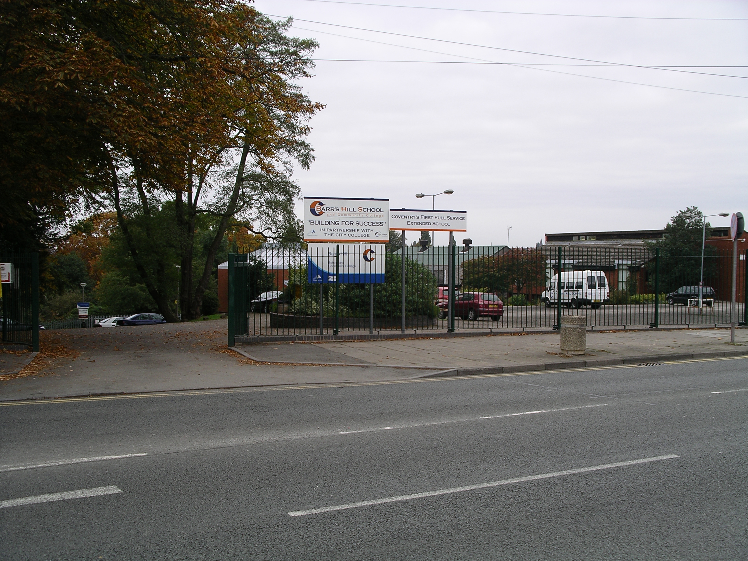
Barr's Hill School

Barr's Hill School is a mixed secondary school and sixth form located in Radford, Coventry, England. == Location == Barr's Hill is situated on a spacious...

Coventry and Warwickshire Hospital

The Coventry and Warwickshire Hospital was a former hospital in Coventry, England, on Stoney Stanton Road on the northern edge of the city centre. The...
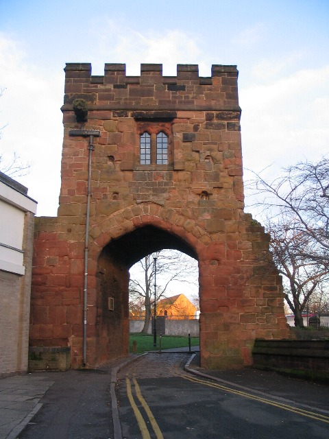
Cook Street Gate

Cook Street Gate is a medieval gate in Coventry, England. It was probably built in the second half of the 14th century as part of the defensive circuit...

Nearby Amenities

Located within 500m of 52.414439,-1.511841
Motorway Junction
Ref: 9
Lat/Long: 52.4123072/-1.5120228
Motorway Junction
Ref: 2
Lat/Long: 52.4122222/-1.5074928
Traffic Signals
Traffic Signals: signal
Lat/Long: 52.4130554/-1.5095577
Crossing
Lat/Long: 52.4120693/-1.5060638
Historic Highway: traffic_signals
Note: Removed September 2016
Source: Warwicks CC Aerial Imagery 2013
Lat/Long: 52.4118486/-1.515036
Crossing
Crossing: traffic_signals
Source: Warwicks CC Aerial Imagery 2013
Tactile Paving: yes
Lat/Long: 52.4122785/-1.5150544
Traffic Signals
Lat/Long: 52.4145699/-1.5147642
Crossing
Crossing: unmarked
Crossing Island: no
Kerb: flush
Tactile Paving: yes
Lat/Long: 52.4126254/-1.5122743
Odbl: clean
Lat/Long: 52.4158671/-1.5051429
Odbl: clean
Lat/Long: 52.4159162/-1.505365
Mini Roundabout
Direction: clockwise
Lat/Long: 52.4149619/-1.5065888
Crossing
Crossing: unmarked
Crossing Markings: no
Tactile Paving: no
Lat/Long: 52.4104643/-1.5109269
Barrier: bollard
Lat/Long: 52.4140774/-1.5107718
Barrier: bollard
Lat/Long: 52.4129945/-1.5124917
James Brindley
Artwork Type: statue
Note: approx
Tourism: artwork
Lat/Long: 52.4133476/-1.5116536
Source: Warwicks CC Aerial Imagery 2013
Traffic Calming: bump
Lat/Long: 52.4151143/-1.5109446
Source: Warwicks CC Aerial Imagery 2013
Traffic Calming: bump
Lat/Long: 52.4156841/-1.5109932
Post Box
Brand: Royal Mail
Brand Wikidata: Q638098
Brand Wikipedia: en:Royal Mail
Collection Times: Mo-Fr 16:00; Sa 09:15
Drive Through: no
Note: The Saturday collection time was physically obscured. My best guess from my photo is 9:15.
Operator: Royal Mail
Operator Wikidata: Q638098
Post Box Type: pillar
Ref: CV1 7
Royal Cypher: EIIR
Royal Cypher Wikidata: Q33102113
Source: survey
Lat/Long: 52.4128596/-1.5124269
Parking
Access: yes
Fee: yes
Parking: layby
Wheelchair: yes
Lat/Long: 52.4119166/-1.511624
Future Monument
Artist Name: Jochen Gerz
Tourism: artwork
Lat/Long: 52.4106186/-1.5082819
Canal Lock Gates
Tourism: artwork
Lat/Long: 52.4131802/-1.510079
Waterway: turning_point
Lat/Long: 52.4134909/-1.511483
Water Point
Waterway: water_point
Lat/Long: 52.4149433/-1.5101959
Created By: xybot
Note: approx
Waterway: water_point
Lat/Long: 52.4152776/-1.5099959
Mini Roundabout
Direction: clockwise
Lat/Long: 52.4146042/-1.5101987
Crossing
Crossing: traffic_signals
Lat/Long: 52.4143962/-1.5096752
Crossing
Crossing: traffic_signals
Lat/Long: 52.4145021/-1.5095299
Traffic Signals
Traffic Signals: signal
Lat/Long: 52.413064/-1.5097371
Toilets
Changing Table: no
Check Date: 2022-10-16
Fee: no
Unisex: yes
Wheelchair: limited
Lat/Long: 52.4139732/-1.5112732
Toilets
Access: private
Lat/Long: 52.4139531/-1.5112377
Crossing
Lat/Long: 52.412281/-1.5131568
Telephone
Booth: KX100
Covered: booth
Lat/Long: 52.4126851/-1.5117322
Crossing
Crossing: traffic_signals
Crossing Ref: toucan
Lat/Long: 52.4119215/-1.5143021
Crossing
Bicycle: yes
Crossing: traffic_signals
Crossing Ref: toucan
Foot: yes
Tactile Paving: yes
Lat/Long: 52.411664/-1.5143706
Crossing
Crossing: traffic_signals
Tactile Paving: yes
Lat/Long: 52.4121889/-1.5151757
Tourism: artwork
Lat/Long: 52.4117535/-1.5134051
Crossing
Crossing: marked
Crossing Ref: zebra
Tactile Paving: yes
Lat/Long: 52.4104919/-1.5107196
Barrier: bollard
Lat/Long: 52.4159595/-1.5055938
Barrier: bollard
Lat/Long: 52.4158245/-1.5049477
E2
Local Ref: E2
Naptan AtcoCode: 43000003101
Naptan Bearing: NE
Naptan BusStopType: MKD
Naptan CommonName: Well St
Naptan Indicator: Stop E2
Naptan Landmark: Tudor Rose
Naptan NaptanCode: nwmadadp
Naptan PlusbusZoneRef: BHAMNWS
Naptan Status: DEL
Naptan StopType: BCT
Naptan Street: CORPORATION ST
Naptan Verified: no
Note: removed between initial NaPTAN import 2009 and WMCA refresh 2017. Any errors just re-instate bus_stop tag
Source: WMCA
Lat/Long: 52.41042/-1.5114796
Bus Stop
BS3
Bus: yes
Local Ref: BS3
Location: Corporation St Well St
Naptan AtcoCode: 43000003102
Naptan Bearing: NE
Naptan BusStopType: MKD
Naptan CommonName: Well St
Naptan Indicator: Stop BS3
Naptan Landmark: Well Street
Naptan NaptanCode: nwmadadt
Naptan PlusbusZoneRef: BHAMNWS
Naptan Status: ACT
Naptan StopType: BCT
Naptan Street: CORPORATION ST
Naptan Verified: no
Note: Stop EA and EB were wrong way round. This stop moved up Burges road as part of 2011 developments for Olympics 2012
Public Transport: platform
Route Ref: 5;6;6A;7;10;18;18A;19;23;23A;42;47;82;85;87;585;585A;585B;735
Shelter: yes
Source: WMCA
Lat/Long: 52.4104007/-1.5116447
Bus Stop
UL4
NaPTANAreaCode: 43000004101
Bus: yes
Local Ref: UL4
Naptan AtcoCode: 43000004101
Naptan Bearing: SE
Naptan BusStopType: MKD
Naptan CommonName: Belgrade Theatre
Naptan Indicator: Stop UL4
Naptan Landmark: Coventry Telegraph
Naptan NaptanCode: nwmadaga
Naptan PlusbusZoneRef: BHAMNWS
Naptan Status: ACT
Naptan StopType: BCT
Naptan Street: UPPER WELL ST
Naptan Towards: Fenside, Willenhall
Naptan Verified: no
Public Transport: platform
Route Ref: 5;7;13;13A;16;16A
Shelter: yes
Shelter Ref: 0004101
Source: WMCA
Wheelchair: yes
Lat/Long: 52.41032/-1.5136744
Bus Stop
UL5
Bus: yes
Local Ref: UL5
Naptan AtcoCode: 43000004102
Naptan Bearing: SE
Naptan BusStopType: MKD
Naptan CommonName: Belgrade Theatre
Naptan Indicator: Stop UL5
Naptan Landmark: Coventry Telegraph
Naptan NaptanCode: nwmadagd
Naptan PlusbusZoneRef: BHAMNWS
Naptan Status: ACT
Naptan StopType: BCT
Naptan Street: UPPER WELL ST
Naptan Towards: Stoke Aldermoor
Naptan Verified: no
Public Transport: platform
Route Ref: 23;23A;42;82;735;X1
Source: WMCA
Wheelchair: yes
Lat/Long: 52.410408/-1.5137899
Bus Stop
UL3
NaPTANAreaCode: 43000004104
Bus: yes
Local Ref: UL3
Naptan AtcoCode: 43000004104
Naptan Bearing: NW
Naptan BusStopType: MKD
Naptan CommonName: Belgrade Theatre
Naptan Indicator: Stop UL3
Naptan Landmark: Bond Street
Naptan NaptanCode: nwmadagm
Naptan Status: ACT
Naptan StopType: BCT
Naptan Street: UPPER WELL ST
Naptan Towards: Coundon, Allesley
Naptan Verified: no
Public Transport: platform
Route Ref: 5;7;23;23A;42;82;X1
Shelter: yes
Shelter Ref: 0004104
Source: WMCA
Wheelchair: yes
Lat/Long: 52.4104077/-1.5139779
Bus Stop
Upper Well St / Belgrade Theatre
NaPTANAreaCode: 43000004105
Bus: yes
Local Ref: UL2
Naptan AtcoCode: 43000004105
Naptan Bearing: NW
Naptan BusStopType: MKD
Naptan CommonName: Belgrade Theatre
Naptan Indicator: Stop UL2
Naptan Landmark: Bond Street
Naptan NaptanCode: nwmadagp
Naptan Status: ACT
Naptan StopType: BCT
Naptan Street: UPPER WELL ST
Naptan Towards: Allesley Park
Naptan Verified: no
Note: suspended bus stop
Public Transport: platform
Shelter: yes
Shelter Ref: 0004105
Source: WMCA
Wheelchair: yes
Lat/Long: 52.410352/-1.513904
Bus Stop
UL1
NaPTANAreaCode: 43000004106
Bus: yes
Local Ref: UL1
Naptan AtcoCode: 43000004106
Naptan Bearing: NW
Naptan BusStopType: MKD
Naptan CommonName: Belgrade Theatre
Naptan Indicator: Stop UL1
Naptan Landmark: Thomson Travel
Naptan NaptanCode: nwmadagt
Naptan PlusbusZoneRef: BHAMNWS
Naptan Status: ACT
Naptan StopType: BCT
Naptan Street: UPPER WELL ST
Naptan Towards: Radford
Naptan Verified: no
Public Transport: platform
Route Ref: 13;13A;16;16A;735
Shelter: yes
Shelter Ref: 0004106
Source: WMCA
Wheelchair: yes
Lat/Long: 52.4102816/-1.5138154
Bus Stop
BS2
NaPTANAreaCode: 43000004201
Bench: yes
Bin: no
Bus: yes
Lit: yes
Local Ref: BS2
Mapillary: 5532683223472356
Naptan AtcoCode: 43000004201
Naptan Bearing: SE
Naptan BusStopType: MKD
Naptan CommonName: Corporation St
Naptan Indicator: Stop BS2
Naptan NaptanCode: nwmdptwg
Naptan PlusbusZoneRef: BHAMNWS
Naptan Status: ACT
Naptan StopType: BCT
Naptan Street: BISHOP ST
Naptan Towards: City Centre
Naptan Verified: no
Public Transport: platform
Route Ref: 4;20;20A;20E;48;55;55A;56;57;X48
Shelter: yes
Shelter Ref: 711694
Source: WMCA
Survey Date: 2021-03-29
Tactile Paving: no
Lat/Long: 52.4108957/-1.5109956
Bus Stop
BS1
NaPTANAreaCode: 43000004203
Bench: yes
Bin: no
Bus: yes
Lit: yes
Local Ref: BS1
Naptan AtcoCode: 43000004203
Naptan Bearing: NW
Naptan BusStopType: MKD
Naptan CommonName: Corporation St
Naptan Indicator: Stop BS1
Naptan NaptanCode: nwmdptwm
Naptan PlusbusZoneRef: BHAMNWS
Naptan Status: ACT
Naptan StopType: BCT
Naptan Street: BISHOP ST
Naptan Towards: Foleshill, Holbrooks
Naptan Verified: no
Public Transport: platform
Route Ref: 4;20;20A;20E;48;55;56;57;X48
Shelter: yes
Shelter Ref: 711693
Source: WMCA
Tactile Paving: yes
Lat/Long: 52.4114284/-1.511427
Bus Stop
White St / Bus Garage
Bus: yes
Naptan AtcoCode: 43000005401
Naptan Bearing: NE
Naptan BusStopType: MKD
Naptan CommonName: Bus Garage
Naptan Indicator: opp
Naptan NaptanCode: nwmptjmt
Naptan PlusbusZoneRef: BHAMNWS
Naptan Status: ACT
Naptan StopType: BCT
Naptan Street: WHITE ST
Naptan Towards: Binley
Naptan Verified: no
Public Transport: platform
Route Ref: 16A
Source: WMCA
Lat/Long: 52.4121281/-1.5055708
Bus Stop
Stoney Stanton Rd / Swanswell St
NaPTANAreaCode: 43000007401
Bench: yes
Bin: yes
Bus: yes
Lit: yes
Naptan AtcoCode: 43000007401
Naptan Bearing: NE
Naptan BusStopType: MKD
Naptan CommonName: Swanswell St
Naptan Indicator: adj
Naptan NaptanCode: nwmptjpm
Naptan PlusbusZoneRef: BHAMNWS
Naptan Status: ACT
Naptan StopType: BCT
Naptan Street: STONEY STANTON RD
Naptan Towards: Bell Green
Naptan Verified: no
Public Transport: platform
Route Ref: 21;30
Shelter: yes
Shelter Ref: 711627
Source: WMCA
Tactile Paving: yes
Wheelchair: yes
Lat/Long: 52.4139666/-1.5054668
Bus Stop
Stoney Stanton Rd / Swanswell St
NaPTANAreaCode: 43000007402
Bench: yes
Bin: no
Bus: yes
Lit: yes
Naptan AtcoCode: 43000007402
Naptan Bearing: NE
Naptan BusStopType: MKD
Naptan CommonName: Swanswell St
Naptan Indicator: before
Naptan NaptanCode: nwmptjpt
Naptan PlusbusZoneRef: BHAMNWS
Naptan Status: ACT
Naptan StopType: BCT
Naptan Street: STONEY STANTON RD
Naptan Towards: Stoke Heath
Naptan Verified: no
Public Transport: platform
Route Ref: 6;6A
Shelter: yes
Shelter Ref: 711628
Source: WMCA
Tactile Paving: yes
Wheelchair: yes
Lat/Long: 52.4138512/-1.5056284
Bus Stop
Radford Rd / Nauls Mill House
Bench: yes
Bin: yes
Bus: yes
Lit: yes
Naptan AtcoCode: 43000010001
Naptan Bearing: N
Naptan BusStopType: MKD
Naptan CommonName: Nauls Mill House
Naptan Indicator: adj
Naptan NaptanCode: nwmptjwg
Naptan PlusbusZoneRef: BHAMNWS
Naptan Status: ACT
Naptan StopType: BCT
Naptan Street: RADFORD RD
Naptan Towards: Holbrooks
Naptan Verified: no
Public Transport: platform
Route Ref: 13;13A;43W
Shelter: yes
Source: WMCA
Tactile Paving: no
Lat/Long: 52.4131139/-1.51528
Bus Stop
Radford Rd / Nauls Mill House
NaPTANAreaCode: 43000010002
Bench: yes
Bin: yes
Bus: yes
Lit: yes
Naptan AtcoCode: 43000010002
Naptan Bearing: N
Naptan BusStopType: MKD
Naptan CommonName: Nauls Mill House
Naptan Indicator: adj
Naptan NaptanCode: nwmptjwj
Naptan PlusbusZoneRef: BHAMNWS
Naptan Status: ACT
Naptan StopType: BCT
Naptan Street: RADFORD RD
Naptan Towards: Keresley
Naptan Verified: no
Public Transport: platform
Route Ref: 16;16A;735
Shelter: yes
Shelter Ref: 711644
Source: WMCA
Tactile Paving: no
Lat/Long: 52.4130377/-1.5152876
Bus Stop
Radford Rd / Nauls Mill House
Bench: no
Bin: yes
Bus: yes
Naptan AtcoCode: 43000010003
Naptan Bearing: S
Naptan BusStopType: MKD
Naptan CommonName: Nauls Mill House
Naptan Indicator: opp
Naptan NaptanCode: nwmptjwm
Naptan PlusbusZoneRef: BHAMNWS
Naptan Status: ACT
Naptan StopType: BCT
Naptan Street: RADFORD RD
Naptan Towards: City Centre
Naptan Verified: no
Public Transport: platform
Route Ref: 13;13A;16;16A;735
Shelter: no
Source: WMCA
Lat/Long: 52.4137759/-1.5147555
Bus Stop
Sandy Lane / Ellys Rd
NaPTANAreaCode: 43000010101
Bench: yes
Bin: yes
Bus: yes
Lit: yes
Naptan AtcoCode: 43000010101
Naptan Bearing: S
Naptan BusStopType: MKD
Naptan CommonName: Ellys Rd
Naptan Indicator: opp
Naptan NaptanCode: nwmptjwt
Naptan PlusbusZoneRef: BHAMNWS
Naptan Status: ACT
Naptan StopType: BCT
Naptan Street: SANDY LANE
Naptan Towards: City Centre
Naptan Verified: no
Public Transport: platform
Route Ref: 13;13A
Shelter: yes
Shelter Ref: 0010101
Source: WMCA
Tactile Paving: yes
Lat/Long: 52.4172749/-1.5133118
Bus Stop
Sandy Lane / Ellys Rd
Bench: no
Bin: no
Bus: yes
Lit: yes
Naptan AtcoCode: 43000010102
Naptan Bearing: N
Naptan BusStopType: MKD
Naptan CommonName: Ellys Rd
Naptan Indicator: adj
Naptan NaptanCode: nwmptmad
Naptan PlusbusZoneRef: BHAMNWS
Naptan Status: ACT
Naptan StopType: BCT
Naptan Street: SANDY LANE
Naptan Towards: Holbrooks
Naptan Verified: no
Public Transport: platform
Route Ref: 13;13A
Shelter: no
Source: WMCA
Tactile Paving: yes
Lat/Long: 52.4167531/-1.5135411
Bus Stop
Radford Rd / Barrs Hill School
Bench: no
Bin: no
Bus: yes
Lit: no
Naptan AtcoCode: 43000010501
Naptan Bearing: S
Naptan BusStopType: MKD
Naptan CommonName: Barrs Hill School
Naptan Indicator: opp
Naptan NaptanCode: nwmptmaw
Naptan PlusbusZoneRef: BHAMNWS
Naptan Status: ACT
Naptan StopType: BCT
Naptan Street: RADFORD RD
Naptan Towards: City Centre
Naptan Verified: no
Public Transport: platform
Route Ref: 16;16A;735
Shelter: no
Source: WMCA
Tactile Paving: no
Lat/Long: 52.4156372/-1.5153744
Bus Stop
Radford Rd / Barrs Hill School
NaPTANAreaCode: 43000010502
Bench: yes
Bin: no
Bus: yes
Lit: yes
Naptan AtcoCode: 43000010502
Naptan Bearing: NW
Naptan BusStopType: MKD
Naptan CommonName: Barrs Hill School
Naptan Indicator: adj
Naptan NaptanCode: nwmptmda
Naptan PlusbusZoneRef: BHAMNWS
Naptan Status: ACT
Naptan StopType: BCT
Naptan Street: RADFORD RD
Naptan Towards: Keresley
Naptan Verified: no
Public Transport: platform
Route Ref: 16;16A;43W;735
Shelter: yes
Shelter Ref: 711645
Source: WMCA
Tactile Paving: no
Lat/Long: 52.4163387/-1.5162327
Bus Stop
Foleshill Rd / Leicester Row
NaPTANAreaCode: 43000020101
Bus: yes
Naptan AtcoCode: 43000020101
Naptan Bearing: N
Naptan BusStopType: MKD
Naptan CommonName: Leicester Row
Naptan Indicator: adj
Naptan NaptanCode: nwmptwtw
Naptan PlusbusZoneRef: BHAMNWS
Naptan Status: ACT
Naptan StopType: BCT
Naptan Street: FOLESHILL RD
Naptan Towards: Foleshill, Holbrooks
Naptan Verified: no
Public Transport: platform
Route Ref: 4;20;20A;20E;48;55;55A;56;57;X48
Shelter: yes
Shelter Ref: 711618
Source: WMCA
Lat/Long: 52.4150095/-1.5098436
Bus Stop
Foleshill Rd / Leicester Row
NaPTANAreaCode: 43000020102
Bench: yes
Bin: yes
Bus: yes
Image: https://storage13.openstreetcam.org/files/photo/2021/5/11/lth/3581097_53013_609ac1e285fa5.jpg
Naptan AtcoCode: 43000020102
Naptan Bearing: S
Naptan BusStopType: MKD
Naptan CommonName: Leicester Row
Naptan Indicator: opp
Naptan NaptanCode: nwmpwada
Naptan PlusbusZoneRef: BHAMNWS
Naptan Status: ACT
Naptan StopType: BCT
Naptan Street: FOLESHILL RD
Naptan Towards: City Centre
Naptan Verified: no
Public Transport: platform
Route Ref: 4;20;20A;20E;48;55;55A;56;57;X48
Shelter: yes
Shelter Ref: 711682
Source: WMCA
Survey Date: 2021-05-11
Lat/Long: 52.4149695/-1.5094413
Bus Stop
Foleshill Rd / City Engineers
NaPTANAreaCode: 43000020201
Bench: yes
Bin: no
Bus: yes
Lit: yes
Naptan AtcoCode: 43000020201
Naptan Bearing: SW
Naptan BusStopType: MKD
Naptan CommonName: City Engineers
Naptan Indicator: opp
Naptan NaptanCode: nwmpwadg
Naptan PlusbusZoneRef: BHAMNWS
Naptan Status: ACT
Naptan StopType: BCT
Naptan Street: FOLESHILL RD
Naptan Towards: City Centre
Naptan Verified: no
Public Transport: platform
Route Ref: 4;20;20A;20E;48;55;55A;56;57;X48
Shelter: yes
Shelter Ref: 711681
Source: WMCA
Tactile Paving: yes
Lat/Long: 52.4163412/-1.5090242
Bus Stop
Foleshill Rd / City Engineers
NaPTANAreaCode: 43000020202
Bench: no
Bin: no
Bus: yes
Lit: yes
Naptan AtcoCode: 43000020202
Naptan Bearing: NE
Naptan BusStopType: MKD
Naptan CommonName: City Engineers
Naptan Indicator: adj
Naptan NaptanCode: nwmpwadj
Naptan PlusbusZoneRef: BHAMNWS
Naptan Status: ACT
Naptan StopType: BCT
Naptan Street: FOLESHILL RD
Naptan Towards: Foleshill, Holbrooks
Naptan Verified: no
Public Transport: platform
Route Ref: 4;20;20A;20E;48;55;56;57;X48
Shelter: yes
Shelter Ref: 711678
Source: WMCA
Tactile Paving: yes
Lat/Long: 52.4165392/-1.5091288
Springfield Rd / Harnall Lane West
NaPTANAreaCode: 43000020401
Naptan AtcoCode: 43000020401
Naptan Bearing: S
Naptan BusStopType: MKD
Naptan CommonName: Harnall Lane West
Naptan Indicator: before
Naptan NaptanCode: nwmpwadt
Naptan PlusbusZoneRef: BHAMNWS
Naptan Status: DEL
Naptan StopType: BCT
Naptan Street: SPRINGFIELD RD
Naptan Towards: City Centre
Naptan Verified: no
Note: removed between initial NaPTAN import 2009 and WMCA refresh 2017. Any errors just re-instate bus_stop tag
Shelter: yes
Shelter Ref: 711638
Source: WMCA
Lat/Long: 52.4164058/-1.5063286
Springfield Rd / Harnall Lane West
NaPTANAreaCode: 43000020402
Naptan AtcoCode: 43000020402
Naptan Bearing: N
Naptan BusStopType: MKD
Naptan CommonName: Harnall Lane West
Naptan Indicator: after
Naptan NaptanCode: nwmpwadw
Naptan PlusbusZoneRef: BHAMNWS
Naptan Status: DEL
Naptan StopType: BCT
Naptan Street: SPRINGFIELD RD
Naptan Towards: Holbrooks
Naptan Verified: no
Note: removed between initial NaPTAN import 2009 and WMCA refresh 2017. Any errors just re-instate bus_stop tag
Shelter: yes
Shelter Ref: 711637
Source: WMCA
Lat/Long: 52.4165294/-1.5066062
Bus Stop
St Nicholas St / Sandy Lane
Bench: no
Bin: yes
Bus: yes
Lit: yes
Naptan AtcoCode: 43000020801
Naptan Bearing: NW
Naptan BusStopType: MKD
Naptan CommonName: Sandy Lane
Naptan Indicator: opp
Naptan Landmark: Merrick Lodge Hotel
Naptan NaptanCode: nwmpwaja
Naptan PlusbusZoneRef: BHAMNWS
Naptan Status: ACT
Naptan StopType: BCT
Naptan Street: ST NICHOLAS ST
Naptan Towards: Holbrooks
Naptan Verified: no
Public Transport: platform
Route Ref: 13;13A
Shelter: no
Source: WMCA
Tactile Paving: yes
Lat/Long: 52.4157113/-1.514407
Bus Stop
St Nicholas St / Sandy Lane
Bench: no
Bin: no
Bus: yes
Lit: yes
Naptan AtcoCode: 43000020802
Naptan Bearing: SE
Naptan BusStopType: MKD
Naptan CommonName: Sandy Lane
Naptan Indicator: adj
Naptan Landmark: Merrick Lodge Hotel
Naptan NaptanCode: nwmpwajd
Naptan PlusbusZoneRef: BHAMNWS
Naptan Status: ACT
Naptan StopType: BCT
Naptan Street: ST NICHOLAS ST
Naptan Towards: City Centre
Naptan Verified: no
Public Transport: platform
Route Ref: 13;13A
Shelter: no
Source: WMCA
Tactile Paving: yes
Lat/Long: 52.4154199/-1.5141926
Bus Stop
HS1
NaPTANAreaCode: 43000001101
Bench: yes
Bin: no
Bus: yes
Lit: yes
Local Ref: HS1
Naptan AtcoCode: 43000001101
Naptan Bearing: E
Naptan BusStopType: MKD
Naptan CommonName: Transport Museum
Naptan Indicator: Stop HS1
Naptan NaptanCode: nwmadada
Naptan PlusbusZoneRef: BHAMNWS
Naptan Status: ACT
Naptan StopType: BCT
Naptan Street: HALES ST
Naptan Towards: Binley
Naptan Verified: no
Public Transport: platform
Route Ref: 13;13A;16A;18;86;X18
Shelter: yes
Shelter Ref: 0001101
Source: WMCA
Tactile Paving: no
Wheelchair: yes
Lat/Long: 52.4104507/-1.509166
Traffic Signals
Traffic Signals: signal
Lat/Long: 52.4128669/-1.5087318
Traffic Signals
Traffic Signals: signal
Lat/Long: 52.4133239/-1.509221
Traffic Signals
Traffic Signals: signal
Lat/Long: 52.4134339/-1.5091535
Traffic Signals
Traffic Signals: signal
Lat/Long: 52.4131031/-1.5098456
Historic Highway: traffic_signals
Note: Removed September 2016
Source: Warwicks CC Aerial Imagery 2013
Lat/Long: 52.411931/-1.514976
Note: Removed September 2016
Historic Highway: traffic_signals
Lat/Long: 52.4113155/-1.5148865
Bus Stop
HS2
NaPTANAreaCode: 43000001102
Bench: yes
Bin: yes
Bus: yes
Lit: yes
Local Ref: HS2
Naptan AtcoCode: 43000001102
Naptan Bearing: E
Naptan BusStopType: MKD
Naptan CommonName: Transport Museum
Naptan Indicator: Stop HS2
Naptan NaptanCode: nwmadadg
Naptan PlusbusZoneRef: BHAMNWS
Naptan Status: ACT
Naptan StopType: BCT
Naptan Street: HALES ST
Naptan Towards: Bell Green
Naptan Verified: no
Public Transport: platform
Route Ref: 16;16A;23;23A
Shelter: yes
Shelter Ref: 0001102
Source: WMCA
Tactile Paving: no
Wheelchair: yes
Lat/Long: 52.4105685/-1.509622
Restaurant
Cosmo
Brand: Cosmo
Brand Wikidata: Q5174239
Brand Wikipedia: en:Cosmo (restaurant)
Cuisine: international
Wheelchair: yes
Lat/Long: 52.4100298/-1.5125155
Meter Room Project Space & Studios
Designation: Contemporary Art Project Space and adjoining studios
Source: www.meter-room.org
Tourism: museum
Lat/Long: 52.410219/-1.5114131
Historic Highway: traffic_signals
Note: Removed September 2016
Lat/Long: 52.4114182/-1.5148383
Noexit: yes
Lat/Long: 52.4142366/-1.510742
Bar
The Tin Music & Arts
Addr Postcode: CV1 4LY
Description: Under car park with access from canal basin.
Layer: -1
Leisure: music_venue
Old Name: Taylor John's House
Website: https://thetinmusicandarts.org.uk/
Lat/Long: 52.4135723/-1.512314
Crossing
Lat/Long: 52.4126748/-1.5180237
Telephone
Booth: KXPlus
Covered: booth
Lat/Long: 52.4121406/-1.5056391
Leisure: playground
Lat/Long: 52.4140554/-1.5187505
Leisure: playground
Lat/Long: 52.4145658/-1.5186324
Note: Was the start of the 20mph zone sign until late 2015
Lat/Long: 52.4103398/-1.5137998
Note: 20mph zone sign (approx)
Lat/Long: 52.4109754/-1.5074336
Note: 20mph zone sign (approx)
Lat/Long: 52.411031/-1.5075303
Note: 20mph zone sign (approx)
Lat/Long: 52.4113339/-1.5126722
Note: 20mph zone sign (approx)
Lat/Long: 52.4114665/-1.511412
Restaurant
Bella Italia
Addr City: Coventry
Addr Housename: Belgrade Plaza
Addr Housenumber: 4
Addr Postcode: CV1 4BF
Addr Street: Upper Well Street
Brand: Bella Italia
Brand Wikidata: Q4883362
Brand Wikipedia: en:Bella Italia
Cuisine: italian
Fhrs Id: 240277
Source Addr: FHRS Open Data
Wheelchair: yes
Lat/Long: 52.4104407/-1.5144353
Restaurant
PizzaExpress
Addr City: Coventry
Addr Postcode: CV1 4BF
Addr Street: Upper Well Street
Brand: PizzaExpress
Brand Wikidata: Q662845
Brand Wikipedia: en:PizzaExpress
Cuisine: pizza
Fhrs Id: 240756
Source Addr: FHRS Open Data
Website: https://www.pizzaexpress.com/coventry-belgrade-plaza
Lat/Long: 52.4104563/-1.5151077
Barrier: bollard
Bicycle: yes
Foot: yes
Lat/Long: 52.4106525/-1.5152053
Entrance: yes
Lat/Long: 52.4107332/-1.5147763
Cafe
Esquires
Addr City: Coventry
Addr Housename: Museum Of British Road Transport
Addr Housenumber: 16
Addr Postcode: CV1 1JD
Addr Street: Hales Street
Cuisine: coffee_shop
Fhrs Id: 239284
Fixme Addr2: 16 Hales Street
Note: Postcode is CV1 1PN in FHRS data bubt CV1 1JD on website and facebook page.
Opening Hours: Mo-Fr 08:00-17:00; Sa,Su 09:00-17:00
Source Addr: FHRS Open Data
Lat/Long: 52.4106062/-1.5094576
Car Rental
Budget
Brand: Budget
Brand Wikidata: Q1001437
Brand Wikipedia: en:Budget Rent a Car
Official Name: Budget Rent a Car
Operator: Budget
Lat/Long: 52.411903/-1.5097288
Made In Coventry
Addr City: Coventry
Addr Housename: Ego HQ, Jesson House
Addr Postcode: CV1 1JN
Addr Street: Silver Street
Opening Hours: Mo-Fr 11:00-18:00; Sa 10:00-17:00; Su 11:00-16:00
Shop: jewelry
Website: www.madeincoventryshop.co.uk
Lat/Long: 52.4118028/-1.5097591
Source: Warwicks CC Aerial Imagery 2013
Traffic Calming: bump
Lat/Long: 52.4146526/-1.5114092
Fast Food
Sandy Fish Bar and Kebab House
Cuisine: fish_and_chips
Lat/Long: 52.4170008/-1.5136157
Crossing
Crossing: uncontrolled
Crossing Island: no
Tactile Paving: yes
Lat/Long: 52.4106138/-1.5109582
Bench
Lat/Long: 52.4106344/-1.5113673
Bench
Lat/Long: 52.4106895/-1.5113912
Bench
Lat/Long: 52.4107314/-1.5112993
Bench
Lat/Long: 52.4107505/-1.5113337
Bench
Lat/Long: 52.4107546/-1.5112575
Bench
Lat/Long: 52.4108002/-1.5112433
Bench
Backrest: no
Mapillary: 1123645734778782
Survey Date: 2017-03-09
Lat/Long: 52.4108289/-1.5111417
Bench
Backrest: no
Mapillary: 1123645734778782
Survey Date: 2017-03-09
Lat/Long: 52.4108576/-1.5111694
Waterway: pump_out
Lat/Long: 52.4140017/-1.5109336
Bishopsgate Green
Alt Name: Bishopgate Green
Is In: Coventry
Place: neighbourhood
Wikidata: Q4918087
Wikipedia: en:Bishopgate Green
Lat/Long: 52.4182286/-1.5082879
Restaurant
Polovia Restaurant
Lat/Long: 52.4163956/-1.506546
Cafe
Booths Cafe
Lat/Long: 52.4159541/-1.5065248
Daimler
Historic Railway: halt
Railway: site
Wikidata: Q5209436
Wikipedia: en:Daimler Halt
Lat/Long: 52.4181405/-1.5152313
Noexit: yes
Lat/Long: 52.4140061/-1.5108571
Water Point
Waterway: water_point
Lat/Long: 52.4147383/-1.5103314
Priory Maze 2000 plaque
Historic: memorial
Image: https://upload.wikimedia.org/wikipedia/commons/f/f0/Priory_Maze_2000_-_Plaque.JPG
Memorial: plaque
Lat/Long: 52.4118486/-1.5078
Entrance: yes
Lat/Long: 52.4105542/-1.5094536
Entrance: main
Lat/Long: 52.4106545/-1.5092957
Bench
Backrest: yes
Lat/Long: 52.410704/-1.5091488
Bench
Backrest: yes
Lat/Long: 52.4107173/-1.5091213
Bench
Backrest: yes
Lat/Long: 52.4107307/-1.5090922
Bench
Backrest: yes
Lat/Long: 52.4107421/-1.5090636
Bench
Backrest: yes
Lat/Long: 52.4107537/-1.5090333
Bench
Backrest: yes
Lat/Long: 52.4107643/-1.5089999
Bench
Backrest: yes
Lat/Long: 52.4107738/-1.5089682
Bench
Backrest: yes
Lat/Long: 52.4107826/-1.5089347
Bench
Backrest: yes
Lat/Long: 52.4107899/-1.5089048
Bench
Backrest: yes
Lat/Long: 52.4107969/-1.508871
Bench
Backrest: yes
Lat/Long: 52.4108024/-1.5088375
Bench
Backrest: yes
Lat/Long: 52.4108079/-1.5088027
Bench
Backrest: yes
Lat/Long: 52.4108124/-1.5087644
Bench
Backrest: yes
Lat/Long: 52.4108152/-1.5087314
Bench
Backrest: yes
Lat/Long: 52.4108176/-1.5086932
Bench
Backrest: yes
Lat/Long: 52.4108187/-1.5086612
Bench
Backrest: yes
Lat/Long: 52.4108195/-1.5086261
Barrier: bollard
Lat/Long: 52.4123133/-1.5085957
Crossing
Crossing: uncontrolled
Lat/Long: 52.4124512/-1.5094001
Entrance: main
Lat/Long: 52.4125054/-1.5092459
Entrance: yes
Lat/Long: 52.4125582/-1.5089732
Traffic Signals
Traffic Signals: signal
Lat/Long: 52.4127183/-1.5087282
Barrier: bollard
Bicycle: yes
Bollard: fixed
Lat/Long: 52.4127396/-1.5099576
Bench
Shelter: yes
Lat/Long: 52.4114961/-1.5134472
Extra Care
Shop: charity
Lat/Long: 52.4102418/-1.5114813
Heslyn's
Shop: hairdresser
Lat/Long: 52.410226/-1.5115517
Spa Beauty
Leisure: spa
Lat/Long: 52.4102137/-1.511653
American Nail Design
Shop: beauty
Lat/Long: 52.4104358/-1.5106077
Arina Market
Addr City: Coventry
Addr Housenumber: 8
Addr Postcode: CV1 1JD
Addr Street: Hales Street
Fhrs Id: 669311
Shop: convenience
Source Addr: FHRS Open Data
Lat/Long: 52.4106664/-1.5102387
Fast Food
Benny's
Lat/Long: 52.4106609/-1.5103162
Restaurant
Old Name: Café Rouge
Lat/Long: 52.410309/-1.5146482
Carhartt
Brand: Carhartt
Brand Wikidata: Q527877
Brand Wikipedia: en:Carhartt
Clothes: workwear
Shop: clothes
Lat/Long: 52.4102896/-1.5107284
Coventry Jewellery
Shop: jewelry
Lat/Long: 52.410422/-1.5106758
Restaurant
Frango's
Lat/Long: 52.4103136/-1.5127304
Godiva News
Shop: newsagent
Lat/Long: 52.4104566/-1.5104702
H&T Pawnbrokers
Brand: H&T Pawnbrokers
Brand Wikidata: Q105672451
Shop: pawnbroker
Lat/Long: 52.4106719/-1.5101612
Hannigans
Shop: clothes
Lat/Long: 52.4104445/-1.5105298
Kong
Shop: shoes
Lat/Long: 52.410409/-1.5107637
Past & Presents
Shop: gift
Lat/Long: 52.4107091/-1.5093047
Dentist
Spa Dental
Healthcare: dentist
Lat/Long: 52.4103454/-1.5125099
Turkish Barber Shop
Shop: hairdresser
Lat/Long: 52.4104687/-1.5104022
Bicycle Parking
Bicycle Parking: stands
Capacity: 34
Covered: no
Lat/Long: 52.4146597/-1.504674
Crossing
Button Operated: yes
Crossing: traffic_signals
Crossing Island: no
Kerb: lowered
Tactile Paving: yes
Traffic Signals Sound: yes
Traffic Signals Vibration: yes
Lat/Long: 52.4160448/-1.5158091
Crossing
Crossing: zebra
Crossing Island: yes
Lat/Long: 52.4100759/-1.5134432
Historic Natural: tree
Lat/Long: 52.4102605/-1.5141838
Former Widdrington Sidings
Addr City: Coventry
Addr Country: GB
Addr Street: Sandy Lane
Lat/Long: 52.4183306/-1.5142898
JD Gyms
Brand: JD Gyms
Brand Wikidata: Q112947108
Leisure: fitness_centre
Lat/Long: 52.410598/-1.5144838
Source: Warwicks CC Aerial Imagery 2013
Traffic Calming: bump
Lat/Long: 52.4186326/-1.5132541
Bus Stop
HS3
NaPTANAreaCode: 43001025501
Bench: yes
Bin: yes
Bus: yes
Local Ref: HS3
Naptan AtcoCode: 43001025501
Naptan Bearing: NE
Naptan BusStopType: MKD
Naptan CommonName: Old Fire Station
Naptan Indicator: Stop HS3
Naptan NaptanCode: nwmwajwm
Naptan PlusbusZoneRef: BHAMNWS
Naptan Status: ACT
Naptan StopType: BCT
Naptan Street: HALES ST
Naptan Verified: no
Public Transport: platform
Route Ref: 21
Shelter: yes
Shelter Ref: 1025501
Source: WMCA
Lat/Long: 52.410634/-1.5081145
Leisure: playground
Wheelchair: yes
Lat/Long: 52.4125906/-1.5060979
Bus Stop
Sandy Lane / Somerset Road
Bench: no
Bin: no
Bus: yes
Lit: yes
Naptan AtcoCode: 43001003001
Naptan Bearing: N
Naptan BusStopType: MKD
Naptan CommonName: Somerset Road
Naptan Indicator: opp
Naptan NaptanCode: nwmwgapt
Naptan Status: ACT
Naptan StopType: BCT
Naptan Street: SANDY LANE
Naptan Towards: Holbrooks
Public Transport: platform
Route Ref: 13;13A
Shelter: no
Source: WMCA
Tactile Paving: yes
Lat/Long: 52.4185403/-1.5138039
Bus Stop
BS4
NaPTANAreaCode: 43000001204
Bench: yes
Bin: no
Bus: yes
Naptan AtcoCode: 43000001204
Naptan Bearing: NW
Naptan BusStopType: MKD
Naptan CommonName: Cross Cheaping
Naptan Indicator: Stop BS4
Naptan NaptanCode: nwmdptjp
Naptan Status: ACT
Naptan StopType: BCT
Naptan Street: THE BURGES
Naptan Towards: Allesley Park, Tile Hill
Public Transport: platform
Route Ref: 5;6;6A;18;18A;19;23;23A
Shelter: yes
Shelter Ref: 0001204
Source: WMCA
Lat/Long: 52.4100666/-1.5108335
Ellys
Shop: convenience
Lat/Long: 52.4178196/-1.5131408
Atm
Lat/Long: 52.4177618/-1.5131813
Traffic Signals
Lat/Long: 52.4145555/-1.5045516
Post Box
Brand: Royal Mail
Brand Wikidata: Q638098
Brand Wikipedia: en:Royal Mail
Collection Times: Mo-Fr 09:00; Sa 07:00; Su off
Drive Through: no
Operator: Royal Mail
Operator Wikidata: Q638098
Post Box Type: pillar
Ref: CV1 14D
Royal Cypher: EIIR
Royal Cypher Wikidata: Q33102113
Source: survey
Lat/Long: 52.4147929/-1.509816
Parson's Nose (Historic)
Note: The original Parson's Nose fish and chip shop stood here
Tourism: viewpoint
Lat/Long: 52.4105669/-1.5110775
Tesco Express
Brand: Tesco Express
Brand Wikidata: Q98456772
Brand Wikipedia: en:Tesco
Contact Website: https://www.tesco.com/store-locator/coventry/unit-1-bishopsgate
Shop: convenience
Lat/Long: 52.4117668/-1.5113696
Bus Stop
BS7
Bus: yes
Local Ref: BS7
Location: Corporation St Well St
Naptan AtcoCode: 43000003103
Naptan Bearing: SW
Naptan CommonName: Well St
Naptan Indicator: Stop BS7
Naptan Landmark: Well Street
Naptan NaptanCode: nwmadadw
Naptan PlusbusZoneRef: BHAMNWS
Naptan Status: ACT
Naptan Street: CORPORATION ST
Naptan Verified: no
Public Transport: platform
Shelter: yes
Lat/Long: 52.4103369/-1.5115268
Bishop Gate
Historic: archaeological_site
Lat/Long: 52.4122052/-1.5120291
Bicycle Rental
Millennium Place
Capacity: 9
Email: support@beryl.cc
Fee: yes
Network: West Midlands Cycle Hire
Network Regional: Starley
Official Name: Millennium Place
Operator: Beryl
Operator Wikidata: Q106575369
Payment App: yes
Payment Cash: no
Payment Credit Cards: no
Payment Cryptocurrencies: no
Payment Debit Cards: no
Payment Electronic Purses: no
Phone: +44 20 3003 5044
Ref Gbfs: beryl_west_midlands:2660
Ref Wmch: 34
Rental: city_bike;ebike
Source: tfwm/serco
Website: https://beryl.cc/scheme/west-midlands
Lat/Long: 52.4105056/-1.5082604
Bicycle Rental
Sandy Lane
Brand: Beryl
Brand Wikidata: Q106575365
Capacity: 9
Email: support@beryl.cc
Fee: yes
Network: Beryl
Network Regional: Starley
Network Wikidata: Q106575365
Official Name: Sandy Lane
Operator: Beryl
Operator Wikidata: Q106575369
Payment App: yes
Payment Cash: no
Payment Credit Cards: no
Payment Cryptocurrencies: no
Payment Debit Cards: no
Payment Electronic Purses: no
Phone: +44 20 3003 5044
Ref Gbfs: beryl_west_midlands:2675
Ref Wmch: 4
Rental: city_bike;ebike
Source: tfwm/serco
Website: https://beryl.cc/scheme/west-midlands
Lat/Long: 52.4175412/-1.513269
Bicycle Rental
St Nicholas Street
Capacity: 9
Network: Beryl
Network Regional: Starley
Official Name: St Nicholas Street
Operator: West Midlands Cycle Hire
Ref Wmch: 25
Source: tfwm/serco
Lat/Long: 52.4133001/-1.5126792
Bicycle Rental
Bishop Street Car Park
Capacity: 10
Email: support@beryl.cc
Fee: yes
Network: West Midlands Cycle Hire
Network Regional: Starley
Official Name: Bishop Street Car Park
Operator: Beryl
Operator Wikidata: Q106575369
Payment App: yes
Payment Cash: no
Payment Credit Cards: no
Payment Cryptocurrencies: no
Payment Debit Cards: no
Payment Electronic Purses: no
Phone: +44 20 3003 5044
Ref Gbfs: beryl_west_midlands:2670
Ref Wmch: 11
Rental: city_bike;ebike
Source: tfwm/serco
Website: https://beryl.cc/scheme/west-midlands
Lat/Long: 52.4118103/-1.5103998
Crossing
Lat/Long: 52.4122374/-1.5131613
Social Facility
Coventry City, Salvation Army Foodbank
Addr City: Coventry
Addr Postcode: CV1 4AG
Addr Street: Upper Well Street
Address: Upper Well Street Coventry CV1 4AG
Email: coventry.city.corps@salvationarmy.org.uk
Foodbank: Salvation Army
Foodbank Url: https://www.givefood.org.uk/needs/at/salvation-army/
Network: Independent
Parliamentary Constituency: Coventry South
Phone: 02476552183
Social Facility: food_bank
Social Facility For: underprivileged
Source: give_food
Url: https://www.givefood.org.uk/needs/at/salvation-army/coventry-city/
Lat/Long: 52.4109668/-1.5140051
Charging Station
PitPoint
Website: https://www.pitpointcleanfuels.com/
Lat/Long: 52.4105362/-1.510025
Belgrade Plaza
Tourism: apartment
Website: https://www.coventryservicedapartments.com
Wikidata: Q4882644
Wikipedia: en:Belgrade Plaza
Lat/Long: 52.41038/-1.514999
Bicycle Parking
Access: private
Bicycle Parking: hoop
Capacity: 10
Covered: no
Fee: no
Operator: Coventry University
Operator Type: university
Lat/Long: 52.4120537/-1.5100728
Bicycle Parking
Access: private
Bicycle Parking: shed
Capacity: 41
Covered: yes
Operator: Coventry University
Operator Type: university
Lat/Long: 52.4122954/-1.5106856
Speed Camera
Maxspeed: 30 mph
Source: survey
Speed Camera: average_speed
Lat/Long: 52.4142946/-1.5097565
Speed Camera
Maxspeed: 30 mph
Source: survey
Speed Camera: average_speed
Lat/Long: 52.41645/-1.5089598
Crossing
Crossing: unmarked
Crossing Markings: no
Tactile Paving: yes
Lat/Long: 52.4161159/-1.5092476
Crossing
Crossing: unmarked
Crossing Markings: no
Tactile Paving: yes
Lat/Long: 52.4161323/-1.5093043
Crossing
Bicycle: yes
Crossing: uncontrolled
Crossing Markings: yes
Crossing Ref: parallel
Foot: yes
Tactile Paving: yes
Traffic Calming: table
Lat/Long: 52.4110692/-1.5142626
Crossing
Crossing: marked
Crossing Markings: yes
Crossing Ref: parallel
Traffic Calming: table
Lat/Long: 52.4110606/-1.5142853
Crossing
Crossing: marked
Crossing Ref: tiger
Lat/Long: 52.4109085/-1.514355
Crossing
Crossing: marked
Crossing Ref: tiger
Lat/Long: 52.4108664/-1.5144941
A1 Gas Force
Addr City: Coventry
Addr Housename: A1 Gas Force
Addr Housenumber: 106A
Addr Postcode: CV1 4BT
Addr Street: St Nicholas Street
Check Date: 2022-10-14
Opening Hours: 24/7
Phone: +44 24 7622 3355
Shop: repair
Website: https://a1gasforce.co.uk/contact
Lat/Long: 52.4166249/-1.5146004
Cafe
Playwrights Cafe - Coventry Canal Basin
Addr City: Coventry
Addr Housename: Playwrights Cafe - Coventry Canal Basin
Addr Housenumber: Unit 12
Addr Postcode: CV1 4LY
Addr Street: St Nicholas Street
Check Date: 2022-10-14
Delivery: no
Indoor Seating: yes
Opening Hours: Fr 08:00-16:00; Sa 08:00-16:00; Su 08:00-16:00; Mo closed; Tu 08:00-16:00; We 08:00-16:00; Th 08:00-16:00
Outdoor Seating: yes
Phone: +44 24 7767 0430
Smoking: outside
Source: survey;local knowledge;streetlevel imagery;Website
Takeaway: no
Website: https://www.playwrightscafe.co.uk/
Lat/Long: 52.4137926/-1.5113106
Information: board
Tourism: information
Lat/Long: 52.4131814/-1.5121451
Milage Sign
Marker: yes
Lat/Long: 52.4133914/-1.5116752
Bench
Lat/Long: 52.4131725/-1.5124385
Bench
Lat/Long: 52.4132308/-1.5120488
Bench
Lat/Long: 52.4132599/-1.5116452
Bench
Lat/Long: 52.4130334/-1.5119718
Life Ring
Emergency: life_ring
Lat/Long: 52.412893/-1.5118588
Toilet Pump Out
Man Made: pumping_station
Operator: Canal & River Trust
Website: https://canalrivertrust.org.uk/enjoy-the-waterways/canal-and-river-network/coventry-canal
Lat/Long: 52.4139756/-1.5111352
Access: customers
Fee: no
Operator: Canal & River Trust
Waterway: water_point
Lat/Long: 52.4139513/-1.5111357
Entrance: yes
Lat/Long: 52.4151932/-1.5161782
Entrance: yes
Lat/Long: 52.4149827/-1.5161762
Bicycle Rental
St Nicholas Street
Capacity: 9
Email: support@beryl.cc
Fee: yes
Network: West Midlands Cycle Hire
Operator: Beryl
Operator Wikidata: Q106575369
Payment App: yes
Payment Cash: no
Payment Credit Cards: no
Payment Cryptocurrencies: no
Payment Debit Cards: no
Payment Electronic Purses: no
Phone: +44 20 3003 5044
Ref Gbfs: beryl_west_midlands:2667
Rental: city_bike;ebike
Website: https://beryl.cc/scheme/west-midlands
Lat/Long: 52.412682/-1.512035
Bicycle Parking
Bicycle Parking: wall_loops
Capacity: 12
Covered: no
Fee: no
Lat/Long: 52.4106939/-1.5138986
Bicycle Parking
Bicycle Parking: stands
Capacity: 8
Fee: no
Lat/Long: 52.4110002/-1.5109719
Bicycle Parking
Bicycle Parking: stands
Capacity: 8
Covered: no
Fee: no
Lat/Long: 52.4104778/-1.5092774
Street Lamp
Lamp Mount: straight_mast
Lamp Type: led
Light Count: 8
Support: pole
Lat/Long: 52.4109165/-1.5163495
Street Lamp
Lamp Mount: straight_mast
Lamp Type: led
Light Count: 6
Support: pole
Lat/Long: 52.4117128/-1.5155519
Street Lamp
Lamp Mount: straight_mast
Lamp Type: led
Light Count: 6
Support: pole
Lat/Long: 52.4114867/-1.514432
Street Lamp
Lamp Mount: straight_mast
Lamp Type: led
Light Count: 6
Support: pole
Lat/Long: 52.4118472/-1.5133331
Street Lamp
Lamp Mount: straight_mast
Lamp Type: led
Light Count: 6
Support: pole
Lat/Long: 52.4125311/-1.5122155
Street Lamp
Lamp Mount: straight_mast
Lamp Type: led
Light Count: 6
Support: pole
Lat/Long: 52.4125152/-1.5109545
Street Lamp
Lamp Mount: straight_mast
Lamp Type: led
Light Count: 6
Support: pole
Lat/Long: 52.412722/-1.5093703
Street Lamp
Lamp Mount: straight_mast
Lamp Type: led
Light Count: 6
Support: pole
Lat/Long: 52.412996/-1.5084046
Street Lamp
Lamp Mount: straight_mast
Lamp Type: led
Light Count: 6
Support: pole
Lat/Long: 52.4122173/-1.508122
Street Lamp
Lamp Mount: straight_mast
Lamp Type: led
Light Count: 6
Support: pole
Lat/Long: 52.4120291/-1.5068556
Street Lamp
Lamp Mount: straight_mast
Lamp Type: led
Light Count: 10
Support: pole
Lat/Long: 52.4111662/-1.5068349
Street Lamp
Lamp Mount: straight_mast
Lamp Type: led
Light Count: 6
Support: pole
Lat/Long: 52.4136512/-1.5091368
Street Lamp
Lamp Mount: straight_mast
Lamp Type: led
Light Count: 6
Support: pole
Lat/Long: 52.4130893/-1.5099115
Taxi
Lat/Long: 52.4103417/-1.5091732
Barrier: bollard
Lat/Long: 52.4160562/-1.5061539
Give Way
Lat/Long: 52.4126679/-1.5090352
Recycling
Recycling Clothes: yes
Recycling Type: container
Lat/Long: 52.4158203/-1.5070393
The data included in this document is from www.openstreetmap.org. The data is made available under ODbL.

Have you been to Drapers Field?

Leave your review of Drapers Field below (or comments, questions and feedback).