Bastins Copse
Wood, Forest in Hampshire Basingstoke and Deane
England
Bastins Copse

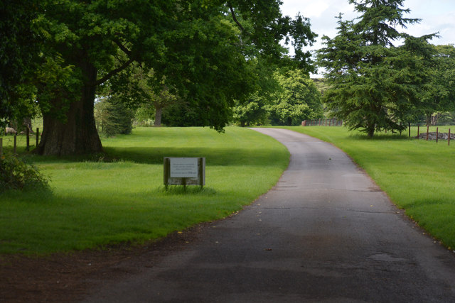
Bastins Copse is a picturesque woodland located in Hampshire, England. Spanning over an area of approximately 100 acres, it is known for its diverse range of flora and fauna, making it a popular destination for nature enthusiasts and hikers alike.
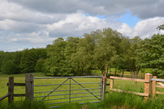
The copse is dominated by a variety of tree species, including oak, beech, and birch trees, which create a dense canopy that provides shelter and habitat for a wide range of wildlife. The forest floor is adorned with a lush carpet of bluebells in the spring, adding a vibrant burst of color to the landscape.
Tranquil walking trails wind their way through the copse, allowing visitors to explore its natural beauty at their leisure. These paths are well-maintained and provide easy access for visitors of all ages and abilities. Along the trails, one may encounter a variety of bird species, such as woodpeckers, nuthatches, and tawny owls, as well as small mammals like foxes, rabbits, and squirrels.
Bastins Copse is not only a haven for wildlife but also serves as an important ecological site. The woodland contributes to the overall health of the local ecosystem by improving air quality, providing natural flood mitigation, and acting as a carbon sink.
With its tranquil ambiance and breathtaking scenery, Bastins Copse offers a welcome respite from the hustle and bustle of everyday life. Whether it's a leisurely stroll, birdwatching, or simply enjoying the peace and serenity of nature, this woodland is a must-visit destination for anyone seeking solace in the beauty of the natural world.
If you have any feedback on the listing, please let us know in the comments section below.
Bastins Copse Images
Images are sourced within 2km of 51.34779/-1.3517101 or Grid Reference SU4561. Thanks to Geograph Open Source API. All images are credited.


Bastins Copse is located at Grid Ref: SU4561 (Lat: 51.34779, Lng: -1.3517101)
Administrative County: Hampshire
District: Basingstoke and Deane
Police Authority: Hampshire
What 3 Words
///commuted.mavericks.pushy. Near Highclere, Hampshire
Nearby Locations
Related Wikis

Penwood
Penwood is a village in the civil parish of Highclere in the Basingstoke and Deane district of Hampshire, England. Its nearest town is Newbury, which lies...

Highclere Park
Highclere Park is a 69.6-hectare (172-acre) biological Site of Special Scientific Interest east of Highclere in Hampshire. It is the park of Highclere...
Sandham Memorial Chapel
Sandham Memorial Chapel is in the village of Burghclere, Hampshire, England. It is a Grade I listed, 1920s decorated chapel, designed by Lionel Godfrey...

Highclere railway station
Highclere railway station was a station on the Didcot, Newbury and Southampton Railway in England. It shares the name of the nearby village of Highclere...

Highclere
Highclere (pronounced ) is a village and civil parish situated in the North Wessex Downs (an Area of Outstanding Natural Beauty) in the Basingstoke and...
Whitway
Whitway is a hamlet in the civil parish of Burghclere in the Basingstoke and Deane district of Hampshire, England. Its nearest town is Newbury, which lies...
Clere School
The Clere School is a small co-educational community secondary school in Burghclere. Although its postcode locates to Reading via Newbury, it is in Hampshire...
Horris Hill School
Horris Hill, is an independent day and boarding preparatory school for boys aged 4–13. It is located in Berkshire in England, south of Newbury in West...
Nearby Amenities
Located within 500m of 51.34779,-1.3517101Have you been to Bastins Copse?
Leave your review of Bastins Copse below (or comments, questions and feedback).