Long Plantation

Wood, Forest in Durham

England

Long Plantation

Mine Wheel Memorial, Blackhall Colliery One of several similar monuments in this area commemorating the former mining industry.
A sea mist has blown in making colour photography rather unrewarding, but this looks ok in B&W.
Mine Wheel Memorial, Blackhall Colliery Credit: Des Blenkinsopp

Long Plantation is a sprawling forested area located in Durham, a county in the northeastern part of England. Covering an extensive land area, the plantation is characterized by dense woodlands and majestic trees, creating a serene and picturesque natural environment.

The plantation is known for its diverse range of flora and fauna, providing a haven for various species of plants and animals. The towering trees, including oak, beech, and pine, form a dense canopy that provides shade and shelter for wildlife. The forest floor is adorned with a vibrant carpet of moss, ferns, and wildflowers, adding to the enchanting beauty of the area.

Long Plantation offers numerous recreational opportunities for visitors to enjoy. Well-maintained walking trails meander through the plantation, allowing nature enthusiasts to explore the area at their own pace. The trails are also suitable for cycling and horseback riding, catering to a wide range of outdoor enthusiasts.

The plantation is a popular destination for birdwatchers, as it attracts a variety of avian species. Visitors can spot woodpeckers, owls, and various songbirds amidst the tranquil surroundings. Additionally, the plantation is home to several small mammals, such as squirrels and rabbits, providing ample opportunities for wildlife observation.

Long Plantation is not only a haven for nature lovers but also serves as an important ecological resource. The forest plays a crucial role in maintaining local biodiversity, contributing to the overall health of the surrounding ecosystem.

Overall, Long Plantation in Durham is a captivating natural landscape that offers both recreational and ecological benefits to visitors and the local community alike.

If you have any feedback on the listing, please let us know in the comments section below.

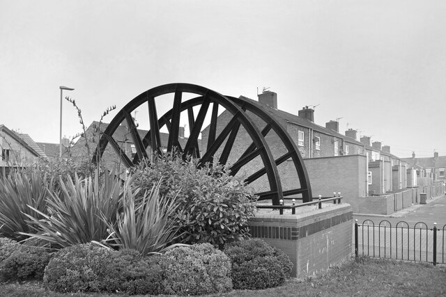
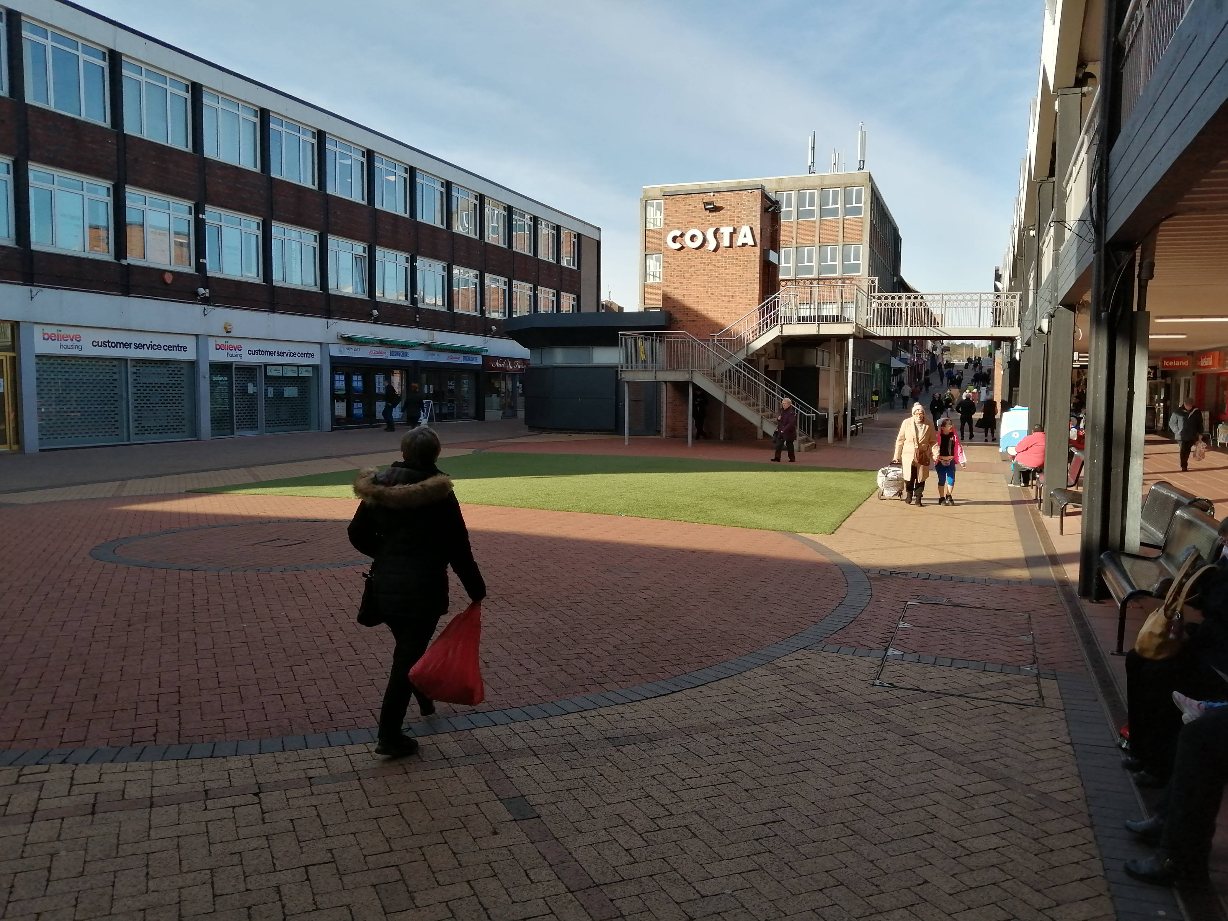
Long Plantation Images

Images are sourced within 2km of 54.755436/-1.319063 or Grid Reference NZ4340. Thanks to Geograph Open Source API. All images are credited.

Mine Wheel Memorial, Blackhall Colliery One of several similar monuments in this area commemorating the former mining industry.
A sea mist has blown in making colour photography rather unrewarding, but this looks ok in B&W.
Mine Wheel Memorial, Blackhall Colliery
One of several similar monuments in this area commemorating the former mining industry. A sea mist has blown in making colour photography rather unrewarding, but this looks ok in B&W.
Eighth Street, Blackhall Colliery Making it easy for the postman, a group of adjacent streets are named from First to Eleventh. I think that's right. I can't see any more on the map.
Eighth Street, Blackhall Colliery
Making it easy for the postman, a group of adjacent streets are named from First to Eleventh. I think that's right. I can't see any more on the map.
Middle Street, Blackhall Colliery A town with very logical street naming. This is Middle Street, the main road, with East and West Streets running parallel. In between are First to Eleventh Streets. Easy.
Further along, it's poets.
Middle Street, Blackhall Colliery
A town with very logical street naming. This is Middle Street, the main road, with East and West Streets running parallel. In between are First to Eleventh Streets. Easy. Further along, it's poets.
Hardwicke Hall Manor Hotel car park Shared with Manor Motors and hopefully the car stock does not get mixed up.
Hardwicke Hall Manor Hotel car park
Shared with Manor Motors and hopefully the car stock does not get mixed up.
Drive to Hardwicke Hall Manor Hotel Passing the entrance to Wood Cottage, screened by trees
Drive to Hardwicke Hall Manor Hotel
Passing the entrance to Wood Cottage, screened by trees
Train at Horden train station A northern (Northern Trains Limited) class 156 train at Horden train station
Train at Horden train station
A northern (Northern Trains Limited) class 156 train at Horden train station
Mine Water Treatment Pond As has been found in many former mining districts, you can't just close a deep mine and forget about it. Once the pumps that drained the workings are turned off, groundwater comes back in and gets polluted. 
The limestone aquifer here supplies clean water to a large area and cannot be allowed to become contaminated.
These ponds contain polluted mine water and are part of the cleaning up process.
Mine Water Treatment Pond
As has been found in many former mining districts, you can't just close a deep mine and forget about it. Once the pumps that drained the workings are turned off, groundwater comes back in and gets polluted. The limestone aquifer here supplies clean water to a large area and cannot be allowed to become contaminated. These ponds contain polluted mine water and are part of the cleaning up process.
Treatment Pond for Mine Water Another picture of one of the ponds which are part of the treatment process for polluted water from a former coal mine.
Treatment Pond for Mine Water
Another picture of one of the ponds which are part of the treatment process for polluted water from a former coal mine.
Crosslands Stores, Horden Local shop on Sunderland Road.
Crosslands Stores, Horden
Local shop on Sunderland Road.
Horden Colliery Memorial Marking the site of a former coal mine. The site has been extensively landscaped and redeveloped but these old wheels have been set up as a memorial.
Horden Colliery Memorial
Marking the site of a former coal mine. The site has been extensively landscaped and redeveloped but these old wheels have been set up as a memorial.
Business Premises on Kilburn Drive Part of the Sea View Industrial Estate.
Business Premises on Kilburn Drive
Part of the Sea View Industrial Estate.
Co-operative Buildings, Cotsford Lane Presumably all a co-op store at one time, but now only partly retained as a co-op funeral parlour at the far end.
Co-operative Buildings, Cotsford Lane
Presumably all a co-op store at one time, but now only partly retained as a co-op funeral parlour at the far end.
Fourth Street, Horden A very short street leading to a green. In between the much longer Third and Fifth Streets.
Fourth Street, Horden
A very short street leading to a green. In between the much longer Third and Fifth Streets.
Coal Dust in the Sand I'm guessing that's what the black stuff is. Coal mining waste was dumped into the sea here for much of the 20th century and although a lot has been cleared or washed away there is still loads left.
Coal Dust in the Sand
I'm guessing that's what the black stuff is. Coal mining waste was dumped into the sea here for much of the 20th century and although a lot has been cleared or washed away there is still loads left.
A Closer Look at the Mining Waste Huge amounts of waste rock were dumped on the coast along here for years from the coal mines which used to work a short way inland.
All along the beach at the base of the natural cliffs is a second cliff line   around a metre high made up of all this stuff.
Easily eroded, it is gradually being washed away by the sea, but there is still a lot left.
It looks stratified but I guess that's down to what was being dumped at the time rather than any natural process.
Some fairly colourful stuff seems to be leaching out of it. I doubt it's particularly healthy for marine life.
A Closer Look at the Mining Waste
Huge amounts of waste rock were dumped on the coast along here for years from the coal mines which used to work a short way inland. All along the beach at the base of the natural cliffs is a second cliff line around a metre high made up of all this stuff. Easily eroded, it is gradually being washed away by the sea, but there is still a lot left. It looks stratified but I guess that's down to what was being dumped at the time rather than any natural process. Some fairly colourful stuff seems to be leaching out of it. I doubt it's particularly healthy for marine life.
Another Look at the Coal Dust Cliff Showing how the sea is eating away at the lower layers of the old mining waste which has been dumped here. Big lumps fall off from time to time.
When it's all gone I guess the sea will start attacking the natural coastline again.
Another Look at the Coal Dust Cliff
Showing how the sea is eating away at the lower layers of the old mining waste which has been dumped here. Big lumps fall off from time to time. When it's all gone I guess the sea will start attacking the natural coastline again.
The Mist is Coming The last minute of the good weather for now. This sea mist appeared on the horizon a few minutes ago and is heading straight for us. 
A view on the coast path above Castle Eden Dene
The Mist is Coming
The last minute of the good weather for now. This sea mist appeared on the horizon a few minutes ago and is heading straight for us. A view on the coast path above Castle Eden Dene
Castle Eden Dene A small stream with a valley deep and wide enough for the railway to need a mighty viaduct to cross it.
Now a nature reserve, one of the information panels tells how this was once a tidal inlet until the dumping of mine waste blocked the mouth of the valley and it silted up to form what you see today.
Castle Eden Dene
A small stream with a valley deep and wide enough for the railway to need a mighty viaduct to cross it. Now a nature reserve, one of the information panels tells how this was once a tidal inlet until the dumping of mine waste blocked the mouth of the valley and it silted up to form what you see today.
Show me another place!

Long Plantation is located at Grid Ref: NZ4340 (Lat: 54.755436, Lng: -1.319063)

Unitary Authority: County Durham

Police Authority: Durham

What 3 Words

///moods.stage.wipes. Near Peterlee, Co. Durham

Related Wikis

Dene Academy

Dene Academy (formerly Dene Community School) is a coeducational secondary school located in Peterlee, County Durham, England.Established in 1962, in November...

Castle Eden Dene

Castle Eden Dene is a Site of Special Scientific Interest and National Nature Reserve in the Easington district of County Durham, England. It is located...

Peterlee

Peterlee is a town in County Durham, England. It lies between Sunderland to the north, Hartlepool to the south, the Durham Coast to the east and Durham...

Peterlee Community Hospital

Peterlee Community Hospital is a health facility in O'Neill Drive, Peterlee, County Durham, England. It is managed by North Tees and Hartlepool NHS Foundation...

Horden

Horden is a village and electoral ward in County Durham, England. It is situated on the North Sea coast, to the east of Peterlee, approximately 12 miles...

Horden Community Welfare F.C.

Horden Community Welfare Football Club is a football club based in Horden, County Durham, England. The club was formed as Horden Athletic in 1907, changing...

Darlington Town F.C.

Darlington Town is a football club based in Darlington, in County Durham, England. The club was formed in 2018, taking the place in the Wearside League...

Horden railway station

Horden (also known as Horden Peterlee during the planning stage) is a railway station on the Durham Coast Line, which runs between Newcastle and Middlesbrough...

Nearby Amenities

Located within 500m of 54.755436,-1.319063
Bus Stop
Manor Way-Hatfield
Bus: yes
Naptan AtcoCode: 13003222C
Naptan Bearing: E
Naptan CommonName: Manor Way-Hatfield
Naptan Indicator: east bound
Naptan Landmark: Landmark not known
Naptan NaptanCode: durapgjp
Naptan Notes: opposite 106 and 104 manor way- peterlee
Naptan Street: Manor Way
Naptan Verified: no
Public Transport: platform
Source: naptan_import
Lat/Long: 54.7550652/-1.3262604
Bus Stop
Manor Way-Hatfield
Bus: yes
Naptan AtcoCode: 13003222G
Naptan Bearing: W
Naptan CommonName: Manor Way-Hatfield
Naptan Indicator: west bound
Naptan Landmark: Outside No 90
Naptan NaptanCode: durapgjt
Naptan Street: Manor Way
Naptan Verified: no
Public Transport: platform
Source: naptan_import
Lat/Long: 54.7550063/-1.3253756
Bus Stop
Fulwell Road
Bench: no
Bin: yes
Bus: yes
Naptan AtcoCode: 13003223D
Naptan Bearing: SE
Naptan CommonName: Fulwell Road
Naptan Indicator: south east bound
Naptan Landmark: Near entrance to Dean Close
Naptan NaptanCode: durapgjw
Naptan Street: Fulwell Raod
Naptan Verified: no
Public Transport: platform
Shelter: no
Source: naptan_import
Lat/Long: 54.7557426/-1.3236386
Bus Stop
Fulwell Road
Bus: yes
Naptan AtcoCode: 13003223H
Naptan Bearing: NW
Naptan CommonName: Fulwell Road
Naptan Indicator: north west bound
Naptan Landmark: Outside No 21
Naptan NaptanCode: durapgma
Naptan Street: Fulwell Road
Naptan Verified: no
Public Transport: platform
Source: naptan_import
Lat/Long: 54.7565582/-1.3248681
Bus Stop
Yoden Way-Chapel Hill Road
Bus: yes
Naptan AtcoCode: 13003521G
Naptan Bearing: W
Naptan CommonName: Yoden Way-Chapel Hill Road
Naptan Indicator: west bound
Naptan Landmark: opposite junction with Chapel Hill Road
Naptan NaptanCode: duratdmj
Naptan Street: Yodan Way
Naptan Verified: no
Public Transport: platform
Source: naptan_import
Lat/Long: 54.757285/-1.324654
Bus Stop
Dene House Comp. School
Bus: yes
Naptan AtcoCode: 13003524H
Naptan Bearing: NW
Naptan CommonName: Dene House Comp. School
Naptan Indicator: north west bound
Naptan Landmark: Outside school entrance
Naptan NaptanCode: duratdpd
Naptan Street: Manor Way
Naptan Verified: no
Public Transport: platform
Source: naptan_import
Lat/Long: 54.7577089/-1.32171
Bus Stop
Eastfield
Bus: yes
Naptan AtcoCode: 13003525C
Naptan Bearing: E
Naptan CommonName: Eastfield
Naptan Indicator: east bound
Naptan Landmark: Landmark not known
Naptan NaptanCode: duratdpg
Naptan Notes: between number 7 and 8 eastfield- peterlee
Naptan Street: Eastfield
Naptan Verified: no
Public Transport: platform
Source: naptan_import
Lat/Long: 54.7562053/-1.3180058
Bus Stop
Eastfield
Bus: yes
Naptan AtcoCode: 13003525G
Naptan Bearing: W
Naptan CommonName: Eastfield
Naptan Indicator: west bound
Naptan Landmark: Landmark not known
Naptan NaptanCode: duratdpj
Naptan Notes: between 30 and 31 eastfield- peterlee
Naptan Street: Eastfield
Naptan Verified: no
Public Transport: platform
Source: naptan_import
Lat/Long: 54.7561318/-1.3177118
Power: pole
Lat/Long: 54.7522911/-1.3232079
Location Transition: yes
Power: pole
Lat/Long: 54.7529342/-1.3234351
Crossing
Crossing: unmarked
Crossing Island: yes
Lat/Long: 54.7580019/-1.3227065
Morrisons Daily
Addr City: Peterlee
Addr Housenumber: 18-20
Addr Postcode: SR8 5RT
Addr Street: Fulwell Road
Brand: Morrisons Daily
Brand Wikidata: Q99752411
Fhrs Id: 302154
Operator: McColl's
Operator Wikidata: Q16997477
Shop: convenience
Source Addr: FHRS Open Data
Website: https://my.morrisons.com/storefinder/64301/morrisons-daily-peterlee-fullwell-road
Lat/Long: 54.7559472/-1.3236727
Fast Food
New Century
Addr City: Peterlee
Addr Housenumber: 16
Addr Postcode: SR8 5RT
Addr Street: Fulwell Road
Cuisine: chinese
Delivery: yes
Drive Through: no
Fhrs Id: 302066
Operator: New Century
Smoking: outside
Source Addr: FHRS Open Data
Takeaway: yes
Lat/Long: 54.7558351/-1.323472
Christine
Addr Street: Eastfield
Operator: Christine
Shop: hairdresser
Lat/Long: 54.7563188/-1.3131778
Entrance: main
Lat/Long: 54.7576413/-1.3173633
Post Office
Fulwell Road Post Office
Addr City: Peterlee
Addr Country: GB
Addr Housenumber: 18
Addr Postcode: SR8 5RT
Addr Street: Fulwell Road
Brand: Post Office
Brand Wikidata: Q1783168
Brand Wikipedia: en:Post Office Ltd
Check Date Opening Hours: 2020‑11‑13
Contact Website: https://www.postoffice.co.uk/branch-finder/2363437/fulwell-road
Opening Hours: Mo-Su 06:00-23:00
Ref Pol Id: 148500
Lat/Long: 54.7559272/-1.3234801
Street Lamp
Lat/Long: 54.7580484/-1.324912
Street Lamp
Lat/Long: 54.7579455/-1.3244292
Street Lamp
Lat/Long: 54.7579029/-1.323823
Street Lamp
Lat/Long: 54.7579091/-1.3232692
Street Lamp
Lat/Long: 54.7581622/-1.3214707
Street Lamp
Lat/Long: 54.7579517/-1.3227421
Street Lamp
Lat/Long: 54.7580128/-1.3221788
Street Lamp
Lat/Long: 54.7579873/-1.3251601
Post Box
Operator: Royal Mail
Operator Wikidata: Q638098
Post Box Type: pillar
Royal Cypher: EIIR
Royal Cypher Wikidata: Q33102113
Lat/Long: 54.7559352/-1.3237863
The data included in this document is from www.openstreetmap.org. The data is made available under ODbL.

Have you been to Long Plantation?

Leave your review of Long Plantation below (or comments, questions and feedback).