Clay Quarry Wood

Wood, Forest in Leicestershire Hinckley and Bosworth

England

Clay Quarry Wood

Junction in Bagworth
Junction in Bagworth Credit: Dave Thompson

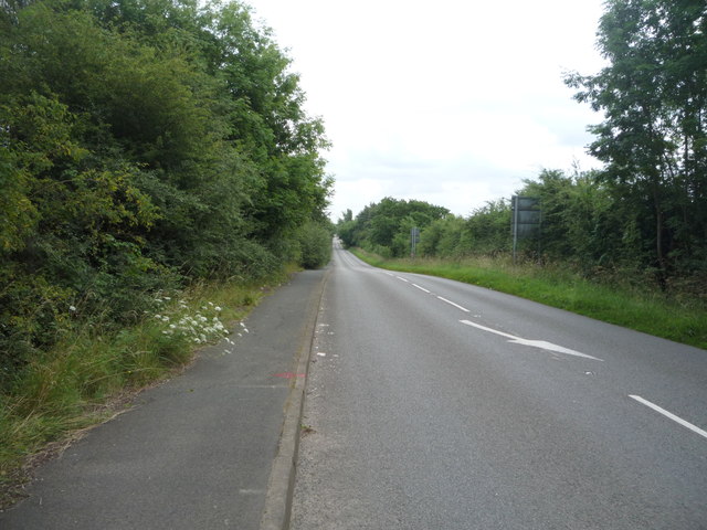
Clay Quarry Wood is a charming woodland area located in Leicestershire, England. Covering an impressive area of approximately 30 acres, it is a popular destination for nature enthusiasts and outdoor adventurers alike. The wood is named after the historic clay quarry that was once in operation here during the 19th century.

As visitors step into Clay Quarry Wood, they are greeted by a dense canopy of mature trees, creating a tranquil and secluded atmosphere. The wood is predominantly made up of native species such as oak, ash, birch, and beech, which provide a rich habitat for a variety of wildlife.

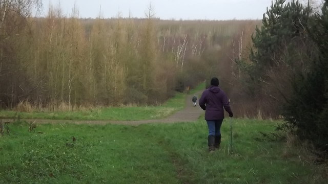
Walking along the well-maintained trails that wind through the wood, visitors can admire the picturesque scenery and observe the diverse flora and fauna that call this place home. The forest floor is carpeted with an array of wildflowers, adding vibrant pops of color to the landscape.

For those interested in birdwatching, Clay Quarry Wood offers ample opportunities to spot a wide range of species. Woodpeckers, owls, and warblers are just a few of the many birds that can be seen and heard throughout the year.

The wood also features a small pond, which attracts a host of aquatic creatures and provides a peaceful spot for reflection. Picnic areas are scattered throughout the wood, inviting visitors to relax and enjoy a meal surrounded by nature.

Overall, Clay Quarry Wood is a hidden gem in Leicestershire, offering a tranquil escape from the hustle and bustle of everyday life. With its diverse wildlife, scenic trails, and peaceful ambiance, it is a must-visit destination for nature lovers and outdoor enthusiasts.

If you have any feedback on the listing, please let us know in the comments section below.

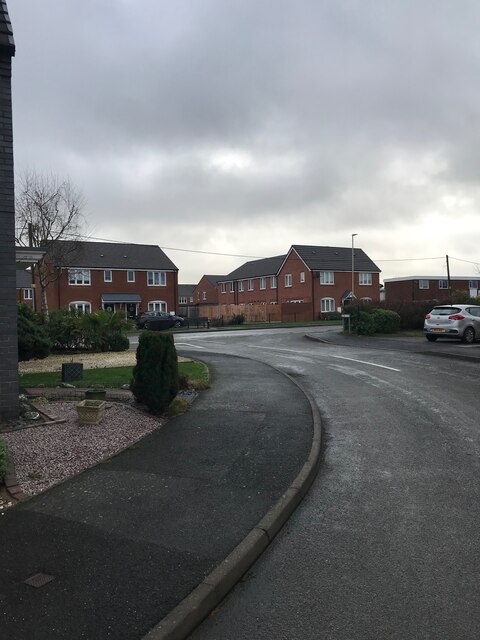
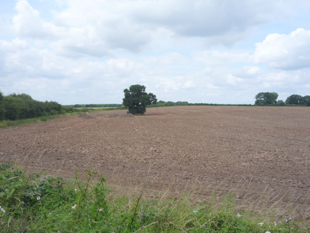
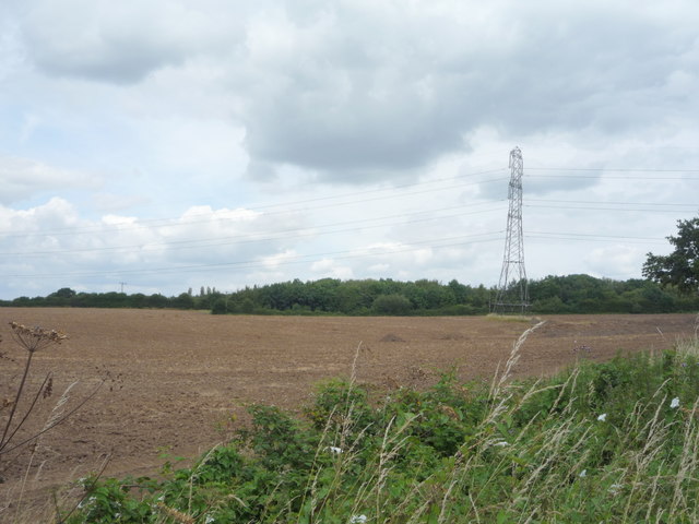
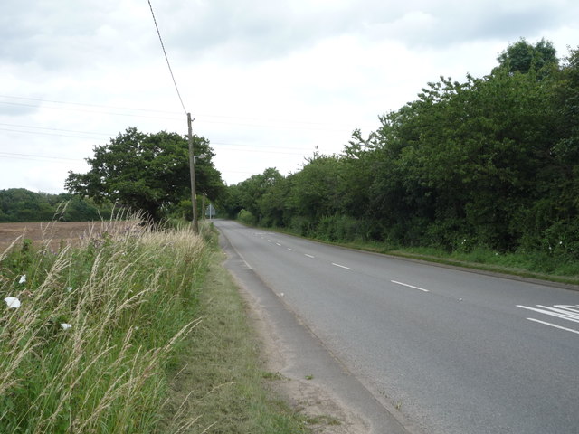
Clay Quarry Wood Images

Images are sourced within 2km of 52.683517/-1.3531834 or Grid Reference SK4309. Thanks to Geograph Open Source API. All images are credited.

Junction in Bagworth
Farming and power A row of pylons strides across a field near Bagworth
Farming and power
A row of pylons strides across a field near Bagworth
In Battram Wood Part of the National Forest Way
In Battram Wood
Part of the National Forest Way
Overgrown pond, Ellistown There is water in there somewhere!
Overgrown pond, Ellistown
There is water in there somewhere!
Farmland off the B585
Entrance to Lodge Farm
Wood Road (B585) Heading north east.
Wood Road (B585)
Heading north east.
Crop field off Wood Road (A585)
Wood Road (B585)  Heading north east.
Wood Road (B585)
Heading north east.
The Cinamon Tree Indian Restaurant Former public house on the B585.
The Cinamon Tree Indian Restaurant
Former public house on the B585.
Sign on the Cinamon Tree Indian Restaurant
Field off Wood Road (B585)
Field and pylon Off Wood Road (B585).
Field and pylon
Off Wood Road (B585).
National Cycle Route 63 Wood Road (B585) heading north east.
National Cycle Route 63
Wood Road (B585) heading north east.
Station Road National Cycle Route 63 heading south east.
Station Road
National Cycle Route 63 heading south east.
New houses on Station Road, Bagworth
Station Road, Bagworth Looking south east.
Station Road, Bagworth
Looking south east.
New shop on Station Road, Bagworth
Show me another place!

Clay Quarry Wood is located at Grid Ref: SK4309 (Lat: 52.683517, Lng: -1.3531834)

Administrative County: Leicestershire

District: Hinckley and Bosworth

Police Authority: Leicestershire

What 3 Words

///slicer.northward.overlooks. Near Bagworth, Leicestershire

Nearby Locations

Clay Quarry Wood

Related Wikis

Bagworth and Ellistown railway station

Bagworth and Ellistown was a railway station on the Leicester to Burton upon Trent Line, that served the villages of Bagworth and Ellistown in Leicestershire...

Ellistown F.C.

Ellistown Football Club is a football club based in the village of Ellistown, near Coalville in Leicestershire, England. They are currently members of...

Ellistown and Battleflat

Ellistown and Battleflat is a civil parish in North West Leicestershire, England, just south of the town of Coalville. Most of the parish's population...

Bagworth

Bagworth is a village and former civil parish, now in the parish of Bagworth and Thornton, in the Hinckley and Bosworth district, in Leicestershire, England...

Dan-Air Flight 240

Dan-Air Flight 240 was a fatal accident involving a Hawker Siddeley HS 748 series 2A turboprop aircraft operated by Dan Air Services Limited on the first...

Ellistown

Ellistown is a village about 2 miles (3 km) south of Coalville in North West Leicestershire, England. It is named after Colonel Joseph Joel Ellis who died...

Chapel of the Holy Rood, Bagworth

The Chapel of the Holy Rood was a Church of England chapel in Bagworth, Leicestershire. It closed in 2013 to worship and was demolished in 2019. Now, a...

Bagworth and Thornton

Bagworth and Thornton, formerly just Bagworth is a civil parish in the Hinckley and Bosworth district of Leicestershire, England, west of Leicester. The...

Nearby Amenities

Located within 500m of 52.683517,-1.3531834
Bus Stop
Station Road
Bus: yes
Naptan AtcoCode: 260010005
Naptan Bearing: SE
Naptan CommonName: Station Road
Naptan Indicator: 20m after
Naptan Landmark: 399 'Firbanks' Station Road
Naptan NaptanCode: leidwtma
Naptan Notes: Hourly - County
Naptan Street: Station Road
Naptan Verified: no
Public Transport: platform
Source: naptan_import
Lat/Long: 52.68123/-1.3497507
Bus Stop
Maynard PH
Alt Name: Bagworth - Station Road
Bus: yes
Naptan AltCommonName: Bagworth - Station Road
Naptan AtcoCode: 260010007
Naptan Bearing: SE
Naptan CommonName: Maynard PH
Naptan Indicator: opposite
Naptan Landmark: Maynard PH
Naptan NaptanCode: leidwtmg
Naptan Notes: Hourly - County
Naptan Street: Station Road
Naptan Verified: no
Public Transport: platform
Source: naptan_import
Lat/Long: 52.6801368/-1.3487759
Bus Stop
Victoria Road
Bus: yes
Naptan AtcoCode: 260014238
Naptan Bearing: S
Naptan CommonName: Victoria Road
Naptan Indicator: adjacent
Naptan Landmark: Victoria Road
Naptan NaptanCode: leijgjgw
Naptan Notes: Hourly - County
Naptan Street: Station Road
Naptan Verified: no
Public Transport: platform
Source: naptan_import
Lat/Long: 52.6872183/-1.3548546
Bus Stop
Wood Road
Bus: yes
Naptan AtcoCode: 260014239
Naptan Bearing: SE
Naptan CommonName: Wood Road
Naptan Indicator: opposite
Naptan Landmark: Wood Road
Naptan NaptanCode: leijgjma
Naptan Notes: Hourly - County
Naptan Street: Station Road
Naptan Verified: no
Public Transport: platform
Source: naptan_import
Lat/Long: 52.6861795/-1.3539526
Bus Stop
Wood Road
Bus: yes
Naptan AtcoCode: 260014240
Naptan Bearing: NW
Naptan CommonName: Wood Road
Naptan Indicator: beyond
Naptan Landmark: Wood Road
Naptan NaptanCode: leijgjmd
Naptan Notes: Hourly - County
Naptan Street: Station Road
Naptan Verified: no
Public Transport: platform
Source: naptan_import
Lat/Long: 52.6864786/-1.354392
Bus Stop
Victoria Road
Bus: yes
Naptan AtcoCode: 260014241
Naptan Bearing: N
Naptan CommonName: Victoria Road
Naptan Indicator: opposite
Naptan Landmark: Victoria Road
Naptan NaptanCode: leijgjmg
Naptan Notes: Hourly - County
Naptan Street: Ellistown Terrace Road
Naptan Verified: no
Public Transport: platform
Source: naptan_import
Lat/Long: 52.6876623/-1.355499
Barrier: stile
Lat/Long: 52.6851371/-1.3527759
Power: tower
Lat/Long: 52.6806035/-1.3534479
Power: tower
Lat/Long: 52.6829841/-1.353464
Power: tower
Lat/Long: 52.6847629/-1.3560067
Pall-Ex
Building: industrial
Lat/Long: 52.6865822/-1.3529106
Location Transition: yes
Power: pole
Lat/Long: 52.6835712/-1.3515115
Power: pole
Lat/Long: 52.6831176/-1.3524905
Power: pole
Lat/Long: 52.6826054/-1.3534883
Power: pole
Lat/Long: 52.681846/-1.3541374
Power: pole
Lat/Long: 52.681046/-1.3548106
Power: pole
Lat/Long: 52.6803581/-1.3553953
Material: wood
Power: pole
Lat/Long: 52.6796426/-1.3559935
Power: pole
Lat/Long: 52.684498/-1.3538155
Power: pole
Lat/Long: 52.6841419/-1.3542634
Power: pole
Lat/Long: 52.6831972/-1.3547435
Power: pole
Lat/Long: 52.682846/-1.3549206
Power: pole
Lat/Long: 52.6825338/-1.3556018
Power: pole
Lat/Long: 52.6822493/-1.3562724
Power: pole
Lat/Long: 52.6819923/-1.3569108
Power: pole
Lat/Long: 52.6815289/-1.3574982
Power: pole
Lat/Long: 52.6811078/-1.3579756
Power: pole
Lat/Long: 52.6806947/-1.3584504
Location Transition: yes
Power: pole
Lat/Long: 52.6836558/-1.3515812
Location Transition: yes
Power: pole
Lat/Long: 52.6843289/-1.3496447
Location Transition: yes
Power: pole
Lat/Long: 52.6844249/-1.3497278
Power: pole
Lat/Long: 52.6846444/-1.34873
Power: pole
Lat/Long: 52.6849956/-1.3476142
Power: pole
Lat/Long: 52.6810525/-1.3549206
Power: pole
Lat/Long: 52.6809143/-1.3565165
Power: pole
Lat/Long: 52.6807647/-1.3582304
Bagworth No.2 Crossing
Railway: crossing
Lat/Long: 52.6850788/-1.3503185
Railway: buffer_stop
Lat/Long: 52.6858148/-1.3504465
Nailstone Branch Junction
Railway: junction
Lat/Long: 52.6839066/-1.3498563
Ibstock Branch Junction
Historic Railway: junction
Railway: site
Lat/Long: 52.6852656/-1.3503635
The data included in this document is from www.openstreetmap.org. The data is made available under ODbL.

Have you been to Clay Quarry Wood?

Leave your review of Clay Quarry Wood below (or comments, questions and feedback).