Bottom Wood

Wood, Forest in Derbyshire South Derbyshire

England

Bottom Wood

Dark clouds over Moorland House Not generating much energy on the panels at the moment.
Dark clouds over Moorland House Credit: Christine Johnstone

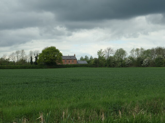
Bottom Wood is a picturesque forest located in the county of Derbyshire, England. Covering an area of approximately 100 acres, it is nestled within the beautiful Peak District National Park. The woodland is characterized by its diverse ecosystem and rich biodiversity.

The forest is home to a wide variety of tree species, including oak, birch, beech, and pine. These towering trees create a dense canopy, providing shelter and habitat for a range of wildlife, such as deer, foxes, badgers, and numerous bird species.

Bottom Wood offers a tranquil escape for nature enthusiasts and hikers alike. There are several well-maintained trails that wind through the forest, allowing visitors to explore its natural beauty and discover hidden treasures along the way. The paths are often lined with vibrant wildflowers and ferns, adding to the charm of the woodland.

One of the highlights of Bottom Wood is its enchanting bluebell display during springtime. The forest floor transforms into a carpet of delicate blue flowers, creating a magical and ethereal atmosphere. This spectacle attracts photographers and nature lovers from far and wide.

In addition to its natural beauty, Bottom Wood also has historical significance. It is believed to have been part of the ancient Sherwood Forest, which was famous for its association with the legendary outlaw Robin Hood. The wood retains an air of mystery and intrigue, making it even more appealing to visitors.

Overall, Bottom Wood is a captivating forest that offers a serene and immersive experience in nature. Its combination of diverse flora and fauna, scenic trails, and historical significance make it a must-visit destination for anyone seeking a true woodland escape in Derbyshire.

If you have any feedback on the listing, please let us know in the comments section below.
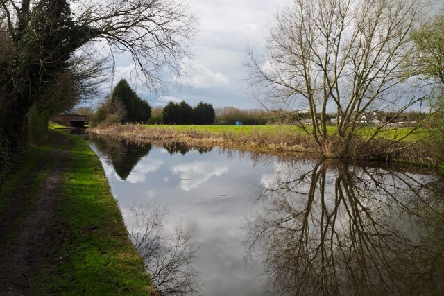
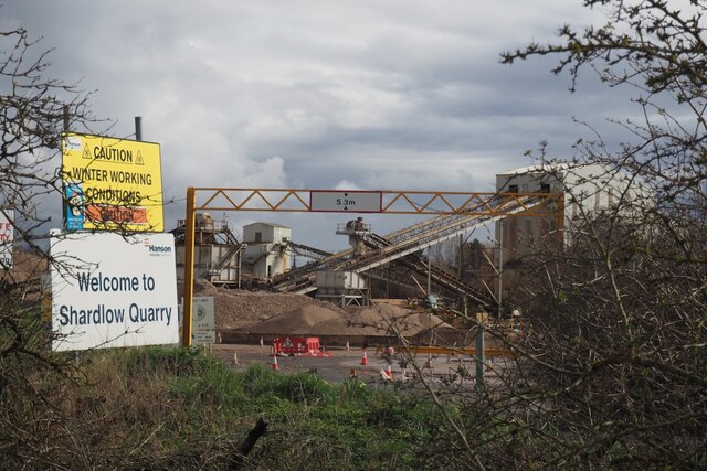
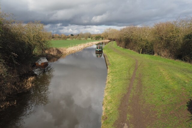
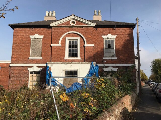
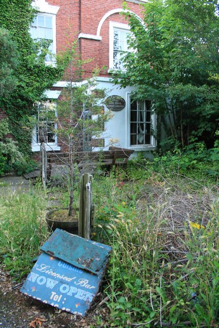
Bottom Wood Images

Images are sourced within 2km of 52.873138/-1.3503524 or Grid Reference SK4330. Thanks to Geograph Open Source API. All images are credited.

Dark clouds over Moorland House Not generating much energy on the panels at the moment.
Dark clouds over Moorland House
Not generating much energy on the panels at the moment.
The three Plumtree Cottages, Cavendish Bridge These appear to be the same homes that were mapped here in 1880, but then there were four smaller cottages at this end and a larger one at the far end, making five in all.
The three Plumtree Cottages, Cavendish Bridge
These appear to be the same homes that were mapped here in 1880, but then there were four smaller cottages at this end and a larger one at the far end, making five in all.
The centre of Cavendish Bridge Opposite the site of the south end of original bridge across the Trent. Before the Trent & Mersey canal opened, with its inland port at Shardlow, boats from the Cromford Canal used the wharf at Cavendish Bridge.
The centre of Cavendish Bridge
Opposite the site of the south end of original bridge across the Trent. Before the Trent & Mersey canal opened, with its inland port at Shardlow, boats from the Cromford Canal used the wharf at Cavendish Bridge.
Former school, Cavendish Bridge Shown as such on the large-scale OS maps surveyed around 1880. Now converted to a house called Cavendish House.
Former school, Cavendish Bridge
Shown as such on the large-scale OS maps surveyed around 1880. Now converted to a house called Cavendish House.
Hicken's Bridge The A50 bridge over the Trent and Mersey Canal.
Hicken's Bridge
The A50 bridge over the Trent and Mersey Canal.
The Trent and Mersey Canal Near Shardlow
The Trent and Mersey Canal
Near Shardlow
Back Lane is flooded Thankfully a raised path at the side of the carriageway is provided.  This is a gated lane with only foot and cycle traffic possible.  The bridge carries the A50.
Back Lane is flooded
Thankfully a raised path at the side of the carriageway is provided. This is a gated lane with only foot and cycle traffic possible. The bridge carries the A50.
Erroneous sign still here Fifteen years since <a href="https://www.geograph.org.uk/photo/689661">SK4429 : Erroneous A Road sign</a> and this still hasn't been removed.
Erroneous sign still here
Fifteen years since SK4429 : Erroneous A Road sign and this still hasn't been removed.
Old Crown Inn, Cavendish Bridge
The sign of the Old Crown Inn See <a href="https://www.geograph.org.uk/photo/7433278">SK4429 : Old Crown Inn, Cavendish Bridge</a>.
The sign of the Old Crown Inn
Bridge 3A Trent & Mersey Canal (1997) This seems to be an expensive looking bridge for what appears to be just a farm track running across it.

The date is probably the big clue as this is the time that the nearby A50 was finished.  Presumably therefore this was needed to restore access to the farm visible behind destroyed by the new road.
Bridge 3A Trent & Mersey Canal (1997)
This seems to be an expensive looking bridge for what appears to be just a farm track running across it. The date is probably the big clue as this is the time that the nearby A50 was finished. Presumably therefore this was needed to restore access to the farm visible behind destroyed by the new road.
The Trent & Mersey Canal Hicken's Bridge carrying the A50 visible in the distance.
The Trent & Mersey Canal
Hicken's Bridge carrying the A50 visible in the distance.
Canal Milepost Shardlow 1 Mile Preston Brook 91 Miles.

Grade II listed List Entry Number:1088357 <span class="nowrap"><a title="https://historicengland.org.uk/listing/the-list/list-entry/1088357?section=official-list-entry" rel="nofollow ugc noopener" href="https://historicengland.org.uk/listing/the-list/list-entry/1088357?section=official-list-entry">Link</a><img style="margin-left:2px;" alt="External link" title="External link - shift click to open in new window" src="https://s1.geograph.org.uk/img/external.png" width="10" height="10"/></span>

Originally at SK429 298.

See also <a href="https://www.geograph.org.uk/photo/6897993">SK4329 : A canal milepost</a> <a href="https://www.geograph.org.uk/photo/5700633">SK4329 : Shardlow 1 mile</a>.
Canal Milepost
Shardlow 1 Mile Preston Brook 91 Miles. Grade II listed List Entry Number:1088357 LinkExternal link Originally at SK429 298. See also SK4329 : A canal milepost SK4329 : Shardlow 1 mile.
Shardlow Quarry Sand and gravel extraction from the Trent flood plain.
Shardlow Quarry
Sand and gravel extraction from the Trent flood plain.
The Trent and Mesey Canal from Acrelane Bridge The Trent and Mersey Canal is 93·5 miles in length from Derwent Mouth to Preston Brook. The first cut was made by Josiah Wedgwood in July 1766 at Middleport (Stoke-on-Trent). The eastern section between Derwent Mouth and Shugborough (the junction with the Staffordshire and Worcestershire Canal) was already operational by 1770 and the whole canal through to Preston Brook, where it linked with the Bridgewater Canal was open for business by 1777. James Brindley was the engineer until his death in 1772. There are seventy-six locks en route to raise and lower the water level where hills impede the course. There are four tunnels, including the famous Harecastle Tunnel near Stoke-on-Trent.
The Trent and Mesey Canal from Acrelane Bridge
The Trent and Mersey Canal is 93·5 miles in length from Derwent Mouth to Preston Brook. The first cut was made by Josiah Wedgwood in July 1766 at Middleport (Stoke-on-Trent). The eastern section between Derwent Mouth and Shugborough (the junction with the Staffordshire and Worcestershire Canal) was already operational by 1770 and the whole canal through to Preston Brook, where it linked with the Bridgewater Canal was open for business by 1777. James Brindley was the engineer until his death in 1772. There are seventy-six locks en route to raise and lower the water level where hills impede the course. There are four tunnels, including the famous Harecastle Tunnel near Stoke-on-Trent.
Old Milepost by the B5010, London Road, near Cavendish Bridge Cast iron post by the B5010 (former A6), in parish of LOCKINGTON HEMINGTON (NORTH WEST LEICESTERSHIRE District), London Road; junction with the former A453, by Golden Dragon PH, in pavement, back to low garden wall, on South side of road. Gamble iron casting, erected by the Loughborough to Cavendish Bridge turnpike trust in the 19th century. 

Inscription reads:-
: DERBY / 8 : : TO / LONDON / 118 : : LOUGH / BRO / 9 :
: PARISH : : OF HEM / INGTON : 

Grade II listed. 
List Entry Number: 1074175 <span class="nowrap"><a title="https://historicengland.org.uk/listing/the-list/list-entry/1074175" rel="nofollow ugc noopener" href="https://historicengland.org.uk/listing/the-list/list-entry/1074175">Link</a><img style="margin-left:2px;" alt="External link" title="External link - shift click to open in new window" src="https://s1.geograph.org.uk/img/external.png" width="10" height="10"/></span>

Milestone Society National ID: LE_LM118.
Old Milepost by the B5010, London Road, near Cavendish Bridge
Cast iron post by the B5010 (former A6), in parish of LOCKINGTON HEMINGTON (NORTH WEST LEICESTERSHIRE District), London Road; junction with the former A453, by Golden Dragon PH, in pavement, back to low garden wall, on South side of road. Gamble iron casting, erected by the Loughborough to Cavendish Bridge turnpike trust in the 19th century. Inscription reads:- : DERBY / 8 : : TO / LONDON / 118 : : LOUGH / BRO / 9 : : PARISH : : OF HEM / INGTON : Grade II listed. List Entry Number: 1074175 LinkExternal link Milestone Society National ID: LE_LM118.
The former Lady in Grey Fine Grade II listed building.  Sadly still vacant and decaying See <a href="https://www.geograph.org.uk/photo/5659790">SK4430 : The Lady in Grey</a>.

List Entry Number: 1205393 <span class="nowrap"><a title="https://historicengland.org.uk/listing/the-list/list-entry/1205393" rel="nofollow ugc noopener" href="https://historicengland.org.uk/listing/the-list/list-entry/1205393">Link</a><img style="margin-left:2px;" alt="External link" title="External link - shift click to open in new window" src="https://s1.geograph.org.uk/img/external.png" width="10" height="10"/></span>
The former Lady in Grey
Fine Grade II listed building. Sadly still vacant and decaying See SK4430 : The Lady in Grey. List Entry Number: 1205393 LinkExternal link
The former Lady in Grey Looked to have been closed a year or two when this was taken.  After realising that I have not got a picture of the decaying sign on this visit I planned to return to rectify that omission.  Unfortunately I never did and it is now long gone.  See also <a href="https://www.geograph.org.uk/photo/5659790">SK4430 : The Lady in Grey</a> and <a href="https://www.geograph.org.uk/photo/7019925">SK4430 : The former Lady in Grey</a>.

The building is Grade II listed List Entry Number: 1205393 <span class="nowrap"><a title="https://historicengland.org.uk/listing/the-list/list-entry/1205393" rel="nofollow ugc noopener" href="https://historicengland.org.uk/listing/the-list/list-entry/1205393">Link</a><img style="margin-left:2px;" alt="External link" title="External link - shift click to open in new window" src="https://s1.geograph.org.uk/img/external.png" width="10" height="10"/></span>
The former Lady in Grey
Looked to have been closed a year or two when this was taken. After realising that I have not got a picture of the decaying sign on this visit I planned to return to rectify that omission. Unfortunately I never did and it is now long gone. See also SK4430 : The Lady in Grey and SK4430 : The former Lady in Grey. The building is Grade II listed List Entry Number: 1205393 LinkExternal link
Show me another place!

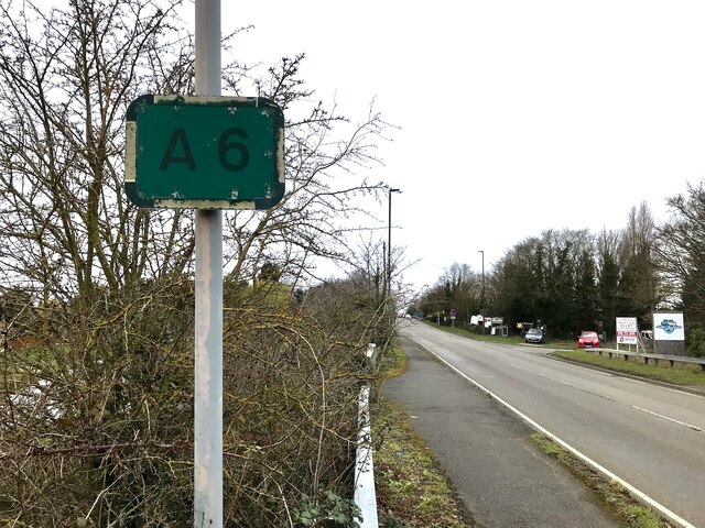
Bottom Wood is located at Grid Ref: SK4330 (Lat: 52.873138, Lng: -1.3503524)

Administrative County: Derbyshire

District: South Derbyshire

Police Authority: Derbyshire

What 3 Words

///unimpeded.bulky.powder. Near Aston-on-Trent, Derbyshire

Nearby Locations

Bottom Wood Shardlow

Related Wikis

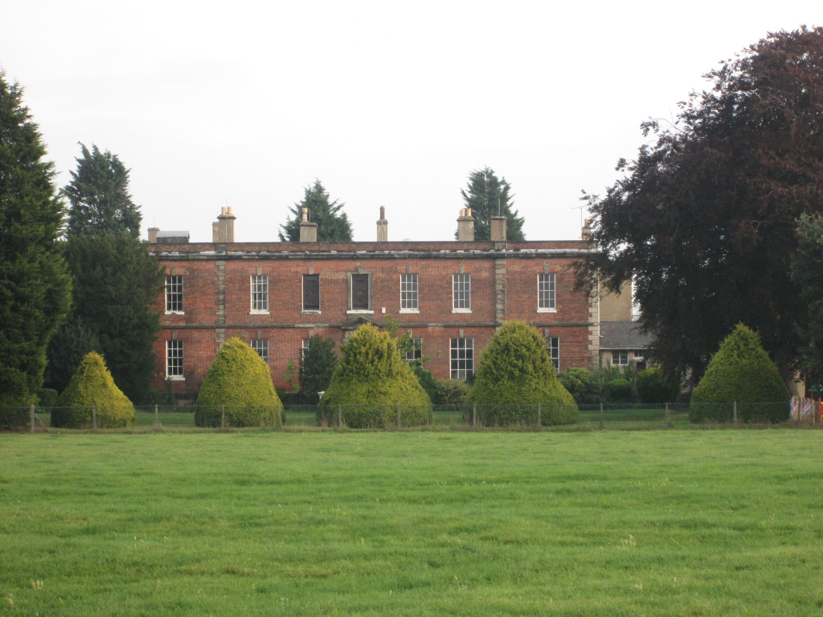
Shardlow Hall, Derbyshire

Shardlow Hall is a 17th-century former country house at Shardlow, Derbyshire now in use as commercial offices. It is a Grade II* listed building which...

Shardlow Hall (school)

Shardlow Hall was a school in Shardlow, a village seven miles south of Derby in the English Midlands. It was founded by B.O.Corbett, who had played football...

St James' Church, Shardlow

St James’ Church, Shardlow is a Grade II listed parish church in the Church of England in Shardlow, Derbyshire. == History == The foundation stone was...

Shardlow and Great Wilne

Shardlow and Great Wilne is a civil parish in the South Derbyshire district of the English county of Derbyshire. The population of the civil parish taken...

Shardlow

Shardlow is a village in Derbyshire, England about 6 miles (9.7 km) southeast of Derby and 11 miles (18 km) southwest of Nottingham. Part of the civil...

Great Wilne

Great Wilne is a small village in Derbyshire, England on the border with Leicestershire. It is 7 miles (11 km) south east of Derby. It is a village split...

Cavendish Bridge

Cavendish Bridge is a bridge over the River Trent, connecting the counties of Leicestershire and Derbyshire; it is also the name of a hamlet on the Leicestershire...

Derby South services

The Derby South services are two service stations run by Welcome Break on either side of the A50 road. The services are located in South Derbyshire, near...

Nearby Amenities

Located within 500m of 52.873138,-1.3503524
Shardlow
Is In: Derbyshire, England, UK
Place: village
Wikidata: Q7489471
Wikipedia: en:Shardlow
Lat/Long: 52.8695464/-1.3531504
Entrance: yes
Lat/Long: 52.8689462/-1.3521834
Entrance: main
Lat/Long: 52.8687765/-1.3517013
Description: War memorial
Historic: memorial
Memorial: war_memorial
Source: survey
Lat/Long: 52.8687903/-1.3508597
Entrance: main
Lat/Long: 52.8688215/-1.3512276
Barrier: stile
Lat/Long: 52.8699601/-1.3553679
Barrier: cattle_grid
Lat/Long: 52.8706331/-1.3546885
Barrier: stile
Lat/Long: 52.870922/-1.3528441
Barrier: stile
Lat/Long: 52.8709363/-1.3527584
Barrier: stile
Lat/Long: 52.8723002/-1.34902
Barrier: stile
Lat/Long: 52.8723787/-1.3475619
Barrier: stile
Lat/Long: 52.8734796/-1.3436464
Bus Stop
Shakespeare Road
Alt Name: Shakespeare Inn
Bus: yes
Naptan AtcoCode: 1000DSLR5102
Naptan NaptanCode: dbsadjap
Note: Name as written on sign, but most probably an error
Public Transport: platform
Shelter: no
Source: survey
Lat/Long: 52.8689426/-1.3520772
Kindergarten
Shardlow Hall Day Nursery
Addr City: Derby
Addr Housenumber: 125
Addr Postcode: DE72 2GP
Addr Street: London Road
Fhrs Id: 734915
Fixme: Exact location needs confirming
Source Addr: Food Hygiene Open Data
Lat/Long: 52.8699181/-1.3511565
Bench
Lat/Long: 52.8687384/-1.3508588
Entrance: main
Lat/Long: 52.8686671/-1.3510312
Entrance: service
Lat/Long: 52.8686784/-1.3507054
Bench
Source: survey
Lat/Long: 52.8687529/-1.3505354
Man Made: utility_cabinet
Lat/Long: 52.8687874/-1.3501634
Bench
Source: survey
Lat/Long: 52.8689787/-1.3519815
Entrance: yes
Lat/Long: 52.8690756/-1.3521473
WW2 Pillbox (brick)
Building: bunker
Bunker Type: pillbox
Military: bunker
Lat/Long: 52.8702429/-1.3472372
Waste Basket
Colour: black
Material: metal
Operator: South Derbyshire District Council
Waste: trash
Lat/Long: 52.8689735/-1.3520096
The data included in this document is from www.openstreetmap.org. The data is made available under ODbL.

Have you been to Bottom Wood?

Leave your review of Bottom Wood below (or comments, questions and feedback).