Black Wood

Wood, Forest in Durham

England

Black Wood

The A19 northbound approaching the turn off for Elwick
The A19 northbound approaching the turn off for Elwick Credit: peter robinson

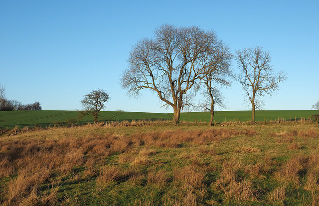
Black Wood is a dense forest located in Durham, England. Spanning over a vast area, it is known for its lush greenery, tall trees, and diverse wildlife. The woodland is situated in the heart of the Durham countryside, providing a peaceful and serene environment for visitors to immerse themselves in nature.

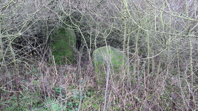
The forest is predominantly composed of various species of deciduous and evergreen trees, such as oak, beech, and pine. These towering trees create a dense canopy, which filters sunlight and creates a cool and shaded atmosphere within the woodland. The forest floor is covered in a thick layer of fallen leaves and moss, providing a soft carpet for explorers to tread upon.

Black Wood is home to a wide range of wildlife, making it a popular destination for nature enthusiasts and bird watchers. Visitors may catch a glimpse of various bird species, including woodpeckers, owls, and thrushes. The forest also provides a habitat for small mammals like squirrels, foxes, and rabbits.

The woodland offers several well-maintained walking trails and pathways, allowing visitors to explore its beauty at their own pace. These trails wind through the forest, offering breathtaking views of the surrounding landscape and glimpses of the local flora and fauna.

Black Wood is not only a haven for nature lovers but also serves as an important ecological and environmental resource. It plays a crucial role in maintaining the biodiversity of the region and contributes to the overall health and wellbeing of the local ecosystem.

If you have any feedback on the listing, please let us know in the comments section below.

Black Wood Images

Images are sourced within 2km of 54.661695/-1.3222279 or Grid Reference NZ4329. Thanks to Geograph Open Source API. All images are credited.

The A19 northbound approaching the turn off for Elwick
Trees on Embleton Moor The foreground land in the image may well have the appearance of moorland but the name Embleton Moor is surely historic as the terrain generally in this area is fully cultivated. The view is from close to (but not on) a bridleway about to descend into the shallow valley, Bedlam Gill.
Trees on Embleton Moor
The foreground land in the image may well have the appearance of moorland but the name Embleton Moor is surely historic as the terrain generally in this area is fully cultivated. The view is from close to (but not on) a bridleway about to descend into the shallow valley, Bedlam Gill.
A19  Winter devastation just off the A19 near Peterlee.
A19
Winter devastation just off the A19 near Peterlee.
Gravestones at abandoned church at Embleton I'm sure that the people putting flowers on these graves never imagined that they would end up in such a sorry neglected state.
Gravestones at abandoned church at Embleton
I'm sure that the people putting flowers on these graves never imagined that they would end up in such a sorry neglected state.
A19 lay-by
A19 lay-by
View from A19
View from A19
A19 southbound
A19 southbound
Track to Benkowle Farm Not the main way to the farm; the main access road is off the A19.
Track to Benkowle Farm
Not the main way to the farm; the main access road is off the A19.
Feed me! Although I gave them no cause for encouragement, as soon as I approached the field, this flock of sheep congregated in full expectation that I was going to feed them. In the background is Amerston Hall, which stands on the probable site of a medieval fortified manor house. Although scarcely visible on the ground, this field is the site of a medieval village.
Feed me!
Although I gave them no cause for encouragement, as soon as I approached the field, this flock of sheep congregated in full expectation that I was going to feed them. In the background is Amerston Hall, which stands on the probable site of a medieval fortified manor house. Although scarcely visible on the ground, this field is the site of a medieval village.
Barn at Amerston Hall I believe that one of the businesses of this farm is bottled water from a borehole. The trailers visible are possibly in conjunction with this business.
Barn at Amerston Hall
I believe that one of the businesses of this farm is bottled water from a borehole. The trailers visible are possibly in conjunction with this business.
Amerston Hall On the possible site of a Medieval fortified manor house. The site of a medieval village has been identified in adjacent fields.
Amerston Hall
On the possible site of a Medieval fortified manor house. The site of a medieval village has been identified in adjacent fields.
Farm track across ravine, near Embleton
Amerston Hill - for the person who has everything How about a helicopter on the lawn?
Amerston Hill - for the person who has everything
How about a helicopter on the lawn?
Fields at Amerston Hill The helicopter has just taken off from the lawn of the house <a href="https://www.geograph.org.uk/photo/344697">NZ4330 : Amerston Hill - for the person who has everything</a>. The North York Moors can be seen on the horizon.
Fields at Amerston Hill
The helicopter has just taken off from the lawn of the house NZ4330 : Amerston Hill - for the person who has everything. The North York Moors can be seen on the horizon.
New building at Amerston Hill There are a surprising number of expensive new houses built in the generally deserted countryside between Sedgefield and Hartlepol
New building at Amerston Hill
There are a surprising number of expensive new houses built in the generally deserted countryside between Sedgefield and Hartlepol
Footpath near Amerston Hill The line of this footpath across the field is marked by yellow vegetation (application of weedkiller?). Amerston Hill in the background.
Footpath near Amerston Hill
The line of this footpath across the field is marked by yellow vegetation (application of weedkiller?). Amerston Hill in the background.
Stotfold Moor Farm
Stotfold Moor Farm
Farm track above High Stotfold The dreaming towers of Teesside can be seen in the distance, with the Cleveland Hills on the skyline.
Farm track above High Stotfold
The dreaming towers of Teesside can be seen in the distance, with the Cleveland Hills on the skyline.
Show me another place!

Black Wood is located at Grid Ref: NZ4329 (Lat: 54.661695, Lng: -1.3222279)

Unitary Authority: Hartlepool

Police Authority: Cleveland

What 3 Words

///vest.meaty.otter. Near Elwick, Co. Durham

Nearby Locations

Red Gap Moor Black Wood

Related Wikis

Embleton, County Durham

Embleton is a hamlet and former civil parish, now in the parish of Sedgefield, in the County Durham district, in the ceremonial county of Durham, in England...

Dalton Piercy

Dalton Piercy is a village and civil parish in the borough of Hartlepool, County Durham, in England. The population of the civil parish taken at the 2011...

Brierton

Brierton is a civil parish and hamlet in the borough of Hartlepool, County Durham, England. At the 2011 Census the population of the civil parish was less...

Elwick, County Durham

Elwick is a village and civil parish in the borough of Hartlepool in County Durham, England. It is situated near the A19 road to the west of Hartlepool...

Wynyard railway station (England)

Wynyard railway station was a railway station on the Castle Eden branch of the North Eastern Railway (NER) from 1880 to 1931. It was located immediately...

The Hartlepools (UK Parliament constituency)

The Hartlepools was a borough constituency represented in the House of Commons of the UK Parliament. The constituency became Hartlepool in 1974. The...

Hartlepool (UK Parliament constituency)

Hartlepool is a borough constituency represented in the House of Commons of the UK Parliament by Jill Mortimer of the Conservative Party from 2021. The...

Newton Bewley

Newton Bewley is a village and civil parish in the borough of Hartlepool in County Durham, England. It is situated between the towns of Hartlepool and...

Nearby Amenities

Located within 500m of 54.661695,-1.3222279
Power: pole
Lat/Long: 54.6580435/-1.317723
Power: pole
Lat/Long: 54.6584215/-1.3192122
Power: pole
Lat/Long: 54.6585213/-1.3189019
Power: pole
Lat/Long: 54.6588687/-1.3203645
Power: pole
Lat/Long: 54.6589894/-1.3201376
Power: pole
Lat/Long: 54.6593908/-1.321653
Power: pole
Lat/Long: 54.6594554/-1.3213636
Power: pole
Lat/Long: 54.6601639/-1.3224469
Power: pole
Lat/Long: 54.6602251/-1.3221391
Power: pole
Lat/Long: 54.6609562/-1.3232705
Power: pole
Lat/Long: 54.66103/-1.3229694
Power: pole
Lat/Long: 54.6617293/-1.3240731
Power: pole
Lat/Long: 54.661784/-1.3237508
Power: pole
Lat/Long: 54.6625059/-1.3248706
Power: pole
Lat/Long: 54.6625712/-1.324544
Power: pole
Lat/Long: 54.6632513/-1.3251712
Power: pole
Lat/Long: 54.6632704/-1.3248162
Power: pole
Lat/Long: 54.6639462/-1.3254578
Power: pole
Lat/Long: 54.6640752/-1.3251119
Power: pole
Lat/Long: 54.6646725/-1.325741
Power: pole
Lat/Long: 54.6647254/-1.3253724
Power: pole
Lat/Long: 54.6654138/-1.3260164
Power: pole
Lat/Long: 54.6654324/-1.3256896
The data included in this document is from www.openstreetmap.org. The data is made available under ODbL.

Have you been to Black Wood?

Leave your review of Black Wood below (or comments, questions and feedback).