Ireland's Copse

Wood, Forest in Hampshire Basingstoke and Deane

England

Ireland's Copse

Fields by the A343, Hollington Cross
Fields by the A343, Hollington Cross Credit: David Howard

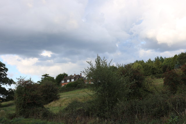
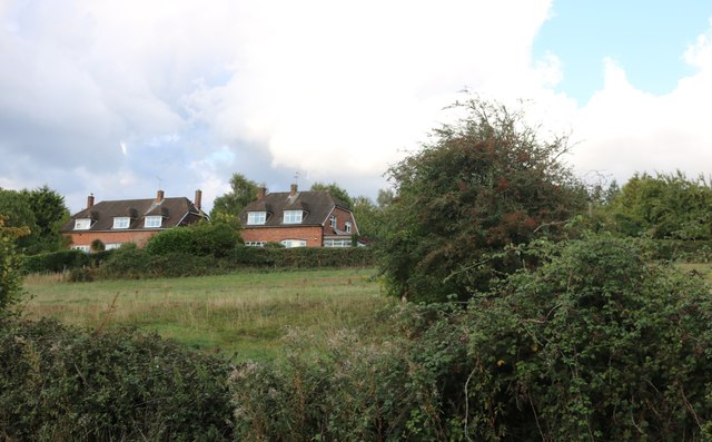
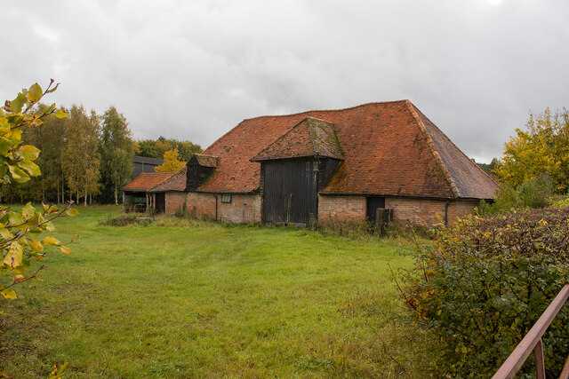
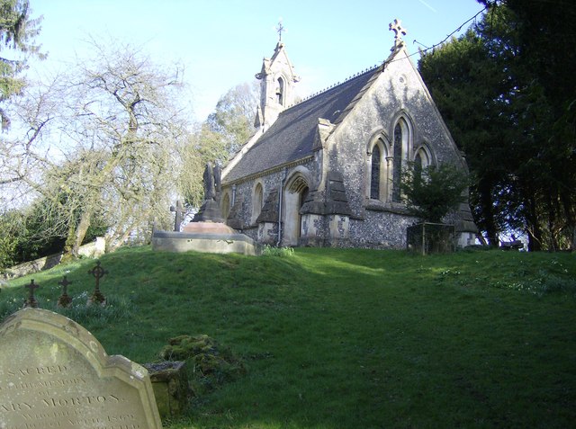
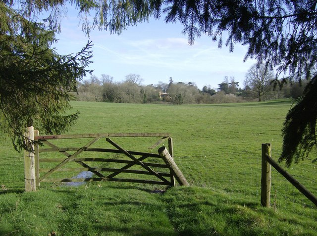
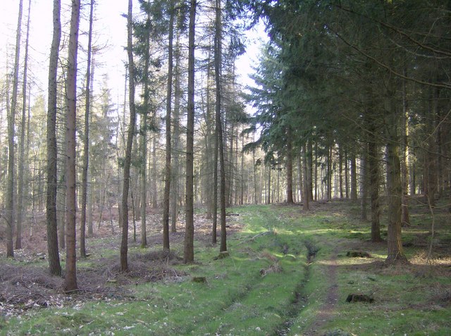
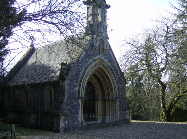
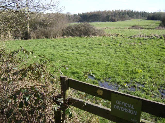
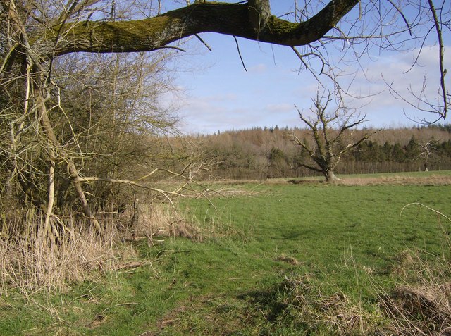
Ireland's Copse is a picturesque woodland located in Hampshire, England. Covering an area of approximately 100 acres, this enchanting forest is known for its diverse range of flora and fauna, making it a popular destination for nature enthusiasts and hikers alike.

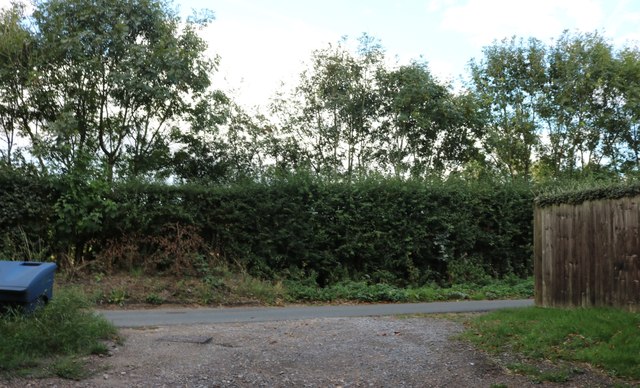
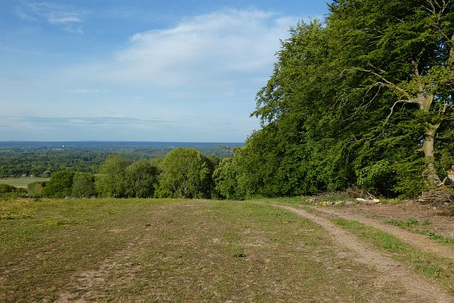
The copse is characterized by its dense, lush vegetation, with towering oak, beech, and pine trees dominating the landscape. These majestic trees provide a dense canopy that filters sunlight, creating a cool and tranquil atmosphere within the forest. The forest floor is covered with a rich layer of moss, ferns, and wildflowers, adding to the overall beauty of the woodland.

Walking through Ireland's Copse, visitors can expect to encounter a variety of wildlife. Squirrels, rabbits, and foxes are commonly spotted, while birdwatchers may catch glimpses of woodpeckers, owls, and various songbirds. The copse is also home to a diverse range of insects, including butterflies and beetles, adding to the biodiversity of the area.

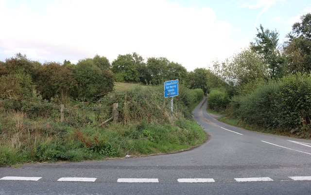
The forest is crisscrossed by a network of well-maintained trails, providing visitors with the opportunity to explore the copse at their own pace. These paths lead to hidden clearings and secluded ponds, providing serene spots for picnicking or simply enjoying the tranquility of the forest.

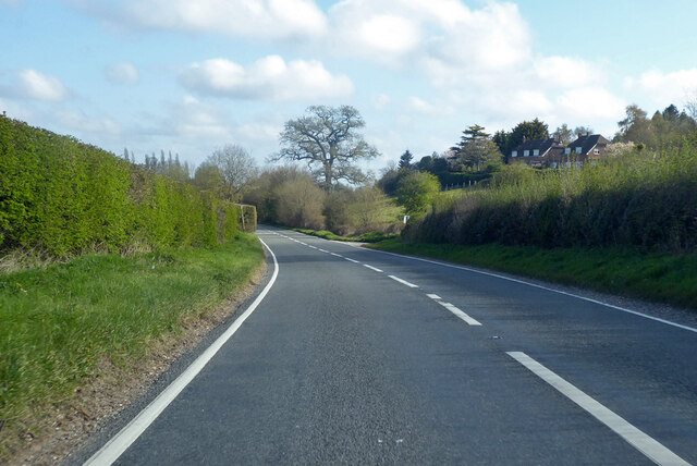
Ireland's Copse is open to the public year-round, with designated parking areas and picnic spots available. It is advisable to bring appropriate footwear and clothing, as the forest can be muddy and uneven in places. Whether it's for a leisurely stroll or a deeper connection with nature, Ireland's Copse offers a breathtaking escape into the heart of Hampshire's woodlands.

If you have any feedback on the listing, please let us know in the comments section below.

Ireland's Copse Images

Images are sourced within 2km of 51.339027/-1.3875653 or Grid Reference SU4260. Thanks to Geograph Open Source API. All images are credited.

Fields by the A343, Hollington Cross
Highclere Street at the junction of the A343
Houses on Highclere Street, Hollington Cross By the A343
Houses on Highclere Street, Hollington Cross
By the A343
Highclere Street, Hollington Cross
Old Milestone by the A343, near Highclere Farm, Highclere parish Carved stone post by the A343, in parish of HIGHCLERE (BASINGSTOKE AND DEANE District), near Highclere Farm, South of village, just before bridge, deep in the hedge, on West side of road. Newbury waist, erected by the Andover & Chilton Pond turnpike trust in the 18th century. 

Inscription reads:-
: NEWBURY / 5 : : SARUM / 29 (overpainted 27) / (OXFORD / 31) : : ANDOVER / 11 (overpainted 10) :

Grade II listed.  
List Entry Number: 1419228 <span class="nowrap"><a title="https://historicengland.org.uk/listing/the-list/list-entry/1419228" rel="nofollow ugc noopener" href="https://historicengland.org.uk/listing/the-list/list-entry/1419228">Link</a><img style="margin-left:2px;" alt="External link" title="External link - shift click to open in new window" src="https://s1.geograph.org.uk/img/external.png" width="10" height="10"/></span>

Milestone Society National ID: HA_NEAN05.
Old Milestone by the A343, near Highclere Farm, Highclere parish
Carved stone post by the A343, in parish of HIGHCLERE (BASINGSTOKE AND DEANE District), near Highclere Farm, South of village, just before bridge, deep in the hedge, on West side of road. Newbury waist, erected by the Andover & Chilton Pond turnpike trust in the 18th century. Inscription reads:- : NEWBURY / 5 : : SARUM / 29 (overpainted 27) / (OXFORD / 31) : : ANDOVER / 11 (overpainted 10) : Grade II listed. List Entry Number: 1419228 LinkExternal link Milestone Society National ID: HA_NEAN05.
Farmland, East Woodhay A crop of wheat to the west of Pill Hill.
Farmland, East Woodhay
A crop of wheat to the west of Pill Hill.
Highclere: Harvested agricultural land
Hollington Cross, Zell House Farm
Zell House Farm
Zell House Farm
Farmland and woodland, East Woodhay A view over the Kennet valley from the edge of Buckhanger Copse.
Farmland and woodland, East Woodhay
A view over the Kennet valley from the edge of Buckhanger Copse.
A343 towards Newbury
Highclere estate chapel This is within the Highclere Castle estate, but the gravestones seem to indicate that it fulfils (or used to fulfil) the role of a parish church.  Yes, the angles are right; the church itself is on a slight hill so any picture will involve looking up at it.  The tree to its left does lean at that angle, and poor Ann Morton's headstone in the foreground does lean alarmingly the other way!
Highclere estate chapel
This is within the Highclere Castle estate, but the gravestones seem to indicate that it fulfils (or used to fulfil) the role of a parish church. Yes, the angles are right; the church itself is on a slight hill so any picture will involve looking up at it. The tree to its left does lean at that angle, and poor Ann Morton's headstone in the foreground does lean alarmingly the other way!
Approaching Highclere Estate Leaving Highclere Wood the footpath passes through some open pasture and heads towards the Dairy Farm (ahead).  The gate and fencepost have seen better days, indeed they are only holding each other up with a chain.  When I undid the chain both fell down, but the situation was returned to normal.
Approaching Highclere Estate
Leaving Highclere Wood the footpath passes through some open pasture and heads towards the Dairy Farm (ahead). The gate and fencepost have seen better days, indeed they are only holding each other up with a chain. When I undid the chain both fell down, but the situation was returned to normal.
In Highclere Wood Within the Highclere Estate, Highclere Wood is mainly conifers but quite thinly planted.  This area of the wood is called Ivyhouse Copse on 1:25K map, but is bigger than expected for a copse.  There is a footpath through.
In Highclere Wood
Within the Highclere Estate, Highclere Wood is mainly conifers but quite thinly planted. This area of the wood is called Ivyhouse Copse on 1:25K map, but is bigger than expected for a copse. There is a footpath through.
Highclere estate chapel This is the front of the chapel within the estate.
Highclere estate chapel
This is the front of the chapel within the estate.
Footpath to Highclere estate As the footpath leaves the A343 there is immediately a diversion round woodland.  The path runs parallel to the southern edge of the wood in a very soggy pasture.  The trees in the background are also part of Highclere Wood within the square.
Footpath to Highclere estate
As the footpath leaves the A343 there is immediately a diversion round woodland. The path runs parallel to the southern edge of the wood in a very soggy pasture. The trees in the background are also part of Highclere Wood within the square.
Footpath to Highclere estate The path stays in pasture just outside woodland to the left.  Ahead Highclere Wood is part of the same continuous section of woodland within the square.
Footpath to Highclere estate
The path stays in pasture just outside woodland to the left. Ahead Highclere Wood is part of the same continuous section of woodland within the square.
Show me another place!

Ireland's Copse is located at Grid Ref: SU4260 (Lat: 51.339027, Lng: -1.3875653)

Administrative County: Hampshire

District: Basingstoke and Deane

Police Authority: Hampshire

What 3 Words

///intervene.months.stripped. Near Highclere, Hampshire

Related Wikis

Highclere

Highclere (pronounced ) is a village and civil parish situated in the North Wessex Downs (an Area of Outstanding Natural Beauty) in the Basingstoke and...

Woolton Hill

Woolton Hill is a village in Hampshire, England, in the civil parish of East Woodhay. The village lies approximately 4 miles (6 km) south-west of the centre...

Gainsborough Stud

Gainsborough Stud is a stud farm based in Woolton Hill, Hampshire, 3 miles (4.8 km) outside Newbury. It is owned by United Arab Emirates-based international...

Stargroves

Stargroves (also known as Stargrove House) is a manor house and associated estate at East Woodhay in the English county of Hampshire. The house belonged...

Highclere Castle

Highclere Castle is a Grade I listed country house built in 1679 and largely renovated in the 1840s, with a park designed by Capability Brown in the 18th...

East Woodhay

East Woodhay is a village and civil parish in Hampshire, England. The village is approximately 5.5 miles (9 km) south-west of Newbury in Berkshire. At...

Penwood

Penwood is a village in the civil parish of Highclere in the Basingstoke and Deane district of Hampshire, England. Its nearest town is Newbury, which lies...

Highclere Park

Highclere Park is a 69.6-hectare (172-acre) biological Site of Special Scientific Interest east of Highclere in Hampshire. It is the park of Highclere...

Nearby Amenities

Located within 500m of 51.339027,-1.3875653
Barrier: stile
Foot: yes
Lat/Long: 51.3387367/-1.3868691
Barrier: stile
Foot: yes
Lat/Long: 51.3382729/-1.3835062
The data included in this document is from www.openstreetmap.org. The data is made available under ODbL.

Have you been to Ireland's Copse?

Leave your review of Ireland's Copse below (or comments, questions and feedback).