Douglas West

Settlement in Lanarkshire

Scotland

Douglas West

Underneath the old railway footbridge near Windrow Wood A view from the course of the former Muirkirk Branch of the Caledonian Railway of the remains of the footbridge shown in <a href="https://www.geograph.org.uk/photo/6916551">NS8129 : Remains of bridge over the former Muirkirk railway</a>

Some of the crumbling masonry from the bridge piers can be seen scattered around. The bridge span is gone but some of the ironwork remains, as can be seen here.
Underneath the old railway footbridge near Windrow Wood Credit: Alan O'Dowd

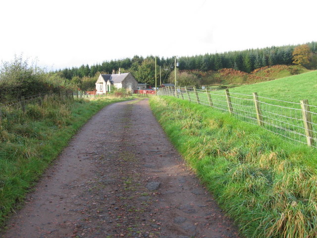
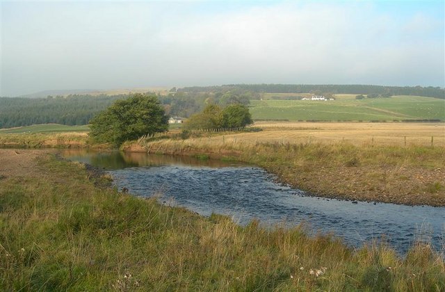
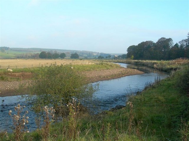
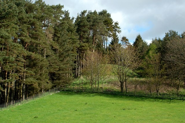
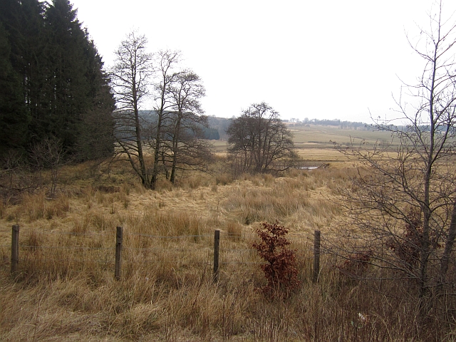
Douglas West is a small village located in the county of Lanarkshire, Scotland. Situated in the southern part of the country, it lies approximately 40 miles southeast of Glasgow and 70 miles southwest of Edinburgh. The village is nestled within a rural landscape, surrounded by rolling hills and farmland, offering residents a tranquil and picturesque setting.

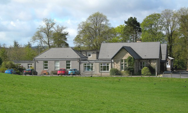
Historically, Douglas West was primarily an agricultural community, with farming being the main occupation for its inhabitants. Over the years, the village has seen some development, including the establishment of a primary school, a church, and a few local businesses. However, it has managed to retain its quaint charm and close-knit community spirit, making it an attractive place for those seeking a slower pace of life.

The village benefits from its proximity to the nearby town of Lanark, which provides residents with access to a wider range of amenities, including shops, restaurants, and healthcare facilities. Additionally, the surrounding countryside offers numerous opportunities for outdoor activities, such as hiking, cycling, and fishing.

Although modest in size, Douglas West has a rich history and is known for its connections to the Douglas family, one of Scotland's most prominent noble families. The nearby Douglas Castle, which dates back to the 14th century, serves as a reminder of the area's historical significance.

Overall, Douglas West offers a peaceful and idyllic lifestyle within a close community, making it an appealing place for those seeking a rural retreat in the heart of Lanarkshire.

If you have any feedback on the listing, please let us know in the comments section below.
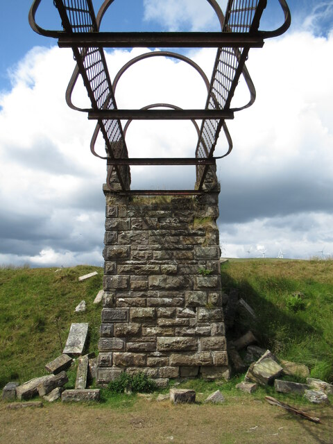
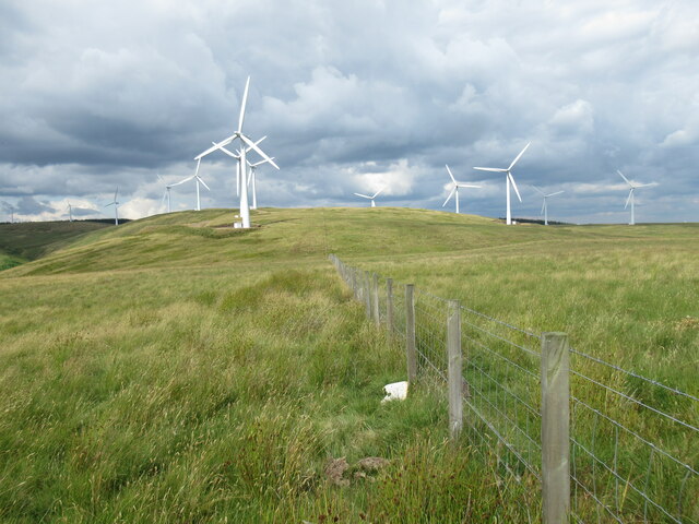
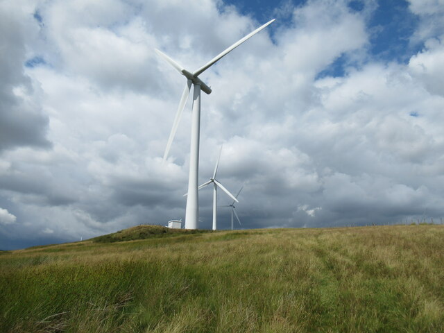
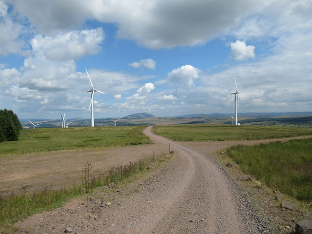
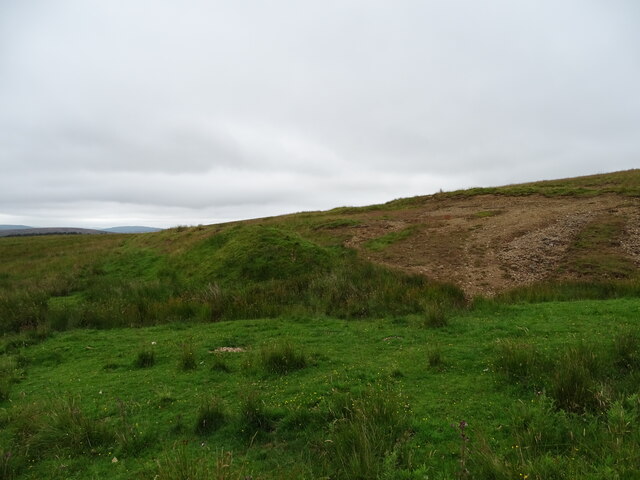
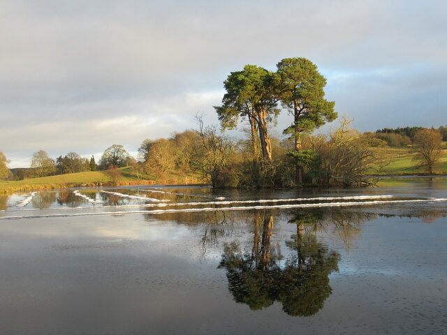
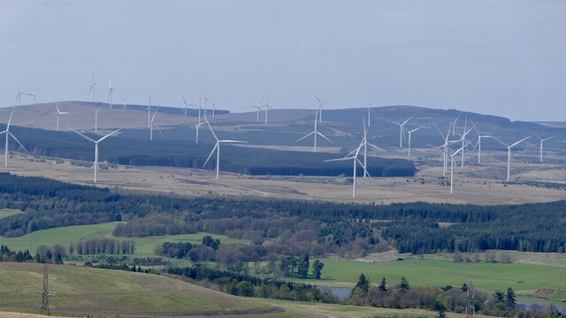
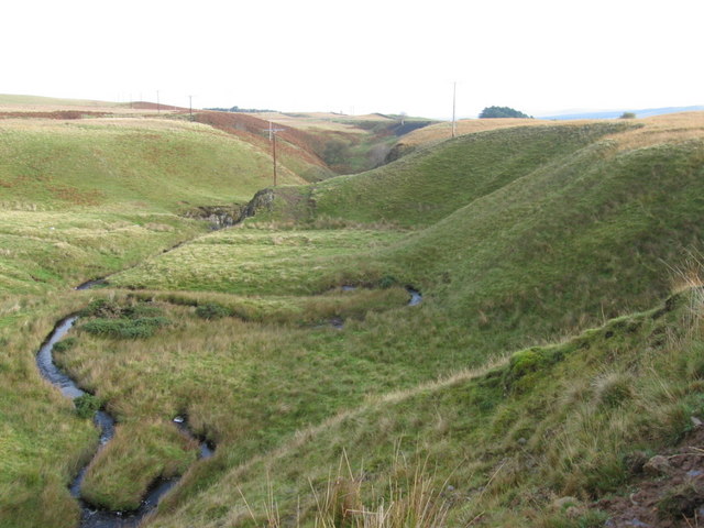
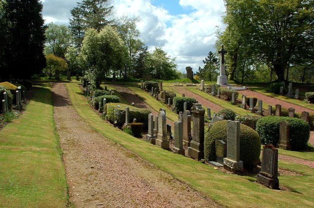
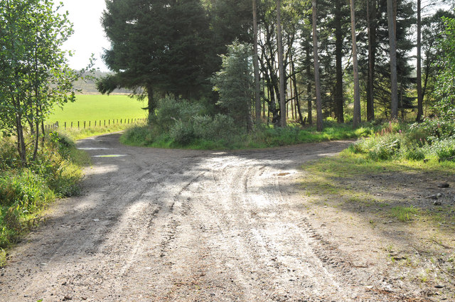
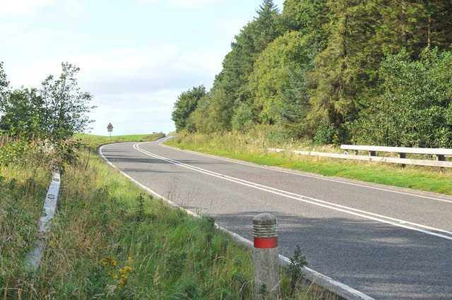
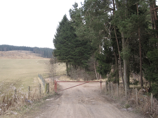
Douglas West Images

Images are sourced within 2km of 55.558359/-3.870809 or Grid Reference NS8230. Thanks to Geograph Open Source API. All images are credited.

Underneath the old railway footbridge near Windrow Wood A view from the course of the former Muirkirk Branch of the Caledonian Railway of the remains of the footbridge shown in <a href="https://www.geograph.org.uk/photo/6916551">NS8129 : Remains of bridge over the former Muirkirk railway</a>

Some of the crumbling masonry from the bridge piers can be seen scattered around. The bridge span is gone but some of the ironwork remains, as can be seen here.
Underneath the old railway footbridge near Windrow Wood
A view from the course of the former Muirkirk Branch of the Caledonian Railway of the remains of the footbridge shown in NS8129 : Remains of bridge over the former Muirkirk railway Some of the crumbling masonry from the bridge piers can be seen scattered around. The bridge span is gone but some of the ironwork remains, as can be seen here.
Wind farm landscape on Windrow Hill These turbines are part of the Hagshaw Hill Wind Farm, Scotland's first wind farm when originally constructed in 1995, and much extended since.
Wind farm landscape on Windrow Hill
These turbines are part of the Hagshaw Hill Wind Farm, Scotland's first wind farm when originally constructed in 1995, and much extended since.
Wind turbines on Burnt Rig These turbines (not yet shown on some maps) are part of the Hagshaw Hill Wind Farm, Scotland's first wind farm when originally constructed in 1995, and much extended since.
Wind turbines on Burnt Rig
These turbines (not yet shown on some maps) are part of the Hagshaw Hill Wind Farm, Scotland's first wind farm when originally constructed in 1995, and much extended since.
Track at Hagshaw Hill Wind Farm These turbines (some not yet on the map) are part of the Hagshaw Hill Wind Farm, Scotland's first wind farm when originally constructed in 1995, and much extended since, causing the landscape here to be dominated by tracks, turbines and other infrastructure.
Track at Hagshaw Hill Wind Farm
These turbines (some not yet on the map) are part of the Hagshaw Hill Wind Farm, Scotland's first wind farm when originally constructed in 1995, and much extended since, causing the landscape here to be dominated by tracks, turbines and other infrastructure.
Rifle Range This was the target area for an old rifle range near
Douglas West.
This photo was taken on the 31st July 2022.
Rifle Range
This was the target area for an old rifle range near Douglas West. This photo was taken on the 31st July 2022.
Scots pines reflected in loch, Douglas Estate The thaw over the last day or so has left unusual lines of ice or slush in the water.
Scots pines reflected in loch, Douglas Estate
The thaw over the last day or so has left unusual lines of ice or slush in the water.
Patterns and reflections in loch, Douglas Estate The thaw over the last day or so has left unusual lines of ice or slush in the water.
Patterns and reflections in loch, Douglas Estate
The thaw over the last day or so has left unusual lines of ice or slush in the water.
Wind turbines near Douglas
Windrow Burn
Windrow Burn
Windrow Cottage
Windrow Cottage
Douglas Water Looking towards Windrow Cottage on a misty October morning.  Scrogtonhead Farm is in the background.
Douglas Water
Looking towards Windrow Cottage on a misty October morning. Scrogtonhead Farm is in the background.
Douglas Water Looking downstream on a misty October morning.
Douglas Water
Looking downstream on a misty October morning.
A Motte Near Douglas This small mound would have been the site of an old, wooden structure, possibly dating back to the 12th century.
A Motte Near Douglas
This small mound would have been the site of an old, wooden structure, possibly dating back to the 12th century.
Douglas Cemetery This well-tended cemetery lies outside the village on the A70.  The large cross on the far side is the War Memorial.
Douglas Cemetery
This well-tended cemetery lies outside the village on the A70. The large cross on the far side is the War Memorial.
Entrance to Townhead Wood
A70 west of Douglas
A70 west of Douglas
Forest access Road into Townhead Wood, assuming it survives the open cast onslaught here. A good gate is a wise investment, dumpers hover around rural Lanarkshire in much the same way as flies do in a field of cattle.
Forest access
Road into Townhead Wood, assuming it survives the open cast onslaught here. A good gate is a wise investment, dumpers hover around rural Lanarkshire in much the same way as flies do in a field of cattle.
Wetland beside the Douglas Water View from beside the A70.
Wetland beside the Douglas Water
View from beside the A70.
Show me another place!

Douglas West is located at Grid Ref: NS8230 (Lat: 55.558359, Lng: -3.870809)

Unitary Authority: South Lanarkshire

Police Authority: Lanarkshire

What 3 Words

///barks.skater.weary. Near Douglas, South Lanarkshire

Nearby Locations

Douglas West

Related Wikis

Douglas West railway station

Douglas West railway station served the village of Douglas West, South Lanarkshire in Scotland between 1896 and 1964. == History == The railway line between...

Douglas, South Lanarkshire

Douglas (Scottish Gaelic: Dùbhghlas) is a village in South Lanarkshire, Scotland. It is located on the south bank of the Douglas Water and on the A70 road...

Lady Home Hospital

Lady Home Hospital is a health facility in Ayr Road, Douglas, South Lanarkshire, Scotland. It is managed by NHS Lanarkshire. == History == The facility...

Douglas Castle

Douglas Castle was a stronghold of the Douglas (later Douglas-Home) family from medieval times to the 20th century. The first castle, erected in the 13th...

Nearby Amenities

Located within 500m of 55.558359,-3.870809
Power: pole
Lat/Long: 55.5599676/-3.8765519
Power: pole
Lat/Long: 55.5576146/-3.8664374
Power: pole
Lat/Long: 55.5575152/-3.8638967
Power: pole
Lat/Long: 55.5602507/-3.8761039
Power: pole
Lat/Long: 55.5592126/-3.8753208
Power: pole
Lat/Long: 55.5581762/-3.8745273
Power: pole
Lat/Long: 55.5579561/-3.8736292
Power: pole
Lat/Long: 55.5577605/-3.8737974
Power: pole
Lat/Long: 55.5581677/-3.8752912
Power: pole
Lat/Long: 55.5590727/-3.8759029
Douglas West
Historic Railway: station
Railway: site
Wikidata: Q5302098
Wikipedia: en:Douglas West railway station
Lat/Long: 55.557933/-3.8715394
Power: pole
Lat/Long: 55.5578146/-3.8737322
Power: pole
Lat/Long: 55.5552401/-3.8744375
Power: pole
Lat/Long: 55.5560002/-3.8740003
Power: pole
Lat/Long: 55.5567678/-3.8735873
Power: pole
Lat/Long: 55.5551977/-3.8748479
Power: pole
Lat/Long: 55.5558622/-3.8744777
Power: pole
Lat/Long: 55.5565266/-3.8740808
Power: pole
Lat/Long: 55.5572108/-3.873716
Power: pole
Lat/Long: 55.5578889/-3.8733324
Power: pole
Lat/Long: 55.558303/-3.8741398
Power: pole
Lat/Long: 55.5584441/-3.8737536
Power: pole
Lat/Long: 55.5585063/-3.8734639
Power: pole
Lat/Long: 55.5625124/-3.8723937
Power: pole
Lat/Long: 55.5619315/-3.8733244
Power: pole
Lat/Long: 55.5610714/-3.8738528
Power: pole
Lat/Long: 55.5598018/-3.8747004
Power: pole
Lat/Long: 55.5591792/-3.8751153
Power: pole
Lat/Long: 55.559233/-3.8749101
Power: pole
Lat/Long: 55.5597456/-3.8745475
Power: pole
Lat/Long: 55.560542/-3.874011
Power: pole
Lat/Long: 55.5611518/-3.8736141
Power: pole
Lat/Long: 55.561845/-3.8732117
Power: pole
Lat/Long: 55.5623395/-3.8724071
Power: pole
Lat/Long: 55.5619876/-3.87142
Power: pole
Lat/Long: 55.5611928/-3.8723052
Power: pole
Lat/Long: 55.5602417/-3.8733405
Power: pole
Lat/Long: 55.5593084/-3.8743812
Power: pole
Lat/Long: 55.5592299/-3.8740057
Power: pole
Lat/Long: 55.5601006/-3.873083
Power: pole
Lat/Long: 55.5609713/-3.8721228
Power: pole
Lat/Long: 55.5618511/-3.8711143
Power: pole
Lat/Long: 55.5628127/-3.870095
Power: pole
Lat/Long: 55.5625397/-3.8727772
Power: pole
Lat/Long: 55.5619997/-3.8735658
Power: pole
Lat/Long: 55.5612656/-3.874113
Power: pole
Lat/Long: 55.5604995/-3.8745394
Power: pole
Lat/Long: 55.5597866/-3.8749981
Power: pole
Lat/Long: 55.5575653/-3.8718323
Power: pole
Lat/Long: 55.5568522/-3.8721961
Power: pole
Lat/Long: 55.5560889/-3.8725832
Power: pole
Lat/Long: 55.5554441/-3.8729026
Power: pole
Lat/Long: 55.5547561/-3.8732474
Power: pole
Lat/Long: 55.5594428/-3.8747617
Power: pole
Lat/Long: 55.5593993/-3.8746626
Power: pole
Lat/Long: 55.5593622/-3.8745505
Power: pole
Lat/Long: 55.558063/-3.8728223
Power: pole
Lat/Long: 55.5573428/-3.8668655
Power: pole
Lat/Long: 55.5569539/-3.866343
Power: pole
Lat/Long: 55.5566082/-3.8658819
Power: pole
Lat/Long: 55.5561775/-3.865315
Power: pole
Lat/Long: 55.5559848/-3.8645725
The data included in this document is from www.openstreetmap.org. The data is made available under ODbL.

Have you been to Douglas West?

Leave your review of Douglas West below (or comments, questions and feedback).