Douglas Water

Settlement in Lanarkshire

Scotland

Douglas Water

Farmland near Easter Tofts
Farmland near Easter Tofts Credit: Steven Brown

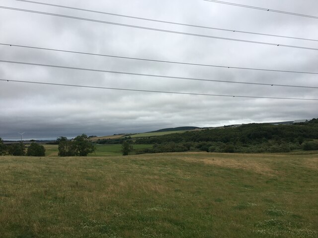
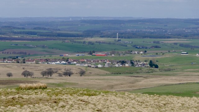
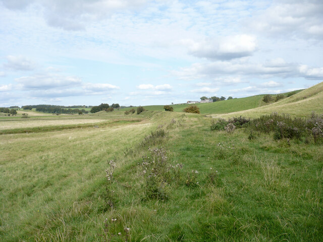
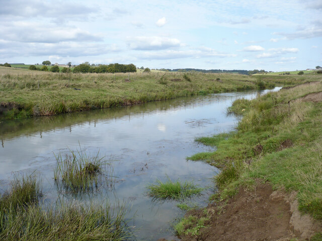
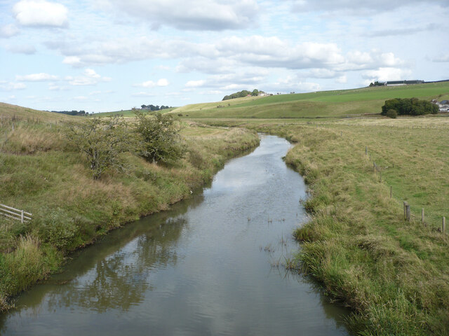
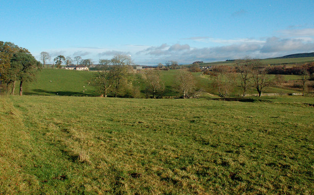
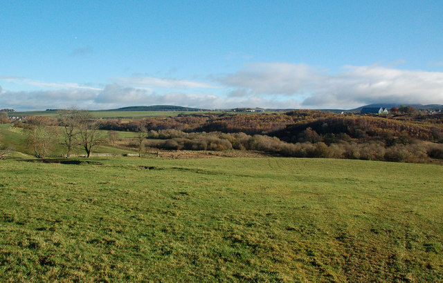
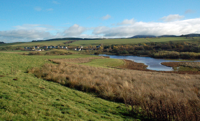
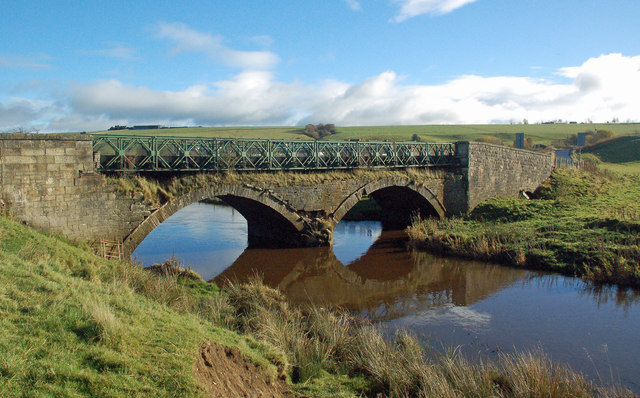
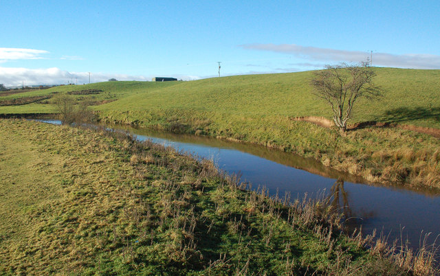
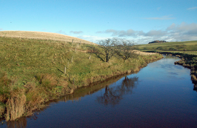
Douglas Water is a small village located in the county of Lanarkshire, Scotland. Situated about 20 miles southeast of Glasgow, it lies on the banks of the Douglas Water River, from which it derives its name. The village is surrounded by picturesque countryside, offering residents and visitors a tranquil and scenic environment.

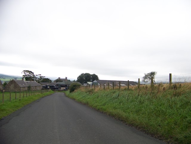
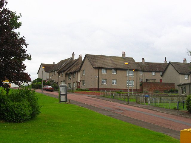
With a population of around 1,500 people, Douglas Water maintains a close-knit community atmosphere. It features a range of amenities, including a primary school, a post office, a local shop, and a pub, providing essential services for its residents. The village is well-connected to nearby towns and cities, with regular bus services operating in the area.

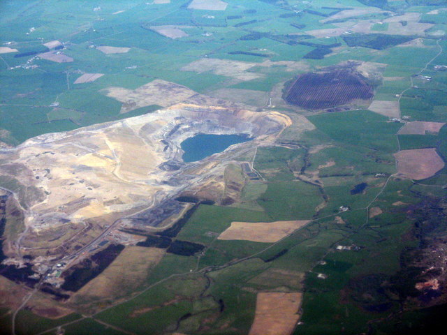
Douglas Water is known for its rich history, dating back to ancient times. There is evidence of Roman occupation in the area, with artifacts such as coins and pottery being discovered. Additionally, the ruins of Douglas Castle, a 14th-century stronghold, can be found nearby, adding to the historical significance of the village.

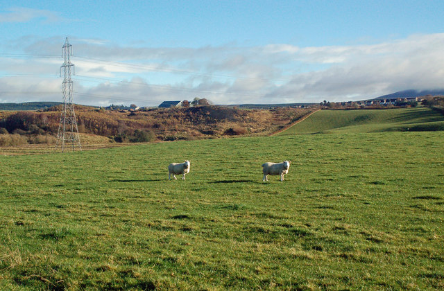
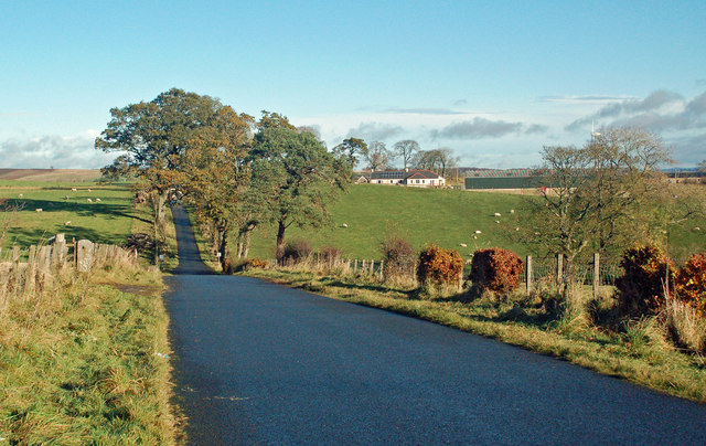
The natural beauty of Douglas Water and its surroundings attracts many outdoor enthusiasts. The village is surrounded by lush green fields and woodlands, offering opportunities for walking, cycling, and exploring nature. The Douglas Water River is a popular spot for fishing, attracting anglers from near and far.

Overall, Douglas Water is a charming village that combines a rich history with a peaceful rural setting. It offers a range of amenities and outdoor activities, making it an attractive place to live or visit for those seeking a quiet and idyllic Scottish village experience.

If you have any feedback on the listing, please let us know in the comments section below.

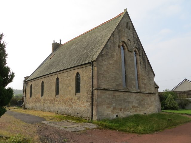
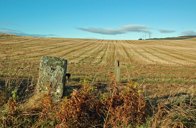
Douglas Water Images

Images are sourced within 2km of 55.607861/-3.790084 or Grid Reference NS8736. Thanks to Geograph Open Source API. All images are credited.

Farmland near Easter Tofts
Rigside View from Robert Law.
Rigside
View from Robert Law.
Course of former Muirkirk–Lanark railway An embankment which used to carry a railway here – it closed to passengers in 1964 and to freight in 1968.

The farm buildings at Sandilands are visible in the distance.
Course of former Muirkirk–Lanark railway
An embankment which used to carry a railway here – it closed to passengers in 1964 and to freight in 1968. The farm buildings at Sandilands are visible in the distance.
Murky shallows, Douglas Water The Douglas Water is a tributary of the Clyde, rising on Cairn Table near Muirkirk, and joining the Clyde just upstream of Lanark.
Murky shallows, Douglas Water
The Douglas Water is a tributary of the Clyde, rising on Cairn Table near Muirkirk, and joining the Clyde just upstream of Lanark.
Douglas Water viewed from Ponfeigh Bridge The Douglas Water is a tributary of the Clyde, rising on Cairn Table near Muirkirk, and joining the Clyde just upstream of Lanark.

Ponfeigh is pronounced 'pon-feech', with the 'ch' sound as in 'loch'.
Douglas Water viewed from Ponfeigh Bridge
The Douglas Water is a tributary of the Clyde, rising on Cairn Table near Muirkirk, and joining the Clyde just upstream of Lanark. Ponfeigh is pronounced 'pon-feech', with the 'ch' sound as in 'loch'.
Broken Cross Muir opencast mine With Folkerton Mill in the foreground, where the Douglas Water meets and runs alongside a minor road. The round, brown patch towards the upper right is a peat extraction site at Hillhouse.
Broken Cross Muir opencast mine
With Folkerton Mill in the foreground, where the Douglas Water meets and runs alongside a minor road. The round, brown patch towards the upper right is a peat extraction site at Hillhouse.
Eastertown Farm from the north
Road junction near Tower Farm
Douglas Water Free Church at Rigside Viewed from the north.
Douglas Water Free Church at Rigside
Viewed from the north.
After The Harvest Good arable land in the valley of the Douglas Water, viewed in mid-November.
After The Harvest
Good arable land in the valley of the Douglas Water, viewed in mid-November.
Grazing Land In The Douglas Water Valley Grazing land on the west side of Douglas Water. The disused colliery spoil heap at Rigside is in the next square.
Grazing Land In The Douglas Water Valley
Grazing land on the west side of Douglas Water. The disused colliery spoil heap at Rigside is in the next square.
Towards Wolfcrooks Looking along the minor road that runs on the west side of the Douglas Water towards Wolfcrooks Farm.
Towards Wolfcrooks
Looking along the minor road that runs on the west side of the Douglas Water towards Wolfcrooks Farm.
Wolfcrooks View Good grazing land in the valley of the Douglas Water at Wolfcrooks, viewed in mid-November.
Wolfcrooks View
Good grazing land in the valley of the Douglas Water at Wolfcrooks, viewed in mid-November.
Disused Colliery View Grazing land on the west side of Douglas Water, with the disused colliery spoil heap at Rigside in the background.
Disused Colliery View
Grazing land on the west side of Douglas Water, with the disused colliery spoil heap at Rigside in the background.
Loudon Pond Nature Reserve A mid-November view of this large, marshy pool on the Douglas Water.
Loudon Pond Nature Reserve
A mid-November view of this large, marshy pool on the Douglas Water.
Douglaswater Bridge Again This bridge has now been closed to traffic. It has deteriorated a lot since 2013 <a href="https://www.geograph.org.uk/photo/3565383">NS8736 : Douglaswater Bridge</a> and 2011 <a href="https://www.geograph.org.uk/photo/2350725">NS8736 : Douglaswater Bridge</a>. It seems to have suffered from the floods of autumn 2015.
Douglaswater Bridge Again
This bridge has now been closed to traffic. It has deteriorated a lot since 2013 NS8736 : Douglaswater Bridge and 2011 NS8736 : Douglaswater Bridge. It seems to have suffered from the floods of autumn 2015.
The Douglas Water An upstream view on a lovely mid-November morning.
The Douglas Water
An upstream view on a lovely mid-November morning.
Douglas Water A downstream view taken on a lovely mid-November morning.
Douglas Water
A downstream view taken on a lovely mid-November morning.
Show me another place!

Douglas Water is located at Grid Ref: NS8736 (Lat: 55.607861, Lng: -3.790084)

Unitary Authority: South Lanarkshire

Police Authority: Lanarkshire

What 3 Words

///easels.tribes.flop. Near Coalburn, South Lanarkshire

Nearby Locations

Douglas Water

Related Wikis

Douglas Water (hamlet)

Douglas Water is a hamlet in Lanarkshire, Scotland. Named after the Douglas Water, the river which flows through the hamlet, local mining operations provided...

Ponfeigh railway station

Ponfeigh railway station served the hamlet of Douglas Water, in the historical county of Lanarkshire, Scotland, from 1864 to 1964 on the Douglas Branch...

South Lanarkshire

South Lanarkshire (Scots: Sooth Lanrikshire; Scottish Gaelic: Siorrachd Lannraig a Deas) is one of 32 unitary authorities of Scotland. It borders the south...

Rigside

Rigside is a small village in South Lanarkshire, Scotland, about 5 miles (8 kilometres) from the town of Lanark, and less than 1 mi (1.6 km) from Douglas...

A70 road

The A70 road is a major road in Scotland, United Kingdom. It runs a total of 74.3 miles (119.6 km) from Edinburgh to Ayr. It begins as Dalry Road at the...

Owenstown

Owenstown is the name of a proposed new town of 3200 homes to be built on 400 acres of a 2000-acre site in South Lanarkshire, next to Tinto Hill and the...

Sandilands railway station

Sandilands railway station co-served the town of Lanark, in the historical county of Lanarkshire, Scotland, from 1864 to 1964 on the Douglas Branch....

Happendon railway station

Happendon railway station served the settlement of Happendon, South Lanarkshire, Scotland, from 1864 to 1964 on the Douglas Branch. == History == The station...

Nearby Amenities

Located within 500m of 55.607861,-3.790084
Douglas Water
Is In: South Lanarkshire
Place: village
Source: local_knowledge
Wikidata: Q5302084
Lat/Long: 55.6071748/-3.789461
Bus Stop
Struan Place
Naptan AtcoCode: 61501355
Naptan Bearing: N
Naptan CommonName: Struan Place
Naptan Indicator: At Douglas Water Primary School
Naptan Landmark: Douglas Water Primary School
Naptan NaptanCode: 75232324
Naptan Street: Douglas Water
Naptan Verified: no
Source: naptan_import
Lat/Long: 55.6071686/-3.789609
Ponfeigh
Historic Railway: junction
Railway: site
Wikidata: Q110858833
Wikipedia: en:Ponfeigh railway station
Lat/Long: 55.609676/-3.7895273
Post Box
Collection Times: Mo-Fr 09:00; Sa 07:00
Operator: Royal Mail
Post Box Type: lamp
Ref: ML11 62D
Royal Cypher: scottish_crown
Lat/Long: 55.6072554/-3.7896399
Parking
Lat/Long: 55.6078516/-3.7902001
Power: pole
Lat/Long: 55.6048644/-3.7912321
Power: pole
Lat/Long: 55.6044354/-3.7903098
Power: pole
Lat/Long: 55.6040148/-3.7893558
Power: pole
Lat/Long: 55.6034388/-3.7886387
Power: pole
Lat/Long: 55.6060199/-3.7907201
Power: pole
Lat/Long: 55.6055025/-3.7909444
Power: pole
Lat/Long: 55.6042216/-3.7915219
The data included in this document is from www.openstreetmap.org. The data is made available under ODbL.

Have you been to Douglas Water?

Leave your review of Douglas Water below (or comments, questions and feedback).