Bower Plantation

Wood, Forest in Derbyshire North East Derbyshire

England

Bower Plantation

Lake in Ringwood Park A former reservoir now used by waterfowl and anglers.
Lake in Ringwood Park Credit: Bill Boaden

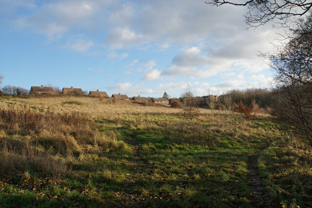
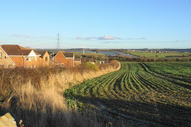
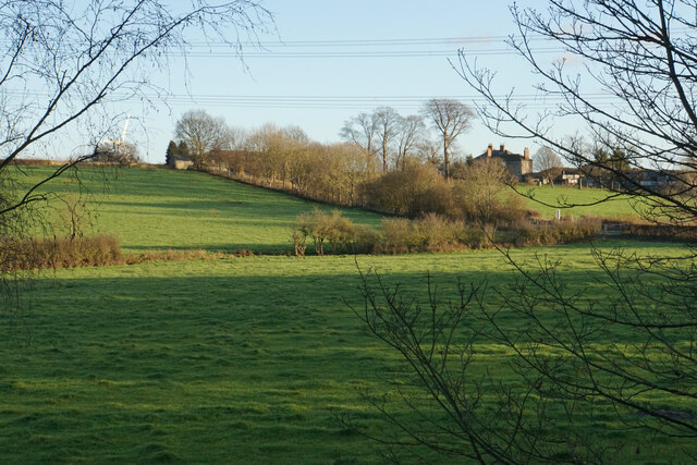
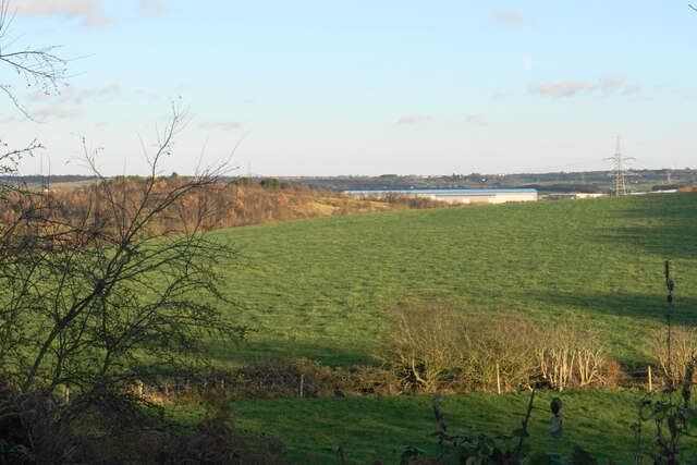
Bower Plantation is a picturesque woodland located in Derbyshire, England. Covering an area of approximately 100 acres, it is a popular destination for nature enthusiasts and hikers alike. The plantation is situated in the heart of the county, just a short distance from the town of Belper.

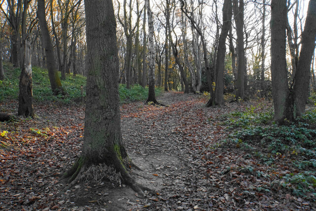
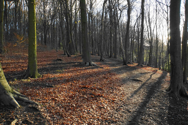
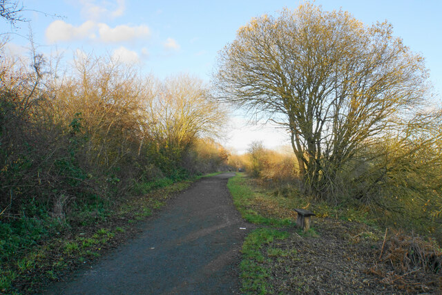
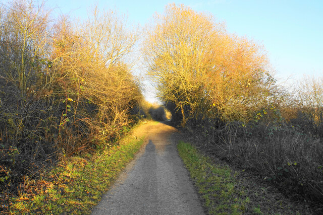
The woodland is characterized by a diverse range of tree species, including oak, birch, beech, and pine. These trees form a dense canopy that provides shade during the summer months and transforms the forest into a vibrant display of colors during the autumn season. The forest floor is adorned with an array of wildflowers, adding to the beauty of the surroundings.

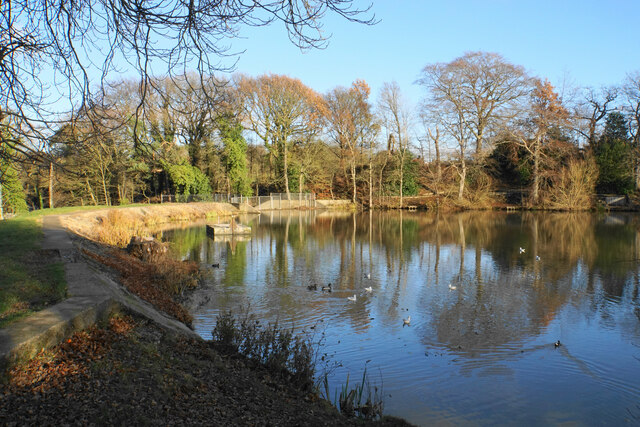
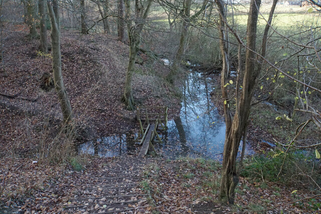
Bower Plantation is home to a variety of wildlife, making it a haven for nature lovers. Visitors may spot deer, foxes, squirrels, and a wide range of bird species while exploring the woodland trails. The plantation is also home to several small ponds, which attract a variety of aquatic creatures.

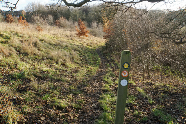
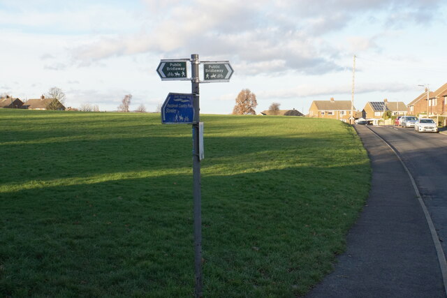
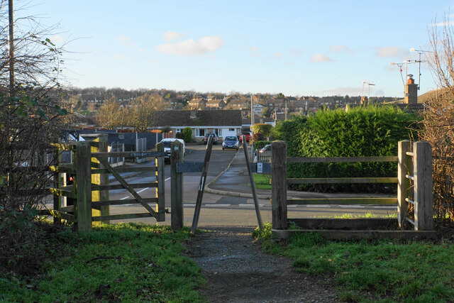
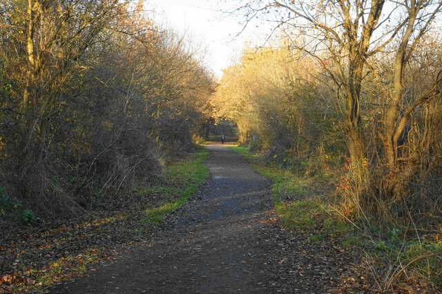
The woodland offers a network of well-maintained walking trails, allowing visitors to explore the plantation at their own pace. These trails vary in length and difficulty, catering to individuals of all fitness levels. Along the way, visitors can enjoy breathtaking views of the surrounding countryside and take in the tranquility of the natural environment.

Bower Plantation is managed by the local authorities, who ensure the preservation of its natural beauty and wildlife. The plantation is open to the public throughout the year, with free admission. Whether for a leisurely stroll, a family picnic, or birdwatching, Bower Plantation offers a serene escape into nature.

If you have any feedback on the listing, please let us know in the comments section below.

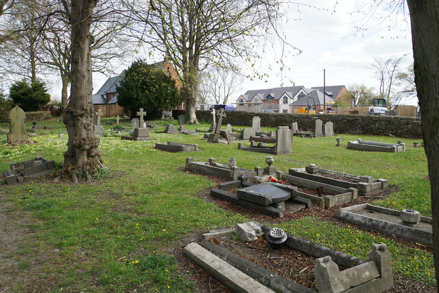
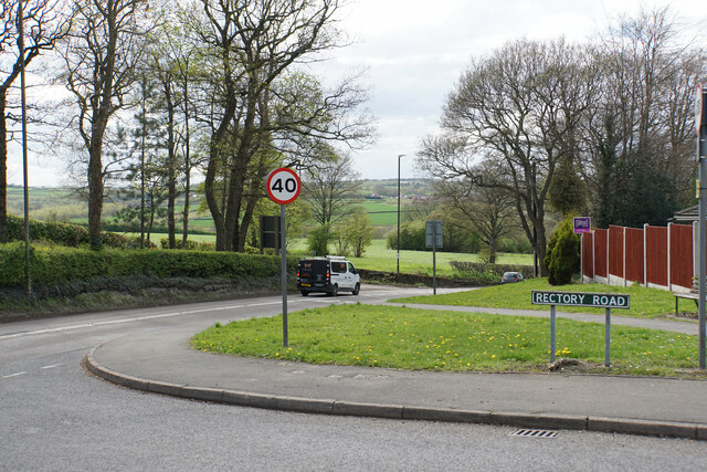
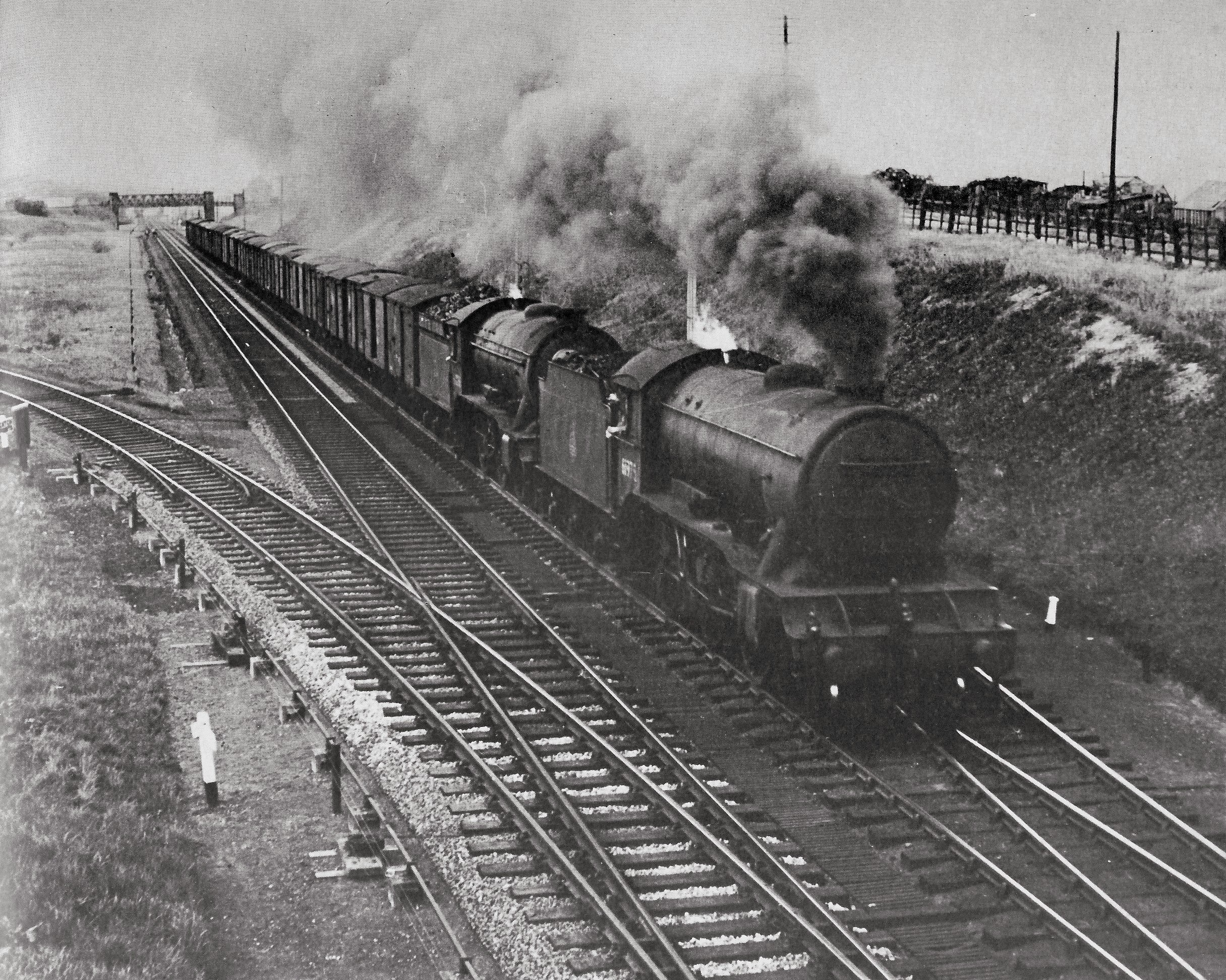
Bower Plantation Images

Images are sourced within 2km of 53.242308/-1.3652168 or Grid Reference SK4271. Thanks to Geograph Open Source API. All images are credited.

Lake in Ringwood Park A former reservoir now used by waterfowl and anglers.
Lake in Ringwood Park
A former reservoir now used by waterfowl and anglers.
Path near Trough Brook Some of the houses on the edge of Inkersall Green are seen ahead.
Path near Trough Brook
Some of the houses on the edge of Inkersall Green are seen ahead.
Path near Trough Brook Trough Brook is down to the right and the path follows the valley. This is part of the route of West Wood Long Walk.
Path near Trough Brook
Trough Brook is down to the right and the path follows the valley. This is part of the route of West Wood Long Walk.
Path by Trough Brook The path crosses a tributary of Trough Brook. There is a plank missing at the far end of the footbridge but it is possible to take a big step across.
Path by Trough Brook
The path crosses a tributary of Trough Brook. There is a plank missing at the far end of the footbridge but it is possible to take a big step across.
Path in West Wood West Wood is ancient woodland managed by Chesterfield Borough Council. It was mentioned in the Domesday Book.
Path in West Wood
West Wood is ancient woodland managed by Chesterfield Borough Council. It was mentioned in the Domesday Book.
Path in West Wood West Wood is ancient woodland managed by Chesterfield Borough Council. It was mentioned in the Domesday Book.
Path in West Wood
West Wood is ancient woodland managed by Chesterfield Borough Council. It was mentioned in the Domesday Book.
Open green space at Inkersall Green A large area retained when the village was vastly expanded to become a residential suburb of Staveley. The Trans Pennine Trail runs through part of the village.
Open green space at Inkersall Green
A large area retained when the village was vastly expanded to become a residential suburb of Staveley. The Trans Pennine Trail runs through part of the village.
Bamford Road A residential road on the edge of Inkersall Green. Further away you can see the solar farm at Duckmanton. There are some roadworks by the water company just round the corner.
Bamford Road
A residential road on the edge of Inkersall Green. Further away you can see the solar farm at Duckmanton. There are some roadworks by the water company just round the corner.
Emerging crop on the edge of Inkersall Green This is as far as the expansion of Staveley has got so far in this direction. On the hillside ahead is a solar farm near Duckmanton.
Emerging crop on the edge of Inkersall Green
This is as far as the expansion of Staveley has got so far in this direction. On the hillside ahead is a solar farm near Duckmanton.
Exit from the Trans Pennine Trail The Trans Pennine Trail here is on the course of a former railway. This access point is opposite Milford Road in Inkersall Green. Behind that you can see the Hop Flower, the pub built on this part of the estate.
Exit from the Trans Pennine Trail
The Trans Pennine Trail here is on the course of a former railway. This access point is opposite Milford Road in Inkersall Green. Behind that you can see the Hop Flower, the pub built on this part of the estate.
Trans Pennine Trail passing Inkersall Green The trail is using a former Great Central Railway link line.
Trans Pennine Trail passing Inkersall Green
The trail is using a former Great Central Railway link line.
Inkersall Green Road Heading towards the centre of Inkersall Green and viewed from the Trans Pennine Trail which crosses it.
Inkersall Green Road
Heading towards the centre of Inkersall Green and viewed from the Trans Pennine Trail which crosses it.
Fields below Inkersall Farm The eastern side of the Trans Pennine Trail, in contrast to the western side which has all been developed as part of Inkersall Green.
Fields below Inkersall Farm
The eastern side of the Trans Pennine Trail, in contrast to the western side which has all been developed as part of Inkersall Green.
Fields near Inkersall Green The fields are on the opposite side of the Trans Pennine Trail to the housing development of Inkersall Green. In this view, the wooded hillside to the left is part of Pools Brook Country Park. The Great Bear distribution warehouse near Junction 29a of the M1 is seen straight ahead and behind that you can see moving traffic on the M1.
Fields near Inkersall Green
The fields are on the opposite side of the Trans Pennine Trail to the housing development of Inkersall Green. In this view, the wooded hillside to the left is part of Pools Brook Country Park. The Great Bear distribution warehouse near Junction 29a of the M1 is seen straight ahead and behind that you can see moving traffic on the M1.
Trans Pennine Trail Passing Inkersall Green to the left, though most of it is screened by foliage and sometimes a cutting.
Trans Pennine Trail
Passing Inkersall Green to the left, though most of it is screened by foliage and sometimes a cutting.
Trans Pennine Trail near Staveley Following the route of a former Great Central railway track. My shadow is very long in the low winter sun.
Trans Pennine Trail near Staveley
Following the route of a former Great Central railway track. My shadow is very long in the low winter sun.
Churchyard of St Peter & St Paul, Duckmanton The church building is behind but has now been closed as a place of worship.
Churchyard of St Peter & St Paul, Duckmanton
The church building is behind but has now been closed as a place of worship.
The southern end of Rectory Road Here it meets the A632. Beyond, there are green fields between Bolsover and Chesterfield.
The southern end of Rectory Road
Here it meets the A632. Beyond, there are green fields between Bolsover and Chesterfield.
Show me another place!

Bower Plantation is located at Grid Ref: SK4271 (Lat: 53.242308, Lng: -1.3652168)

Administrative County: Derbyshire

District: North East Derbyshire

Police Authority: Derbyshire

What 3 Words

///airliners.winters.locate. Near Staveley, Derbyshire

Related Wikis

Nearby Amenities

Located within 500m of 53.242308,-1.3652168
Traffic Calming: cushion
Lat/Long: 53.2457767/-1.3676816
Bench
Created By: Potlatch 0.10f
Lat/Long: 53.2453588/-1.3653354
Bench
Created By: Potlatch 0.10f
Lat/Long: 53.2441467/-1.3658332
Bench
Created By: Potlatch 0.10f
Lat/Long: 53.2428061/-1.366228
Bench
Created By: Potlatch 0.10f
Lat/Long: 53.240279/-1.3663997
Bench
Created By: Potlatch 0.10f
Lat/Long: 53.2402841/-1.3662538
Duckmanton North Junction
Historic Railway: junction
Railway: site
Lat/Long: 53.2402156/-1.3663212
Barrier: stile
Lat/Long: 53.2402795/-1.3665877
Barrier: stile
Note: Anti-cycle trap alongside
Stile: squeezer
Lat/Long: 53.2427168/-1.3662333
Barrier: cycle_barrier
Lat/Long: 53.2463172/-1.364987
Barrier: horse_stile
Lat/Long: 53.2426865/-1.366238
Power: tower
Lat/Long: 53.2386937/-1.3685318
Power: tower
Lat/Long: 53.2415681/-1.3668766
Power: tower
Lat/Long: 53.2439755/-1.3654723
Direction: 170
Generator Method: photovoltaic
Generator Output Electricity: yes
Generator Solar Modules: 15
Generator Source: solar
Generator Type: solar_photovoltaic_panel
Location: roof
Power: generator
Lat/Long: 53.2458263/-1.368504
Direction: 165
Generator Method: photovoltaic
Generator Output Electricity: yes
Generator Solar Modules: 15
Generator Source: solar
Generator Type: solar_photovoltaic_panel
Location: roof
Power: generator
Lat/Long: 53.2461264/-1.3683711
Direction: 165
Generator Method: photovoltaic
Generator Output Electricity: yes
Generator Solar Modules: 15
Generator Source: solar
Generator Type: solar_photovoltaic_panel
Location: roof
Power: generator
Lat/Long: 53.2461306/-1.3662551
Direction: 165
Generator Method: photovoltaic
Generator Output Electricity: yes
Generator Solar Modules: 15
Generator Source: solar
Generator Type: solar_photovoltaic_panel
Location: roof
Power: generator
Lat/Long: 53.2461732/-1.3659858
Direction: 165
Generator Method: photovoltaic
Generator Output Electricity: yes
Generator Solar Modules: 16
Generator Source: solar
Generator Type: solar_photovoltaic_panel
Location: roof
Power: generator
Lat/Long: 53.2464325/-1.3661425
Direction: 165
Generator Method: photovoltaic
Generator Output Electricity: yes
Generator Solar Modules: 18
Generator Source: solar
Generator Type: solar_photovoltaic_panel
Location: roof
Power: generator
Lat/Long: 53.2464645/-1.365968
Direction: SE
Generator Method: photovoltaic
Generator Output Electricity: yes
Generator Solar Modules: 16
Generator Source: solar
Generator Type: solar_photovoltaic_panel
Location: roof
Power: generator
Lat/Long: 53.2465461/-1.3657741
Direction: SSW
Generator Method: photovoltaic
Generator Output Electricity: yes
Generator Solar Modules: 16
Generator Source: solar
Generator Type: solar_photovoltaic_panel
Location: roof
Power: generator
Lat/Long: 53.246648/-1.3656861
Direction: ESE
Generator Method: photovoltaic
Generator Output Electricity: yes
Generator Solar Modules: 16
Generator Source: solar
Generator Type: solar_photovoltaic_panel
Location: roof
Power: generator
Lat/Long: 53.2463984/-1.3653322
Direction: ESE
Generator Method: photovoltaic
Generator Output Electricity: yes
Generator Solar Modules: 16
Generator Source: solar
Generator Type: solar_photovoltaic_panel
Location: roof
Power: generator
Lat/Long: 53.2467011/-1.3650863
Direction: ESE
Generator Method: photovoltaic
Generator Output Electricity: yes
Generator Solar Modules: 16
Generator Source: solar
Generator Type: solar_photovoltaic_panel
Location: roof
Power: generator
Lat/Long: 53.2467657/-1.3650542
Direction: SSW
Generator Method: photovoltaic
Generator Output Electricity: yes
Generator Solar Modules: 16
Generator Source: solar
Generator Type: solar_photovoltaic_panel
Location: roof
Power: generator
Lat/Long: 53.2467522/-1.3656356
Direction: 105
Generator Method: photovoltaic
Generator Output Electricity: yes
Generator Solar Modules: 16
Generator Source: solar
Generator Type: solar_photovoltaic_panel
Location: roof
Power: generator
Lat/Long: 53.2463206/-1.3680085
Traffic Calming: cushion
Lat/Long: 53.2460178/-1.3661544
Direction: 165
Generator Method: photovoltaic
Generator Output Electricity: yes
Generator Solar Modules: 15
Generator Source: solar
Generator Type: solar_photovoltaic_panel
Location: roof
Power: generator
Lat/Long: 53.2461584/-1.3682763
Traffic Calming: cushion
Lat/Long: 53.245665/-1.3697432
The data included in this document is from www.openstreetmap.org. The data is made available under ODbL.

Have you been to Bower Plantation?

Leave your review of Bower Plantation below (or comments, questions and feedback).