Titlark Copse

Wood, Forest in Hampshire Test Valley

England

Titlark Copse

Crusaders Way, Chandler's Ford With Zionshill Copse on the left / south side and a 1990s housing estate on the right / north side.
Crusaders Way, Chandler's Ford Credit: Christine Johnstone

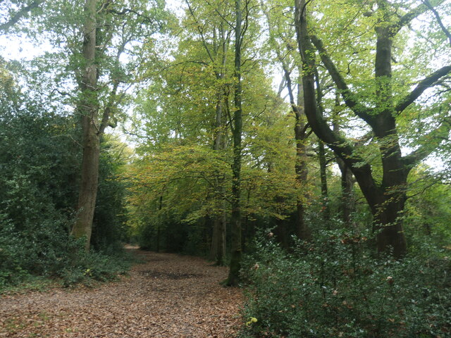
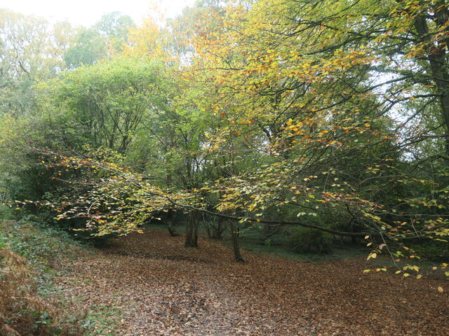
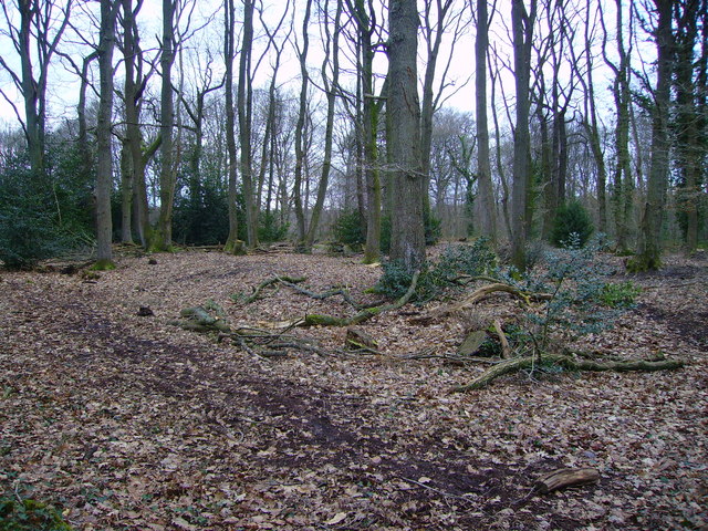
Titlark Copse is a picturesque woodland located in Hampshire, England. Covering an area of approximately 30 acres, it is known for its dense forest and diverse range of flora and fauna. The copse is situated in a rural setting, surrounded by rolling hills and agricultural fields, offering visitors a peaceful and tranquil experience.

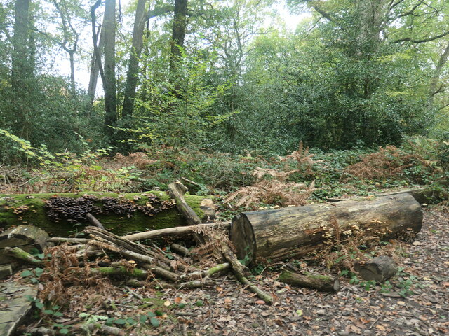
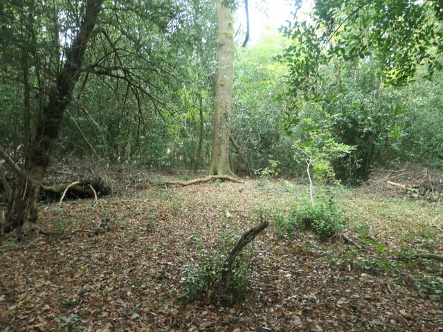
The woodland is predominantly composed of native broadleaf trees, including oak, beech, and birch, which create a beautiful canopy overhead. The forest floor is covered in a carpet of wildflowers, such as bluebells and primroses, which bloom in vibrant colors during the spring months. This rich biodiversity makes Titlark Copse an important habitat for a variety of bird species, including the titular titlark, as well as woodpeckers, thrushes, and owls.

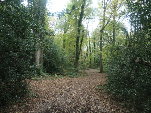
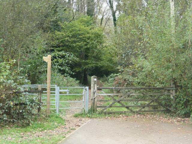
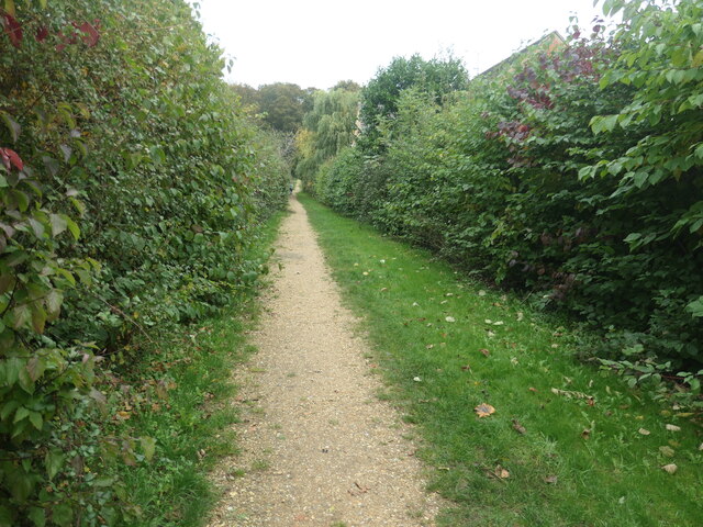
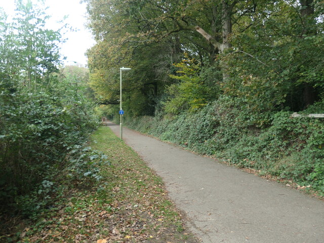
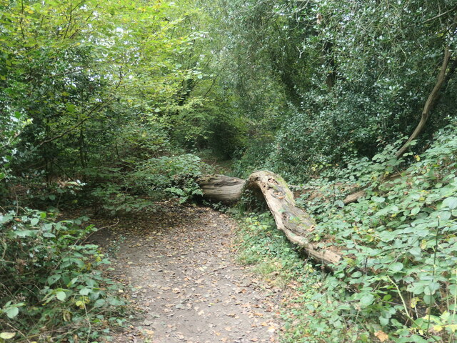
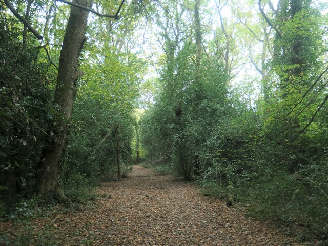
Walking trails wind their way through the copse, allowing visitors to explore the natural beauty of the area. These paths are well-maintained and provide access to different parts of the woodland, ensuring that visitors can fully appreciate its diverse ecosystem. The copse is also a popular spot for nature lovers, birdwatchers, and photographers, who flock to the area to capture its scenic beauty.

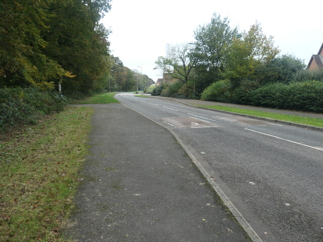
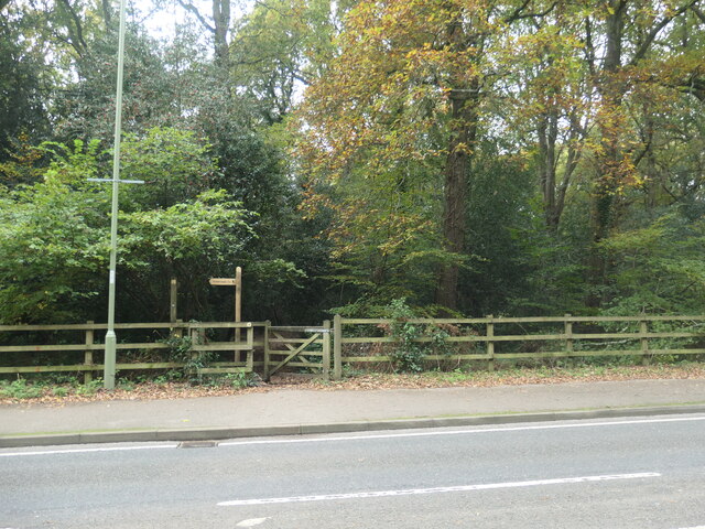
Titlark Copse is easily accessible by car, with ample parking available nearby. It is also well-connected to the surrounding towns and villages by public transportation. The copse is open to the public throughout the year, offering a peaceful retreat for anyone seeking solace in nature or wishing to explore the beauty of Hampshire's woodlands.

If you have any feedback on the listing, please let us know in the comments section below.

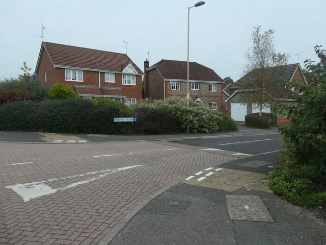
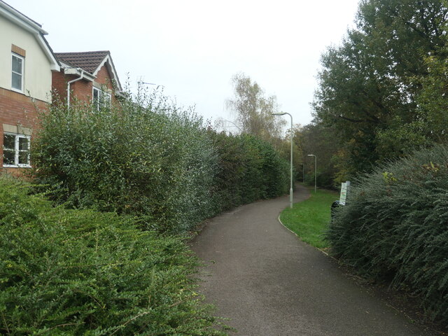
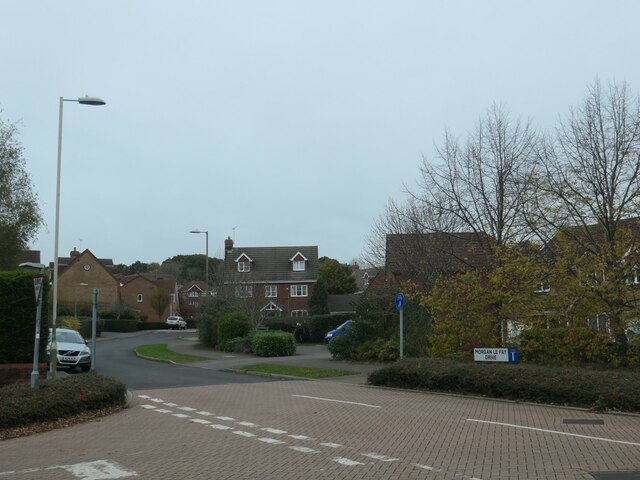
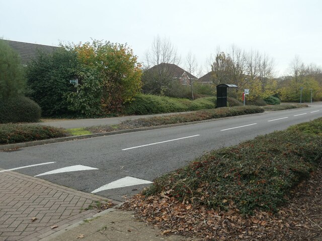
Titlark Copse Images

Images are sourced within 2km of 50.977485/-1.3986415 or Grid Reference SU4219. Thanks to Geograph Open Source API. All images are credited.

Crusaders Way, Chandler's Ford With Zionshill Copse on the left / south side and a 1990s housing estate on the right / north side.
Crusaders Way, Chandler's Ford
With Zionshill Copse on the left / south side and a 1990s housing estate on the right / north side.
Logs and fungi, Zionshill Copse Part of Valley Park local nature reserve, on the western edge of Chandler's Ford.
Logs and fungi, Zionshill Copse
Part of Valley Park local nature reserve, on the western edge of Chandler's Ford.
Path through Zionshill Copse The copse is part of Valley Park local nature reserve, on the western edge of Chandler's Ford.
Path through Zionshill Copse
The copse is part of Valley Park local nature reserve, on the western edge of Chandler's Ford.
An entrance to Zionshill Copse On the west side of Sky's Wood Road. The copse is part of Valley Park local nature reserve, on the western edge of Chandler's Ford.
An entrance to Zionshill Copse
On the west side of Sky's Wood Road. The copse is part of Valley Park local nature reserve, on the western edge of Chandler's Ford.
Houses on the north side of Harvest Road Part of a large housing development on the western edge of Chandler's Ford.
Houses on the north side of Harvest Road
Part of a large housing development on the western edge of Chandler's Ford.
Path heading east from Sky's Wood Road Cutting across a large loop in the road, which is the main thoroughfare in a housing development on the western edge of Chandler's Ford.
Path heading east from Sky's Wood Road
Cutting across a large loop in the road, which is the main thoroughfare in a housing development on the western edge of Chandler's Ford.
Terraced houses, Jack Close Off Sky's Wood Road. Part of a housing development on the west side of Chandler's Ford.
Terraced houses, Jack Close
Off Sky's Wood Road. Part of a housing development on the west side of Chandler's Ford.
Tolefrey Gardens Off Sky's Wood Road. Part of a housing development on the west side of Chandler's Ford.
Tolefrey Gardens
Off Sky's Wood Road. Part of a housing development on the west side of Chandler's Ford.
Morgan le Fey Drive, western edge of Chandler's Ford Named after a powerful enchantress in the Arthurian legends.
Morgan le Fey Drive, western edge of Chandler's Ford
Named after a powerful enchantress in the Arthurian legends.
Sky's Wood Road, western edge of Chandler's Ford The main thoroughfare through a large-ish housing development.
Sky's Wood Road, western edge of Chandler's Ford
The main thoroughfare through a large-ish housing development.
Public footpath between Merlin Way and Catmint Close On the western edge of Chandler's Ford. Heading north-east from Sky's Wood Road towards Knight Wood.
Public footpath between Merlin Way and Catmint Close
On the western edge of Chandler's Ford. Heading north-east from Sky's Wood Road towards Knight Wood.
Footpath and cycleway behind Merlin Way Heading north towards Flexford Road, on the western edge of Chandler's ford.
Footpath and cycleway behind Merlin Way
Heading north towards Flexford Road, on the western edge of Chandler's ford.
Fallen leaves, Knight Wood Part of the Valley Park Woodlands local nature reserve.
Fallen leaves, Knight Wood
Part of the Valley Park Woodlands local nature reserve.
Tree fallen across a path, Knight Wood With an informal detour through the shrubbery. Knight Wood is part of the Valley Park Woodlands local nature reserve.
Tree fallen across a path, Knight Wood
With an informal detour through the shrubbery. Knight Wood is part of the Valley Park Woodlands local nature reserve.
Path heading eastwards in Knight Wood Part of the Valley Park local nature reserve on the western side of Chandler's Ford.
Path heading eastwards in Knight Wood
Part of the Valley Park local nature reserve on the western side of Chandler's Ford.
Public footpath entering Knight Wood On the western side of Knightwood Road.
Public footpath entering Knight Wood
On the western side of Knightwood Road.
Public footpath in Knight Wood Open access woodland on the east side of Knightwood Road, Chandler's Ford.
Public footpath in Knight Wood
Open access woodland on the east side of Knightwood Road, Chandler's Ford.
Autumn colour, Knight Wood, Chandler's Ford Along a public footpath crossing the open access woodland.
Autumn colour, Knight Wood, Chandler's Ford
Along a public footpath crossing the open access woodland.
Show me another place!

Titlark Copse is located at Grid Ref: SU4219 (Lat: 50.977485, Lng: -1.3986415)

Administrative County: Hampshire

District: Test Valley

Police Authority: Hampshire

What 3 Words

///music.funded.traded. Near North Baddesley, Hampshire

Nearby Locations

Titlark Copse

Related Wikis

Nearby Amenities

Located within 500m of 50.977485,-1.3986415
Traffic Signals
Lat/Long: 50.9785129/-1.40449
Pub
The Cleveland Bay
Lat/Long: 50.9782612/-1.4020067
Post Box
Collection Plate: CP8
Collection Times: Mo-Fr 16:00; Sa 11:30
Operator: Royal Mail
Operator Wikidata: Q638098
Post Box Type: pillar
Ref: SO53 125
Royal Cypher: EIIR
Royal Cypher Wikidata: Q33102113
Lat/Long: 50.9777793/-1.4018597
Traffic Signals
Lat/Long: 50.9752861/-1.4042414
Mulberry Corner
Odbl: clean
Lat/Long: 50.9748635/-1.398881
Traffic Signals
Crossing: traffic_signals
Crossing Ref: pelican
Lat/Long: 50.975856/-1.3979011
Odbl: clean
Lat/Long: 50.9762433/-1.4012942
Odbl: clean
Lat/Long: 50.976299/-1.4012304
Traffic Signals
Odbl: clean
Lat/Long: 50.9795174/-1.4020061
Odbl: clean
Lat/Long: 50.9763395/-1.4011733
Odbl: clean
Lat/Long: 50.9801746/-1.3977621
Bus Stop
Victory Close
Bus: yes
Naptan AtcoCode: 1900HA030005
Naptan Bearing: SW
Naptan CommonName: Victory Close
Naptan Crossing: Victory Close
Naptan NaptanCode: hamawdgw
Naptan Street: School Lane
Naptan Verified: no
Public Transport: platform
Source: naptan_import
Lat/Long: 50.9782599/-1.3932527
Bus Stop
Victory Close
Bus: yes
Naptan AtcoCode: 1900HA030006
Naptan Bearing: NE
Naptan CommonName: Victory Close
Naptan Crossing: Victory Close
Naptan NaptanCode: hamawdgm
Naptan Street: School Lane
Naptan Verified: no
Public Transport: platform
Source: naptan_import
Lat/Long: 50.9783055/-1.393366
Bus Stop
School Lane Community Centre
Bus: yes
Naptan AtcoCode: 1900HA100001
Naptan Bearing: N
Naptan CommonName: School Lane Community Centre
Naptan NaptanCode: hamawagm
Naptan Street: School Lane
Naptan Verified: no
Public Transport: platform
Source: naptan_import
Lat/Long: 50.9755611/-1.3982589
Bus Stop
School Lane Communtiy Centre
Bus: yes
Naptan AtcoCode: 1900HA100002
Naptan Bearing: N
Naptan CommonName: School Lane Communtiy Centre
Naptan Crossing: Castle Lane
Naptan NaptanCode: hamawadw
Naptan Street: School Lane
Naptan Verified: no
Public Transport: platform
Source: naptan_import
Lat/Long: 50.9752134/-1.3988474
Bus Stop
Castle Lane
Bus: yes
Naptan AtcoCode: 1900HA100003
Naptan Bearing: SE
Naptan CommonName: Castle Lane
Naptan Crossing: Raglan Close
Naptan NaptanCode: hamatwgp
Naptan Street: Templars Way
Naptan Verified: no
Public Transport: platform
Source: naptan_import
Lat/Long: 50.9747754/-1.4028698
Bus Stop
Castle Lane
Bus: yes
Naptan AtcoCode: 1900HA100004
Naptan Bearing: NW
Naptan CommonName: Castle Lane
Naptan Crossing: Castle Lane
Naptan NaptanCode: hamatwgm
Naptan Street: Templars Way
Naptan Verified: no
Public Transport: platform
Source: naptan_import
Lat/Long: 50.9747864/-1.4032542
Bus Stop
Knightwood Road
Bus: yes
Naptan AtcoCode: 1900HA100005
Naptan Bearing: NW
Naptan CommonName: Knightwood Road
Naptan Crossing: Templars Way
Naptan NaptanCode: hamatpwm
Naptan Street: Tristram Close
Naptan Verified: no
Public Transport: platform
Source: naptan_import
Lat/Long: 50.9760736/-1.4049535
Bus Stop
Knightwood Road
Bus: yes
Naptan AtcoCode: 1900HA100006
Naptan Bearing: NW
Naptan CommonName: Knightwood Road
Naptan Crossing: Castle Lane
Naptan NaptanCode: hamatpwp
Naptan Street: Templars Way
Naptan Verified: no
Public Transport: platform
Source: naptan_import
Lat/Long: 50.9757933/-1.4049791
Bus Stop
Pilgrims Close
Bus: yes
Naptan AtcoCode: 1900HA100007
Naptan Bearing: NE
Naptan CommonName: Pilgrims Close
Naptan Crossing: Acorn Grove
Naptan NaptanCode: hamatpwd
Naptan Street: Knightwood Road
Naptan Verified: no
Public Transport: platform
Source: naptan_import
Lat/Long: 50.9773512/-1.4054007
Bus Stop
Pilgrims Close
Bus: yes
Naptan AtcoCode: 1900HA100008
Naptan Bearing: SW
Naptan CommonName: Pilgrims Close
Naptan Crossing: Pilgrims Close
Naptan NaptanCode: hamatpwg
Naptan Street: Knightwood Road
Naptan Verified: no
Public Transport: platform
Source: naptan_import
Lat/Long: 50.9775196/-1.4050939
Bus Stop
Chidden Holt
Bus: yes
Naptan AtcoCode: 1900HA100009
Naptan Bearing: SW
Naptan CommonName: Chidden Holt
Naptan Crossing: Chidden Holt
Naptan NaptanCode: hamatwgw
Naptan Street: Knightwood Road
Naptan Verified: no
Public Transport: platform
Source: naptan_import
Lat/Long: 50.9792183/-1.4027682
Bus Stop
Chidden Holt
Bus: yes
Naptan AtcoCode: 1900HA100010
Naptan Bearing: NE
Naptan CommonName: Chidden Holt
Naptan Crossing: Opp Chidden Holt
Naptan NaptanCode: hamatwjt
Naptan Street: Knightwood Road
Naptan Verified: no
Public Transport: platform
Source: naptan_import
Lat/Long: 50.9797245/-1.4017379
Doctors
St. Francis Centre
Healthcare: doctor
Lat/Long: 50.9776655/-1.4015841
Post Box
Collection Plate: CP8
Collection Times: Mo-Fr 17:15; Sa 11:45
Operator: Royal Mail
Operator Wikidata: Q638098
Post Box Type: pillar
Ref: SO53 718
Royal Cypher: EIIR
Royal Cypher Wikidata: Q33102113
Lat/Long: 50.9752623/-1.3988222
Post Box
Collection Times: Mo-Fr 17:15; Sa 11:45
Operator: Royal Mail
Operator Wikidata: Q638098
Post Box Type: pillar
Ref: SO53 717
Royal Cypher: EIIR
Royal Cypher Wikidata: Q33102113
Lat/Long: 50.9772778/-1.3943745
Turning Circle
Source: Bing
Lat/Long: 50.9732728/-1.39817
Turning Circle
Source: Bing
Lat/Long: 50.9759482/-1.3969539
Power: pole
Lat/Long: 50.9800817/-1.394841
Power: pole
Lat/Long: 50.9795223/-1.3957324
Traffic Calming: table
Lat/Long: 50.9812705/-1.3964111
Noexit: yes
Lat/Long: 50.9795675/-1.3972251
Noexit: yes
Lat/Long: 50.978937/-1.397583
Crossing
Lat/Long: 50.9786811/-1.4042422
Traffic Calming: table
Lat/Long: 50.978774/-1.4050211
Crossing
Lat/Long: 50.9786037/-1.4047354
Doctors
Knightwood Surgery
Healthcare: doctor
Lat/Long: 50.9787915/-1.4035008
Dentist
St Francis Centre
Healthcare: dentist
Lat/Long: 50.9775963/-1.4015904
Veterinary
Lat/Long: 50.9774779/-1.4017402
Pharmacy
Healthcare: pharmacy
Shop: chemist
Lat/Long: 50.977516/-1.4019038
Fast Food
Rock & Sole Plaice
Cuisine: fish_and_chips
Lat/Long: 50.9778163/-1.402278
Addr City: Valley Park, Eastleigh
Addr Street: Pilgrims Close
Old Phone: +44 2380 253385
Removed Amenity: telephone
Lat/Long: 50.9780307/-1.4025513
Post Box
Collection Plate: CP7D
Collection Times: Mo-Fr 09:00; Sa 07:00
Operator: Royal Mail
Operator Wikidata: Q638098
Post Box Type: lamp
Ref: SO53 613D
Royal Cypher: EIIR
Royal Cypher Wikidata: Q33102113
Lat/Long: 50.9735628/-1.3965766
Atm
Cash Machine
Brand: RBS
Brand Wikidata: Q160126
Currency GBP: yes
Drive Through: no
Fee: no
Official Name: Royal Bank of Scotland
Opening Hours: 24/7
Operator: RBS
Operator Wikidata: Q160126
Lat/Long: 50.9778348/-1.4024482
Tesco Express
Addr Housenumber: 6
Addr Postcode: SO53 4ST
Addr Street: Pilgrims Close
Brand: Tesco Express
Brand Wikidata: Q98456772
Contact Website: https://www.tesco.com/store-locator/eastleigh/6-pilgrims-close-valley-park
Fhrs Id: 23352
Operator: Tesco
Shop: convenience
Lat/Long: 50.9778408/-1.4024983
March Hair
Shop: hairdresser
Lat/Long: 50.9778081/-1.402187
Valley Park
Place: suburb
Lat/Long: 50.9795086/-1.3985357
Crossing
Lat/Long: 50.9783528/-1.4046549
Crossing
Lat/Long: 50.978432/-1.4041899
The data included in this document is from www.openstreetmap.org. The data is made available under ODbL.

Have you been to Titlark Copse?

Leave your review of Titlark Copse below (or comments, questions and feedback).