Douglas

Settlement in Lanarkshire

Scotland

Douglas

Track on descent from Pagie Hill
Track on descent from Pagie Hill Credit: thejackrustles

Douglas is a small town located in South Lanarkshire, Scotland. Situated in the Clyde Valley, it lies approximately 35 miles southeast of Glasgow and 30 miles southwest of Edinburgh. With a population of around 1,200 residents, Douglas is a close-knit community known for its scenic countryside and rich history.

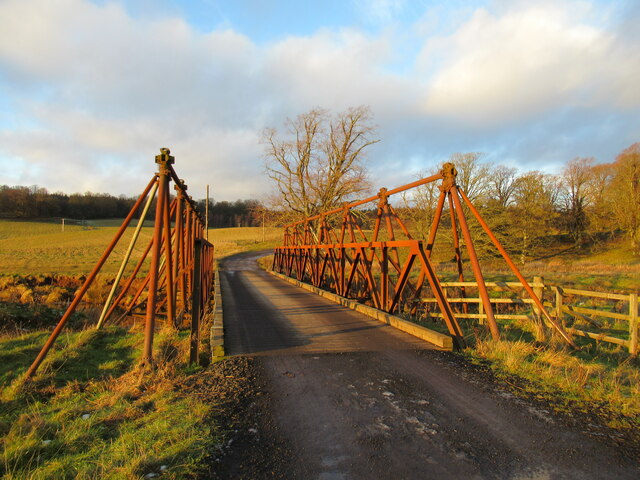
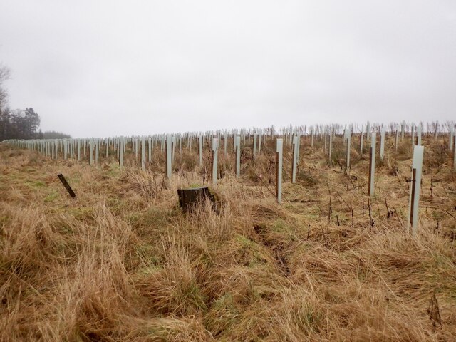
The town's origins can be traced back to the 18th century when it flourished as a center for coal mining and ironworks. Today, although the mining industry has declined, the remnants of its industrial past can still be seen in the form of old mining cottages and disused mine shafts that dot the landscape.

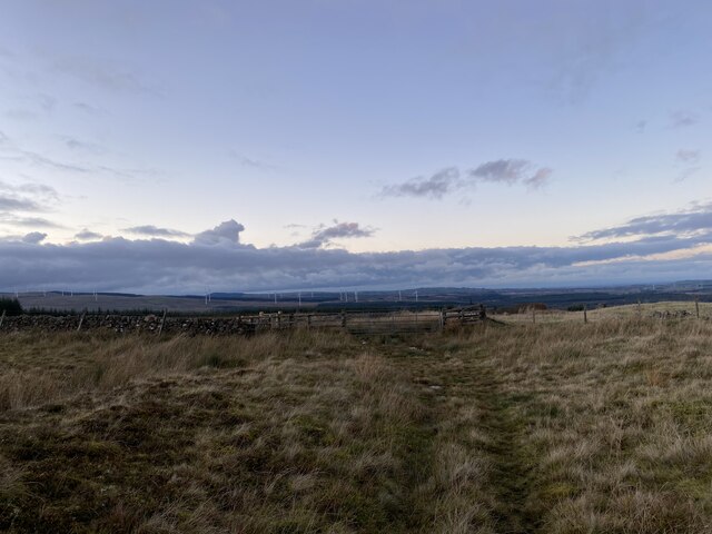
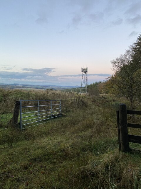
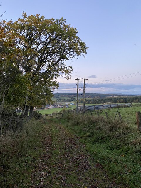
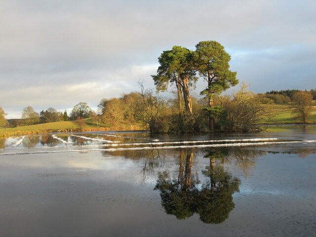
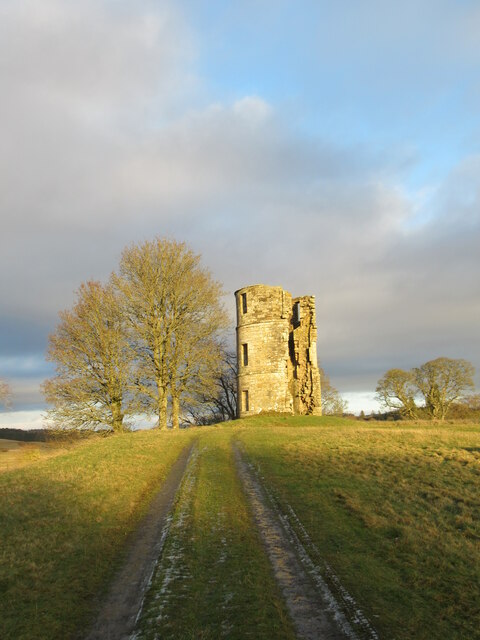
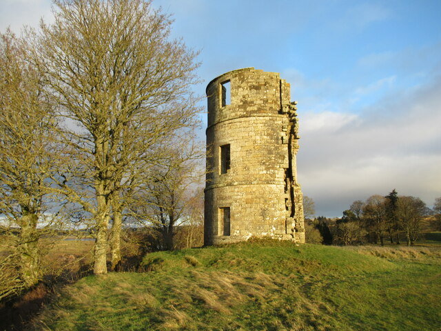
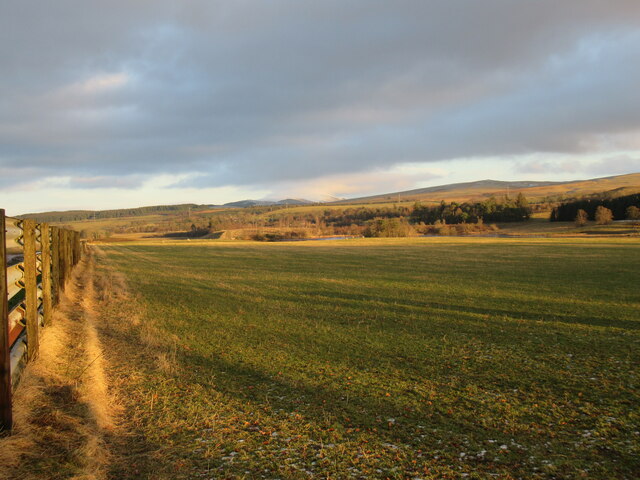
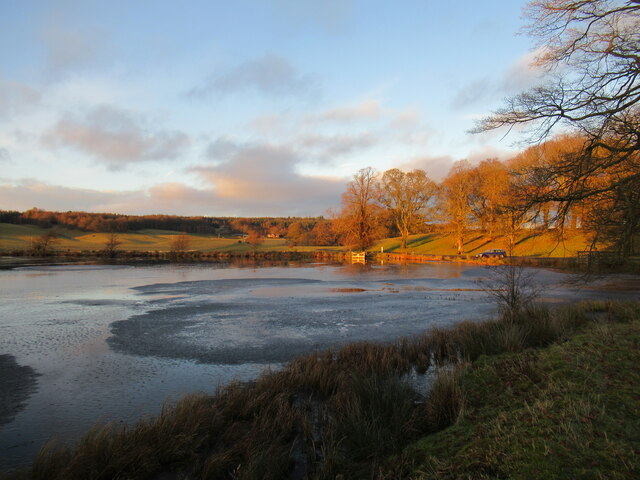
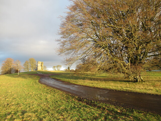
Douglas offers stunning natural beauty, with the nearby Douglas Water and the Douglas Castle Estate providing picturesque spots for outdoor activities such as fishing, hiking, and birdwatching. The historic Douglas Castle, a Category A listed building, stands as a prominent landmark and attracts visitors interested in its architectural significance.

Alongside its natural attractions, the town boasts a few amenities to cater to the needs of its residents. These include a primary school, a local pub, a convenience store, and a community center. The town's annual events, such as the Douglas Gala Day and the Christmas lights switch-on, foster a sense of community spirit and bring locals together.

Overall, Douglas, Lanarkshire offers a tranquil and scenic environment, making it an appealing place for those seeking a peaceful retreat while still having access to nearby cities and amenities.

If you have any feedback on the listing, please let us know in the comments section below.

Douglas Images

Images are sourced within 2km of 55.556641/-3.8452163 or Grid Reference NS8330. Thanks to Geograph Open Source API. All images are credited.

Track on descent from Pagie Hill
Mast above Douglas
Mast above Douglas
Decaying sleeper fence near Douglas West By the side of the former railway line near the remains of Douglas West railway station.
Decaying sleeper fence near Douglas West
By the side of the former railway line near the remains of Douglas West railway station.
Site of former Douglas West railway station Some traces of former buildings can be seen at the site of this station, which closed in 1964.
Site of former Douglas West railway station
Some traces of former buildings can be seen at the site of this station, which closed in 1964.
View down into Douglas from descent from Pagie Hill
Target Area on an old Rifle Range What's left of the target area for the old rifle range was in the centre of this photo.  The wee copse of trees was not there when the rifle range was in use.
This photo was taken on the 7th June 2022.
Target Area on an old Rifle Range
What's left of the target area for the old rifle range was in the centre of this photo. The wee copse of trees was not there when the rifle range was in use. This photo was taken on the 7th June 2022.
Gravel track near Douglas
Scots pines reflected in loch, Douglas Estate The thaw over the last day or so has left unusual lines of ice or slush in the water.
Scots pines reflected in loch, Douglas Estate
The thaw over the last day or so has left unusual lines of ice or slush in the water.
Patterns and reflections in loch, Douglas Estate The thaw over the last day or so has left unusual lines of ice or slush in the water.
Patterns and reflections in loch, Douglas Estate
The thaw over the last day or so has left unusual lines of ice or slush in the water.
Remains of Douglas Castle The earliest recorded mention of Douglas Castle was in 1288, but this remnant three-storey tower dates from around the seventeenth century, and was retained as a garden folly when a later mansion house was built here. More information is available at: 

<span class="nowrap"><a title="http://portal.historicenvironment.scot/designation/LB1449" rel="nofollow ugc noopener" href="http://portal.historicenvironment.scot/designation/LB1449">Link</a><img style="margin-left:2px;" alt="External link" title="External link - shift click to open in new window" src="https://s1.geograph.org.uk/img/external.png" width="10" height="10"/></span>
Remains of Douglas Castle
The earliest recorded mention of Douglas Castle was in 1288, but this remnant three-storey tower dates from around the seventeenth century, and was retained as a garden folly when a later mansion house was built here. More information is available at: LinkExternal link
Remains of Douglas Castle The earliest recorded mention of Douglas Castle was in 1288, but this remnant three-storey tower dates from around the seventeenth century, and was retained as a garden folly when a later mansion house was built here. More information is available at: <span class="nowrap"><a title="https://canmore.org.uk/site/46528/douglas-castle" rel="nofollow ugc noopener" href="https://canmore.org.uk/site/46528/douglas-castle">Link</a><img style="margin-left:2px;" alt="External link" title="External link - shift click to open in new window" src="https://s1.geograph.org.uk/img/external.png" width="10" height="10"/></span>
Remains of Douglas Castle
The earliest recorded mention of Douglas Castle was in 1288, but this remnant three-storey tower dates from around the seventeenth century, and was retained as a garden folly when a later mansion house was built here. More information is available at: LinkExternal link
Rusty bridge over the Douglas Water The lower winter sun highlights the vivid rusty colour of this bridge over the Douglas Water, a tributary of the Clyde.
Rusty bridge over the Douglas Water
The lower winter sun highlights the vivid rusty colour of this bridge over the Douglas Water, a tributary of the Clyde.
Detail of rusty bridge over the Douglas Water Looking downstream on this tributary of the Clyde as the low winter sun highlights the vivid rusty colour of the bridge.
Detail of rusty bridge over the Douglas Water
Looking downstream on this tributary of the Clyde as the low winter sun highlights the vivid rusty colour of the bridge.
Looking towards Tinto from the Douglas Estate Looking towards the north-eastern loch on the Douglas Estate, with a still snow-covered Tinto in the distance.
Looking towards Tinto from the Douglas Estate
Looking towards the north-eastern loch on the Douglas Estate, with a still snow-covered Tinto in the distance.
Thawing loch, Douglas Estate In the last twenty-four hours, the temperature has gone above freezing for the first time in several days, and a thaw is well under way.
Thawing loch, Douglas Estate
In the last twenty-four hours, the temperature has gone above freezing for the first time in several days, and a thaw is well under way.
Douglas Castle ruins and parkland The earliest recorded mention of Douglas Castle was in 1288, but this remnant three-storey tower dates from around the seventeenth century, and was retained as a garden folly when a later mansion house was built here. More information is available at: <span class="nowrap"><a title="https://canmore.org.uk/site/46528/douglas-castle" rel="nofollow ugc noopener" href="https://canmore.org.uk/site/46528/douglas-castle">Link</a><img style="margin-left:2px;" alt="External link" title="External link - shift click to open in new window" src="https://s1.geograph.org.uk/img/external.png" width="10" height="10"/></span>
Douglas Castle ruins and parkland
The earliest recorded mention of Douglas Castle was in 1288, but this remnant three-storey tower dates from around the seventeenth century, and was retained as a garden folly when a later mansion house was built here. More information is available at: LinkExternal link
Brown Hill View from Parkhead Hill
Brown Hill
View from Parkhead Hill
Newly planted trees, Mainshill Reclamation of an open cast site.
Newly planted trees, Mainshill
Reclamation of an open cast site.
Show me another place!

Douglas is located at Grid Ref: NS8330 (Lat: 55.556641, Lng: -3.8452163)

Unitary Authority: South Lanarkshire

Police Authority: Lanarkshire

What 3 Words

///riverside.kiosk.install. Near Douglas, South Lanarkshire

Nearby Locations

Douglas

Related Wikis

Douglas, South Lanarkshire

Douglas (Scottish Gaelic: Dùbhghlas) is a village in South Lanarkshire, Scotland. It is located on the south bank of the Douglas Water and on the A70 road...
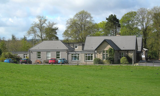
Lady Home Hospital

Lady Home Hospital is a health facility in Ayr Road, Douglas, South Lanarkshire, Scotland. It is managed by NHS Lanarkshire. == History == The facility...

Douglas Castle

Douglas Castle was a stronghold of the Douglas (later Douglas-Home) family from medieval times to the 20th century. The first castle, erected in the 13th...

Douglas West railway station

Douglas West railway station served the village of Douglas West, South Lanarkshire in Scotland between 1896 and 1964. == History == The railway line between...

Lanarkshire

Lanarkshire, also called the County of Lanark (Scottish Gaelic: Siorrachd Lannraig; Scots: Lanrikshire), is a historic county, lieutenancy area and registration...

Lanarkshire (UK Parliament constituency)

Lanarkshire was a Scottish county constituency of the House of Commons of the Parliament of the United Kingdom (Westminster) from 1708 to 1868. It elected...

Glespin

Glespin is a hamlet in South Lanarkshire, Scotland. It is on the A70, east of Muirkirk and west of Douglas. == Notable people == Footballer Bobby Crawford...

Happendon railway station

Happendon railway station served the settlement of Happendon, South Lanarkshire, Scotland, from 1864 to 1964 on the Douglas Branch. == History == The station...

Nearby Amenities

Located within 500m of 55.556641,-3.8452163
Douglas
Is In: South Lanarkshire
Name En: Douglas
Name Gd: Dùghlas
Name Lt: Daglasas
Place: village
Population: 1620
Wikidata: Q5301155
Wikipedia: en:Douglas, South Lanarkshire
Lat/Long: 55.556821/-3.8480017
Fuel
Brand: Highland Fuels
Lat/Long: 55.5553327/-3.8486604
Bus Stop
Braehead
Bench: yes
Bus: yes
Naptan AtcoCode: 61501365
Naptan Bearing: NE
Naptan CommonName: Braehead
Naptan Indicator: At Braehead
Naptan Landmark: Braehead
Naptan NaptanCode: 75236236
Naptan Street: Ayr Road
Public Transport: platform
Shelter: yes
Source: naptan_import
Lat/Long: 55.5571548/-3.8449184
Bus Stop
Springhill Road
Bus: yes
Naptan AtcoCode: 61501366
Naptan Bearing: S
Naptan CommonName: Springhill Road
Naptan Indicator: Near Springhill Road
Naptan Landmark: Springhill Road
Naptan NaptanCode: 75235256
Naptan Street: Ayr Road
Naptan Verified: no
Public Transport: platform
Source: naptan_import
Lat/Long: 55.5569825/-3.8448837
Bus Stop
Dale Street
Bus: yes
Naptan AtcoCode: 61501368
Naptan Bearing: S
Naptan CommonName: Dale Street
Naptan Indicator: At Dale Street
Naptan Landmark: Dale Street
Naptan NaptanCode: 75232534
Naptan Street: Springhill Road
Naptan Verified: no
Public Transport: platform
Source: naptan_import
Lat/Long: 55.554885/-3.8427243
Bus Stop
Manse View Terrace
Bus: yes
Naptan AtcoCode: 61501372
Naptan Bearing: NE
Naptan CommonName: Manse View Terrace
Naptan Indicator: Opp Manse View Terrace
Naptan Landmark: Manse View Terrace
Naptan NaptanCode: 75236839
Naptan Street: Springhill Street
Naptan Verified: no
Public Transport: platform
Source: naptan_import
Lat/Long: 55.5535752/-3.846151
Bus Stop
Ayr Road
Bus: yes
Naptan AtcoCode: 61501373
Naptan Bearing: NW
Naptan CommonName: Ayr Road
Naptan Indicator: Near Ayr Road
Naptan Landmark: Ayr Road
Naptan NaptanCode: 75235646
Naptan Street: Addison Avenue
Naptan Verified: no
Public Transport: platform
Source: naptan_import
Lat/Long: 55.5547864/-3.8480787
Bus Stop
Kilncroft Terrace
Bus: yes
Naptan AtcoCode: 61501374
Naptan Bearing: SE
Naptan CommonName: Kilncroft Terrace
Naptan Indicator: Near Kilncroft Terrace
Naptan Landmark: Kilncroft Terrace
Naptan NaptanCode: 75232367
Naptan Street: Addison Avenue
Naptan Verified: no
Public Transport: platform
Source: naptan_import
Lat/Long: 55.5548252/-3.8478902
Bus Stop
Manse View Terrace
Bus: yes
Naptan AtcoCode: 61501591
Naptan Bearing: NW
Naptan CommonName: Manse View Terrace
Naptan Indicator: At Manse View Terrace Southbound
Naptan Landmark: Manse View Terrace
Naptan NaptanCode: 75232345
Naptan Street: Springhill street
Naptan Verified: no
Public Transport: platform
Source: naptan_import
Lat/Long: 55.5535138/-3.846053
Bus Stop
Lady Home Cottage Hospital
Bus: yes
Naptan AtcoCode: 61501716
Naptan Bearing: NE
Naptan CommonName: Lady Home Cottage Hospital
Naptan Indicator: opp Lady Home Cottage Hospital
Naptan Landmark: Lady Home Cottage Hospital
Naptan NaptanCode: 75296989
Naptan Street: A70
Naptan Verified: no
Public Transport: platform
Source: naptan_import
Lat/Long: 55.558621/-3.8393156
Bus Stop
Lady Home Cottage Hospital
Bus: yes
Naptan AtcoCode: 61501717
Naptan Bearing: SW
Naptan CommonName: Lady Home Cottage Hospital
Naptan Indicator: at Lady Home Cottage Hospital
Naptan Landmark: Lady Home Cottage Hospital
Naptan NaptanCode: 75238376
Naptan Street: A70
Naptan Verified: no
Public Transport: platform
Source: naptan_import
Lat/Long: 55.5585979/-3.8390608
Power: pole
Lat/Long: 55.5572424/-3.8499592
Power: pole
Lat/Long: 55.5582205/-3.8503318
Power: pole
Lat/Long: 55.558691/-3.8505109
Power: pole
Lat/Long: 55.559334/-3.8507557
Power: pole
Lat/Long: 55.5564632/-3.8496616
Mini Roundabout
Lat/Long: 55.5566498/-3.8451753
Traffic Calming: chicane
Lat/Long: 55.5537732/-3.849709
James Gavin Memorial
Historic: memorial
Lat/Long: 55.5564667/-3.8480045
Statue
Historic: monument
Lat/Long: 55.5583322/-3.8490349
WWII Army Camp
Historic: ruins
Lat/Long: 55.5595063/-3.8437672
Maxspeed: 60 mph
Maxspeed Type: GB:nsl_single
Lat/Long: 55.5575194/-3.8422361
Charging Station
Lat/Long: 55.5580762/-3.8445161
Post Box
Collection Times: Mo-Fr 17:00; Sa 11:00
Operator: Royal Mail
Operator Wikidata: Q638098
Post Box Type: wall
Ref: ML11 35
Royal Cypher: GVIR
Royal Cypher Wikidata: Q33102169
Lat/Long: 55.5572422/-3.8448526
Leisure: playground
Lat/Long: 55.5539142/-3.8441581
Post Box
Collection Times: Mo-Fr 09:00; Sa 07:00
Operator: Royal Mail
Operator Wikidata: Q638098
Post Box Type: pillar
Ref: ML11 75D
Royal Cypher: scottish_crown
Lat/Long: 55.553486/-3.8438878
Mane Attraction
Shop: hairdresser
Lat/Long: 55.5567087/-3.8480821
Morrisons Daily
Brand: Morrisons Daily
Brand Wikidata: Q99752411
Shop: convenience
Website: https://my.morrisons.com/storefinder/64644/morrisons-daily-lanark-douglas-main-st
Lat/Long: 55.5564584/-3.8482229
Wm Brown
Shop: butcher
Lat/Long: 55.5566184/-3.8479386
Post Box
Collection Times: Mo-Fr 09:00; Sa 07:00
Operator: Royal Mail
Operator Wikidata: Q638098
Post Box Type: wall
Ref: ML11 79D
Royal Cypher: GVIR
Royal Cypher Wikidata: Q33102169
Lat/Long: 55.5569051/-3.8478729
Douglas Heritage Museum
Tourism: museum
Website: https://douglasheritagemuseum.co.uk/
Wikidata: Q113370094
Lat/Long: 55.5583779/-3.8478271
Pub
The Cross Keys Inn
Lat/Long: 55.5578898/-3.847078
Power: pole
Lat/Long: 55.5602675/-3.8497075
Power: pole
Lat/Long: 55.5567891/-3.8522114
Power: pole
Lat/Long: 55.5562848/-3.8380601
Power: pole
Lat/Long: 55.5559953/-3.8397037
Power: pole
Lat/Long: 55.5557333/-3.841214
Power: pole
Lat/Long: 55.5555096/-3.8424536
Traffic Calming: chicane
Lat/Long: 55.554691/-3.8489568
The data included in this document is from www.openstreetmap.org. The data is made available under ODbL.

Have you been to Douglas?

Leave your review of Douglas below (or comments, questions and feedback).