Black Bushes

Wood, Forest in Berkshire Vale of White Horse

England

Black Bushes

Farmland, Lockinge Looking down over wheat from the restricted byway to the west of Triangle Wood.
Farmland, Lockinge Credit: Andrew Smith

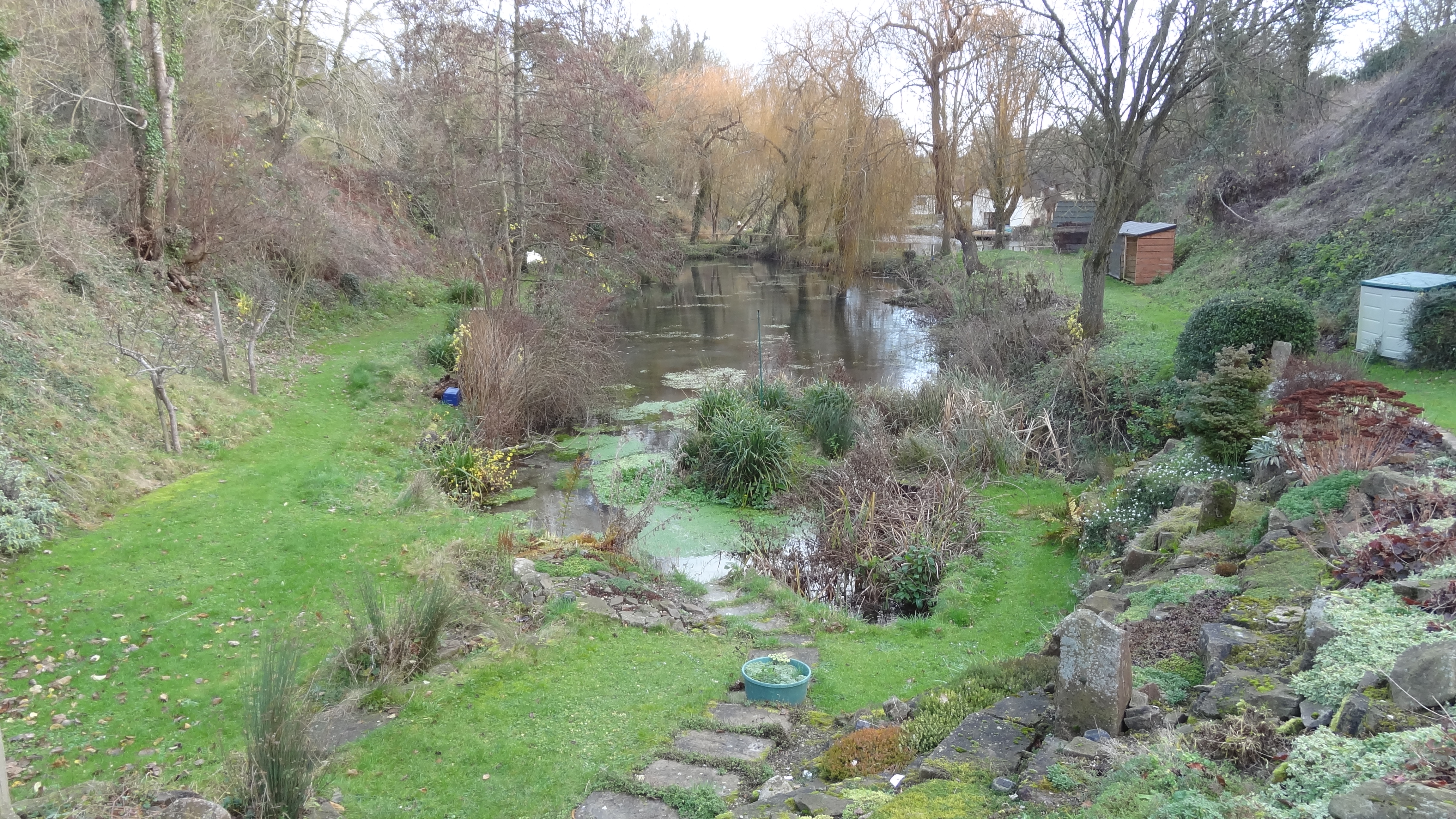
Black Bushes is a dense forest located in Berkshire, England. Spanning an area of approximately 200 acres, it is known for its rich biodiversity and stunning natural beauty. The forest is situated in a remote and tranquil location, offering visitors a peaceful retreat away from the bustling city life.

The woodland is characterized by its thick canopy of majestic oak and beech trees, which create a dark and mysterious ambiance. The forest floor is covered with a lush carpet of ferns, mosses, and wildflowers, adding to its enchanting appeal. Numerous walking trails wind through the woods, allowing visitors to explore the diverse flora and fauna that call Black Bushes their home.

Wildlife thrives in this woodland sanctuary, with sightings of various species such as deer, foxes, badgers, and rabbits being common. Birdwatchers will be delighted by the presence of woodpeckers, owls, and various songbirds that fill the air with their melodious tunes.

Black Bushes has a long and storied history, with evidence of human habitation dating back to ancient times. Archaeological excavations have uncovered artifacts from different periods, including Roman pottery and medieval tools, indicating that the forest has been a significant site for centuries.

The forest is a popular destination for nature enthusiasts, hikers, and photographers, who are drawn to its natural charm and picturesque landscapes. It offers a serene escape for those seeking solace in nature, providing a welcome respite from the demands of modern life. Black Bushes is truly a hidden gem in Berkshire, offering a glimpse into the timeless beauty of England's woodlands.

If you have any feedback on the listing, please let us know in the comments section below.
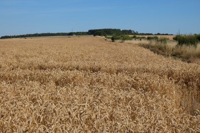
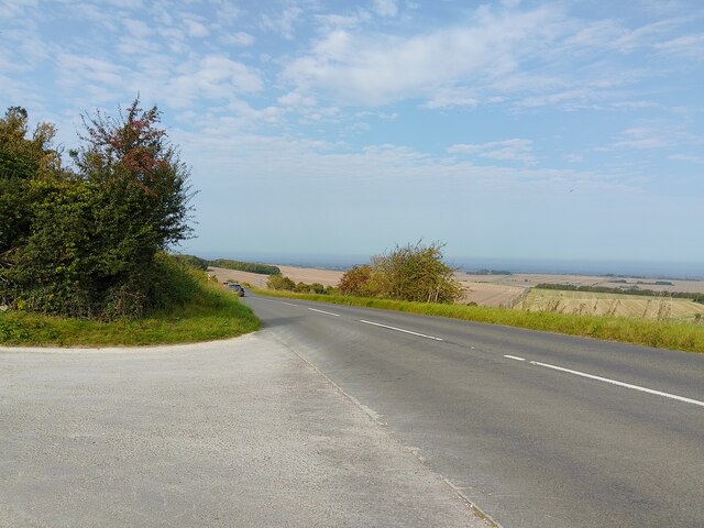
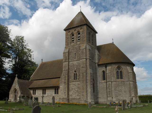
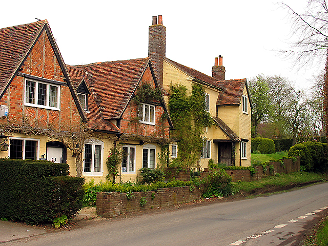
Black Bushes Images

Images are sourced within 2km of 51.546227/-1.4222976 or Grid Reference SU4083. Thanks to Geograph Open Source API. All images are credited.

Farmland, Lockinge Looking down over wheat from the restricted byway to the west of Triangle Wood.
Farmland, Lockinge
Looking down over wheat from the restricted byway to the west of Triangle Wood.
Farmland, Lockinge
Farmland, Lockinge
Downland, Chaddleworth The restricted byway climbing above Woolley Down Cottage.
Downland, Chaddleworth
The restricted byway climbing above Woolley Down Cottage.
Bridleway towards Woolley Down A public bridleway between Combe Hill (a lane) and a restricted byway on Woolley Down.
Bridleway towards Woolley Down
A public bridleway between Combe Hill (a lane) and a restricted byway on Woolley Down.
Restricted byway towards Combe Hill A restricted byway between Combe Hill (a lane) and an unnamed lane.
Restricted byway towards Combe Hill
A restricted byway between Combe Hill (a lane) and an unnamed lane.
Bridleway towards Coombe Hill A public bridleway between Combe Hill (a lane) and a restricted byway on Woolley Down.
Bridleway towards Coombe Hill
A public bridleway between Combe Hill (a lane) and a restricted byway on Woolley Down.
Woolley Down An area of downland near Fawley.
Woolley Down
An area of downland near Fawley.
Chain Hill (B4494) Viewed from the entrance to the car park for access to The Ridgeway.
Chain Hill (B4494)
Viewed from the entrance to the car park for access to The Ridgeway.
Middlehill Down from Chain Hill Farmland on Middlehill Down, viewed from Chain Hill.
Middlehill Down from Chain Hill
Farmland on Middlehill Down, viewed from Chain Hill.
North Farm, Fawley
North Farm, Fawley
Old Milestone by the A338, Manor Road, south of Wantage Carved stone post by the A338, in parish of Wantage (Vale of White Horse District), Manor Road; Black Bushes and Angel Down; opposite lane to Letcombe Bowes Farm, on open on grass verge, in front of wooden fence post of field boundary, on East side of road. Besselsleigh tombstone, erected by the Besselsleigh turnpike trust in the 18th century. 

Inscription reads:-
WANTAGE
3
HUNGERFORD
10½ 
Carved benchmark on lower right face.

Grade II listed.
List Entry Number: 1048543 <span class="nowrap"><a title="https://historicengland.org.uk/listing/the-list/list-entry/1048543" rel="nofollow ugc noopener" href="https://historicengland.org.uk/listing/the-list/list-entry/1048543">Link</a><img style="margin-left:2px;" alt="External link" title="External link - shift click to open in new window" src="https://s1.geograph.org.uk/img/external.png" width="10" height="10"/></span>

Milestone Society National ID: BE_WAHG03
Old Milestone by the A338, Manor Road, south of Wantage
Carved stone post by the A338, in parish of Wantage (Vale of White Horse District), Manor Road; Black Bushes and Angel Down; opposite lane to Letcombe Bowes Farm, on open on grass verge, in front of wooden fence post of field boundary, on East side of road. Besselsleigh tombstone, erected by the Besselsleigh turnpike trust in the 18th century. Inscription reads:- WANTAGE 3 HUNGERFORD 10½ Carved benchmark on lower right face. Grade II listed. List Entry Number: 1048543 LinkExternal link Milestone Society National ID: BE_WAHG03
Old Milestone by the A338, Manor Road, Furzewick Down Carved stone post by the A338, in parish of Wantage (Vale of White Horse District), Manor Road; 30m South of Court Hill junction, North of hill crest at Red House, on grass verge below bank of poor hedge, on East side of road. Besselsleigh tombstone, erected by the Besselsleigh turnpike trust in the 18th century. 

Inscription reads:-
WANTAGE
2
HUNGERFORD
11½ 
Carved benchmark middle left face.

Grade II listed.
List Entry Number: 1198110 <span class="nowrap"><a title="https://historicengland.org.uk/listing/the-list/list-entry/1198110" rel="nofollow ugc noopener" href="https://historicengland.org.uk/listing/the-list/list-entry/1198110">Link</a><img style="margin-left:2px;" alt="External link" title="External link - shift click to open in new window" src="https://s1.geograph.org.uk/img/external.png" width="10" height="10"/></span>

Milestone Society National ID: BE_WAHG02
Old Milestone by the A338, Manor Road, Furzewick Down
Carved stone post by the A338, in parish of Wantage (Vale of White Horse District), Manor Road; 30m South of Court Hill junction, North of hill crest at Red House, on grass verge below bank of poor hedge, on East side of road. Besselsleigh tombstone, erected by the Besselsleigh turnpike trust in the 18th century. Inscription reads:- WANTAGE 2 HUNGERFORD 11½ Carved benchmark middle left face. Grade II listed. List Entry Number: 1198110 LinkExternal link Milestone Society National ID: BE_WAHG02
A338 south of Wantage As A roads go, this is a pleasant one. Much nicer than the racetrack A34 which is the main north - south route in the area. 
From Wantage to the M4 the A338 crosses beautiful downland scenery, without towns, roundabouts,  traffic lights or any of that stuff.
A338 south of Wantage
As A roads go, this is a pleasant one. Much nicer than the racetrack A34 which is the main north - south route in the area. From Wantage to the M4 the A338 crosses beautiful downland scenery, without towns, roundabouts, traffic lights or any of that stuff.
Farming Landscape at Letcombe Bowers
Tree at the highest point on Manor Road The signs point along the Ridgeway and a horseriding route
Tree at the highest point on Manor Road
The signs point along the Ridgeway and a horseriding route
Looking east along the Ridgeway from Manor Road
Segsbury hillfort, southern side This is a view east from the top of the rampart on the south side of the fort - so the area to the left is the inner inclosure.  Cowslips were abundant on this May evening.

To the right, the hedge running parallel to the ditch marks the line of the Ridgeway.
Segsbury hillfort, southern side
This is a view east from the top of the rampart on the south side of the fort - so the area to the left is the inner inclosure. Cowslips were abundant on this May evening. To the right, the hedge running parallel to the ditch marks the line of the Ridgeway.
Segsbury hillfort: a view along the ditch Looking east along the southern rampart and ditch, from the track which crosses the site.  At this point the rampart runs parallel to (and a little to the north of) the Ridgeway.

It occurs to me that the stretch of ditch in front of the camera is so straight - and so regular in cross-section - that it might almost be an abandoned railway cutting.
Segsbury hillfort: a view along the ditch
Looking east along the southern rampart and ditch, from the track which crosses the site. At this point the rampart runs parallel to (and a little to the north of) the Ridgeway. It occurs to me that the stretch of ditch in front of the camera is so straight - and so regular in cross-section - that it might almost be an abandoned railway cutting.
Show me another place!

Black Bushes is located at Grid Ref: SU4083 (Lat: 51.546227, Lng: -1.4222976)

Administrative County: Oxfordshire

District: Vale of White Horse

Police Authority: Thames Valley

What 3 Words

///germinate.conclude.fewer. Near Farnborough, Berkshire

Nearby Locations

Middle Covert Black Bushes

Related Wikis

Segsbury Camp

Segsbury Camp or Segsbury Castle is an Iron Age hillfort on the crest of the Berkshire Downs, near the Ridgeway above Wantage, in the Vale of White Horse...

Fawley, Berkshire

Fawley is a village and civil parish in West Berkshire, England. The hub of the village is centred 3.5 miles (5.6 km) east of Lambourn and has a sub-community...

Farnborough, Berkshire

Farnborough is a village and civil parish in West Berkshire, about 4 miles (6.4 km) south of Wantage. The village is 720 feet (220 m) above sea level on...

Letcombe Bassett

Letcombe Bassett is a village and civil parish about 2 miles (3 km) southwest of the market town of Wantage in the Vale of White Horse. It was part of...

Letcombe Valley

Letcombe Valley is a 7.5-hectare (19-acre) nature reserve south of Letcombe Regis in Oxfordshire. It is managed by the Berkshire, Buckinghamshire and Oxfordshire...

Letcombe Regis

Letcombe Regis is a village and civil parish in the Vale of White Horse. It was part of Berkshire until the 1974 boundary changes transferred the Vale...

Wantage Town F.C.

Wantage Town Football Club is a football club based in Wantage, Oxfordshire that currently play in the Hellenic League Premier Division. The club is affiliated...
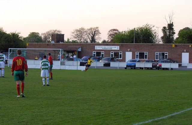
Alfredian Park

Alfredian Park is a football ground in Wantage, Oxfordshire, England, and the home of Wantage Town Football Club. With a capacity of about 1,500. ��2...

Nearby Amenities

Located within 500m of 51.546227,-1.4222976
Rest Area
Lat/Long: 51.54406/-1.4260474
The data included in this document is from www.openstreetmap.org. The data is made available under ODbL.

Have you been to Black Bushes?

Leave your review of Black Bushes below (or comments, questions and feedback).