Butterwick Belt

Wood, Forest in Durham

England

Butterwick Belt

Derelict filling station on north side of A689 The old petrol station was clearly a modest affair by modern standards, having just a tiny forecourt. It has been disused for some time - even seven year's earlier, Pauline's image shows the building to be in a poor state <a title="https://www.geograph.org.uk/photo/4015894" href="https://www.geograph.org.uk/photo/4015894">Link</a> .
Derelict filling station on north side of A689 Credit: Trevor Littlewood

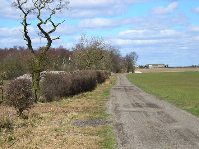
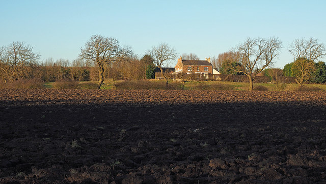
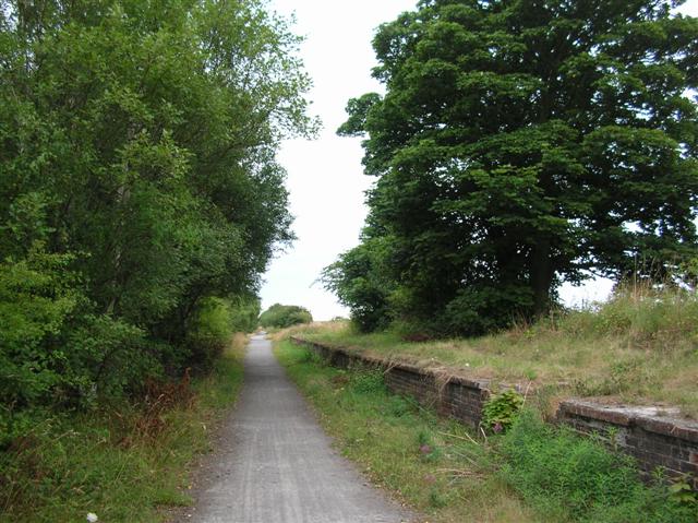
Butterwick Belt is a woodland area located in Durham, England. Situated near the village of Butterwick, it is a picturesque forest that covers a vast area and is known for its natural beauty and diverse wildlife.

The forest consists mainly of a mix of deciduous and coniferous trees, creating a rich and varied landscape. The canopy of the trees provides a sheltered environment, making it a perfect habitat for numerous species of flora and fauna. The forest floor is covered in a thick carpet of mosses, ferns, and wildflowers, adding to the enchanting atmosphere of the area.

Butterwick Belt is a popular destination for nature lovers, hikers, and photographers. There are numerous trails and pathways that wind through the woodland, allowing visitors to explore and immerse themselves in the serene surroundings. The forest is home to a wide range of wildlife, including deer, foxes, badgers, and a variety of bird species. Birdwatchers can spot woodpeckers, owls, and even elusive species like the nightjar.

The woodland is also an important ecological site, providing a valuable habitat for rare and endangered species. Conservation efforts are in place to protect the delicate ecosystem and ensure the preservation of the natural environment.

Overall, Butterwick Belt in Durham is a stunning woodland area with its diverse flora, abundant wildlife, and tranquil atmosphere. It offers a peaceful retreat for those seeking a connection with nature and a chance to explore the beauty of the Durham countryside.

If you have any feedback on the listing, please let us know in the comments section below.

Butterwick Belt Images

Images are sourced within 2km of 54.668012/-1.3827775 or Grid Reference NZ3930. Thanks to Geograph Open Source API. All images are credited.

Derelict filling station on north side of A689 The old petrol station was clearly a modest affair by modern standards, having just a tiny forecourt. It has been disused for some time - even seven year's earlier, Pauline's image shows the building to be in a poor state <a title="https://www.geograph.org.uk/photo/4015894" href="https://www.geograph.org.uk/photo/4015894">Link</a> .
Derelict filling station on north side of A689
The old petrol station was clearly a modest affair by modern standards, having just a tiny forecourt. It has been disused for some time - even seven year's earlier, Pauline's image shows the building to be in a poor state Link .
Poultry houses at Little Butterwick Farm
Bridleway near Humble Knowe Farm A very superior bridleway with hard surface
Bridleway near Humble Knowe Farm
A very superior bridleway with hard surface
Entering County Durham on the A689 Leaving Teesside
Entering County Durham on the A689
Leaving Teesside
Farm road to Old Acres Hall Farm
A689 road linking A1(north) with Teesside The dual carriageway has recently been extended over this section and a cycle path incorporated on the south side (right hand side of this picture)
A689 road linking A1(north) with Teesside
The dual carriageway has recently been extended over this section and a cycle path incorporated on the south side (right hand side of this picture)
Ten O'Clock Farm
Ten O'Clock Farm
Farm road from Butterwick Moor Farm
Farm road to Butterwick Moor Farm
Bridleway to the north of Butterwick Moor Farm Formed by rolling a strip over a field of winter-sown crops. A dreadful glutinous muddy passage.
Bridleway to the north of Butterwick Moor Farm
Formed by rolling a strip over a field of winter-sown crops. A dreadful glutinous muddy passage.
Butterwick Moor Farm
Butterwick House Farm, near Sedgefield
The edge of square plantation With Old Acres Hall Farm in the background.
The edge of square plantation
With Old Acres Hall Farm in the background.
Sustrans cycle way This runs alongside the A689 dual carriageway. This section is part of the old A689 single road and leads to the quieter road towards Fishburn village.
Sustrans cycle way
This runs alongside the A689 dual carriageway. This section is part of the old A689 single road and leads to the quieter road towards Fishburn village.
Wild flowers beside the cycle way I think these are pink dead nettle.
Wild flowers beside the cycle way
I think these are pink dead nettle.
Sign for Old Acres Lodge Farm The farm is directly behind the sign.
Sign for Old Acres Lodge Farm
The farm is directly behind the sign.
Badger sett on stream bank The whole bank at this point was riddled with large holes which had earth scraped out from them.
Badger sett on stream bank
The whole bank at this point was riddled with large holes which had earth scraped out from them.
Ploughed field south of Embleton Old Hall The field lies between Embleton Old Hall and Tinklers Wood.
Ploughed field south of Embleton Old Hall
The field lies between Embleton Old Hall and Tinklers Wood.
Show me another place!

Butterwick Belt is located at Grid Ref: NZ3930 (Lat: 54.668012, Lng: -1.3827775)

Unitary Authority: County Durham

Police Authority: Durham

What 3 Words

///hires.fish.scooter. Near Fishburn, Co. Durham

Related Wikis

Butterwick, County Durham

Butterwick is a small village in County Durham, England. It is situated a short distance to the south east of Fishburn. Butterwick is first mentioned in...

Wynyard railway station (England)

Wynyard railway station was a railway station on the Castle Eden branch of the North Eastern Railway (NER) from 1880 to 1931. It was located immediately...

Embleton, County Durham

Embleton is a hamlet and former civil parish, now in the parish of Sedgefield, in the County Durham district, in the ceremonial county of Durham, in England...

Hurworth Burn railway station

Hurworth Burn railway station was a railway station on the Castle Eden branch of the North Eastern Railway (NER) from 1880 to 1931. It was located between...

Pike Whin Bog

Pike Whin Bog is a Site of Special Scientific Interest in the Easington district of east County Durham, England. It is situated just east of Hurworth Burn...

Fishburn

Fishburn is a village and civil parish in County Durham, in England. It is situated about 12 miles west of Hartlepool. It had a population of 2,454, increasing...

Sedgefield Community College

Sedgefield Community College, which is in the laidlaw trust, is an coeducational secondary school located in Sedgefield in County Durham, England. ��2...

Winterton Hospital

Winterton Hospital was a psychiatric hospital north of Sedgefield in County Durham, England. == History == A site for the facility at Far Winterton, north...

Nearby Amenities

Located within 500m of 54.668012,-1.3827775
Generator Method: wind_turbine
Generator Output Electricity: yes
Generator Source: wind
Generator Type: horizontal_axis
Power: generator
Lat/Long: 54.6686505/-1.3796213
Generator Method: wind_turbine
Generator Output Electricity: yes
Generator Source: wind
Generator Type: horizontal_axis
Power: generator
Lat/Long: 54.6642513/-1.378667
Butterwick Moor
Generator Method: wind_turbine
Generator Output Electricity: yes
Generator Source: wind
Generator Type: horizontal_axis
Power: generator
Lat/Long: 54.6714487/-1.3779798
Generator Method: wind_turbine
Generator Output Electricity: yes
Generator Source: wind
Generator Type: horizontal_axis
Power: generator
Lat/Long: 54.6667519/-1.3763061
Generator Method: wind_turbine
Generator Output Electricity: yes
Generator Source: wind
Generator Type: horizontal_axis
Power: generator
Lat/Long: 54.665815/-1.381185
Butterwick Moor
Generator Method: wind_turbine
Generator Output Electricity: yes
Generator Source: wind
Generator Type: horizontal_axis
Power: generator
Lat/Long: 54.6700841/-1.3886984
Butterwick Moor
Generator Method: wind_turbine
Generator Output Electricity: yes
Generator Source: wind
Generator Type: horizontal_axis
Power: generator
Lat/Long: 54.6716475/-1.383849
Butterwick Moor
Generator Method: wind_turbine
Generator Output Electricity: yes
Generator Source: wind
Generator Type: horizontal_axis
Power: generator
Lat/Long: 54.6688925/-1.3854047
The data included in this document is from www.openstreetmap.org. The data is made available under ODbL.

Have you been to Butterwick Belt?

Leave your review of Butterwick Belt below (or comments, questions and feedback).