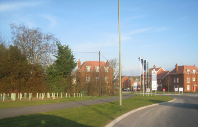
Round Bush Copse

Wood, Forest in Hampshire Test Valley

England

Round Bush Copse

Path across junction of A3093 and A303 This path, not marked as a right of way on the map, seems to be quite well used. Here is cuts across the A3093 dual carriageway. This path enables walking from the southern end of Picket Twenty across the junction to the eastern end of Micheldever Road (an obsolete tarmac road which has become a path with encroaching vegetation).
Path across junction of A3093 and A303 Credit: Peter Facey

Round Bush Copse is a picturesque woodland located in Hampshire, England. Covering an area of approximately 50 hectares, it is a popular destination for nature enthusiasts and those seeking a tranquil escape from the hustle and bustle of urban life.

The copse is characterized by its dense canopy of broadleaf trees, predominantly consisting of oak, beech, and ash. This diverse mix of tree species provides a rich habitat for a wide range of flora and fauna. Bluebells, wood anemones, and primroses create a colorful carpet during the springtime, while ferns, mosses, and lichens thrive in the shady understory.

The woodland is crisscrossed by a network of well-maintained footpaths, allowing visitors to explore its natural beauty at their own pace. These paths wind through ancient stands of trees, revealing hidden clearings, babbling brooks, and occasional glimpses of wildlife such as deer, foxes, and various bird species.

Round Bush Copse also holds historical significance, with remnants of old boundary banks and ditches dating back to the medieval period. These features add an intriguing element to the woodland, hinting at its past use for grazing or woodland management.

As a designated Site of Special Scientific Interest (SSSI), Round Bush Copse is protected and managed to preserve its ecological value. The management practices aim to maintain the diverse habitat and encourage natural regeneration, ensuring the perpetuation of this precious woodland for future generations to enjoy.

Whether one seeks solace in nature, wishes to indulge in wildlife spotting, or simply desires a peaceful walk surrounded by ancient trees, Round Bush Copse offers a truly enchanting experience in the heart of Hampshire.

If you have any feedback on the listing, please let us know in the comments section below.

Round Bush Copse Images

Images are sourced within 2km of 51.206267/-1.4316978 or Grid Reference SU3945. Thanks to Geograph Open Source API. All images are credited.

Path across junction of A3093 and A303 This path, not marked as a right of way on the map, seems to be quite well used. Here is cuts across the A3093 dual carriageway. This path enables walking from the southern end of Picket Twenty across the junction to the eastern end of Micheldever Road (an obsolete tarmac road which has become a path with encroaching vegetation).
Path across junction of A3093 and A303
This path, not marked as a right of way on the map, seems to be quite well used. Here is cuts across the A3093 dual carriageway. This path enables walking from the southern end of Picket Twenty across the junction to the eastern end of Micheldever Road (an obsolete tarmac road which has become a path with encroaching vegetation).
Bridge carrying A303 over the A3093 In the foreground is the continuation of <a href="https://www.geograph.org.uk/photo/7410123">SU3844 : Path across junction of A3093 and A303</a>.
Bridge carrying A303 over the A3093
In the foreground is the continuation of SU3844 : Path across junction of A3093 and A303.
Micheldever Road An obsolete tarmac road, now a path with encroaching vegetation. Not marked as a right of way on the map but seems to be well used by the public.
Micheldever Road
An obsolete tarmac road, now a path with encroaching vegetation. Not marked as a right of way on the map but seems to be well used by the public.
Underpass below A303 with footpath going towards Cow Down This track is a public footpath but passable by vehicle.
Underpass below A303 with footpath going towards Cow Down
This track is a public footpath but passable by vehicle.
Planning Application notice for an anaerobic digester Notice of Planning Application 22/03267/FULLN dated 20th December 2022 for the construction of an anaerobic digester plant on farm land between the A303 and Cowdown Lane. This notice was on the perimeter fence of Cowdown Solar Farm which lies immediately southwest of the application site.
Planning Application notice for an anaerobic digester
Notice of Planning Application 22/03267/FULLN dated 20th December 2022 for the construction of an anaerobic digester plant on farm land between the A303 and Cowdown Lane. This notice was on the perimeter fence of Cowdown Solar Farm which lies immediately southwest of the application site.
Footpath along east side of Cowdown Solar Farm Going towards Cowdown Farm.
Footpath along east side of Cowdown Solar Farm
Going towards Cowdown Farm.
Footpath along eastern side of Cowdown Solar Farm Running from Cowdown Farm towards, and then beneath the A303 at <a href="https://www.geograph.org.uk/photo/7410130">SU3744 : Underpass below A303 with footpath going towards Cow Down</a>.
Footpath along eastern side of Cowdown Solar Farm
Running from Cowdown Farm towards, and then beneath the A303 at SU3744 : Underpass below A303 with footpath going towards Cow Down.
Cowdown Solar Farm Seen looking across Cowdown Lane.
Cowdown Solar Farm
Seen looking across Cowdown Lane.
Cowdown Solar Farm Seen from public footpath along its eastern edge.
Cowdown Solar Farm
Seen from public footpath along its eastern edge.
Field upon which anaerobic digester plant may be built .
Field upon which anaerobic digester plant may be built
.
Field upon which anaerobic digester plant may be built .
Field upon which anaerobic digester plant may be built
.
Field upon which anaerobic digester plant may be built .
Field upon which anaerobic digester plant may be built
.
Field upon which anaerobic digester plant may be built .
Field upon which anaerobic digester plant may be built
.
End of vehicular access on Micheldever Road At left private drive to property named Flagstaff House. The turning left in front of the metal barrier is a newish cycle way not yet marked on OS maps. Beyond the metal barrier Micheldever Road continues as an overgrowing tarmac path to the A3093.
End of vehicular access on Micheldever Road
At left private drive to property named Flagstaff House. The turning left in front of the metal barrier is a newish cycle way not yet marked on OS maps. Beyond the metal barrier Micheldever Road continues as an overgrowing tarmac path to the A3093.
Cycleway from Micheldever Road to the A3093 This newish cycleway is not yet shown on OS maps. For context see <a href="https://www.geograph.org.uk/photo/7410159">SU3844 : End of vehicular access on Micheldever Road</a>.
Cycleway from Micheldever Road to the A3093
This newish cycleway is not yet shown on OS maps. For context see SU3844 : End of vehicular access on Micheldever Road.
Cowdown Solar Farm A view of the entrance to Cowdown Solar Farm on Cowdown Lane. The vehicles in the distance beyond are travelling on the A303.
Cowdown Solar Farm
A view of the entrance to Cowdown Solar Farm on Cowdown Lane. The vehicles in the distance beyond are travelling on the A303.
Cowdown Solar Farm and footpath Looking at the entrance to Cowdown Solar Farm and the public footpath that runs beside the farm.
Cowdown Solar Farm and footpath
Looking at the entrance to Cowdown Solar Farm and the public footpath that runs beside the farm.
Cowdown Farm buildings A series of buildings form part of Cowdown Farm off Cowdown Lane.
Cowdown Farm buildings
A series of buildings form part of Cowdown Farm off Cowdown Lane.
Show me another place!

Round Bush Copse is located at Grid Ref: SU3945 (Lat: 51.206267, Lng: -1.4316978)

Administrative County: Hampshire

District: Test Valley

Police Authority: Hampshire

What 3 Words

///purified.follow.impulses. Near Andover, Hampshire

Related Wikis

Andover Down

Andover Down is a hamlet in Hampshire, England 2 miles (3.2 km) east of Andover. == History == On the 1888 OS map there are a very small number of houses...

Dead Man's Plack

Dead Man's Plack is a Grade-II listed 19th-century monument to Æthelwald, Ealdorman of East Anglia, who, according to legend, was killed in 963 near the...

Picket Twenty

Picket Twenty, once a hamlet, is now effectively a suburb of Andover, in the Test Valley district of Hampshire, England. The centre of Andover lies to...

Picket Piece

Picket Piece is a small village in the Test Valley district of Hampshire, England. Andover lies approximately 2 miles (3.2 km) south-west from the village...

Finkley Down

Finkley Down is a suburb and hamlet in the civil parish of Finkley in Hampshire, England. It is in the civil parish of Smannell. Its nearest town is Andover...

East Anton

East Anton is a suburb and housing development of Andover in the Test Valley district of Hampshire, England. It lies 1.5 miles (2.1 km) north-east from...

Winton Community Academy

Winton Community Academy (formerly Winton School) is a mixed secondary school located in Andover in the English county of Hampshire. == History == The...

Longparish railway station

Longparish railway station served the village of Longparish, Hampshire, England from 1885 to 1956 on the Fullerton to Hurstbourne Line. == History == The...

Nearby Amenities

Located within 500m of 51.206267,-1.4316978
Power: pole
Source: Bing
Lat/Long: 51.2072196/-1.4286627
Power: pole
Source: Bing
Lat/Long: 51.2079119/-1.4290758
Power: pole
Source: Bing
Lat/Long: 51.2065138/-1.4282309
Power: pole
Source: Bing
Lat/Long: 51.2090595/-1.4340781
Power: pole
Source: Bing
Lat/Long: 51.2086631/-1.4314817
Power: pole
Source: Bing
Lat/Long: 51.2058752/-1.4268575
Power: pole
Source: Bing
Lat/Long: 51.2052332/-1.4254547
Power: pole
Source: Bing
Lat/Long: 51.2088766/-1.4328149
Power: pole
Source: Bing
Lat/Long: 51.2093236/-1.4357493
Barrier: stile
Lat/Long: 51.2052601/-1.4266992
Old Halls Copse
Place: locality
Lat/Long: 51.2032549/-1.4349282
Deadman's Plack Copse
Place: locality
Lat/Long: 51.2024395/-1.4290353
Round Bush Copse
Place: locality
Lat/Long: 51.2063127/-1.431114
The data included in this document is from www.openstreetmap.org. The data is made available under ODbL.

Have you been to Round Bush Copse?

Leave your review of Round Bush Copse below (or comments, questions and feedback).