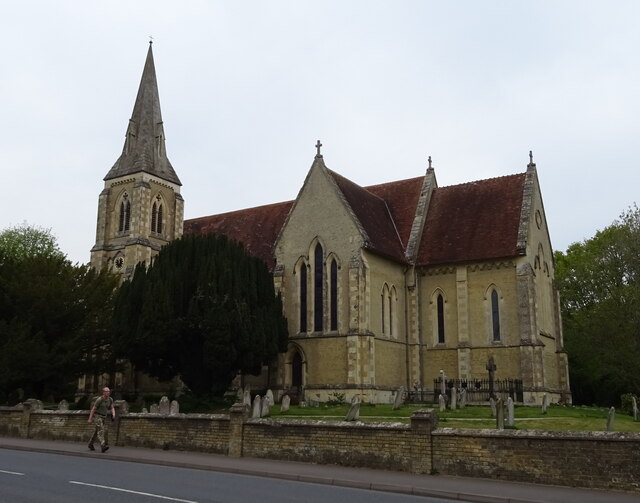
Warwick's Copse
Wood, Forest in Hampshire New Forest
England
Warwick's Copse

Warwick's Copse is a picturesque woodland located in Hampshire, England. Covering an area of approximately 50 acres, this enchanting forest is a haven for nature enthusiasts and those seeking tranquility amidst natural beauty.
The copse is predominantly composed of oak and beech trees, creating a dense canopy that provides shade and shelter for a diverse range of flora and fauna. The forest floor is carpeted with a lush undergrowth of ferns, bluebells, and wildflowers, adding vibrant splashes of color to the landscape.
Visitors to Warwick's Copse can enjoy a network of well-maintained footpaths that wind through the forest, offering opportunities for leisurely strolls and immersive nature walks. Along these paths, one can encounter a variety of wildlife, including deer, squirrels, and numerous bird species, making it a popular spot for birdwatchers.
The copse is also home to an array of historical features, with remnants of ancient earthworks and burial mounds scattered throughout the woodland. These archaeological treasures provide glimpses into the rich history of the area, dating back thousands of years.
Warwick's Copse is a popular destination for families, as it offers picnic areas and designated spaces for outdoor activities. Its serene atmosphere and natural beauty make it an ideal spot for relaxation, meditation, and photography.
Managed by local authorities, the copse is well-preserved and accessible to the public, with ample parking facilities nearby. Whether one is seeking an escape from the bustle of everyday life or wishing to explore the wonders of nature, Warwick's Copse is an idyllic destination for all nature lovers and outdoor enthusiasts.
If you have any feedback on the listing, please let us know in the comments section below.
Warwick's Copse Images
Images are sourced within 2km of 50.882732/-1.4479512 or Grid Reference SU3809. Thanks to Geograph Open Source API. All images are credited.


Warwick's Copse is located at Grid Ref: SU3809 (Lat: 50.882732, Lng: -1.4479512)
Administrative County: Hampshire
District: New Forest
Police Authority: Hampshire
What 3 Words
///tulip.heat.local. Near Marchwood, Hampshire
Nearby Locations
Related Wikis

Marchwood railway station
Marchwood railway station was an intermediate station on the Totton, Hythe and Fawley Light Railway, which was built along the coast of Southampton Water...

Marchwood
Marchwood is a village and civil parish located in Hampshire, England. It lies between Totton and Hythe on the western shore of Southampton Water and directly...

Southampton F.C. Under-21s and Academy
Southampton F.C. Under-21s and Academy or Saints U21s and Academy is the youth organisation run by Southampton F.C. to encourage and develop young footballers...
Staplewood Campus
Staplewood Campus in Marchwood, Hampshire is the training ground of Southampton Football Club. It was the home ground of Road-Sea Southampton until 1987...
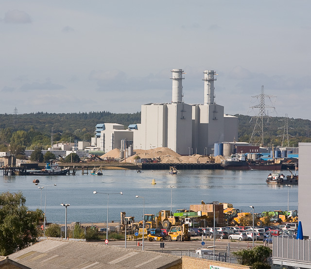
Marchwood Power Station
Marchwood Power Station is an 898.1 MW gas-fired power station in Marchwood, near Southampton, England. It is situated beside estuary of the River Test...

Dibden Bay
Dibden Bay is a 229.4-hectare (567-acre) biological Site of Special Scientific Interest (SSSI) between Marchwood and Hythe in Hampshire.Most of this site...
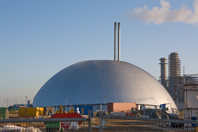
Marchwood ERF
Marchwood ERF (or Marchwood Energy Recovery Facility) is a waste incineration plant in Marchwood, near Southampton, England. It is situated beside the...

Marchwood Military Port
Marchwood Military Port (MMP) or Marchwood Sea Mounting Centre (SMC) is a military port located in Marchwood, Southampton on the south coast of the UK...
Nearby Amenities
Located within 500m of 50.882732,-1.4479512Have you been to Warwick's Copse?
Leave your review of Warwick's Copse below (or comments, questions and feedback).