Ushercoombe Copse
Wood, Forest in Oxfordshire Cherwell
England
Ushercoombe Copse

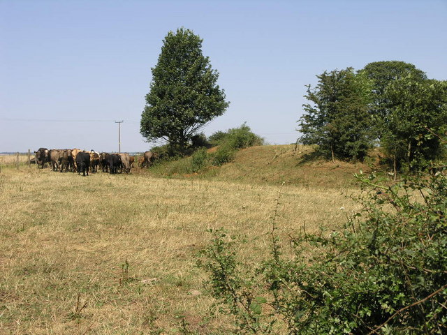
Ushercoombe Copse, located in Oxfordshire, is a picturesque and serene woodland area that encompasses approximately 200 acres. This enchanting forest is situated near the village of Ushercoombe, surrounded by rolling hills and charming countryside.
The copse is predominantly composed of deciduous trees, including oak, beech, and ash, which create a rich and diverse canopy. These towering trees provide a haven for a wide variety of wildlife, including deer, foxes, badgers, and an array of bird species.
Walking through Ushercoombe Copse, visitors are greeted with a carpet of vibrant wildflowers and ferns, adding to the beauty and tranquility of the surroundings. The forest floor is home to an assortment of flora, including bluebells, primroses, and wood anemones, which create a stunning display during the spring months.
The copse is crisscrossed with a network of well-maintained footpaths, allowing visitors to explore the area at their leisure. These paths lead to hidden clearings, babbling brooks, and secluded ponds, providing opportunities for peaceful reflection and a chance to connect with nature.
Ushercoombe Copse is a popular destination for nature enthusiasts, hikers, and photographers, who are drawn to its natural beauty and abundant wildlife. The copse also serves as an important ecological habitat, providing shelter and sustenance for many species.
Managed by a local conservation group, Ushercoombe Copse is cherished by the community and offers a tranquil escape from the hustle and bustle of everyday life. It stands as a testament to the importance of preserving and appreciating the natural wonders of Oxfordshire's woodlands.
If you have any feedback on the listing, please let us know in the comments section below.
Ushercoombe Copse Images
Images are sourced within 2km of 52.030105/-1.4359819 or Grid Reference SP3837. Thanks to Geograph Open Source API. All images are credited.


Ushercoombe Copse is located at Grid Ref: SP3837 (Lat: 52.030105, Lng: -1.4359819)
Administrative County: Oxfordshire
District: Cherwell
Police Authority: Thames Valley
What 3 Words
///among.hands.darts. Near Bloxham, Oxfordshire
Nearby Locations
Related Wikis

Banbury Rural District
Banbury was a rural district in Oxfordshire, England from 1894 to 1974. It was formed under the Local Government Act 1894 from the bulk of the Banbury...

Tadmarton
Tadmarton is a village and civil parish about 4 miles (6.4 km) west of Banbury, Oxfordshire. The 2011 Census recorded the parish's population as 541, which...

Swalcliffe Park School
Swalcliffe Park School is a specialist residential and day school in Oxfordshire, England for boys aged 11–19 who have needs arising from their Autistic...

Swalcliffe
Swalcliffe is a village and civil parish about 5 miles (8 km) west of Banbury in Oxfordshire. The parish is about 2+1⁄2 miles (4 km) long north–south and...
Sibford
Sibford (or The Sibfords) is the collective name given to the villages of Sibford Gower, Sibford Ferris and Burdrop on the edge of the Cotswolds in north...

Sibford Gower
Sibford Gower is a village and civil parish about 6.5 miles (10.5 km) west of Banbury in Oxfordshire, on the north side of the Sib valley, opposite Sibford...

Sibford School
Sibford School is a British co-educational independent school in Sibford Ferris, west of Banbury in north Oxfordshire, linked with the Religious Society...

Sibford Ferris
Sibford Ferris is a village and civil parish about 6.5 miles (10.5 km) west of Banbury in Oxfordshire. It is on the south side of the Sib valley opposite...
Nearby Amenities
Located within 500m of 52.030105,-1.4359819Have you been to Ushercoombe Copse?
Leave your review of Ushercoombe Copse below (or comments, questions and feedback).