Chaddesden Wood

Wood, Forest in Derbyshire

England

Chaddesden Wood

Moor Road (Ryknild Street) - near Breadsall This dead straight section of Moor Road, on the way to Breadsall, is part of the Roman road known as Ryknild Street which ran from the Fosse Way at Bourton-on-the-Water in the Cotswolds to Templeborough near Rotherham.
Moor Road (Ryknild Street) - near Breadsall Credit: Nikki Mahadevan

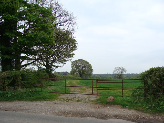
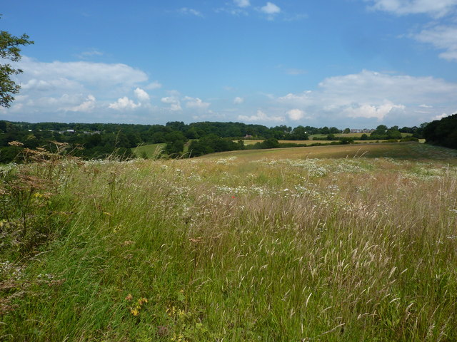
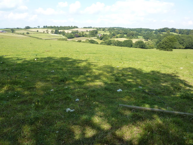
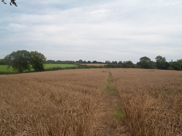
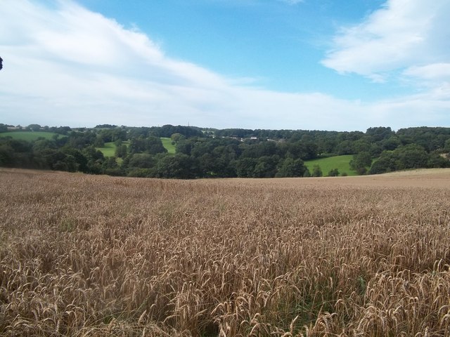
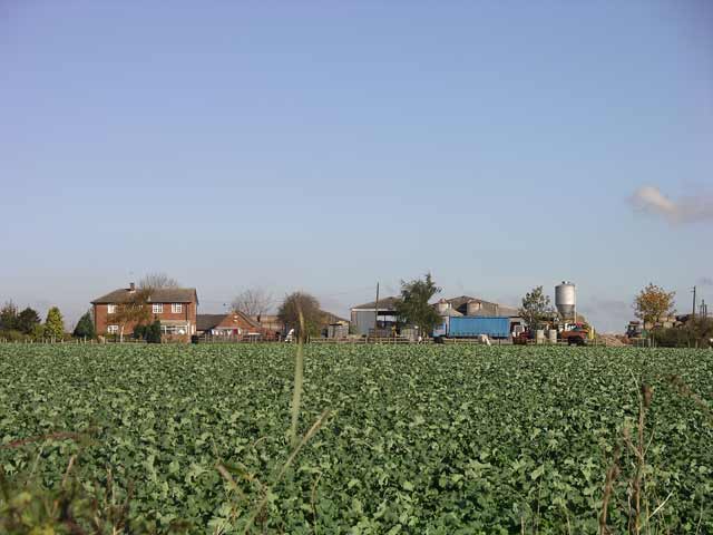
Chaddesden Wood is a beautiful woodland located in Derbyshire, England. Covering an area of approximately 18.5 hectares, it is a popular destination for nature enthusiasts and locals alike. The wood is situated within the Chaddesden Park area and is easily accessible for visitors.

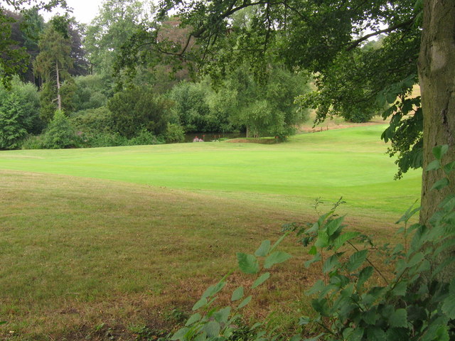
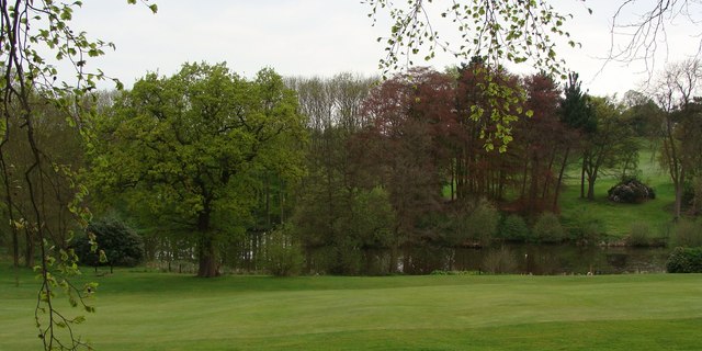
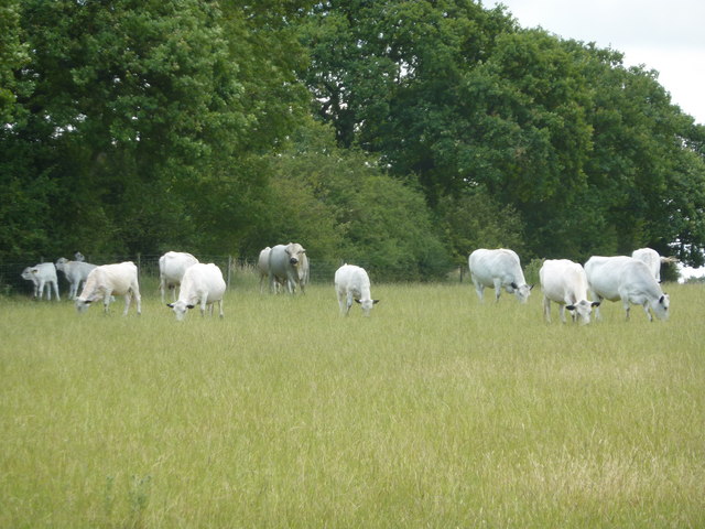
The woodland is characterized by a diverse range of trees, including oak, ash, and birch, which provide a rich habitat for numerous species of birds, insects, and mammals. The forest floor is adorned with a variety of wildflowers and ferns, creating a picturesque and tranquil setting.

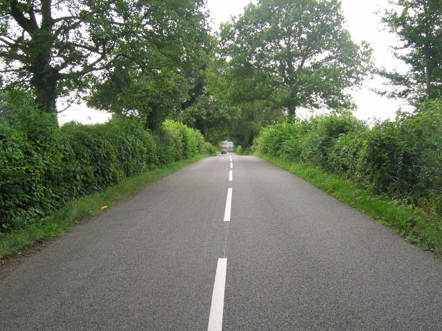
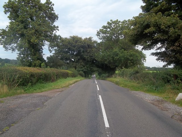
Several well-maintained paths wind through the wood, offering visitors the opportunity to explore and enjoy its natural beauty. These pathways are suitable for walkers of all abilities and are often used by joggers and dog walkers.

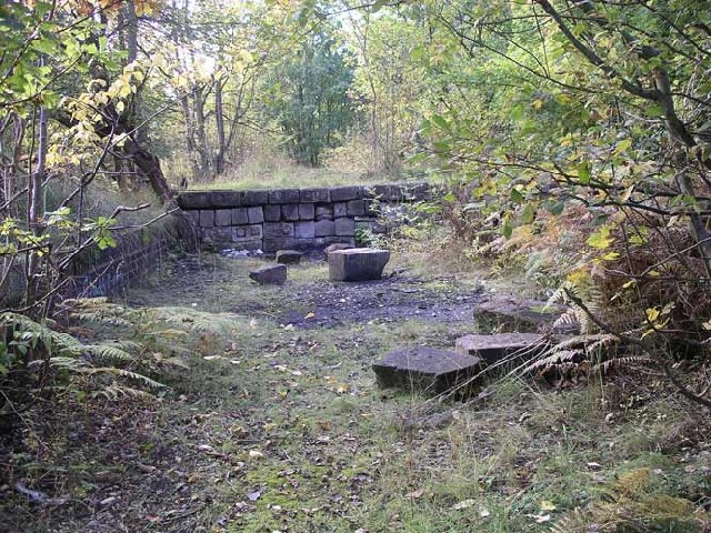
Chaddesden Wood is not only a haven for wildlife but also a place of historical interest. The wood was once part of the Chaddesden Hall estate and remnants of the old hall can still be found within the woodland. These remnants, including a sunken garden and a walled garden, provide a glimpse into the area's past.

The wood is managed by the local council and conservation efforts are in place to protect its natural environment. Educational activities and events are regularly organized to promote understanding and appreciation of the woodland's flora and fauna.

Overall, Chaddesden Wood is a cherished natural space that offers a peaceful retreat for both locals and visitors, providing an opportunity to connect with nature and explore the rich history of the area.

If you have any feedback on the listing, please let us know in the comments section below.

Chaddesden Wood Images

Images are sourced within 2km of 52.947315/-1.431974 or Grid Reference SK3839. Thanks to Geograph Open Source API. All images are credited.

Moor Road (Ryknild Street) - near Breadsall This dead straight section of Moor Road, on the way to Breadsall, is part of the Roman road known as Ryknild Street which ran from the Fosse Way at Bourton-on-the-Water in the Cotswolds to Templeborough near Rotherham.
Moor Road (Ryknild Street) - near Breadsall
This dead straight section of Moor Road, on the way to Breadsall, is part of the Roman road known as Ryknild Street which ran from the Fosse Way at Bourton-on-the-Water in the Cotswolds to Templeborough near Rotherham.
Breadsall Priory golf course Looking across the golf course of Breadsall Priory Country Club <a href="https://www.geograph.org.uk/gridref/SK3841">SK3841</a> at the tip of a small lake on the course. Photo taken from Moor Road which is part of the Roman road "Ryknild Street".
Breadsall Priory golf course
Looking across the golf course of Breadsall Priory Country Club SK3841 at the tip of a small lake on the course. Photo taken from Moor Road which is part of the Roman road "Ryknild Street".
The pond in the grounds of Breadsall Priory Hotel
Field entrance from Moor Road, near Breadsall
Bull, cows and calves, Morley The breed is British White,a naturally polled breed, white with black or red points, used mainly for beef. It has a confirmed history dating back to the 17th century, and may be derived from similar cattle kept in parks for many centuries before that.
Bull, cows and calves, Morley
The breed is British White,a naturally polled breed, white with black or red points, used mainly for beef. It has a confirmed history dating back to the 17th century, and may be derived from similar cattle kept in parks for many centuries before that.
Looking north towards Morleymoor On a path heading for Moor Road (Ryknild Street, a Roman road).
Looking north towards Morleymoor
On a path heading for Moor Road (Ryknild Street, a Roman road).
Farmland and a view of Breadsall Lodge Seen from Moor Road (Ryknild Street), which runs from Breadsall to Morleymoor.
Farmland and a view of Breadsall Lodge
Seen from Moor Road (Ryknild Street), which runs from Breadsall to Morleymoor.
Moor Road near Breadsall This road follows the course of the Roman Ryknild Street, hence its arrow-straight trajectory.
Moor Road near Breadsall
This road follows the course of the Roman Ryknild Street, hence its arrow-straight trajectory.
Path Crossing a Field of Wheat near Breadsall Heading towards Morley on a warm and occasionally bright Saturday in early September.
Path Crossing a Field of Wheat near Breadsall
Heading towards Morley on a warm and occasionally bright Saturday in early September.
A Rural Scene near Morley Field of wheat viewed here from a footpath junction close to Broomfield Hall.
A Rural Scene near Morley
Field of wheat viewed here from a footpath junction close to Broomfield Hall.
Sports facility Broomfield Hall
Rams Academy Training Ground Rams academy training ground, the site of the old Moor Farm on Morley Road, Oakwood, Derby

<span class="nowrap"><a title="http://www.picturesofderby.co.uk/area_moor_farm.htm" rel="nofollow ugc noopener" href="http://www.picturesofderby.co.uk/area_moor_farm.htm">Link</a><img style="margin-left:2px;" alt="External link" title="External link - shift click to open in new window" src="https://s1.geograph.org.uk/img/external.png" width="10" height="10"/></span>
Rams Academy Training Ground
Rams academy training ground, the site of the old Moor Farm on Morley Road, Oakwood, Derby LinkExternal link
Cross Roads Farm Cross Roads Farm, junction of Lime lane and Morley Road, the main farmhouse was built in 1972
<span class="nowrap"><a title="https://web.archive.org/web/20060625154440/http://www.picturesofderby.co.uk/area_oakwood.htm" rel="nofollow ugc noopener" href="https://web.archive.org/web/20060625154440/http://www.picturesofderby.co.uk/area_oakwood.htm">Archive Link</a><img style="margin-left:2px;" alt="External link" title="External link - shift click to open in new window" src="https://s1.geograph.org.uk/img/external.png" width="10" height="10"/></span>
Cross Roads Farm
Cross Roads Farm, junction of Lime lane and Morley Road, the main farmhouse was built in 1972 Archive LinkExternal link
Charingworth Road, Oakwood Drive, Bishops Drive and Springwood Road Junction This picture shows the remains on the endless cable tramway, which was the longest one in the world. The coal from the Footrill colliery at Stanley had to be taken to Derby by horse and cart, which was not an ideal situation. At the time the Great Northern Railway, refused to build a siding, so in 1894 a continuous cable conveyor was constructed across country to a landsale wharf on Hill Crest Road, Chaddesden. The plan was to terminate at Derby Canal on Nottingham Road, but the council refused permission to allow the trackway to cross Nottingham Road, This picture is on the junction of Bishops Drive, Springwood Road, Charingworth Road and Oakwood Drive, and clearly show the raised trackway, now protected with a cast iron rail. Coal was carried on trains clipped on to an anchor rope, running over rollers between the tram-rails. 

<span class="nowrap"><a title="https://web.archive.org/web/20060625154440/http://www.picturesofderby.co.uk/area_oakwood.htm" rel="nofollow ugc noopener" href="https://web.archive.org/web/20060625154440/http://www.picturesofderby.co.uk/area_oakwood.htm">Archive Link</a><img style="margin-left:2px;" alt="External link" title="External link - shift click to open in new window" src="https://s1.geograph.org.uk/img/external.png" width="10" height="10"/></span>
Charingworth Road, Oakwood Drive, Bishops Drive and Springwood Road Junction
This picture shows the remains on the endless cable tramway, which was the longest one in the world. The coal from the Footrill colliery at Stanley had to be taken to Derby by horse and cart, which was not an ideal situation. At the time the Great Northern Railway, refused to build a siding, so in 1894 a continuous cable conveyor was constructed across country to a landsale wharf on Hill Crest Road, Chaddesden. The plan was to terminate at Derby Canal on Nottingham Road, but the council refused permission to allow the trackway to cross Nottingham Road, This picture is on the junction of Bishops Drive, Springwood Road, Charingworth Road and Oakwood Drive, and clearly show the raised trackway, now protected with a cast iron rail. Coal was carried on trains clipped on to an anchor rope, running over rollers between the tram-rails. Archive LinkExternal link
Breadsall Old Hall This Medieval Old Hall stands opposite the Church on Moor Road and was once a manor house for the Lord of Breadsall, when the Manor was divided into Overhall and Netherhall. It later became the residence of the Harpur family
<span class="nowrap"><a title="http://www.picturesofderby.co.uk/area_breadsall.htm" rel="nofollow ugc noopener" href="http://www.picturesofderby.co.uk/area_breadsall.htm">Link</a><img style="margin-left:2px;" alt="External link" title="External link - shift click to open in new window" src="https://s1.geograph.org.uk/img/external.png" width="10" height="10"/></span>
Breadsall Old Hall
This Medieval Old Hall stands opposite the Church on Moor Road and was once a manor house for the Lord of Breadsall, when the Manor was divided into Overhall and Netherhall. It later became the residence of the Harpur family LinkExternal link
Da Vinci College (Henry Cavendish School) Da Vinci College, which was previously Henry Cavendish School, and one of Derby's top Grammar Schools, just had a multi million re-fit and the entrance moved to face Oakwood, in an attempt to produce better examination results!
Da Vinci College (Henry Cavendish School)
Da Vinci College, which was previously Henry Cavendish School, and one of Derby's top Grammar Schools, just had a multi million re-fit and the entrance moved to face Oakwood, in an attempt to produce better examination results!
Remains of Breadsall Railway Station Breadsall once had its own railway station on the Great Northern Line from Ilkeston to Derby, the Station closed in 1953 and the line eventually closed in 1964.
<span class="nowrap"><a title="http://www.picturesofderby.co.uk/area_breadsall2.htm" rel="nofollow ugc noopener" href="http://www.picturesofderby.co.uk/area_breadsall2.htm">Link</a><img style="margin-left:2px;" alt="External link" title="External link - shift click to open in new window" src="https://s1.geograph.org.uk/img/external.png" width="10" height="10"/></span>
Remains of Breadsall Railway Station
Breadsall once had its own railway station on the Great Northern Line from Ilkeston to Derby, the Station closed in 1953 and the line eventually closed in 1964. LinkExternal link
Prefabs Chaddesden Prefabs in Chaddesden, just meant to last a few years after the Second World War still going strong some 60 years later!
<span class="nowrap"><a title="https://web.archive.org/web/20060625160132/http://www.picturesofderby.co.uk/area_chaddesden%20page%203.htm" rel="nofollow ugc noopener" href="https://web.archive.org/web/20060625160132/http://www.picturesofderby.co.uk/area_chaddesden%20page%203.htm">Archive Link</a><img style="margin-left:2px;" alt="External link" title="External link - shift click to open in new window" src="https://s1.geograph.org.uk/img/external.png" width="10" height="10"/></span>

2015 edit: The houses are not traditional post WWII temporary prefabs; they are BISF (British Iron & Steel Federation) houses which were designed and built immediately after the war to be permanent structures. Many still survive around the country. Here is a <span class="nowrap"><a title="https://en.wikipedia.org/wiki/BISF_house" rel="nofollow ugc noopener" href="https://en.wikipedia.org/wiki/BISF_house">Link</a><img style="margin-left:2px;" alt="External link" title="External link - shift click to open in new window" src="https://s1.geograph.org.uk/img/external.png" width="10" height="10"/></span> to the BISF Wikipedia article.
Prefabs Chaddesden
Prefabs in Chaddesden, just meant to last a few years after the Second World War still going strong some 60 years later! Archive LinkExternal link 2015 edit: The houses are not traditional post WWII temporary prefabs; they are BISF (British Iron & Steel Federation) houses which were designed and built immediately after the war to be permanent structures. Many still survive around the country. Here is a LinkExternal link to the BISF Wikipedia article.
Show me another place!

Chaddesden Wood is located at Grid Ref: SK3839 (Lat: 52.947315, Lng: -1.431974)

Unitary Authority: Derby

Police Authority: Derbyshire

What 3 Words

///leap.solo.limit. Near Little Eaton, Derbyshire

Related Wikis

Oakwood, Derby

Oakwood is a modern housing estate in Derby, Derbyshire, England that was built mainly in the 1980s and 1990s. At the time of construction, it was one...

Da Vinci Academy

Da Vinci Academy is a co-educational secondary school located in Derby, Derbyshire, England.The school originally opened in 1988 as High View Community...

All Saints' Church, Breadsall

All Saints' Church, Breadsall is a Grade I listed parish church in the Church of England in Breadsall, Derbyshire. == History == The church dates from...

Breadsall

Breadsall is a village and civil parish in the Borough of Erewash in Derbyshire, England. The population of the village at the 2021 census was 792 Breadsall...

Breadsall railway station

Breadsall railway station was a former railway station in Breadsall, Derbyshire. It was opened by the Great Northern Railway (Great Britain) on its Derbyshire...

Lees Brook Community School

Lees Brook Community School (previously Lees Brook Sports College) is a co-educational secondary school and sixth form located in the Chaddesden area of...

Chaddesden

Chaddesden, also known locally as Chadd, is a large residential suburb of Derby, United Kingdom. Historically a separate village centred on Chaddesden...

St Mary's Church, Chaddesden

St Mary's Church is a Church of England parish church in Chaddesden, a suburb of Derby, England. One of the oldest churches in the city, it is a Grade...

Nearby Amenities

Located within 500m of 52.947315,-1.431974
Bench
Backrest: yes
Lat/Long: 52.9482612/-1.4314007
Bench
Lat/Long: 52.946679/-1.4300541
Turning Circle
Lat/Long: 52.9436371/-1.435623
Turning Circle
Lat/Long: 52.9435266/-1.4346246
Turning Circle
Lat/Long: 52.9437999/-1.4331888
Turning Circle
Lat/Long: 52.9433395/-1.4336836
Bus Stop
Lime Lane
Bus: yes
Public Transport: platform
Lat/Long: 52.9509098/-1.4349343
Post Box
Operator: Royal Mail
Ref: DE21 898
Lat/Long: 52.9489332/-1.4250892
Post Box
Operator: Royal Mail
Operator Wikidata: Q638098
Ref: DE21 769
Lat/Long: 52.9431525/-1.4346266
Turning Circle
Lat/Long: 52.9459672/-1.4249219
Library
Springwood Library
Addr City: Derby
Addr Postcode: DE21 2RQ
Addr Street: Springwood Drive
Addr Suburb: Oakwood
Website: https://www.inderby.org.uk/libraries/our-libraries/springwood-library/
Lat/Long: 52.9429038/-1.4313501
Traffic Calming: chicane
Lat/Long: 52.9441466/-1.4313081
Turning Circle
Lat/Long: 52.9477426/-1.4256049
Turning Circle
Lat/Long: 52.9472399/-1.4253206
Turning Circle
Lat/Long: 52.9462886/-1.4286445
Turning Circle
Lat/Long: 52.9466188/-1.4278337
Turning Circle
Lat/Long: 52.945723/-1.4261386
Turning Circle
Lat/Long: 52.945105/-1.4276246
Turning Circle
Lat/Long: 52.9443991/-1.4314975
Turning Circle
Lat/Long: 52.9479856/-1.4343008
Turning Circle
Lat/Long: 52.9445854/-1.4379095
Turning Circle
Lat/Long: 52.9454777/-1.4343428
Traffic Calming: chicane
Lat/Long: 52.9458018/-1.4300878
Barrier: motorcycle_barrier
Bicycle: designated
Foot: designated
Horse: designated
Maxwidth Physical: 0.59
Lat/Long: 52.9511787/-1.4346135
First Friends Out of School Club
Addr City: Derby
Addr Housename: Parkview primary School
Addr Postcode: DE21 2RQ
Addr Street: Springwood Drive
Craft: caterer
Fhrs Id: 772472
Lat/Long: 52.9450358/-1.4312867
Crossing
Crossing Island: yes
Lat/Long: 52.9506631/-1.4360578
Bus Stop
Lime Lane
Bus: yes
Public Transport: platform
Shelter: no
Lat/Long: 52.9508958/-1.4352577
Bus Stop
Limedale Avenue
Bus: yes
Public Transport: platform
Lat/Long: 52.9488734/-1.4253145
Direction: 220
Generator Method: photovoltaic
Generator Output Electricity: yes
Generator Solar Modules: 15
Generator Source: solar
Generator Type: solar_photovoltaic_panel
Location: roof
Power: generator
Lat/Long: 52.9462186/-1.4353113
Direction: 310
Generator Method: photovoltaic
Generator Output Electricity: yes
Generator Solar Modules: 20
Generator Source: solar
Generator Type: solar_photovoltaic_panel
Location: roof
Power: generator
Lat/Long: 52.9472485/-1.4364534
Direction: 225
Generator Method: photovoltaic
Generator Output Electricity: yes
Generator Solar Modules: 12
Generator Source: solar
Generator Type: solar_photovoltaic_panel
Location: roof
Power: generator
Lat/Long: 52.9477872/-1.4286799
Direction: 220
Generator Method: photovoltaic
Generator Output Electricity: yes
Generator Solar Modules: 16
Generator Source: solar
Generator Type: solar_photovoltaic_panel
Location: roof
Power: generator
Lat/Long: 52.9455311/-1.4276415
Direction: 225
Generator Method: photovoltaic
Generator Output Electricity: yes
Generator Solar Modules: 9
Generator Source: solar
Generator Type: solar_photovoltaic_panel
Location: roof
Power: generator
Lat/Long: 52.9470459/-1.4361189
Direction: 130
Generator Method: photovoltaic
Generator Output Electricity: yes
Generator Solar Modules: 11
Generator Source: solar
Generator Type: solar_photovoltaic_panel
Location: roof
Power: generator
Lat/Long: 52.9445808/-1.4327712
Direction: 175
Generator Method: photovoltaic
Generator Output Electricity: yes
Generator Solar Modules: 8
Generator Source: solar
Generator Type: solar_photovoltaic_panel
Location: roof
Power: generator
Lat/Long: 52.9475746/-1.4277285
Direction: 180
Generator Method: photovoltaic
Generator Output Electricity: yes
Generator Solar Modules: 18
Generator Source: solar
Generator Type: solar_photovoltaic_panel
Location: roof
Power: generator
Lat/Long: 52.9469683/-1.4289166
Direction: 225
Generator Method: photovoltaic
Generator Output Electricity: yes
Generator Solar Modules: 18
Generator Source: solar
Generator Type: solar_photovoltaic_panel
Location: roof
Power: generator
Lat/Long: 52.945055/-1.4366167
Direction: 140
Generator Method: photovoltaic
Generator Output Electricity: yes
Generator Solar Modules: 14
Generator Source: solar
Generator Type: solar_photovoltaic_panel
Location: roof
Power: generator
Lat/Long: 52.9444483/-1.4354347
Direction: 135
Generator Method: photovoltaic
Generator Output Electricity: yes
Generator Solar Modules: 18
Generator Source: solar
Generator Type: solar_photovoltaic_panel
Location: roof
Power: generator
Lat/Long: 52.9466993/-1.4370716
Direction: 210
Generator Method: photovoltaic
Generator Output Electricity: yes
Generator Solar Modules: 16
Generator Source: solar
Generator Type: solar_photovoltaic_panel
Location: roof
Power: generator
Lat/Long: 52.9454839/-1.427454
Direction: 225
Generator Method: photovoltaic
Generator Output Electricity: yes
Generator Solar Modules: 16
Generator Source: solar
Generator Type: solar_photovoltaic_panel
Location: roof
Power: generator
Lat/Long: 52.9440648/-1.4340004
Direction: 140
Generator Method: photovoltaic
Generator Output Electricity: yes
Generator Solar Modules: 15
Generator Source: solar
Generator Type: solar_photovoltaic_panel
Location: roof
Power: generator
Lat/Long: 52.9438921/-1.4279058
Direction: 135
Generator Method: photovoltaic
Generator Output Electricity: yes
Generator Solar Modules: 15
Generator Source: solar
Generator Type: solar_photovoltaic_panel
Location: roof
Power: generator
Lat/Long: 52.9444472/-1.4364603
Direction: 130
Generator Method: photovoltaic
Generator Output Electricity: yes
Generator Solar Modules: 4
Generator Source: solar
Generator Type: solar_photovoltaic_panel
Location: roof
Power: generator
Lat/Long: 52.9445304/-1.4328145
Direction: 225
Generator Method: photovoltaic
Generator Output Electricity: yes
Generator Solar Modules: 17
Generator Source: solar
Generator Type: solar_photovoltaic_panel
Location: roof
Power: generator
Lat/Long: 52.9442704/-1.4365151
Direction: 130
Generator Method: photovoltaic
Generator Output Electricity: yes
Generator Solar Modules: 8
Generator Source: solar
Generator Type: solar_photovoltaic_panel
Location: roof
Power: generator
Lat/Long: 52.9446767/-1.4327773
Direction: 150
Generator Method: photovoltaic
Generator Output Electricity: yes
Generator Solar Modules: 16
Generator Source: solar
Generator Type: solar_photovoltaic_panel
Location: roof
Power: generator
Lat/Long: 52.9464942/-1.4281686
Direction: 205
Generator Method: photovoltaic
Generator Output Electricity: yes
Generator Solar Modules: 18
Generator Source: solar
Generator Type: solar_photovoltaic_panel
Location: roof
Power: generator
Lat/Long: 52.9481584/-1.4279415
Direction: 225
Generator Method: photovoltaic
Generator Output Electricity: yes
Generator Solar Modules: 14
Generator Source: solar
Generator Type: solar_photovoltaic_panel
Location: roof
Power: generator
Lat/Long: 52.9470444/-1.4368442
Direction: 220
Generator Method: photovoltaic
Generator Output Electricity: yes
Generator Solar Modules: 8
Generator Source: solar
Generator Type: solar_photovoltaic_panel
Location: roof
Power: generator
Lat/Long: 52.9446961/-1.4328451
Direction: 225
Generator Method: photovoltaic
Generator Output Electricity: yes
Generator Solar Modules: 17
Generator Source: solar
Generator Type: solar_photovoltaic_panel
Location: roof
Power: generator
Lat/Long: 52.9451186/-1.4367271
Direction: 220
Generator Method: photovoltaic
Generator Output Electricity: yes
Generator Solar Modules: 6
Generator Source: solar
Generator Type: solar_photovoltaic_panel
Location: roof
Power: generator
Lat/Long: 52.9461738/-1.435256
Direction: 190
Generator Method: photovoltaic
Generator Output Electricity: yes
Generator Solar Modules: 18
Generator Source: solar
Generator Type: solar_photovoltaic_panel
Location: roof
Power: generator
Lat/Long: 52.9456842/-1.4277605
Direction: 150
Generator Method: photovoltaic
Generator Output Electricity: yes
Generator Solar Modules: 14
Generator Source: solar
Generator Type: solar_photovoltaic_panel
Location: roof
Power: generator
Lat/Long: 52.9445557/-1.4358613
Direction: 220
Generator Method: photovoltaic
Generator Output Electricity: yes
Generator Solar Modules: 10
Generator Source: solar
Generator Type: solar_photovoltaic_panel
Location: roof
Power: generator
Lat/Long: 52.9461469/-1.4352148
Direction: 130
Generator Method: photovoltaic
Generator Output Electricity: yes
Generator Solar Modules: 8
Generator Source: solar
Generator Type: solar_photovoltaic_panel
Location: roof
Power: generator
Lat/Long: 52.9456106/-1.4286089
Direction: 90
Generator Method: photovoltaic
Generator Output Electricity: yes
Generator Solar Modules: 15
Generator Source: solar
Generator Type: solar_photovoltaic_panel
Location: roof
Power: generator
Lat/Long: 52.9455425/-1.428034
Direction: 210
Generator Method: photovoltaic
Generator Output Electricity: yes
Generator Solar Modules: 15
Generator Source: solar
Generator Type: solar_photovoltaic_panel
Location: roof
Power: generator
Lat/Long: 52.9465397/-1.4260078
Direction: 205
Generator Method: photovoltaic
Generator Output Electricity: yes
Generator Solar Modules: 14
Generator Source: solar
Generator Type: solar_photovoltaic_panel
Location: roof
Power: generator
Lat/Long: 52.9454353/-1.4272582
Direction: 220
Generator Method: photovoltaic
Generator Output Electricity: yes
Generator Solar Modules: 18
Generator Source: solar
Generator Type: solar_photovoltaic_panel
Location: roof
Power: generator
Lat/Long: 52.9460973/-1.4351042
Direction: 165
Generator Method: photovoltaic
Generator Output Electricity: yes
Generator Solar Modules: 14
Generator Source: solar
Generator Type: solar_photovoltaic_panel
Location: roof
Power: generator
Lat/Long: 52.9464857/-1.4273746
Direction: 150
Generator Method: photovoltaic
Generator Output Electricity: yes
Generator Solar Modules: 16
Generator Source: solar
Generator Type: solar_photovoltaic_panel
Location: roof
Power: generator
Lat/Long: 52.9465246/-1.4280093
Direction: 135
Generator Method: photovoltaic
Generator Output Electricity: yes
Generator Solar Modules: 16
Generator Source: solar
Generator Type: solar_photovoltaic_panel
Location: roof
Power: generator
Lat/Long: 52.9461053/-1.4287237
Direction: 135
Generator Method: photovoltaic
Generator Output Electricity: yes
Generator Solar Modules: 12
Generator Source: solar
Generator Type: solar_photovoltaic_panel
Location: roof
Power: generator
Lat/Long: 52.9446675/-1.4348621
Direction: 180
Generator Method: photovoltaic
Generator Output Electricity: yes
Generator Solar Modules: 16
Generator Source: solar
Generator Type: solar_photovoltaic_panel
Location: roof
Power: generator
Lat/Long: 52.9457425/-1.4288981
Direction: 225
Generator Method: photovoltaic
Generator Output Electricity: yes
Generator Solar Modules: 11
Generator Source: solar
Generator Type: solar_photovoltaic_panel
Location: roof
Power: generator
Lat/Long: 52.9439935/-1.4338869
Direction: 235
Generator Method: photovoltaic
Generator Output Electricity: yes
Generator Solar Modules: 16
Generator Source: solar
Generator Type: solar_photovoltaic_panel
Location: roof
Power: generator
Lat/Long: 52.9497051/-1.4280596
Direction: 280
Generator Method: photovoltaic
Generator Output Electricity: yes
Generator Solar Modules: 16
Generator Source: solar
Generator Type: solar_photovoltaic_panel
Location: roof
Power: generator
Lat/Long: 52.9491813/-1.4278006
Direction: 185
Generator Method: photovoltaic
Generator Output Electricity: yes
Generator Solar Modules: 18
Generator Source: solar
Generator Type: solar_photovoltaic_panel
Location: roof
Power: generator
Lat/Long: 52.9491572/-1.4269978
Direction: 245
Generator Method: photovoltaic
Generator Output Electricity: yes
Generator Solar Modules: 17
Generator Source: solar
Generator Type: solar_photovoltaic_panel
Location: roof
Power: generator
Lat/Long: 52.9496129/-1.4270173
Direction: 170
Generator Method: photovoltaic
Generator Output Electricity: yes
Generator Solar Modules: 10
Generator Source: solar
Generator Type: solar_photovoltaic_panel
Location: roof
Power: generator
Lat/Long: 52.9495146/-1.4259233
Direction: 280
Generator Method: photovoltaic
Generator Output Electricity: yes
Generator Solar Modules: 6
Generator Source: solar
Generator Type: solar_photovoltaic_panel
Location: roof
Power: generator
Lat/Long: 52.9464081/-1.4250939
Direction: 185
Generator Method: photovoltaic
Generator Output Electricity: yes
Generator Solar Modules: 18
Generator Source: solar
Generator Type: solar_photovoltaic_panel
Location: roof
Power: generator
Lat/Long: 52.9492108/-1.4265943
Direction: 100
Generator Method: photovoltaic
Generator Output Electricity: yes
Generator Solar Modules: 8
Generator Source: solar
Generator Type: solar_photovoltaic_panel
Location: roof
Power: generator
Lat/Long: 52.9483374/-1.4262807
Direction: 185
Generator Method: photovoltaic
Generator Output Electricity: yes
Generator Solar Modules: 18
Generator Source: solar
Generator Type: solar_photovoltaic_panel
Location: roof
Power: generator
Lat/Long: 52.949172/-1.426859
Direction: 280
Generator Method: photovoltaic
Generator Output Electricity: yes
Generator Solar Modules: 8
Generator Source: solar
Generator Type: solar_photovoltaic_panel
Location: roof
Power: generator
Lat/Long: 52.9483394/-1.4263366
Crossing
Crossing: marked
Lat/Long: 52.9468696/-1.4275506
Direction: 215
Generator Method: photovoltaic
Generator Output Electricity: yes
Generator Solar Modules: 8
Generator Source: solar
Generator Type: solar_photovoltaic_panel
Location: roof
Power: generator
Lat/Long: 52.9448854/-1.4324169
Direction: 125
Generator Method: photovoltaic
Generator Output Electricity: yes
Generator Solar Modules: 19
Generator Source: solar
Generator Type: solar_photovoltaic_panel
Location: roof
Power: generator
Lat/Long: 52.9449452/-1.4377821
Direction: 85
Generator Method: photovoltaic
Generator Output Electricity: yes
Generator Solar Modules: 20
Generator Source: solar
Generator Type: solar_photovoltaic_panel
Location: roof
Power: generator
Lat/Long: 52.9467377/-1.4383709
Direction: 240
Generator Method: photovoltaic
Generator Output Electricity: yes
Generator Solar Modules: 20
Generator Source: solar
Generator Type: solar_photovoltaic_panel
Location: roof
Power: generator
Lat/Long: 52.9470566/-1.4386607
Direction: 130
Generator Method: photovoltaic
Generator Output Electricity: yes
Generator Solar Modules: 16
Generator Source: solar
Generator Type: solar_photovoltaic_panel
Location: roof
Power: generator
Lat/Long: 52.9438815/-1.4360625
Direction: 175
Generator Method: photovoltaic
Generator Output Electricity: yes
Generator Solar Modules: 4
Generator Source: solar
Generator Type: solar_photovoltaic_panel
Location: roof
Power: generator
Lat/Long: 52.94756/-1.4278099
Barrier: bollard
Bicycle: designated
Foot: designated
Horse: designated
Width: 1.85
Lat/Long: 52.9516119/-1.4339778
Barrier: horse_stile
Lat/Long: 52.951174/-1.4346139
Barrier: cycle_barrier
Bicycle: yes
Foot: yes
Lat/Long: 52.950592/-1.436018
The data included in this document is from www.openstreetmap.org. The data is made available under ODbL.

Have you been to Chaddesden Wood?

Leave your review of Chaddesden Wood below (or comments, questions and feedback).