Carr Plantation

Wood, Forest in Derbyshire North East Derbyshire

England

Carr Plantation

Track at Nether Moor The track off Nethermoor Road is also a bridleway.
Track at Nether Moor Credit: Bill Boaden

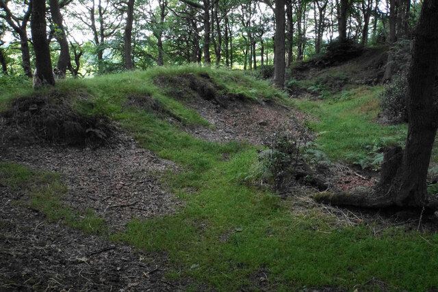
Carr Plantation is a picturesque woodland located in Derbyshire, England. Spread across a vast expanse, it is a delightful destination for nature enthusiasts and those seeking tranquility. The plantation is nestled within the heart of the Derbyshire Dales, known for its stunning landscapes and rich biodiversity.

Covering an area of approximately 500 acres, Carr Plantation is predominantly made up of deciduous trees, including oak, ash, and beech. These majestic trees provide a dense canopy, creating a shaded and serene environment within the woodland. The plantation is also home to a variety of wildlife, including deer, squirrels, and an array of bird species.

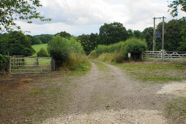
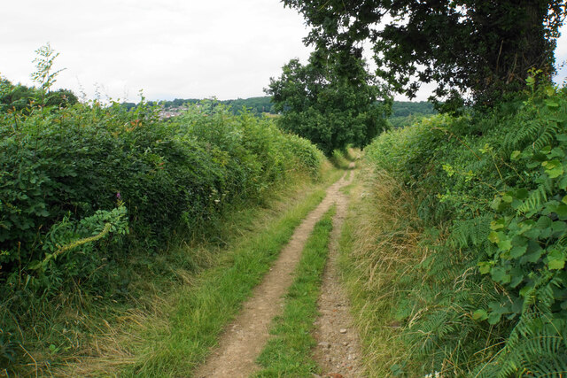
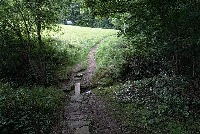
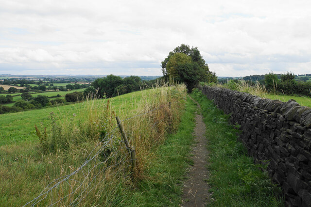
A network of well-maintained trails winds through Carr Plantation, allowing visitors to explore the woodland at their own pace. The paths offer breathtaking views of the surrounding countryside, with glimpses of rolling hills and meandering streams. These trails are popular among hikers, joggers, and dog walkers.

Carr Plantation is not only a haven for nature lovers but also a valuable ecological site. The woodland plays a crucial role in providing habitat for many endangered species and contributes to the overall health of the local ecosystem.

Visitors to Carr Plantation can enjoy a range of activities, including picnicking, wildlife spotting, and photography. The woodland is open year-round, with each season showcasing its unique charm. In spring, vibrant wildflowers blanket the forest floor, while autumn brings a breathtaking display of foliage in various shades of red, orange, and gold.

Overall, Carr Plantation is a cherished natural gem in Derbyshire, offering a peaceful retreat and an opportunity to connect with the beauty of the surrounding environment.

If you have any feedback on the listing, please let us know in the comments section below.

Carr Plantation Images

Images are sourced within 2km of 53.187599/-1.4287903 or Grid Reference SK3865. Thanks to Geograph Open Source API. All images are credited.

Track at Nether Moor The track off Nethermoor Road is also a bridleway.
Track at Nether Moor
The track off Nethermoor Road is also a bridleway.
Ford near Nether Moor The track crosses Tricket Brook. There is a footbridge on the right to avoid getting your feet wet.
Ford near Nether Moor
The track crosses Tricket Brook. There is a footbridge on the right to avoid getting your feet wet.
Wet field entrance Grazing land with Hardwick Wood in the background.
Wet field entrance
Grazing land with Hardwick Wood in the background.
Track above Nether Moor A steady climb up with not much to be seen because of the hedgerows.
Track above Nether Moor
A steady climb up with not much to be seen because of the hedgerows.
Track down to Nether Moor You can get a tiny glimpse of some houses in Wingerworth.
Track down to Nether Moor
You can get a tiny glimpse of some houses in Wingerworth.
Crossing of paths above Old Tupton In addition to the paths, of which this one and the route left are bridleways, there is field access.
Crossing of paths above Old Tupton
In addition to the paths, of which this one and the route left are bridleways, there is field access.
Path to Bole Hill The path skirts round the top of Hardwick Wood.
Path to Bole Hill
The path skirts round the top of Hardwick Wood.
Footpath to Bole Hill Crossing a small tributary of Tricket Brook at the top of Hardwick Wood.
Footpath to Bole Hill
Crossing a small tributary of Tricket Brook at the top of Hardwick Wood.
Footpath on the Bole Hill ridge Slowly descending towards Clay Cross.
Footpath on the Bole Hill ridge
Slowly descending towards Clay Cross.
Remains of former quarrying on Bole Hill Small scale activity as opposed to the bigger quarry further down the hill.
Remains of former quarrying on Bole Hill
Small scale activity as opposed to the bigger quarry further down the hill.
Farm paraphernalia above Carr House Farm Looking down from Bole Hill.
Farm paraphernalia above Carr House Farm
Looking down from Bole Hill.
Wingerworth Lido A longstanding artificial pool, which became a swimming pool in 1934. It is now used for fishing.
Wingerworth Lido
A longstanding artificial pool, which became a swimming pool in 1934. It is now used for fishing.
Churchyard of All Saints, Wingerworth
Lych gate at All Saints, Wingerworth The church is Grade I listed but the lych gate does not appear to have historical significance.
Lych gate at All Saints, Wingerworth
The church is Grade I listed but the lych gate does not appear to have historical significance.
Longedge Lane Almost the highest point in the village.
Longedge Lane
Almost the highest point in the village.
All Saints Church, Wingerworth The church is Grade I listed, with the oldest part dating from the 12th Century. It has had additions at numerous times since, including the extension seen here which was built in 1964.
All Saints Church, Wingerworth
The church is Grade I listed, with the oldest part dating from the 12th Century. It has had additions at numerous times since, including the extension seen here which was built in 1964.
The Tupton Tap Public House in Old Tupton.
The Tupton Tap
Public House in Old Tupton.
The Britannia Inn Public House in Tupton.
The Britannia Inn
Public House in Tupton.
Show me another place!

Carr Plantation is located at Grid Ref: SK3865 (Lat: 53.187599, Lng: -1.4287903)

Administrative County: Derbyshire

District: North East Derbyshire

Police Authority: Derbyshire

What 3 Words

///ranch.enlighten.formal. Near Wingerworth, Derbyshire

Related Wikis

Old Tupton

Old Tupton is a village in Derbyshire, England. It is located on the A61 Derby road, near to Tupton, and to the south of Chesterfield. == External links... ==

Chesterfield Road railway station

Chesterfield Road railway station was a small station on the Ashover Light Railway and it served the village of Old Tupton, near Clay Cross, North East...

Wingerworth

Wingerworth is a large village and parish in North East Derbyshire, England. Its population, according to the 2011 census, was 6,533. Wingerworth is 3...

Tupton Hall School

Tupton Hall School is a coeducational secondary school and sixth form located in Chesterfield in the English county of Derbyshire. It is one of the largest...
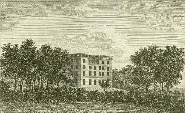
Tupton Hall

Tupton Hall was a former mansion, in Tupton, near Wingerworth in North East Derbyshire, 4.5 miles (7 km) south of Chesterfield. Since its demolition following...

Tupton

Tupton is a village and civil parish in North East Derbyshire, Derbyshire, England, 4.5 miles (7 km) south of Chesterfield. The population of the civil...
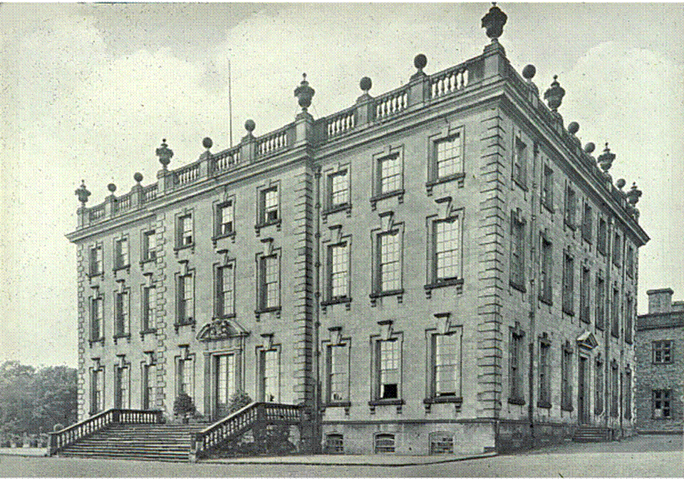
Wingerworth Hall

Wingerworth Hall, demolished 1927, was the ancestral home of the Hunloke family in the village of Wingerworth, Derbyshire, England. It was built on an...

All Saints' Church, Wingerworth

All Saints’ Church, Wingerworth is a Grade I listed parish church in the Church of England in Wingerworth, Derbyshire. == History == The church dates from...

Nearby Amenities

Located within 500m of 53.187599,-1.4287903
Barrier: stile
Steps: 2
Stile: stepover
Lat/Long: 53.1861982/-1.427248
Barrier: stile
Steps: 1
Stile: stepover
Lat/Long: 53.1865767/-1.4347327
Barrier: stile
Lat/Long: 53.1866086/-1.428882
Barrier: stile
Lat/Long: 53.1876805/-1.4278407
Ele: 143
Lat/Long: 53.186599/-1.4359902
Ele: 128
Lat/Long: 53.1884528/-1.4356327
Ele: 123
Lat/Long: 53.1900486/-1.4337204
Ele: 127.0000000
Lat/Long: 53.1895666/-1.432861
Barrier: stile
Stile: squeezer
Lat/Long: 53.1866787/-1.4350008
Information: route_marker
Tourism: information
Lat/Long: 53.1851079/-1.4270907
Ford: yes
Lat/Long: 53.1916832/-1.430941
Barrier: horse_barrier
Lat/Long: 53.1865391/-1.4338978
Information: route_marker
Tourism: information
Lat/Long: 53.1865755/-1.4346982
Information: route_marker
Tourism: information
Lat/Long: 53.1853917/-1.4277604
Information: route_marker
Tourism: information
Lat/Long: 53.186248/-1.4272978
Information: route_marker
Tourism: information
Lat/Long: 53.1865035/-1.4338202
Power: pole
Lat/Long: 53.1861906/-1.4257013
Power: pole
Lat/Long: 53.1865567/-1.4316945
Power: pole
Lat/Long: 53.1861799/-1.4329492
Power: pole
Lat/Long: 53.1858048/-1.4337092
Power: pole
Lat/Long: 53.1853905/-1.4344751
Power: pole
Lat/Long: 53.1869174/-1.4304637
Power: pole
Lat/Long: 53.1872263/-1.4293968
Power: pole
Lat/Long: 53.187846/-1.4297723
Power: pole
Lat/Long: 53.1884728/-1.4301567
Power: pole
Lat/Long: 53.189111/-1.4305565
Power: pole
Lat/Long: 53.1903041/-1.4312885
Power: pole
Lat/Long: 53.1907066/-1.4319151
Power: pole
Lat/Long: 53.191087/-1.4325439
Power: pole
Lat/Long: 53.1896971/-1.4309186
The data included in this document is from www.openstreetmap.org. The data is made available under ODbL.

Have you been to Carr Plantation?

Leave your review of Carr Plantation below (or comments, questions and feedback).