Doddington

Settlement in Lincolnshire North Kesteven

England

Doddington

Track and footpath, Doddington Hall Estate The footpath goes across the field to the left,
Track and footpath, Doddington Hall Estate Credit: Humphrey Bolton

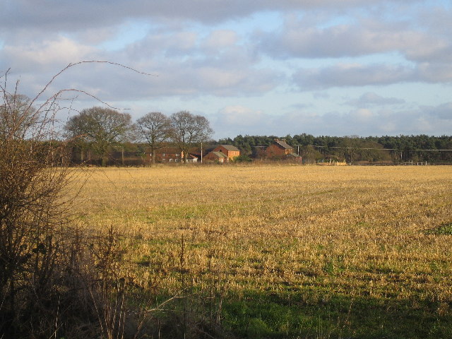
Doddington is a small village located in the East Lindsey district of Lincolnshire, England. Situated approximately 12 miles east of the city of Lincoln, it is nestled amidst the scenic Lincolnshire Wolds, an Area of Outstanding Natural Beauty.

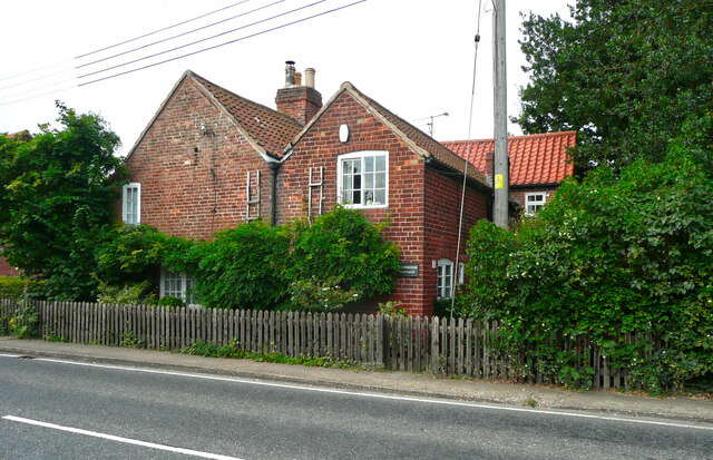
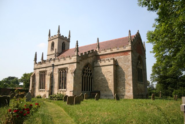
The village dates back to medieval times and still retains much of its historical charm. Its picturesque setting and traditional stone cottages make it an attractive destination for visitors seeking a peaceful rural retreat. The village is also known for its well-preserved Grade I listed church, St. Peter and St. Paul, which dates back to the 13th century.

Doddington is a close-knit community, with a population of around 300 residents. It offers a range of amenities to cater to the needs of its residents, including a primary school, a village hall, and a post office. The village pub, The Red Lion, serves as a popular gathering spot for locals and visitors alike.

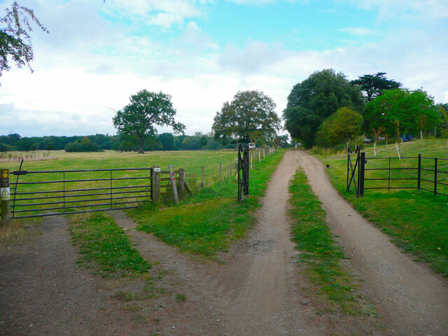
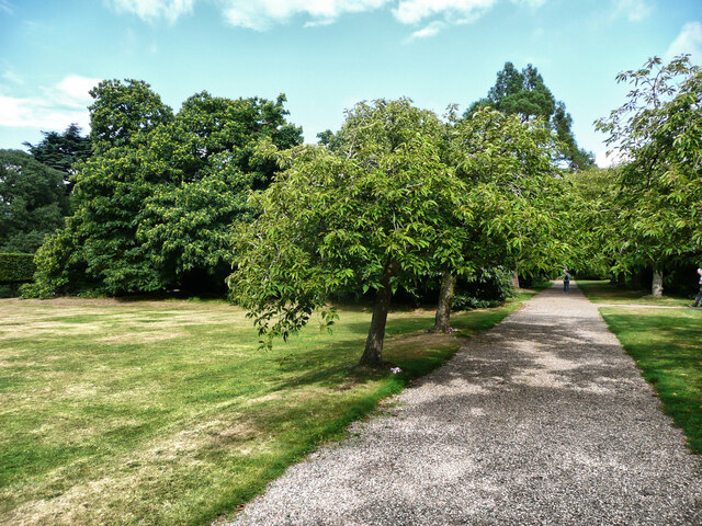
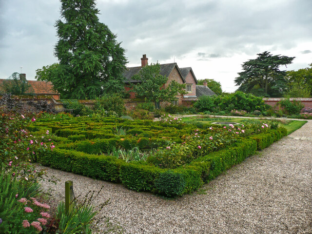
For outdoor enthusiasts, Doddington provides ample opportunities for exploring the surrounding countryside. The nearby Lincolnshire Wolds offers scenic walking and cycling routes, with breathtaking views of the rolling hills and picturesque landscapes. The village is also in close proximity to Doddington Hall, an Elizabethan mansion with beautiful gardens that are open to the public.

Overall, Doddington offers a tranquil and idyllic setting for those seeking a peaceful retreat or a taste of rural English life. Its rich history, natural beauty, and friendly community make it a charming destination in Lincolnshire.

If you have any feedback on the listing, please let us know in the comments section below.

Doddington Images

Images are sourced within 2km of 53.218156/-0.6512479 or Grid Reference SK9069. Thanks to Geograph Open Source API. All images are credited.

Track and footpath, Doddington Hall Estate The footpath goes across the field to the left,
Track and footpath, Doddington Hall Estate
The footpath goes across the field to the left,
Path in the garden, Doddington Hall
The Fishpond, Doddington Hall estate Looking across to the farm buildings. The shed open at the front houses a collection of old carts.
The Fishpond, Doddington Hall estate
Looking across to the farm buildings. The shed open at the front houses a collection of old carts.
Boat House on the shore of the Fishpond, Doddington Hall estate Really just a shelter rather than a 'house'. I don't know what the wheel is for, but it might operate a hoist to lift boats out of the water.
Boat House on the shore of the Fishpond, Doddington Hall estate
Really just a shelter rather than a 'house'. I don't know what the wheel is for, but it might operate a hoist to lift boats out of the water.
Fish pond and poplars, Doddington Hall estate
Path around the end of the Fishpond, Doddington Hall estate Plank bridges have been provided over the streams.
Path around the end of the Fishpond, Doddington Hall estate
Plank bridges have been provided over the streams.
Footbridge over the Fishpond, Doddington Hall estate The bridge is closed, presumably it is unsafe.
Footbridge over the Fishpond, Doddington Hall estate
The bridge is closed, presumably it is unsafe.
The southern part of the Fishpond, Doddington Hall estate In the centre is the little boat house, and on the right what was a changing room.
The southern part of the Fishpond, Doddington Hall estate
In the centre is the little boat house, and on the right what was a changing room.
Buildings around the stable yard, Doddington Hall estate The stables are now converted to other uses.
Buildings around the stable yard, Doddington Hall estate
The stables are now converted to other uses.
The maze, Doddington Hall gardens
Temple of the Winds, Doddington Hall gardens
Maze, looking northwards, Doddington Hall gardens
Part of the formal garden, Doddington Hall
Holly Farmhouse, Doddington An early 19C farmhouse with chequer-brick walls, listed Grade II.
Holly Farmhouse, Doddington
An early 19C farmhouse with chequer-brick walls, listed Grade II.
Foresters Cottage, Doddington An 18C house, listed Grade II.
Foresters Cottage, Doddington
An 18C house, listed Grade II.
Pickworth's Plot Pickworth's Plot near the Grange on a frosty November morning
Pickworth's Plot
Pickworth's Plot near the Grange on a frosty November morning
Wintry scene in Doddington Trees along Whisby Road Doddington in the snow, December 2005
Wintry scene in Doddington
Trees along Whisby Road Doddington in the snow, December 2005
Blackmoor Farm Blackmoor Farm near Skellingthorpe, looking south east from the corner of Gilberts plot.
Blackmoor Farm
Blackmoor Farm near Skellingthorpe, looking south east from the corner of Gilberts plot.
Show me another place!

Doddington is located at Grid Ref: SK9069 (Lat: 53.218156, Lng: -0.6512479)

Division: Parts of Kesteven

Administrative County: Lincolnshire

District: North Kesteven

Police Authority: Lincolnshire

What 3 Words

///thrashed.smelter.purist. Near Skellingthorpe, Lincolnshire

Related Wikis

Doddington, Lincolnshire

Doddington is a village in the civil parish of Doddington and Whisby, in the North Kesteven district of Lincolnshire, England. The population of the civil...

Doddington Hall, Lincolnshire

Doddington Hall is, from the outside, an Elizabethan prodigy house or mansion complete with walled courtyards and a gabled gatehouse. Inside it was largely...

Jerusalem, Lincolnshire

Jerusalem is a small ribbon development in the North Kesteven district of Lincolnshire, England. It conjoined to the south of Skellingthorpe, and is part...

Harby, Nottinghamshire

Harby is a village and civil parish in the Newark and Sherwood district of Nottinghamshire, England. It is close to the Lincolnshire border with Doddington...

Nearby Amenities

Located within 500m of 53.218156,-0.6512479
Doddington
Is In: Lincolnshire, England, UK
Place: hamlet
Wikidata: Q5287776
Wikipedia: en:Doddington, Lincolnshire
Lat/Long: 53.2196454/-0.6520068
Bus Stop
Telephone Box
Naptan AtcoCode: 270000014179
Naptan Bearing: W
Naptan CommonName: Telephone Box
Naptan Indicator: opp
Naptan Landmark: Telephone Box
Naptan NaptanCode: linjpdgw
Naptan Street: Lincoln Road
Naptan Verified: no
Source: naptan_import
Lat/Long: 53.2180917/-0.6501584
Bus Stop
Telephone Box
Naptan AtcoCode: 2700LDTB5931
Naptan Bearing: E
Naptan CommonName: Telephone Box
Naptan Indicator: adj
Naptan Landmark: Telephone Box
Naptan NaptanCode: lindwtwp
Naptan Street: Lincoln Road
Naptan Verified: no
Source: naptan_import
Lat/Long: 53.2182003/-0.6502298
Noexit: yes
Lat/Long: 53.2202841/-0.6550315
Noexit: yes
Lat/Long: 53.2203067/-0.6550399
Noexit: yes
Lat/Long: 53.2202811/-0.655066
Noexit: yes
Lat/Long: 53.2203034/-0.6550698
Noexit: yes
Lat/Long: 53.2202446/-0.6551331
Noexit: yes
Lat/Long: 53.2202476/-0.6550787
Noexit: yes
Lat/Long: 53.2202755/-0.6549544
Toilets
Lat/Long: 53.2193837/-0.6524571
Noexit: yes
Lat/Long: 53.2201947/-0.6550537
Noexit: yes
Lat/Long: 53.2201824/-0.6550238
Noexit: yes
Lat/Long: 53.2201834/-0.6550099
Noexit: yes
Lat/Long: 53.220216/-0.6549532
Noexit: yes
Lat/Long: 53.2202702/-0.6550265
Noexit: yes
Lat/Long: 53.2202083/-0.6550149
Noexit: yes
Lat/Long: 53.2202545/-0.6550032
Noexit: yes
Lat/Long: 53.2202495/-0.6550621
Noexit: yes
Lat/Long: 53.2202462/-0.6550987
Church Farm
Historic Place: farm
Source: Bing
Lat/Long: 53.221103/-0.651363
Doddington Farm Shop
Contact Website: http://www.doddingtonhall.com/farmshop
Shop: farm
Lat/Long: 53.2194911/-0.6522002
Cafe
Lat/Long: 53.2194782/-0.652101
Fixme: More shops here
Lat/Long: 53.2194895/-0.6520125
Generator Method: photovoltaic
Generator Output Electricity: yes
Generator Source: solar
Generator Type: solar_photovoltaic_panel
Location: roof
Power: generator
Lat/Long: 53.2182991/-0.649879
Generator Method: photovoltaic
Generator Output Electricity: yes
Generator Source: solar
Generator Type: solar_photovoltaic_panel
Location: roof
Power: generator
Lat/Long: 53.2183264/-0.6498146
Generator Method: photovoltaic
Generator Output Electricity: yes
Generator Source: solar
Generator Type: solar_photovoltaic_panel
Location: roof
Power: generator
Lat/Long: 53.2187753/-0.6525666
Generator Method: photovoltaic
Generator Output Electricity: yes
Generator Source: solar
Generator Type: solar_photovoltaic_panel
Location: roof
Power: generator
Lat/Long: 53.2187874/-0.6524499
Public Bookcase
Booth: K6
Disused Amenity: telephone
Man Made: telephone_box
Old Phone: +44 1522 680302
Operator: Doddington & Whisby Parish Council
Public Bookcase Type: phone_box
Lat/Long: 53.2181812/-0.65047
Post Box
Post Box Type: lamp
Royal Cypher: EIIR
Royal Cypher Wikidata: Q33102113
Lat/Long: 53.2196077/-0.651799
Bicycle Parking
Bicycle Parking: stands
Capacity: 10
Covered: no
Lat/Long: 53.2197683/-0.6516649
Natural: shrub
Lat/Long: 53.2201933/-0.653337
Natural: shrub
Lat/Long: 53.2200474/-0.6532941
Natural: shrub
Lat/Long: 53.2200266/-0.6534915
Natural: shrub
Lat/Long: 53.2201725/-0.6535344
Unicorn
Artwork Type: sculpture
Colour: white
Material: wood
Tourism: artwork
Lat/Long: 53.2191293/-0.652659
The data included in this document is from www.openstreetmap.org. The data is made available under ODbL.

Have you been to Doddington?

Leave your review of Doddington below (or comments, questions and feedback).