Dobcross

Settlement in Yorkshire

England

Dobcross

View of St Chad Church, Saddleworth Link to Church Website <span class="nowrap"><a title="https://www.cofeinsaddleworth.org.uk/st-chad-saddleworth-parish-church" rel="nofollow ugc noopener" href="https://www.cofeinsaddleworth.org.uk/st-chad-saddleworth-parish-church">Link</a><img style="margin-left:2px;" alt="External link" title="External link - shift click to open in new window" src="https://s1.geograph.org.uk/img/external.png" width="10" height="10"/></span>
View of St Chad Church, Saddleworth Credit: Philip Cornwall

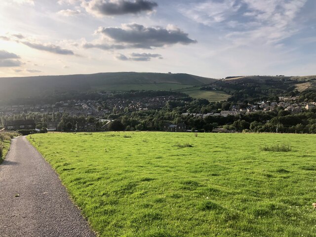
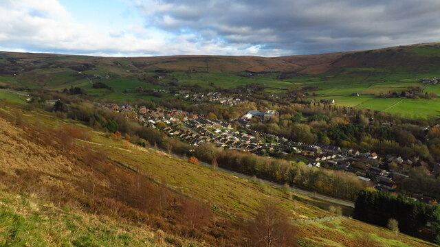
Dobcross is a small village located in the county of Yorkshire, England. Situated in the picturesque Pennine Hills, Dobcross offers residents and visitors a tranquil and scenic environment. The village is part of the Metropolitan Borough of Oldham and lies approximately 11 miles northeast of Manchester.

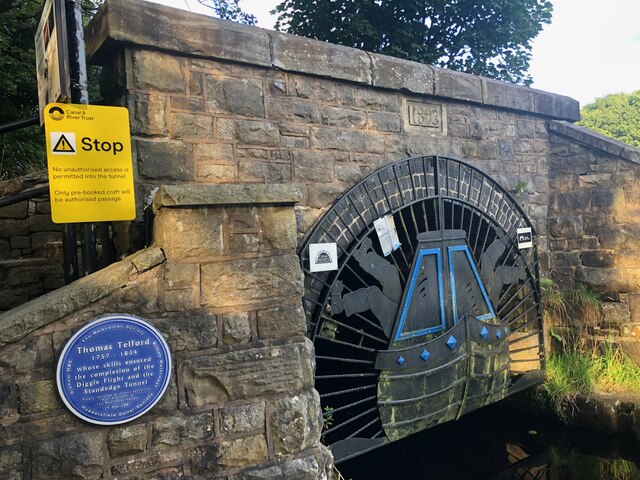
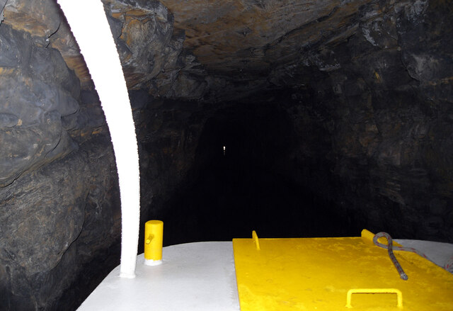
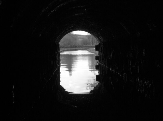
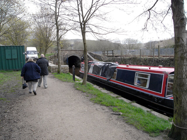
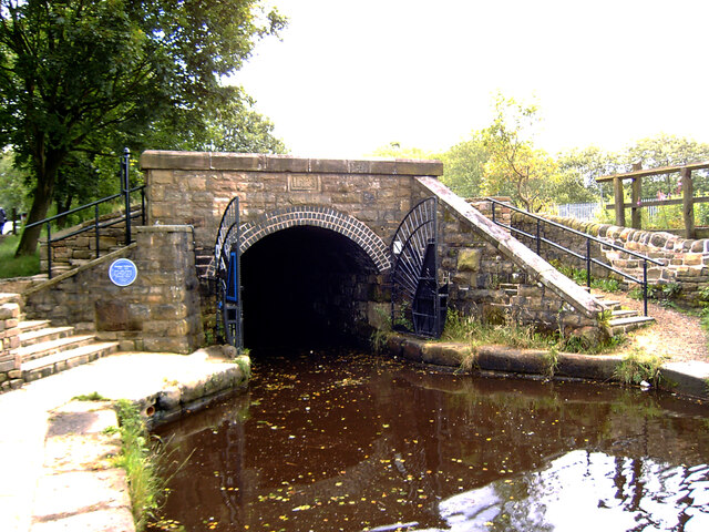
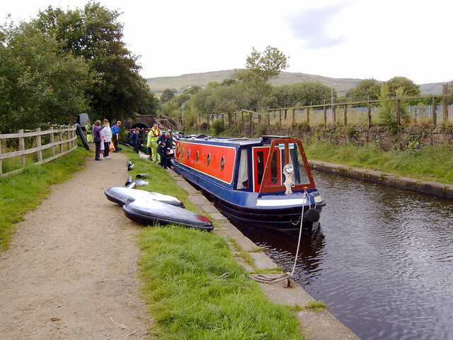
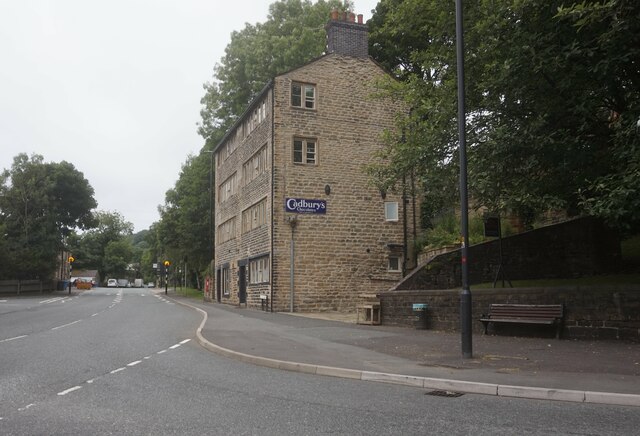
Historically, Dobcross was a significant hub for the textile industry during the 19th century. Its proximity to the River Tame made it an ideal location for water-powered weaving mills and other industrial establishments. Today, remnants of this rich industrial heritage can still be seen in the form of old mill buildings and canal systems.

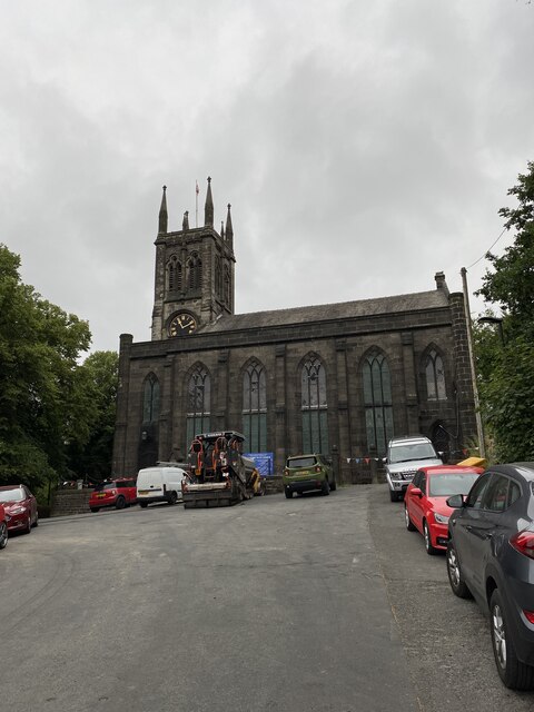
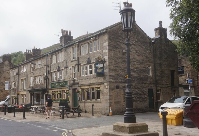
The village is famed for its vibrant community spirit and its commitment to preserving its historical character. Dobcross is home to numerous well-preserved stone cottages and buildings, showcasing the architectural style of the region. The village also boasts several traditional pubs and eateries, where locals and visitors can enjoy a taste of Yorkshire hospitality.

One of the prominent landmarks in Dobcross is the Dobcross Loom Works, a former textile mill that has been converted into a residential complex. It stands as a testament to the village's industrial past and is a popular attraction for history enthusiasts.

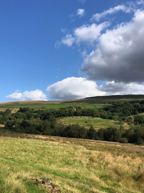
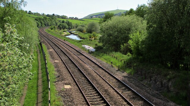
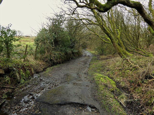
Surrounded by stunning natural beauty, Dobcross offers ample opportunities for outdoor activities. The area is crisscrossed with walking trails and hiking routes, providing breathtaking views of the Pennine Hills and the neighboring countryside.

In conclusion, Dobcross is a charming village in Yorkshire, England, offering a blend of historical significance, natural beauty, and a close-knit community.

If you have any feedback on the listing, please let us know in the comments section below.

Dobcross Images

Images are sourced within 2km of 53.557815/-2.016572 or Grid Reference SD9906. Thanks to Geograph Open Source API. All images are credited.

View of St Chad Church, Saddleworth Link to Church Website <span class="nowrap"><a title="https://www.cofeinsaddleworth.org.uk/st-chad-saddleworth-parish-church" rel="nofollow ugc noopener" href="https://www.cofeinsaddleworth.org.uk/st-chad-saddleworth-parish-church">Link</a><img style="margin-left:2px;" alt="External link" title="External link - shift click to open in new window" src="https://s1.geograph.org.uk/img/external.png" width="10" height="10"/></span>
View of St Chad Church, Saddleworth
Link to Church Website LinkExternal link
View over Diggle from track connecting Back o'th Lee Farm to Lee Side
Entrance to Standedge Canal Tunnel, Diggle The Huddersfield Narrow Canal opened in 1811. It runs for just under 20 miles from Lock 1E, where it joins the Huddersfield Broad Canal at the rear of the University of Huddersfield campus, to the junction with the Ashton Canal at Whitelands Basin in Ashton-under-Lyne. It crosses the Pennines by means of 74 locks and the Standedge Tunnel.
Entrance to Standedge Canal Tunnel, Diggle
The Huddersfield Narrow Canal opened in 1811. It runs for just under 20 miles from Lock 1E, where it joins the Huddersfield Broad Canal at the rear of the University of Huddersfield campus, to the junction with the Ashton Canal at Whitelands Basin in Ashton-under-Lyne. It crosses the Pennines by means of 74 locks and the Standedge Tunnel.
Sculpture by the Huddersfield Narrow Canal near Diggle The Huddersfield Narrow Canal opened in 1811. It runs for just under 20 miles from Lock 1E, where it joins the Huddersfield Broad Canal at the rear of the University of Huddersfield campus, to the junction with the Ashton Canal at Whitelands Basin in Ashton-under-Lyne. It crosses the Pennines by means of 74 locks and the Standedge Tunnel.
Sculpture by the Huddersfield Narrow Canal near Diggle
The Huddersfield Narrow Canal opened in 1811. It runs for just under 20 miles from Lock 1E, where it joins the Huddersfield Broad Canal at the rear of the University of Huddersfield campus, to the junction with the Ashton Canal at Whitelands Basin in Ashton-under-Lyne. It crosses the Pennines by means of 74 locks and the Standedge Tunnel.
Approaching the West Portal of the Standedge Tunnel The Huddersfield Narrow Canal opened in 1811. It runs for just under 20 miles from Lock 1E, where it joins the Huddersfield Broad Canal at the rear of the University of Huddersfield campus, to the junction with the Ashton Canal at Whitelands Basin in Ashton-under-Lyne. It crosses the Pennines by means of 74 locks and the Standedge Tunnel.
Approaching the West Portal of the Standedge Tunnel
The Huddersfield Narrow Canal opened in 1811. It runs for just under 20 miles from Lock 1E, where it joins the Huddersfield Broad Canal at the rear of the University of Huddersfield campus, to the junction with the Ashton Canal at Whitelands Basin in Ashton-under-Lyne. It crosses the Pennines by means of 74 locks and the Standedge Tunnel.
The Huddersfield Narrow Canal seen through the West Portal of the Standedge Tunnel The Huddersfield Narrow Canal opened in 1811. It runs for just under 20 miles from Lock 1E, where it joins the Huddersfield Broad Canal at the rear of the University of Huddersfield campus, to the junction with the Ashton Canal at Whitelands Basin in Ashton-under-Lyne. It crosses the Pennines by means of 74 locks and the Standedge Tunnel.
The Huddersfield Narrow Canal seen through the West Portal of the Standedge Tunnel
The Huddersfield Narrow Canal opened in 1811. It runs for just under 20 miles from Lock 1E, where it joins the Huddersfield Broad Canal at the rear of the University of Huddersfield campus, to the junction with the Ashton Canal at Whitelands Basin in Ashton-under-Lyne. It crosses the Pennines by means of 74 locks and the Standedge Tunnel.
The West Portal of the Standedge Tunnel, Huddersfield Narrow Canal The Huddersfield Narrow Canal opened in 1811. It runs for just under 20 miles from Lock 1E, where it joins the Huddersfield Broad Canal at the rear of the University of Huddersfield campus, to the junction with the Ashton Canal at Whitelands Basin in Ashton-under-Lyne. It crosses the Pennines by means of 74 locks and the Standedge Tunnel.
The West Portal of the Standedge Tunnel, Huddersfield Narrow Canal
The Huddersfield Narrow Canal opened in 1811. It runs for just under 20 miles from Lock 1E, where it joins the Huddersfield Broad Canal at the rear of the University of Huddersfield campus, to the junction with the Ashton Canal at Whitelands Basin in Ashton-under-Lyne. It crosses the Pennines by means of 74 locks and the Standedge Tunnel.
Diggle from Harrop Edge
The West Portal of the Standedge Tunnel, Huddersfield Narrow Canal The Standedge Tunnels are four parallel tunnels through the Pennines between Marsden, West Yorkshire and Diggle, Greater Manchester. Three of them are railway tunnels and the fourth, and earliest, carries the Huddersfield Narrow Canal.
The canal tunnel was built between 1794 and 1811; initial work was supervised by Benjamin Outram but it was completed under the direction of Thomas Telford. It only allows one-way traffic but it is the longest (4984m), deepest and highest canal tunnel in Britain.
The three railway tunnels were built in 1848 (single track), 1871 (single track) and 1894 (double track). Only the last of these remains in use.
All four tunnels are connected to each other by cross-tunnels.
The West Portal of the Standedge Tunnel, Huddersfield Narrow Canal
The Standedge Tunnels are four parallel tunnels through the Pennines between Marsden, West Yorkshire and Diggle, Greater Manchester. Three of them are railway tunnels and the fourth, and earliest, carries the Huddersfield Narrow Canal. The canal tunnel was built between 1794 and 1811; initial work was supervised by Benjamin Outram but it was completed under the direction of Thomas Telford. It only allows one-way traffic but it is the longest (4984m), deepest and highest canal tunnel in Britain. The three railway tunnels were built in 1848 (single track), 1871 (single track) and 1894 (double track). Only the last of these remains in use. All four tunnels are connected to each other by cross-tunnels.
Narrowboats outside the West Portal of the Standedge Tunnel, Huddersfield Narrow Canal The Huddersfield Narrow Canal opened in 1811. It runs for just under 20 miles from Lock 1E, where it joins the Huddersfield Broad Canal at the rear of the University of Huddersfield campus, to the junction with the Ashton Canal at Whitelands Basin in Ashton-under-Lyne. It crosses the Pennines by means of 74 locks and the Standedge Tunnel.
Narrowboats outside the West Portal of the Standedge Tunnel, Huddersfield Narrow Canal
The Huddersfield Narrow Canal opened in 1811. It runs for just under 20 miles from Lock 1E, where it joins the Huddersfield Broad Canal at the rear of the University of Huddersfield campus, to the junction with the Ashton Canal at Whitelands Basin in Ashton-under-Lyne. It crosses the Pennines by means of 74 locks and the Standedge Tunnel.
Railway and Canal Together View south from large footbridge that serves Ravenstones Drive
Railway and Canal Together
View south from large footbridge that serves Ravenstones Drive
St Chad's Saddleworth
OS Cut Mark - Saddleworth, Saint Chad's Church <span class="nowrap"><a title="https://www.bench-marks.org.uk/bm83022" rel="nofollow ugc noopener" href="https://www.bench-marks.org.uk/bm83022">Link</a><img style="margin-left:2px;" alt="External link" title="External link - shift click to open in new window" src="https://s1.geograph.org.uk/img/external.png" width="10" height="10"/></span>
OS Cut Mark - Saddleworth, Saint Chad's Church
Location of OS Cut Mark - Saddleworth, Saint Chad's Church
Shaws Lane The lane changes from a well surfaced route to a rough track at this point
Shaws Lane
The lane changes from a well surfaced route to a rough track at this point
Huddersfield Narrow Canal, Uppermill Railway Viaduct visible in distance
Huddersfield Narrow Canal, Uppermill
Railway Viaduct visible in distance
The Swan Inn, Delph
The Swan Inn, Delph
Oldham Road A62, Delph
Show me another place!

Dobcross is located at Grid Ref: SD9906 (Lat: 53.557815, Lng: -2.016572)

Division: West Riding

Unitary Authority: Oldham

Police Authority: Greater Manchester

What 3 Words

///collected.century.jacuzzi. Near Delph, Manchester

Nearby Locations

Dobcross Woolroad

Related Wikis

Dobcross

Dobcross is a village in the civil parish of Saddleworth in the Metropolitan Borough of Oldham in Greater Manchester, England. It is in a valley in the...

Measurements Halt railway station

Measurements Halt railway station was opened on 18 July 1932 as part of the former London and North Western Railway route from Oldham to Delph. The station...

Dobcross railway station

Dobcross railway station served the village of Dobcross between 1912 and 1955. == History == The station was opened on 1 January 1912 as part of the London...

Delph railway station

Delph railway station served the village of Delph, Oldham, in what is now Greater Manchester, United Kingdom, between 1851 and 1955. == History == The...

Nearby Amenities

Located within 500m of 53.557815,-2.016572
Dobcross
Is In: Saddleworth, Oldham, Greater Manchester, England, UK
Name Ur: ڈوبکروس
Note: name - Dobcross (wikipedia), Dob Cross (npe)
Place: village
Population: 1567
Population Date: 2021
Source: npe
Wikidata: Q5286554
Lat/Long: 53.5566119/-2.0165484
Mini Roundabout
Direction: clockwise
Odbl: clean
Source: Bing
Lat/Long: 53.5541808/-2.0169574
Bus Stop
Dobcross, Dobcross New Road / opposite The Woolpack
Bench: yes
Bin: yes
Bus: yes
Lit: no
Naptan AtcoCode: 1800ED13181
Naptan Bearing: W
Naptan CommonName: Dobcross New Road/The Woolpack
Naptan Indicator: Opp Woolpack Pu
Naptan Landmark: HOUSE 1A
Naptan NaptanCode: manapadm
Naptan PlusbusZoneRef: MNCRPIC
Naptan ShortCommonName: The Woolpack
Naptan Street: Dobcross New Road
Naptan Verified: no
Network: TfGM
Operator: TfGM
Public Transport: platform
Shelter: yes
Source: naptan_import
Tactile Paving: no
Lat/Long: 53.5540517/-2.0167854
Bus Stop
Dobcross, Dobcross New Road / outside The Woolpack
Bench: no
Bin: no
Bus: yes
Naptan AtcoCode: 1800ED13191
Naptan Bearing: E
Naptan CommonName: Dobcross New Road/The Woolpack
Naptan Indicator: Woolpack
Naptan Landmark: HOUSE 2
Naptan NaptanCode: manapadp
Naptan PlusbusZoneRef: MNCRPIC
Naptan ShortCommonName: The Woolpack
Naptan Street: Dobcross New Road
Naptan Verified: no
Network: TfGM
Operator: TfGM
Public Transport: platform
Shelter: no
Source: naptan_import
Tactile Paving: no
Lat/Long: 53.5541596/-2.0165892
Bus Stop
Dobcross, Delph New Road / opposite Wall Hill Road
Bus: yes
Naptan AtcoCode: 1800ED13211
Naptan Bearing: S
Naptan CommonName: Delph New Road/Wall Hill Road
Naptan Indicator: O/s House 8
Naptan Landmark: HOUSE 8
Naptan NaptanCode: manapadw
Naptan PlusbusZoneRef: MNCRPIC
Naptan ShortCommonName: Wall Hill Road
Naptan Street: DELPH NEW ROAD
Naptan Verified: no
Network: TfGM
Operator: TfGM
Public Transport: platform
Source: naptan_import
Lat/Long: 53.554258/-2.0194874
Bus Stop
Dobcross, Delph New Road / opposite Tamewater Court
Bus: yes
Naptan AtcoCode: 1800ED13221
Naptan Bearing: SE
Naptan CommonName: Delph New Road/Pine Factory Shop
Naptan Indicator: Neptune Ltd
Naptan Landmark: NEPTUNE LTD
Naptan NaptanCode: manapaga
Naptan PlusbusZoneRef: MNCRPIC
Naptan ShortCommonName: Pine Factory Shop
Naptan Street: DELPH NEW ROAD
Naptan Verified: no
Network: TfGM
Operator: TfGM
Public Transport: platform
Source: naptan_import
Lat/Long: 53.5575024/-2.0225232
Bus Stop
Dobcross, Sugar Lane / at Dobcross Square
Bus: yes
Naptan AtcoCode: 1800ED13271
Naptan Bearing: SE
Naptan CommonName: Sugar Lane/Dobcross Square
Naptan Indicator: Post Office
Naptan Landmark: THE SWAN
Naptan NaptanCode: manapagp
Naptan PlusbusZoneRef: MNCRPIC
Naptan ShortCommonName: Dobcross Square
Naptan Street: SUGAR LANE
Naptan Verified: no
Network: TfGM
Operator: TfGM
Public Transport: platform
Source: naptan_import
Lat/Long: 53.5562184/-2.0128765
Bus Stop
Sugar Lane/Dobcross Square
Bus: yes
Naptan AtcoCode: 1800ED13281
Naptan Bearing: NW
Naptan CommonName: Sugar Lane/Dobcross Square
Naptan Indicator: Opp Post Office
Naptan Landmark: HOUSE 20
Naptan NaptanCode: manapagt
Naptan PlusbusZoneRef: MNCRPIC
Naptan ShortCommonName: Dobcross Square
Naptan Street: SUGAR LANE
Naptan Verified: no
Network: TfGM
Public Transport: platform
Source: naptan_import
Lat/Long: 53.5562004/-2.0131633
Noexit: yes
Lat/Long: 53.5547271/-2.0174103
Noexit: yes
Lat/Long: 53.5540978/-2.0180019
Noexit: yes
Lat/Long: 53.5573844/-2.0132393
Material: wood
Power: pole
Transformer: distribution
Voltage Primary: 11000
Voltage Secondary: 240
Lat/Long: 53.5596111/-2.0110052
Noexit: yes
Lat/Long: 53.5536311/-2.0183328
Noexit: yes
Lat/Long: 53.5537282/-2.0182471
Crossing: informal
Lat/Long: 53.5583584/-2.0108253
Noexit: yes
Lat/Long: 53.5576063/-2.0133704
Generator Method: photovoltaic
Generator Output Electricity: yes
Generator Source: solar
Generator Type: solar_photovoltaic_panel
Location: roof
Power: generator
Lat/Long: 53.5563615/-2.0170649
Generator Method: photovoltaic
Generator Output Electricity: yes
Generator Source: solar
Generator Type: solar_photovoltaic_panel
Location: roof
Power: generator
Lat/Long: 53.5565272/-2.0167591
Generator Method: photovoltaic
Generator Output Electricity: yes
Generator Source: solar
Generator Type: solar_photovoltaic_panel
Location: roof
Power: generator
Lat/Long: 53.556575/-2.0169334
Generator Method: photovoltaic
Generator Output Electricity: yes
Generator Source: solar
Generator Type: solar_photovoltaic_panel
Location: roof
Power: generator
Lat/Long: 53.5577127/-2.0134466
Generator Method: photovoltaic
Generator Output Electricity: yes
Generator Source: solar
Generator Type: solar_photovoltaic_panel
Location: roof
Power: generator
Lat/Long: 53.5578206/-2.0102909
Generator Method: photovoltaic
Generator Output Electricity: yes
Generator Source: solar
Generator Type: solar_photovoltaic_panel
Location: roof
Power: generator
Lat/Long: 53.5581819/-2.0104599
Generator Method: photovoltaic
Generator Output Electricity: yes
Generator Source: solar
Generator Type: solar_photovoltaic_panel
Location: roof
Power: generator
Lat/Long: 53.5580608/-2.0141506
Noexit: yes
Lat/Long: 53.5542584/-2.0183001
Bench
Backrest: yes
Lat/Long: 53.5564453/-2.0232482
Generator Method: wind_turbine
Generator Source: wind
Power: generator
Lat/Long: 53.5611123/-2.0131269
Bench
Backrest: yes
Material: wood
Lat/Long: 53.5553281/-2.0157315
Historic: memorial
Lat/Long: 53.5563984/-2.013361
Telephone
Defibrillator
Booth: K6
Covered: booth
Defibrillator Location: inside old red phone box next to Swan pub, Dobcross
Emergency: defibrillator
Listed Status: Grade II
Man Made: telephone_box
Wikidata: Q26545274
Lat/Long: 53.5563934/-2.0131669
Bench
Lat/Long: 53.5564036/-2.0133823
Bench
Lat/Long: 53.5539955/-2.0205697
Power: pole
Lat/Long: 53.5549517/-2.0223132
Material: wood
Power: pole
Lat/Long: 53.559296/-2.0103262
Material: wood
Power: pole
Lat/Long: 53.558954/-2.0097564
Material: wood
Power: pole
Lat/Long: 53.5563106/-2.0095625
Power: pole
Lat/Long: 53.5567217/-2.0103766
Generator Method: photovoltaic
Generator Output Electricity: yes
Generator Source: solar
Generator Type: solar_photovoltaic_panel
Power: generator
Lat/Long: 53.5546237/-2.0171712
Grit Bin
Lat/Long: 53.55366/-2.0189744
Post Box
Post Box Type: lamp
Royal Cypher: EIIR
Royal Cypher Wikidata: Q33102113
Lat/Long: 53.5536774/-2.0189761
Telephone
Defibrillator
Booth: K6
Covered: booth
Defibrillator Location: inside red phone box by bridge over River Tameon Dobcross New Road, Dobcross
Emergency: defibrillator
Man Made: telephone_box
Lat/Long: 53.5536953/-2.0189761
Playground: slide
Lat/Long: 53.5537995/-2.0164438
Playground: sandpit
Lat/Long: 53.5538531/-2.0163845
Playground: swing
Lat/Long: 53.5537201/-2.0163721
Playground: structure
Lat/Long: 53.5537743/-2.0162757
Noexit: yes
Lat/Long: 53.5568013/-2.0109339
Grit Bin
Lat/Long: 53.5580279/-2.0188412
Bus Stop
Dobcross, Delph New Road / near Wall Hill Road
Bus: yes
Naptan AtcoCode: 1800ED13201
Naptan Bearing: N
Naptan CommonName: Wall Hill Road
Naptan Indicator: nr
Naptan Landmark: HOUSE 19
Naptan NaptanCode: MANAPADT
Naptan Street: DELPH NEW Road
Naptan Verified: no
Network: TfGM
Operator: TfGM
Public Transport: platform
Source: naptan;bing;naptan_compare_tool
Lat/Long: 53.5540655/-2.0196145
Measurements
Historic Railway: station
Railway: site
Wikidata: Q6804214
Wikipedia: en:Measurements Halt railway station
Lat/Long: 53.5575173/-2.0237353
Bench: yes
Leisure: picnic_table
Lit: no
Material: wood
Lat/Long: 53.5544726/-2.0209586
Noexit: yes
Lat/Long: 53.5562463/-2.0235694
Addr City: Oldham
Addr Housenumber: 74
Addr Postcode: OL3 5BH
Addr Street: Wall Hill Road
Addr Suburb: Dobcross
Lat/Long: 53.5562132/-2.0236209
Noexit: yes
Lat/Long: 53.5562583/-2.0235126
Noexit: yes
Lat/Long: 53.5562629/-2.0232974
Noexit: yes
Lat/Long: 53.5562542/-2.0232489
Addr City: Oldham
Addr Housenumber: 72
Addr Postcode: OL3 5BH
Addr Street: Wall Hill Road
Addr Suburb: Dobcross
Lat/Long: 53.5562306/-2.0234552
Addr City: Oldham
Addr Housenumber: 70
Addr Postcode: OL3 5BH
Addr Street: Wall Hill Road
Addr Suburb: Dobcross
Lat/Long: 53.5562322/-2.0233687
Addr City: Oldham
Addr Housenumber: 68
Addr Postcode: OL3 5BH
Addr Street: Wall Hill Road
Addr Suburb: Dobcross
Lat/Long: 53.5562138/-2.0232165
Addr City: Oldham
Addr Housenumber: 66
Addr Postcode: OL3 5BH
Addr Street: Wall Hill Road
Addr Suburb: Dobcross
Lat/Long: 53.5562019/-2.0231186
Addr City: Oldham
Addr Housenumber: 64
Addr Postcode: OL3 5BH
Addr Street: Wall Hill Road
Addr Suburb: Dobcross
Lat/Long: 53.5561605/-2.0229623
Addr City: Oldham
Addr Housenumber: 62
Addr Postcode: OL3 5BH
Addr Street: Wall Hill Road
Addr Suburb: Dobcross
Lat/Long: 53.5561266/-2.0228866
Addr City: Oldham
Addr Housenumber: 60
Addr Postcode: OL3 5BH
Addr Street: Wall Hill Road
Addr Suburb: Dobcross
Lat/Long: 53.5560724/-2.0227779
Addr City: Oldham
Addr Housenumber: 58
Addr Postcode: OL3 5BH
Addr Street: Wall Hill Road
Addr Suburb: Dobcross
Lat/Long: 53.5560418/-2.0227129
The data included in this document is from www.openstreetmap.org. The data is made available under ODbL.

Have you been to Dobcross?

Leave your review of Dobcross below (or comments, questions and feedback).