Nut Covert

Wood, Forest in Wiltshire

England

Nut Covert

Farmland, Buttermere A cereal crop and shallow dry valley to the west of Heath Lane.
Farmland, Buttermere Credit: Andrew Smith

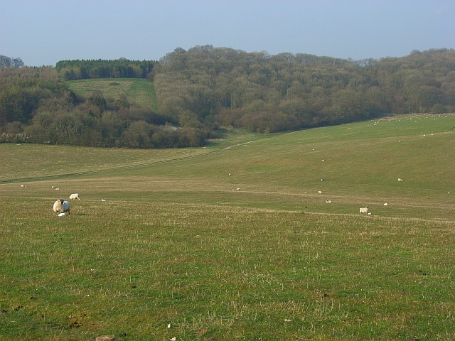
Nut Covert is a small woodland area located in Wiltshire, England. Situated in the county's southern region, it forms part of the larger forest known as Wiltshire Wood. This woodland is a popular destination for nature enthusiasts and hikers, offering a serene and tranquil environment.

Covering an area of approximately 50 acres, Nut Covert is characterized by its dense vegetation and diverse range of tree species. The woodland is primarily composed of native trees such as oak, beech, and ash, creating a rich and vibrant canopy overhead. This provides a haven for various wildlife species, including birds, squirrels, and deer, which can often be spotted among the trees.

The forest floor is covered in a thick layer of leaf litter and fallen branches, creating a natural habitat for small mammals and insects. Walking through Nut Covert, visitors may come across enchanting wildflowers and mushrooms, adding to the area's natural beauty.

There are several well-maintained walking trails within Nut Covert, allowing visitors to explore the woodland at their own pace. These pathways wind through the trees, providing glimpses of sunlight and offering a peaceful escape from the hustle and bustle of daily life.

Nut Covert is easily accessible, with a small parking area available for visitors. The woodland is open year-round, although autumn is particularly popular due to its stunning display of colorful foliage. Whether it's for a leisurely stroll, birdwatching, or simply enjoying the serenity of nature, Nut Covert is a charming destination for outdoor enthusiasts in Wiltshire.

If you have any feedback on the listing, please let us know in the comments section below.
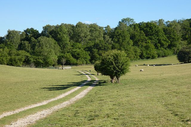
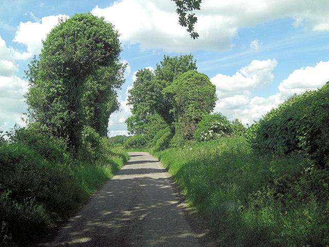
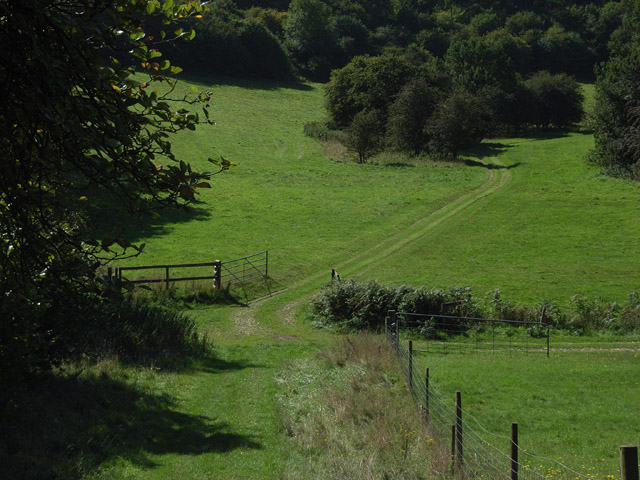
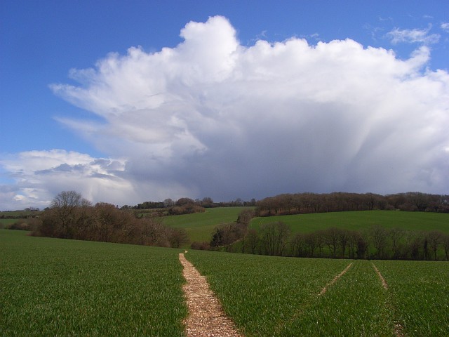
Nut Covert Images

Images are sourced within 2km of 51.345815/-1.5054538 or Grid Reference SU3460. Thanks to Geograph Open Source API. All images are credited.

Farmland, Buttermere A cereal crop and shallow dry valley to the west of Heath Lane.
Farmland, Buttermere
A cereal crop and shallow dry valley to the west of Heath Lane.
Pasture, Buttermere A bridleway approaching the junction of paths below Rockmoor Down.
Pasture, Buttermere
A bridleway approaching the junction of paths below Rockmoor Down.
Farmland, Vernhams Dean A permitted footpath follows the edge of this field of barley to the east of Upper Horns Farm.
Farmland, Vernhams Dean
A permitted footpath follows the edge of this field of barley to the east of Upper Horns Farm.
Fields near Upper Horns Farm
Timber from Buttermere Wood
Descending the Test Way Approaching a crossroads of paths with the Test Way continuing to the left at the foot of this hill.
Descending the Test Way
Approaching a crossroads of paths with the Test Way continuing to the left at the foot of this hill.
Path crossroads on the Test Way
Rockmoor Lane crossroads within Heath Plantation
Rockmoor Lane junction with Heath Lane Call me fanciful: but do the trees resemble heads, talking to one another across the lane?
Rockmoor Lane junction with Heath Lane
Call me fanciful: but do the trees resemble heads, talking to one another across the lane?
Lane junction on Hungerford Road
Direction Sign – Signpost on Rockmoor Lane in Vernhams Dean Located on the southwest side of a crossroads of Rockmoor Lane and two lanes in Heath Plantation. Vernhams Dean parish. 4 arms and annulus finial. See also <a title="https://www.geograph.org.uk/photo/985178" href="https://www.geograph.org.uk/photo/985178">Link</a>.

Milestone Society National ID: HA_SU3458
Direction Sign – Signpost on Rockmoor Lane in Vernhams Dean
Located on the southwest side of a crossroads of Rockmoor Lane and two lanes in Heath Plantation. Vernhams Dean parish. 4 arms and annulus finial. See also Link. Milestone Society National ID: HA_SU3458
Footpath to Ballyack House
Looking South
Looking South
Heath Plantation Crossroads
On the Test Way near Buttermere The route has wandered some way from the river, out of Hampshire and along the Berkshire/Wiltshire boundary. It is strange to see Hampshire County Council waymarkers here. The path, which links up with the Wayfarers' Walk between Gallows Down and Walbury Hill, turns left here into Combe Wood.
On the Test Way near Buttermere
The route has wandered some way from the river, out of Hampshire and along the Berkshire/Wiltshire boundary. It is strange to see Hampshire County Council waymarkers here. The path, which links up with the Wayfarers' Walk between Gallows Down and Walbury Hill, turns left here into Combe Wood.
Beside Combe Wood The Test Way descends between the trees opposite.
Beside Combe Wood
The Test Way descends between the trees opposite.
Footpath through wheat, Henley The route of the path heading ENE from Moordown Farm is, unlike some locally, clearly marked. The path soon heads out of the grid-square on its way towards Buttermere such that the copse to the left is outside of the grid-square though most of the hedgerow in the valley is within it.
Footpath through wheat, Henley
The route of the path heading ENE from Moordown Farm is, unlike some locally, clearly marked. The path soon heads out of the grid-square on its way towards Buttermere such that the copse to the left is outside of the grid-square though most of the hedgerow in the valley is within it.
Farmland, Vernham Dean Looking down from the road from Buttermere along the valley descending to Henley.
Farmland, Vernham Dean
Looking down from the road from Buttermere along the valley descending to Henley.
Show me another place!

Nut Covert is located at Grid Ref: SU3460 (Lat: 51.345815, Lng: -1.5054538)

Unitary Authority: Wiltshire

Police Authority: Wiltshire

What 3 Words

///movie.snoozing.sailed. Near Shalbourne, Wiltshire

Related Wikis

Buttermere, Wiltshire

Buttermere is a small village and civil parish on the eastern boundary of Wiltshire, England, about 4.5 miles (7 km) south of Hungerford and 10 miles...

Inkpen Hill

Inkpen Hill is a summit in Berkshire, England, with a maximum elevation of 291 m (955 ft). The hill is about 7 miles (11 km) southwest of Newbury on the...

Ham Hill, Wiltshire

Ham Hill is a hill and area of chalk downland in Wiltshire, England, on the steep banks running alongside the road from the village of Ham to Buttermere...

Combe Wood and Linkenholt Hanging

Combe Wood and Linkenholt Hanging is a 106.5-hectare (263-acre) biological Site of Special Scientific Interest south of Hungerford in Berkshire. It is...

Nearby Amenities

Located within 500m of 51.345815,-1.5054538
Ele: 256.9
Lat/Long: 51.3441523/-1.5120573
Post Box
Operator: Royal Mail
Post Box Type: lamp
Ref: SN8 116
Royal Cypher: EIIR
Royal Cypher Wikidata: Q33102113
Lat/Long: 51.3471633/-1.5114972
Buttermere Botttom
Place: locality
Lat/Long: 51.3480529/-1.5058639
Booth: K6
Covered: booth
Disused Amenity: telephone
Man Made: telephone_box
Lat/Long: 51.3472075/-1.5115306
Give Way
Direction: backward
Lat/Long: 51.3472754/-1.5116277
The data included in this document is from www.openstreetmap.org. The data is made available under ODbL.

Have you been to Nut Covert?

Leave your review of Nut Covert below (or comments, questions and feedback).