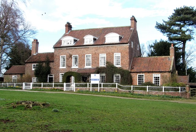
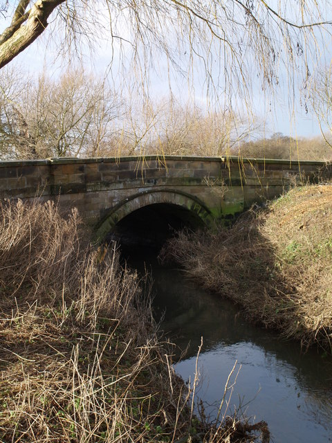
Stell Plantation

Wood, Forest in Yorkshire Hambleton

England

Stell Plantation

Farmland near Birkby
Farmland near Birkby Credit: N Chadwick

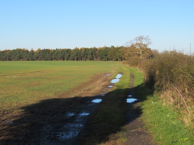
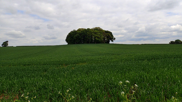
Stell Plantation, located in Yorkshire, is a sprawling woodland area renowned for its natural beauty and serene ambiance. Situated in the heart of the county, the plantation covers a vast expanse of land, encompassing dense forests, meandering streams, and picturesque valleys.

The plantation is primarily composed of various species of trees, including oak, beech, and ash, which create a rich and diverse ecosystem. This thriving woodland is home to a wide array of flora and fauna, attracting nature enthusiasts, hikers, and birdwatchers from far and wide.

The enchanting woodland paths allow visitors to immerse themselves in the tranquility of nature, providing a perfect escape from the bustling city life. The plantation offers numerous walking trails, ranging from easy strolls to more challenging hikes, catering to people of all fitness levels.

Throughout the year, Stell Plantation is adorned with vibrant colors, showcasing the changing seasons in all their glory. In spring, the woodland floor is carpeted with a sea of bluebells, creating a breathtaking spectacle. In autumn, the foliage transforms into a kaleidoscope of reds, oranges, and yellows, offering a visual feast for the eyes.

The plantation also provides a habitat for a diverse range of wildlife. Visitors may catch a glimpse of deer grazing amidst the trees, squirrels scurrying along branches, or various species of birds soaring through the sky.

Stell Plantation is not only a haven for nature enthusiasts but also serves as an important conservation area, aiding in the preservation of Yorkshire's natural heritage. Its stunning landscapes and tranquil atmosphere make it a must-visit destination for anyone seeking solace in the beauty of nature.

If you have any feedback on the listing, please let us know in the comments section below.

Stell Plantation Images

Images are sourced within 2km of 54.428689/-1.4719735 or Grid Reference NZ3403. Thanks to Geograph Open Source API. All images are credited.

Farmland near Birkby
Frigidale Wood
Frigidale Wood
Fieldside track at High Entercommon Farmer's track accessed via a locked gate. No right of way here.
Fieldside track at High Entercommon
Farmer's track accessed via a locked gate. No right of way here.
Country road
Country road
Old Toll House This wreck of a building, the back wall and most of the rear portion of the roof have fallen in, is the toll keepers house on the Boroughbridge and Durham Turnpike which was built some-time around 1745. It now stands forlorn next to the A167 which runs from Topcliffe in North Yorkshire to Cowgate in Tyne & Wear.
Old Toll House
This wreck of a building, the back wall and most of the rear portion of the roof have fallen in, is the toll keepers house on the Boroughbridge and Durham Turnpike which was built some-time around 1745. It now stands forlorn next to the A167 which runs from Topcliffe in North Yorkshire to Cowgate in Tyne & Wear.
Fields to the south of Smeaton Manor
Round Clump, Smeaton Manor
Ditch near Great Smeaton
Edge of rapeseed field alongside Soursike Gill
Fields around the Wiske The line of trees and shrubs marks the course of the River Wiske, otherwise scarcely noticeable in this flat country.
Fields around the Wiske
The line of trees and shrubs marks the course of the River Wiske, otherwise scarcely noticeable in this flat country.
The River Wiske A view downstream from the old road bridge along this tiny river which has a rather odd course. It begins life near Mount Grace Priory on the edge of the Cleveland Hills and meanders its way north westwards and then west to a point within 3km of the Tees, which is flowing in the opposite direction, before turning south near Birkby to run almost unnoticed all the way down to the Swale a mile to the south of Kirby Wiske. One has to assume that its course has been determined by glacial deposits across the Vale of Mowbray which have blocked a more likely course towards the Tees.
The River Wiske
A view downstream from the old road bridge along this tiny river which has a rather odd course. It begins life near Mount Grace Priory on the edge of the Cleveland Hills and meanders its way north westwards and then west to a point within 3km of the Tees, which is flowing in the opposite direction, before turning south near Birkby to run almost unnoticed all the way down to the Swale a mile to the south of Kirby Wiske. One has to assume that its course has been determined by glacial deposits across the Vale of Mowbray which have blocked a more likely course towards the Tees.
Another pub gone? It's not so long ago that Great Smeaton had two pubs, the Bay Horse and the Black Bull, but the Bay Horse closed a few years back and has been adapted as dwellings, whilst the Black Bull looks as though it could go the same way. On a short drive through several villages in the Vale of Mowbray I passed 4 pubs that were either closed or appeared to be so. A sad comment on village amenities.
Update 2023. The Black Bull is now open and thriving again.
Another pub gone?
It's not so long ago that Great Smeaton had two pubs, the Bay Horse and the Black Bull, but the Bay Horse closed a few years back and has been adapted as dwellings, whilst the Black Bull looks as though it could go the same way. On a short drive through several villages in the Vale of Mowbray I passed 4 pubs that were either closed or appeared to be so. A sad comment on village amenities. Update 2023. The Black Bull is now open and thriving again.
East House, Gt Smeaton This mid 18th century house dominates the green in the middle of Great Smeaton. Only the 20th century porch spoils the overall look of the house.
East House, Gt Smeaton
This mid 18th century house dominates the green in the middle of Great Smeaton. Only the 20th century porch spoils the overall look of the house.
Church of St Eloy, Gt Smeaton This is said to be the only historic dedication to this saint in England, which is about the only notable thing about this church which is mostly of 1862, but with a few medieval items inside.
Church of St Eloy, Gt Smeaton
This is said to be the only historic dedication to this saint in England, which is about the only notable thing about this church which is mostly of 1862, but with a few medieval items inside.
Farm track, Gt Smeaton Farm track heading east out of the village. This is also the line of a public footpath which eventually leads to West Lane at Appleton Wiske, probably after encounters with mud and barbed wire.
Farm track, Gt Smeaton
Farm track heading east out of the village. This is also the line of a public footpath which eventually leads to West Lane at Appleton Wiske, probably after encounters with mud and barbed wire.
Bridleway along field edge No sign of a walked route here along the line of a bridleway that is less than 500m in length and which simply connects two roads. Even the gate at the start of the path looks difficult to open.
Bridleway along field edge
No sign of a walked route here along the line of a bridleway that is less than 500m in length and which simply connects two roads. Even the gate at the start of the path looks difficult to open.
Old Toll House by Northallerton Road, Great Smeaton Entercommon Toll House by the A167, in parish of Great Smeaton (Hambleton District), Toll Bar Cottage, Northallerton Road, by Toll Bar Garage, Murco petrol station, near junction with B1264, DL6 2EX.

Surveyed

Milestone Society National ID: YN.GSM01
Old Toll House by Northallerton Road, Great Smeaton
Entercommon Toll House by the A167, in parish of Great Smeaton (Hambleton District), Toll Bar Cottage, Northallerton Road, by Toll Bar Garage, Murco petrol station, near junction with B1264, DL6 2EX. Surveyed Milestone Society National ID: YN.GSM01
Old Milepost by the A167, Great Smeaton Milepost by the A167, in parish of Great Smeaton (Hambleton District), in village, 30m South East of Church of St Eloy, between Black Bull PH and Bay Horse PH, in front of No.1 Church View, South side of road.

Inscription reads:-
: DARLINGTON / 9 : : LONDON / 228 : : NO'ALLERTON / 7 :

Grade II listed.
List Entry Number: 1190565 <span class="nowrap"><a title="https://historicengland.org.uk/listing/the-list/list-entry/1190565" rel="nofollow ugc noopener" href="https://historicengland.org.uk/listing/the-list/list-entry/1190565">Link</a><img style="margin-left:2px;" alt="External link" title="External link - shift click to open in new window" src="https://s1.geograph.org.uk/img/external.png" width="10" height="10"/></span>

Milestone Society National ID: YN_NADL07
Old Milepost by the A167, Great Smeaton
Milepost by the A167, in parish of Great Smeaton (Hambleton District), in village, 30m South East of Church of St Eloy, between Black Bull PH and Bay Horse PH, in front of No.1 Church View, South side of road. Inscription reads:- : DARLINGTON / 9 : : LONDON / 228 : : NO'ALLERTON / 7 : Grade II listed. List Entry Number: 1190565 LinkExternal link Milestone Society National ID: YN_NADL07
Show me another place!

Stell Plantation is located at Grid Ref: NZ3403 (Lat: 54.428689, Lng: -1.4719735)

Division: North Riding

Administrative County: North Yorkshire

District: Hambleton

Police Authority: North Yorkshire

What 3 Words

///surviving.defensive.encrusted. Near Hurworth, Co. Durham

Related Wikis

Little Smeaton, Hambleton

Little Smeaton is a hamlet and civil parish in North Yorkshire, England. == Etymology == The name of Little Smeaton is first attested in the Domesday Book...

Great Smeaton

Great Smeaton is a village and civil parish in North Yorkshire, England. It lies on elevated ground near the River Wiske, which is a tributary of the River...

Birkby, North Yorkshire

Birkby is a village and civil parish about 6 miles north of the county town of Northallerton in the Hambleton district of North Yorkshire, England. The...

Cowton railway station

Cowton railway station is a disused station on the East Coast Main Line, it is situated in the Hambleton district of North Yorkshire in England the station...

Hornby, Hambleton

Hornby is a village and civil parish in the Hambleton district of North Yorkshire, England. It lies on a minor road between Great Smeaton and Appleton...

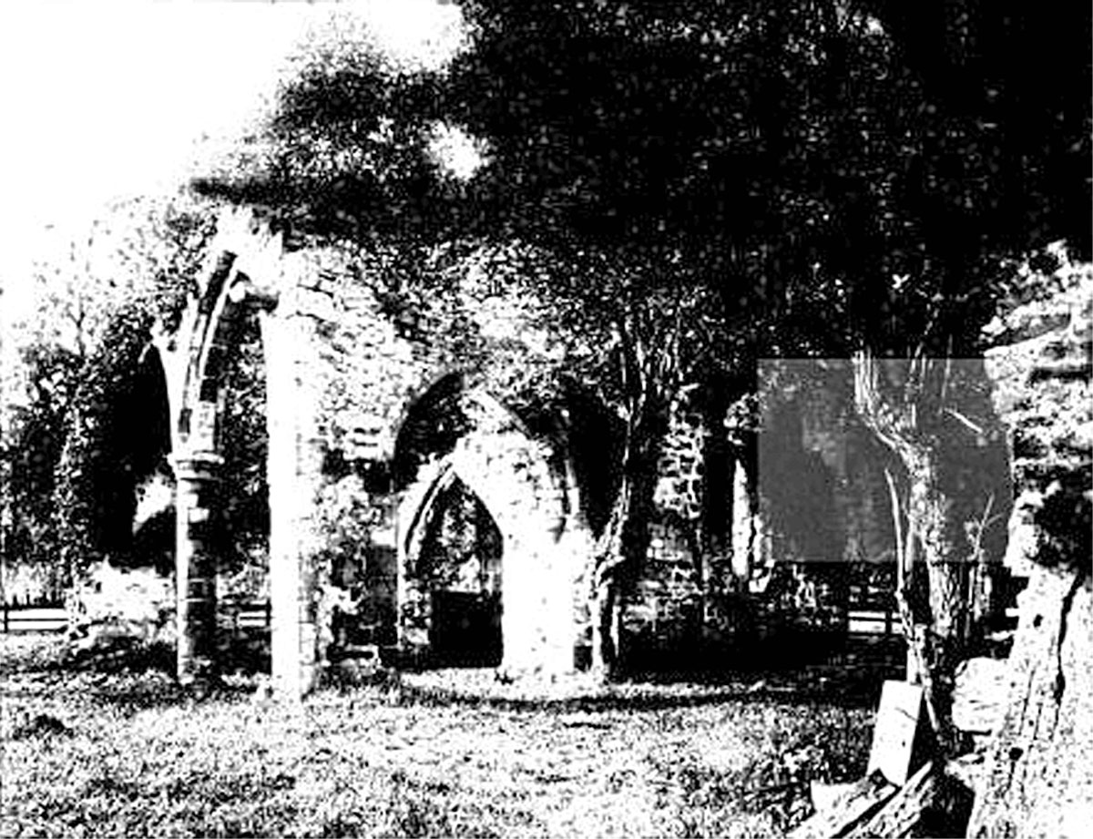
All Saints Church, Sockburn

All Saints Church is a ruined Church of England parish church in Sockburn, County Durham, England. A Grade I listed building, the church has pre- and post...
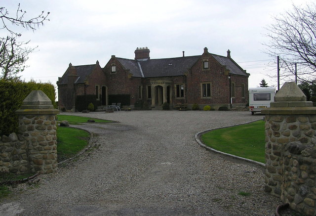
Sockburn Hall

Sockburn Hall is a privately owned 19th-century country house at Sockburn, near Darlington, County Durham, England. It is a Grade II* listed building....

East Cowton

East Cowton is a village and civil parish in the Hambleton District of North Yorkshire, England. It is 7 miles (11 km) north west of the county town of...

Nearby Amenities

Located within 500m of 54.428689,-1.4719735
Fixme: Line continues
Power: pole
Lat/Long: 54.432961/-1.4695501
The data included in this document is from www.openstreetmap.org. The data is made available under ODbL.

Have you been to Stell Plantation?

Leave your review of Stell Plantation below (or comments, questions and feedback).