Dinnington

Settlement in Somerset South Somerset

England

Dinnington

St George's Church, Hinton St George, Somerset
St George's Church, Hinton St George, Somerset Credit: Ray Jennings

Dinnington is a small village located in the county of Somerset, in the southwest of England. Situated just 9 miles south of the city of Bath, it falls within the Mendip district and is surrounded by picturesque countryside.

The village of Dinnington boasts a rich history, with records of its existence dating back to the Domesday Book of 1086. It has retained much of its traditional charm, with a number of well-preserved historic buildings and a quaint, peaceful atmosphere.

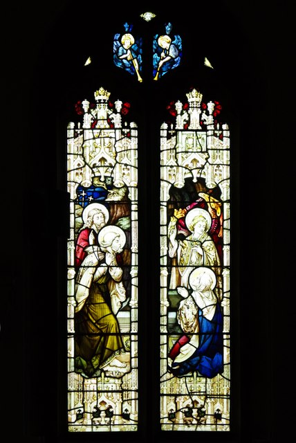
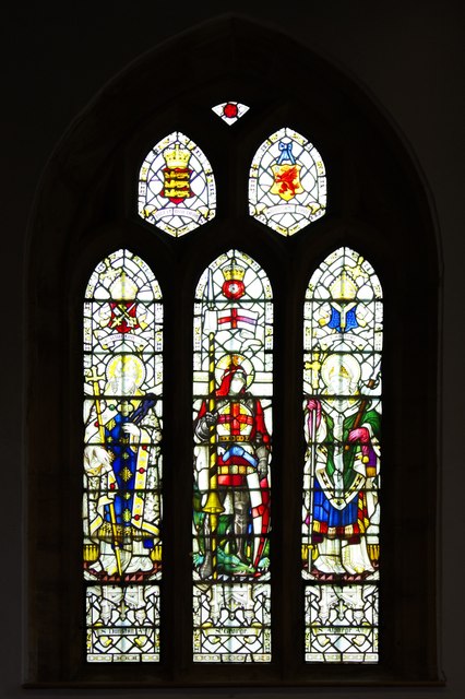
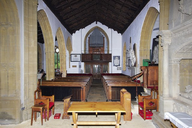
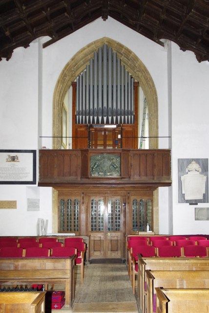
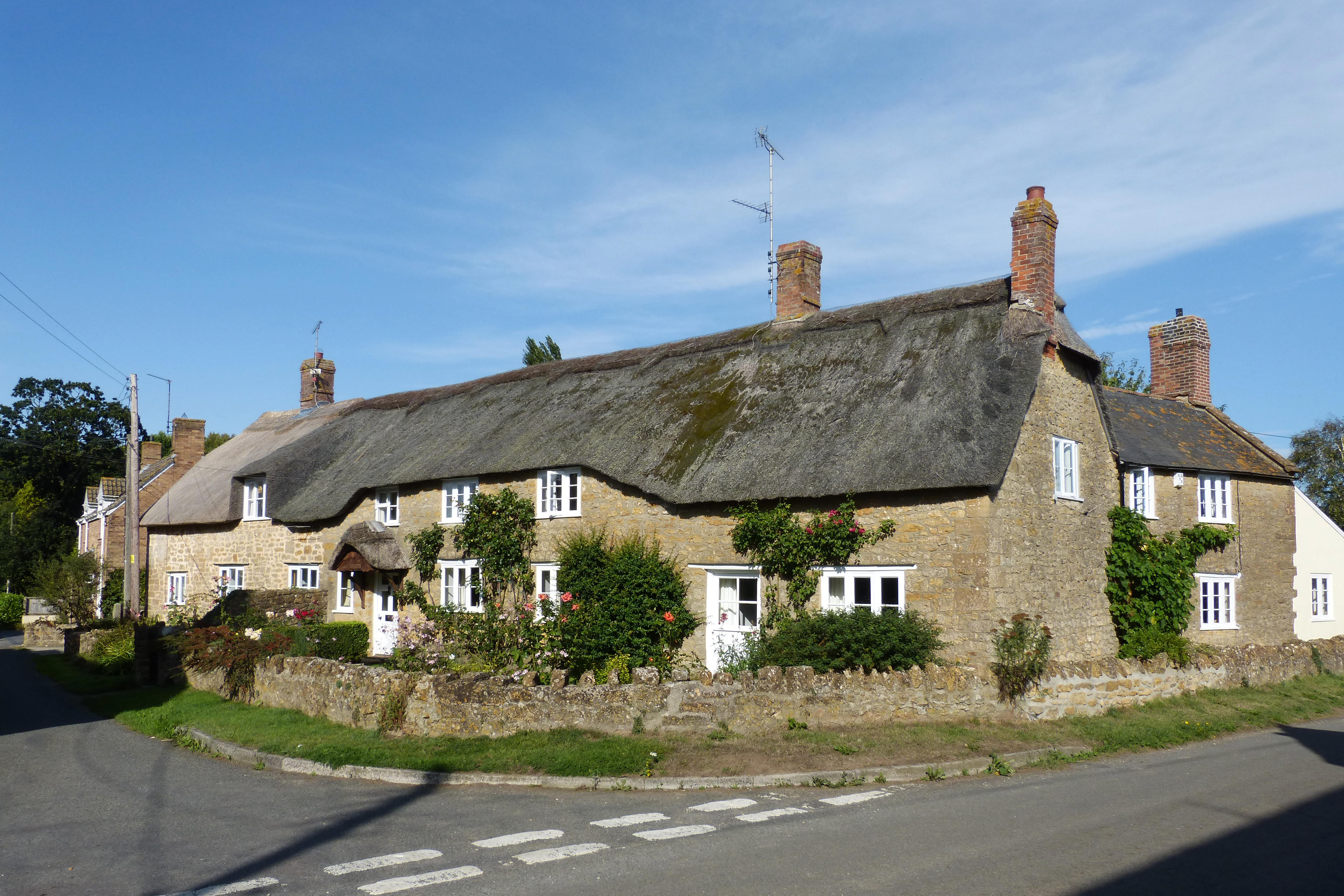
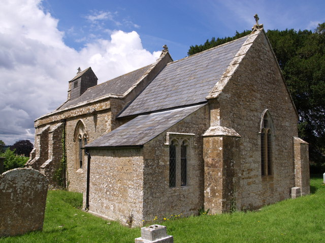
One of the notable landmarks in Dinnington is the St. Nicholas Church, a beautiful 12th-century structure that still holds regular services. The church's architecture is a testament to the village's long-standing heritage. Additionally, there are several other listed buildings in the area, including a collection of thatched cottages that add to the village's character.

Despite its small size, Dinnington offers a range of amenities for its residents and visitors. There is a local pub, The Dinnington Docks, which serves traditional British cuisine and offers a cozy atmosphere for gatherings. The village also has a primary school, providing education for local children.

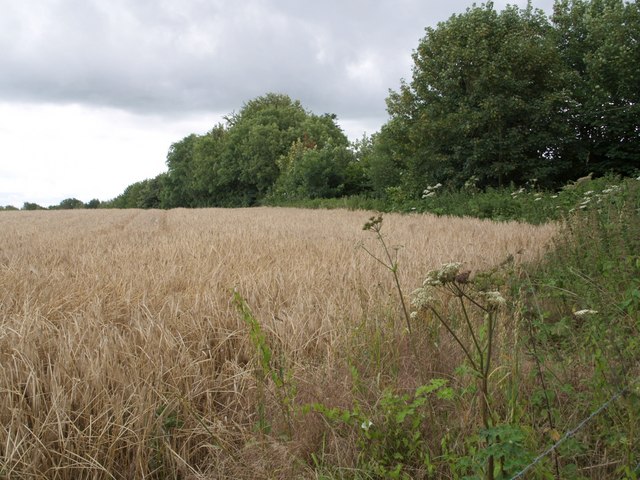
The surrounding countryside provides opportunities for outdoor activities such as hiking, cycling, and horse riding, allowing residents and tourists to enjoy the natural beauty of the area. The village is well-connected to nearby towns and cities, with good transport links and easy access to major roads.

In summary, Dinnington is a charming and historic village nestled in the Somerset countryside. With its rich heritage, picturesque surroundings, and range of amenities, it offers a peaceful and idyllic setting for those seeking a slower pace of life.

If you have any feedback on the listing, please let us know in the comments section below.
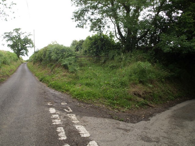
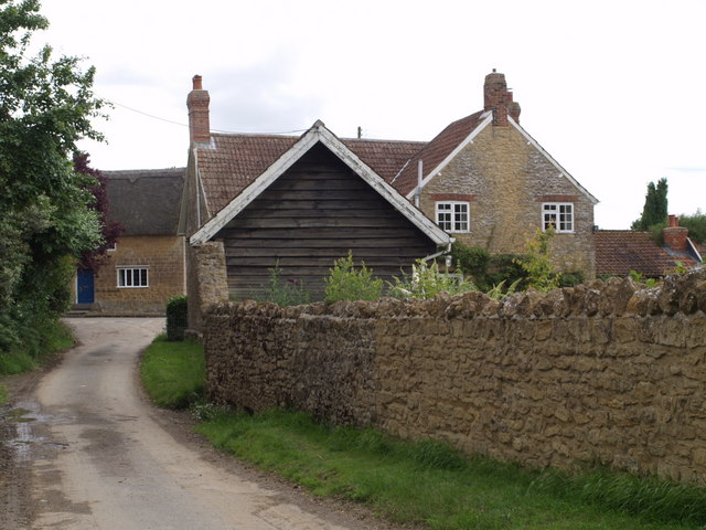
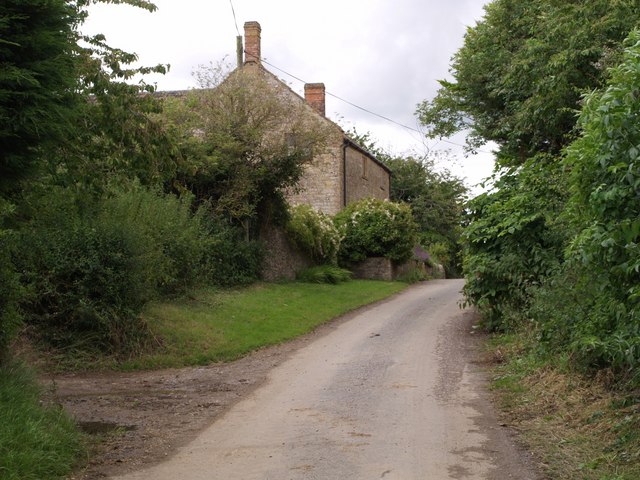
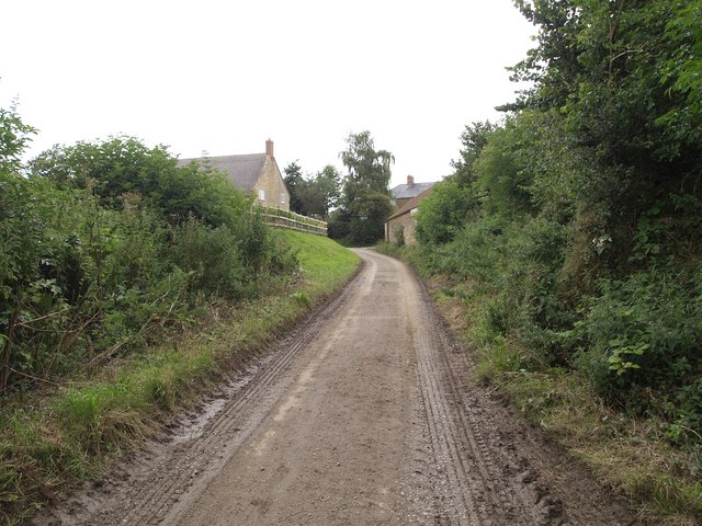
Dinnington Images

Images are sourced within 2km of 50.911925/-2.8504422 or Grid Reference ST4012. Thanks to Geograph Open Source API. All images are credited.

St George's Church, Hinton St George, Somerset
St George's Church, Hinton St George, Somerset The Nave.
St George's Church, Hinton St George, Somerset
The Nave.
St George's Church, Hinton St George, Somerset The Sanctuary.
St George's Church, Hinton St George, Somerset
The Sanctuary.
St George's Church, Hinton St George, Somerset
St George's Church, Hinton St George, Somerset The East window, depicting the Ascension of Christ.
St George's Church, Hinton St George, Somerset
The East window, depicting the Ascension of Christ.
St George's Church, Hinton St George, Somerset The East window of the South aisle.
St George's Church, Hinton St George, Somerset
The East window of the South aisle.
St George's Church, Hinton St George, Somerset The South aisle window, installed in memory of Olga Lorraine Countess Poulett, wife of the 8th Earl Poulett.
St George's Church, Hinton St George, Somerset
The South aisle window, installed in memory of Olga Lorraine Countess Poulett, wife of the 8th Earl Poulett.
St George's Church, Hinton St George, Somerset South aisle window with no dedication.
St George's Church, Hinton St George, Somerset
South aisle window with no dedication.
St George's Church, Hinton St George, Somerset A South aisle window dedicated to Saints Dunstan, George and Alphege.
St George's Church, Hinton St George, Somerset
A South aisle window dedicated to Saints Dunstan, George and Alphege.
St George's Church, Hinton St George, Somerset Westward view of the Nave.
St George's Church, Hinton St George, Somerset
Westward view of the Nave.
St George's Church, Hinton St George, Somerset The organ gallery.
St George's Church, Hinton St George, Somerset
The organ gallery.
Lane junction near Dinnington Wood Close Lane branches off to the right down a steep shady lane to Alleowenshay. The lane ahead, which has just emerged from a dark sunken stretch where it diverts from the line of the Fosse Way, leads to Dozens Corner.
Lane junction near Dinnington
Wood Close Lane branches off to the right down a steep shady lane to Alleowenshay. The lane ahead, which has just emerged from a dark sunken stretch where it diverts from the line of the Fosse Way, leads to Dozens Corner.
Allowenshay An attractive hamlet of stone cottages tucked away down lanes southeast of Ilminster. See <span class="nowrap"><a title="http://webapp1.somerset.gov.uk/her/details.asp?prn=54117" rel="nofollow ugc noopener" href="http://webapp1.somerset.gov.uk/her/details.asp?prn=54117">Link</a><img style="margin-left:2px;" alt="External link" title="External link - shift click to open in new window" src="https://s1.geograph.org.uk/img/external.png" width="10" height="10"/></span> for historical notes.
Allowenshay
An attractive hamlet of stone cottages tucked away down lanes southeast of Ilminster. See LinkExternal link for historical notes.
Higher Dairy House, Allowenshay Looking the opposite way along the lane from <a href="https://www.geograph.org.uk/photo/491961">ST3913 : Allowenshay</a>. Architectural details are at <span class="nowrap"><a title="http://webapp1.somerset.gov.uk/her/details.asp?prn=56703" rel="nofollow ugc noopener" href="http://webapp1.somerset.gov.uk/her/details.asp?prn=56703">Link</a><img style="margin-left:2px;" alt="External link" title="External link - shift click to open in new window" src="https://s1.geograph.org.uk/img/external.png" width="10" height="10"/></span> .
Higher Dairy House, Allowenshay
Looking the opposite way along the lane from ST3913 : Allowenshay. Architectural details are at LinkExternal link .
Approaching Allowenshay Wood Close Lane approaches the hamlet.
Approaching Allowenshay
Wood Close Lane approaches the hamlet.
Field beside Wood Close Lane A corner of a wheatfield, taken from beside the junction shown in <a href="https://www.geograph.org.uk/photo/491948">ST3912 : Lane junction near Dinnington</a>. Secreted away behind the trees on the right, a sunken lane plunges down to meet the Fosse Way.
Field beside Wood Close Lane
A corner of a wheatfield, taken from beside the junction shown in ST3912 : Lane junction near Dinnington. Secreted away behind the trees on the right, a sunken lane plunges down to meet the Fosse Way.
Junction near Dinnington Fisher's Lane joins the road from Ludney to St Rayn Hill. The oak and signpost are on a triangular island within the junction. On the left is North Lodge Copse, which belongs to the Woodland Trust.
Junction near Dinnington
Fisher's Lane joins the road from Ludney to St Rayn Hill. The oak and signpost are on a triangular island within the junction. On the left is North Lodge Copse, which belongs to the Woodland Trust.
Show me another place!

Dinnington is located at Grid Ref: ST4012 (Lat: 50.911925, Lng: -2.8504422)

Administrative County: Somerset

District: South Somerset

Police Authority: Avon and Somerset

What 3 Words

///timed.equipment.vanish. Near Merriott, Somerset

Related Wikis

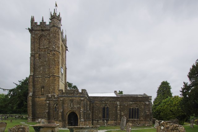
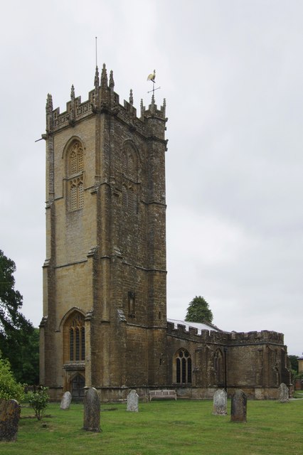
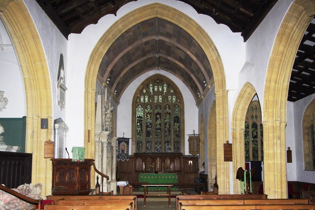
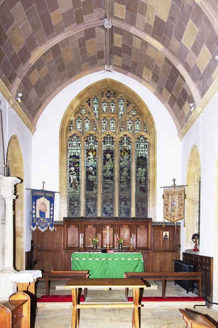
Church of St Nicholas, Dinnington

The Anglican Church of St Nicholas in Dinnington, Somerset, England was built in the 15th century. It is a Grade II* listed building. == History == A church...

Dinnington, Somerset

Dinnington is a village and civil parish in the English county of Somerset, situated 4 miles (6.4 km) north of Crewkerne in the South Somerset district...
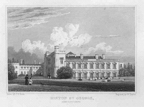
Hinton House

Hinton House is a large country house near Hinton St George in Somerset, England. == History == The house started life as a medieval hall house and was...

Seavington St. Mary SSSI, Somerset

Seavington St. Mary (grid reference ST400144) is a 0.3 hectare geological Site of Special Scientific Interest near the village of Seavington St Mary in...

St George's Church, Hinton St George

The Church of St George in Hinton St George, Somerset, England includes 13th-century work by masons of Wells Cathedral, and has been designated as a Grade...

Seavington St Mary

Seavington St Mary is a village and civil parish in Somerset, England. It is situated next to the village of Seavington St Michael, about 3 miles (4.8...

Church of St Mary, Seavington St Mary

The Church of St Mary in Seavington St Mary, Somerset, England, dates from the 15th century and is recorded in the National Heritage List for England as...

Church of St Michael, Seavington St Michael

The Anglican Church of St Michael in Seavington St Michael, Somerset, England was built in the 12th century. It is a Grade II* listed building. == History... ==

Nearby Amenities

Located within 500m of 50.911925,-2.8504422
Dinnington
Place: village
Wikidata: Q2298458
Wikipedia: en:Dinnington, Somerset
Lat/Long: 50.914379/-2.8495199
Parking
Lat/Long: 50.9139365/-2.8508678
The data included in this document is from www.openstreetmap.org. The data is made available under ODbL.

Have you been to Dinnington?

Leave your review of Dinnington below (or comments, questions and feedback).