Ayton's Wood

Wood, Forest in Durham

England

Ayton's Wood

The Penshaw Monument viewed from the Cleadon Hills near South Shields The Penshaw Monument or Earl of Durham's Monument is explained in this Wikipedia <span class="nowrap"><a title="https://en.wikipedia.org/wiki/Penshaw_Monument" rel="nofollow ugc noopener" href="https://en.wikipedia.org/wiki/Penshaw_Monument">Link</a><img style="margin-left:2px;" alt="External link" title="External link - shift click to open in new window" src="https://s1.geograph.org.uk/img/external.png" width="10" height="10"/></span>
The Penshaw Monument viewed from the Cleadon Hills near South Shields Credit: Jeremy Bolwell

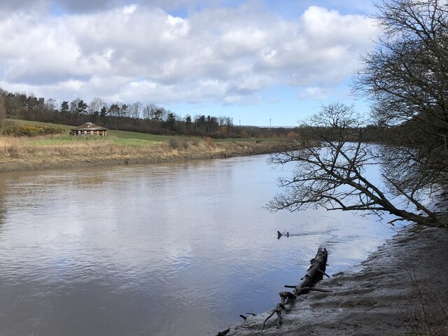
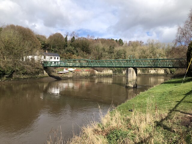
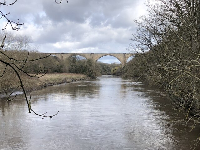
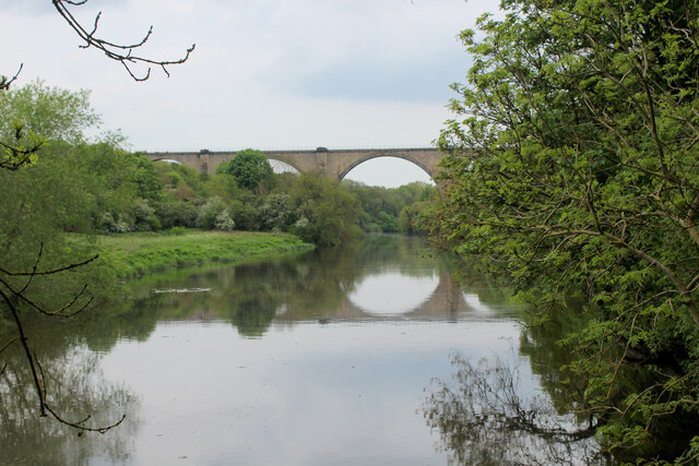
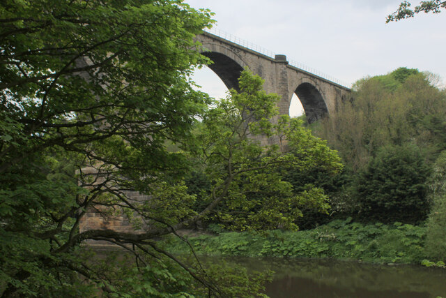
Ayton's Wood is a picturesque forest located in Durham, England. Covering an area of approximately 100 acres, this woodland is known for its natural beauty and diverse range of flora and fauna. The wood is situated near the village of Ayton, making it easily accessible for visitors.

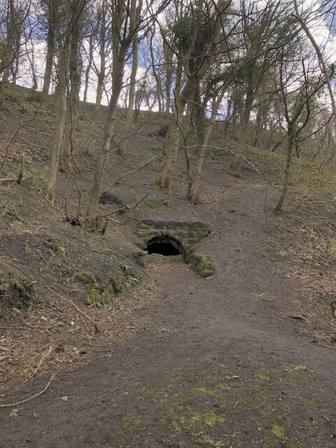
The woodland is predominantly composed of mature deciduous trees such as oak, beech, and ash, creating a dense canopy that provides shade and shelter for a variety of wildlife. The forest floor is adorned with a rich carpet of bluebells in the spring, creating a stunning display of color.

Ayton's Wood is a haven for wildlife enthusiasts, as it is home to a wide range of animals and birds. Visitors may spot roe deer grazing amongst the trees or catch a glimpse of a red squirrel scurrying along the branches. The forest is also a paradise for birdwatchers, with species such as woodpeckers, owls, and various songbirds frequenting the area.

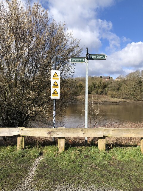
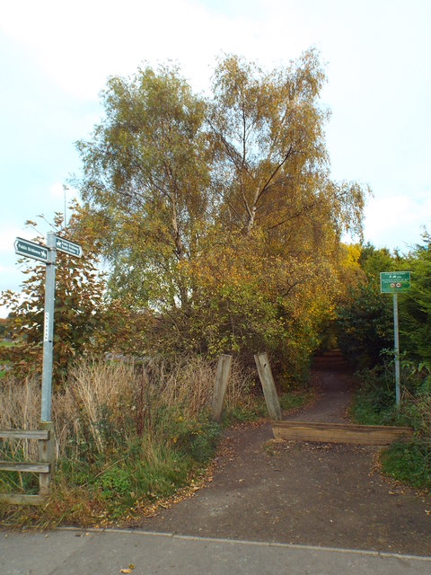
Walking trails crisscross the wood, allowing visitors to explore its hidden beauty. Well-maintained paths wind through the trees, offering peaceful and tranquil surroundings for a leisurely stroll or a more vigorous hike. Information boards along the trails provide educational insights into the woodland's history, wildlife, and conservation efforts.

Ayton's Wood is not only a natural gem but also an important ecological site. It is managed by local conservation organizations, who work tirelessly to preserve the woodland's biodiversity and protect it for future generations to enjoy. Whether you are seeking a peaceful escape into nature or a chance to observe wildlife in its natural habitat, Ayton's Wood is a must-visit destination in Durham.

If you have any feedback on the listing, please let us know in the comments section below.
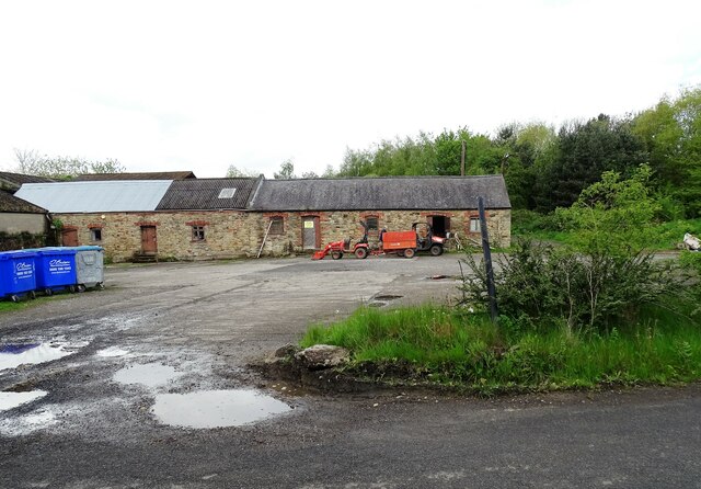
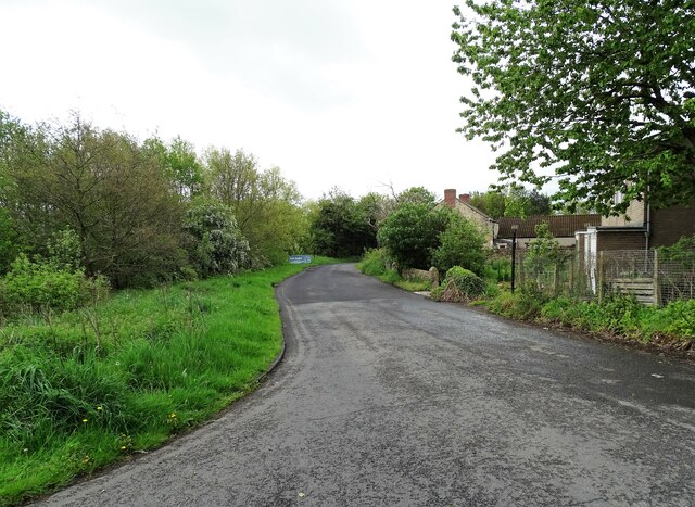
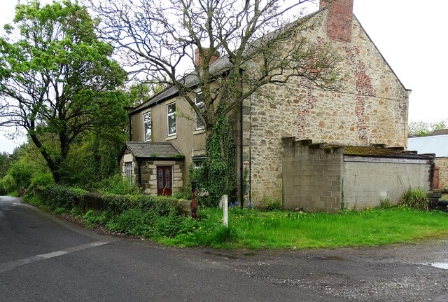
Ayton's Wood Images

Images are sourced within 2km of 54.891045/-1.4833452 or Grid Reference NZ3355. Thanks to Geograph Open Source API. All images are credited.

The Penshaw Monument viewed from the Cleadon Hills near South Shields The Penshaw Monument or Earl of Durham's Monument is explained in this Wikipedia <span class="nowrap"><a title="https://en.wikipedia.org/wiki/Penshaw_Monument" rel="nofollow ugc noopener" href="https://en.wikipedia.org/wiki/Penshaw_Monument">Link</a><img style="margin-left:2px;" alt="External link" title="External link - shift click to open in new window" src="https://s1.geograph.org.uk/img/external.png" width="10" height="10"/></span>
The Penshaw Monument viewed from the Cleadon Hills near South Shields
The Penshaw Monument or Earl of Durham's Monument is explained in this Wikipedia LinkExternal link
Penshaw Monument The monument to the Earl of Durham and freemasonry
Penshaw Monument
The monument to the Earl of Durham and freemasonry
View from Penshaw Hill Looking south east from the path around the hill a short way down from the summit.
View from Penshaw Hill
Looking south east from the path around the hill a short way down from the summit.
Flinton Hill Farm An agricultural landscape south east of Penshaw Hill
Flinton Hill Farm
An agricultural landscape south east of Penshaw Hill
An Empty Monument On a sunny Sunday afternoon in August there were people all over the monument most of the time and I didn't think I'd get a clear picture, but just for a few seconds there was nothing but a small dog in there
An Empty Monument
On a sunny Sunday afternoon in August there were people all over the monument most of the time and I didn't think I'd get a clear picture, but just for a few seconds there was nothing but a small dog in there
Sunken boat in the River Wear
Direction and warning signs at path junction beside the River Wear
River Wear beside Washington Waterfowl Park
Footbridge across River Wear at Cox Green
Adit in riverbank near Cox Green One of several adits in the vicinity of Cox Green. The tunnels were used to extract sandstone from beneath Penshaw Hill for loading onto boats moored on the adjacent River Wear,
Adit in riverbank near Cox Green
One of several adits in the vicinity of Cox Green. The tunnels were used to extract sandstone from beneath Penshaw Hill for loading onto boats moored on the adjacent River Wear,
Victoria Viaduct crossing the River Wear Victoria Viaduct. Built by the Durham Junction Railway and opened in 1838 to take coal from the Houghton-le-Spring area to the Tyne. As the railways expanded the viaduct became part of the main line from Darlington to Newcastle, before being relegated to a secondary route when the main line took the new route via Durham and Team Valley in 1872. By the 1980s the route was little used except when work on the main line required diversions, finally closing in 1991. Though the track is lifted the line retains a ‘mothballed’ status so has not been severed or built on, and is frequently proposed for reopening either as a heavy rail route or part of the Tyne and Wear Metro.
Victoria Viaduct crossing the River Wear
Victoria Viaduct. Built by the Durham Junction Railway and opened in 1838 to take coal from the Houghton-le-Spring area to the Tyne. As the railways expanded the viaduct became part of the main line from Darlington to Newcastle, before being relegated to a secondary route when the main line took the new route via Durham and Team Valley in 1872. By the 1980s the route was little used except when work on the main line required diversions, finally closing in 1991. Though the track is lifted the line retains a ‘mothballed’ status so has not been severed or built on, and is frequently proposed for reopening either as a heavy rail route or part of the Tyne and Wear Metro.
Factories on Mandarin Way Part of Pattinson Industrial Estate, on the east side of Washington. Built on former farmland in the late 20th century.
Factories on Mandarin Way
Part of Pattinson Industrial Estate, on the east side of Washington. Built on former farmland in the late 20th century.
Waterview Park offices This large office block is occupied by HM Revenue and Customs with over 2000 staff based here. It is on Mandarin Way on the eastern edge of Washington.
Waterview Park offices
This large office block is occupied by HM Revenue and Customs with over 2000 staff based here. It is on Mandarin Way on the eastern edge of Washington.
Old farm buildings at Middle Barmston Middle Barmston farm is an old Victorian farmstead which is now used by Washington Wetland Centre. No longer a working farm, these outbuildings would originally have been stables and cattle byres.
Old farm buildings at Middle Barmston
Middle Barmston farm is an old Victorian farmstead which is now used by Washington Wetland Centre. No longer a working farm, these outbuildings would originally have been stables and cattle byres.
Top of Barmston Lane At the junction with Madarin Way. The lane leads past Middle Barmston Farm here and down to the Washington Wetland Centre.
Top of Barmston Lane
At the junction with Madarin Way. The lane leads past Middle Barmston Farm here and down to the Washington Wetland Centre.
Former farmhouse The mid 19th century farmhouse at Middle Barmston. No longer used as such.
Former farmhouse
The mid 19th century farmhouse at Middle Barmston. No longer used as such.
Weardale Way approaching Victoria Viaduct A slightly misty scene looking down the River Wear towards the Victoria Viaduct.
Completed in 1836 on a design based on the Alcantara Bridge in Spain, as part of the Durham Junction Railway.
The Beeching axe fell in 1964, when passenger services ceased. 1991 saw the last freight crossing the viaduct, and it has been mothballed ever since.
Grade II Listed.
Weardale Way approaching Victoria Viaduct
A slightly misty scene looking down the River Wear towards the Victoria Viaduct. Completed in 1836 on a design based on the Alcantara Bridge in Spain, as part of the Durham Junction Railway. The Beeching axe fell in 1964, when passenger services ceased. 1991 saw the last freight crossing the viaduct, and it has been mothballed ever since. Grade II Listed.
Looking up to Victoria Viaduct A slightly misty scene looking down the River Wear towards the Victoria Viaduct.
Completed in 1836 on a design based on the Alcantara Bridge in Spain, as part of the Durham Junction Railway.
The Beeching axe fell in 1964, when passenger services ceased. 1991 saw the last freight crossing the viaduct, and it has been mothballed ever since.
Grade II Listed.
Looking up to Victoria Viaduct
A slightly misty scene looking down the River Wear towards the Victoria Viaduct. Completed in 1836 on a design based on the Alcantara Bridge in Spain, as part of the Durham Junction Railway. The Beeching axe fell in 1964, when passenger services ceased. 1991 saw the last freight crossing the viaduct, and it has been mothballed ever since. Grade II Listed.
Show me another place!

Ayton's Wood is located at Grid Ref: NZ3355 (Lat: 54.891045, Lng: -1.4833452)

Unitary Authority: Sunderland

Police Authority: Northumbria

What 3 Words

///sketch.chops.moved. Near Washington, Tyne & Wear

Nearby Locations

Ayton's Wood

Related Wikis

Cox Green, Tyne and Wear

Cox Green is a village in the Sunderland district, Tyne and Wear, England, situated on the south bank of the River Wear between Penshaw and Offerton. The...

Cox Green railway station

Cox Green railway station served the civil parish of Cox Green, Tyne and Wear, England, from 1854 to 1964 on the Penshaw Branch. == History == The station...

WWT Washington

WWT Washington Wetland Centre is a wetland reserve managed by the Wildfowl and Wetlands Trust at Washington, Tyne and Wear, North East England. Established...
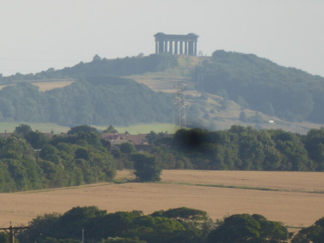
Penshaw Monument

The Penshaw Monument (officially the Earl of Durham's Monument) is a memorial in the style of an ancient Greek temple on Penshaw Hill in the metropolitan...

Washington and Sunderland West (UK Parliament constituency)

Washington and Sunderland West is a constituency represented in the House of Commons of the UK Parliament since its 2010 creation by Sharon Hodgson, a...

Washington railway station (England)

Washington railway station served the town of Washington, Tyne and Wear, England from 1835 to 1963, initially on the Stanhope & Tyne Railway and later...

Offerton, Tyne and Wear

Offerton is a hamlet in the Sunderland district, of Tyne and Wear, England. It is situated about 4 miles (6.4 km) west of Sunderland city centre. ��2...

Penshaw

The village of Penshaw locally , formerly known as Painshaw or Pensher, is an area of the metropolitan district of the City of Sunderland, in Tyne and...

Nearby Amenities

Located within 500m of 54.891045,-1.4833452
Source: PGS
Lat/Long: 54.8919158/-1.4907779
Created By: almien_coastlines
Source: PGS
Lat/Long: 54.892182/-1.489785
Source: PGS
Lat/Long: 54.8922715/-1.4894853
Source: PGS
Lat/Long: 54.8923111/-1.4891424
Source: PGS
Lat/Long: 54.8925686/-1.4881433
Source: PGS
Lat/Long: 54.8926992/-1.4874945
Source: PGS
Lat/Long: 54.8929691/-1.4867336
Source: PGS
Lat/Long: 54.8931578/-1.486165
Source: PGS
Lat/Long: 54.8935139/-1.4853527
Source: PGS
Lat/Long: 54.8938159/-1.484828
Source: PGS
Lat/Long: 54.8941534/-1.4842775
Source: PGS
Lat/Long: 54.8943858/-1.4839429
Source: PGS
Lat/Long: 54.8946751/-1.4835043
Source: PGS
Lat/Long: 54.8950101/-1.4829794
Source: PGS
Lat/Long: 54.8952605/-1.4825919
Source: PGS
Lat/Long: 54.8954837/-1.4821879
Source: PGS
Lat/Long: 54.895206/-1.4811536
Source: PGS
Lat/Long: 54.89502/-1.4814971
Source: PGS
Lat/Long: 54.8945125/-1.4824722
Source: PGS
Lat/Long: 54.8943314/-1.4828772
Created By: almien_coastlines
Source: PGS
Lat/Long: 54.894025/-1.483495
Source: PGS
Lat/Long: 54.8934662/-1.48425
Source: PGS
Lat/Long: 54.8932383/-1.4846794
Created By: almien_coastlines
Source: PGS
Lat/Long: 54.8929933/-1.4851228
Created By: almien_coastlines
Source: PGS
Lat/Long: 54.8928683/-1.4853498
Created By: almien_coastlines
Source: PGS
Lat/Long: 54.8927423/-1.4855758
Created By: almien_coastlines
Source: PGS
Lat/Long: 54.8926173/-1.4858038
Created By: almien_coastlines
Source: PGS
Lat/Long: 54.8925287/-1.4860795
Created By: almien_coastlines
Source: PGS
Lat/Long: 54.8921488/-1.487243
Created By: almien_coastlines
Source: PGS
Lat/Long: 54.8919707/-1.4883952
Created By: almien_coastlines
Source: PGS
Lat/Long: 54.8919237/-1.4886561
Created By: almien_coastlines
Source: PGS
Lat/Long: 54.8918595/-1.4890064
Source: PGS
Lat/Long: 54.8915708/-1.4903157
Power: tower
Lat/Long: 54.8903394/-1.4794779
Power: pole
Lat/Long: 54.8947027/-1.4877147
Power: pole
Lat/Long: 54.8885768/-1.4848423
Power: pole
Lat/Long: 54.8886861/-1.4846147
Power: pole
Lat/Long: 54.8948089/-1.4874654
Source: Bing
Lat/Long: 54.8900162/-1.4785932
Power: tower
Lat/Long: 54.8946354/-1.4853485
Power: tower
Lat/Long: 54.8923302/-1.4821996
Barrier: stile
Bicycle: no
Foot: designated
Horse: no
Motor Vehicle: no
Lat/Long: 54.8890953/-1.4767148
Power: pole
Lat/Long: 54.8917446/-1.4825105
Power: pole
Lat/Long: 54.8911083/-1.4861586
Fixme: continue
Power: pole
Lat/Long: 54.8867178/-1.4852907
Cox Green
Historic Railway: station
Railway: site
Wikidata: Q105044426
Wikipedia: en:Cox Green railway station
Lat/Long: 54.8879281/-1.4861194
Cafe
The New Plough
Lat/Long: 54.8915357/-1.4901581
Source: PGS
Lat/Long: 54.89502/-1.4814971
Barrier: wicket_gate
Lat/Long: 54.8955196/-1.4840408
Saline lagoon path - steep decline
Lat/Long: 54.8955187/-1.4838669
The data included in this document is from www.openstreetmap.org. The data is made available under ODbL.

Have you been to Ayton's Wood?

Leave your review of Ayton's Wood below (or comments, questions and feedback).