Kirklington Grange Wood

Wood, Forest in Yorkshire Hambleton

England

Kirklington Grange Wood

A 1 northbound - 1980 On the A 1 near Kirklington heading north.
A 1 northbound - 1980 Credit: Helmut Zozmann

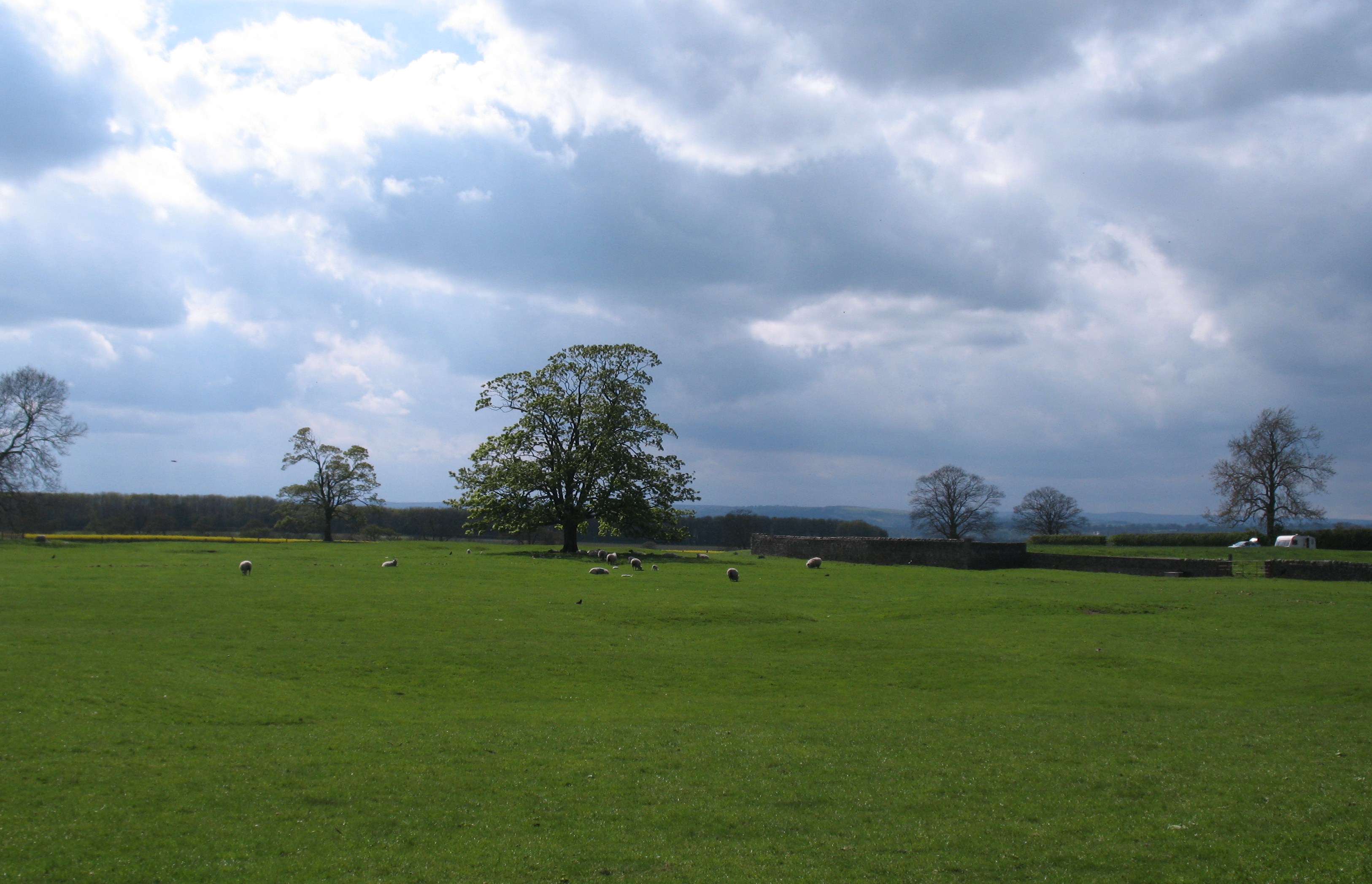
Kirklington Grange Wood is a picturesque woodland located in the county of Yorkshire, England. Covering an area of approximately 100 hectares, it is situated near the village of Kirklington and is a popular destination for nature enthusiasts and outdoor enthusiasts alike.

The woodland is characterized by its diverse and rich vegetation, consisting of a mixture of broadleaf and coniferous trees. Ancient oaks, beech, and ash trees dominate the landscape, providing a lush and vibrant habitat for a wide range of wildlife. The forest floor is covered with a carpet of bluebells and other wildflowers during the spring and summer months, creating a stunning display of colors and scents.

The woodland is crisscrossed by a network of well-maintained trails, allowing visitors to explore the area on foot or by bike. These trails offer breathtaking views of the surrounding countryside and provide opportunities for birdwatching, as the wood is home to various species of birds, including woodpeckers, owls, and thrushes.

Kirklington Grange Wood is also known for its historical significance, with traces of ancient settlements and archaeological remains found within its boundaries. The wood has been used as a source of timber for centuries and has played a vital role in the local economy.

Overall, Kirklington Grange Wood offers a peaceful and tranquil retreat, allowing visitors to immerse themselves in the beauty of nature while enjoying a range of outdoor activities. It is a true gem of Yorkshire and a must-visit destination for anyone seeking a connection with the natural world.

If you have any feedback on the listing, please let us know in the comments section below.

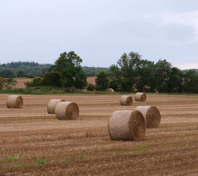
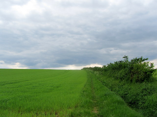
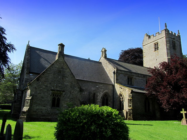
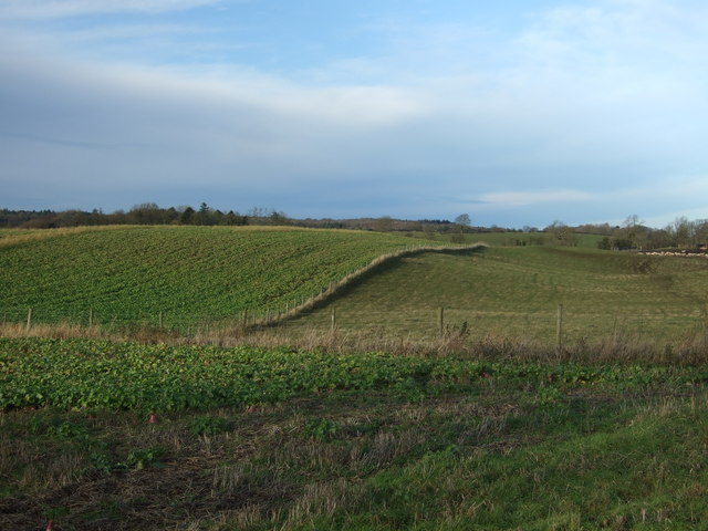
Kirklington Grange Wood Images

Images are sourced within 2km of 54.210268/-1.4943876 or Grid Reference SE3379. Thanks to Geograph Open Source API. All images are credited.

A 1 northbound - 1980 On the A 1 near Kirklington heading north.
A 1 northbound - 1980
On the A 1 near Kirklington heading north.
Green Lane, Kirklington Green lane appears to be one of those unsurfaced lanes that might be a county road or byway, but it turns out to be just a track leading towards Kirklington Grange.
Green Lane, Kirklington
Green lane appears to be one of those unsurfaced lanes that might be a county road or byway, but it turns out to be just a track leading towards Kirklington Grange.
Arable land at Kirklington Straw bales in a field to the south of Kirklington village.
Arable land at Kirklington
Straw bales in a field to the south of Kirklington village.
Coldstone Lane A1 junction
Quernhow Cafe
Quernhow Cafe
A1(M), northbound The A1 is the longest numbered road in the UK at 410 miles long. It connects London with Edinburgh, via the east of England. 
For much of its path it follows the Great North Road the old coaching route between London and Edinburgh. Several sections of the route are classified as motorway A1(M). The modern A1 bypasses the towns the Great North Road passed through and is dual carriageway for most of its route through England.
A1(M), northbound
The A1 is the longest numbered road in the UK at 410 miles long. It connects London with Edinburgh, via the east of England. For much of its path it follows the Great North Road the old coaching route between London and Edinburgh. Several sections of the route are classified as motorway A1(M). The modern A1 bypasses the towns the Great North Road passed through and is dual carriageway for most of its route through England.
A1(M) heading north
A1(M) heading north
Lorry on the old A1
Lorry on the old A1
Sinderby railway station (site), Yorkshire Opened in 1852 by the Leeds Northern Railway on its line from Leeds to Northallerton, this station was closed in 1963 and was demolished in 2009. View north towards Pickhill and Northallerton.
Sinderby railway station (site), Yorkshire
Opened in 1852 by the Leeds Northern Railway on its line from Leeds to Northallerton, this station was closed in 1963 and was demolished in 2009. View north towards Pickhill and Northallerton.
Footpath between Street House Farm and Kirklington Section of the path climbing beside the hedgerow of an arable field from Street House Farm on the A6055 (Formerly the A1, Great North Road) to the village of Kirklington
Footpath between Street House Farm and Kirklington
Section of the path climbing beside the hedgerow of an arable field from Street House Farm on the A6055 (Formerly the A1, Great North Road) to the village of Kirklington
St. Michael the Archangel's Church, Kirklington The church and tower seen from the north east, just inside the lych gate.
St. Michael the Archangel's Church, Kirklington
The church and tower seen from the north east, just inside the lych gate.
Quernhow Cafe Built on the site of a bronze age burial mound circa 1900 BC - called Quernhow.
This cafe is to be found on the A6055.  This used to be the northbound carriageway of the A1 (Great North Road), but has now been downgraded because of the construction of a new motorway that runs side by side. Business, as  consequence must have diminished, as there is no access from the new road.
Quernhow Cafe
Built on the site of a bronze age burial mound circa 1900 BC - called Quernhow. This cafe is to be found on the A6055. This used to be the northbound carriageway of the A1 (Great North Road), but has now been downgraded because of the construction of a new motorway that runs side by side. Business, as consequence must have diminished, as there is no access from the new road.
The A1 and Sewards near Sinderby Sewards are a well established company with several branches in the area. They are primarily agents for Class machinery.
This site is very well located by the A1 although there is no adjacent junction.
The A1 closely follows the 'Dere Street' Roman Road on this section.
The A1 and Sewards near Sinderby
Sewards are a well established company with several branches in the area. They are primarily agents for Class machinery. This site is very well located by the A1 although there is no adjacent junction. The A1 closely follows the 'Dere Street' Roman Road on this section.
Sewards farm Machinery Near Sinderby and the A1.
The site seems curiously laid out with the building somewhat awkwardly jammed against the embankment.
This is largely explained when you discover that the site is a former Station Yard.
Sinderby Station was on the Northallerton to Harrogate line.
There are some excellent pictures of the gradual transformations here.
<span class="nowrap"><a title="http://www.disused-stations.org.uk/s/sinderby/" rel="nofollow ugc noopener" href="http://www.disused-stations.org.uk/s/sinderby/">Link</a><img style="margin-left:2px;" alt="External link" title="External link - shift click to open in new window" src="https://s1.geograph.org.uk/img/external.png" width="10" height="10"/></span>
Sewards farm Machinery
Near Sinderby and the A1. The site seems curiously laid out with the building somewhat awkwardly jammed against the embankment. This is largely explained when you discover that the site is a former Station Yard. Sinderby Station was on the Northallerton to Harrogate line. There are some excellent pictures of the gradual transformations here. LinkExternal link
Roundabout on the A6055 and B6267 There is no access to the A1 thundering close by.
Roundabout on the A6055 and B6267
There is no access to the A1 thundering close by.
Sewards Close by the A1, this dealership specialises in Claas farm machinery.
Sewards
Close by the A1, this dealership specialises in Claas farm machinery.
Kirklington village green (south side) Unlike many Yorkshire village greens, Kirklington has a number of very large trees growing.
Kirklington village green (south side)
Unlike many Yorkshire village greens, Kirklington has a number of very large trees growing.
Mixed fields near Berryhills View from Lime Lane (B6267).
Mixed fields near Berryhills
View from Lime Lane (B6267).
Show me another place!

Kirklington Grange Wood is located at Grid Ref: SE3379 (Lat: 54.210268, Lng: -1.4943876)

Division: North Riding

Administrative County: North Yorkshire

District: Hambleton

Police Authority: North Yorkshire

What 3 Words

///flank.necklace.clincher. Near Ripon, North Yorkshire

Nearby Locations

Kirklington Grange Wood

Related Wikis

Middleton Quernhow

Middleton Quernhow is a settlement and civil parish in North Yorkshire, England. The parish is included in the Wathvale Ward with a population of 3,479...

Howgrave

Howgrave is a civil parish in the Hambleton District of North Yorkshire, England. It is a very small parish, with an area of only 323 acres (131 ha) and...

Sinderby railway station

Sinderby railway station served the village of Sinderby, North Yorkshire, England from 1852 to 1963 on the Leeds-Northallerton Railway. == History == The...

Sutton Howgrave

Sutton Howgrave is a village in North Yorkshire, England. It is the only village in the civil parish of Sutton with Howgrave. The population of the parish...

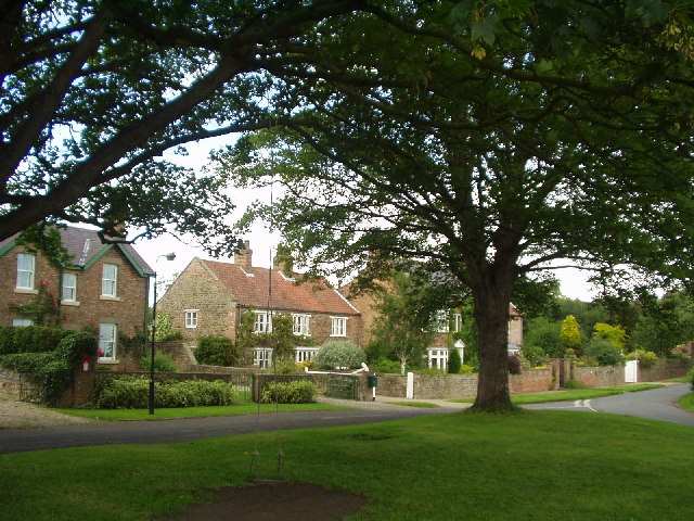
Kirklington, North Yorkshire

Kirklington is a village in the English county of North Yorkshire close to the A1(M) motorway. Kirklington forms the major part of the civil parish of...

Kirklington-cum-Upsland

Kirklington-cum-Upsland is a civil parish in the Hambleton district of North Yorkshire, England. The main settlement is Kirklington. Upsland is a single...
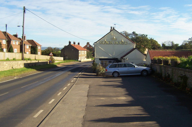
Ainderby Quernhow

Ainderby Quernhow is a village and civil parish in the Hambleton District of North Yorkshire, England. The village is situated on the B6267 Thirsk to...
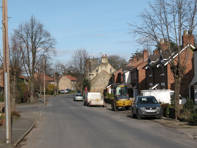
Wath (near Ripon)

Wath (alias Wath-by-Ripon) is a village and civil parish 3.7 miles (6 km) north of Ripon in North Yorkshire, England. The population of the parish was...

Nearby Amenities

Located within 500m of 54.210268,-1.4943876
Generator Method: photovoltaic
Generator Output Electricity: yes
Generator Source: solar
Generator Type: solar_photovoltaic_panel
Location: roof
Power: generator
Lat/Long: 54.2131811/-1.4895235
The data included in this document is from www.openstreetmap.org. The data is made available under ODbL.

Have you been to Kirklington Grange Wood?

Leave your review of Kirklington Grange Wood below (or comments, questions and feedback).