Dinas Bach

Settlement in Carmarthenshire

Wales

Dinas Bach

Old Milestone by UC road, Rhandirmwyn The Milestone is located 200m South of the crossroads on the side of the road.  Parish of Llanfair-ar-y-bryn (Carmarthenshire District), erected in the 19th Century.

Inscription reads:-  Llandovery 7 

Milestone Society National ID: CAM_LDNB07
Old Milestone by UC road, Rhandirmwyn Credit: Adrian Dust

Dinas Bach is a small village located in the county of Carmarthenshire, Wales. Situated in the picturesque countryside, it is nestled between the towns of Llandeilo and Carmarthen. The name "Dinas Bach" translates to "little fort" in English, which reflects the village's historical significance.

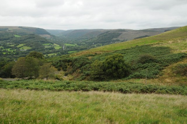
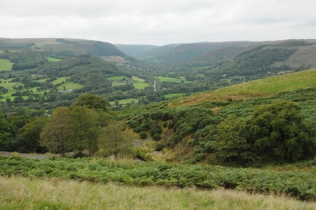
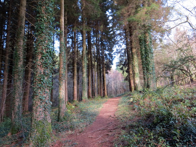
The village is known for its charming and tranquil atmosphere, making it a popular destination for those seeking a peaceful retreat. Surrounded by rolling hills and lush green fields, Dinas Bach offers breathtaking views of the Welsh countryside. The area is also rich in wildlife, with various species of birds and animals making their home in the nearby woodlands.

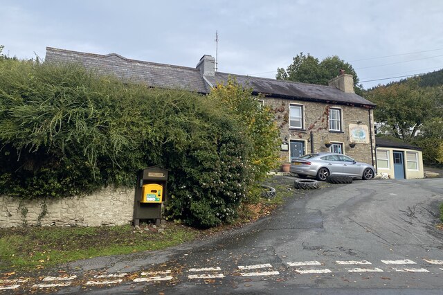
Despite its small size, Dinas Bach boasts a close-knit community that takes pride in its heritage and traditions. The village is home to a number of well-preserved historic buildings, including the St. Michael's Church, which dates back to the 13th century. The church serves as a reminder of the area's long and fascinating history.

In terms of amenities, Dinas Bach offers a few local shops and a community center where residents can gather for events and activities. The village is also well-connected to nearby towns and cities via a reliable bus service, providing convenient access to a wider range of services and facilities.

Overall, Dinas Bach is a charming and idyllic village that offers a peaceful escape from the hustle and bustle of modern life. With its stunning surroundings and strong sense of community, it continues to attract visitors and residents alike who appreciate its natural beauty and rich cultural heritage.

If you have any feedback on the listing, please let us know in the comments section below.
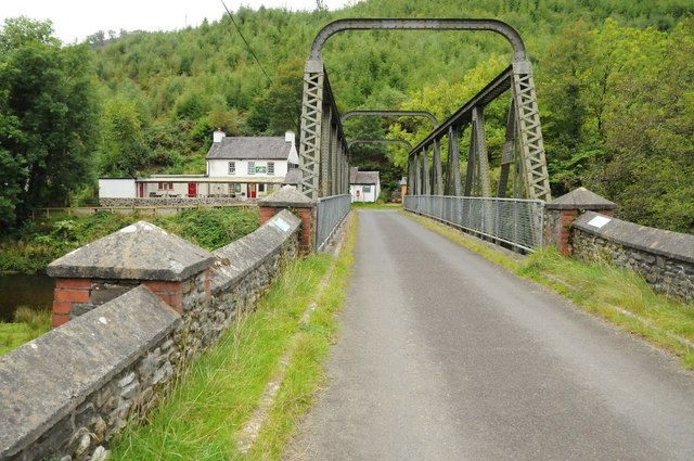
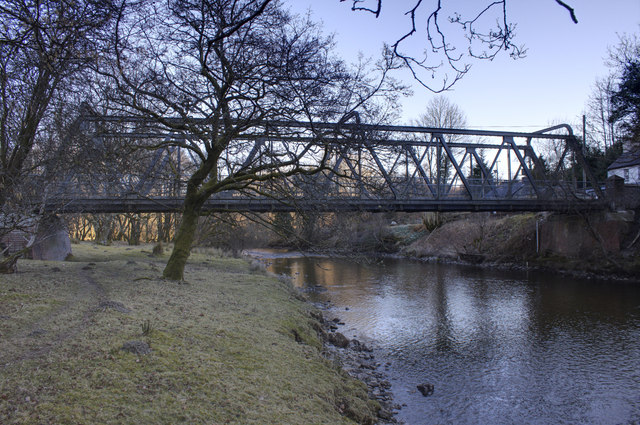
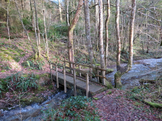
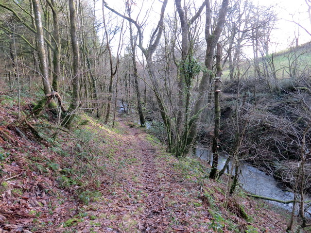
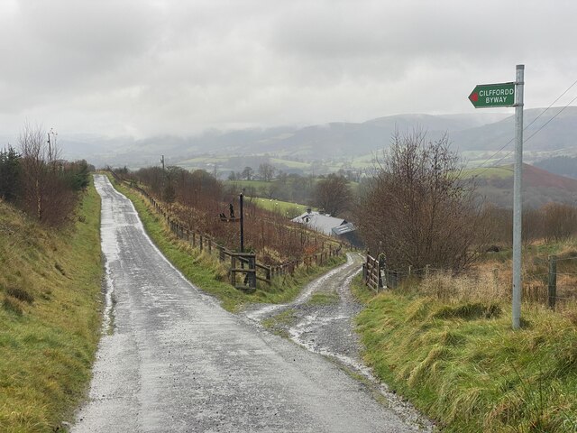
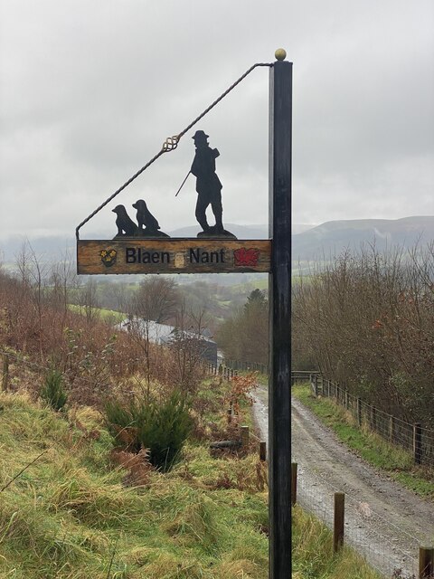
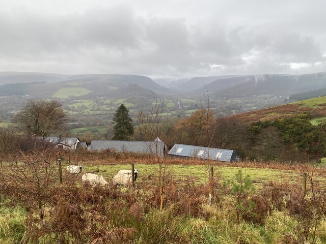
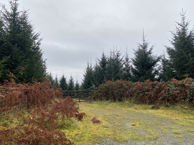
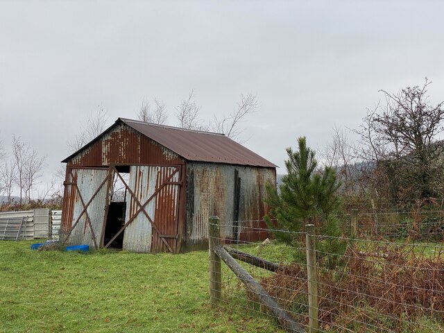
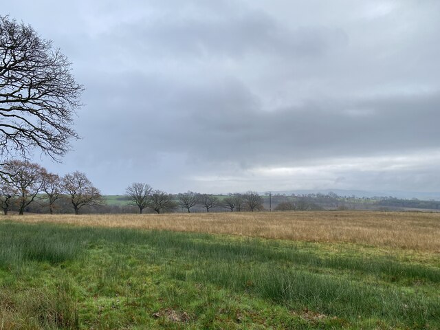
Dinas Bach Images

Images are sourced within 2km of 52.073675/-3.785753 or Grid Reference SN7743. Thanks to Geograph Open Source API. All images are credited.

Old Milestone by UC road, Rhandirmwyn The Milestone is located 200m South of the crossroads on the side of the road.  Parish of Llanfair-ar-y-bryn (Carmarthenshire District), erected in the 19th Century.

Inscription reads:-  Llandovery 7 

Milestone Society National ID: CAM_LDNB07
Old Milestone by UC road, Rhandirmwyn
The Milestone is located 200m South of the crossroads on the side of the road.  Parish of Llanfair-ar-y-bryn (Carmarthenshire District), erected in the 19th Century. Inscription reads:- Llandovery 7 Milestone Society National ID: CAM_LDNB07
Rhandirmwyn Bridge Rhandirmwyn Bridge, which was built in 1913, crossing Afon Twyi/Towey with The Bridge Inn to the left in the background.
Rhandirmwyn Bridge
Rhandirmwyn Bridge, which was built in 1913, crossing Afon Twyi/Towey with The Bridge Inn to the left in the background.
Country road near Dolfallt Country road near Dolfallt high above Rhandirmwyn.
Country road near Dolfallt
Country road near Dolfallt high above Rhandirmwyn.
View into the Twyi valley View into the Twyi valley near Rhandirmwyn.
View into the Twyi valley
View into the Twyi valley near Rhandirmwyn.
View into the Twyi valley View into the Twyi valley near Rhandirmwyn.
View into the Twyi valley
View into the Twyi valley near Rhandirmwyn.
Rhandirmwyn Bridge Built in 1913, linking the 2 sides of the Towy valley by road beside the Towy Bridge Inn, the bridge is a rivetted girder construction.  Before the road bridge was built there was a footbridge and a drift ford, although in wet weather, you'd be brave to try to ford the Towy!  The road across the valley floor (left side of this picture) wasn't there before the bridge was built.
Rhandirmwyn Bridge
Built in 1913, linking the 2 sides of the Towy valley by road beside the Towy Bridge Inn, the bridge is a rivetted girder construction. Before the road bridge was built there was a footbridge and a drift ford, although in wet weather, you'd be brave to try to ford the Towy! The road across the valley floor (left side of this picture) wasn't there before the bridge was built.
Pompren Nant y Rhaeadr / Nant y Rhaeadr Footbridge Pompren yn rhychwantu Nant y Rhaeadr.


A footbridge spanning Nant y Rhaeadr (trans. stream of the waterfall).
Pompren Nant y Rhaeadr / Nant y Rhaeadr Footbridge
Pompren yn rhychwantu Nant y Rhaeadr. A footbridge spanning Nant y Rhaeadr (trans. stream of the waterfall).
Llwybr glanafon / Riverside path Llwybr cyhoeddus ar lan Nant y Rhaeadr.

A public footpath above Nant y Rhaeadr (trans. stream of the waterfall).
Llwybr glanafon / Riverside path
Llwybr cyhoeddus ar lan Nant y Rhaeadr. A public footpath above Nant y Rhaeadr (trans. stream of the waterfall).
Llwybr y coedwig / Woodland path Llwybr o fewn planhigfa goniferaidd Coed y Rhaeadr.

A path within Coed y Rhaeadr (trans. waterfall wood) conifer plantation.
Llwybr y coedwig / Woodland path
Llwybr o fewn planhigfa goniferaidd Coed y Rhaeadr. A path within Coed y Rhaeadr (trans. waterfall wood) conifer plantation.
Milestone, Nant-y-Bai On the road from Nat-y-Bai to Rhandirmwyn

Inscription: Llandovery 8 

Milestone Society National ID: TBA
Milestone, Nant-y-Bai
On the road from Nat-y-Bai to Rhandirmwyn Inscription: Llandovery 8 Milestone Society National ID: TBA
Royal Oak, Rhandirmwyn
Milestone - Llandovery 7 The milestone which is now leaning has an Ordnance Survey cut mark which marked a point 560.9ft above mean sea level.
Milestone - Llandovery 7
The milestone which is now leaning has an Ordnance Survey cut mark which marked a point 560.9ft above mean sea level.
Track to Blaen Nant
Track to Blaen Nant
Blaen Nant Farm sign
Farm nestling in a valley Dolfallt Farm.
Farm nestling in a valley
Dolfallt Farm.
Track near Dolfallt Farm
Corrugated iron shed Farm building near Blaen Nant.
Corrugated iron shed
Farm building near Blaen Nant.
Contrasting colours of reed grasses
Show me another place!

Dinas Bach is located at Grid Ref: SN7743 (Lat: 52.073675, Lng: -3.785753)

Unitary Authority: Carmarthenshire

Police Authority: Dyfed Powys

What 3 Words

///revamped.scraper.uncouth. Near Llandovery, Carmarthenshire

Related Wikis

Pwllpriddog Oak

The Pwllpriddog Oak (Welsh: Derwen Pwllpriddog), also known as the Rhandirmwyn Oak, is a 600–700-year-old tree located in farmland near Rhandirmwyn in...

Rhandirmwyn

Rhandirmwyn (or Rhandir-mwyn) is a small village in the north east of Carmarthenshire, Wales. Located in the upper Towy valley, 3 km north of Cilycwm village...

Cilycwm transmitting station

The Cilycwm television relay station is sited on high ground to the east of the village of Cilycwm to the north of Llandovery in Carmarthenshire, South...

Cynghordy railway station

Cynghordy railway station () serves the rural community of Cynghordy near Llandovery, Carmarthenshire, Wales. The station is on the Heart of Wales Line...

Related Videos

The highest waterfall in Carmarthenshire! / The 'Valley of the Waterfall' 4km walk in Cwm Rhaeadr...

On Sunday the 27th of June we walked the 4km waterfall walk at Cwm Rhaeadr in Carmarthenshire. Cwm Rhaeadr means the ...

A dreamy holiday cottage in the foothills of the Cambrian Mountains next to the Brecon Beacons

The perfect weekend getaway in Wales for your and your tribe to relax and restore, with adventures on your doorstep.

Nearby Amenities

Located within 500m of 52.073675,-3.785753
Barrier: stile
Foot: yes
Service: survey
Lat/Long: 52.0771523/-3.7845446
Barrier: stile
Foot: yes
Source: survey
Lat/Long: 52.076963/-3.7850807
Barrier: cattle_grid
Lat/Long: 52.0769794/-3.7838438
Place: farm
Lat/Long: 52.0719717/-3.7833448
Post Box
Collection Times: Mo-Fr 15:00; Sa 09:15
Post Box Type: lamp
Ref: SA20 213
Royal Cypher: GR
Royal Cypher Wikidata: Q33102273
Lat/Long: 52.0735171/-3.7914761
Crossing
Lat/Long: 52.0763215/-3.7811976
Surface: gravel
Tourism: camp_pitch
Lat/Long: 52.0755447/-3.7813005
Surface: gravel
Tourism: camp_pitch
Lat/Long: 52.0754961/-3.7814319
Surface: gravel
Tourism: camp_pitch
Lat/Long: 52.075445/-3.7815553
Surface: gravel
Tourism: camp_pitch
Lat/Long: 52.0756173/-3.781448
Surface: gravel
Tourism: camp_pitch
Lat/Long: 52.0755686/-3.7815821
Surface: gravel
Tourism: camp_pitch
Lat/Long: 52.07552/-3.7817296
Surface: gravel
Tourism: camp_pitch
Lat/Long: 52.0760022/-3.7816022
Surface: gravel
Tourism: camp_pitch
Lat/Long: 52.0760154/-3.7813474
Surface: gravel
Tourism: camp_pitch
Lat/Long: 52.0758077/-3.7810202
Surface: gravel
Tourism: camp_pitch
Lat/Long: 52.0758959/-3.781094
Surface: gravel
Tourism: camp_pitch
Lat/Long: 52.0758563/-3.7812696
Surface: gravel
Tourism: camp_pitch
Lat/Long: 52.0757648/-3.7811959
Surface: gravel
Tourism: camp_pitch
Lat/Long: 52.0751252/-3.780701
Surface: gravel
Tourism: camp_pitch
Lat/Long: 52.0750296/-3.7806487
Surface: gravel
Tourism: camp_pitch
Lat/Long: 52.0749265/-3.7806112
Surface: gravel
Tourism: camp_pitch
Lat/Long: 52.0749348/-3.7808029
Surface: gravel
Tourism: camp_pitch
Lat/Long: 52.0750353/-3.7808552
Surface: gravel
Tourism: camp_pitch
Lat/Long: 52.0751276/-3.7808901
Surface: gravel
Tourism: camp_pitch
Lat/Long: 52.0752051/-3.780748
Surface: gravel
Tourism: camp_pitch
Lat/Long: 52.0753073/-3.7807882
Surface: gravel
Tourism: camp_pitch
Lat/Long: 52.0752266/-3.780933
Surface: gravel
Tourism: camp_pitch
Lat/Long: 52.075403/-3.7808405
Surface: gravel
Tourism: camp_pitch
Lat/Long: 52.0754977/-3.7808713
Surface: gravel
Tourism: camp_pitch
Lat/Long: 52.0755942/-3.7818651
Surface: gravel
Tourism: camp_pitch
Lat/Long: 52.0756535/-3.7817337
Surface: gravel
Tourism: camp_pitch
Lat/Long: 52.0757046/-3.7816036
Surface: gravel
Tourism: camp_pitch
Lat/Long: 52.0757574/-3.7814561
Surface: gravel
Tourism: camp_pitch
Lat/Long: 52.0758868/-3.7815633
Surface: gravel
Tourism: camp_pitch
Lat/Long: 52.0758316/-3.7816988
Surface: gravel
Tourism: camp_pitch
Lat/Long: 52.0757796/-3.7818356
Barrier: stile
Material: wood
Source: survey;gps
Stile: stepover
Lat/Long: 52.0772192/-3.7845801
Barrier: cattle_grid
Lat/Long: 52.073754/-3.7905369
Power: pole
Transformer: distribution
Lat/Long: 52.0716573/-3.7835616
Power: pole
Lat/Long: 52.0713325/-3.7845916
Power: pole
Lat/Long: 52.0709335/-3.7856323
Power: pole
Lat/Long: 52.0706582/-3.7863377
Power: pole
Lat/Long: 52.0701669/-3.7876198
Power: pole
Lat/Long: 52.0715913/-3.7877539
Power: pole
Lat/Long: 52.0719392/-3.788234
Power: pole
Lat/Long: 52.0734889/-3.7905863
Power: pole
Transformer: distribution
Lat/Long: 52.0738401/-3.7912381
Power: pole
Lat/Long: 52.0742523/-3.7878209
Power: pole
Lat/Long: 52.0736011/-3.78869
Power: pole
Lat/Long: 52.072963/-3.7895831
Power: pole
Lat/Long: 52.0723102/-3.7905219
Power: pole
Lat/Long: 52.0716655/-3.7918711
The data included in this document is from www.openstreetmap.org. The data is made available under ODbL.

Have you been to Dinas Bach?

Leave your review of Dinas Bach below (or comments, questions and feedback).