Dinas

Settlement in Cornwall

England

Dinas

Padstow Outer Harbour
Padstow Outer Harbour Credit: SMJ

Dinas is a small village located in Cornwall, England. Situated on the northern coast of the county, it lies within the civil parish of St. Wenn. Dinas is nestled amidst picturesque countryside and offers a peaceful retreat away from the bustling city life.

The village is known for its charming and traditional Cornish architecture, with many of the houses dating back centuries. The local community takes pride in preserving the area's historic character, contributing to the village's quaint and welcoming atmosphere.

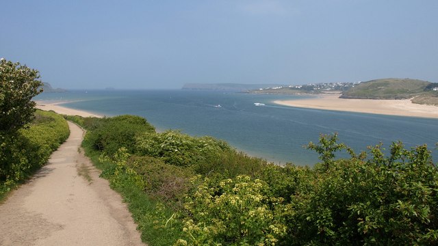
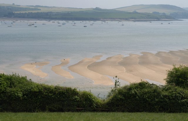
Dinas benefits from its close proximity to the dramatic coastline, offering residents and visitors stunning views of the Atlantic Ocean. The nearby beaches of Polzeath and Trebetherick are popular destinations for surfers and sun-seekers alike. The South West Coast Path, a famous long-distance trail, passes through Dinas, providing an excellent opportunity for hikers to explore the rugged coastline and admire breathtaking vistas.

Despite its small size, Dinas boasts a strong sense of community. The village is home to a primary school, a local pub, and a community center, which hosts various events throughout the year. Residents often come together to celebrate local traditions, such as the annual Dinas Summer Fair and the Christmas lights switch-on.

Dinas offers a peaceful and idyllic setting for those looking to escape the city and immerse themselves in the natural beauty of Cornwall. With its rich history, stunning coastline, and vibrant community spirit, Dinas is a hidden gem that captures the essence of traditional Cornish life.

If you have any feedback on the listing, please let us know in the comments section below.
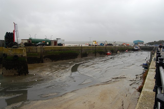
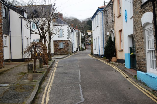
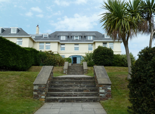
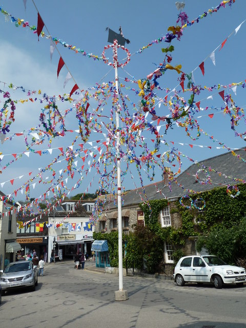
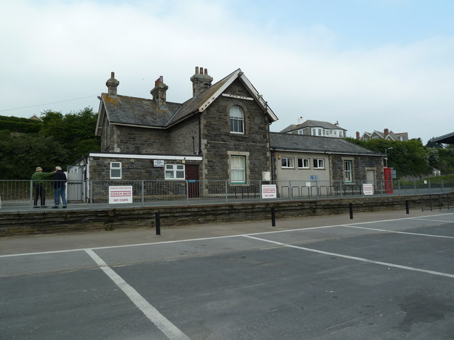
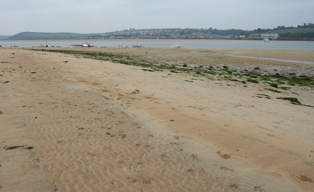
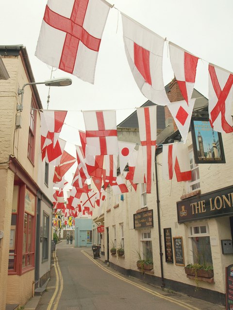
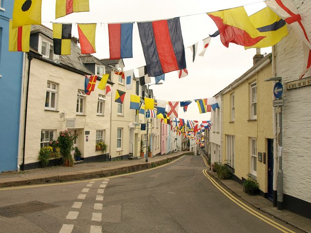
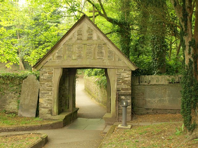
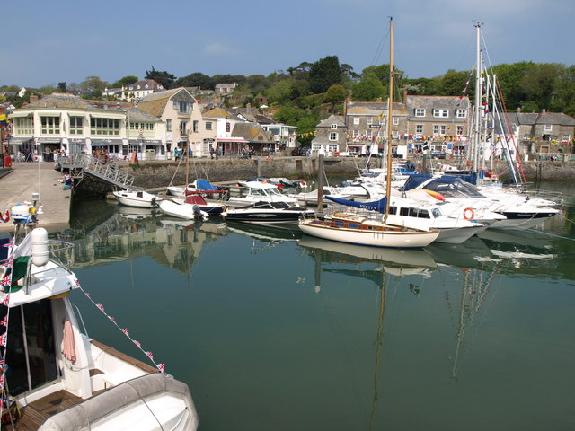
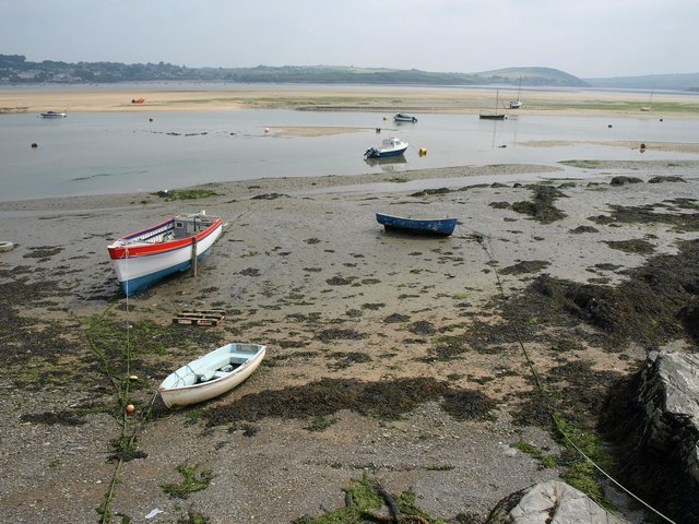
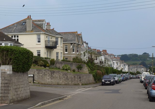
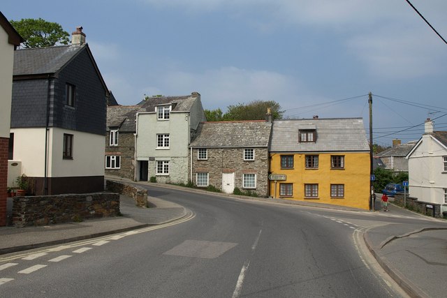
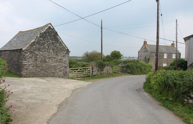
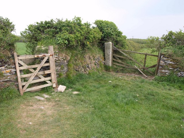
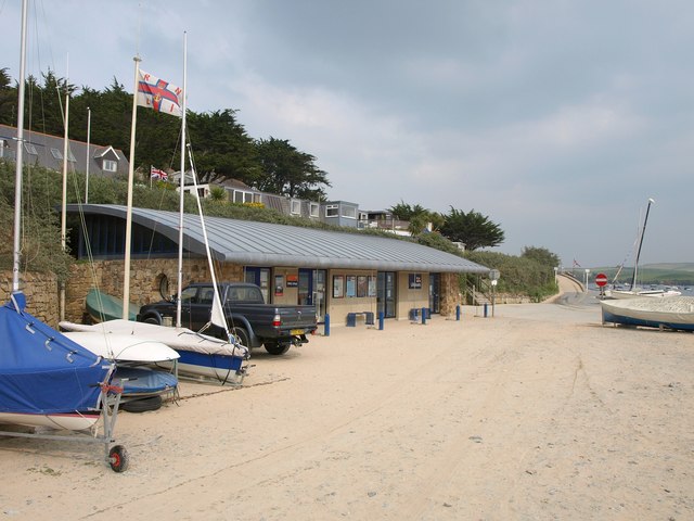
Dinas Images

Images are sourced within 2km of 50.535917/-4.936948 or Grid Reference SW9174. Thanks to Geograph Open Source API. All images are credited.

Padstow Outer Harbour
Padstow
Padstow
Camel estuary From the South West Coast Path following footpath 532/22/2 north of the war memorial above St Saviour's Point. The settlement past Brea Hill is Trebetherick.
Camel estuary
From the South West Coast Path following footpath 532/22/2 north of the war memorial above St Saviour's Point. The settlement past Brea Hill is Trebetherick.
St Enodoc Hotel, Rock An excellent hotel with Michelin starred chef Nathan Outlaw in the kitchen. A nice place to stop for lunch en route to a Cornish holiday.
St Enodoc Hotel, Rock
An excellent hotel with Michelin starred chef Nathan Outlaw in the kitchen. A nice place to stop for lunch en route to a Cornish holiday.
Padstow ready for the 'obby 'oss celebrations The bunting was not for the royal wedding but for 'obby 'oss festivities at the beginning of May.
Padstow ready for the 'obby 'oss celebrations
The bunting was not for the royal wedding but for 'obby 'oss festivities at the beginning of May.
Former Station building, Padstow Now in a car park area. This is a former (closed) railway station.
Former Station building, Padstow
Now in a car park area. This is a former (closed) railway station.
Beach at Rock Approaching the point where the ferry leaves at low tide, with Padstow across the water.
Beach at Rock
Approaching the point where the ferry leaves at low tide, with Padstow across the water.
Flags in Lanadwell Street, Padstow As <a href="https://www.geograph.org.uk/photo/2398560">SW9175 : Padstow ready for the 'obby 'oss celebrations</a>, taken on the same day, shows, the Beltane and Obby Oss celebrations are imminent, and flags crowd every street in the town centre. Later in the summer, Lanadwell Street is clad merely in bunting - see <a href="https://www.geograph.org.uk/photo/1469824">SW9175 : Lanadwell Street looking to Broad Street, Padstow</a> and <a href="https://www.geograph.org.uk/photo/936353">SW9175 : Lanadwell Street, Padstow</a>. On the right is the London Inn <a title="https://www.geograph.org.uk/search.php?i=21982043" href="https://www.geograph.org.uk/search.php?i=21982043">Link</a> .
Flags in Lanadwell Street, Padstow
As SW9175 : Padstow ready for the 'obby 'oss celebrations, taken on the same day, shows, the Beltane and Obby Oss celebrations are imminent, and flags crowd every street in the town centre. Later in the summer, Lanadwell Street is clad merely in bunting - see SW9175 : Lanadwell Street looking to Broad Street, Padstow and SW9175 : Lanadwell Street, Padstow. On the right is the London Inn Link .
Duke Street, Padstow Decorated with flags for the forthcoming Mayday celebrations. Seen at the junction with Cross Street (left) and Church Street (behind camera).
Duke Street, Padstow
Decorated with flags for the forthcoming Mayday celebrations. Seen at the junction with Cross Street (left) and Church Street (behind camera).
Lychgate, Padstow The Victorian lychgate at the south entrance to the churchyard of <a href="https://www.geograph.org.uk/photo/936305">SW9175 : St Petroc's church, Padstow</a>. "Timber frame infilled with slate ...  a cambered inscribed bressumer with a chamfered soffit which is supported on jowled timber posts" <span class="nowrap"><a title="http://www.britishlistedbuildings.co.uk/en-396237-lychgate-at-south-entrance-to-churchyard" rel="nofollow ugc noopener" href="http://www.britishlistedbuildings.co.uk/en-396237-lychgate-at-south-entrance-to-churchyard">Link</a><img style="margin-left:2px;" alt="External link" title="External link - shift click to open in new window" src="https://s1.geograph.org.uk/img/external.png" width="10" height="10"/></span> . The bressumer is the large crossbeam supporting the gable.
Lychgate, Padstow
The Victorian lychgate at the south entrance to the churchyard of SW9175 : St Petroc's church, Padstow. "Timber frame infilled with slate ... a cambered inscribed bressumer with a chamfered soffit which is supported on jowled timber posts" LinkExternal link . The bressumer is the large crossbeam supporting the gable.
Padstow Inner Harbour A similar view to several of those at <a title="https://www.geograph.org.uk/search.php?i=21982942" href="https://www.geograph.org.uk/search.php?i=21982942">Link</a> . The sun has finally appeared on this enforced Friday bank holiday.
Padstow Inner Harbour
A similar view to several of those at Link . The sun has finally appeared on this enforced Friday bank holiday.
Foreshore south of Padstow The Camel estuary near the former station, with boats tied up on the foreshore. The main river channel is beyond the Town Bar.
Foreshore south of Padstow
The Camel estuary near the former station, with boats tied up on the foreshore. The main river channel is beyond the Town Bar.
Dennis Road, Padstow The junction with Alan Road (left). A crow is pretending to be F on the treble clef.
Dennis Road, Padstow
The junction with Alan Road (left). A crow is pretending to be F on the treble clef.
New Street, Padstow Cottages at the junction with Station Road (foreground). The sign points to Wadebridge.
New Street, Padstow
Cottages at the junction with Station Road (foreground). The sign points to Wadebridge.
Town Bar, Padstow A curious effect as the incoming tide fills the gaps between arrow-shaped ridges at the northern tip of the bar. Seen from Chapel Stile Field.
Town Bar, Padstow
A curious effect as the incoming tide fills the gaps between arrow-shaped ridges at the northern tip of the bar. Seen from Chapel Stile Field.
Road, Trethillick The road south towards the A389 winds past slate buildings. Footpath 532/14/1 leaves to the left of the barn.
Road, Trethillick
The road south towards the A389 winds past slate buildings. Footpath 532/14/1 leaves to the left of the barn.
Gate and stile near Trethillick Footpath 532/14/1 goes through the gate and over the stile in the Cornish hedge on the left.
Gate and stile near Trethillick
Footpath 532/14/1 goes through the gate and over the stile in the Cornish hedge on the left.
RNLI Lifeboat Station, Rock Designed by local architects The Bazeley Partnership and built in 1998. "The curved wave-like roof is constructed from zinc with the external walls being a mixture of local stone and render. The building received a Civic Trust Commendation in 1999" <span class="nowrap"><a title="http://www.bazeley-architects.co.uk/rnli/rnli-rock.html" rel="nofollow ugc noopener" href="http://www.bazeley-architects.co.uk/rnli/rnli-rock.html">Link</a><img style="margin-left:2px;" alt="External link" title="External link - shift click to open in new window" src="https://s1.geograph.org.uk/img/external.png" width="10" height="10"/></span> .
RNLI Lifeboat Station, Rock
Designed by local architects The Bazeley Partnership and built in 1998. "The curved wave-like roof is constructed from zinc with the external walls being a mixture of local stone and render. The building received a Civic Trust Commendation in 1999" LinkExternal link .
Show me another place!

Dinas is located at Grid Ref: SW9174 (Lat: 50.535917, Lng: -4.936948)

Unitary Authority: Cornwall

Police Authority: Devon and Cornwall

What 3 Words

///sprouting.wimp.dentistry. Near Padstow, Cornwall

Nearby Locations

Dinas

Related Wikis

Padstow

Padstow (; Standard Written Form: Lannwedhenek) is a town, civil parish and fishing port on the north coast of Cornwall, England, United Kingdom. The town...

Black Tor Ferry

The Black Tor Ferry, also known as the Padstow to Rock Ferry, is a passenger ferry which crosses the tidal River Camel in north Cornwall, United Kingdom...

National Lobster Hatchery

The National Lobster Hatchery is a charitable organization located in Padstow, England. The hatchery was opened in August 2000 and is situated on South...

Padstow railway station (England)

Padstow railway station (Cornish: Lannwedhenek) was the western terminus of the North Cornwall Railway. It was opened in 1899 by the London and South Western...

Nearby Amenities

Located within 500m of 50.535917,-4.936948
Source: PGS
Lat/Long: 50.5322853/-4.9337973
Source: PGS
Lat/Long: 50.5324/-4.9339837
Source: PGS
Lat/Long: 50.5330321/-4.934748
Source: PGS
Lat/Long: 50.5337562/-4.9348145
Source: PGS
Lat/Long: 50.5340116/-4.9347096
Source: PGS
Lat/Long: 50.5342362/-4.9345567
Source: PGS
Lat/Long: 50.5354647/-4.9338339
Source: PGS
Lat/Long: 50.5361092/-4.9338478
Source: PGS
Lat/Long: 50.5369714/-4.9340553
Source: PGS
Lat/Long: 50.5375641/-4.9343612
Source: PGS
Lat/Long: 50.5378941/-4.93429
Source: PGS
Lat/Long: 50.5378938/-4.9342331
Source: PGS
Lat/Long: 50.538636/-4.9350202
Source: PGS
Lat/Long: 50.539438/-4.9359375
Padstow
Is In: Cornwall, England, UK
Is In Country: England
Is In Country Code: GB
Is In County: Cornwall
Name Br: Lannwedhenek
Name Kw: Lannwedhenek
Place: town
Postal Code: PL28 8
Source: npe
Source Name Br: proper translation
Wikidata: Q943931
Wikipedia: en:Padstow
Lat/Long: 50.5403819/-4.9369874
Padstow
Historic Railway: station
Railway: site
Source: NPE
Lat/Long: 50.5385877/-4.9352879
Post Box
Brand: Royal Mail
Brand Wikidata: Q638098
Brand Wikipedia: en:Royal Mail
Collection Times: Mo-Fr 09:00; Sa 07:00
Image: https://archive.org/details/pxl-20210912-142432333/DSCN6369.JPG
Operator: Royal Mail
Operator Wikidata: Q638098
Post Box Manufacturer: W.T. Allen & Co. London
Post Box Type: wall
Ref: PL28 88D
Royal Cypher: VR
Royal Cypher Wikidata: Q33102356
Lat/Long: 50.5395797/-4.9384378
Bus Stop
Padstow Bus Terminus
Bus: yes
Image: https://archive.org/details/padstow-2021-09-14/PXL_20210914_095022197.jpg
Naptan AtcoCode: 0800COA10420
Naptan Bearing: NW
Naptan CommonName: Padstow Bus Terminus
Naptan Crossing: Station Road
Naptan NaptanCode: cordgajw
Naptan Street: Treverbyn Road
Naptan Verified: yes
Public Transport: platform
Shelter: yes
Source: naptan_import
Lat/Long: 50.538597/-4.9362071
Bus Stop
Boyd Avenue
Bus: yes
Name Kw: Rosva Las Boyd
Naptan AtcoCode: 0800COA10440
Naptan Bearing: NE
Naptan CommonName: Boyd Avenue
Naptan NaptanCode: cordawpm
Naptan Street: A389
Naptan Verified: no
Public Transport: platform
Source: naptan_import
Lat/Long: 50.5372695/-4.9421093
Bus Stop
Sarahs Lane
Bus: yes
Naptan AtcoCode: 0800COA10442
Naptan Bearing: W
Naptan CommonName: Sarahs Lane
Naptan Crossing: Trelawney Road
Naptan NaptanCode: cordgadj
Naptan Street: Sarah's Lane
Naptan Verified: no
Public Transport: platform
Shelter: yes
Source: naptan_import
Lat/Long: 50.535851/-4.9395086
Bus Stop
Dennis Road
Bus: yes
Name Kw: Fordh Dennis
Naptan AtcoCode: 0800COA10444
Naptan Bearing: S
Naptan CommonName: Dennis Road
Naptan Crossing: Dennis Lane
Naptan NaptanCode: cordgajp
Naptan Street: Dennis Road
Naptan Verified: no
Public Transport: platform
Source: naptan_import
Lat/Long: 50.5364952/-4.9367964
Bus Stop
Subway
Bench: yes
Bin: no
Bus: yes
Kerb: raised
Lit: yes
Naptan AtcoCode: 0800COA10446
Naptan Bearing: S
Naptan CommonName: Subway
Naptan NaptanCode: cordawtg
Naptan Street: A389
Naptan Verified: no
Public Transport: platform
Shelter: yes
Source: naptan_import
Tactile Paving: no
Lat/Long: 50.5380469/-4.9411332
Bus Stop
Subway
Bus: yes
Naptan AtcoCode: 0800FWX38556
Naptan Bearing: N
Naptan CommonName: Subway
Naptan NaptanCode: cordawtd
Naptan Street: A389
Naptan Verified: no
Public Transport: platform
Source: naptan_import
Lat/Long: 50.5383539/-4.9412029
Bus Stop
School Hill
Bus: yes
Naptan AtcoCode: 0800FWX38558
Naptan Bearing: NE
Naptan BusStopType: CUS
Naptan CommonName: School Hill
Naptan Crossing: New Street
Naptan Indicator: NE-bound
Naptan NaptanCode: cordgagj
Naptan Street: New Street
Naptan Verified: no
Public Transport: platform
Source: naptan;bing;naptan_compare_tool
Lat/Long: 50.5389435/-4.9401984
Bus Stop
Junction of Glynn Road
Bus: yes
Naptan AtcoCode: 0800FWX38590
Naptan Bearing: NW
Naptan CommonName: Junction of Glynn Road
Naptan Crossing: Dennis Road
Naptan NaptanCode: cordgagm
Naptan Street: Station Road
Naptan Verified: no
Public Transport: platform
Shelter: no
Source: naptan_import
Lat/Long: 50.5388443/-4.9381704
Bus Stop
Junction of Glynn Road
Bus: yes
Naptan AtcoCode: 0800FWX38591
Naptan Bearing: S
Naptan CommonName: Junction of Glynn Road
Naptan Crossing: Glynn Road
Naptan NaptanCode: cordgagp
Naptan Street: Dennis Road
Naptan Verified: no
Public Transport: platform
Source: naptan_import
Lat/Long: 50.5386893/-4.9378957
Turning Circle
Lat/Long: 50.5345973/-4.9389894
Give Way
Lat/Long: 50.5382959/-4.9357976
Bicycle Parking
Bicycle Parking: stands
Capacity: 55
Covered: no
Lat/Long: 50.5353987/-4.9341485
Addr Housenumber: 7
Building: house
Lat/Long: 50.5360339/-4.935673
Give Way
Lat/Long: 50.5396527/-4.9385024
Sanitary Dump Station
Access: customers
Water Point: yes
Lat/Long: 50.5321386/-4.9362578
Recycling
Recycling Type: container
Lat/Long: 50.5317139/-4.9376152
Give Way
Lat/Long: 50.5398128/-4.9387489
Give Way
Lat/Long: 50.5386905/-4.9362257
Restaurant
The Seafood Restaurant
Addr City: Padstow
Addr Country: GB
Addr Housename: Seafood Restaurant
Addr Postcode: PL28 8BY
Addr Street: Riverside
Cuisine: seafood
Fhrs Id: 559499
Image: https://archive.org/details/padstow-2021-09-16/DSCN6865.JPG
Operator: Rick Stein
Source Addr: FHRS Open Data
Lat/Long: 50.5401478/-4.9368383
Generator Method: photovoltaic
Generator Output Electricity: yes
Generator Source: solar
Generator Type: solar_photovoltaic_panel
Location: roof
Power: generator
Lat/Long: 50.5339113/-4.9363805
Generator Method: photovoltaic
Generator Output Electricity: yes
Generator Source: solar
Generator Type: solar_photovoltaic_panel
Location: roof
Power: generator
Lat/Long: 50.5363615/-4.9356512
Generator Method: photovoltaic
Generator Output Electricity: yes
Generator Source: solar
Generator Type: solar_photovoltaic_panel
Location: roof
Power: generator
Lat/Long: 50.5350625/-4.9357352
Generator Method: photovoltaic
Generator Output Electricity: yes
Generator Source: solar
Generator Type: solar_photovoltaic_panel
Location: roof
Power: generator
Lat/Long: 50.5342337/-4.9387874
Generator Method: photovoltaic
Generator Output Electricity: yes
Generator Source: solar
Generator Type: solar_photovoltaic_panel
Location: roof
Power: generator
Lat/Long: 50.5364673/-4.9389345
Noexit: yes
Lat/Long: 50.5396699/-4.9377066
Generator Method: photovoltaic
Generator Output Electricity: yes
Generator Source: solar
Generator Type: solar_photovoltaic_panel
Location: roof
Power: generator
Lat/Long: 50.5336278/-4.9359701
Generator Method: photovoltaic
Generator Output Electricity: yes
Generator Source: solar
Generator Type: solar_photovoltaic_panel
Location: roof
Power: generator
Lat/Long: 50.5357452/-4.9365762
Generator Method: photovoltaic
Generator Output Electricity: yes
Generator Source: solar
Generator Type: solar_photovoltaic_panel
Location: roof
Power: generator
Lat/Long: 50.5357418/-4.9364931
Generator Method: photovoltaic
Generator Output Electricity: yes
Generator Source: solar
Generator Type: solar_photovoltaic_panel
Location: roof
Power: generator
Lat/Long: 50.5361266/-4.9356302
Generator Method: photovoltaic
Generator Output Electricity: yes
Generator Source: solar
Generator Type: solar_photovoltaic_panel
Location: roof
Power: generator
Lat/Long: 50.5375233/-4.9387033
Generator Method: photovoltaic
Generator Output Electricity: yes
Generator Source: solar
Generator Type: solar_photovoltaic_panel
Location: roof
Power: generator
Lat/Long: 50.5377738/-4.9397144
Generator Method: photovoltaic
Generator Output Electricity: yes
Generator Source: solar
Generator Type: solar_photovoltaic_panel
Location: roof
Power: generator
Lat/Long: 50.5378591/-4.9367318
Generator Method: photovoltaic
Generator Output Electricity: yes
Generator Source: solar
Generator Type: solar_photovoltaic_panel
Location: roof
Power: generator
Lat/Long: 50.5379805/-4.9386805
Generator Method: photovoltaic
Generator Output Electricity: yes
Generator Source: solar
Generator Type: solar_photovoltaic_panel
Location: roof
Power: generator
Lat/Long: 50.5392454/-4.9404883
Generator Method: photovoltaic
Generator Output Electricity: yes
Generator Source: solar
Generator Type: solar_photovoltaic_panel
Location: roof
Power: generator
Lat/Long: 50.5400121/-4.9382714
Bus Stop
New Street
Bus: yes
Naptan AtcoCode: 0800COA15782
Naptan Bearing: SW
Naptan BusStopType: CUS
Naptan CommonName: New Street
Naptan Indicator: SW-bound
Naptan NaptanCode: corgjtpj
Naptan Verified: no
Public Transport: platform
Source: naptan;bing;naptan_compare_tool
Lat/Long: 50.5395339/-4.9390653
Bus Stop
School Hill
Bench: yes
Bin: no
Bus: yes
Naptan AtcoCode: 0800FWX38557
Naptan Bearing: SW
Naptan CommonName: School Hill
Naptan Crossing: New Street
Naptan Indicator: opp
Naptan NaptanCode: cordgagd
Naptan Street: New Street
Naptan Verified: no
Public Transport: platform
Shelter: yes
Source: naptan;bing;naptan_compare_tool
Lat/Long: 50.5388486/-4.9400779
Bus Stop
New Street
Bus: yes
Naptan AtcoCode: 0800COA15781
Naptan Bearing: NE
Naptan CommonName: New Street
Naptan Indicator: NE-bound
Naptan NaptanCode: corgjtpg
Naptan Verified: no
Public Transport: platform
Source: naptan;bing;naptan_compare_tool
Lat/Long: 50.5396123/-4.9391967
Generator Method: photovoltaic
Generator Output Electricity: yes
Generator Source: solar
Generator Type: solar_photovoltaic_panel
Location: roof
Power: generator
Lat/Long: 50.5341926/-4.9370528
Generator Method: photovoltaic
Generator Output Electricity: yes
Generator Source: solar
Generator Type: solar_photovoltaic_panel
Location: roof
Power: generator
Lat/Long: 50.5341577/-4.9375224
Generator Method: photovoltaic
Generator Output Electricity: yes
Generator Source: solar
Generator Type: solar_photovoltaic_panel
Location: roof
Power: generator
Lat/Long: 50.5341511/-4.9374493
Generator Method: photovoltaic
Generator Output Electricity: yes
Generator Source: solar
Generator Type: solar_photovoltaic_panel
Location: roof
Power: generator
Lat/Long: 50.5342407/-4.9386338
Generator Method: photovoltaic
Generator Output Electricity: yes
Generator Source: solar
Generator Type: solar_photovoltaic_panel
Location: roof
Power: generator
Lat/Long: 50.5359355/-4.9345891
Generator Method: photovoltaic
Generator Output Electricity: yes
Generator Source: solar
Generator Type: solar_photovoltaic_panel
Location: roof
Power: generator
Lat/Long: 50.535926/-4.9345225
Generator Method: photovoltaic
Generator Output Electricity: yes
Generator Source: solar
Generator Type: solar_photovoltaic_panel
Location: roof
Power: generator
Lat/Long: 50.5366369/-4.9352456
Generator Method: photovoltaic
Generator Output Electricity: yes
Generator Source: solar
Generator Type: solar_photovoltaic_panel
Location: roof
Power: generator
Lat/Long: 50.5353816/-4.9405391
Generator Method: photovoltaic
Generator Output Electricity: yes
Generator Source: solar
Generator Type: solar_photovoltaic_panel
Location: roof
Power: generator
Lat/Long: 50.536235/-4.9436116
Generator Method: photovoltaic
Generator Output Electricity: yes
Generator Source: solar
Generator Type: solar_photovoltaic_panel
Location: roof
Power: generator
Lat/Long: 50.5387375/-4.9423482
Generator Method: photovoltaic
Generator Output Electricity: yes
Generator Source: solar
Generator Type: solar_photovoltaic_panel
Location: roof
Power: generator
Lat/Long: 50.5372159/-4.9431233
Generator Method: photovoltaic
Generator Output Electricity: yes
Generator Source: solar
Generator Type: solar_photovoltaic_panel
Location: roof
Power: generator
Lat/Long: 50.5372168/-4.9431886
Generator Method: photovoltaic
Generator Output Electricity: yes
Generator Source: solar
Generator Type: solar_photovoltaic_panel
Location: roof
Power: generator
Lat/Long: 50.5372171/-4.9423926
Give Way
Lat/Long: 50.5389092/-4.9380769
Cafe
Bug Pan Parties
Outdoor Seating: yes
Lat/Long: 50.5352279/-4.9341332
Addr City: Padstow
Addr Housename: Kilden Mor
Addr Street: Dennis Road
Note: New house under construction (as of Sep 2021) - aerial imagery currently shows old house on site
Lat/Long: 50.5369189/-4.936839
Addr City: Padstow
Addr Housenumber: 8
Addr Street: Dennis Road
Lat/Long: 50.5388435/-4.9387743
Addr City: Padstow
Addr Housenumber: 6
Addr Street: Dennis Road
Lat/Long: 50.5389057/-4.9389017
Addr City: Padstow
Addr Housename: The Retreat
Addr Housenumber: 4
Addr Street: Dennis Road
Lat/Long: 50.5391324/-4.9386536
Addr City: Padstow
Addr Housename: An Dyji
Addr Street: Dennis Road
Lat/Long: 50.5394546/-4.9382794
Addr City: Padstow
Addr Housename: Kittiwake
Addr Street: New Street
Lat/Long: 50.5402665/-4.9385563
Addr City: Padstow
Addr Housename: Camel Cottage
Addr Street: New Street
Lat/Long: 50.5401254/-4.9386442
Addr City: Padstow
Addr Housenumber: 22
Addr Street: New Street
Lat/Long: 50.5400832/-4.9386616
Addr City: Padstow
Addr Housenumber: 4
Lat/Long: 50.5387642/-4.9396192
Addr City: Padstow
Addr Housenumber: 7
Lat/Long: 50.5388256/-4.9395441
Post Box
Collection Times: Mo-Fr 09:00; Sa 07:00
Post Box Type: lamp
Ref: PL28 86D
Royal Cypher: EIIR
Royal Cypher Wikidata: Q33102113
Survey Date: 2022-10-29
Lat/Long: 50.5360284/-4.9366241
Waste Basket
Survey Date: 2022-10-29
Lat/Long: 50.535773/-4.9340581
Bench
Backrest: yes
Survey Date: 2022-10-29
Lat/Long: 50.5369556/-4.934147
Bench
Backrest: yes
Survey Date: 2022-10-29
Lat/Long: 50.537013/-4.9341967
Bench
Backrest: yes
Survey Date: 2022-10-29
Lat/Long: 50.5370297/-4.9342051
Bench
Backrest: yes
Survey Date: 2022-10-29
Lat/Long: 50.5375088/-4.9345056
Life Ring
Emergency: life_ring
Survey Date: 2022-10-29
Lat/Long: 50.5393465/-4.9354583
Waste Basket
Survey Date: 2022-10-29
Waste: dog_excrement
Lat/Long: 50.535771/-4.9341253
Bench
Backrest: yes
Survey Date: 2022-10-29
Lat/Long: 50.5363183/-4.9338464
Bench
Backrest: yes
Survey Date: 2022-10-29
Lat/Long: 50.5363766/-4.9338528
Bench
Backrest: yes
Survey Date: 2022-10-29
Lat/Long: 50.5364262/-4.9338584
Bench
Backrest: yes
Survey Date: 2022-10-29
Lat/Long: 50.5370805/-4.9342292
Bench
Backrest: yes
Survey Date: 2022-10-29
Lat/Long: 50.5374882/-4.9344975
Waste Basket
Survey Date: 2022-10-29
Waste: dog_excrement
Lat/Long: 50.5375309/-4.9345118
Waste Basket
Survey Date: 2022-10-29
Waste: dog_excrement
Lat/Long: 50.5389539/-4.9355257
Waste Basket
Survey Date: 2022-10-29
Lat/Long: 50.5389612/-4.935534
Waste Basket
Survey Date: 2022-10-29
Waste: dog_excrement
Lat/Long: 50.538943/-4.9355106
Life Ring
Emergency: life_ring
Survey Date: 2022-10-29
Lat/Long: 50.5362859/-4.933811
Bench
Backrest: yes
Survey Date: 2022-10-29
Lat/Long: 50.5369629/-4.9341711
Defibrillator
Defibrillator Location: On exterior wall of Padstow Sailing Club
Emergency: defibrillator
Image: https://archive.org/details/padstow-2021-09-16/PXL_20210916_165202662.jpg
Indoor: no
Operator: Duchy Defibrillators
Ref: CC0474
Survey Date: 2022-10-29
Lat/Long: 50.5367506/-4.9341728
Bench
Backrest: yes
Survey Date: 2022-10-29
Lat/Long: 50.5370546/-4.9342156
Life Ring
Emergency: life_ring
Survey Date: 2022-10-29
Lat/Long: 50.5389565/-4.935387
Life Ring
Emergency: life_ring
Survey Date: 2022-10-29
Lat/Long: 50.5389565/-4.935387
Waste Basket
Survey Date: 2022-10-29
Lat/Long: 50.5391353/-4.9360101
Post Box
Ref: PL28 190D
Survey Date: 2022-10-29
Lat/Long: 50.5372928/-4.9421119
Fire Hydrant
Emergency: fire_hydrant
Fire Hydrant Type: underground
Survey Date: 2022-10-29
Lat/Long: 50.5371489/-4.9399103
Post Box
Collection Times: Mo-Fr 09:00; Sa 07:00
Image: https://archive.org/details/padstow-2021-09-15/2021-09-15_09-45-26_20210915_10_26_47.jpg
Post Box Type: wall
Ref: PL28 193D
Royal Cypher: GVIR
Survey Date: 2022-10-29
Lat/Long: 50.5367276/-4.9397325
Fire Hydrant
Emergency: fire_hydrant
Fire Hydrant Type: underground
Survey Date: 2022-10-29
Lat/Long: 50.5359229/-4.9390913
Life Ring
Emergency: life_ring
Survey Date: 2022-10-29
Lat/Long: 50.5392532/-4.935805
Life Ring
Emergency: life_ring
Survey Date: 2022-10-29
Lat/Long: 50.5399977/-4.9362992
Waste Basket
Survey Date: 2022-10-29
Lat/Long: 50.5372682/-4.9420973
Access: private
Barrier: lift_gate
Lat/Long: 50.5389852/-4.9352616
Crossing
Crossing: marked
Crossing Markings: yes
Lat/Long: 50.5391228/-4.9358981
Parking
Padstow Harbour Hotel
Access: customers
Fee: no
Operator: Padstow Harbour Hotel
Park Ride: no
Parking: surface
Surface: asphalt
Lat/Long: 50.5396992/-4.9375458
Noexit: yes
Lat/Long: 50.5400444/-4.9369839
Noexit: yes
Lat/Long: 50.539747/-4.937692
Barrier: bollard
Foot: yes
Lat/Long: 50.5387284/-4.9353283
Give Way
Lat/Long: 50.5385825/-4.9353816
Street Lamp
Lat/Long: 50.5386358/-4.9352716
Entrance: main
Lat/Long: 50.5382654/-4.9348794
Crossing
Crossing: uncontrolled
Crossing Markings: zebra
Kerb: no
Note: Not a proper zebra crossing, no Belisha beacons
Lat/Long: 50.5385846/-4.9351919
Give Way
Lat/Long: 50.5378164/-4.9349146
Entrance: main
Lat/Long: 50.537771/-4.9344258
Street Lamp
Lat/Long: 50.5377073/-4.9346584
Waste Basket
Lat/Long: 50.5371245/-4.9342464
Vending Machine
Vending: parking_tickets
Lat/Long: 50.5391772/-4.9361021
Give Way
Lat/Long: 50.5402697/-4.93672
Access: private
Barrier: lift_gate
Lift Gate Type: single
Lat/Long: 50.5400123/-4.936249
Access: private
Barrier: lift_gate
Lift Gate Type: single
Lat/Long: 50.539948/-4.9364416
Welcome to Padstow
Image: https://archive.org/details/pxl-20210912-142432333/DSCN5689.JPG
Information: map
Operator: Padstow Town Council
Tourism: information
Lat/Long: 50.5396291/-4.9365745
Give Way
Lat/Long: 50.5399013/-4.9387383
Street Lamp
Lat/Long: 50.5403018/-4.9374995
Man Made: mast
Lat/Long: 50.5393685/-4.9408422
Coast Guard
Padstow (St Merryn) Coastguard Rescue Station
Image: https://archive.org/details/padstow-2021-09-14/2021-09-14_11-17-42_20210914_11_24_19.jpg
Note: Shares fire station building
Operator: HM Coastguard
Lat/Long: 50.5392859/-4.9411641
Defibrillator
Access: yes
Defibrillator Location: On outside wall of fire station
Emergency: defibrillator
Indoor: no
Lat/Long: 50.5391622/-4.9411513
Street Lamp
Ref: A102
Lat/Long: 50.5388328/-4.9362771
Street Lamp
Lat/Long: 50.5355256/-4.9439234
Street Lamp
Lat/Long: 50.5355465/-4.943452
Street Lamp
Lat/Long: 50.5357217/-4.9430765
Street Lamp
Lat/Long: 50.5359467/-4.9416181
Street Lamp
Lat/Long: 50.5358184/-4.9425635
Street Lamp
Lat/Long: 50.5358368/-4.9420633
Give Way
Lat/Long: 50.5359071/-4.9420586
Street Lamp
Lat/Long: 50.5358713/-4.9411239
Street Lamp
Lat/Long: 50.5358385/-4.9401154
Street Lamp
Lat/Long: 50.5358321/-4.9396306
Street Lamp
Lat/Long: 50.5358696/-4.9391042
Street Lamp
Lat/Long: 50.5361219/-4.9372025
Street Lamp
Lat/Long: 50.5359729/-4.9368089
Give Way
Lat/Long: 50.5359115/-4.9359409
Street Lamp
Lat/Long: 50.5364245/-4.9357192
Street Lamp
Lat/Long: 50.5361313/-4.9357883
Give Way
Lat/Long: 50.5358653/-4.9359498
Street Lamp
Lat/Long: 50.5355866/-4.9360444
Street Lamp
Lat/Long: 50.5352124/-4.936082
Street Lamp
Lat/Long: 50.5349353/-4.9361088
Street Lamp
Lat/Long: 50.534663/-4.9361356
Street Lamp
Lat/Long: 50.5343906/-4.9361645
Street Lamp
Lat/Long: 50.5341166/-4.9361262
Grit Bin
Lat/Long: 50.539842/-4.9386294
Crossing
Crossing: uncontrolled
Crossing Markings: zebra
Note: Not a proper zebra crossing, as no Belisha beacons or zig-zag markings
Lat/Long: 50.539557/-4.9394529
Give Way
Lat/Long: 50.5394649/-4.9393597
Bench
Backrest: yes
Material: wood
Lat/Long: 50.5391616/-4.9397875
Give Way
Lat/Long: 50.5389621/-4.9400831
Street Lamp
Lat/Long: 50.5386926/-4.9407873
Street Lamp
Lat/Long: 50.5357138/-4.9403571
Street Lamp
Lat/Long: 50.5347252/-4.93493
Street Lamp
Lat/Long: 50.5357805/-4.9352941
Street Lamp
Lat/Long: 50.5350822/-4.9347184
Street Lamp
Lat/Long: 50.5353675/-4.9344505
Street Lamp
Ref: B089
Lat/Long: 50.5356842/-4.9343956
Street Lamp
Lat/Long: 50.535734/-4.9348502
Street Lamp
Lat/Long: 50.5359544/-4.9362376
Give Way
Lat/Long: 50.5360343/-4.9379572
Give Way
Lat/Long: 50.5359414/-4.9391572
Fire Hydrant
Emergency: fire_hydrant
Fire Hydrant Type: underground
Lat/Long: 50.5358785/-4.9402374
Give Way
Lat/Long: 50.5358583/-4.9402938
Give Way
Lat/Long: 50.535596/-4.943792
Entrance: main
Lat/Long: 50.5384659/-4.9351031
Notice Board
Lat/Long: 50.5386285/-4.9358581
Padstow Town Council
Government: town_council
Office: government
Lat/Long: 50.5386624/-4.9359385
Padstow Museum
Tourism: museum
Lat/Long: 50.5385486/-4.9358741
Defibrillator
Defibrillator Location: On exterior wall of St. Petroc's Lodge
Emergency: defibrillator
Indoor: no
Ref GB The Circuit: F69A5253-E469-4B59-96D5-ADAA011568C3
Lat/Long: 50.537531/-4.9386663
Operator: Western Power Distribution
Power: pole
Lat/Long: 50.5375731/-4.9386348
Operator: Western Power Distribution
Power: pole
Lat/Long: 50.5377114/-4.9402092
Barrier: cycle_barrier
Foot: yes
Image: https://archive.org/details/padstow-2021-09-15/2021-09-15_09-45-26_20210915_10_15_53.jpg
Lat/Long: 50.5386012/-4.9401754
Barrier: bollard
Bicycle: yes
Foot: yes
Image: https://archive.org/details/padstow-2021-09-15/2021-09-15_09-45-26_20210915_10_15_39.jpg
Vehicle: private
Lat/Long: 50.5386025/-4.9402421
Barrier: bollard
Lat/Long: 50.5387898/-4.935684
Barrier: bollard
Lat/Long: 50.5388135/-4.9357048
Entrance: service
Lat/Long: 50.5387931/-4.9357225
Entrance: main
Wheelchair: designated
Lat/Long: 50.538779/-4.935709
Vending Machine
Vending: parking_tickets
Lat/Long: 50.5383873/-4.9353685
Entrance: service
Lat/Long: 50.5387182/-4.9357824
Entrance: main
Female: yes
Lat/Long: 50.5387025/-4.9358231
Entrance: main
Male: yes
Lat/Long: 50.5387373/-4.9357329
Entrance: service
Lat/Long: 50.5387461/-4.9357102
Street Lamp
Lat/Long: 50.5360268/-4.9430128
Street Lamp
Lat/Long: 50.5357477/-4.9438074
Give Way
Lat/Long: 50.5363554/-4.9439214
Street Lamp
Lat/Long: 50.5362263/-4.9439784
Street Lamp
Lat/Long: 50.5365302/-4.9431335
Street Lamp
Lat/Long: 50.5364824/-4.9436519
Street Lamp
Lat/Long: 50.5369862/-4.9424368
Street Lamp
Lat/Long: 50.5367105/-4.9426903
Barrier: bollard
Foot: yes
Lat/Long: 50.5376033/-4.9414431
Barrier: bollard
Foot: yes
Lat/Long: 50.5376566/-4.9413954
Barrier: bollard
Foot: yes
Lat/Long: 50.5376457/-4.9414052
Barrier: bollard
Foot: yes
Lat/Long: 50.537634/-4.9414169
Barrier: bollard
Foot: yes
Lat/Long: 50.5376253/-4.9414273
Street Lamp
Lat/Long: 50.5376643/-4.9413787
Street Lamp
Lat/Long: 50.5379438/-4.9411601
Street Lamp
Lat/Long: 50.5382328/-4.9410474
Street Lamp
Lat/Long: 50.538875/-4.9411836
Street Lamp
Lat/Long: 50.5361658/-4.9393462
Give Way
Lat/Long: 50.5383764/-4.9355067
Fire Hydrant
Emergency: fire_hydrant
Fire Hydrant Type: underground
Lat/Long: 50.5388162/-4.9357809
Family Room
Entrance: main
Lat/Long: 50.5387652/-4.9356958
Operator: Western Power Distribution
Power: pole
Lat/Long: 50.5385972/-4.9381057
Street Lamp
Lat/Long: 50.5369342/-4.9373178
Barrier: bollard
Foot: yes
Lat/Long: 50.5378875/-4.940937
The data included in this document is from www.openstreetmap.org. The data is made available under ODbL.

Have you been to Dinas?

Leave your review of Dinas below (or comments, questions and feedback).