An Dig

Settlement in Inverness-shire

Scotland

An Dig

Across Staffin Bay
Across Staffin Bay Credit: Chris Morgan

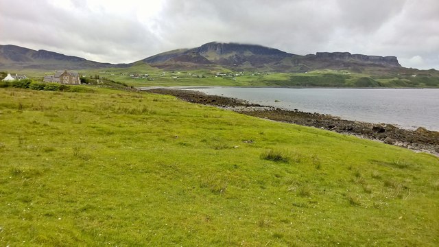
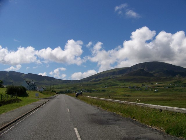
An Dig is a small village located in the county of Inverness-shire in the Scottish Highlands. Situated amidst stunning natural surroundings, it is nestled in the heart of the picturesque Glen Strathfarrar, approximately 15 miles west of Beauly.

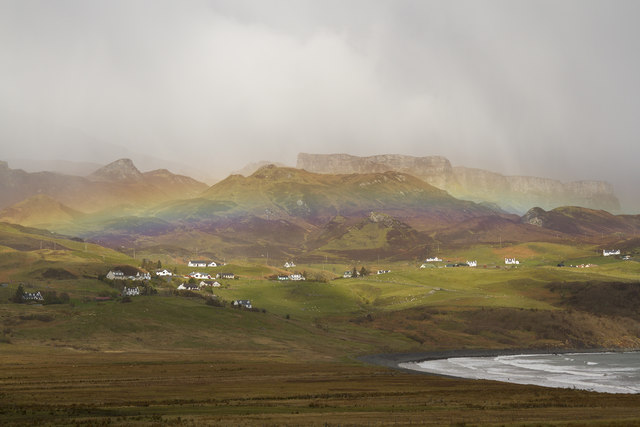
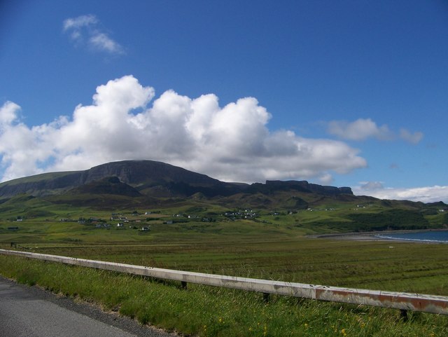
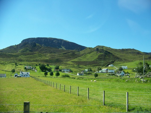
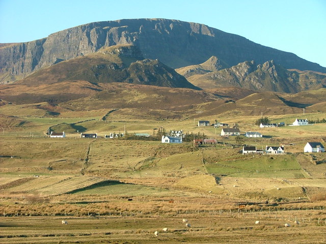
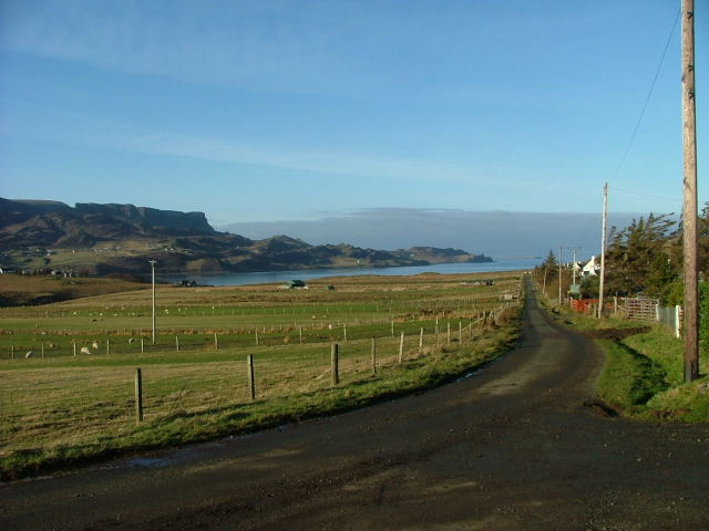
The village is known for its tranquility and its idyllic setting, making it a popular destination for nature enthusiasts and those seeking a peaceful retreat. An Dig is surrounded by lush green hills and mountains, with the River Farrar flowing nearby, providing ample opportunities for outdoor activities such as hiking, fishing, and wildlife spotting.

The village itself is small, with a handful of traditional stone houses and cottages dotted along its single road. There is no shop or post office in An Dig, making it a truly secluded and remote location. However, the nearest amenities can be found in nearby Beauly, which offers a range of shops, cafes, and accommodation options.

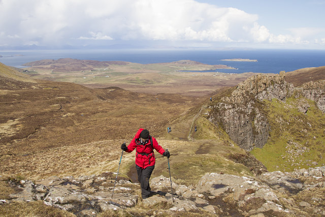
One of the main attractions near An Dig is the Glen Strathfarrar Nature Reserve, which is home to a variety of wildlife, including red deer, golden eagles, and red squirrels. The reserve offers several walking trails, allowing visitors to explore the natural beauty of the area.

Overall, An Dig is a charming and peaceful village that offers a unique opportunity to experience the tranquility of the Scottish Highlands. Its breathtaking natural surroundings and remote location make it an ideal destination for those looking to escape the hustle and bustle of everyday life.

If you have any feedback on the listing, please let us know in the comments section below.

An Dig Images

Images are sourced within 2km of 57.642283/-6.247292 or Grid Reference NG4669. Thanks to Geograph Open Source API. All images are credited.

Across Staffin Bay
Across Staffin Bay
Hill path to the Quirang
The Needle from below
Morning view to the Quiraing Long shadows from low winter sun show in this view from the escarpment north of Bioda Buidhe.
Morning view to the Quiraing
Long shadows from low winter sun show in this view from the escarpment north of Bioda Buidhe.
The Needle Quiraing A bright morning in the Quiraing after snow which had melted very quickly
The Needle Quiraing
A bright morning in the Quiraing after snow which had melted very quickly
A circular walk around the Quiraing A sunny day in Skye walking around the Quiraing.
A circular walk around the Quiraing
A sunny day in Skye walking around the Quiraing.
Stenscholl view with a rainbow As we drove up to the Quiraing this rainbow appeared over Stenscholl.
Stenscholl view with a rainbow
As we drove up to the Quiraing this rainbow appeared over Stenscholl.
The Quiraing from the footpath This small spectacular range of hills is in the far north of Skye and has some very interesting walks. Ours was made very wet by the melting snow, some of which you can see on the flat topped hills in the middle ground.
The Quiraing from the footpath
This small spectacular range of hills is in the far north of Skye and has some very interesting walks. Ours was made very wet by the melting snow, some of which you can see on the flat topped hills in the middle ground.
The Needle This spectacular pinnacle is called the Needle. If you walk up the steep slope to the side left hand side of the needle you come to a small flat grass covered area called the Table. If you walk up it is a very unexpected sight.
The Needle
This spectacular pinnacle is called the Needle. If you walk up the steep slope to the side left hand side of the needle you come to a small flat grass covered area called the Table. If you walk up it is a very unexpected sight.
Northeast gully dropping from The Table of Quiraing
Looking from Staffin Bay towards the crofts with the Quiraing in the background
A855 at Stenscholl
A855 at Stenscholl
Staffin Bay at Glashvin
The township of Digg
Road junction at Brogaig
Minor road from Uig to Staffin
The Table This area of flat land in the heart of the Quiraing lies partly in this and partly in the adjoining square.    It is said to have been the venue for an annual shinty match which must have been a rather hazardous undertaking.
The Table
This area of flat land in the heart of the Quiraing lies partly in this and partly in the adjoining square. It is said to have been the venue for an annual shinty match which must have been a rather hazardous undertaking.
The Prison
The Prison
Show me another place!

An Dig is located at Grid Ref: NG4669 (Lat: 57.642283, Lng: -6.247292)

Unitary Authority: Highland

Police Authority: Highlands and Islands

Also known as: Digg

What 3 Words

///cries.snuggled.active. Near Uig, Highland

Related Wikis

Quiraing

The Quiraing (Scottish Gaelic: A' Chuith-Raing) is a landslip on the eastern face of Meall na Suiramach, the northernmost summit of the Trotternish on...

Trotternish

Trotternish or Tròndairnis (Scottish Gaelic) is the northernmost peninsula of the Isle of Skye, in Scotland. Its most northerly point, Rubha Hùinis, is...

Brogaig

Brogaig (Scottish Gaelic: Brògaig), Norse for Burgh Bay, is a small coastal village, on the northwest coast of the Trotternish peninsula, close to Staffin...

Flodigarry

Flodigarry (Scottish Gaelic: Flòdaigearraidh) is a scattered settlement on the north east side of the Trotternish peninsula on the island of Skye, and...

Staffin Island

Staffin Island (possibly also known as Stenscholl Island) is an uninhabited islet off the east coast of the Trotternish peninsula of Skye in Scotland....

Staffin

Staffin (Scottish Gaelic: Stafain) is a district with the Gaelic name An Taobh Sear, which translates as "the East Side", on the northeast coast of the...

Garafad

Garafad or Garafad, (Scottish Gaelic: An Garradh Fada) is a linear crofting settlement on the east coast of the Trotternish Peninsula of Skye in the...
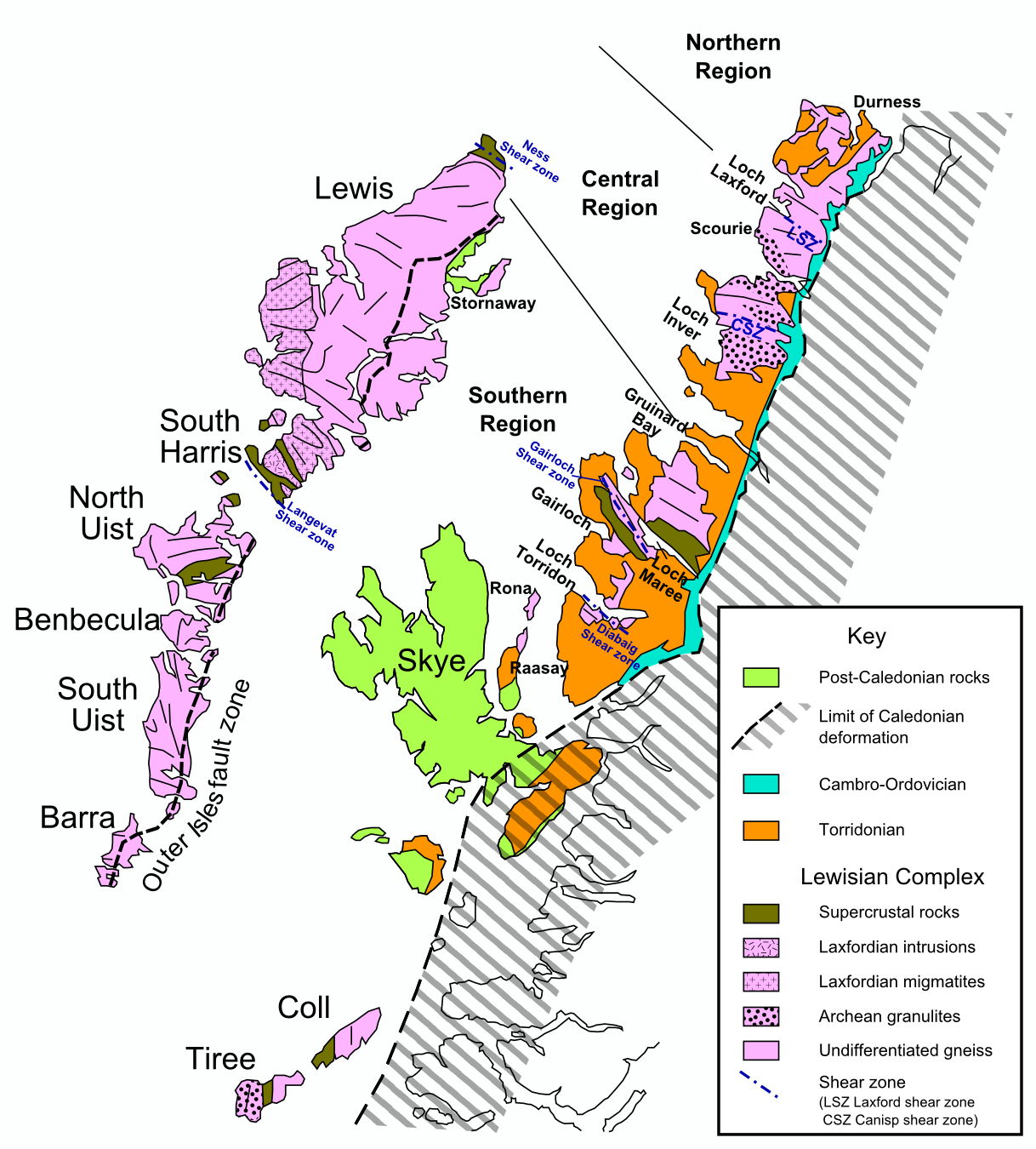
Hebridean Terrane

The Hebridean Terrane is one of the terranes that form part of the Caledonian orogenic belt in northwest Scotland. Its boundary with the neighbouring Northern...

Related Videos

Piękna Szkocja I Góry Quiairing ogromnym planem filmowym? Travel UK | SZKOCJA | Podróże

Góry Quiraing - Wyspa Skye - Szkocja W dzisiejszym filmie pokażemy wam naszą podróż w Góry Quiraing, czyli największe ...

Nearby Amenities

Located within 500m of 57.642283,-6.247292
Post Box
Check Date: 2021-05-31
Ref: IV51 72
Royal Cypher: scottish_crown
Source: survey
Lat/Long: 57.6391483/-6.2417521
Digg
Name Gd: An Dig
Place: hamlet
Source: survey
Lat/Long: 57.6417968/-6.243481
Bus Stop
Digg, Road End
Bus: yes
Naptan AtcoCode: 670088
Naptan NaptanCode: 45343268
Public Transport: platform
Lat/Long: 57.6427722/-6.2420168
Bus Stop
Digg, South Road End
Bus: yes
Naptan AtcoCode: 670091
Naptan NaptanCode: 45343273
Public Transport: platform
Lat/Long: 57.6392645/-6.2419146
Place: farm
Lat/Long: 57.6404875/-6.241821
Place: farm
Lat/Long: 57.6391552/-6.2452549
Power: pole
Lat/Long: 57.6395349/-6.2466924
Power: pole
Lat/Long: 57.6398312/-6.2462033
Power: pole
Lat/Long: 57.6401211/-6.2457182
Power: pole
Lat/Long: 57.6405294/-6.2450378
Power: pole
Lat/Long: 57.6409108/-6.2447076
Power: pole
Lat/Long: 57.6413557/-6.2443755
Power: pole
Lat/Long: 57.6399573/-6.2476164
Power: pole
Lat/Long: 57.6392483/-6.2461026
Power: pole
Lat/Long: 57.6388303/-6.245225
Power: pole
Lat/Long: 57.6383519/-6.2442024
Power: pole
Lat/Long: 57.6405736/-6.2484477
Power: pole
Lat/Long: 57.6410778/-6.2491845
Power: pole
Lat/Long: 57.6416596/-6.2500259
Power: pole
Lat/Long: 57.6422974/-6.249567
Power: pole
Lat/Long: 57.6428748/-6.2492086
Power: pole
Lat/Long: 57.6435514/-6.2487618
Power: pole
Lat/Long: 57.6442732/-6.2482907
Power: pole
Lat/Long: 57.6449626/-6.2478841
Power: pole
Lat/Long: 57.6452513/-6.2475781
Power: pole
Lat/Long: 57.6457792/-6.247091
Power: pole
Lat/Long: 57.6461864/-6.24662
Power: pole
Lat/Long: 57.6451371/-6.2468776
Power: pole
Lat/Long: 57.6450467/-6.246161
Power: pole
Lat/Long: 57.64487/-6.2449572
Power: pole
Lat/Long: 57.6446524/-6.2440635
Power: pole
Lat/Long: 57.644452/-6.2431818
Power: pole
Lat/Long: 57.6441288/-6.245072
Power: pole
Lat/Long: 57.6440383/-6.2457926
Power: pole
Lat/Long: 57.6439457/-6.2465857
Power: pole
Lat/Long: 57.6436839/-6.2469702
Power: pole
Lat/Long: 57.6433747/-6.247409
Power: pole
Lat/Long: 57.6434253/-6.247874
Barrier: cattle_grid
Lat/Long: 57.6440535/-6.2444836
Archaeological Site: hut_circle
Historic: archaeological_site
Lat/Long: 57.6454954/-6.2484151
Archaeological Site: hut_circle
Historic: archaeological_site
Lat/Long: 57.645293/-6.2481388
Barrier: cattle_grid
Lat/Long: 57.6426682/-6.2421914
The data included in this document is from www.openstreetmap.org. The data is made available under ODbL.

Have you been to An Dig?

Leave your review of An Dig below (or comments, questions and feedback).