Malin's Coppice

Wood, Forest in Derbyshire Amber Valley

England

Malin's Coppice

Near Wirksworth. A picture of one of the many narrow country lanes in this vicinity.
Near Wirksworth. Credit: Mike Fowkes

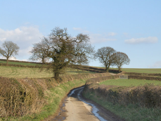
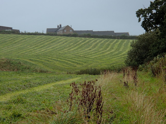
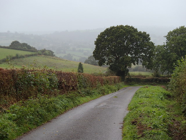
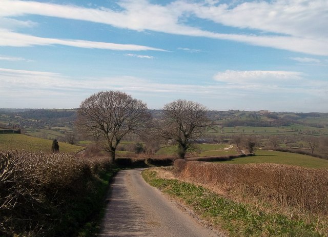
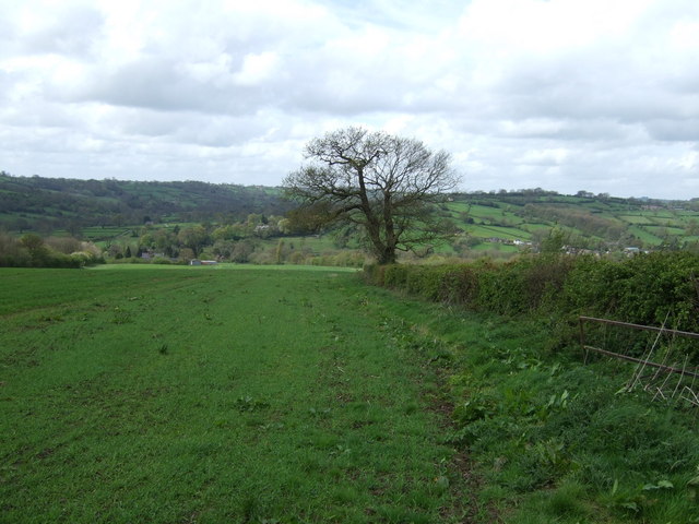
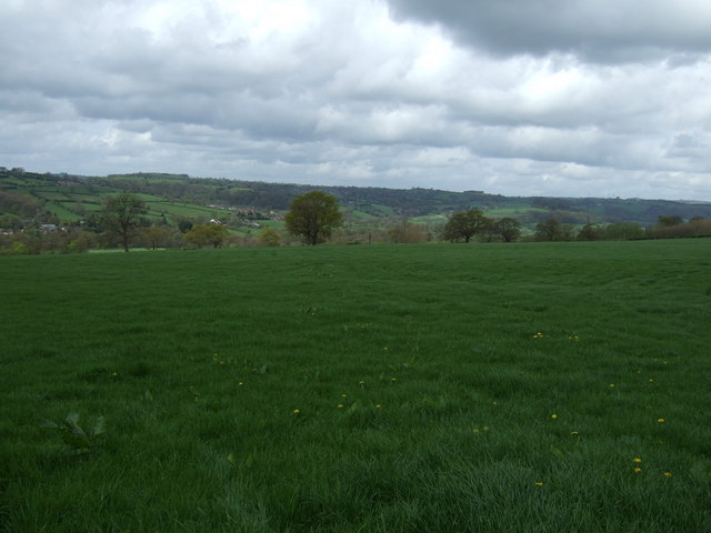
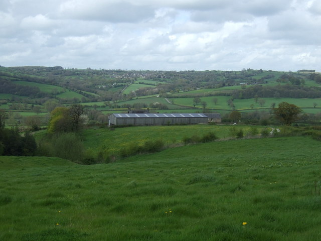
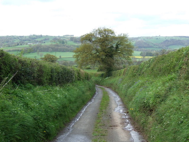
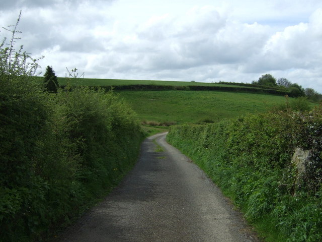
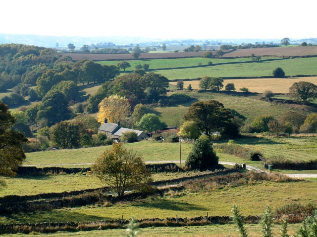
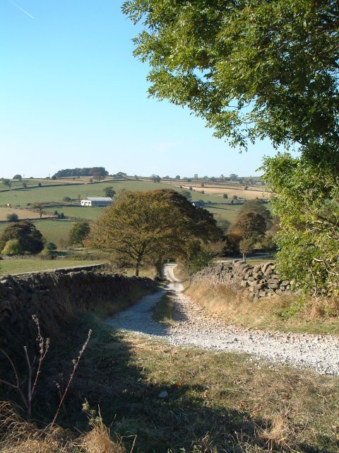
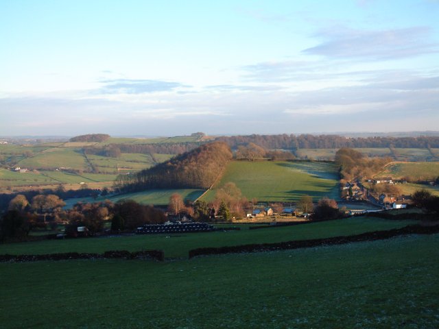
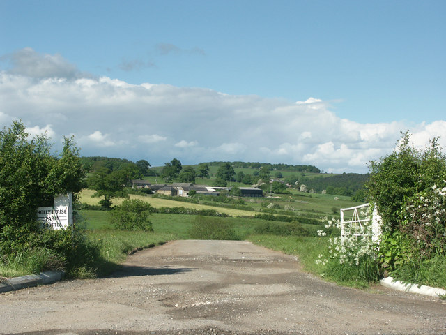
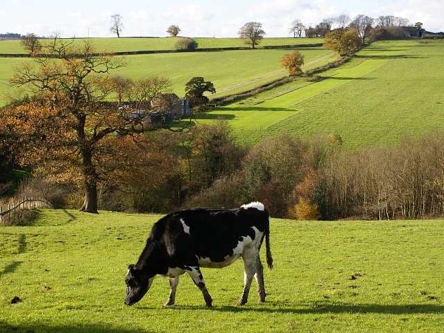
Malin's Coppice is a picturesque woodland located in Derbyshire, England. Situated near the village of Matlock, it covers an area of approximately 10 acres and is known for its natural beauty and diverse flora and fauna.

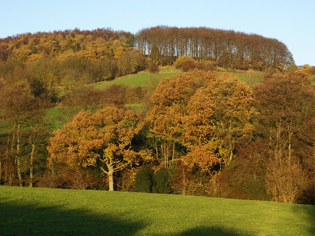
This ancient woodland is predominantly composed of deciduous trees such as oak, ash, beech, and birch, which create a dense canopy that provides shade and shelter. The forest floor is covered in a rich carpet of wildflowers, ferns, and mosses, making it a haven for wildlife.

Malin's Coppice is home to a variety of bird species, including woodpeckers, tits, and warblers, which can be spotted darting among the treetops. It also attracts small mammals like squirrels and hedgehogs, as well as a range of insects and butterflies.

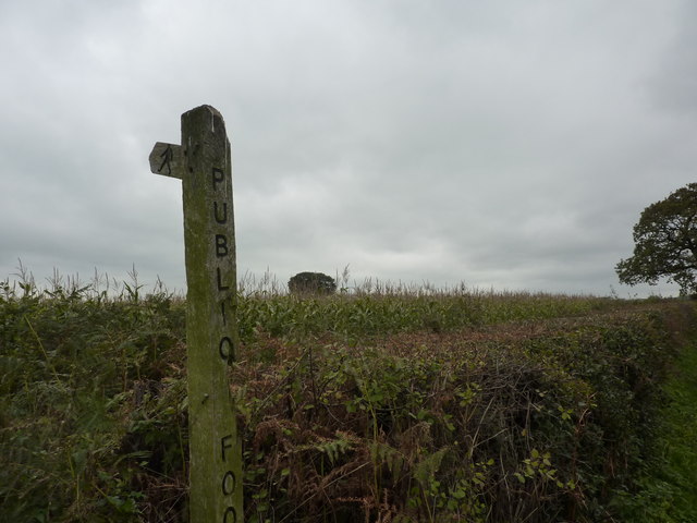
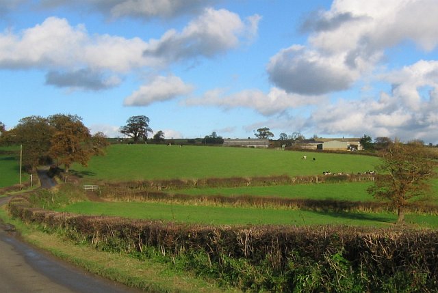
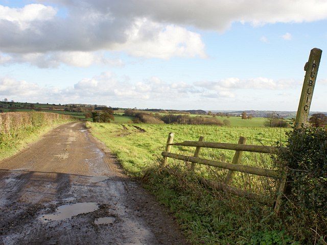
The woodland has a network of well-maintained walking trails, allowing visitors to explore its natural wonders at their own pace. These trails lead through enchanting glades, across babbling brooks, and up gentle hills, offering breathtaking views of the surrounding countryside.

Malin's Coppice is not only a place of natural beauty but also holds historical significance. It has been managed by local conservation organizations for many years, aiming to preserve its unique ecosystem and protect its ancient trees.

Overall, Malin's Coppice is a hidden gem in Derbyshire, offering visitors the chance to immerse themselves in nature, discover its rich biodiversity, and experience the tranquility of a truly enchanting woodland.

If you have any feedback on the listing, please let us know in the comments section below.

Malin's Coppice Images

Images are sourced within 2km of 53.043929/-1.5326094 or Grid Reference SK3149. Thanks to Geograph Open Source API. All images are credited.

Near Wirksworth. A picture of one of the many narrow country lanes in this vicinity.
Near Wirksworth.
A picture of one of the many narrow country lanes in this vicinity.
Field of corn and difficult footpath
Fields towards Manifold Farm Rows of recently cut grass.  Hoping in vain for drying weather.
Fields towards Manifold Farm
Rows of recently cut grass. Hoping in vain for drying weather.
Jebb's Lane The narrow country lane heads downhill, passing Manifold Farm lower down.
Jebb's Lane
The narrow country lane heads downhill, passing Manifold Farm lower down.
Jebb's Lane Looking west across the Ecclesbourne Valley and beyond towards Kirk Ireton.
Jebb's Lane
Looking west across the Ecclesbourne Valley and beyond towards Kirk Ireton.
Footpath towards Old Lane Heading west from Calladine Lane.
Footpath towards Old Lane
Heading west from Calladine Lane.
Farmland west of Calladine Lane
Grazing towards Manifold Farm
Downhill on Jebb's Lane
Unnamed lane of Jebb's Lane Towards Idridgehay
Unnamed lane of Jebb's Lane
Towards Idridgehay
Farm buildings near Belper SK328493. Looking south-west from Longwalls Lane. The northern tip of Handley Wood is visible to the left.
Farm buildings near Belper
SK328493. Looking south-west from Longwalls Lane. The northern tip of Handley Wood is visible to the left.
Looking south along Longwalls Lane, part of the Midshires Way
View south-east of Belper Lane End Grid reference given is of the centre of the village; photographer position is the slightly off-square SK333494 (sorry!)
View south-east of Belper Lane End
Grid reference given is of the centre of the village; photographer position is the slightly off-square SK333494 (sorry!)
Near Shottlegate Picture shows the gateway to Holly House farm.
Near Shottlegate
Picture shows the gateway to Holly House farm.
Handley Wood The footpath from Plains Lane leads down over Black Brook, shown by the first line of trees, up to Handley Woods. Further north, Plains Lane appears to end in a farmyard. Had I been brave enough to open the gate, maybe I would have found my way to Lambhouse Lane!
Handley Wood
The footpath from Plains Lane leads down over Black Brook, shown by the first line of trees, up to Handley Woods. Further north, Plains Lane appears to end in a farmyard. Had I been brave enough to open the gate, maybe I would have found my way to Lambhouse Lane!
White House Farm and fields The buildings of White House Farm can be seen across the fields. A footpath crosses Lambhouse Lane in a dip in the road.
White House Farm and fields
The buildings of White House Farm can be seen across the fields. A footpath crosses Lambhouse Lane in a dip in the road.
Footpath between Lambhouse Lane and Callandine Lane The footpath leads down past the cow over Franker Brook (hidden by trees), then up past Hole Cottage to Newbuildings Farm. The field between Hole cottage an Newbuildings Farm has a rather curiously mown strip of grass. Has someone got their own driving range?
Footpath between Lambhouse Lane and Callandine Lane
The footpath leads down past the cow over Franker Brook (hidden by trees), then up past Hole Cottage to Newbuildings Farm. The field between Hole cottage an Newbuildings Farm has a rather curiously mown strip of grass. Has someone got their own driving range?
Track and footpath to Carrbrook Farm This footpath leads from Calladine Lane, past Carrbrook Farm to Lambhouse Lane.
Track and footpath to Carrbrook Farm
This footpath leads from Calladine Lane, past Carrbrook Farm to Lambhouse Lane.
Show me another place!

Malin's Coppice is located at Grid Ref: SK3149 (Lat: 53.043929, Lng: -1.5326094)

Administrative County: Derbyshire

District: Amber Valley

Police Authority: Derbyshire

What 3 Words

///analogy.tortoises.hardens. Near Belper, Derbyshire

Nearby Locations

Malin's Coppice Shottle

Related Wikis

Shottle

Shottle is a village approximately 3 miles (4.8 km) south of the market town of Wirksworth in Derbyshire. The population of the civil parish (Shottle and...

Shottle and Postern

Shottle and Postern is a civil parish within the Amber Valley district, which is in the county of Derbyshire, England. Sparsely built up with much rural...

Duffield Frith

Duffield Frith was, in medieval times, an area of Derbyshire in England, part of that bestowed upon Henry de Ferrers (or Ferrars) by King William, controlled...

Belper Lane End

Belper Lane End is a village in the civil parish of Belper, in the Amber Valley district, in the county of Derbyshire, England. == History == Belper lane...

Alport Height

Alport Height is a hill near Wirksworth in Derbyshire. It is a popular picnic site, since it has extensive views to the South, and is the first hill over...

Idridgehay and Alton

Idridgehay and Alton is a civil parish in the Amber Valley district of Derbyshire, England. The population of the civil parish taken at the 2011 Census...

Idridgehay railway station

Idridgehay railway station is an intermediate station on the former Midland Railway branch line to the town of Wirksworth in Derbyshire. Off the Midland...

Idridgehay

Idridgehay is a village in the civil parish of Idridgehay and Alton, in the Amber Valley district of Derbyshire, England. The population of this parish...

Nearby Amenities

Located within 500m of 53.043929,-1.5326094
Shottle
Place: village
Wikidata: Q7502589
Lat/Long: 53.0434321/-1.5355353
Barrier: stile
Material: wood
Stile: squeezer
Lat/Long: 53.0409268/-1.5321542
Power: pole
Lat/Long: 53.0409869/-1.5357548
Power: pole
Lat/Long: 53.0409805/-1.5321278
Power: pole
Lat/Long: 53.0426029/-1.5271213
Barrier: stile
Stile: squeezer
Lat/Long: 53.0421927/-1.5294513
Barrier: stile
Material: wood
Steps: 2
Stile: stepover
Lat/Long: 53.0417565/-1.5280316
Ele: 219.0000000
Lat/Long: 53.0464855/-1.5313547
Barrier: stile
Ele: 230.0000000
Material: stone
Stile: squeezer
Lat/Long: 53.0473101/-1.535646
Barrier: stile
Ele: 229.0000000
Material: stone
Stile: squeezer
Lat/Long: 53.0472161/-1.5358077
Barrier: stile
Material: stone
Stile: squeezer
Lat/Long: 53.0442001/-1.5335032
Barrier: stile
Material: wood
Note: wood stepover through stone squeezer.
Steps: 2
Stile: stepover
Lat/Long: 53.0436727/-1.5331206
Barrier: stile
Material: stone
Source: survey;gps
Stile: squeezer
Lat/Long: 53.040953/-1.5270272
Barrier: stile
Material: wood
Source: survey;gps
Stile: stepover
Lat/Long: 53.0413607/-1.535711
Pipeline: marker
Source: survey
Substance: gas
Support: pole
Lat/Long: 53.0408847/-1.5314713
Power: pole
Lat/Long: 53.0409847/-1.5348494
Power: pole
Lat/Long: 53.0409755/-1.5330592
Power: pole
Lat/Long: 53.0409908/-1.5366409
Power: pole
Lat/Long: 53.0409932/-1.5375584
Power: pole
Lat/Long: 53.0409764/-1.5340016
Power: pole
Lat/Long: 53.0412399/-1.531382
Power: pole
Lat/Long: 53.0415155/-1.530579
Power: pole
Lat/Long: 53.0418145/-1.5297203
Power: pole
Lat/Long: 53.042109/-1.5288472
Power: pole
Lat/Long: 53.0423803/-1.5281041
Power: pole
Lat/Long: 53.0428232/-1.526186
Power: pole
Lat/Long: 53.0431362/-1.5255136
Barrier: stile
Material: stone
Source: survey;gps
Stile: squeezer
Lat/Long: 53.0439154/-1.5351664
Barrier: stile
Material: stone
Source: survey;gps
Stile: squeezer
Lat/Long: 53.0447969/-1.5358572
Barrier: stile
Material: stone
Source: survey;gps
Stile: squeezer
Lat/Long: 53.0469549/-1.5351982
Barrier: stile
Material: wood
Source: survey;gps
Stile: stepover
Lat/Long: 53.044615/-1.5372182
Dannah Farm Country House
Addr City: Belper
Addr Country: GB
Addr Housename: Dannah Farm
Addr Postcode: DE56 2DR
Addr Street: Bomans Lane
Fhrs Id: 882
Tourism: guest_house
Lat/Long: 53.0481662/-1.5338963
Barrier: stile
Material: wood
Source: survey;gps
Stile: stepover
Lat/Long: 53.0429434/-1.530964
Barrier: stile
Material: wood
Source: survey;gps
Stile: stepover
Lat/Long: 53.0407335/-1.5309769
Barrier: stile
Material: stone
Source: survey;gps
Stile: squeezer
Lat/Long: 53.0403951/-1.5288888
Barrier: stile
Material: wood
Source: survey;gps
Stile: stepover
Lat/Long: 53.0473007/-1.5356442
The data included in this document is from www.openstreetmap.org. The data is made available under ODbL.

Have you been to Malin's Coppice?

Leave your review of Malin's Coppice below (or comments, questions and feedback).