Tender Heads Plantations

Wood, Forest in Yorkshire Hambleton

England

Tender Heads Plantations

St Mary's churchyard, East Cowton - headstones St Mary's was a medieval church, half a mile west of the village, which fell into ruin after being replaced by the present All Saints in the village in 1910. The ruins were demolished c.1968. The churchyard remains open for burials as can be seen by the recent headstone in the foreground to Ursula and James Kinsella.
St Mary's churchyard, East Cowton - headstones Credit: Diocese of Leeds

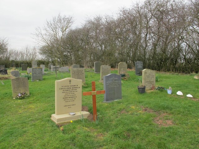
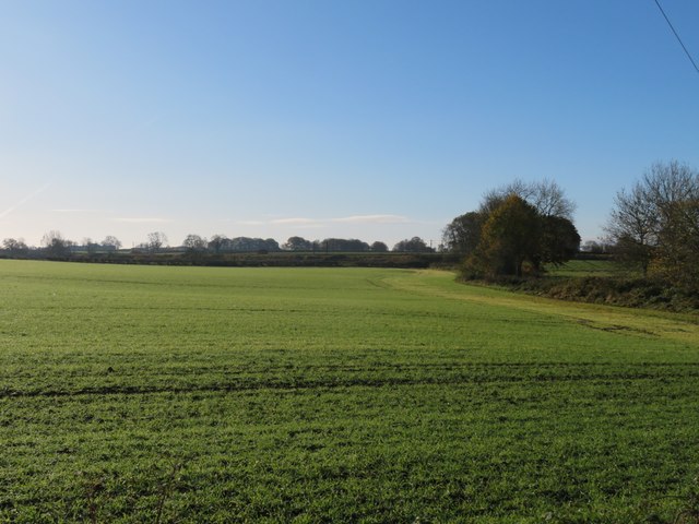
Tender Heads Plantations, located in Yorkshire, is a picturesque woodland area renowned for its beautiful and well-preserved forests. Situated in the heart of Yorkshire, this plantation covers a vast area of land and is a popular destination for nature enthusiasts and outdoor lovers.

The forest in Tender Heads Plantations is characterized by a diverse range of trees, including oak, beech, and pine, creating a rich and vibrant ecosystem. The woodland is carefully managed to ensure the preservation of its natural beauty and to provide a habitat for various wildlife species.

Visitors to Tender Heads Plantations can explore the numerous walking trails and pathways that wind through the forest, offering a chance to immerse oneself in the serene and tranquil surroundings. The well-maintained trails provide an opportunity for hikers and nature lovers to witness the harmonious coexistence of flora and fauna.

Additionally, Tender Heads Plantations offers educational programs and guided tours for visitors interested in learning more about the plantation's history, conservation efforts, and the importance of sustainable forestry practices. These initiatives aim to promote awareness and appreciation for the natural environment.

The plantation also features a visitor center, where guests can access information about the area, purchase local products, and enjoy refreshments. The center serves as a hub for visitors seeking to gather knowledge about the plantation and its surrounding area.

Overall, Tender Heads Plantations in Yorkshire is a prime example of a well-preserved and managed woodland, providing a haven for nature enthusiasts and offering a range of activities and educational opportunities for visitors to enjoy.

If you have any feedback on the listing, please let us know in the comments section below.

Tender Heads Plantations Images

Images are sourced within 2km of 54.433596/-1.5170793 or Grid Reference NZ3104. Thanks to Geograph Open Source API. All images are credited.

St Mary's churchyard, East Cowton - headstones St Mary's was a medieval church, half a mile west of the village, which fell into ruin after being replaced by the present All Saints in the village in 1910. The ruins were demolished c.1968. The churchyard remains open for burials as can be seen by the recent headstone in the foreground to Ursula and James Kinsella.
St Mary's churchyard, East Cowton - headstones
St Mary's was a medieval church, half a mile west of the village, which fell into ruin after being replaced by the present All Saints in the village in 1910. The ruins were demolished c.1968. The churchyard remains open for burials as can be seen by the recent headstone in the foreground to Ursula and James Kinsella.
St Mary's churchyard, East Cowton - chest tomb St Mary's was a medieval church, half a mile west of the village, which fell into ruin after being replaced by the present All Saints in the village in 1910. The ruins were just beyond the end of the path in this view but were demolished c.1968.
St Mary's churchyard, East Cowton - chest tomb
St Mary's was a medieval church, half a mile west of the village, which fell into ruin after being replaced by the present All Saints in the village in 1910. The ruins were just beyond the end of the path in this view but were demolished c.1968.
St Mary's churchyard, East Cowton - trees A pair of Irish yew trees.
St Mary's churchyard, East Cowton - trees
A pair of Irish yew trees.
All Saints, East Cowton - north side The church was built in 1909, architects Woolfall & Eccles of Liverpool, and is grade II listed (list entry 1376534).
All Saints, East Cowton - north side
The church was built in 1909, architects Woolfall & Eccles of Liverpool, and is grade II listed (list entry 1376534).
All Saints, East Cowton - south side The church was built in 1909, architects Woolfall & Eccles of Liverpool, and is grade II listed (list entry 1376534). The southern extension is more recent.
All Saints, East Cowton - south side
The church was built in 1909, architects Woolfall & Eccles of Liverpool, and is grade II listed (list entry 1376534). The southern extension is more recent.
All Saints, East Cowton - east end The church was built in 1909, architects Woolfall & Eccles of Liverpool, and is grade II listed (list entry 1376534). The east window looks to have been designed for a single stained glass scene, but has been partly infilled with stone with a few smaller glazed panels.
All Saints, East Cowton - east end
The church was built in 1909, architects Woolfall & Eccles of Liverpool, and is grade II listed (list entry 1376534). The east window looks to have been designed for a single stained glass scene, but has been partly infilled with stone with a few smaller glazed panels.
All Saints, East Cowton - interior with organ An unusual arrangement with the organ forming a barrier between the nave and chancel. This suggests it is a later addition but the National Pipe Organ Register says the organ came from St Mary, Staindrop in 1909 (i.e. when All Saints was built) and was restored in 1991. See <a href="https://www.geograph.org.uk/photo/7364250">NZ3003 : All Saints, East Cowton - north side</a> for the outside.
All Saints, East Cowton - interior with organ
An unusual arrangement with the organ forming a barrier between the nave and chancel. This suggests it is a later addition but the National Pipe Organ Register says the organ came from St Mary, Staindrop in 1909 (i.e. when All Saints was built) and was restored in 1991. See NZ3003 : All Saints, East Cowton - north side for the outside.
All Saints, East Cowton - war memorial Erected in 1921 and grade II listed (list entry 1452758).
All Saints, East Cowton - war memorial
Erected in 1921 and grade II listed (list entry 1452758).
Frigidale Wood
Frigidale Wood
Village street East Cowton Towards the eastern end of the village. The turning for Birkby is by the white house in the distance.
Village street East Cowton
Towards the eastern end of the village. The turning for Birkby is by the white house in the distance.
Village Hall, East Cowton I believe the hall is one of several in this part of North Yorkshire which were originally military buildings at Catterick. At the far end of the hall is a small village shop.
Village Hall, East Cowton
I believe the hall is one of several in this part of North Yorkshire which were originally military buildings at Catterick. At the far end of the hall is a small village shop.
Across a corner of the grid square Agricultural land to the NE of East Cowton. The hedge to the right marks the line of a small beck which seems destined to eventually join the Wiske. A straight line in the distance is that of the main east coast railway line.
Across a corner of the grid square
Agricultural land to the NE of East Cowton. The hedge to the right marks the line of a small beck which seems destined to eventually join the Wiske. A straight line in the distance is that of the main east coast railway line.
Minor road at Stone Riggs A mile long lane connecting two rather more used roads in East Cowton parish.
Minor road at Stone Riggs
A mile long lane connecting two rather more used roads in East Cowton parish.
A section of the old road The current OS map gives some clues as to the old route of the A167, which at one time meandered its way along here, past Plantation House and onwards towards Dalton on Tees. My guess is that the route was improved in the 1950's, as were several other sections of main roads in the old North Riding in that decade.
A section of the old road
The current OS map gives some clues as to the old route of the A167, which at one time meandered its way along here, past Plantation House and onwards towards Dalton on Tees. My guess is that the route was improved in the 1950's, as were several other sections of main roads in the old North Riding in that decade.
A167 towards Dalton on Tees Taken from a point where an overgrown section of the former road joins the current route, which was probably upgraded in the 1950's. The current OS map indicates several sections of old road meanders along here, but most have now virtually disappeared except for the nest meander on the right, some 300m further on.
A167 towards Dalton on Tees
Taken from a point where an overgrown section of the former road joins the current route, which was probably upgraded in the 1950's. The current OS map indicates several sections of old road meanders along here, but most have now virtually disappeared except for the nest meander on the right, some 300m further on.
Approaching a junction on A167 Ahead and to the right, a vehicle waits to turn on to the A167 from the B1263, the turning being right on the grid line. The A167 between Croft on Tees and Northallerton is generally a pleasant road to drive as it carries relatively little traffic.
Approaching a junction on A167
Ahead and to the right, a vehicle waits to turn on to the A167 from the B1263, the turning being right on the grid line. The A167 between Croft on Tees and Northallerton is generally a pleasant road to drive as it carries relatively little traffic.
Grazing, Cowton Moor
Farm track, Cowton Moor Looking north from the B1263.
Farm track, Cowton Moor
Looking north from the B1263.
Show me another place!

Tender Heads Plantations is located at Grid Ref: NZ3104 (Lat: 54.433596, Lng: -1.5170793)

Division: North Riding

Administrative County: North Yorkshire

District: Hambleton

Police Authority: North Yorkshire

What 3 Words

///distilled.drama.sake. Near Hurworth, Co. Durham

Nearby Locations

Tender Heads Plantations

Related Wikis

Cowton railway station

Cowton railway station is a disused station on the East Coast Main Line, it is situated in the Hambleton district of North Yorkshire in England the station...

East Cowton

East Cowton is a village and civil parish in the Hambleton District of North Yorkshire, England. It is 7 miles (11 km) north west of the county town of...

Temple Cowton Preceptory

Temple Cowton Preceptory was a priory in North Yorkshire, England. The preceptory was in the village of East Cowton, 5 miles (8 km) north west of Northallerton...

Eryholme railway station

Eryholme railway station, originally named as Dalton Junction, was a railway station located on the East Coast Main Line between Northallerton and Darlington...

Dalton Gates

Dalton Gates is a hamlet in the Richmondshire district of North Yorkshire, England. The hamlet was built up around the now disused railway station that...

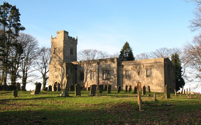
St Mary's Church, South Cowton

St Mary's Church is a redundant Anglican church standing in open countryside in the former village of South Cowton, near Scotch Corner in North Yorkshire...

Birkby, North Yorkshire

Birkby is a village and civil parish about 6 miles north of the county town of Northallerton in the Hambleton district of North Yorkshire, England. The...

North Cowton

North Cowton is a village and civil parish, located in Richmondshire, North Yorkshire, England. It is 8 miles (13 km) north-west of the county town of...

Nearby Amenities

Located within 500m of 54.433596,-1.5170793
Railway: signal
Railway Signal Direction: forward
Railway Signal Main: GB-NR:main
Railway Signal Main Design: individual
Railway Signal Main Form: light
Railway Signal Main Height: normal
Railway Signal Main States: red;green;yellow;flashing_yellow;double_yellow;flashing_double_yellow
Railway Signal Operator: Network Rail
Railway Signal Position: left
Railway Signal Route: GB-NR:junction
Railway Signal Route Design: feather
Railway Signal Route Form: light
Railway Signal Route States: position_4;off
Lat/Long: 54.4341269/-1.5166082
Railway: signal
Railway Signal Direction: backward
Railway Signal Main: GB-NR:main
Railway Signal Main Design: individual
Railway Signal Main Form: light
Railway Signal Main Height: normal
Railway Signal Main States: red;green;yellow;flashing_yellow;double_yellow;flashing_double_yellow
Railway Signal Operator: Network Rail
Railway Signal Position: left
Railway Signal Route: GB-NR:junction
Railway Signal Route Design: feather
Railway Signal Route Form: light
Railway Signal Route States: position_1;off
Lat/Long: 54.4341062/-1.5166715
The data included in this document is from www.openstreetmap.org. The data is made available under ODbL.

Have you been to Tender Heads Plantations?

Leave your review of Tender Heads Plantations below (or comments, questions and feedback).