Hungerford Copse

Wood, Forest in Hampshire New Forest

England

Hungerford Copse

Garden at White Hart Public House
Garden at White Hart Public House Credit: Paul Collins

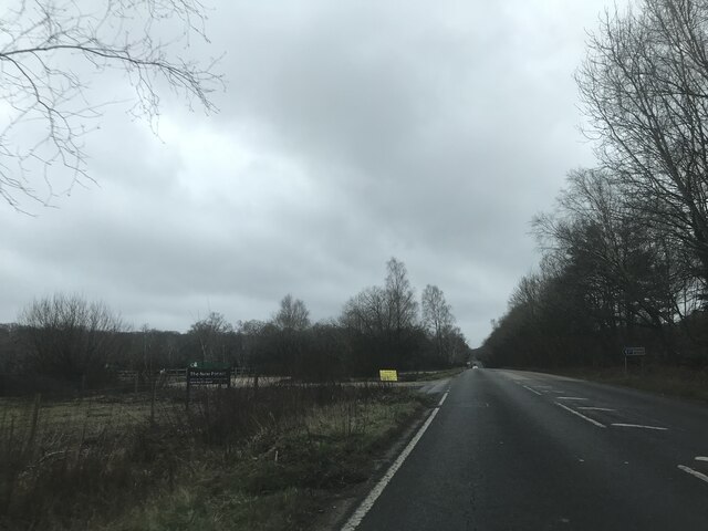
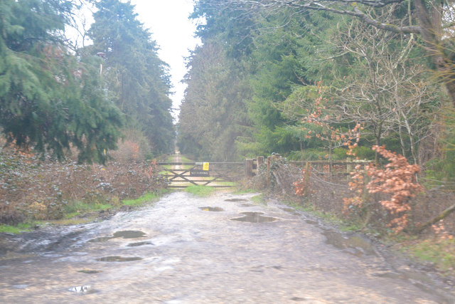
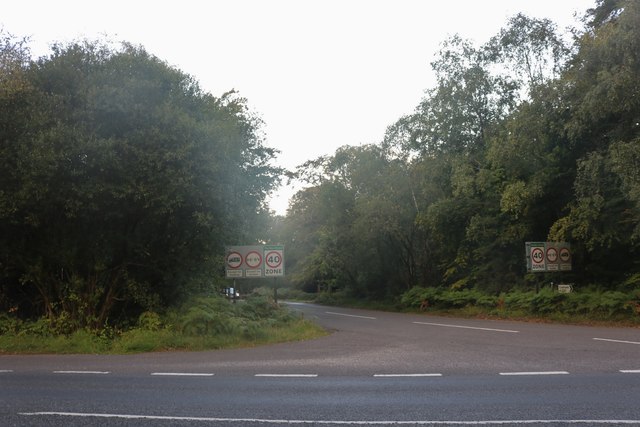
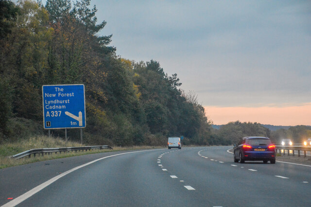
Hungerford Copse is a picturesque woodland located in Hampshire, England. Spanning over a vast area of approximately 500 acres, this dense forest is a haven for nature enthusiasts and a popular destination for outdoor activities. Situated near the village of Hungerford, the copse offers a peaceful and serene atmosphere that invites visitors to relax and reconnect with nature.

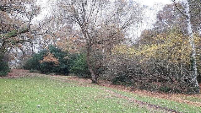
The copse is predominantly composed of native broadleaf trees, such as oak, beech, and ash, which form a dense canopy that provides shade and shelter to a variety of wildlife. The forest floor is covered in a thick carpet of moss and wildflowers, creating a vibrant and colorful landscape. Walking through the copse, visitors can observe a diverse range of flora and fauna, including various species of birds, butterflies, and small mammals.

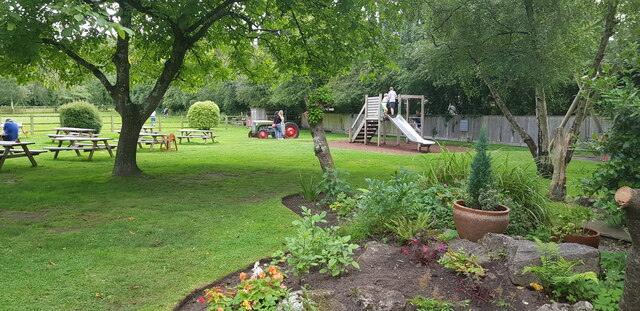
Hungerford Copse is intersected by a network of well-maintained footpaths and trails, making it an ideal location for hiking, cycling, and horseback riding. The copse also features a designated picnic area, where visitors can enjoy a packed lunch amidst the tranquility of the forest. Additionally, the copse has several designated camping spots, allowing visitors to immerse themselves in the natural beauty of the area for an extended period.

The copse is managed by local authorities, who ensure the preservation of its natural beauty and the protection of its wildlife. Educational programs and guided tours are often organized to educate visitors about the copse's ecology and history. Hungerford Copse is truly a gem in Hampshire, offering a peaceful retreat for nature lovers and a valuable habitat for a wide range of flora and fauna.

If you have any feedback on the listing, please let us know in the comments section below.

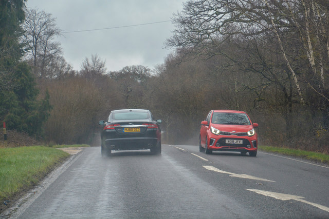
Hungerford Copse Images

Images are sourced within 2km of 50.915034/-1.5558067 or Grid Reference SU3112. Thanks to Geograph Open Source API. All images are credited.

Garden at White Hart Public House
Car Park off A337 - southbound
Haydon Tyres, Cadnam Bright afternoon sunlight on 1 November, but it was raining hard soon afterwards.
Haydon Tyres, Cadnam
Bright afternoon sunlight on 1 November, but it was raining hard soon afterwards.
Cadnam, White Hart Free House on Romsey Road. Central bar, with drinking at eating areas on three sides; garden. Cask ales on offer at my visit: Brunning & Price Original, Flack's Double, Hop Back GB, Itchen Valley Bulgarum. The pub also stocks a wide range of gins.
Cadnam, White Hart
Free House on Romsey Road. Central bar, with drinking at eating areas on three sides; garden. Cask ales on offer at my visit: Brunning & Price Original, Flack's Double, Hop Back GB, Itchen Valley Bulgarum. The pub also stocks a wide range of gins.
Ponies by Cricket Field car park, New Forest
New Forest : The A337 Looking along the A337 in the New Forest.
New Forest : The A337
Looking along the A337 in the New Forest.
New Forest : Track A track off of the A337 through the woods.
New Forest : Track
A track off of the A337 through the woods.
Romsey Road, Cadnam
Romsey Road, Cadnam
Crossroads on the A337 south of Cadnam
Petrol station on Romsey Road, Cadnam
Haydon Tyres on Romsey Road, Cadnam
Romsey Road, Cadnam
Romsey Road, Cadnam
Romsey Road, Cadnam
Romsey Road, Cadnam
Junction on the A337 south of Cadnam Looking towards the New Forest
Junction on the A337 south of Cadnam
Looking towards the New Forest
Roundabout on Romsey Road, Cadnam Entering the New Forest from the north
Roundabout on Romsey Road, Cadnam
Entering the New Forest from the north
Forest path near Bartley Lodge Hotel
Full ditch and waterlogged field at the White Hart
Copythorne : M27 Motorway Looking along the M27 motorway.
Copythorne : M27 Motorway
Looking along the M27 motorway.
Show me another place!

Hungerford Copse is located at Grid Ref: SU3112 (Lat: 50.915034, Lng: -1.5558067)

Administrative County: Hampshire

District: New Forest

Police Authority: Hampshire

What 3 Words

///amends.wolves.nipping. Near Cadnam, Hampshire

Related Wikis

Bartley, Hampshire

Bartley is a village in Hampshire, England, within the boundaries of the New Forest National Park, seven miles (11 km) west of Southampton. == Overview... ==

Winsor, Hampshire

Winsor is a village in the civil parish of Copythorne, in Hampshire, England. It is situated within the boundaries of the New Forest National Park. Surrounding...

Bartley Lodge

Bartley Lodge is a country house near Cadnam in Hampshire, England, within the boundaries of the New Forest National Park. It was built in the 18th century...

Woodlands, Hampshire

Woodlands is a village in the New Forest National Park of Hampshire, England. The village lies 6 miles (9.7 km) west from Southampton and 2+3⁄4 miles...

Netley Marsh

Netley Marsh is a village and civil parish in Hampshire, close to the town of Totton. It lies within the New Forest District, and the New Forest National...

Copythorne

Copythorne is a village and civil parish in Hampshire, England, within the boundaries of the New Forest National Park. == Overview == Copythorne is in...

Cadnam

Cadnam is a village situated in Hampshire, England, within the boundaries of the New Forest National Park. The village has existed since the medieval period...

Copythorne Common

Copythorne Common is a 17-hectare (42-acre) nature reserve west of Southampton in Hampshire. It is managed by the Hampshire and Isle of Wight Wildlife...

Nearby Amenities

Located within 500m of 50.915034,-1.5558067
Bus Stop
Bourne Bridge
Bench: no
Bin: no
Bus: yes
Lit: no
Naptan AtcoCode: 1900HA080134
Naptan Bearing: N
Naptan CommonName: Bourne Bridge
Naptan Crossing: Paradise Lane
Naptan NaptanCode: hamajpjt
Naptan Street: Bourne Road
Naptan Verified: no
Public Transport: platform
Shelter: no
Source: naptan_import
Tactile Paving: no
Lat/Long: 50.9121145/-1.5536128
Bus Stop
Bourne Bridge
Bench: no
Bin: no
Bus: yes
Lit: no
Naptan AtcoCode: 1900HA080135
Naptan Bearing: S
Naptan CommonName: Bourne Bridge
Naptan Crossing: Paradise Lane
Naptan NaptanCode: hamajpma
Naptan Street: Bourne Road
Naptan Verified: no
Public Transport: platform
Shelter: no
Source: naptan_import
Tactile Paving: no
Lat/Long: 50.9120641/-1.5531924
Bus Stop
Bartley Cafe
Bench: no
Bin: no
Bus: yes
Lit: no
Naptan AtcoCode: 1900HA080136
Naptan Bearing: W
Naptan CommonName: Bartley Cafe
Naptan Crossing: Bourne Road
Naptan NaptanCode: hamajpjd
Naptan Street: Chinham Road
Naptan Verified: no
Public Transport: platform
Shelter: no
Source: naptan_import
Tactile Paving: no
Lat/Long: 50.9147758/-1.5537
Bus Stop
Bartley Cafe
Bench: no
Bin: no
Bus: yes
Lit: no
Naptan AtcoCode: 1900HA080137
Naptan Bearing: E
Naptan CommonName: Bartley Cafe
Naptan Crossing: Bourne Road
Naptan NaptanCode: hamajpjg
Naptan Street: Chinham Road
Naptan Verified: no
Public Transport: platform
Shelter: no
Source: naptan_import
Tactile Paving: no
Lat/Long: 50.9148563/-1.5536725
Bus Stop
Middle Chinham Road
Bus: yes
Naptan AtcoCode: 1900HA080138
Naptan Bearing: W
Naptan CommonName: Middle Chinham Road
Naptan Crossing: Riverside Close
Naptan NaptanCode: hamajmwm
Naptan Street: Chinham Road
Naptan Verified: no
Source: naptan_import
Lat/Long: 50.9140813/-1.5579992
Bus Stop
Middle Chinham Road
Bus: yes
Naptan AtcoCode: 1900HA080139
Naptan Bearing: E
Naptan CommonName: Middle Chinham Road
Naptan NaptanCode: hamajmwj
Naptan Street: Chinham Road
Naptan Verified: no
Public Transport: platform
Source: naptan_import
Lat/Long: 50.9141661/-1.5579942
Bus Stop
Shepherds Road
Bus: yes
Naptan AtcoCode: 1900HA080140
Naptan Bearing: E
Naptan CommonName: Shepherds Road
Naptan Crossing: Shepherds Road
Naptan NaptanCode: hamajmdw
Naptan Street: Chinham Road
Naptan Verified: no
Source: naptan_import
Lat/Long: 50.9143566/-1.56278
Bus Stop
Shepherds Road
Bus: yes
Naptan AtcoCode: 1900HA080141
Naptan Bearing: W
Naptan CommonName: Shepherds Road
Naptan Crossing: Shepherds Road
Naptan NaptanCode: hamajmga
Naptan Street: Chinham Road
Naptan Verified: no
Source: naptan_import
Lat/Long: 50.9142616/-1.5627805
Bus Stop
Bartley Cafe
Bus: yes
Naptan AtcoCode: 1900HAA09369
Naptan Bearing: E
Naptan CommonName: Bartley Cafe
Naptan Crossing: Bourne Road
Naptan NaptanCode: hamjdpgj
Naptan Street: Ringwood Road
Naptan Verified: no
Public Transport: platform
Source: naptan_import
Lat/Long: 50.9149946/-1.5521474
Bus Stop
Bartley Cafe
Bus: yes
Naptan AtcoCode: 1900HAA09370
Naptan Bearing: W
Naptan CommonName: Bartley Cafe
Naptan Crossing: Bourne Road
Naptan NaptanCode: hamjdpgm
Naptan Street: Ringwood Road
Naptan Verified: no
Public Transport: platform
Source: naptan_import
Lat/Long: 50.9148777/-1.5521343
Layby
Lat/Long: 50.9158037/-1.5561902
Communication Mobile Phone: yes
Man Made: tower
Tower Construction: mast
Tower Type: communication
Lat/Long: 50.914843/-1.5523656
The data included in this document is from www.openstreetmap.org. The data is made available under ODbL.

Have you been to Hungerford Copse?

Leave your review of Hungerford Copse below (or comments, questions and feedback).