Oakley Wood

Wood, Forest in Warwickshire Warwick

England

Oakley Wood

Banbury Road, B4100
Banbury Road, B4100 Credit: David Dixon

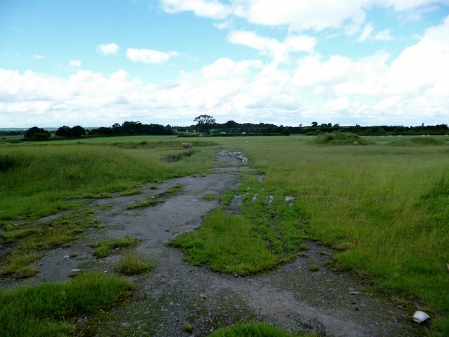
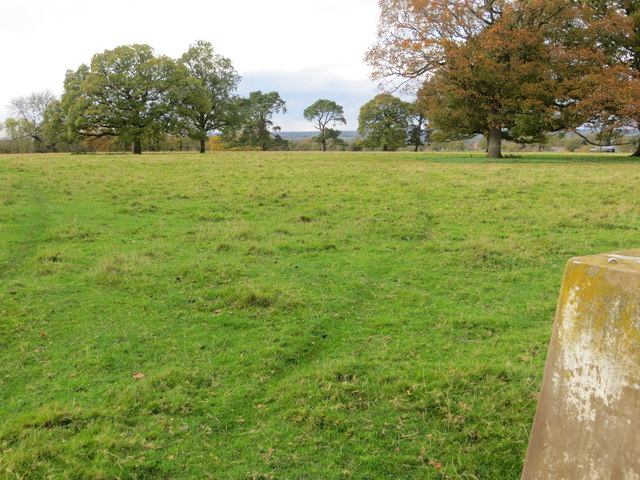
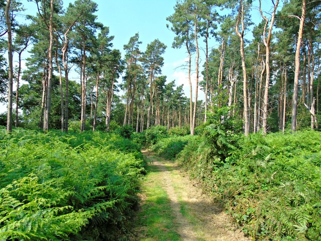
Oakley Wood is a picturesque woodland located in Warwickshire, England. Spanning over an area of approximately 100 acres, this ancient woodland is a haven for nature enthusiasts and outdoor lovers. The wood is predominantly composed of oak trees, hence its name, which provide a stunning backdrop throughout the year.

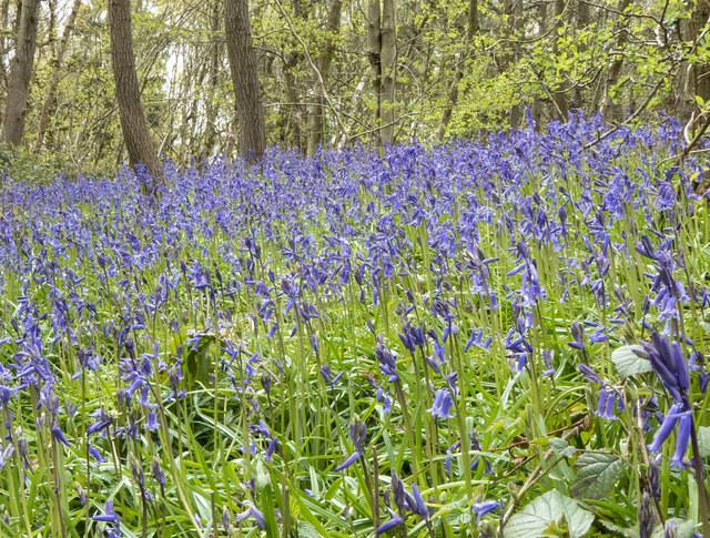
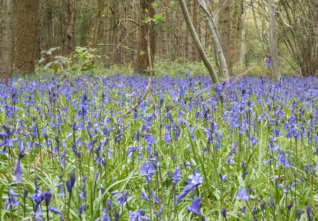
The wood is home to a diverse range of flora and fauna, making it a popular spot for wildlife enthusiasts. Visitors can spot various species of birds, such as woodpeckers, tawny owls, and nuthatches, as well as mammals like badgers, foxes, and deer. The wood is also known for its colorful array of wildflowers, including bluebells, primroses, and wood anemones, which create a vibrant carpet during springtime.

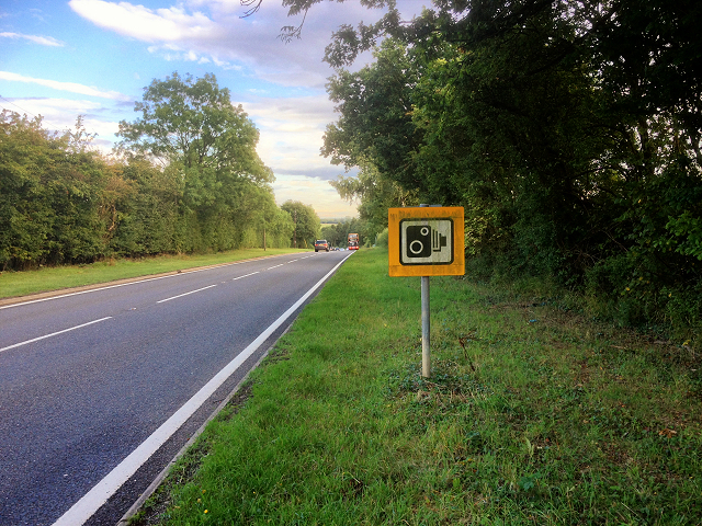
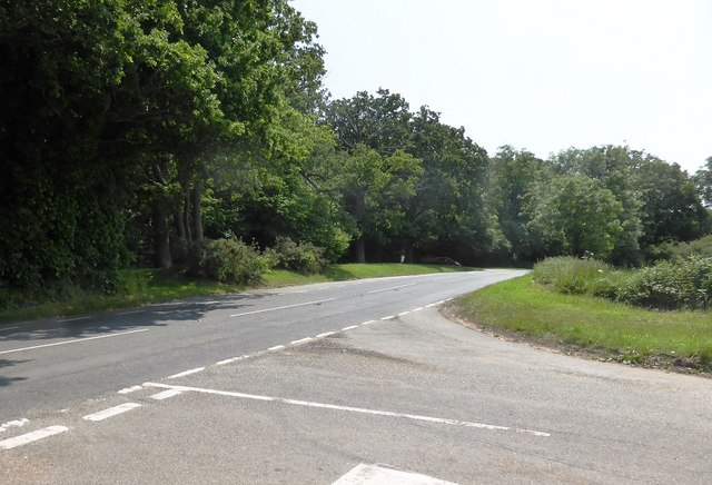
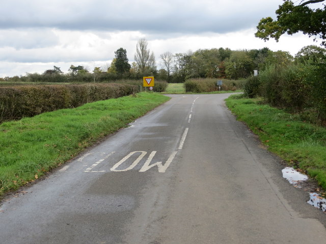
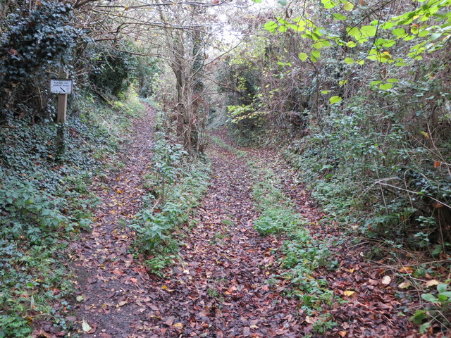
Walking trails are scattered throughout Oakley Wood, offering visitors the opportunity to explore its natural beauty. These paths wind through the woodland, passing by ancient trees and tranquil streams, providing a peaceful and serene atmosphere. The wood is also intersected by the Warwickshire Centenary Way, a long-distance footpath that offers stunning views of the surrounding countryside.

Oakley Wood is managed by the Warwickshire Wildlife Trust, who work tirelessly to preserve its natural habitats and protect its wildlife. The trust organizes regular events and guided walks for visitors to learn more about the wood's biodiversity and ecological importance.

Overall, Oakley Wood is a delightful destination for those seeking a peaceful retreat in nature. With its ancient oaks, diverse wildlife, and scenic trails, it offers a captivating experience for all who venture into its enchanting embrace.

If you have any feedback on the listing, please let us know in the comments section below.

Oakley Wood Images

Images are sourced within 2km of 52.233488/-1.5459076 or Grid Reference SP3159. Thanks to Geograph Open Source API. All images are credited.

Banbury Road, B4100
Banbury Road, B4100
B4100, Banbury Road near to Ashorne
Unibus on Banbury Road Stagecoach in Warwickshire Dennis Trident 2/Alexander ALX400 number 17059 (T659 KPU), painted in the Unibus livery is pictured here on Banbury Road,  working the X17 service to Leamington.
Unibus on Banbury Road
Stagecoach in Warwickshire Dennis Trident 2/Alexander ALX400 number 17059 (T659 KPU), painted in the Unibus livery is pictured here on Banbury Road, working the X17 service to Leamington.
Bluebells in Oakley Wood Bang on time, 1st May, the bluebells are in flower.
Bluebells in Oakley Wood
Bang on time, 1st May, the bluebells are in flower.
Bluebells in Oakley Wood Bang on time, 1st May, the bluebells are in flower.
Bluebells in Oakley Wood
Bang on time, 1st May, the bluebells are in flower.
The B4087 at Oakley Wood
Oakley Wood Old workings in a field on the road to Bishop's Tachbrook.
Oakley Wood
Old workings in a field on the road to Bishop's Tachbrook.
Covered way, South Warwickshire Crematorium, Oakley Wood It shelters the path between the office and the South Chapel, right. <span class="nowrap"><a title="https://www.warwickdc.gov.uk/info/20645/oakley_wood_crematorium" rel="nofollow ugc noopener" href="https://www.warwickdc.gov.uk/info/20645/oakley_wood_crematorium">Link</a><img style="margin-left:2px;" alt="External link" title="External link - shift click to open in new window" src="https://s1.geograph.org.uk/img/external.png" width="10" height="10"/></span>
Covered way, South Warwickshire Crematorium, Oakley Wood
It shelters the path between the office and the South Chapel, right. LinkExternal link
Ashorne Cottages At the eastern end of the village.
Ashorne Cottages
At the eastern end of the village.
Crossroads to the east of Ashorne Looking north-eastward.
Crossroads to the east of Ashorne
Looking north-eastward.
View from the Triangulation Pillar on Ashorne Hill Looking north-westward.
View from the Triangulation Pillar on Ashorne Hill
Looking north-westward.
Division of path and Bridleway to Ashorne Hill Looking north-eastward.
Division of path and Bridleway to Ashorne Hill
Looking north-eastward.
Fly-tipping in a field entrance by the B4087 south of Bishop’s Tachbrook Unexplained landforms in the field are perhaps shelter for livestock. On the right, traffic on the M40; junction 13 is left of centre. The B4087 Tachbrook Road-Oakley Wood Road comes south from Leamington: a common sight is a funeral cortège heading for the Mid-Warwickshire Crematorium in Oakley Wood <a href="https://www.geograph.org.uk/photo/3466342">SP3059 : Mid Warwickshire Crematorium, South Chapel</a>.
Fly-tipping in a field entrance by the B4087 south of Bishop’s Tachbrook
Unexplained landforms in the field are perhaps shelter for livestock. On the right, traffic on the M40; junction 13 is left of centre. The B4087 Tachbrook Road-Oakley Wood Road comes south from Leamington: a common sight is a funeral cortège heading for the Mid-Warwickshire Crematorium in Oakley Wood SP3059 : Mid Warwickshire Crematorium, South Chapel.
The M40 runs under a footbridge
Ashorne Hill House
Ashorne Hill House
Solar farm by Tollgate Farm Glimpsed from the B4087 Oakley Wood Road; the northeastern edge is visible from the M40. The panels face south in rows running east-west. The land falls away to the northeast (right to left in the photo), from about 85m down to 75m. The site covers perhaps nine hectares.
Solar farm by Tollgate Farm
Glimpsed from the B4087 Oakley Wood Road; the northeastern edge is visible from the M40. The panels face south in rows running east-west. The land falls away to the northeast (right to left in the photo), from about 85m down to 75m. The site covers perhaps nine hectares.
Path through Oakley Wood
Ashorne-Mill Farm Entrance of the road to Little Morrell.
Ashorne-Mill Farm
Entrance of the road to Little Morrell.
Show me another place!

Oakley Wood is located at Grid Ref: SP3159 (Lat: 52.233488, Lng: -1.5459076)

Administrative County: Warwickshire

District: Warwick

Police Authority: Warwickshire

What 3 Words

///expose.sigh.acclaimed. Near Wellesbourne, Warwickshire

Related Wikis

Related Videos

Mallory Court Luxury Hotel Spa in Warwickshire | Eden Hotel Collection

To book and find out more »» https://www.mallory.co.uk/ This magnificent 31 bedroom manor house, set in 10 acres of grounds, ...

Luxury Spa in Warwickshire | Mallory Court Hotel and Spa

Find our more about our Luxury Spa in Warwickshire » https://www.mallory.co.uk/warwickshire-spa/

How SIMPLE can we get the GOLF swing with a Proper Golf Swing? Golf Made Simple

Sometimes the simple things are the best!!! Golf Made Simple is my mantra! This training aid has certainly created a stir on my ...

Watch in Amazement : These Simple Golf Tips From A Pro! #onlinegolflessons

Looking at how to play shots from different lies. Also check out this video https://youtu.be/IPxkaeEbSbM to learn more course ...

Nearby Amenities

Located within 500m of 52.233488,-1.5459076
Bus Stop
Moreton Morrell Road
Bench: no
Bin: no
Bus: yes
Lit: no
Naptan AtcoCode: 4200F150011
Naptan Bearing: NW
Naptan CommonName: Moreton Morrell Road
Naptan Indicator: Adj
Naptan NaptanCode: wardjgjt
Naptan Street: Banbury Road
Naptan Verified: no
Public Transport: platform
Shelter: no
Source: naptan_import
Tactile Paving: no
Lat/Long: 52.2313599/-1.5482165
Moreton Morrell Road
Naptan AtcoCode: 4200F150012
Naptan Bearing: SE
Naptan BusStopType: CUS
Naptan CommonName: Moreton Morrell Road
Naptan Indicator: Opp
Naptan NaptanCode: wardjgjw
Naptan Street: Banbury Road
Naptan Verified: no
Source: naptan_import
Lat/Long: 52.2314399/-1.547996
Parking
Access: yes
Fee: no
Parking: layby
Lat/Long: 52.2346021/-1.550738
Post Box
Collection Times: Mo-Fr 16:15; Sa 10:45
Operator: Royal Mail
Operator Wikidata: Q638098
Post Box Design: hovis
Post Box Mounting: telegraph_pole
Post Box Type: lamp
Ref: CV33 52
Royal Cypher: VR
Royal Cypher Wikidata: Q33102356
Source: survey
Lat/Long: 52.2320957/-1.5490619
Curve: right
Direction: forward
Hazard: curve
Traffic Sign: GB:512
Traffic Sign Direction: forward
Traffic Sign Forward: GB:512
Lat/Long: 52.2377538/-1.5479435
Curve: left
Direction: backward
Hazard: curve
Traffic Sign: GB:512L
Traffic Sign Backward: GB:512L
Traffic Sign Direction: backward
Lat/Long: 52.2366601/-1.5496243
Give Way
Direction: forward
Lat/Long: 52.2359296/-1.5517089
Direction: both
Maxspeed: 50 mph
Traffic Sign: maxspeed
Traffic Sign 2: GB:501
Traffic Sign 3: GB:503
Traffic Sign 3 Direction: forward
Traffic Sign 3 Distanceto: 140 yards
Traffic Sign Direction: forward
Traffic Sign Forward: GB:501
Lat/Long: 52.236354/-1.5504748
Direction: backward
Traffic Sign: GB:622.1A
Traffic Sign 2: GB:602
Traffic Sign 2 Direction: forward
Traffic Sign Backward: GB:622.1A
Traffic Sign Direction: backward
Traffic Sign Forward: GB:602
Traffic Sign Maxweightrating: 7.5
Traffic Sign Maxweightrating Conditional: none @ delivery
Lat/Long: 52.2359684/-1.5515918
Material: wood
Operator: National Grid Electricity Distribution
Operator Wikidata: Q7988183
Power: pole
Source: bing
Lat/Long: 52.2377355/-1.5435871
Frequency: 50
Location Transition: yes
Material: wood
Operator: National Grid Electricity Distribution
Operator Wikidata: Q7988183
Power: pole
Ref: 932351
Source: wpd_opendata
Transformer: distribution
Voltage Primary: 11000
Voltage Secondary: 400
Lat/Long: 52.236975/-1.5432546
Frequency: 50
Material: wood
Operator: National Grid Electricity Distribution
Operator Wikidata: Q7988183
Power: pole
Ref: 932352
Source: wpd_opendata
Transformer: distribution
Voltage Primary: 11000
Voltage Secondary: 400
Lat/Long: 52.2336807/-1.5480168
Material: wood
Operator: National Grid Electricity Distribution
Operator Wikidata: Q7988183
Power: pole
Source: bing
Lat/Long: 52.2341603/-1.5473221
Material: wood
Operator: National Grid Electricity Distribution
Operator Wikidata: Q7988183
Power: pole
Source: bing
Lat/Long: 52.2346926/-1.5465349
Frequency: 50
Material: wood
Operator: National Grid Electricity Distribution
Operator Wikidata: Q7988183
Power: pole
Ref: 932353
Source: wpd_opendata
Transformer: distribution
Voltage Primary: 11000
Voltage Secondary: 400
Lat/Long: 52.2360395/-1.5485828
Material: wood
Operator: National Grid Electricity Distribution
Operator Wikidata: Q7988183
Power: pole
Source: bing
Lat/Long: 52.2354079/-1.547652
Material: wood
Operator: National Grid Electricity Distribution
Operator Wikidata: Q7988183
Power: pole
Source: bing
Lat/Long: 52.2346499/-1.5466113
The data included in this document is from www.openstreetmap.org. The data is made available under ODbL.

Have you been to Oakley Wood?

Leave your review of Oakley Wood below (or comments, questions and feedback).