Gladwin's Mark Wood

Wood, Forest in Derbyshire North East Derbyshire

England

Gladwin's Mark Wood

Harland South trig point It is a bit of a scramble through bracken and heather to get here on Harland Edge, but it is worth it.
Harland South trig point Credit: Bill Boaden

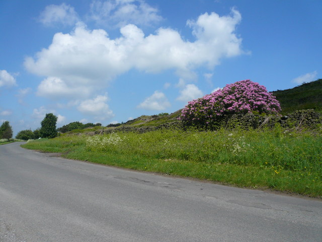
Gladwin's Mark Wood is a picturesque forest located in the county of Derbyshire, England. Covering an area of approximately 200 acres, this woodland is a popular destination for nature lovers and outdoor enthusiasts alike.

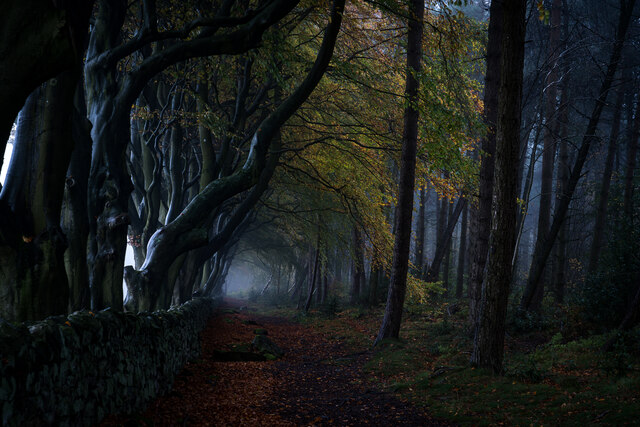
The wood is characterized by a diverse range of tree species, including oak, birch, beech, and pine, which create a beautiful and tranquil environment. The forest floor is carpeted with an array of wildflowers and ferns, adding to its natural charm. Walking paths wind through the woods, allowing visitors to explore its various sections and discover hidden gems along the way.

Gladwin's Mark Wood is not only known for its scenic beauty but also for its rich wildlife. The forest provides a habitat for numerous species, such as deer, foxes, rabbits, and a wide variety of birdlife. Birdwatchers can spot species like woodpeckers, owls, and various songbirds, making it a paradise for bird enthusiasts.

Visitors can engage in a range of recreational activities within the wood, including hiking, picnicking, and nature photography. The peaceful atmosphere and well-maintained trails make it an ideal spot for a leisurely walk or a family outing.

The wood is easily accessible, with ample parking facilities nearby. It is open to the public throughout the year, offering a different experience in each season, from the vibrant colors of autumn to the fresh greenery of spring.

Overall, Gladwin's Mark Wood in Derbyshire is a true natural gem, offering a serene escape from the hustle and bustle of everyday life.

If you have any feedback on the listing, please let us know in the comments section below.

Gladwin's Mark Wood Images

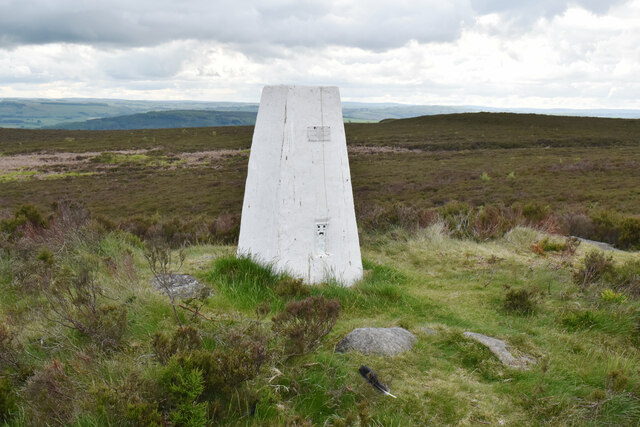
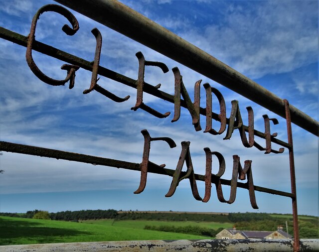
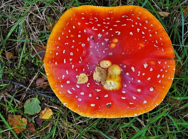
Images are sourced within 2km of 53.195766/-1.544881 or Grid Reference SK3066. Thanks to Geograph Open Source API. All images are credited.

Harland South trig point It is a bit of a scramble through bracken and heather to get here on Harland Edge, but it is worth it.
Harland South trig point
It is a bit of a scramble through bracken and heather to get here on Harland Edge, but it is worth it.
Gateway to  Glendale Farm
Gateway to Glendale Farm
Fly agaric mushroom seen from above On Longside Moor
Fly agaric mushroom seen from above
On Longside Moor
View to Harewood House Farm From the edge of Harewood Moor
View to Harewood House Farm
From the edge of Harewood Moor
Old railway box car near Harewood Grange Farm (I) Probably once used as stabling.
Old railway box car near Harewood Grange Farm (I)
Probably once used as stabling.
Old railway box car near Harewood Grange Farm (II) Probably once used as stabling.
Old railway box car near Harewood Grange Farm (II)
Probably once used as stabling.
Three young sheep (I) Guarding the path over Harewood Moor
Three young sheep (I)
Guarding the path over Harewood Moor
Three young sheep (II) Guarding the path over Harewood Moor
Three young sheep (II)
Guarding the path over Harewood Moor
Harewood Grange
Harewood Grange
Tree Lined Path Got some wonderful photos before the mist abated. What a photographic location.
Tree Lined Path
Got some wonderful photos before the mist abated. What a photographic location.
Darley Road (B5057)
Darley Road (B5057)
Layby on Darley Road
B5057, Darley Road
B5057, Darley Road
Darley Road near Dean Farm
Old Boundary Marker on Harewood Moor Parish Boundary Marker set in a drystone wall on Harewood Moor 1000 metres southeast of Harewood Grange. Inscribed B and A on opposite faces. On the boundary of Beeley and Ashover parishes.

Milestone Society National ID: DE_BEE13pb
Old Boundary Marker on Harewood Moor
Parish Boundary Marker set in a drystone wall on Harewood Moor 1000 metres southeast of Harewood Grange. Inscribed B and A on opposite faces. On the boundary of Beeley and Ashover parishes. Milestone Society National ID: DE_BEE13pb
Old Boundary Marker on Harewood Moor Parish Boundary Marker on Harewood Moor 1100 metres southeast of Harewood Grange. On the boundary of Beeley and Ashover parishes.

Milestone Society National ID: DE_BEE14pb
Old Boundary Marker on Harewood Moor
Parish Boundary Marker on Harewood Moor 1100 metres southeast of Harewood Grange. On the boundary of Beeley and Ashover parishes. Milestone Society National ID: DE_BEE14pb
Old Boundary Marker on Harewood Moor Parish Boundary Marker on Harewood Moor 1150 metres southeast of Harewood Grange. Inscribed B and A on opposite faces. On the boundary of Beeley and Ashover parishes.

Milestone Society National ID: DE_BEE15pb
Old Boundary Marker on Harewood Moor
Parish Boundary Marker on Harewood Moor 1150 metres southeast of Harewood Grange. Inscribed B and A on opposite faces. On the boundary of Beeley and Ashover parishes. Milestone Society National ID: DE_BEE15pb
Old Boundary Marker on Harewood Moor Parish Boundary Marker on Harewood Moor 1300 metres southeast of Harewood Grange. On the boundary of Beeley and Ashover parishes.

Milestone Society National ID: DE_BEE16pb
Old Boundary Marker on Harewood Moor
Parish Boundary Marker on Harewood Moor 1300 metres southeast of Harewood Grange. On the boundary of Beeley and Ashover parishes. Milestone Society National ID: DE_BEE16pb
Show me another place!

Gladwin's Mark Wood is located at Grid Ref: SK3066 (Lat: 53.195766, Lng: -1.544881)

Administrative County: Derbyshire

District: North East Derbyshire

Police Authority: Derbyshire

What 3 Words

///aura.helper.movements. Near Matlock, Derbyshire

Related Wikis

Beeley Moor

Beeley Moor is a small gritstone upland area in the Derbyshire Peak District of central and northern England, near the villages of Beeley and Baslow. Its...

Alicehead

Alicehead is a small area of settlement in Derbyshire, England, 9 miles (14 km) south-west of Chesterfield. It consists of four farms and a cottage on...

North East Derbyshire

North East Derbyshire is a local government district in Derbyshire, England. The council is based in the large village of Wingerworth. The district also...

Hob Hurst's House

Hob Hurst's House is a Bronze Age barrow on Beeley Moor near Bakewell in Derbyshire. It is unique in that instead of the normal round shape, Hob Hurst...

Nearby Amenities

Located within 500m of 53.195766,-1.544881
Give Way
Source: survey
Lat/Long: 53.1966561/-1.5469133
Give Way
Source: survey
Lat/Long: 53.1967815/-1.5472459
The data included in this document is from www.openstreetmap.org. The data is made available under ODbL.

Have you been to Gladwin's Mark Wood?

Leave your review of Gladwin's Mark Wood below (or comments, questions and feedback).