Trindledown Copse

Wood, Forest in Wiltshire

England

Trindledown Copse

Kennet & Avon Canal Canal near Little Bedwyn.
Kennet & Avon Canal Credit: Wayland Smith

Trindledown Copse is a picturesque woodland located in the county of Wiltshire, England. Situated near the village of Trindledown, this copse covers an area of approximately 50 acres, providing a tranquil escape for nature enthusiasts and walkers alike.

The copse is predominantly composed of native broadleaf trees, including oak, beech, and ash, creating a diverse and thriving ecosystem. The dense canopy allows for minimal sunlight to penetrate, resulting in a cool and shaded environment, perfect for a leisurely stroll on warm summer days.

Trindledown Copse is crisscrossed by a network of well-maintained footpaths, which wind through the woodland, enabling visitors to explore its natural beauty at their own pace. These paths meander alongside babbling brooks and small ponds, adding to the charm and serenity of the copse.

Wildlife is abundant in Trindledown Copse, with numerous species of birds, such as woodpeckers and songbirds, making their homes amongst the trees. The woodland floor is also teeming with life, with squirrels, rabbits, and even the occasional deer being spotted by observant visitors.

Throughout the year, Trindledown Copse undergoes a stunning transformation, with spring bringing a vibrant display of bluebells and wildflowers carpeting the forest floor. In autumn, the copse becomes a riot of color as the leaves of the deciduous trees change to hues of orange, red, and gold.

Trindledown Copse is a hidden gem in Wiltshire, offering visitors a peaceful retreat to connect with nature and experience the beauty of an English woodland.

If you have any feedback on the listing, please let us know in the comments section below.

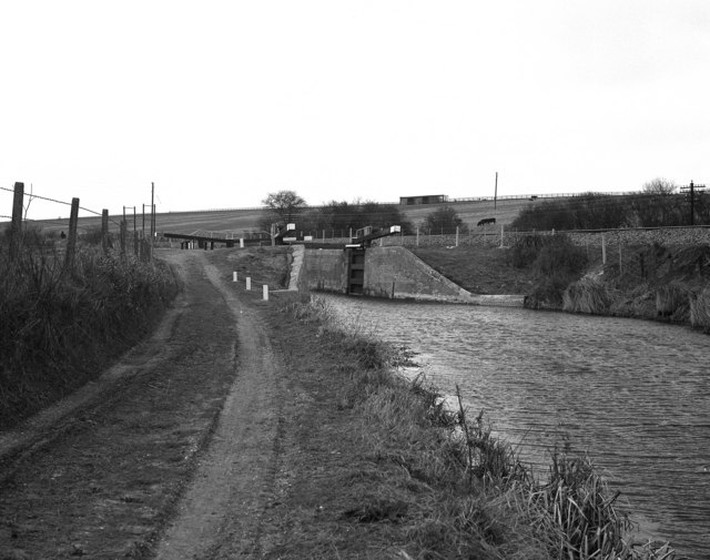
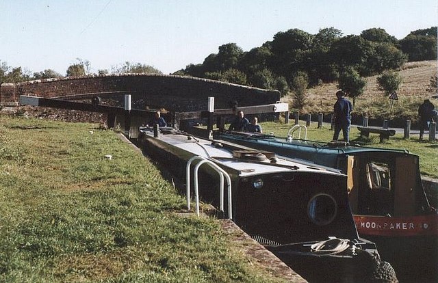
Trindledown Copse Images

Images are sourced within 2km of 51.401603/-1.562929 or Grid Reference SU3067. Thanks to Geograph Open Source API. All images are credited.

Kennet & Avon Canal Canal near Little Bedwyn.
Kennet & Avon Canal
Canal near Little Bedwyn.
Fore Bridge Looking north along the canal.
Fore Bridge
Looking north along the canal.
Oak Hill Lock Lock on the Kennet & Avon
Oak Hill Lock
Lock on the Kennet & Avon
School Lane Dwelling in Little Bedwyn.
School Lane
Dwelling in Little Bedwyn.
Chisbury Lane Crossroads near Little Bedwyn.
Chisbury Lane
Crossroads near Little Bedwyn.
All Saints Church, Froxfield
St Michael's Church, Little Bedwyn
River Dun The River Dun is a tributary of the River Kennet flowing through Wiltshire and Berkshire. Its main source is in the parish of Great Bedwyn, Wiltshire and it flows for its whole course ENE into Berkshire, where it discharges into the River Kennet at Hungerford.
The Dun valley is an important transport route through the high chalklands between the London Basin to the east and the Vale of Pewsey to the west. The Kennet & Avon Canal and the Plymouth to Reading railway follow it.
River Dun
The River Dun is a tributary of the River Kennet flowing through Wiltshire and Berkshire. Its main source is in the parish of Great Bedwyn, Wiltshire and it flows for its whole course ENE into Berkshire, where it discharges into the River Kennet at Hungerford. The Dun valley is an important transport route through the high chalklands between the London Basin to the east and the Vale of Pewsey to the west. The Kennet & Avon Canal and the Plymouth to Reading railway follow it.
Field between woods A field on the slopes of the Dun valley, seen from a train crossing the river. There is a lot of woodland west of Hungerford, and the two blocks shown are unnamed on maps. Neither is actually within this square.
Field between woods
A field on the slopes of the Dun valley, seen from a train crossing the river. There is a lot of woodland west of Hungerford, and the two blocks shown are unnamed on maps. Neither is actually within this square.
Square Plantation
Square Plantation
Woodland by the Great Western Railway
Kennet & Avon Canal The Kennet and Avon is made up of two river navigations and a linking stretch of canal. It runs from Hanham Lock near Bristol to the River Thames at Reading, over 100 miles long with more than 100 locks, some magnificent engineering and crossing some of the most beautiful scenery in southern England. It was only reopened in 1990 after decades of dereliction.
Kennet & Avon Canal
The Kennet and Avon is made up of two river navigations and a linking stretch of canal. It runs from Hanham Lock near Bristol to the River Thames at Reading, over 100 miles long with more than 100 locks, some magnificent engineering and crossing some of the most beautiful scenery in southern England. It was only reopened in 1990 after decades of dereliction.
Oak Hill
Oak Hill
Kennet & Avon Canal The Kennet and Avon is made up of two river navigations and a linking stretch of canal. It runs from Hanham Lock near Bristol to the River Thames at Reading, over 100 miles long with more than 100 locks, some magnificent engineering and crossing some of the most beautiful scenery in southern England. It was only reopened in 1990 after decades of dereliction.
Kennet & Avon Canal
The Kennet and Avon is made up of two river navigations and a linking stretch of canal. It runs from Hanham Lock near Bristol to the River Thames at Reading, over 100 miles long with more than 100 locks, some magnificent engineering and crossing some of the most beautiful scenery in southern England. It was only reopened in 1990 after decades of dereliction.
River Dun The River Dun is a tributary of the River Kennet flowing through Wiltshire and Berkshire. Its main source is in the parish of Great Bedwyn, Wiltshire and it flows for its whole course ENE into Berkshire, where it discharges into the River Kennet at Hungerford.
The Dun valley is an important transport route through the high chalklands between the London Basin to the east and the Vale of Pewsey to the west. The Kennet & Avon Canal and the Plymouth to Reading railway follow it.
River Dun
The River Dun is a tributary of the River Kennet flowing through Wiltshire and Berkshire. Its main source is in the parish of Great Bedwyn, Wiltshire and it flows for its whole course ENE into Berkshire, where it discharges into the River Kennet at Hungerford. The Dun valley is an important transport route through the high chalklands between the London Basin to the east and the Vale of Pewsey to the west. The Kennet & Avon Canal and the Plymouth to Reading railway follow it.
Lock 69, Kennet & Avon Canal The Kennet and Avon is made up of two river navigations and a linking stretch of canal. It runs from Hanham Lock near Bristol to the River Thames at Reading, over 100 miles long with more than 100 locks, some magnificent engineering and crossing some of the most beautiful scenery in southern England. It was only reopened in 1990 after decades of dereliction.
Lock 69, Kennet & Avon Canal
The Kennet and Avon is made up of two river navigations and a linking stretch of canal. It runs from Hanham Lock near Bristol to the River Thames at Reading, over 100 miles long with more than 100 locks, some magnificent engineering and crossing some of the most beautiful scenery in southern England. It was only reopened in 1990 after decades of dereliction.
Lock No.69, Kennet & Avon Canal The Kennet and Avon is made up of two river navigations and a linking stretch of canal. It runs from Hanham Lock near Bristol to the River Thames at Reading, over 100 miles long with more than 100 locks, some magnificent engineering and crossing some of the most beautiful scenery in southern England. It was only reopened in 1990 after decades of dereliction.
Lock No.69, Kennet & Avon Canal
The Kennet and Avon is made up of two river navigations and a linking stretch of canal. It runs from Hanham Lock near Bristol to the River Thames at Reading, over 100 miles long with more than 100 locks, some magnificent engineering and crossing some of the most beautiful scenery in southern England. It was only reopened in 1990 after decades of dereliction.
Show me another place!

Trindledown Copse is located at Grid Ref: SU3067 (Lat: 51.401603, Lng: -1.562929)

Unitary Authority: Wiltshire

Police Authority: Wiltshire

What 3 Words

///cliff.surfed.abstracts. Near Chilton Foliat, Wiltshire

Related Wikis

Froxfield Middle Lock

Froxfield Middle Lock is a lock on the Kennet and Avon Canal, at Froxfield, Wiltshire, England. The lock has a rise/fall of 6 ft 11 in (2.11 m). ��2�...

Froxfield Bottom Lock

Froxfield Bottom Lock is a lock on the Kennet and Avon Canal, at Froxfield, Wiltshire, England. The lock has a rise/fall of 7 ft 0 in (2.13 m). == References... ==

Oakhill Down Lock

Oakhill Down Lock is a lock on the Kennet and Avon Canal, at Froxfield, Wiltshire, England, between Newbury Bridge and Pewsey Wharf.The lock was built...

Froxfield

Froxfield is a village and civil parish in the English county of Wiltshire. The parish is on the Wiltshire-West Berkshire border, and the village lies...

Nearby Amenities

Located within 500m of 51.401603,-1.562929
Barrier: bollard
Bollard: removable
Motor Vehicle: no
Lat/Long: 51.4036131/-1.5692154
Fixme: continues?
Lat/Long: 51.4033982/-1.5693216
Power: pole
Lat/Long: 51.4057752/-1.5628232
Power: pole
Lat/Long: 51.4057133/-1.5615065
Power: pole
Lat/Long: 51.4056375/-1.5602039
The data included in this document is from www.openstreetmap.org. The data is made available under ODbL.

Have you been to Trindledown Copse?

Leave your review of Trindledown Copse below (or comments, questions and feedback).