Derringstone

Settlement in Kent Canterbury

England

Derringstone

Elham Valley Rd
Elham Valley Rd Credit: N Chadwick

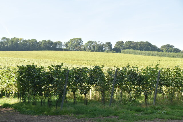
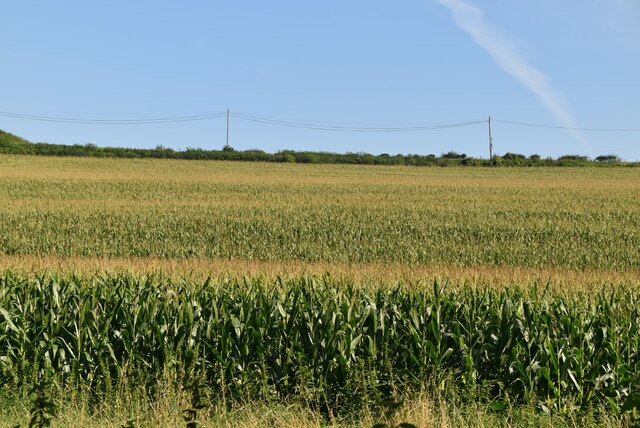
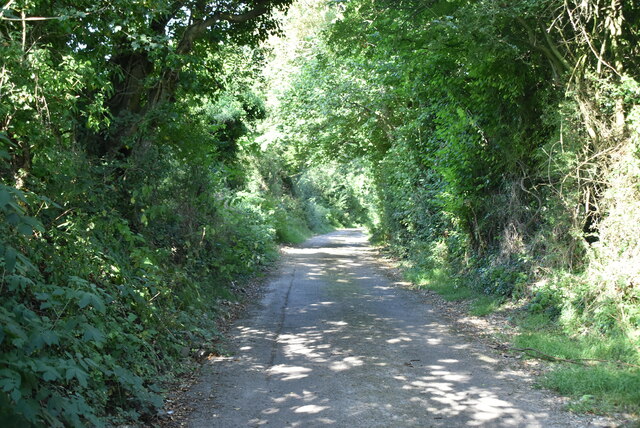
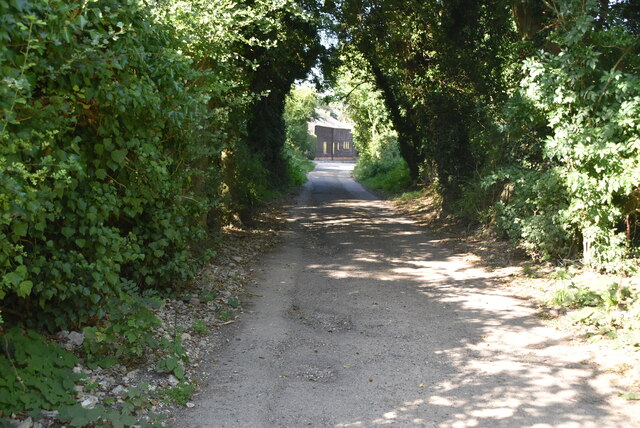
Derringstone is a small village located in the county of Kent, in southeastern England. Situated about 8 miles northeast of the historic city of Canterbury, the village is nestled in a picturesque rural setting, surrounded by rolling hills and green countryside.

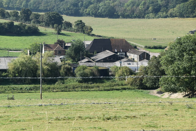
The village of Derringstone is known for its charming and idyllic character, with a population of just over 100 residents. It boasts a collection of traditional, quaint cottages, some of which date back several centuries, adding to the village's historical charm.

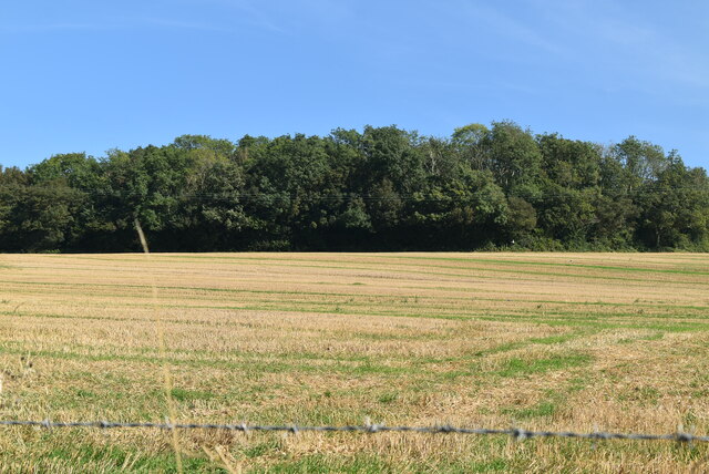
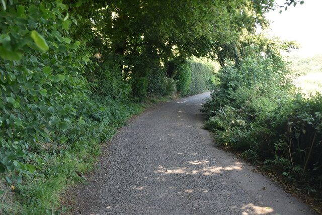
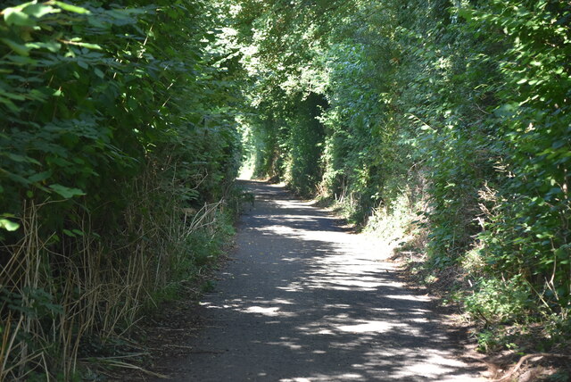
One of the notable landmarks in Derringstone is the Derringstone Downs, a scenic area of chalk grassland that provides breathtaking views of the surrounding countryside. It is a popular spot for walkers and nature enthusiasts, offering a peaceful retreat away from the hustle and bustle of city life.

Despite its small size, Derringstone has a rich history. The village is believed to have been inhabited since Roman times, with archaeological evidence suggesting the presence of Roman villas in the area. The village also played a role in the medieval period, with the imposing St. Nicholas Church standing as a testament to its heritage.

While Derringstone is primarily a residential area, the nearby city of Canterbury provides ample amenities and services for residents. With its historic attractions, shopping centers, and educational institutions, Canterbury offers a range of opportunities for leisure and employment, conveniently accessible to Derringstone residents.

Overall, Derringstone is a charming and tranquil village that offers a slice of rural English life, with its scenic surroundings and historical significance.

If you have any feedback on the listing, please let us know in the comments section below.

Derringstone Images

Images are sourced within 2km of 51.201253/1.15211 or Grid Reference TR2049. Thanks to Geograph Open Source API. All images are credited.

Elham Valley Rd
Elham Valley Rd
Roadside woodland
Roadside woodland
Elham Valley Rd
Elham Valley Rd
South Barham Farm
South Barham Farm
Breach Down
Breach Down
South Barham Farm
South Barham Farm
South Barham Farm
South Barham Farm
Elham Valley Rd
Elham Valley Rd
South Barham Hill
South Barham Hill
An old chalk pit
An old chalk pit
South Barham Rd
South Barham Rd
South Barham Rd
South Barham Rd
Farmland
Farmland
South Barham Rd
South Barham Rd
South Barham Road
South Barham Road
South Barham Rd
South Barham Rd
Show me another place!

Derringstone is located at Grid Ref: TR2049 (Lat: 51.201253, Lng: 1.15211)

Administrative County: Kent

District: Canterbury

Police Authority: Kent

What 3 Words

///prelude.countries.leopard. Near Barham, Kent

Nearby Locations

Derringstone

Related Wikis

Heart's Delight, City of Canterbury

Heart's Delight is a settlement located near Barham in Kent, England. There is a similarly-known settlement near Sittingbourne in the Swale district of...

Barham railway station

Barham was a station on the Elham Valley Railway. It opened in 1887 and closed to passengers in 1940 and freight in 1947. == History == The station opened...

Barham, Kent

Barham is a village and civil parish in the City of Canterbury district of Kent, England. Barham village is approximately 6 miles (10 km) south-east from...

Jumping Downs

Jumping Downs is a 5.7-hectare (14-acre) Local Nature Reserve near Aylesham, between Canterbury and Dover in Kent. It is owned by the Jumping Downs Trust...

Marley, Canterbury

Marley is a scattered hamlet in the civil parish of Kingston, in the county of Kent, England. The hamlet is on a minor road about 1 mile (1.6 km) southwest...

Breach, Kent

Breach is a small settlement in the Elham Valley about one mile (1.6 km) south of Barham(where, at the 2011 Census, the population was included) in Kent...

Black Mill, Barham

Black Mill or Barham Downs Mill was a smock mill at Barham, Kent, England which was accidentally burnt down in 1970 while under restoration. == History... ==
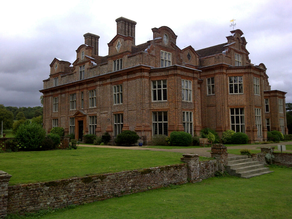
Broome Park

Broome Park is a country house in Barham, within the City of Canterbury, Kent, England. It was built for Basil Dixwell between 1635 and 1638. In the early...

Nearby Amenities

Located within 500m of 51.201253,1.15211
Barham
Is In: Kent,England,UK
Place: village
Wikidata: Q1836548
Lat/Long: 51.2044715/1.1569061
Ford: yes
Lat/Long: 51.2017566/1.1555381
Barham
Historic Railway: station
Railway: site
Source: npe
Wikidata: Q86757099
Lat/Long: 51.2038245/1.1550051
Townhall
Barham Village Hall
Addr City: Canterbury
Addr Place: Barham
Addr Postcode: CT4 6NX
Addr Street: Valley Road
Lat/Long: 51.2042923/1.1565928
Post Box
Collection Times: Mo-Fr 09:00; Sa 07:00
Operator: Royal Mail
Operator Wikidata: Q638098
Post Box Mounting: wall
Post Box Type: wall
Postal Code: CT4
Ref: CT4 20
Royal Cypher: VR
Royal Cypher Wikidata: Q33102356
Source: survey
Lat/Long: 51.2016896/1.1573853
Bus Stop
Mill Lane
Local Ref: opp
Naptan AtcoCode: 240099621
Naptan Bearing: N
Naptan BusStopType: MKD
Naptan CommonName: Mill Lane
Naptan Indicator: opp
Naptan Landmark: Mill Lane
Naptan NaptanCode: kntgpwgw
Naptan RevisionNumber: 2
Naptan Status: act
Naptan Street: Derringstone Hill
Naptan Verified: no
Public Transport: platform
Ref: kntgpwgw
Source: naptan_import
Source Date: 2018-06-26
Lat/Long: 51.1989439/1.1567162
Bus Stop
Mill Lane
Bus: yes
Local Ref: adj
Naptan AtcoCode: 240099623
Naptan Bearing: S
Naptan BusStopType: MKD
Naptan CommonName: Mill Lane
Naptan Indicator: adj
Naptan Landmark: Mill Lane
Naptan NaptanCode: kntgptjt
Naptan RevisionNumber: 2
Naptan Status: act
Naptan Street: Derringstone Hill
Naptan Verified: no
Public Transport: platform
Ref: kntgptjt
Source: naptan_import
Source Date: 2018-06-26
Lat/Long: 51.198992/1.1569342
Stablegate Antiques
Phone: +44 1227 831639
Shop: antiques
Lat/Long: 51.2001967/1.1570355
Place Of Worship
Barham Methodist Church
Denomination: methodist
Religion: christian
Wikidata: Q26369619
Lat/Long: 51.2005544/1.1569957
Post Box
Collection Times: Mo-Fr 09:00; Sa 07:00
Operator: Royal Mail
Operator Wikidata: Q638098
Post Box Mounting: metal_post
Post Box Type: lamp
Postal Code: CT4
Ref: CT4 284
Royal Cypher: EIIR
Source: survey
Lat/Long: 51.1987675/1.1568642
Sussex Farm
Place: farm
Lat/Long: 51.2018655/1.1478557
Millfields Farm
Place: farm
Lat/Long: 51.2013573/1.1456815
Bus Stop
Brickfield Road
Local Ref: opp
Naptan AtcoCode: 2400A043310A
Naptan Bearing: N
Naptan BusStopType: MKD
Naptan CommonName: Brickfield Road
Naptan Indicator: opp
Naptan Landmark: Brickfield Road
Naptan NaptanCode: kntdtpdp
Naptan RevisionNumber: 4
Naptan Status: act
Naptan Street: Valley Road
Naptan Verified: no
Public Transport: platform
Ref: kntdtpdp
Source: naptan_import
Source Date: 2018-06-26
Lat/Long: 51.2024626/1.1569855
Bus Stop
Brickfield Road
Bus: yes
Local Ref: adj
Naptan AtcoCode: 2400A043320A
Naptan Bearing: S
Naptan BusStopType: MKD
Naptan CommonName: Brickfield Road
Naptan Indicator: adj
Naptan Landmark: Brickfield Road
Naptan NaptanCode: kntdtpdt
Naptan RevisionNumber: 4
Naptan Status: act
Naptan Street: Valley Road
Naptan Verified: no
Public Transport: platform
Ref: kntdtpdt
Source: naptan_import
Source Date: 2018-06-26
Lat/Long: 51.2017734/1.1572769
Bus Stop
The Grove
Bus: yes
Local Ref: adj
Naptan AtcoCode: 2400A043330A
Naptan Bearing: S
Naptan BusStopType: MKD
Naptan CommonName: The Grove
Naptan Indicator: adj
Naptan Landmark: The Grove
Naptan NaptanCode: kntdtpdw
Naptan RevisionNumber: 4
Naptan Status: act
Naptan Street: Valley Road
Naptan Verified: no
Public Transport: platform
Ref: kntdtpdw
Source: naptan_import
Source Date: 2018-06-26
Lat/Long: 51.2033816/1.1572632
Power: pole
Lat/Long: 51.2013359/1.1586316
Post Office
Barham Post Office
Addr City: Barham
Addr Postcode: CT4 6NX
Addr Street: Valley Road
Brand: Post Office
Brand Wikidata: Q1783168
Ref Pol Id: 131451
Lat/Long: 51.2041943/1.1570047
Generator Method: photovoltaic
Generator Orientation: 106
Generator Output Electricity: yes
Generator Solar Modules: 6
Generator Source: solar
Generator Type: solar_photovoltaic_panel
Location: roof
Power: generator
Lat/Long: 51.1997178/1.1572673
Generator Method: photovoltaic
Generator Orientation: 280
Generator Output Electricity: yes
Generator Solar Modules: 6
Generator Source: solar
Generator Type: solar_photovoltaic_panel
Location: roof
Power: generator
Lat/Long: 51.2038396/1.1558423
Generator Method: photovoltaic
Generator Orientation: 100
Generator Output Electricity: yes
Generator Solar Modules: 8
Generator Source: solar
Generator Type: solar_photovoltaic_panel
Location: roof
Power: generator
Lat/Long: 51.2038401/1.1559174
Generator Method: photovoltaic
Generator Orientation: 206
Generator Output Electricity: yes
Generator Solar Modules: 16
Generator Source: solar
Generator Type: solar_photovoltaic_panel
Location: roof
Power: generator
Lat/Long: 51.2028943/1.1578788
Generator Method: photovoltaic
Generator Orientation: 118
Generator Output Electricity: yes
Generator Solar Modules: 14
Generator Source: solar
Generator Type: solar_photovoltaic_panel
Location: roof
Power: generator
Lat/Long: 51.200257/1.1573544
Generator Method: photovoltaic
Generator Orientation: 81
Generator Output Electricity: yes
Generator Solar Modules: 16
Generator Source: solar
Generator Type: solar_photovoltaic_panel
Location: roof
Power: generator
Lat/Long: 51.2030737/1.1567375
Generator Method: photovoltaic
Generator Orientation: 100
Generator Output Electricity: yes
Generator Source: solar
Generator Type: solar_photovoltaic_panel
Location: roof
Power: generator
Lat/Long: 51.1991763/1.1572069
Generator Method: photovoltaic
Generator Orientation: 114
Generator Output Electricity: yes
Generator Solar Modules: 8
Generator Source: solar
Generator Type: solar_photovoltaic_panel
Location: roof
Power: generator
Lat/Long: 51.2020099/1.1525827
Generator Method: photovoltaic
Generator Orientation: 169
Generator Output Electricity: yes
Generator Source: solar
Generator Type: solar_photovoltaic_panel
Location: roof
Power: generator
Lat/Long: 51.2042484/1.1567563
Generator Method: photovoltaic
Generator Orientation: 203
Generator Output Electricity: yes
Generator Solar Modules: 12
Generator Source: solar
Generator Type: solar_photovoltaic_panel
Location: roof
Power: generator
Lat/Long: 51.2017335/1.1527933
Telephone
Booth: K6
Covered: booth
Listed Status: Grade II
Lat/Long: 51.2018145/1.1572858
Generator Method: photovoltaic
Generator Output Electricity: yes
Generator Source: solar
Generator Type: solar_photovoltaic_panel
Location: roof
Power: generator
Lat/Long: 51.2017889/1.1472988
Generator Method: photovoltaic
Generator Output Electricity: yes
Generator Solar Modules: 10
Generator Source: solar
Generator Type: solar_photovoltaic_panel
Location: roof
Power: generator
Lat/Long: 51.2020132/1.1545555
Generator Method: photovoltaic
Generator Orientation: 181
Generator Output Electricity: yes
Generator Solar Modules: 5
Generator Source: solar
Generator Type: solar_photovoltaic_panel
Location: roof
Power: generator
Lat/Long: 51.1989091/1.1564559
The data included in this document is from www.openstreetmap.org. The data is made available under ODbL.

Have you been to Derringstone?

Leave your review of Derringstone below (or comments, questions and feedback).