Derrington

Settlement in Staffordshire Stafford

England

Derrington

M6 looking north to J14 from Aston Bank bridge The M6 between junctions 13 and 15 was converted to a managed motorway which was opened in August 2022
M6 looking north to J14 from Aston Bank bridge Credit: Rod Grealish

Derrington is a small village located in the county of Staffordshire, England. Situated approximately 4 miles east of Stafford, the village is nestled in the beautiful countryside of the West Midlands region. With a population of around 1,500 residents, Derrington offers a peaceful and close-knit community atmosphere.

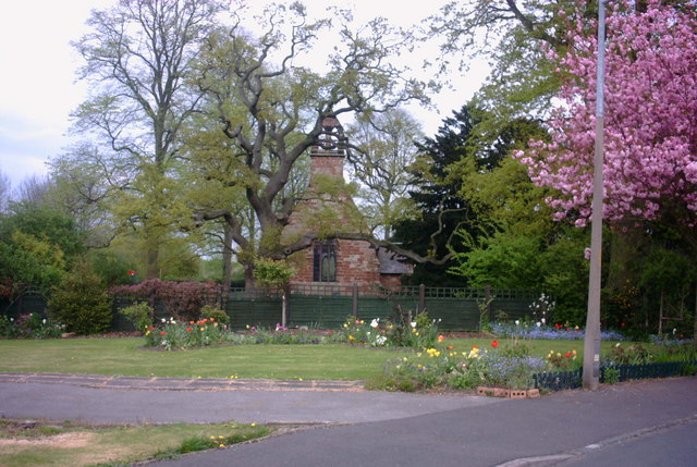
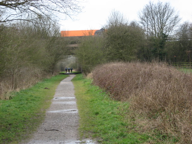
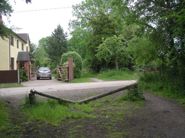
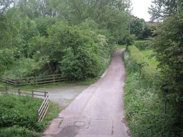
The village is characterized by its picturesque surroundings, featuring rolling hills, lush green fields, and charming country lanes. Derrington is renowned for its rural beauty, attracting visitors who seek tranquility and a taste of traditional English village life.

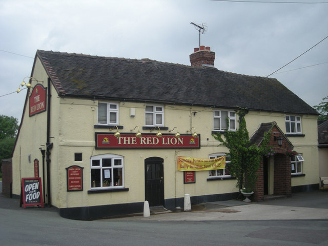
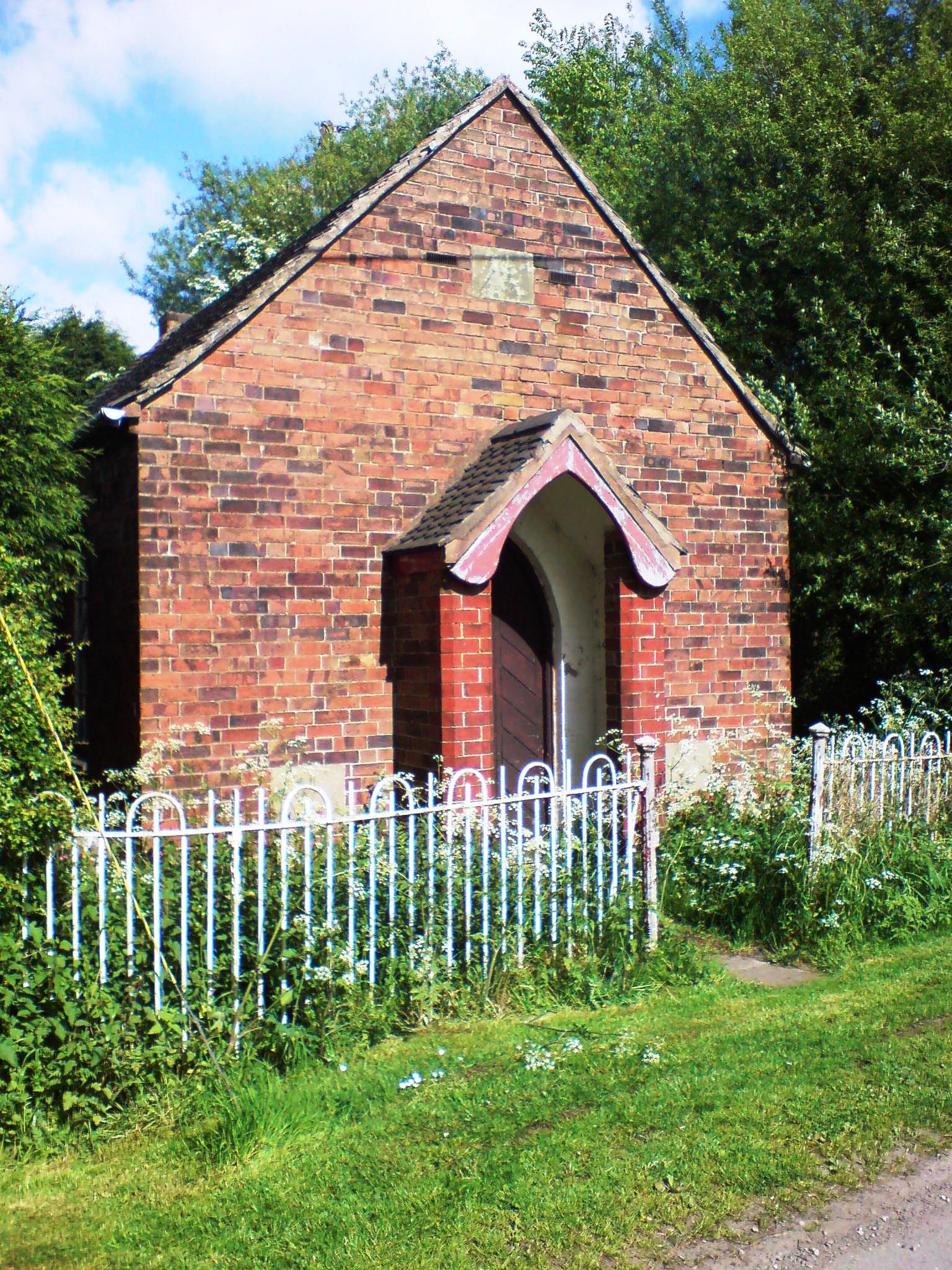
Derrington boasts a number of historic buildings and landmarks, including St. Matthew's Church, a Grade II listed building dating back to the 12th century. The church's architecture and stained glass windows are particularly noteworthy. Additionally, the village has a well-maintained village green and a local pub, The Royal Oak, which serves as a popular meeting place for locals and visitors alike.

Residents of Derrington benefit from a range of amenities, including a village hall, a primary school, and a post office. The village also offers convenient access to nearby amenities and services in the larger town of Stafford, such as shops, supermarkets, healthcare facilities, and educational institutions.

Overall, Derrington is a charming village that combines natural beauty with a strong sense of community. It provides a peaceful and idyllic setting for residents and visitors seeking a slower pace of life in the heart of the Staffordshire countryside.

If you have any feedback on the listing, please let us know in the comments section below.
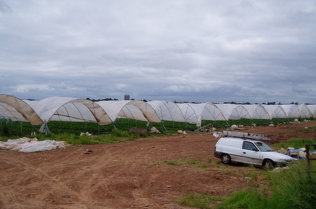
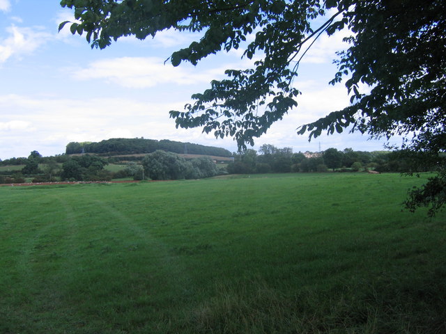
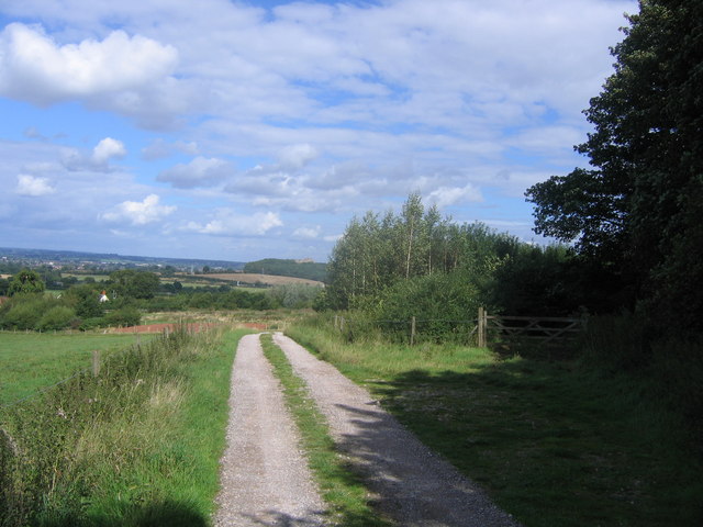
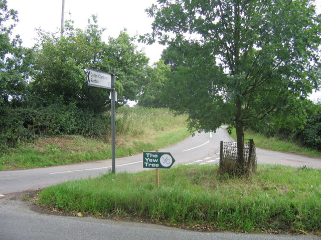
Derrington Images

Images are sourced within 2km of 52.802623/-2.161649 or Grid Reference SJ8922. Thanks to Geograph Open Source API. All images are credited.

M6 looking north to J14 from Aston Bank bridge The M6 between junctions 13 and 15 was converted to a managed motorway which was opened in August 2022
M6 looking north to J14 from Aston Bank bridge
The M6 between junctions 13 and 15 was converted to a managed motorway which was opened in August 2022
Gantry, M6 The M6 motorway runs from junction 19 of the M1 at the Catthorpe Interchange, near Rugby to the Gretna junction (J45). Here it becomes the A74(M) and M74 which continues to Glasgow.

The M6 is the longest motorway in the United Kingdom (232 miles) and one of the busiest. It incorporates the first length of motorway opened in the UK (the Preston bypass in 1958) and forms part of a motorway "Backbone of Britain", running north-south between London and Glasgow via the industrial north of England. It is also part of the east-west route between the Midlands and the east coast ports.
Gantry, M6
The M6 motorway runs from junction 19 of the M1 at the Catthorpe Interchange, near Rugby to the Gretna junction (J45). Here it becomes the A74(M) and M74 which continues to Glasgow. The M6 is the longest motorway in the United Kingdom (232 miles) and one of the busiest. It incorporates the first length of motorway opened in the UK (the Preston bypass in 1958) and forms part of a motorway "Backbone of Britain", running north-south between London and Glasgow via the industrial north of England. It is also part of the east-west route between the Midlands and the east coast ports.
Aston Hill Farm Looking West
Aston Hill Farm
Looking West
Farmland Farmland  - looking NE into square
Farmland
Farmland - looking NE into square
Strawberry fields forever! Giant polytunnels housing strawberry plants, just ready for harvesting.
Strawberry fields forever!
Giant polytunnels housing strawberry plants, just ready for harvesting.
Grassy Field Looking across fields near Derrington, across the M6 ,which is this side of the pylon line to Stafford Castle, just poking above the trees.
Grassy Field
Looking across fields near Derrington, across the M6 ,which is this side of the pylon line to Stafford Castle, just poking above the trees.
Farm entrance The narrow country lane from Doxey to Haughton takes a sharp left hand bend here and makes a cross roads with a farm entrance and a farm lane
Farm entrance
The narrow country lane from Doxey to Haughton takes a sharp left hand bend here and makes a cross roads with a farm entrance and a farm lane
Track at Bury Ring The earthworks of the iron age hill fort of Bury Ring is in the trees to the right, while a later generation of fort (but still very old), that of Stafford Castle, can be seen in the woods in the distance.
Track at Bury Ring
The earthworks of the iron age hill fort of Bury Ring is in the trees to the right, while a later generation of fort (but still very old), that of Stafford Castle, can be seen in the woods in the distance.
Old railway bridge The railway line from Stafford to Newport used to cross this bridge. The track bed has recently been converted to a sustrans cycle route.
Old railway bridge
The railway line from Stafford to Newport used to cross this bridge. The track bed has recently been converted to a sustrans cycle route.
Crossroads A crossroad of country lanes (as another lane unseen in photo goes left)
Crossroads
A crossroad of country lanes (as another lane unseen in photo goes left)
St Matthews Church, Derrington A view of St Matthews Church, Derrington, from St Matthews Drive by the junction of Church Lane. (I was at work when I spied this view, which was so 'captivating' as I drove past that I had to stop, reverse my car, and take a picture - as well as soak up the view for a few minutes!).
St Matthews Church, Derrington
A view of St Matthews Church, Derrington, from St Matthews Drive by the junction of Church Lane. (I was at work when I spied this view, which was so 'captivating' as I drove past that I had to stop, reverse my car, and take a picture - as well as soak up the view for a few minutes!).
On 'The Way for the Millennium' This is a neglected, or should I say under used, footpath and cycleway following the route of the Stafford to Newport (Salop) railway line.
On 'The Way for the Millennium'
This is a neglected, or should I say under used, footpath and cycleway following the route of the Stafford to Newport (Salop) railway line.
Way for the Millennium The WFTM route goes west under the M6. This part of the route, Stafford to Gnosall, is easy walking/riding along the route of an old railway. Nearer to Newport the route is not so well maintained.
Way for the Millennium
The WFTM route goes west under the M6. This part of the route, Stafford to Gnosall, is easy walking/riding along the route of an old railway. Nearer to Newport the route is not so well maintained.
Along the old railway line
At least it keeps them dry
The old level crossing
The Red Lion
The Red Lion
Viewed from a bridge
Show me another place!

Derrington is located at Grid Ref: SJ8922 (Lat: 52.802623, Lng: -2.161649)

Administrative County: Staffordshire

District: Stafford

Police Authority: Staffordshire

What 3 Words

///ledge.lively.oppose. Near Stafford, Staffordshire

Nearby Locations

Derrington

Related Wikis

Stafford Rural District

Stafford Rural District was a rural district in the county of Staffordshire. It was created in 1894 and abolished in 1974 by virtue of the Local Government...

Aston, Stafford

Aston is a hamlet in the county of Staffordshire, England. Aston was recorded in the Domesday Book as Estone. == References ==

Derrington

Derrington is a village west of the town of Stafford, in Staffordshire, England. For population details from the 2011 Census see under Seighford. Derrington...

Stafford Castle

Stafford Castle is an ancient Grade II listed castle situated two miles west of the town of Stafford in Staffordshire, England. From the time of the Norman...

Doxey

Doxey is a village and civil parish in the borough of Stafford in Staffordshire, England. It is a north-western suburb of Stafford. The village became...

Berry Ring

Berry Ring (also known as Bury Ring) is an Iron Age hillfort in Staffordshire, England, lying some two miles southwest of the county town of Stafford,...

Coton Clanford

Coton Clanford is a small dispersed Staffordshire village lying in gently rolling countryside 3 miles due west of Stafford, England, and 1 mile southeast...

Seighford

Seighford ( SY-fərd) is a village and civil parish about 3 miles (5 km) west of Stafford in Staffordshire, England. The population of this civil parish...

Nearby Amenities

Located within 500m of 52.802623,-2.161649
Bus Stop
Mount Pleasant
Naptan AtcoCode: 3800C702600
Naptan Bearing: S
Naptan CommonName: Mount Pleasant
Naptan Indicator: Adj
Naptan Landmark: Mount Pleasant
Naptan Street: Castle View
Naptan Verified: no
Public Transport: platform
Shelter: yes
Source: naptan_import
Lat/Long: 52.8003019/-2.1623134
Bus Stop
Mount Pleasant
Naptan AtcoCode: 3800C702601
Naptan Bearing: N
Naptan BusStopType: CUS
Naptan CommonName: Mount Pleasant
Naptan Indicator: Opp
Naptan Landmark: Mount Pleasant
Naptan Street: Castle View
Naptan Verified: no
Public Transport: platform
Source: naptan_import
Lat/Long: 52.800354/-2.1625937
Derrington
Is In: Staffordshire, UK
Place: village
Wikidata: Q5263153
Lat/Long: 52.8017362/-2.1623156
Source: GPS survey
Lat/Long: 52.8002957/-2.1625014
Source: GPS survey
Lat/Long: 52.8009536/-2.1596508
Source: GPS survey
Lat/Long: 52.8030259/-2.1610008
Source: GPS survey
Lat/Long: 52.8003513/-2.1618809
Fixme: does this continure North
Lat/Long: 52.8004259/-2.1617675
Source: GPS survey
Lat/Long: 52.8018939/-2.1629341
Barrier: bollard
Lat/Long: 52.8027442/-2.1609208
Source: GPS survey
Lat/Long: 52.8010222/-2.1593946
Barrier: bollard
Lat/Long: 52.8026497/-2.1608415
Source: GPS survey
Lat/Long: 52.8001981/-2.1625471
Telephone
Booth: K6
Covered: booth
Lat/Long: 52.8002647/-2.1623014
Post Box
Post Box Type: wall
Ref: ST18 91
Lat/Long: 52.8012207/-2.1634176
Barrier: kissing_gate
Lat/Long: 52.8036869/-2.1629618
Barrier: kissing_gate
Lat/Long: 52.8044604/-2.1610055
Barrier: kissing_gate
Lat/Long: 52.8055513/-2.1613828
Waste Basket
Waste: dog_excrement
Lat/Long: 52.8037716/-2.1629602
Defibrillator
Emergency: defibrillator
Lat/Long: 52.8038041/-2.1629602
Post Box
Post Box Type: lamp
Royal Cypher: EIIR
Royal Cypher Wikidata: Q33102113
Lat/Long: 52.8017723/-2.1614635
The data included in this document is from www.openstreetmap.org. The data is made available under ODbL.

Have you been to Derrington?

Leave your review of Derrington below (or comments, questions and feedback).