Bridge Plantation

Wood, Forest in Warwickshire Warwick

England

Bridge Plantation
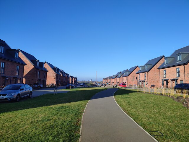
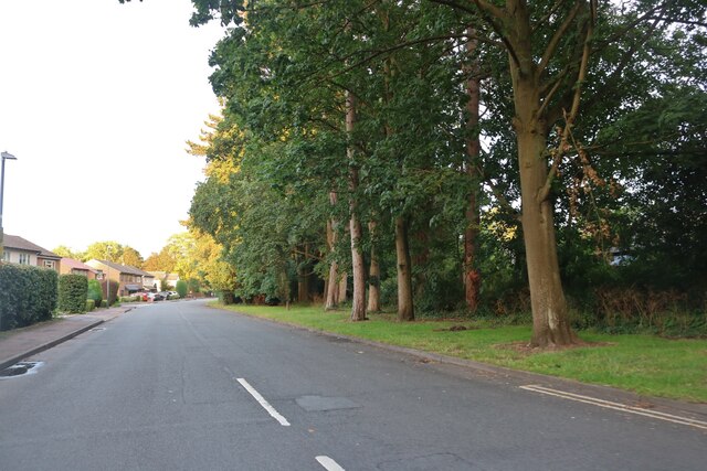
New green space, Beauchamp Park Development New central green avenue in the Beauchamp Park housing development at Gallows Hill.
New green space, Beauchamp Park Development Credit: AJD

Bridge Plantation is a picturesque woodland located in Warwickshire, England. Situated near the village of Wood, the plantation covers an area of approximately 50 acres and is known for its dense forest and scenic beauty. The plantation is a part of the larger Warwickshire Woodlands, which are renowned for their rich biodiversity and ecological significance.

The woodland of Bridge Plantation is predominantly composed of native tree species such as oak, ash, birch, and beech, creating a diverse and vibrant habitat for a variety of flora and fauna. The forest floor is covered with a lush carpet of ferns, mosses, and wildflowers, providing a haven for numerous species of insects, birds, and small mammals.

Visitors to Bridge Plantation can enjoy a tranquil stroll along the well-maintained paths that wind through the woodland. The plantation is also a popular spot for nature enthusiasts, birdwatchers, and photographers, who can capture the scenic beauty and capture sightings of rare and migratory birds that inhabit the area.

The management of Bridge Plantation is overseen by the local authorities, who ensure the preservation and conservation of the woodland. Efforts are made to maintain the delicate balance of the ecosystem, with periodic tree planting and controlled thinning to promote healthy growth and enhance biodiversity.

Overall, Bridge Plantation in Warwickshire is a stunning woodland, offering a serene escape from the hustle and bustle of everyday life. Its natural beauty, diverse wildlife, and well-preserved environment make it a cherished destination for nature lovers and those seeking solace in the great outdoors.

If you have any feedback on the listing, please let us know in the comments section below.

Bridge Plantation Images

Images are sourced within 2km of 52.279077/-1.5794915 or Grid Reference SP2864. Thanks to Geograph Open Source API. All images are credited.
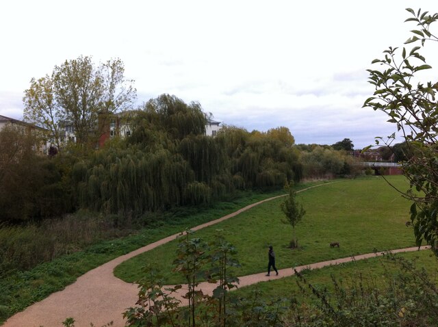
New green space, Beauchamp Park Development New central green avenue in the Beauchamp Park housing development at Gallows Hill.
New green space, Beauchamp Park Development
New central green avenue in the Beauchamp Park housing development at Gallows Hill.
Gallows Hill, Warwick Looking down Gallows Hill towards Warwick Castle from the end of the new housing development.
Gallows Hill, Warwick
Looking down Gallows Hill towards Warwick Castle from the end of the new housing development.
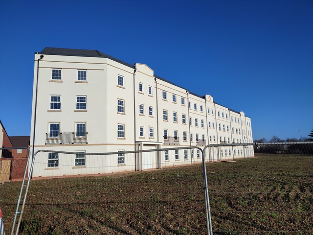
New Apartment Building by Gallows Hill This new apartment building overlooks the Europa Way roundabout, seen her from Gallows Hill.
New Apartment Building by Gallows Hill
This new apartment building overlooks the Europa Way roundabout, seen her from Gallows Hill.
Myton Lane, Warwick
Myton Lane, Warwick
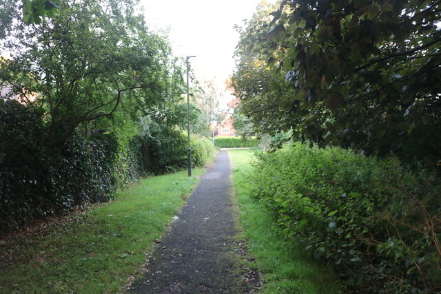
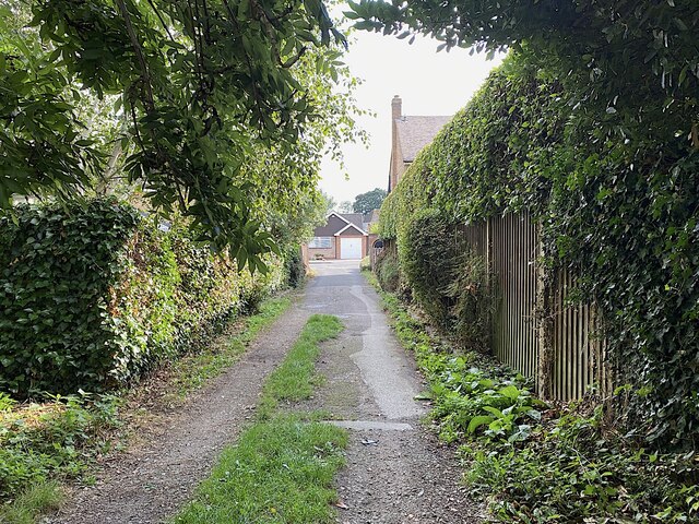
Path from Myton Lane to Myton Road
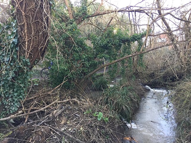
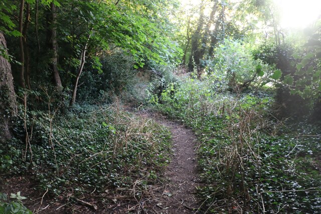
Woodland by Myton Lane, Warwick
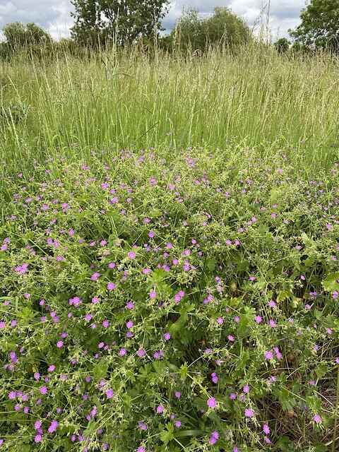
Cranesbill by Portobello Way, Warwick What a sweetie! A jumble of soft leaves and intensely pink little flowers that gladdened the heart. Thought to be Hedgerow Cranesbill (Geranium pyrenaicum), it flowered for only a day or two.
Cranesbill by Portobello Way, Warwick
What a sweetie! A jumble of soft leaves and intensely pink little flowers that gladdened the heart. Thought to be Hedgerow Cranesbill (Geranium pyrenaicum), it flowered for only a day or two.
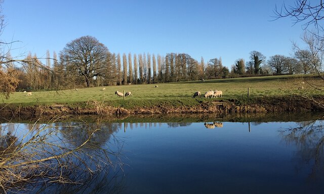
Sheep on Jephson's Farm across the Avon, Myton, Warwick The Lombardy Poplars follow the course of the River Leam <a href="https://www.geograph.org.uk/photo/1229733">SP3065 : Poplars on the Leam</a>. Its confluence with the Avon is out-of-shot left. The farm is bordered by rivers, housing estates and a railway, and is crossed by power lines and the canal. It produces a crop of lambs every year and nothing else.
Sheep on Jephson's Farm across the Avon, Myton, Warwick
The Lombardy Poplars follow the course of the River Leam SP3065 : Poplars on the Leam. Its confluence with the Avon is out-of-shot left. The farm is bordered by rivers, housing estates and a railway, and is crossed by power lines and the canal. It produces a crop of lambs every year and nothing else.
Footpaths by Rock Mill Lane, Milverton The paths are seen looking north from the Portobello Bridge that takes Emscote Road over the River Avon, which runs among the trees on the left hand side of the picture. In the distance, to the right, can be seen the new bridge that carries Sir Anthony Eden Way over the river and, behind it, the 18th century Rock Mill building, now converted to housing.
Footpaths by Rock Mill Lane, Milverton
The paths are seen looking north from the Portobello Bridge that takes Emscote Road over the River Avon, which runs among the trees on the left hand side of the picture. In the distance, to the right, can be seen the new bridge that carries Sir Anthony Eden Way over the river and, behind it, the 18th century Rock Mill building, now converted to housing.
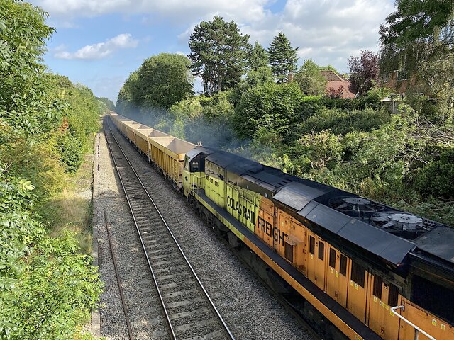
Empty stone train heading north, Myton, Warwick Residue in wagons looked like track ballast. An earlier occasion is <a href="https://www.geograph.org.uk/photo/6762865">SP3065 : Empty northbound stone train, Myton, near Warwick</a>.
Empty stone train heading north, Myton, Warwick
Residue in wagons looked like track ballast. An earlier occasion is SP3065 : Empty northbound stone train, Myton, near Warwick.
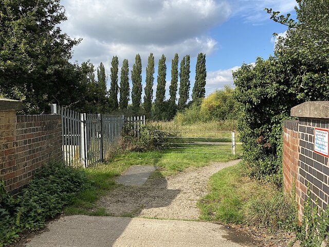
Way to Leam Road field from Leam Road bridge, Myton, Warwick The Riverside Walk runs past. The Lombardy Poplars are on the Edmondscote sports ground across the River Leam. More information about this spot is with <a href="https://www.geograph.org.uk/photo/6762865">SP3065 : Empty northbound stone train, Myton, near Warwick</a>.
Way to Leam Road field from Leam Road bridge, Myton, Warwick
The Riverside Walk runs past. The Lombardy Poplars are on the Edmondscote sports ground across the River Leam. More information about this spot is with SP3065 : Empty northbound stone train, Myton, near Warwick.
Track to Leam Road, Myton, Warwick Leam Road bridge over the railway is behind the camera.
Track to Leam Road, Myton, Warwick
Leam Road bridge over the railway is behind the camera.
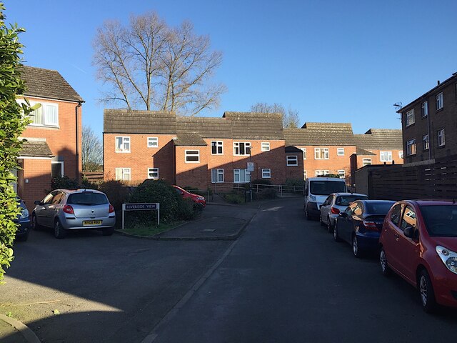
Grange Close, Emscote, Warwick
Canal overflow channel, Emscote, Warwick The Grand Union Canal between Warwick and Offchurch is a 'sink', ie, at a low level with water flowing into it from locks at each end. To avoid flooding there are several overflow weirs along the 7 km stretch. In the photo the canal is at high level left between bridge 46 and the Avon Aqueduct <a href="https://www.geograph.org.uk/photo/1677024">SP2965 : Towpath and overflow weir, Grand Union Canal, Emscote Road</a>. Water drops in a pipe or chute and is channelled to the River Avon behind the camera. The view is from this footbridge <a href="https://www.geograph.org.uk/photo/4448216">SP3065 : Small footbridge next to the River Avon</a>.
Canal overflow channel, Emscote, Warwick
The Grand Union Canal between Warwick and Offchurch is a 'sink', ie, at a low level with water flowing into it from locks at each end. To avoid flooding there are several overflow weirs along the 7 km stretch. In the photo the canal is at high level left between bridge 46 and the Avon Aqueduct SP2965 : Towpath and overflow weir, Grand Union Canal, Emscote Road. Water drops in a pipe or chute and is channelled to the River Avon behind the camera. The view is from this footbridge SP3065 : Small footbridge next to the River Avon.
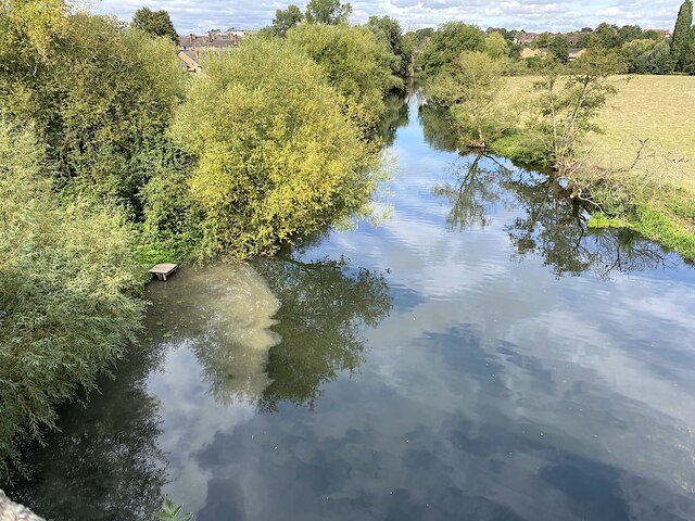
Canal overflow discharging to the River Avon, Warwick The cloudy water is overflow from the Grand Union Canal. It leaves the canal by a weir <a href="https://www.geograph.org.uk/photo/1677024">SP2965 : Towpath and overflow weir, Grand Union Canal, Emscote Road</a> and finds its way to the river by a channel more or less <a href="https://www.geograph.org.uk/photo/7085714">SP3065 : Canal overflow channel, Emscote, Warwick</a>. The viewpoint is the Avon Aqueduct, completed  in 1800 <a href="https://www.geograph.org.uk/photo/5039865">SP3065 : Aqueduct Over The Avon</a>.
Canal overflow discharging to the River Avon, Warwick
The cloudy water is overflow from the Grand Union Canal. It leaves the canal by a weir SP2965 : Towpath and overflow weir, Grand Union Canal, Emscote Road and finds its way to the river by a channel more or less SP3065 : Canal overflow channel, Emscote, Warwick. The viewpoint is the Avon Aqueduct, completed in 1800 SP3065 : Aqueduct Over The Avon.
Anglers call it a day, Jephson's Farm, Warwick Jephson's Farm rents out some fishing pegs on the bank of the River Avon. These two gents were struggling with a heavy cart of fishing gear. The view is from the canal towpath.
Anglers call it a day, Jephson's Farm, Warwick
Jephson's Farm rents out some fishing pegs on the bank of the River Avon. These two gents were struggling with a heavy cart of fishing gear. The view is from the canal towpath.
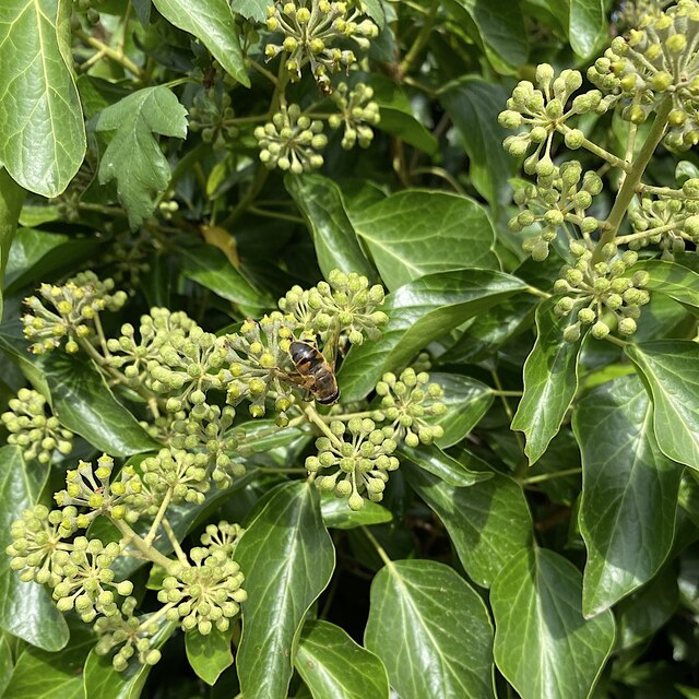
Bee on ivy flowers by the canal, Myton, Warwick Mid-September seems early in the year to be seeing this. One associates bees-on-ivy with early winter. Perhaps ivy has a long flowering season. Note the adult form of the leaves.
Bee on ivy flowers by the canal, Myton, Warwick
Mid-September seems early in the year to be seeing this. One associates bees-on-ivy with early winter. Perhaps ivy has a long flowering season. Note the adult form of the leaves.
Aragon Drive estate across the canal, Myton, Warwick
Show me another place!

Bridge Plantation is located at Grid Ref: SP2864 (Lat: 52.279077, Lng: -1.5794915)

Administrative County: Warwickshire

District: Warwick

Police Authority: Warwickshire

What 3 Words

///dizzy.tree.oasis. Near Warwick, Warwickshire

Related Wikis

Castle Bridge

Castle Bridge is a grade II* listed road bridge in Warwick, Warwickshire, England, which carries the A425 road over the River Avon.In 1788, the Earl of...

Old Castle Bridge

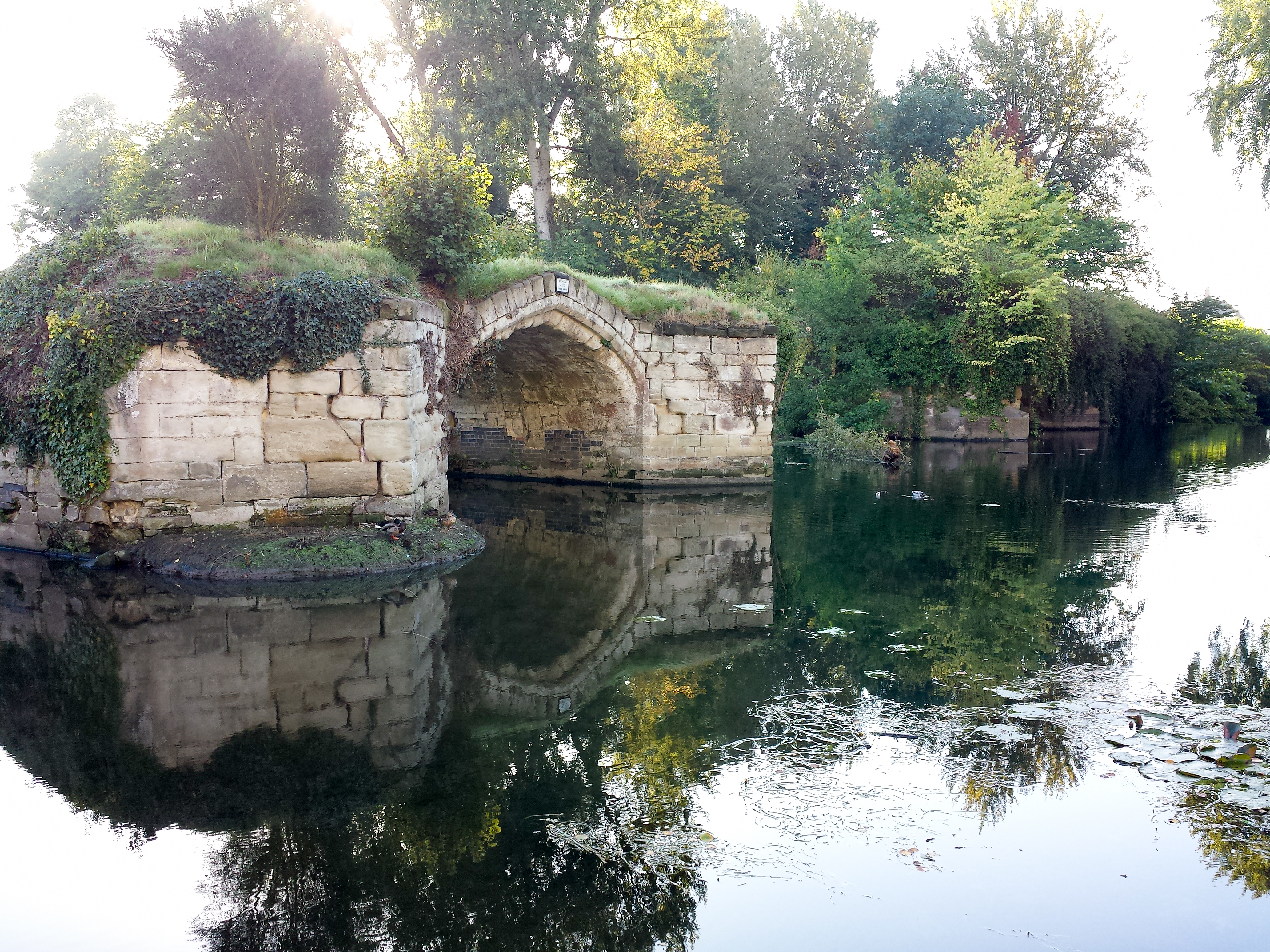
The Old Castle Bridge in Warwick, England is a ruined medieval bridge. The multi-arch stone bridge was built across the River Avon a short distance south...

The Mill Garden

The Mill Garden is a private garden adjacent to Warwick Castle measuring half an acre open to the public and situated on the bank of the River Avon in...

Warwick Boat Club

Warwick Boat Club is a rowing club on the River Avon. == History == The club was founded in 1861. Unusually it includes separate "sections" and good grounds...

St Nicholas' Park, Warwick

St. Nicholas' Park, commonly known as "St. Nick's", is a park is situated in the centre of Warwick, England. Bordering the park to the south is the River...

Warwick Castle

Warwick Castle is a medieval castle developed from a wooden fort, originally built by William the Conqueror during 1068. Warwick is the county town of...

Warwick School

Warwick School is a selective, public school (British independent boarding and day school) in Warwick, England. Known until about 1900 as King's School...

List of owners of Warwick Castle

Warwick Castle, in Warwickshire, UK, was first constructed in 1068. Over its 950 years of history it has been owned by 36 different individuals, plus...

Nearby Amenities

Located within 500m of 52.279077,-1.5794915
Warwick
Place: town
Population: 31345
Wikidata: Q549761
Wikipedia: en:Warwick
Lat/Long: 52.2814519/-1.5815742
Crossing
Bicycle: no
Crossing: marked
Crossing Markings: zebra;dots
Crossing Ref: zebra
Flashing Lights: always
Kerb: lowered
Tactile Paving: yes
Lat/Long: 52.2831434/-1.5816993
Give Way
Direction: forward
Lat/Long: 52.2813116/-1.582658
School
Warwick Preparatory School
Addr City: Warwick
Addr Postcode: CV34 6PL
Addr Street: Banbury Road
Capacity: 520
Fhrs Id: 242486
Isced Level: 0;1
Max Age: 11
Min Age: 3
Operator: Warwick Schools Foundation
Operator Type: private
Phone: +44 1926 491545
Ref GB Uprn: 10013182419
Ref Edubase: 125780
Religion: none
School Boarding: no
School Gender: mixed
School Selective: no
School Trust: no
School Type: independent
Website: https://www.warwickprep.com/
Lat/Long: 52.278224/-1.5763229
Toilets
Changing Table: yes
Fee: no
Operator: Warwick Council
Wheelchair: yes
Lat/Long: 52.2819465/-1.578757
Crazy Golf
Check Date Opening Hours: 2022-07-08
Leisure: miniature_golf
Opening Hours Signed: no
Payment Cash: yes
Wheelchair: no
Lat/Long: 52.2814996/-1.5798981
Cafe
Lat/Long: 52.2786891/-1.5866635
Barrier: height_restrictor
Barrier Movable: yes
Maxheight: 2.1
Lat/Long: 52.2816977/-1.5806938
Crossing
Bicycle: no
Crossing: marked
Crossing Markings: zebra;dots
Crossing Ref: zebra
Flashing Lights: always
Kerb: lowered
Tactile Paving: yes
Lat/Long: 52.2832602/-1.5818384
Addr City: Warwick
Addr Housename: The Garrett
Addr Housenumber: 76
Addr Postcode: CV34 4HU
Addr Street: Smith Street
Lat/Long: 52.2831266/-1.5818125
Addr Housenumber: 2
Addr Street: St. Nicholas Church Street
Lat/Long: 52.2828982/-1.5820004
Addr Housenumber: 4
Addr Street: St. Nicholas Church Street
Lat/Long: 52.282844/-1.5820608
Addr Housenumber: 18
Lat/Long: 52.2825459/-1.5822458
Addr Housenumber: 36
Lat/Long: 52.2820017/-1.5824948
Bicycle Parking
Bicycle Parking: stands
Capacity: 4
Covered: no
Stands: 4
Lat/Long: 52.2817343/-1.5793062
Bench
Backrest: yes
Lat/Long: 52.2811358/-1.5743397
Bench
Backrest: yes
Lat/Long: 52.2808808/-1.5746026
Bench
Backrest: yes
Lat/Long: 52.2806966/-1.5748987
Bench
Backrest: yes
Lat/Long: 52.2805874/-1.5752373
Bench
Backrest: yes
Lat/Long: 52.2804974/-1.5757632
Bench
Backrest: yes
Lat/Long: 52.2804242/-1.5763438
Bench
Backrest: yes
Lat/Long: 52.2803956/-1.576674
Bench
Backrest: yes
Lat/Long: 52.2803782/-1.5771006
Bench
Backrest: yes
Lat/Long: 52.281247/-1.5785772
Bench
Backrest: yes
Lat/Long: 52.2809667/-1.5780797
Bench
Backrest: yes
Lat/Long: 52.2807041/-1.5778067
Bench
Backrest: yes
Lat/Long: 52.2805947/-1.5776475
Bench
Backrest: yes
Lat/Long: 52.2803337/-1.5801219
Bench
Backrest: yes
Lat/Long: 52.2804168/-1.580272
Bench
Backrest: yes
Lat/Long: 52.2805072/-1.5804387
Bench
Backrest: yes
Lat/Long: 52.2807905/-1.5793582
Bench
Backrest: yes
Lat/Long: 52.2807626/-1.5794318
Bench
Backrest: yes
Lat/Long: 52.2807147/-1.5794823
Bench
Backrest: yes
Lat/Long: 52.2806231/-1.5794718
Bench
Backrest: yes
Lat/Long: 52.2805584/-1.5793408
Bench
Backrest: yes
Lat/Long: 52.2805893/-1.5791403
Bench
Backrest: yes
Lat/Long: 52.2803448/-1.5792459
Bench
Backrest: yes
Lat/Long: 52.2804211/-1.5792525
Sport: chess
Lat/Long: 52.2812631/-1.5797417
Bench
Backrest: yes
Lat/Long: 52.2816804/-1.5800955
Bench
Backrest: yes
Lat/Long: 52.2816813/-1.5801836
Bench
Backrest: yes
Lat/Long: 52.2816747/-1.5804128
Addr Housenumber: 17
Addr Street: St. Nicholas Church Street
Lat/Long: 52.2824882/-1.5820712
Addr Housenumber: 23
Addr Street: St. Nicholas Church Street
Lat/Long: 52.2822807/-1.5821847
Addr Housenumber: 1
Addr Postcode: CV34 4QY
Addr Street: St. Nicholas Park
Lat/Long: 52.2816961/-1.5797201
Addr Housenumber: 2
Addr Postcode: CV34 4QY
Addr Street: St. Nicholas Park
Lat/Long: 52.281709/-1.5796175
Bus Stop
Warwick Castle
Bench: no
Bin: yes
Bus: yes
Covered: no
Lit: yes
Naptan AtcoCode: 4200F072500
Naptan Bearing: NW
Naptan CommonName: Warwick Castle
Naptan Indicator: Adj
Naptan Landmark: Warwick Castle
Naptan NaptanCode: waradtga
Naptan PlusbusZoneRef: LMNGTNS
Naptan Street: Castle Hill
Passenger Information Display: no
Physically Present: yes
Public Transport: platform
Shelter: no
Source: naptan_import
Tactile Paving: no
Lat/Long: 52.2816579/-1.5837803
Bus Stop
Warwick Castle
Bench: no
Bin: no
Bus: yes
Covered: no
Lit: yes
Naptan AtcoCode: 4200F072600
Naptan Bearing: SE
Naptan CommonName: Warwick Castle
Naptan Indicator: Opp
Naptan Landmark: Warwick Castle
Naptan NaptanCode: waradtgd
Naptan PlusbusZoneRef: LMNGTNS
Naptan Street: Castle Hill
Passenger Information Display: no
Physically Present: yes
Public Transport: platform
Shelter: no
Source: naptan_import
Tactile Paving: no
Lat/Long: 52.2819586/-1.5842127
Bus Stop
St Nicholas Park
Bench: no
Bin: no
Bus: yes
Covered: no
Lit: yes
Naptan AtcoCode: 4200F074700
Naptan Bearing: SE
Naptan CommonName: St Nicholas Park
Naptan Indicator: Adj
Naptan Landmark: St Nicholas Park
Naptan NaptanCode: waradwaj
Naptan PlusbusZoneRef: LMNGTNS
Naptan Street: Banbury Road
Passenger Information Display: no
Physically Present: yes
Public Transport: platform
Shelter: no
Source: naptan_import
Tactile Paving: no
Lat/Long: 52.2806911/-1.5809886
Weston Close
Naptan AtcoCode: 4200F075000
Naptan Bearing: W
Naptan BusStopType: CUS
Naptan CommonName: Weston Close
Naptan Indicator: Adj
Naptan Landmark: St Johns
Naptan NaptanCode: waradwat
Naptan PlusbusZoneRef: LMNGTNS
Naptan Street: Weston Close
Naptan Verified: no
Source: naptan_import
Lat/Long: 52.2832058/-1.5790309
Bus Stop
Bridge End
Bench: no
Bin: no
Bus: yes
Covered: no
Lit: yes
Naptan AtcoCode: 4200F132321
Naptan Bearing: NW
Naptan CommonName: Bridge End
Naptan Indicator: Adj
Naptan Landmark: The Squirrels
Naptan NaptanCode: warawgpa
Naptan PlusbusZoneRef: LMNGTNS
Naptan Street: Banbury Road
Naptan Verified: no
Passenger Information Display: no
Public Transport: platform
Source: naptan_import
Tactile Paving: no
Lat/Long: 52.2781149/-1.5781585
Bus Stop
Bridge End
Bench: no
Bin: no
Bus: yes
Covered: no
Lit: yes
Naptan AtcoCode: 4200F132322
Naptan Bearing: SE
Naptan CommonName: Bridge End
Naptan Crossing: Bridge End
Naptan Indicator: Opp
Naptan Landmark: Squirells
Naptan NaptanCode: waramaga
Naptan PlusbusZoneRef: LMNGTNS
Naptan Street: Banbury Road
Naptan Verified: no
Passenger Information Display: no
Public Transport: platform
Source: naptan_import
Tactile Paving: no
Lat/Long: 52.2776073/-1.5772518
Bus Stop
Banbury Road
Bench: no
Bin: no
Bus: yes
Covered: no
Lit: yes
Naptan AtcoCode: 4200F145501
Naptan Bearing: SW
Naptan CommonName: Banbury Road
Naptan Crossing: Banbury Road
Naptan Indicator: Adj
Naptan NaptanCode: waragamg
Naptan PlusbusZoneRef: LMNGTNS
Naptan Street: Myton Road
Naptan Verified: no
Passenger Information Display: no
Public Transport: platform
Shelter: no
Source: naptan_import
Tactile Paving: no
Lat/Long: 52.2789585/-1.5779865
Bus Stop
Warwick School
Bench: no
Bin: no
Bus: yes
Covered: no
Lit: yes
Naptan AtcoCode: 4200F145502
Naptan Bearing: E
Naptan CommonName: Warwick School
Naptan Indicator: Opp
Naptan Landmark: Warwick School
Naptan NaptanCode: waragamj
Naptan PlusbusZoneRef: LMNGTNS
Naptan Street: Myton Road
Naptan Verified: no
Passenger Information Display: no
Public Transport: platform
Shelter: no
Source: naptan_import
Tactile Paving: yes
Lat/Long: 52.279636/-1.5750206
Bus Stop
St John's House
Bench: no
Bin: no
Bus: yes
Covered: no
Departures Board: timetable
Lit: no
Naptan AtcoCode: 4200F154501
Naptan Bearing: SW
Naptan CommonName: St Johns Museum
Naptan Indicator: Adj
Naptan Landmark: St Johns Museum
Naptan NaptanCode: warapwgd
Naptan PlusbusZoneRef: LMNGTNS
Naptan Street: St Johns
Passenger Information Display: no
Physically Present: yes
Public Transport: platform
Shelter: no
Source: naptan_import
Tactile Paving: no
Lat/Long: 52.2832858/-1.5813507
Barrier: kerb
Lat/Long: 52.2768943/-1.576424
Parking
Myton Fields
Access: yes
Capacity Disabled: no
Fee: yes
Parking: surface
Lat/Long: 52.2795799/-1.576615
Restaurant
The Undercroft
Source: survey
Lat/Long: 52.2789974/-1.5852036
Toilets
Access: permissive
Female: yes
Level: -1
Male: yes
Lat/Long: 52.2790827/-1.5850886
Atm
Lat/Long: 52.2790433/-1.5851368
Theatre
Bridge House Theatre
Lat/Long: 52.2786924/-1.5761732
Give Way
Direction: backward
Lat/Long: 52.2787503/-1.5788762
Traffic Signals
Crossing Markings: no
Traffic Signals: signal
Traffic Signals Direction: forward
Lat/Long: 52.2821454/-1.5848417
Crossing
Button Operated: yes
Crossing: traffic_signals
Crossing Island: no
Kerb: lowered
Tactile Paving: yes
Traffic Signals Sound: yes
Traffic Signals Vibration: yes
Lat/Long: 52.281161/-1.5820731
Give Way
Direction: forward
Lat/Long: 52.2815488/-1.5829803
Barrier: height_restrictor
Maxheight: 2.1
Lat/Long: 52.2816809/-1.5809174
Barrier: lift_gate
Lift Gate Type: single
Lat/Long: 52.2823774/-1.5784479
Cafe
Lat/Long: 52.2784731/-1.5857874
Crossing
Lat/Long: 52.2790798/-1.5760433
Entrance: main
Lat/Long: 52.2808912/-1.5857395
Metropolis Vintage Toys
Addr City: Warwick
Addr Housenumber: 41b
Addr Postcode: CV34 4JA
Addr Street: Smith Street
Check Date Opening Hours: 2024-04-01
Opening Hours Signed: no
Shop: toys
Website: https://www.metropolistoys.co.uk/
Lat/Long: 52.2829898/-1.5829856
Picturesque
Addr City: Warwick
Addr Housenumber: 41
Addr Postcode: CV34 4JA
Addr Street: Smith Street
Opening Hours: Tu-Sa 09:00-17:25
Phone: +44 1926 495589
Shop: art
Website: https://www.picturesque-warwick.co.uk/
Lat/Long: 52.2829766/-1.5830481
Queen of Hearts & Violet Says
Addr City: Warwick
Addr Housenumber: 39
Addr Postcode: CV34 4JA
Addr Street: Smith Street
Check Date Opening Hours: 2024-04-01
Female Signed: no
Male Signed: no
Opening Hours Signed: no
Shop: hairdresser
Lat/Long: 52.2829578/-1.5831134
Posh Paws by Zoe
Addr City: Warwick
Addr Housenumber: 37
Addr Postcode: CV34 4JA
Addr Street: Smith Street
Check Date Opening Hours: 2024-04-01
Opening Hours Signed: no
Phone: +44 1926 257087
Shop: pet_grooming
Lat/Long: 52.2829366/-1.5832024
Royal Regiment of Fusiliers
Fee: no
Tourism: museum
Wikidata: Q7374770
Lat/Long: 52.2831847/-1.5804278
Traffic Calming: hump
Lat/Long: 52.2820311/-1.5802706
Bench
Backrest: yes
Source: survey
Lat/Long: 52.2802275/-1.579906
Post Box
Brand: Royal Mail
Brand Wikidata: Q638098
Brand Wikipedia: en:Royal Mail
Collection Times: Mo-Fr 09:00; Sa 07:00
Operator: Royal Mail
Operator Wikidata: Q638098
Post Box Design: ludlow
Post Box Type: wall
Ref: CV34 127D
Royal Cypher: ER
Source: survey
Lat/Long: 52.2829827/-1.5825098
Post Box
Brand: Royal Mail
Brand Wikidata: Q638098
Brand Wikipedia: en:Royal Mail
Collection Times: Mo-Fr 09:00, Sa 07:00
Operator: Royal Mail
Operator Wikidata: Q638098
Post Box Mounting: brick_pillar
Post Box Type: wall
Ref: CV34 150
Royal Cypher: EIIR
Royal Cypher Wikidata: Q33102113
Source: survey
Lat/Long: 52.2798074/-1.5739706
Post Box
Brand: Royal Mail
Brand Wikidata: Q638098
Brand Wikipedia: en:Royal Mail
Collection Times: Mo-Fr 09:00; Sa 07:00
Operator: Royal Mail
Operator Wikidata: Q638098
Post Box Mounting: brick_pillar
Post Box Type: wall
Ref: CV34 113D
Royal Cypher: VR
Royal Cypher Wikidata: Q33102356
Source: survey
Lat/Long: 52.2784315/-1.5824961
Bench
Backrest: yes
Check Date: 2021-04-10
Material: metal
Source: survey
Lat/Long: 52.2813045/-1.583034
Bench
Backrest: yes
Check Date: 2021-04-10
Material: metal
Source: survey
Lat/Long: 52.2813521/-1.5830848
Warwick Trebuchet
Historic: heritage
Tourism: attraction
Wheelchair: yes
Lat/Long: 52.2778909/-1.5853029
Fire Hydrant
Emergency: fire_hydrant
Fire Hydrant Diameter Signed: no
Fire Hydrant Position: lane
Fire Hydrant Type: underground
Note: from survey today
Operator: Severn Trent Water
Water Source: main
Lat/Long: 52.2812904/-1.5828247
Fire Hydrant
Emergency: fire_hydrant
Fire Hydrant Diameter Signed: no
Fire Hydrant Position: lane
Fire Hydrant Type: underground
Note: in roadway. from survey today
Operator: Severn Trent Water
Water Source: main
Lat/Long: 52.282026/-1.5845003
Fast Food
Coffee & Waffles
Lat/Long: 52.279912/-1.585376
Shop: confectionery
Lat/Long: 52.27996/-1.58507
Tourism: viewpoint
Wheelchair: no
Lat/Long: 52.280107/-1.585296
Courtyard Shop
Shop: gift
Lat/Long: 52.279717/-1.584553
Shop: gift
Lat/Long: 52.279067/-1.585668
Level: -1
Shop: gift
Lat/Long: 52.2791549/-1.5850036
Tourism: viewpoint
Wheelchair: no
Lat/Long: 52.279067/-1.586252
Accounts and Returns
Addr City: Warwick
Addr Housenumber: 26
Addr Postcode: CV34 4HS
Addr Street: Smith Street
Office: accountant
Source: survey
Lat/Long: 52.2826345/-1.5837459
Aquarius
Addr City: Warwick
Addr Housenumber: 40
Addr Postcode: CV34 4HS
Addr Street: Smith Street
Note: no name visible on exterior 11/04/19
Shop: clothes
Source: survey
Lat/Long: 52.2827647/-1.5831784
The Den Barbershop
Addr City: Warwick
Addr Housenumber: 30
Addr Postcode: CV34 4HS
Addr Street: Smith Street
Male: yes
Shop: hairdresser
Source: survey
Lat/Long: 52.282675/-1.5835867
Bananas
Addr City: Warwick
Addr Housenumber: 42
Addr Postcode: CV34 4HS
Addr Street: Smith Street
Clothes: children
Shop: clothes
Source: survey
Lat/Long: 52.2828187/-1.5829814
Barbers of Warwick
Addr City: Warwick
Addr Housenumber: 46
Addr Postcode: CV34 4HS
Addr Street: Smith Street
Shop: hairdresser
Source: survey
Website: https://barbersofwarwick.co.uk/
Lat/Long: 52.2828447/-1.5828631
Bateman Group
Addr City: Warwick
Addr Housenumber: 52
Addr Postcode: CV34 4HS
Addr Street: Smith Street
Note: upstairs
Office: insurance
Source: survey
Lat/Long: 52.2828736/-1.5827843
Hayley's Hands & Beauty
Addr City: Warwick
Addr Housenumber: 44
Addr Postcode: CV34 4HS
Addr Street: Smith Street
Clothes: women
Phone: +44 1926 494697
Shop: beauty
Source: survey
Website: https://hayleys-hands-beauty.business.site/
Lat/Long: 52.2828312/-1.5829136
Revivr
Addr City: Warwick
Addr Housenumber: 30a
Addr Postcode: CV34 4HS
Addr Street: Smith Street
Phone: +44 7971 958 742
Shop: furniture
Source: survey
Website: https://www.revivr.co.uk/
Lat/Long: 52.2826866/-1.5835063
Browsers
Addr City: Warwick
Addr Housenumber: 42a
Addr Postcode: CV34 4HS
Addr Street: Smith Street
Shop: gift
Source: survey
Lat/Long: 52.2827791/-1.5831201
Cloud 9
Addr City: Warwick
Addr Housenumber: 56-58
Addr Postcode: CV34 4HS
Addr Street: Smith Street
Shop: gift
Source: survey
Lat/Long: 52.2828987/-1.5826614
Eastgate Carpets
Addr City: Warwick
Addr Housenumber: 42
Addr Postcode: CV34 4HS
Addr Street: Smith Street
Shop: carpet
Source: survey
Lat/Long: 52.2827994/-1.5830539
Kindergarten
Noah's Ark Christian Pre-school
Addr City: Warwick
Addr Housename: Church Hall
Addr Postcode: CV34 4HD
Addr Street: Gerrard Street
Capacity: 32
Opening Hours: Mo,We 09:15-13:00; Tu,Th,Fr 09:15-14:45
Operator: Castle Hill Baptist Church
Website: https://noahsark.org.uk/
Lat/Long: 52.281986/-1.5834149
Pillows and Porcelain
Addr City: Warwick
Addr Housenumber: 8
Addr Postcode: CV34 4HH
Addr Street: Smith Street
Note: seems to be a vintage porcelain hire shop and also a B&B
Source: survey
Tourism: guest_house
Website: http://www.pillowsandporcelain.com/
Wheelchair: no
Lat/Long: 52.2823794/-1.5843701
Fast Food
Caprinos
Addr City: Warwick
Addr Housenumber: 36
Addr Postcode: CV34 4HS
Addr Street: Smith Street
Brand: Caprinos
Brand Wikidata: Q125623745
Cuisine: pizza
Fhrs Id: 800942
Opening Hours: Mo-Su 11:00-23:00
Source: survey
Website: https://warwick.caprinospizza.co.uk
Lat/Long: 52.2827492/-1.583273
Restaurant
The Aubergine
Addr City: Warwick
Addr Housenumber: 32
Addr Postcode: CV34 4HS
Addr Street: Smith Street
Cuisine: turkish
Fhrs Id: 242580
Source: survey
Website: https://aubergineturkishrestaurant.co.uk/
Lat/Long: 52.2827097/-1.583448
Concept Beauty Academy
Addr City: Warwick
Addr Housenumber: 28
Addr Postcode: CV34 4HS
Addr Street: Smith Street
Note: currently closed for building work Feb 23
Shop: beauty
Source: survey
Website: https://www.conceptbeautyacademy.com/
Lat/Long: 52.2826538/-1.5836686
Bar
The Wine House
Addr City: Warwick
Addr Housenumber: 34
Addr Postcode: CV34 4HS
Addr Street: Smith Street
Fhrs Id: 1564079
Source: survey
Lat/Long: 52.2827271/-1.583366
Addr City: Warwick
Addr Housenumber: 12-14
Addr Postcode: CV34 4HH
Addr Street: Smith Street
Disused Shop: yes
Note: sign says "attentivy" opening soon
Source: survey
Lat/Long: 52.2824161/-1.5842739
Warwick Guitars
Addr City: Warwick
Addr Housenumber: 54
Addr Postcode: CV34 4HS
Addr Street: Smith Street
Shop: music
Source: survey
Lat/Long: 52.2828871/-1.5827355
Addr City: Warwick
Addr Housenumber: 6
Addr Postcode: CV34 4HH
Addr Street: Smith Street
Disused Shop: vacant
Source: survey
Lat/Long: 52.2823264/-1.5845403
Stephanie Holt Jewellery Artist
Addr City: Warwick
Addr Housenumber: 20
Addr Postcode: CV34 4HS
Addr Street: Smith Street
Opening Hours: Th 11:00-17:30
Shop: yes
Source: survey
Lat/Long: 52.282567/-1.5839808
Toilets
Fee: no
Female: yes
Male: yes
Toilets Handwashing: yes
Wheelchair: yes
Lat/Long: 52.2806338/-1.585962
Bench
Lat/Long: 52.2795031/-1.5838719
Bench
Lat/Long: 52.2795281/-1.5836708
Bench
Lat/Long: 52.2795187/-1.5837103
Entrance: main
Lat/Long: 52.2828674/-1.577086
Note: dropped kerb access for bicycles.
Lat/Long: 52.2786329/-1.578486
Crossing
Crossing: unmarked
Tactile Paving: yes
Lat/Long: 52.2787205/-1.5785876
Crossing
Crossing: unmarked
Tactile Paving: yes
Lat/Long: 52.2786896/-1.578672
Entrance: main
Lat/Long: 52.2817435/-1.5820669
Utopia
Addr City: Warwick
Addr Housenumber: 76
Addr Postcode: CV34 4HU
Addr Street: Smith Street
Phone: +44 1926 493082
Shop: beauty
Website: https://www.utopia-beauty.co.uk/
Lat/Long: 52.2831873/-1.581862
Warwick Print & Copy
Addr City: Warwick
Addr Housenumber: 72-74
Addr Postcode: CV34 4HU
Addr Street: Smith Street
Note: above hairdresser
Shop: copyshop
Source: survey
Lat/Long: 52.2831207/-1.5820531
K A Barber
Addr City: Warwick
Addr Housenumber: 70
Addr Postcode: CV34 4HU
Addr Street: Smith Street
Shop: hairdresser
Lat/Long: 52.2831182/-1.5820805
The Den
Addr City: Warwick
Addr Housenumber: 68a
Addr Postcode: CV34 4HU
Addr Street: Smith Street
Shop: hairdresser
Source: survey
Lat/Long: 52.2831126/-1.5821029
Paul Edwards Interiors
Addr City: Warwick
Addr Housenumber: 48
Addr Postcode: CV34 4HS
Addr Street: Smith Street
Shop: interior_decoration
Lat/Long: 52.2828634/-1.5828303
The Children's Society
Addr City: Warwick
Addr Housenumber: 55
Addr Postcode: CV34 4HU
Addr Street: Smith Street
Brand: The Children's Society
Brand Wikidata: Q7722484
Brand Wikipedia: en:The Children's Society
Opening Hours: Mo-Fr 09:00-17:00; Sa 09:30-17:00
Shop: charity
Source: survey
Lat/Long: 52.2831408/-1.582402
Bateman Group
Addr City: Warwick
Addr Housenumber: 53
Addr Postcode: CV34 4HU
Addr Street: Smith Street
Check Date Opening Hours: 2024-04-01
Office: insurance
Opening Hours Signed: no
Lat/Long: 52.2831244/-1.5824786
Warwick Vacuum Shop
Addr City: Warwick
Addr Housenumber: 43
Addr Postcode: CV34 4JA
Addr Street: Smith Street
Opening Hours: Tu,We,Fr,Sa 10:00-17:00
Shop: vacuum_cleaner
Website: https://www.warwickvac.co.uk/
Lat/Long: 52.2829927/-1.5829056
Metropolis Vintage Toys
Check Date Opening Hours: 2024-04-01
Note: maybe just another display window for their main shop at no 41
Opening Hours Signed: no
Shop: toys
Source: survey
Lat/Long: 52.2828396/-1.583509
Barrier: height_restrictor
Maxheight: 2.1
Lat/Long: 52.2795927/-1.576257
Crossing
Lat/Long: 52.279272/-1.5761279
Crossing
Lat/Long: 52.2770077/-1.5764699
Barrier: bollard
Lat/Long: 52.2804752/-1.5740401
Barrier: bollard
Lat/Long: 52.2804609/-1.5740307
Barrier: bollard
Lat/Long: 52.2804469/-1.5740213
Barrier: bollard
Lat/Long: 52.2804353/-1.5740125
Generator Method: photovoltaic
Generator Output Electricity: yes
Generator Source: solar
Generator Type: solar_photovoltaic_panel
Power: generator
Source: bing
Lat/Long: 52.276966/-1.5791439
Generator Method: photovoltaic
Generator Output Electricity: yes
Generator Source: solar
Generator Type: solar_photovoltaic_panel
Location: roof
Power: generator
Lat/Long: 52.2833519/-1.5784036
Generator Method: photovoltaic
Generator Output Electricity: yes
Generator Source: solar
Generator Type: solar_photovoltaic_panel
Location: roof
Power: generator
Lat/Long: 52.2835127/-1.5786208
Generator Method: photovoltaic
Generator Output Electricity: yes
Generator Source: solar
Generator Type: solar_photovoltaic_panel
Location: roof
Power: generator
Lat/Long: 52.2802091/-1.5731957
Generator Method: photovoltaic
Generator Output Electricity: yes
Generator Source: solar
Generator Type: solar_photovoltaic_panel
Location: roof
Power: generator
Lat/Long: 52.2802459/-1.5730152
Generator Method: photovoltaic
Generator Output Electricity: yes
Generator Source: solar
Generator Type: solar_photovoltaic_panel
Location: roof
Power: generator
Lat/Long: 52.2772265/-1.5819708
Traffic Signals
Crossing Markings: no
Traffic Signals: signal
Traffic Signals Direction: backward
Lat/Long: 52.2811765/-1.5821084
Traffic Signals
Crossing Markings: no
Traffic Signals: signal
Traffic Signals Direction: forward
Lat/Long: 52.2811434/-1.582033
Barrier: kerb
Kerb: lowered
Tactile Paving: yes
Lat/Long: 52.2787296/-1.5785662
Kerb: no
Tactile Paving: no
Lat/Long: 52.2787133/-1.5786067
Kerb: no
Tactile Paving: no
Lat/Long: 52.2787007/-1.5786401
Barrier: kerb
Kerb: lowered
Tactile Paving: yes
Lat/Long: 52.2786727/-1.5787146
Barrier: kerb
Kerb: lowered
Tactile Paving: yes
Lat/Long: 52.277597/-1.5775158
Crossing
Crossing: unmarked
Crossing Island: no
Crossing Markings: no
Tactile Paving: yes
Lat/Long: 52.2775501/-1.5774566
Crossing
Bicycle: yes
Button Operated: yes
Crossing: traffic_signals
Crossing Island: no
Crossing Markings: dots
Crossing Ref: toucan
Tactile Paving: yes
Traffic Signals Sound: yes
Traffic Signals Vibration: yes
Lat/Long: 52.2792764/-1.5768293
Traffic Signals
Crossing Markings: no
Traffic Signals: signal
Traffic Signals Direction: backward
Lat/Long: 52.2792882/-1.5767584
Traffic Signals
Crossing Markings: no
Traffic Signals: signal
Traffic Signals Direction: forward
Lat/Long: 52.2792643/-1.576902
Street Lamp
Lamp Mount: straight_mast
Lamp Type: metal-halide
Ref: 25
Lat/Long: 52.2822943/-1.5775166
Street Lamp
Lamp Mount: straight_mast
Lamp Type: led
Ref: 11
Lat/Long: 52.2826303/-1.5767389
Street Lamp
Lamp Mount: straight_mast
Lamp Type: led
Ref: 10
Lat/Long: 52.2828208/-1.5761556
Street Lamp
Lamp Mount: straight_mast
Lamp Type: metal-halide
Ref: 26
Lat/Long: 52.2823334/-1.5778475
Street Lamp
Lamp Mount: straight_mast
Lamp Type: metal-halide
Ref: 24
Lat/Long: 52.2825068/-1.5770498
Traffic Calming: bump
Lat/Long: 52.2814299/-1.5811475
Stop
Direction: backward
Stop: minor
Lat/Long: 52.2810452/-1.5817178
Street Lamp
Lamp Mount: straight_mast
Lamp Type: led
Lat/Long: 52.281881/-1.5805254
Street Lamp
Lamp Mount: straight_mast
Lat/Long: 52.2811368/-1.5815094
Street Lamp
Lamp Mount: straight_mast
Lat/Long: 52.2815615/-1.580838
Street Lamp
Lamp Mount: bent_mast
Lat/Long: 52.281674/-1.5806084
Street Lamp
Lamp Mount: straight_mast
Lat/Long: 52.2812879/-1.5812703
Street Lamp
Lamp Mount: straight_mast
Ref: 20
Lat/Long: 52.2822174/-1.5809399
Street Lamp
Lamp Mount: straight_mast
Lat/Long: 52.2814198/-1.5810414
Crossing
Crossing: unmarked
Crossing Markings: no
Tactile Paving: yes
Lat/Long: 52.279438/-1.5761431
Crossing
Crossing: unmarked
Crossing Island: no
Tactile Paving: yes
Lat/Long: 52.2799164/-1.5732547
Bicycle Parking
Bicycle Parking: stands
Capacity: 6
Covered: no
Lat/Long: 52.27949/-1.5762458
Street Lamp
Lamp Mount: bent_mast
Lamp Type: metal-halide
Ref: 3
Lat/Long: 52.2827886/-1.5820724
Street Lamp
Lamp Mount: bent_mast
Lamp Type: metal-halide
Ref: 4
Lat/Long: 52.2825661/-1.5822091
Street Lamp
Lamp Mount: bent_mast
Lamp Type: metal-halide
Ref: 5
Lat/Long: 52.2822546/-1.5822075
Street Lamp
Lamp Mount: bent_mast
Lamp Type: metal-halide
Ref: 6
Lat/Long: 52.2819396/-1.5823514
Street Lamp
Lamp Mount: bent_mast
Lamp Type: led
Light Count: 4
Ref: 13
Lat/Long: 52.2814712/-1.5828131
Street Lamp
Lamp Mount: bent_mast
Lamp Type: metal-halide
Ref: 7
Lat/Long: 52.2816458/-1.5824845
Street Lamp
Lamp Mount: bent_mast
Lamp Type: led
Ref: 1
Lat/Long: 52.2814391/-1.582436
Street Lamp
Lamp Mount: bent_mast
Lamp Type: led
Ref: 12
Lat/Long: 52.2816306/-1.5829442
Give Way
Direction: forward
Lat/Long: 52.2816237/-1.5831978
Street Lamp
Lamp Mount: bent_mast
Lamp Type: led
Ref: 6
Lat/Long: 52.2830489/-1.5823186
Street Lamp
Lamp Mount: bent_mast
Lamp Type: led
Ref: 5
Lat/Long: 52.2827722/-1.5833153
Street Lamp
Lamp Mount: bent_mast
Lamp Type: led
Ref: 4
Lat/Long: 52.2819474/-1.5847838
Street Lamp
Lamp Mount: bent_mast
Lamp Type: led
Ref: 5
Lat/Long: 52.2819937/-1.5843085
Street Lamp
Lamp Mount: bent_mast
Lamp Type: led
Ref: 8
Lat/Long: 52.2816747/-1.583862
Street Lamp
Lamp Mount: bent_mast
Lamp Type: led
Ref: 7
Lat/Long: 52.2818688/-1.5840239
Street Lamp
Lamp Mount: bent_mast
Lamp Type: led
Ref: 10
Lat/Long: 52.2815078/-1.5832916
Street Lamp
Lamp Mount: bent_mast
Lamp Type: led
Ref: 11
Lat/Long: 52.281623/-1.5830442
Street Lamp
Lamp Mount: straight_mast
Lamp Type: led
Ref: 1
Lat/Long: 52.2812445/-1.5828705
Street Lamp
Lamp Mount: bent_mast
Lamp Type: led
Ref: 3
Lat/Long: 52.2811173/-1.5821917
Street Lamp
Lamp Mount: bent_mast
Lamp Type: led
Ref: 2
Lat/Long: 52.281205/-1.5824425
Street Lamp
Lamp Mount: bent_mast
Lamp Type: led
Ref: 4
Lat/Long: 52.2811824/-1.581961
Street Lamp
Lamp Mount: bent_mast
Lamp Type: led
Ref: 5
Lat/Long: 52.2809752/-1.5815018
Street Lamp
Lamp Mount: bent_mast
Lamp Type: led
Ref: 6
Lat/Long: 52.2806978/-1.58098
Street Lamp
Lamp Mount: bent_mast
Lamp Type: led
Ref: 7
Lat/Long: 52.2804511/-1.5805324
Street Lamp
Lamp Mount: bent_mast
Lamp Type: led
Ref: 8
Lat/Long: 52.280181/-1.5801059
Street Lamp
Lamp Mount: bent_mast
Lamp Type: led
Ref: 9
Lat/Long: 52.2798954/-1.5797141
Street Lamp
Lamp Mount: bent_mast
Lamp Type: led
Ref: 10
Lat/Long: 52.2793359/-1.5794539
Street Lamp
Lamp Mount: bent_mast
Lamp Type: led
Ref: 11
Lat/Long: 52.2791218/-1.5792153
Street Lamp
Lamp Mount: bent_mast
Lamp Type: led
Ref: 14
Lat/Long: 52.2789459/-1.5787193
Street Lamp
Lamp Mount: bent_mast
Lamp Type: led
Ref: 12
Lat/Long: 52.2790311/-1.5788478
Street Lamp
Lamp Mount: bent_mast
Lamp Type: led
Ref: 13
Lat/Long: 52.2788671/-1.5789292
Street Lamp
Lamp Mount: bent_mast
Lamp Type: led
Ref: 15
Lat/Long: 52.2786774/-1.5787884
Street Lamp
Lamp Mount: bent_mast
Lamp Type: led
Ref: 16
Lat/Long: 52.2787591/-1.5785226
Street Lamp
Lamp Mount: bent_mast
Lamp Type: led
Ref: 15
Lat/Long: 52.2799672/-1.5723698
Street Lamp
Lamp Mount: bent_mast
Lamp Type: led
Lat/Long: 52.2799662/-1.5729157
Street Lamp
Lamp Mount: bent_mast
Lamp Type: led
Ref: 13
Lat/Long: 52.2797942/-1.5733734
Street Lamp
Lamp Mount: bent_mast
Lamp Type: led
Ref: 12
Lat/Long: 52.2797187/-1.573899
Street Lamp
Lamp Mount: bent_mast
Lamp Type: led
Ref: 11
Lat/Long: 52.2796227/-1.5744691
Street Lamp
Lamp Mount: bent_mast
Lamp Type: led
Ref: 10
Lat/Long: 52.2795309/-1.5749823
Street Lamp
Lamp Mount: bent_mast
Lamp Type: led
Ref: 9
Lat/Long: 52.2794492/-1.5755258
Street Lamp
Lamp Mount: bent_mast
Lamp Type: led
Ref: 8
Lat/Long: 52.2793565/-1.5760585
Street Lamp
Lamp Mount: bent_mast
Lamp Type: led
Ref: 7
Lat/Long: 52.2792428/-1.5765732
Street Lamp
Lamp Mount: straight_mast
Lamp Type: led
Ref: 6
Lat/Long: 52.2793484/-1.5768692
Street Lamp
Lamp Mount: straight_mast
Lamp Type: led
Ref: 5
Lat/Long: 52.2791988/-1.576795
Street Lamp
Lamp Mount: bent_mast
Lamp Type: led
Ref: 4
Lat/Long: 52.2791831/-1.5770918
Street Lamp
Lamp Mount: bent_mast
Lamp Type: led
Ref: 3
Lat/Long: 52.2790975/-1.5776112
Street Lamp
Lamp Mount: bent_mast
Lamp Type: led
Ref: 2
Lat/Long: 52.2791284/-1.5779583
Street Lamp
Lamp Mount: bent_mast
Lamp Type: led
Ref: 1
Lat/Long: 52.2789041/-1.5783492
Street Lamp
Lamp Mount: bent_mast
Lamp Type: led
Ref: 17
Lat/Long: 52.2785363/-1.5785925
Street Lamp
Lamp Mount: bent_mast
Lamp Type: led
Ref: 18
Lat/Long: 52.2784718/-1.5782403
Street Lamp
Lamp Mount: bent_mast
Lamp Type: led
Ref: 19
Lat/Long: 52.2781227/-1.5781333
Street Lamp
Lamp Mount: bent_mast
Lamp Type: led
Ref: 20
Lat/Long: 52.2779343/-1.5776041
Street Lamp
Lamp Mount: bent_mast
Lamp Type: led
Ref: 21
Lat/Long: 52.2775981/-1.5775422
Street Lamp
Lamp Mount: bent_mast
Lamp Type: led
Ref: 22
Lat/Long: 52.277636/-1.5772662
Street Lamp
Lamp Mount: straight_mast
Lamp Type: led
Ref: 23
Lat/Long: 52.2772457/-1.5771334
Give Way
Direction: forward
Lat/Long: 52.2816091/-1.5826128
Give Way
Direction: forward
Lat/Long: 52.2815118/-1.5825809
Give Way
Direction: backward
Lat/Long: 52.2833085/-1.5790289
Bus: yes
Public Transport: stop_position
Traffic Sign: GB:970
Lat/Long: 52.2795822/-1.5749998
Bus: yes
Public Transport: stop_position
Traffic Sign: GB:970
Lat/Long: 52.2790747/-1.5780278
Bus: yes
Public Transport: stop_position
Lat/Long: 52.2781633/-1.5780235
Bus: yes
Public Transport: stop_position
Lat/Long: 52.2775599/-1.5773548
St Nicholas Park
Bus: yes
Public Transport: stop_position
Lat/Long: 52.2806633/-1.5810214
Warwick Castle
Bus: yes
Public Transport: stop_position
Lat/Long: 52.2819033/-1.5842748
Street Lamp
Lamp Mount: straight_mast
Lamp Type: metal-halide
Ref: 14
Lat/Long: 52.2825619/-1.5776745
Street Lamp
Lamp Mount: straight_mast
Lamp Type: metal-halide
Ref: 15
Lat/Long: 52.2823577/-1.5782066
Street Lamp
Lamp Mount: straight_mast
Lamp Type: led
Ref: 13
Lat/Long: 52.2827045/-1.5774333
Street Lamp
Lamp Mount: straight_mast
Lamp Type: led
Ref: 16
Lat/Long: 52.282351/-1.5785113
Street Lamp
Lamp Mount: bent_mast
Lamp Type: led
Ref: 17
Lat/Long: 52.2822456/-1.5789926
Street Lamp
Lamp Mount: straight_mast
Lamp Type: led
Ref: 2
Lat/Long: 52.2833707/-1.580134
Street Lamp
Lamp Mount: straight_mast
Lamp Type: led
Ref: 3
Lat/Long: 52.2831854/-1.5799133
Street Lamp
Lamp Mount: straight_mast
Lamp Type: led
Ref: 1
Lat/Long: 52.2831534/-1.5794084
Street Lamp
Lamp Mount: straight_mast
Lamp Type: led
Ref: 2
Lat/Long: 52.2832925/-1.5791596
Street Lamp
Lamp Mount: straight_mast
Lamp Type: led
Ref: 3
Lat/Long: 52.283352/-1.5787023
Street Lamp
Lamp Mount: straight_mast
Lamp Type: led
Ref: 4
Lat/Long: 52.2831506/-1.5783563
Street Lamp
Lamp Mount: straight_mast
Lamp Type: led
Ref: 5
Lat/Long: 52.2829492/-1.5782658
Street Lamp
Lamp Mount: straight_mast
Lamp Type: led
Ref: 6
Lat/Long: 52.2828355/-1.5779768
Street Lamp
Lamp Mount: straight_mast
Lamp Type: led
Ref: 7
Lat/Long: 52.2829816/-1.5776696
Street Lamp
Lamp Mount: straight_mast
Lamp Type: led
Ref: 8
Lat/Long: 52.2826903/-1.5782872
Street Lamp
Lamp Mount: straight_mast
Lamp Type: led
Ref: 3
Lat/Long: 52.2817815/-1.5832646
Street Lamp
Lamp Mount: straight_mast
Lamp Type: led
Ref: 2
Lat/Long: 52.2820498/-1.5835861
Street Lamp
Lamp Mount: straight_mast
Lamp Type: led
Ref: 1
Lat/Long: 52.2823149/-1.5839149
Street Lamp
Lamp Mount: straight_mast
Ref: 1
Lat/Long: 52.2816804/-1.5850331
Street Lamp
Lamp Mount: straight_mast
Ref: 2
Lat/Long: 52.2813264/-1.5857175
Street Lamp
Lat/Long: 52.2802087/-1.5832118
Give Way
Direction: backward
Lat/Long: 52.2830556/-1.582594
Street Lamp
Lamp Mount: bent_mast
Lamp Type: led
Ref: 3
Lat/Long: 52.2821897/-1.5846827
Street Lamp
Lamp Mount: bent_mast
Lamp Type: led
Ref: 30
Lat/Long: 52.2756911/-1.57509
Street Lamp
Lamp Mount: bent_mast
Lamp Type: led
Ref: 29
Lat/Long: 52.2758465/-1.5755322
Street Lamp
Lamp Mount: straight_mast
Lamp Type: led
Ref: 28
Lat/Long: 52.2761443/-1.5756169
Street Lamp
Lamp Mount: straight_mast
Lamp Type: led
Ref: 27
Lat/Long: 52.2763672/-1.576121
Street Lamp
Lamp Mount: straight_mast
Lamp Type: led
Ref: 26
Lat/Long: 52.2766287/-1.5761634
Street Lamp
Lamp Mount: straight_mast
Lamp Type: led
Ref: 25
Lat/Long: 52.2767496/-1.576609
Street Lamp
Lamp Mount: straight_mast
Lamp Type: led
Ref: 24
Lat/Long: 52.2770843/-1.5766103
Street Lamp
Lamp Mount: straight_mast
Lat/Long: 52.2786513/-1.5791864
Street Lamp
Lat/Long: 52.278718/-1.5795797
Street Lamp
Lat/Long: 52.2788245/-1.5800184
Street Lamp
Lat/Long: 52.2788219/-1.5807619
Street Lamp
Lat/Long: 52.2787302/-1.5812555
Street Lamp
Lat/Long: 52.2786151/-1.581865
Street Lamp
Lat/Long: 52.2784397/-1.5824745
Street Lamp
Lat/Long: 52.2781008/-1.5823058
Street Lamp
Lat/Long: 52.2779551/-1.5816797
Street Lamp
Lat/Long: 52.2777814/-1.5811986
Street Lamp
Lat/Long: 52.2774437/-1.5800594
Street Lamp
Lat/Long: 52.2776756/-1.5806161
Street Lamp
Lat/Long: 52.2773894/-1.5794847
Street Lamp
Lat/Long: 52.2772075/-1.5788521
Street Lamp
Lat/Long: 52.2769017/-1.5780732
Street Lamp
Lat/Long: 52.2771821/-1.5777405
Street Lamp
Lamp Mount: straight_mast
Lat/Long: 52.2774669/-1.5776146
Street Lamp
Lat/Long: 52.2776591/-1.5817718
Street Lamp
Lat/Long: 52.277436/-1.5817679
Street Lamp
Lat/Long: 52.2773295/-1.5813579
Street Lamp
Lat/Long: 52.2773349/-1.5797858
Street Lamp
Lat/Long: 52.2770674/-1.5800658
Street Lamp
Lat/Long: 52.2778803/-1.5798186
Street Lamp
Lat/Long: 52.2780529/-1.5792929
Street Lamp
Lat/Long: 52.2777499/-1.5791825
Give Way
Direction: forward
Lat/Long: 52.2787115/-1.5787087
Give Way
Direction: forward
Lat/Long: 52.2775594/-1.5774418
Give Way
Direction: backward
Lat/Long: 52.2788817/-1.5788539
Give Way
Direction: backward
Lat/Long: 52.2788658/-1.5786316
Direction: forward
Maxspeed: 30 mph
Traffic Sign: maxspeed
Lat/Long: 52.2834067/-1.5812588
Direction: forward
Maxspeed: 20 mph
Traffic Sign: maxspeed
Lat/Long: 52.2812596/-1.5824515
Direction: forward
Maxspeed: 30 mph
Traffic Sign: maxspeed
Lat/Long: 52.2813253/-1.5823781
Direction: forward
Maxspeed: 20 mph
Traffic Sign: maxspeed
Lat/Long: 52.2833842/-1.5812385
Smith Street Collective
Addr City: Warwick
Addr Housenumber: 51
Addr Postcode: CV34 4HU
Addr Street: Smith Street
Check Date Opening Hours: 2024-04-01
Opening Hours Signed: no
Shop: deli
Lat/Long: 52.2831139/-1.5825407
Warwick Photography Studio
Craft: photographer
Opening Hours: Mo-Fr 09:30-17:00
Lat/Long: 52.2831592/-1.5823378
Board Type: history
Information: board
Tourism: information
Lat/Long: 52.2818863/-1.5800432
Board Type: notice
Information: board
Tourism: information
Lat/Long: 52.2817002/-1.5802182
Traffic Mirror
Lat/Long: 52.2816301/-1.5850316
Man Made: utility_pole
Material: wood
Operator: Openreach
Utility: telecom
Lat/Long: 52.2799292/-1.5724367
Barrier: kerb
Check Date Tactile Paving: 2023-11-11
Kerb: flush
Tactile Paving: yes
Lat/Long: 52.2799044/-1.5733297
Man Made: utility_pole
Material: wood
Operator: Openreach
Utility: telecom
Lat/Long: 52.2799608/-1.5731283
Man Made: flagpole
Lat/Long: 52.279654/-1.5735229
Barrier: kerb
Kerb: flush
Tactile Paving: yes
Lat/Long: 52.2799314/-1.5731599
Street Lamp
Lamp Mount: straight_mast
Lamp Type: led
Lat/Long: 52.2792949/-1.5759926
Barrier: kerb
Kerb: lowered
Tactile Paving: yes
Lat/Long: 52.2794547/-1.5760385
Barrier: lift_gate
Lat/Long: 52.2792927/-1.57524
Street Lamp
Lamp Mount: straight_mast
Lamp Type: led
Lat/Long: 52.2793179/-1.5756925
Man Made: utility_pole
Material: wood
Operator: Openreach
Utility: telecom
Lat/Long: 52.2791364/-1.5772133
Grit Bin
Seasonal: no
Lat/Long: 52.2789459/-1.5760363
Board Type: history
Information: board
Tourism: information
Lat/Long: 52.2793462/-1.577157
Barrier: kerb
Kerb: lowered
Tactile Paving: yes
Lat/Long: 52.2792425/-1.5768138
Barrier: kerb
Kerb: lowered
Tactile Paving: yes
Lat/Long: 52.2794254/-1.5762228
Street Lamp
Lamp Mount: straight_mast
Lamp Type: led
Lat/Long: 52.2791208/-1.5757757
Street Lamp
Lamp Mount: straight_mast
Ref: 12
Lat/Long: 52.2787252/-1.5786455
Fire Hydrant
Emergency: fire_hydrant
Fire Hydrant Diameter: 100
Fire Hydrant Position: sidewalk
Fire Hydrant Type: underground
Operator: Severn Trent Water
Water Source: main
Lat/Long: 52.2795043/-1.5756839
Street Lamp
Lamp Mount: straight_mast
Lamp Type: led
Lat/Long: 52.2792096/-1.5762007
Barrier: kerb
Kerb: lowered
Tactile Paving: yes
Lat/Long: 52.2793064/-1.5768429
Music School
Janet Harbison Harp Studio
Check Date: 2022-05-20
Operator Type: private
Phone: +44 7495 644355
Website: https://www.janetjarbisonharp.com/
Lat/Long: 52.2818923/-1.5798979
Waste Basket
Waste: cigarettes;dog_excrement;trash
Lat/Long: 52.2805206/-1.5806442
Man Made: utility_pole
Material: wood
Operator: Openreach
Utility: telecom
Lat/Long: 52.2817681/-1.580084
Man Made: utility_pole
Material: wood
Operator: Openreach
Utility: telecom
Lat/Long: 52.2820823/-1.5802874
Man Made: utility_pole
Material: wood
Operator: Openreach
Utility: telecom
Lat/Long: 52.2798744/-1.5797025
Life Ring
Emergency: life_ring
Lat/Long: 52.2796477/-1.5818959
Man Made: utility_pole
Material: wood
Operator: Openreach
Utility: telecom
Lat/Long: 52.2798166/-1.5798737
Camera Type: panning
Man Made: surveillance
Surveillance: public
Surveillance Type: guard
Lat/Long: 52.2822541/-1.5799035
Man Made: utility_pole
Material: wood
Operator: Openreach
Utility: telecom
Lat/Long: 52.2824289/-1.5788066
Man Made: utility_pole
Material: wood
Operator: Openreach
Utility: telecom
Lat/Long: 52.2819865/-1.5787223
Man Made: utility_pole
Material: wood
Operator: Openreach
Utility: telecom
Lat/Long: 52.2824739/-1.5783387
Man Made: utility_pole
Material: wood
Operator: Openreach
Utility: telecom
Lat/Long: 52.2820483/-1.5794734
Man Made: utility_pole
Material: wood
Operator: Openreach
Utility: telecom
Lat/Long: 52.2821455/-1.5792253
Camera Type: dome
Man Made: surveillance
Surveillance: public
Surveillance Type: camera
Lat/Long: 52.28195/-1.5789886
Man Made: utility_pole
Material: wood
Operator: Openreach
Utility: telecom
Lat/Long: 52.281871/-1.5794046
Barrier: swing_gate
Swing Gate Type: single
Lat/Long: 52.2823822/-1.5785012
Give Way
Direction: forward
Lat/Long: 52.2832207/-1.5816593
Give Way
Direction: forward
Lat/Long: 52.2833407/-1.5816863
Information: guidepost
Tourism: information
Lat/Long: 52.2803081/-1.5775706
Board Type: history
Information: board
Tourism: information
Lat/Long: 52.281368/-1.579438
Man Made: utility_pole
Material: wood
Operator: Openreach
Utility: telecom
Lat/Long: 52.2825859/-1.5824799
Fire Hydrant
Emergency: fire_hydrant
Fire Hydrant Diameter Signed: no
Fire Hydrant Position: sidewalk
Fire Hydrant Type: underground
Operator: Severn Trent Water
Water Source: main
Lat/Long: 52.2824169/-1.5822658
Fire Hydrant
Emergency: fire_hydrant
Fire Hydrant Diameter Signed: no
Fire Hydrant Position: sidewalk
Fire Hydrant Type: underground
Operator: Severn Trent Water
Water Source: main
Lat/Long: 52.2816734/-1.5827779
Fade
Office: company
Lat/Long: 52.2826554/-1.5827813
Man Made: utility_pole
Material: wood
Operator: Openreach
Utility: telecom
Lat/Long: 52.2817949/-1.5832703
Man Made: street_cabinet
Utility: telecom
Lat/Long: 52.2819965/-1.5842797
Street Lamp
Lamp Mount: straight_mast
Ref: 21
Lat/Long: 52.2820983/-1.5813739
Street Lamp
Lamp Mount: straight_mast
Ref: 23
Lat/Long: 52.2819485/-1.5819155
Street Lamp
Lamp Mount: straight_mast
Ref: 22
Lat/Long: 52.2820306/-1.5816338
Board Type: notice
Information: board
Tourism: information
Lat/Long: 52.2805496/-1.5806134
Man Made: street_cabinet
Utility: telecom
Lat/Long: 52.2807226/-1.5810129
Man Made: utility_pole
Material: wood
Operator: Openreach
Utility: telecom
Lat/Long: 52.2811008/-1.5815408
Man Made: utility_pole
Material: wood
Operator: Openreach
Utility: telecom
Lat/Long: 52.2814854/-1.5811953
Man Made: utility_pole
Material: wood
Operator: Openreach
Utility: telecom
Lat/Long: 52.2808203/-1.5822678
Man Made: utility_pole
Material: wood
Operator: Openreach
Utility: telecom
Lat/Long: 52.2822644/-1.5839491
Man Made: street_cabinet
Lat/Long: 52.2823637/-1.584022
Fire Hydrant
Emergency: fire_hydrant
Fire Hydrant Diameter Signed: no
Fire Hydrant Position: lane
Fire Hydrant Type: underground
Operator: Severn Trent Water
Water Source: main
Lat/Long: 52.2823527/-1.5840398
Barrier: height_restrictor
Maxheight: 2.1
Lat/Long: 52.2796023/-1.5761764
Barrier: height_restrictor
Maxheight: 2.1
Lat/Long: 52.2796522/-1.575192
Waste Basket
Operator: Warwick District Council
Lat/Long: 52.2796641/-1.5752274
Barrier: lift_gate
Lat/Long: 52.2797409/-1.5730577
Crossing
Crossing: unmarked
Crossing Island: yes
Crossing Markings: no
Tactile Paving: yes
Lat/Long: 52.279987/-1.5725449
Fire Hydrant
Emergency: fire_hydrant
Fire Hydrant Position: lane
Fire Hydrant Type: underground
Operator: Severn Trent Water
Water Source: main
Lat/Long: 52.2799821/-1.5833831
Warwick Castle
Bus: yes
Public Transport: stop_position
Lat/Long: 52.2817231/-1.5837393
Bar
Blue Note Bar
Addr City: Warwick
Addr Housenumber: 74
Addr Postcode: CV34 4HU
Addr Street: Smith Street
Fhrs Id: 242013
Lat/Long: 52.2831598/-1.5819353
Bicycle Parking
Bicycle Parking: stands
Capacity: 12
Covered: no
Fee: no
Indoor: no
Lit: yes
Lat/Long: 52.2828155/-1.5763742
Entrance: yes
Lat/Long: 52.2794395/-1.5849922
Shop: gift
Lat/Long: 52.2806482/-1.5857163
Give Way
Direction: forward
Lat/Long: 52.2787686/-1.5771358
Give Way
Direction: forward
Lat/Long: 52.2772052/-1.5762353
Traffic Signals
Crossing Markings: no
Traffic Signals: signal
Traffic Signals Direction: forward
Lat/Long: 52.276939/-1.5764215
Crossing
Lat/Long: 52.2791414/-1.5761478
Barrier: kerb
Lat/Long: 52.2769313/-1.5764803
Traffic Signals
Crossing Markings: no
Traffic Signals: signal
Traffic Signals Direction: backward
Lat/Long: 52.2770341/-1.5767674
Give Way
Direction: forward
Lat/Long: 52.2792109/-1.5760657
Give Way
Direction: forward
Lat/Long: 52.2770281/-1.5762172
Traffic Signals
Crossing Markings: no
Traffic Signals: signal
Traffic Signals Direction: forward
Lat/Long: 52.2768092/-1.5765108
Barrier: kerb
Lat/Long: 52.2770261/-1.5764911
Crossing
Lat/Long: 52.2769142/-1.5764542
Give Way
Direction: forward
Lat/Long: 52.2790584/-1.5761384
Barrier: kerb
Lat/Long: 52.2769909/-1.5764502
Give Way
Direction: forward
Lat/Long: 52.2774257/-1.5766127
Give Way
Direction: forward
Lat/Long: 52.278514/-1.5776341
Street Lamp
Lamp Mount: bent_mast
Lamp Type: metal-halide
Ref: 2
Lat/Long: 52.2829586/-1.5817999
Street Lamp
Lamp Mount: bent_mast
Lamp Type: led
Ref: 2
Lat/Long: 52.283293/-1.5812718
Street Lamp
Lamp Mount: bent_mast
Lamp Type: led
Ref: 3
Lat/Long: 52.28346/-1.5809097
Street Lamp
Lamp Mount: straight_mast
Lamp Type: led
Lat/Long: 52.2833222/-1.5817975
Street Lamp
Lamp Mount: bent_mast
Lamp Type: metal-halide
Ref: 1
Lat/Long: 52.283214/-1.5817012
Street Lamp
Lamp Mount: straight_mast
Lamp Type: led
Lat/Long: 52.2831042/-1.5816742
Street Lamp
Lamp Mount: bent_mast
Lamp Type: led
Ref: 7
Lat/Long: 52.2832353/-1.5817768
Street Lamp
Lamp Mount: bent_mast
Lamp Type: led
Ref: 6
Lat/Long: 52.2818339/-1.5843857
Street Lamp
Lamp Mount: straight_mast
Lamp Type: led
Lat/Long: 52.2832813/-1.5818735
Street Lamp
Lamp Mount: straight_mast
Lat/Long: 52.2830849/-1.5789809
Avon Court Flats
Frequency: 50
Location: indoor
Operator: National Grid Electricity Distribution
Operator Wikidata: Q7988183
Power: substation
Ref: 42D 2002
Substation: minor_distribution
Voltage: 11000
Lat/Long: 52.2832715/-1.579453
Street Lamp
Lamp Mount: straight_mast
Ref: 2
Lat/Long: 52.2828553/-1.5787537
Warwick School Banbury Road
Frequency: 50
Location: indoor
Operator: National Grid Electricity Distribution
Operator Wikidata: Q7988183
Power: substation
Ref: 939561
Substation: minor_distribution
Voltage: 11000
Lat/Long: 52.276899/-1.5762795
Street Lamp
Lamp Mount: straight_mast
Lamp Type: led
Lat/Long: 52.2770577/-1.5764421
Man Made: utility_pole
Material: wood
Operator: Openreach
Utility: telecom
Lat/Long: 52.2766533/-1.5765196
Generator Method: photovoltaic
Generator Output Electricity: yes
Generator Source: solar
Generator Type: solar_photovoltaic_panel
Location: roof
Power: generator
Lat/Long: 52.278328/-1.5793724
Barrier: kerb
Kerb: raised
Tactile Paving: no
Lat/Long: 52.2794412/-1.5754682
Barrier: kerb
Kerb: raised
Tactile Paving: no
Lat/Long: 52.2794676/-1.5753075
Defibrillator
Emergency: defibrillator
Lat/Long: 52.2800943/-1.5850876
The data included in this document is from www.openstreetmap.org. The data is made available under ODbL.

Have you been to Bridge Plantation?

Leave your review of Bridge Plantation below (or comments, questions and feedback).