Dent

Settlement in Yorkshire South Lakeland

England

Dent

Milestone by Holme Cottage The milestone is of a design distinctive to this area, a circular column just marked  "S 5" (S standing for Sedbergh).  Listed grade II (list entry 1383912).
Milestone by Holme Cottage Credit: Stephen Craven

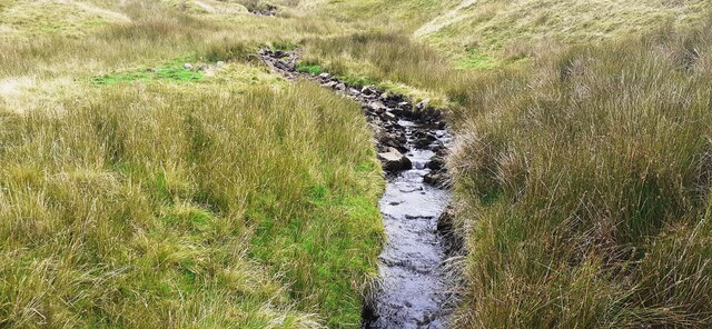
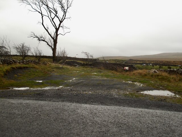
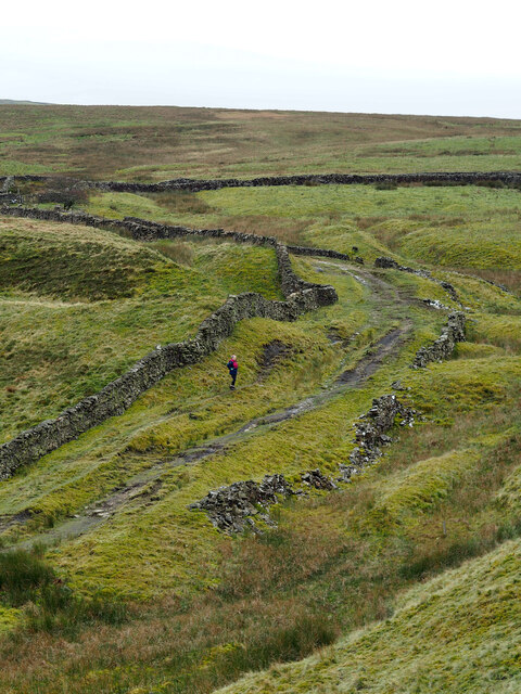
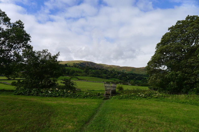
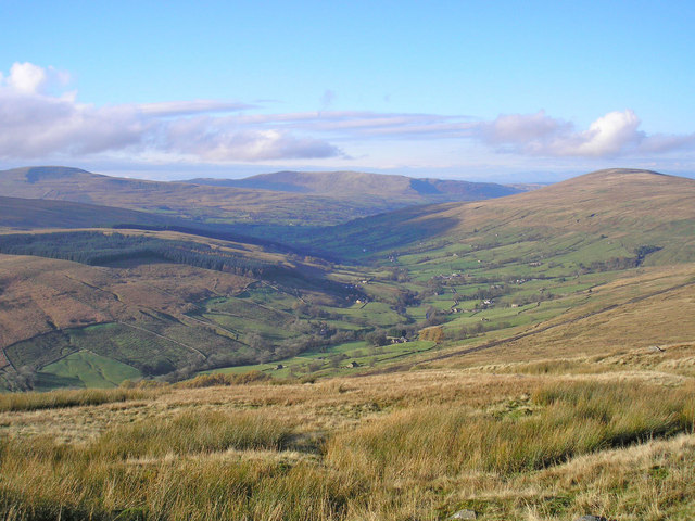
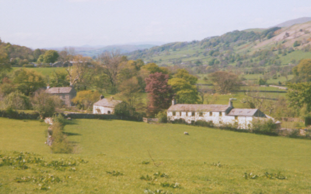
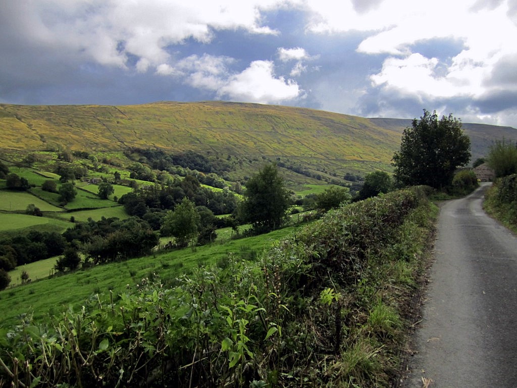
Dent is a small village located in the county of Yorkshire, England. Situated in the northern part of the Yorkshire Dales National Park, Dent is nestled in a picturesque valley surrounded by rolling hills and stunning landscapes. The village is known for its unspoiled beauty and peaceful atmosphere, making it a popular destination for nature lovers and outdoor enthusiasts.

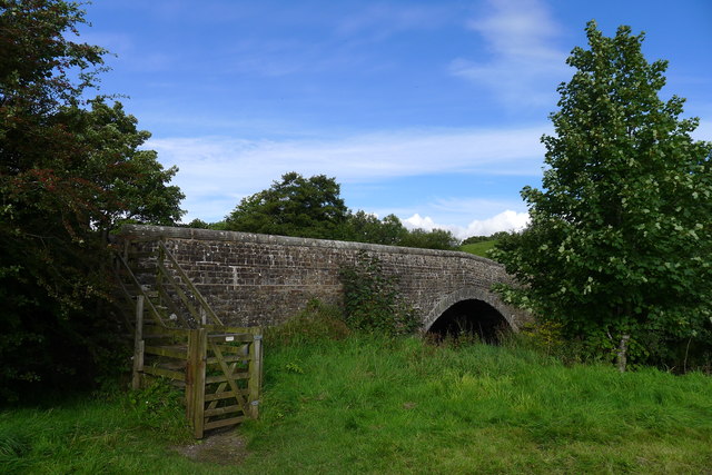
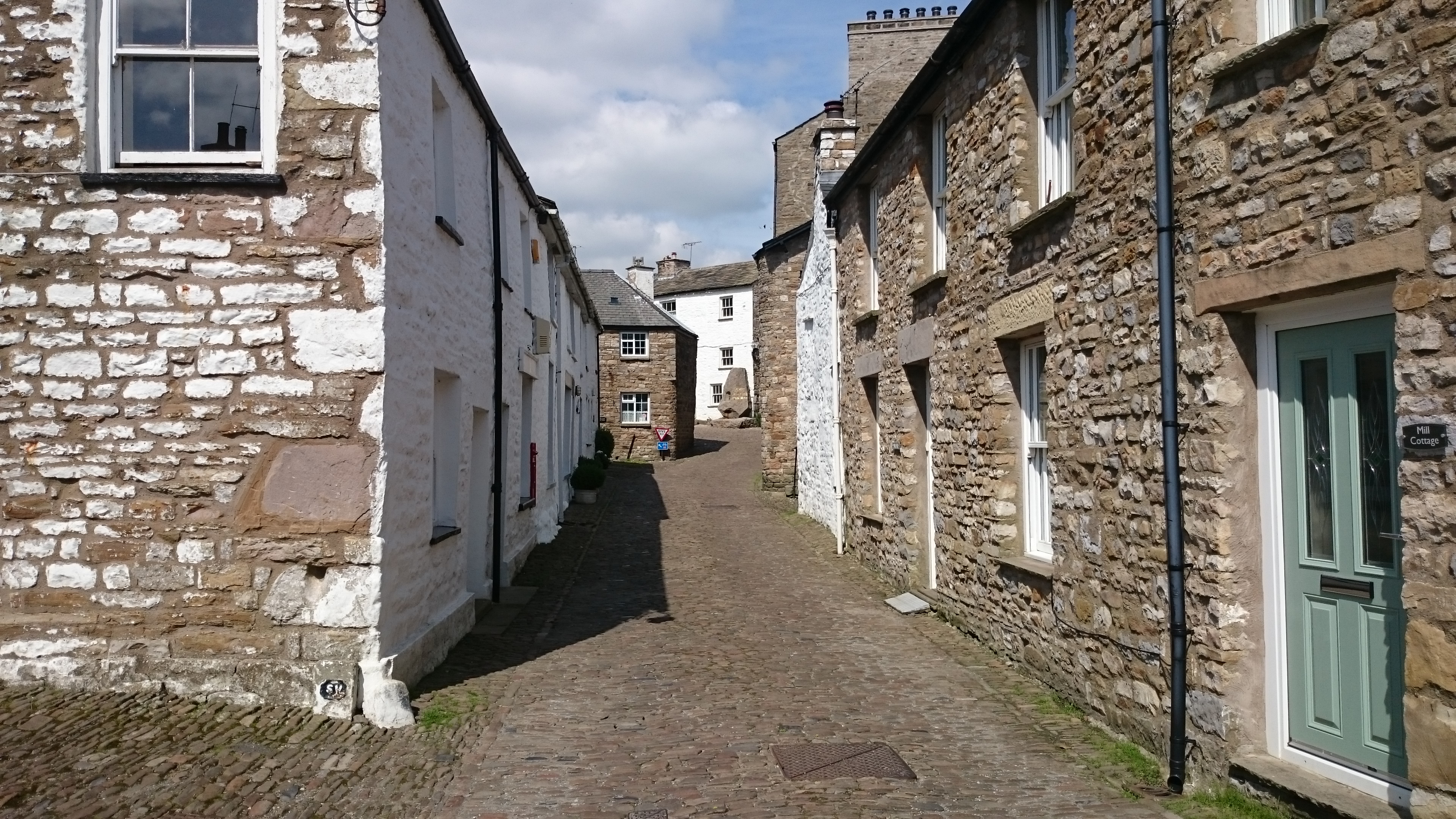
Dent has a rich history dating back to the medieval times when it was a thriving market town due to its strategic location on the trade routes between Lancashire and the North East. Today, the village still retains its historic charm with many well-preserved buildings, including traditional stone houses and a beautiful church that dates back to the 12th century.

The local economy in Dent is primarily based on agriculture and tourism. The village is surrounded by lush green pastures and is home to several working farms that contribute to the local dairy industry. Additionally, Dent attracts visitors from far and wide who come to explore the breathtaking scenery, enjoy hiking and cycling trails, and experience the tranquility of the countryside.

Dent is also famous for its annual Dentdale Music and Beer Festival, which attracts music lovers and beer enthusiasts from all over the country. The festival showcases a wide range of musical genres, from folk and blues to rock and jazz, and offers a selection of local and regional craft beers.

Overall, Dent offers a peaceful retreat away from the hustle and bustle of city life, providing visitors with a chance to immerse themselves in the beauty of the Yorkshire Dales and experience the warmth and hospitality of a traditional English village.

If you have any feedback on the listing, please let us know in the comments section below.
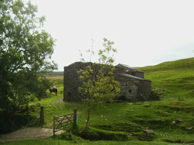
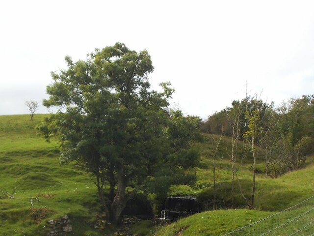
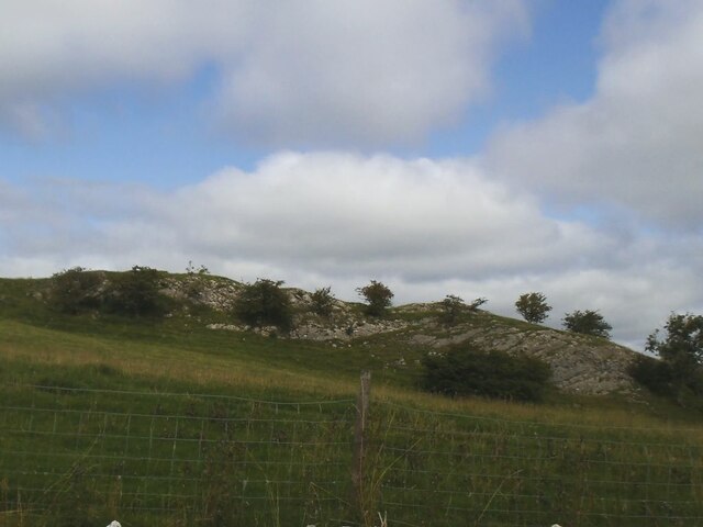
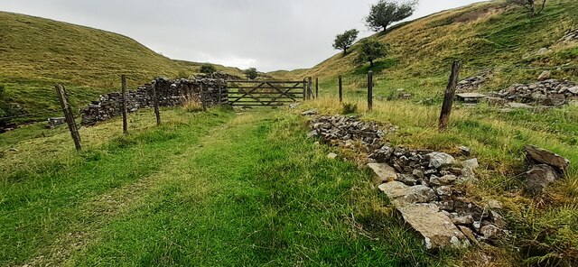
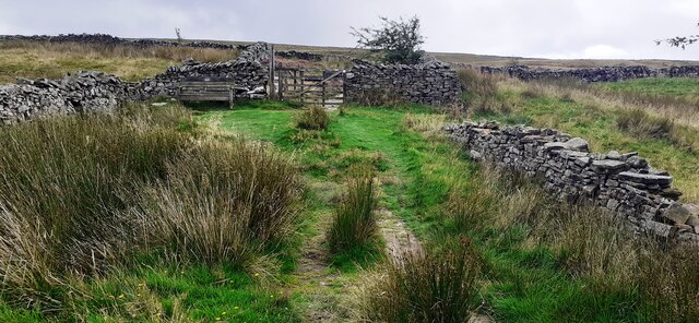
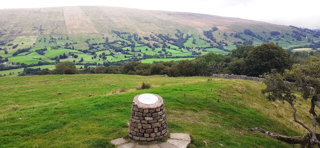
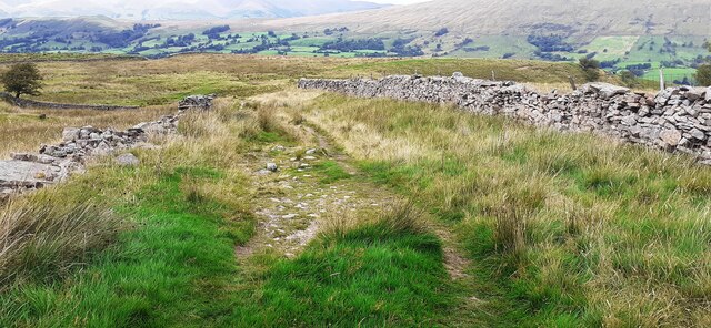
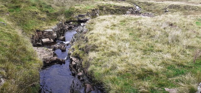
Dent Images

Images are sourced within 2km of 54.277319/-2.454143 or Grid Reference SD7086. Thanks to Geograph Open Source API. All images are credited.

Milestone by Holme Cottage The milestone is of a design distinctive to this area, a circular column just marked  "S 5" (S standing for Sedbergh).  Listed grade II (list entry 1383912).
Milestone by Holme Cottage
The milestone is of a design distinctive to this area, a circular column just marked "S 5" (S standing for Sedbergh). Listed grade II (list entry 1383912).
Gawthrop A small hamlet around a bridge over Oliver Gill.
Gawthrop
A small hamlet around a bridge over Oliver Gill.
Peas Gill House The main part of the nearer building has lost its roof and any glass in the windows, but the further building may still be in use, as evidenced by the horse nearby.
Peas Gill House
The main part of the nearer building has lost its roof and any glass in the windows, but the further building may still be in use, as evidenced by the horse nearby.
Peas Gill with small waterfall There are a few waterfalls marked on the map along the course of this steep gill, not including the small one in this photo.
Peas Gill with small waterfall
There are a few waterfalls marked on the map along the course of this steep gill, not including the small one in this photo.
Limestone outcrop above Peas Gill The line of the major Dent Fault lies a little further up the hillside, so this must represent nearly the western edge of the limestone Dales.
Limestone outcrop above Peas Gill
The line of the major Dent Fault lies a little further up the hillside, so this must represent nearly the western edge of the limestone Dales.
Flinter Gill Outrake (track) at gate
Flinter Gill Outrake approaching gate and Green Lane
View over toposcope beside Flinter Gill Outrake
View north along Flinter Gill Outrake
Flinter Gill from Green Lane bridge
View south along Flinter Gill from bridge on Green Lane
A small flat area by the Barbondale Road Parking is at a premium on this road and this offers a little space to stop.
A small flat area by the Barbondale Road
Parking is at a premium on this road and this offers a little space to stop.
Old Bridge Marker on Oliver Bridge at Gawthrop Bridge Marker at the southeast end of the parapet of Oliver Bridge, Oliver Beck, in Gawthrop. Dent parish. W R in raised lettering on adjacent faces to mark the extent of roadway adjoining the bridge that the County was obliged to maintain. See also <span class="nowrap"><a title="http://www.geog.port.ac.uk/webmap/thelakes/photos/bnh63.jpg" rel="nofollow ugc noopener" href="http://www.geog.port.ac.uk/webmap/thelakes/photos/bnh63.jpg">Link</a><img style="margin-left:2px;" alt="External link" title="External link - shift click to open in new window" src="https://s1.geograph.org.uk/img/external.png" width="10" height="10"/></span>.

Milestone Society National ID: YW_DENT07br
Old Bridge Marker on Oliver Bridge at Gawthrop
Bridge Marker at the southeast end of the parapet of Oliver Bridge, Oliver Beck, in Gawthrop. Dent parish. W R in raised lettering on adjacent faces to mark the extent of roadway adjoining the bridge that the County was obliged to maintain. See also LinkExternal link. Milestone Society National ID: YW_DENT07br
Old Bridge Marker on Oliver Bridge at Gawthrop Bridge Marker against the wall of a garage at the east end of the parapet of Oliver Bridge, Oliver Beck, Gawthrop. Dent parish. W R in raised lettering on adjacent faces to mark the extent of roadway adjoining the bridge that the County was obliged to maintain. See also <span class="nowrap"><a title="http://www.geog.port.ac.uk/webmap/thelakes/photos/bnh64.jpg" rel="nofollow ugc noopener" href="http://www.geog.port.ac.uk/webmap/thelakes/photos/bnh64.jpg">Link</a><img style="margin-left:2px;" alt="External link" title="External link - shift click to open in new window" src="https://s1.geograph.org.uk/img/external.png" width="10" height="10"/></span> and <a title="https://www.geograph.org.uk/photo/2993136" href="https://www.geograph.org.uk/photo/2993136">Link</a>

Milestone Society National ID: YW_DENT04br
Old Bridge Marker on Oliver Bridge at Gawthrop
Bridge Marker against the wall of a garage at the east end of the parapet of Oliver Bridge, Oliver Beck, Gawthrop. Dent parish. W R in raised lettering on adjacent faces to mark the extent of roadway adjoining the bridge that the County was obliged to maintain. See also LinkExternal link and Link Milestone Society National ID: YW_DENT04br
Path alongside Flinter Gill
A barn and Holme Cottage
Barth Bridge Carrying the Dent to Sedbergh road over the River Dee
Barth Bridge
Carrying the Dent to Sedbergh road over the River Dee
The Dales Way in Dentdale The slopes of Combe Scar in the distance
The Dales Way in Dentdale
The slopes of Combe Scar in the distance
Show me another place!

Dent is located at Grid Ref: SD7086 (Lat: 54.277319, Lng: -2.454143)

Division: West Riding

Administrative County: Cumbria

District: South Lakeland

Police Authority: Cumbria

What 3 Words

///gazette.unicorns.merely. Near Sedbergh, Cumbria

Nearby Locations

Mill Beck Plantation Dent

Related Wikis

Dentdale

Dentdale is a dale or valley in the north-west of the Yorkshire Dales National Park in Cumbria, England. It is the valley of the River Dee, but takes...

St Andrew's Church, Dent

St Andrew's Church is in the village of Dent, Cumbria, England. It is an active Anglican parish church in the Western Dales Mission Community in the deanery...

Dent, Cumbria

Dent is a village and civil parish in Cumbria, England, within the historic boundaries of the West Riding of Yorkshire. It lies in Dentdale, a narrow valley...

Gawthrop

Gawthrop is a hamlet in the South Lakeland district, in the county of Cumbria, England. Historically part of the West Riding of Yorkshire, it lies within...

Deepdale, Cumbria

Deepdale is a side valley of Dentdale in the Yorkshire Dales National Park in Cumbria, England. It lies north west of the summit of Whernside. The dale...
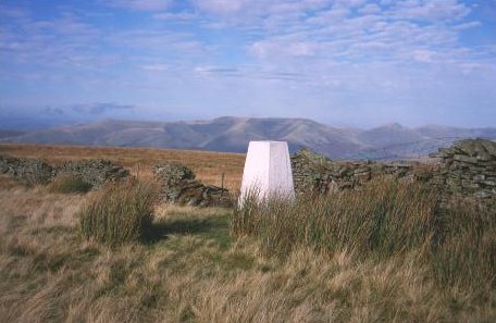
Aye Gill Pike

Aye Gill Pike is a Marilyn in the Yorkshire Dales, the highest point of the ridge of Rise Hill between Dentdale and Garsdale in Cumbria, England.
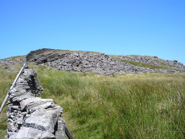
Great Coum

Great Coum is a hill in the Yorkshire Dales, but is located in the South Lakeland district of Cumbria. The highest point is in Dent parish, but the boundary...

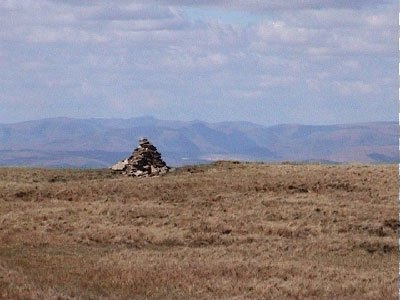
Crag Hill (Yorkshire Dales)

Crag Hill is on the western edge of the Yorkshire Dales in northern England, not to be confused with the higher Crag Hill elsewhere in the county of Cumbria...

Nearby Amenities

Located within 500m of 54.277319,-2.454143
Barrier: kissing_gate
Lat/Long: 54.2798129/-2.4557761
Milestone
Lat/Long: 54.2788732/-2.4575417
Place Of Worship
Wesleyan Chapel
Denomination: wesleyan
Religion: christian
Wikidata: Q26663844
Lat/Long: 54.2784504/-2.4570588
Dent
Alt Name: Dent Town
Place: village
Source: NPE
Lat/Long: 54.2774741/-2.4536373
Main Street
Naptan AtcoCode: 090079181001
Naptan Bearing: W
Naptan BusStopType: CUS
Naptan CommonName: Main Street
Naptan Indicator: near
Naptan Landmark: Car Park
Naptan NaptanCode: cumdgwgd
Naptan Street: Main Street
Naptan Verified: no
Source: naptan_import
Lat/Long: 54.2782209/-2.4556181
Bus Stop
Village
Bus: yes
Fixme: Name not checked
Local Ref: AT
Naptan AtcoCode: 090079183962
Naptan Bearing: E
Naptan BusStopType: CUS
Naptan CommonName: Village
Naptan Indicator: at
Naptan Landmark: Primary School
Naptan NaptanCode: cumdmwmt
Naptan Street: Main Street
Naptan Verified: partial
Note: Postion moved to surveyed bus stop. highway=bus_stop set. BusStopType wrong - should be MKD.
Public Transport: platform
Source: naptan_import
Lat/Long: 54.2782882/-2.4555503
Recycling
Lat/Long: 54.2784452/-2.4554958
Toilets
Lat/Long: 54.2783731/-2.4555657
Open Access in Dentdale
Direction: 270
Information: board
Tourism: information
Lat/Long: 54.2783709/-2.4556179
Dent
Direction: 270
Information: map
Tourism: information
Lat/Long: 54.2783587/-2.4556203
Dentdale Businesses and Places of Interest
Information: map
Tourism: information
Lat/Long: 54.2782994/-2.4556127
Bench
Backrest: yes
Lat/Long: 54.2773254/-2.4556764
Bench
Backrest: yes
Lat/Long: 54.277291/-2.4553974
Bench
Backrest: yes
Lat/Long: 54.2771829/-2.4555503
Telephone
Booth: K6
Covered: booth
Listed Status: Grade II
Lat/Long: 54.2772681/-2.4539541
Pub
George and Dragon
Accommodation: yes
Addr City: Dent
Addr Postcode: LA10 5QL
Addr Street: Main Street
Fhrs Id: 299697
Food: yes
Operator: Dent Brewery
Phone: +44 1539 625256
Real Ale: 4+ from Dent, 3+ others
Real Cider: 2+ ciders
Real Fire: yes
Lat/Long: 54.2776723/-2.4542901
Bench
Backrest: yes
Lat/Long: 54.2781677/-2.4536278
Bench
Backrest: yes
Lat/Long: 54.2781569/-2.4536889
Bench
Backrest: yes
Lat/Long: 54.2786399/-2.4523282
Barrier: stile
Material: wood
Source: survey;gps
Stile: squeezer
Lat/Long: 54.2790981/-2.4509283
The Dales Way
Information: board
Tourism: information
Lat/Long: 54.2791188/-2.4508861
Bench
Backrest: yes
Description: In Memory of Alan Meakin
Lat/Long: 54.2791348/-2.4509281
Barrier: stile
Lat/Long: 54.2804673/-2.4519354
Barrier: stile
Lat/Long: 54.2812468/-2.4551543
Barrier: kissing_gate
Foot: yes
Lat/Long: 54.2804126/-2.4552667
Trees in Dent National Park car park
Board Type: nature
Information: board
Tourism: information
Lat/Long: 54.2788612/-2.4555091
Leisure: picnic_table
Tourism: picnic_site
Lat/Long: 54.2788495/-2.4554236
Barrier: cattle_grid
Bicycle: yes
Foot: yes
Motorcar: yes
Motorcycle: yes
Lat/Long: 54.2754616/-2.4555244
Dent Stores
Addr City: Dent
Addr Postcode: LA10 5QL
Addr Street: Main Street
Fhrs Id: 328605
Shop: convenience
Lat/Long: 54.2778463/-2.453628
Dent Village Heritage Centre & Museum
Addr City: Sedbergh
Addr Postcode: LA10 5QJ
Addr Street: Laning
Email: info@dentvillageheritagecentre.com
Museum: local_history
Opening Hours: 09:00-17:00
Phone: +44 153 962 5800
Tourism: museum
Website: http://www.museumsintheyorkshiredales.co.uk/
Wikidata: Q113370229
Lat/Long: 54.2789714/-2.4577846
Post Box
Operator: Royal Mail
Post Box Type: wall
Ref: LA10 146
Royal Cypher: GR
Royal Cypher Wikidata: Q33102273
Lat/Long: 54.2774014/-2.4542332
High Laning Farm Caravan & Camping Park
Tourism: caravan_site
Lat/Long: 54.2787466/-2.457849
Pub
Sun Inn
Addr City: Dent
Addr Postcode: LA10 5QL
Addr Street: Main Street
Fhrs Id: 328601
Food: yes
Real Ale: 2 from Kirby Lonsdale + 1
Real Fire: yes
Source: survey
Wikidata: Q26663834
Lat/Long: 54.2778477/-2.4549642
Fountain
Adam Sedgwick
Note: In memory of Adam Sedgwick 1785-1873
Lat/Long: 54.277784/-2.4544419
Cafe
Meadowside
Lat/Long: 54.2788671/-2.4571533
Barrier: stile
Material: stone
Source: survey;gps
Stile: squeezer
Lat/Long: 54.2732231/-2.4518763
Barrier: stile
Material: wood
Source: survey;gps
Stile: stepover
Lat/Long: 54.2733114/-2.4522894
Barrier: stile
Material: wood
Source: survey;gps
Stile: stepover
Lat/Long: 54.2737306/-2.4538921
Barrier: kissing_gate
Source: survey;gps
Lat/Long: 54.2739257/-2.45465
Barrier: kissing_gate
Source: survey;gps
Lat/Long: 54.2761021/-2.4566407
Barrier: entrance
Source: survey;gps
Lat/Long: 54.2764429/-2.4580907
Barrier: stile
Material: stone
Source: survey;gps
Stile: stepover
Lat/Long: 54.2763556/-2.4520869
Barrier: stile
Material: stone
Source: survey;gps
Stile: squeezer
Lat/Long: 54.2777365/-2.4511979
Barrier: stile
Material: stone
Source: survey;gps
Stile: squeezer
Lat/Long: 54.2780339/-2.4491622
Barrier: stile
Source: survey;gps
Lat/Long: 54.278079/-2.4490991
Barrier: kissing_gate
Source: survey;gps
Lat/Long: 54.2784268/-2.4498477
Barrier: kissing_gate
Source: survey;gps
Lat/Long: 54.2782023/-2.4483573
Barrier: stile
Material: stone
Source: survey;gps
Stile: squeezer
Lat/Long: 54.2781423/-2.4587274
Barrier: kissing_gate
Source: survey;gps
Lat/Long: 54.2796418/-2.4534879
Barrier: stile
Material: stone
Source: survey;gps
Stile: stepover
Lat/Long: 54.2757886/-2.4554577
Barrier: stile
Material: stone
Source: survey;gps
Stile: squeezer
Lat/Long: 54.2757993/-2.4559692
Barrier: cattle_grid
Bicycle: yes
Foot: yes
Lat/Long: 54.2758144/-2.4554901
Barrier: stile
Material: wood
Source: survey;gps
Stile: stepover
Lat/Long: 54.2742639/-2.4558436
Note: No gate in April 2015
Lat/Long: 54.2748914/-2.4576329
Barrier: stile
Lat/Long: 54.2793852/-2.4504548
Post Office
Dent Post Office
Addr City: Dent
Addr Housename: Dent Stores
Addr Postcode: LA10 5QL
Addr Street: Main Street
Brand: Post Office
Brand Wikidata: Q1783168
Opening Hours: Tu,Th 09:00-13:00
Ref Pol Id: 96427
Website: https://www.postoffice.co.uk/branch-finder/2594706/dent
Lat/Long: 54.2778378/-2.4536404
Bench
Source: GPS survey
Lat/Long: 54.2803388/-2.4595106
Defibrillator
Defibrillator Location: outside toilets (opposite school) in Dent
Emergency: defibrillator
Indoor: no
Lat/Long: 54.2783413/-2.4556044
Cafe
Stone Close Cafe
Lat/Long: 54.2782514/-2.4552794
Bench
Source: GPS survey
Lat/Long: 54.2780439/-2.4536593
Hiking: yes
Information: guidepost
Source: GPS survey
Tourism: information
Lat/Long: 54.2792196/-2.4509543
Hiking: yes
Information: guidepost
Source: GPS survey
Tourism: information
Lat/Long: 54.2793989/-2.4504413
Barrier: stile
Lat/Long: 54.2815755/-2.4524193
Hiking: yes
Information: guidepost
Source: GPS survey
Tourism: information
Lat/Long: 54.2786116/-2.4523249
Hiking: yes
Information: guidepost
Source: GPS survey
Tourism: information
Lat/Long: 54.2814232/-2.4522901
Generator Method: photovoltaic
Generator Orientation: east
Generator Output Electricity: yes
Generator Solar Modules: 8
Generator Source: solar
Generator Type: solar_photovoltaic_panel
Location: roof
Power: generator
Lat/Long: 54.2771729/-2.4565391
Generator Method: photovoltaic
Generator Orientation: east
Generator Output Electricity: yes
Generator Solar Modules: 8
Generator Source: solar
Generator Type: solar_photovoltaic_panel
Location: roof
Power: generator
Lat/Long: 54.2771136/-2.4565536
Generator Method: photovoltaic
Generator Orientation: east
Generator Output Electricity: yes
Generator Solar Modules: 8
Generator Source: solar
Generator Type: solar_photovoltaic_panel
Location: roof
Power: generator
Lat/Long: 54.2770713/-2.4565705
Generator Method: photovoltaic
Generator Orientation: west
Generator Output Electricity: yes
Generator Solar Modules: 7
Generator Source: solar
Generator Type: solar_photovoltaic_panel
Location: roof
Power: generator
Lat/Long: 54.2770417/-2.4566406
Generator Method: photovoltaic
Generator Orientation: west
Generator Output Electricity: yes
Generator Solar Modules: 8
Generator Source: solar
Generator Type: solar_photovoltaic_panel
Location: roof
Power: generator
Lat/Long: 54.2769726/-2.4566623
Generator Method: photovoltaic
Generator Orientation: south
Generator Output Electricity: yes
Generator Solar Modules: 16
Generator Source: solar
Generator Type: solar_photovoltaic_panel
Location: roof
Power: generator
Lat/Long: 54.2768359/-2.4565633
Generator Method: photovoltaic
Generator Orientation: south_east
Generator Output Electricity: yes
Generator Solar Modules: 16
Generator Source: solar
Generator Type: solar_photovoltaic_panel
Location: roof
Power: generator
Lat/Long: 54.2765911/-2.4554288
Generator Method: photovoltaic
Generator Orientation: south_east
Generator Output Electricity: yes
Generator Solar Modules: 16
Generator Source: solar
Generator Type: solar_photovoltaic_panel
Location: roof
Power: generator
Lat/Long: 54.276652/-2.4553465
Generator Method: photovoltaic
Generator Orientation: west
Generator Output Electricity: yes
Generator Solar Modules: 16
Generator Source: solar
Generator Type: solar_photovoltaic_panel
Location: roof
Power: generator
Lat/Long: 54.276171/-2.4563645
Generator Method: photovoltaic
Generator Orientation: east
Generator Output Electricity: yes
Generator Solar Modules: 20
Generator Source: solar
Generator Type: solar_photovoltaic_panel
Location: roof
Power: generator
Lat/Long: 54.2761716/-2.4563301
Generator Method: photovoltaic
Generator Orientation: east
Generator Output Electricity: yes
Generator Solar Modules: 20
Generator Source: solar
Generator Type: solar_photovoltaic_panel
Location: roof
Power: generator
Lat/Long: 54.2770423/-2.4550984
Generator Method: photovoltaic
Generator Orientation: west
Generator Output Electricity: yes
Generator Solar Modules: 6
Generator Source: solar
Generator Type: solar_photovoltaic_panel
Location: roof
Power: generator
Lat/Long: 54.2783574/-2.4533669
Generator Method: photovoltaic
Generator Orientation: south
Generator Output Electricity: yes
Generator Solar Modules: 16
Generator Source: solar
Generator Type: solar_photovoltaic_panel
Location: roof
Power: generator
Lat/Long: 54.2755105/-2.448929
Charging Station
Authentication App: yes
Capacity: 1
Fee: yes
Motorcar: yes
Network: Charge My Street
Payment App: yes
Ref: EG-05481
Socket Type2: 1
Socket Type2 Current: 32
Socket Type2 Output: 22kW
Socket Type2 Voltage: 415
Lat/Long: 54.2786137/-2.4553076
Charging Station
Authentication App: yes
Capacity: 1
Fee: yes
Motorcar: yes
Network: Charge My Street
Payment App: yes
Ref: EG-05485
Socket Type2: 1
Socket Type2 Current: 32
Socket Type2 Output: 22kW
Socket Type2 Voltage: 415
Lat/Long: 54.278605/-2.455315
Man Made: street_cabinet
Lat/Long: 54.2786322/-2.4552979
Entrance: yes
Lat/Long: 54.2783761/-2.4555975
Entrance: yes
Lat/Long: 54.2783883/-2.4555951
Entrance: yes
Lat/Long: 54.2783402/-2.4555394
Power: pole
Lat/Long: 54.274803/-2.4490794
Power: pole
Lat/Long: 54.2750337/-2.4504101
Power: pole
Lat/Long: 54.2752183/-2.4515139
Power: pole
Lat/Long: 54.2752927/-2.4529109
Power: pole
Lat/Long: 54.2753448/-2.4542927
Power: pole
Lat/Long: 54.2754177/-2.4556616
Power: pole
Lat/Long: 54.2757184/-2.4566482
Power: pole
Lat/Long: 54.2754281/-2.4488525
Power: pole
Lat/Long: 54.2736151/-2.4516873
Power: pole
Lat/Long: 54.27448/-2.4515955
Power: pole
Lat/Long: 54.280264/-2.4489532
Power: pole
Lat/Long: 54.2778871/-2.4617124
Power: pole
Lat/Long: 54.2778752/-2.4611082
Power: pole
Lat/Long: 54.2788203/-2.4606468
Power: pole
Lat/Long: 54.2783113/-2.4608788
Power: pole
Lat/Long: 54.2774733/-2.460866
Power: pole
Lat/Long: 54.2769598/-2.460583
Power: pole
Lat/Long: 54.2765698/-2.4603511
Power: pole
Lat/Long: 54.278158/-2.4588929
Charging Station
Access: yes
Capacity: 2
Fee: yes
Network: pilot group
Note: Monyx ID is 08842387
Operator: Dent with Cowgill Parish Council
Payment Contactless: yes
Ref: 0434321621548475
Socket Type2: 2
Socket Type2 Output: 22 kW
Lat/Long: 54.2788228/-2.4553733
Charging Station
Access: yes
Capacity: 2
Fee: yes
Network: pilot group
Note: Monyx ID is 33524464
Operator: Dent with Cowgill Parish Council
Payment Contactless: yes
Ref: 0434321621548525
Socket Type2: 2
Socket Type2 Output: 22 kW
Lat/Long: 54.2788272/-2.4554184
Charging Station
Access: yes
Capacity: 2
Fee: yes
Network: pilot group
Note: Monyx ID is 04455573
Operator: Dent with Cowgill Parish Council
Payment Contactless: yes
Ref: 0434003220457787
Socket Type2: 2
Socket Type2 Output: 22 kW
Lat/Long: 54.2788332/-2.4554746
Entrance: main
Lat/Long: 54.2772485/-2.4539244
Grit Bin
Lat/Long: 54.2772596/-2.4539452
The data included in this document is from www.openstreetmap.org. The data is made available under ODbL.

Have you been to Dent?

Leave your review of Dent below (or comments, questions and feedback).