Brick Kiln Gorse

Wood, Forest in Warwickshire Stratford-on-Avon

England

Brick Kiln Gorse

Friends' Meeting House, Ettington The original part of this Quaker meeting house, which was built in 1684-9. A remarkable survival and still in use for worship.
Friends' Meeting House, Ettington Credit: AJD

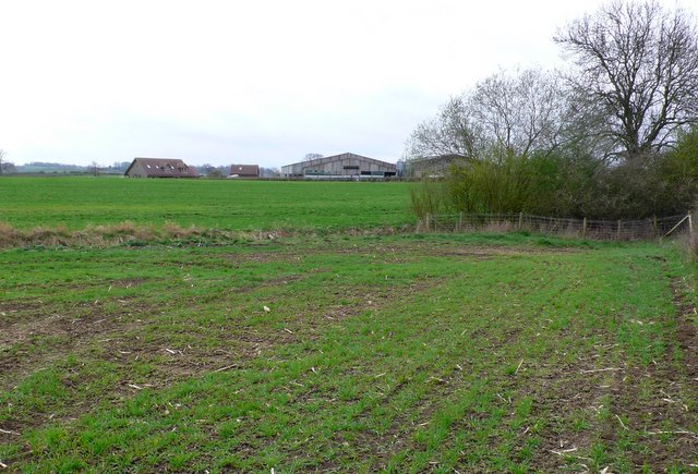
Brick Kiln Gorse is a picturesque woodland area located in the county of Warwickshire, England. Spread across several acres, it is nestled in the heart of the countryside, surrounded by rolling hills and meandering streams. The gorse, a type of flowering shrub, dominates the landscape, creating a vibrant burst of yellow hues during the spring and summer months.

The woodland area is known for its rich biodiversity, offering a haven for a wide range of flora and fauna. Visitors can expect to encounter a variety of native plant species, including oak trees, birches, and wildflowers, which add to the natural beauty of the area. The dense foliage provides ample shelter and nesting sites for numerous bird species, making it a popular destination for birdwatchers.

Tranquility is one of the key attractions of Brick Kiln Gorse. The peaceful ambiance invites visitors to take leisurely walks along the well-maintained trails, allowing them to immerse themselves in the serene surroundings. The woodland also features several picnic spots, providing an ideal setting for a family outing or a relaxing day out in nature.

Brick Kiln Gorse is easily accessible, with ample parking facilities available nearby. It is a popular destination for nature enthusiasts, photographers, and those seeking solace in the tranquility of the countryside. Whether one is looking for a peaceful retreat or a place to explore the wonders of nature, Brick Kiln Gorse offers an unforgettable experience for all who visit.

If you have any feedback on the listing, please let us know in the comments section below.

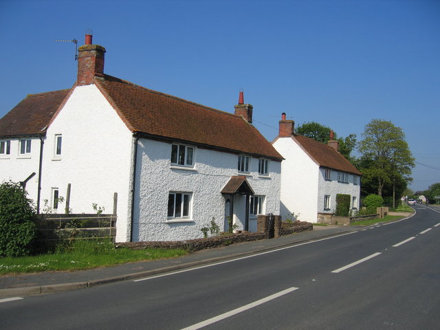
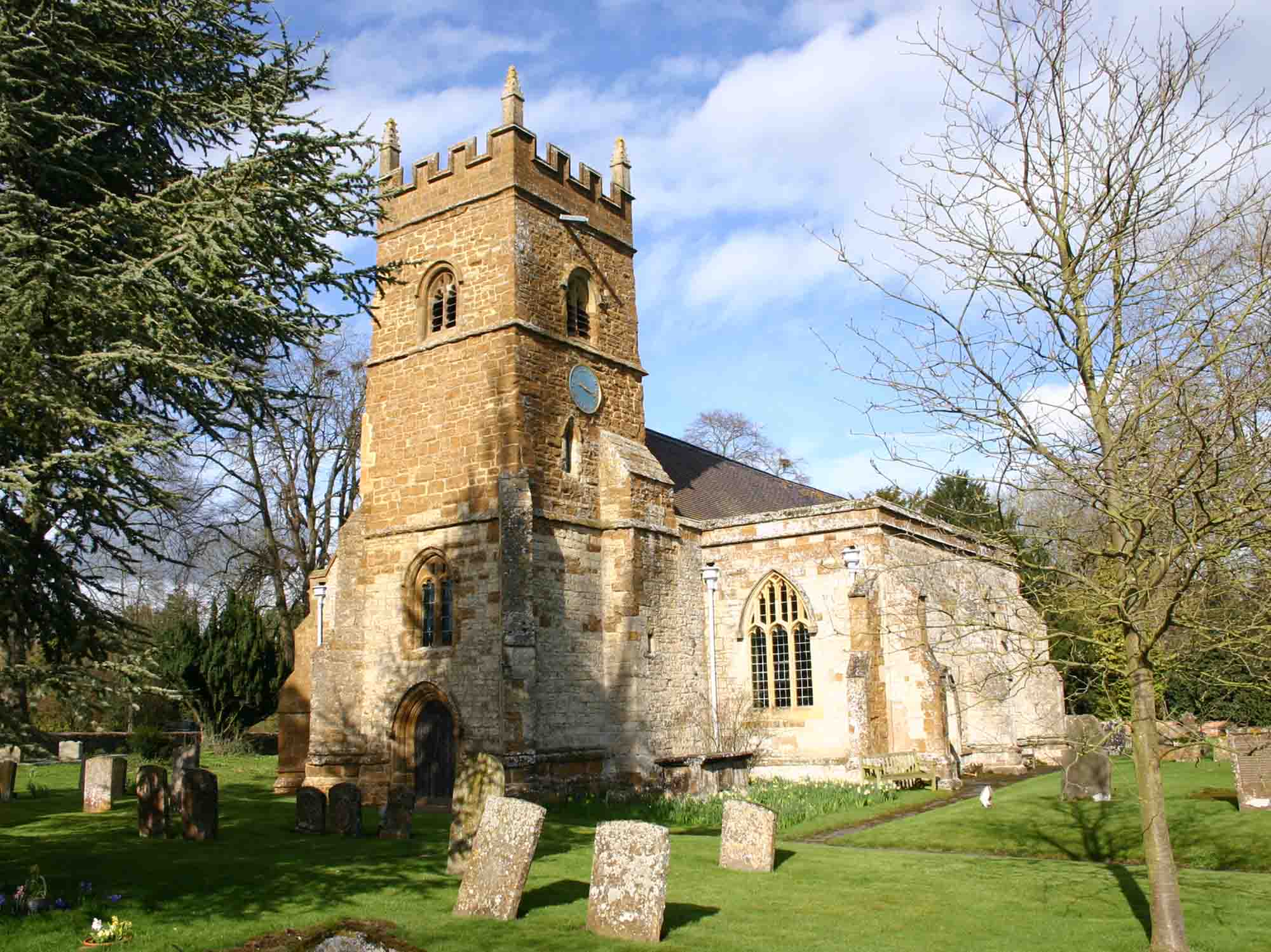
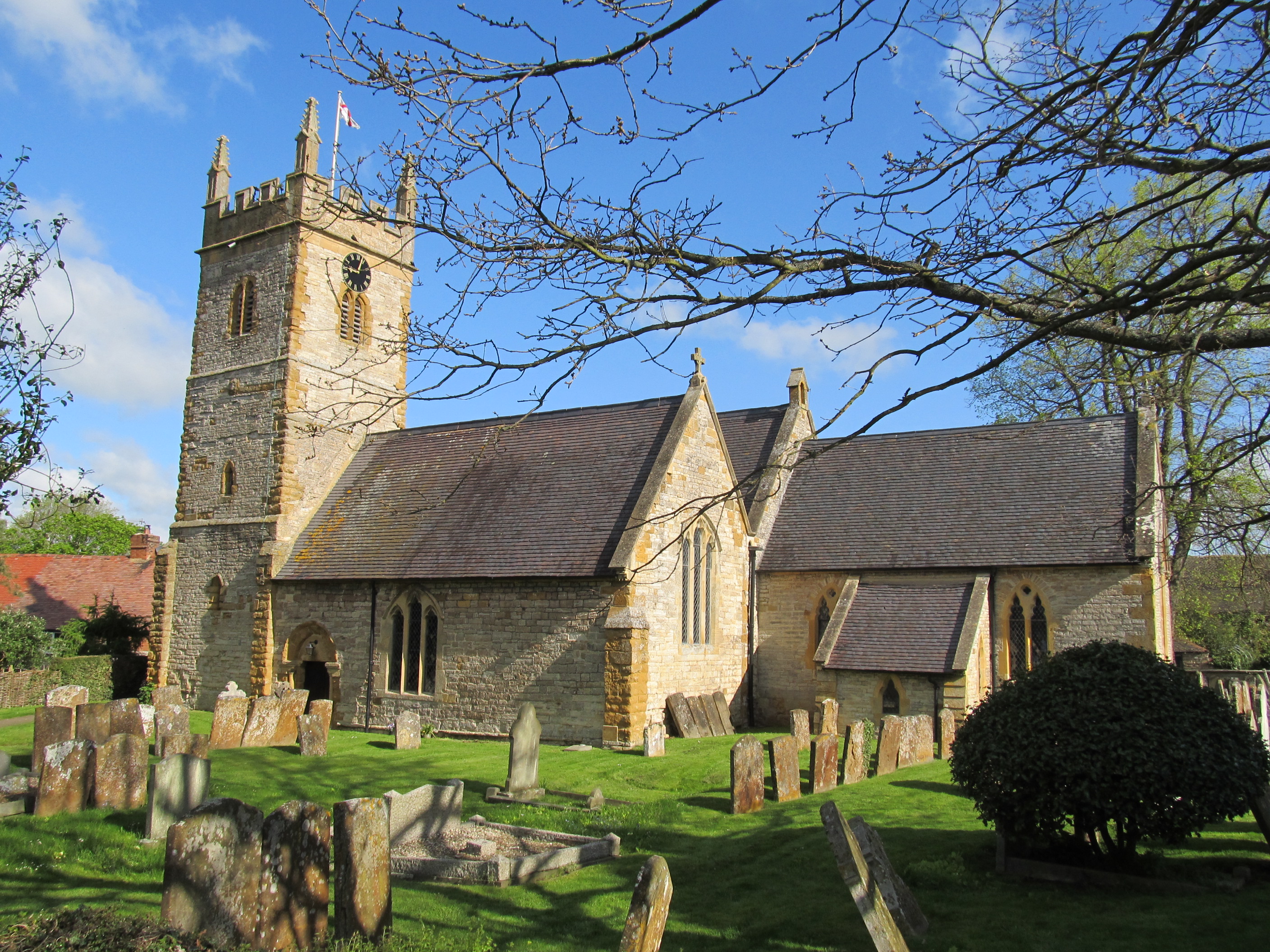
Brick Kiln Gorse Images

Images are sourced within 2km of 52.132341/-1.5888064 or Grid Reference SP2848. Thanks to Geograph Open Source API. All images are credited.

Friends' Meeting House, Ettington The original part of this Quaker meeting house, which was built in 1684-9. A remarkable survival and still in use for worship.
Friends' Meeting House, Ettington
The original part of this Quaker meeting house, which was built in 1684-9. A remarkable survival and still in use for worship.
Footbridge over stream
Layby on the A429 near Ettington The A429 runs 74 miles from the M4 north of Chippenham as a primary route to Warwick, via Malmesbury, Cirencester, Stow-on-the-Wold, and Moreton in Marsh. In Warwick, the A429 follows the old course of the A46 as a non-primary route through Warwick and on to Kenilworth and Coventry, although there is a gap between the A46 Warwick bypass and Kenilworth.
Layby on the A429 near Ettington
The A429 runs 74 miles from the M4 north of Chippenham as a primary route to Warwick, via Malmesbury, Cirencester, Stow-on-the-Wold, and Moreton in Marsh. In Warwick, the A429 follows the old course of the A46 as a non-primary route through Warwick and on to Kenilworth and Coventry, although there is a gap between the A46 Warwick bypass and Kenilworth.
Oxhill Bridle Road This lane from Pillerton Hersey still eventually leads towards Oxhill as a track but its significance seems to have greatly diminished from that implied by the slightly grand name.
Oxhill Bridle Road
This lane from Pillerton Hersey still eventually leads towards Oxhill as a track but its significance seems to have greatly diminished from that implied by the slightly grand name.
Pillerton Hersey ford Taken a little later in the year than <a href="https://www.geograph.org.uk/photo/18384">SP3048 : Pillerton Hersey ford</a> and rather more obscured by greenery.
Pillerton Hersey ford
Taken a little later in the year than SP3048 : Pillerton Hersey ford and rather more obscured by greenery.
Start of Oxhill Bridle Road Leaving Pillerton Hersey at SP30024871 heading south east is the Oxhill Bridle Road. This is an Unclassified Country Road.
Start of Oxhill Bridle Road
Leaving Pillerton Hersey at SP30024871 heading south east is the Oxhill Bridle Road. This is an Unclassified Country Road.
Pumping station, Butlers Marston Road, Pillerton Hersey Severn Trent Water pumping station by the side of the road from Butlers Marston.
Pumping station, Butlers Marston Road, Pillerton Hersey
Severn Trent Water pumping station by the side of the road from Butlers Marston.
Pillerton Hersey This is the main road that runs through the village, the Kineton to Pillerton Priors road. On the left is part of the wall that surrounds the Manor House.
Pillerton Hersey
This is the main road that runs through the village, the Kineton to Pillerton Priors road. On the left is part of the wall that surrounds the Manor House.
Pillerton Hersey Cottage close to the junction with Oxhill Bridle road
Pillerton Hersey
Cottage close to the junction with Oxhill Bridle road
Hockley Lane, Ettington
Chestnut Close, Ettington
Countryside near Stamford Hall View across the square towards Brick Kiln Gorse, the woods in the distance.
Countryside near Stamford Hall
View across the square towards Brick Kiln Gorse, the woods in the distance.
Countryside. These fields are just north of the village of pillerton Priors
Countryside.
These fields are just north of the village of pillerton Priors
House in Pillerton Priors This smart old detached red-brick house is on the A422 road west out of the village towards Ettington.
House in Pillerton Priors
This smart old detached red-brick house is on the A422 road west out of the village towards Ettington.
Countryside View west across the square from close to the (former B4451) Pillerton to Halford road.
Countryside
View west across the square from close to the (former B4451) Pillerton to Halford road.
Countryside near Pillerton Priors The white bushes mark the line of a small strream visible from the minor road running from Pillerton to Fulready.
Countryside near Pillerton Priors
The white bushes mark the line of a small strream visible from the minor road running from Pillerton to Fulready.
Manor Farm These large barns are to the east of the  Fulready to Pillerton Priors road and appear connected to the manor farm.
Manor Farm
These large barns are to the east of the Fulready to Pillerton Priors road and appear connected to the manor farm.
Farmland near Fulready These arable fields are just to the west of the village on the road to Salters Barn. In the middle distance can be seen the houses of Fulready.
Farmland near Fulready
These arable fields are just to the west of the village on the road to Salters Barn. In the middle distance can be seen the houses of Fulready.
Show me another place!

Brick Kiln Gorse is located at Grid Ref: SP2848 (Lat: 52.132341, Lng: -1.5888064)

Administrative County: Warwickshire

District: Stratford-on-Avon

Police Authority: Warwickshire

What 3 Words

///tightrope.digitally.flanks. Near Eattington, Warwickshire

Nearby Locations

Brick Kiln Gorse

Related Wikis

Pillerton Priors

Pillerton Priors or Over Pillerton is a settlement and civil parish 11 miles (18 km) south of Warwick, in the Stratford-on-Avon district, in the county...

Ettington

Ettington is a village and civil parish about 5.5 miles (9 km) south-east of Stratford-upon-Avon in Warwickshire, England. The 2011 Census recorded the...

Pillerton Hersey

Pillerton Hersey is a village and civil parish about 5.5 miles (9 km) north of Shipston-on-Stour in Warwickshire, England. The village is on a stream that...

Ettington railway station

Ettington railway station was a railway station that served the village of Ettington in Warwickshire, England. == History == Opened on 1 July 1873 the...

Combrook

Combrook (also spelt Combroke and - more rarely - Combrooke) is a small village of about 65 houses in rural Warwickshire, located near the junction of...

Halford, Warwickshire

Halford is a village and civil parish about 3 miles (5 km) north of Shipston-on-Stour in Warwickshire, England. The village is where the Fosse Way Roman...

Ettington Park Hotel

Ettington Park, Ettington, Warwickshire, England is a 19th-century country house with earlier origins. The historic home of the Shirley family, whose ownership...

Butlers Marston

Butlers Marston is a village and civil parish on the River Dene in south-eastern Warwickshire, England. The village is part of Stratford-on-Avon district...

Nearby Amenities

Located within 500m of 52.132341,-1.5888064
Material: wood
Power: pole
Ref: 774281
Source: wpd_opendata
Transformer: distribution
Lat/Long: 52.1289371/-1.5870979
Material: wood
Power: pole
Source: bing
Lat/Long: 52.1279937/-1.5883237
Material: wood
Power: pole
Source: bing
Lat/Long: 52.1280431/-1.5893108
Material: wood
Power: pole
Source: bing
Lat/Long: 52.1281698/-1.5913707
Material: wood
Power: pole
Source: bing
Lat/Long: 52.1355312/-1.5842521
Material: wood
Power: pole
Source: bing
Lat/Long: 52.1348595/-1.5843326
Material: wood
Power: pole
Source: bing
Lat/Long: 52.1341911/-1.584397
Material: wood
Power: pole
Source: bing
Lat/Long: 52.1334831/-1.584464
Material: wood
Power: pole
Source: bing
Lat/Long: 52.1327455/-1.5845525
Material: wood
Power: pole
Ref: 774292
Source: wpd_opendata
Transformer: distribution
Lat/Long: 52.1320408/-1.5846303
Material: wood
Power: pole
Source: bing
Lat/Long: 52.1313361/-1.5846947
Material: wood
Power: pole
Source: bing
Lat/Long: 52.1305145/-1.5847859
Material: wood
Power: pole
Source: bing
Lat/Long: 52.1296649/-1.5848744
Material: wood
Power: pole
Source: bing
Lat/Long: 52.1290993/-1.584928
Material: wood
Power: pole
Source: bing
Lat/Long: 52.1292418/-1.58619
The data included in this document is from www.openstreetmap.org. The data is made available under ODbL.

Have you been to Brick Kiln Gorse?

Leave your review of Brick Kiln Gorse below (or comments, questions and feedback).