Denbury

Settlement in Devon Teignbridge

England

Denbury

East Ogwell church  The church is dedicated to St Bartholomew
East Ogwell church Credit: David Smith

Denbury is a picturesque village situated in the Teignbridge district of Devon, England. Nestled in the heart of the South Hams, it is surrounded by rolling hills, lush green fields, and idyllic countryside. The village is located approximately 5 miles south of Newton Abbot and 12 miles southwest of the vibrant city of Exeter.

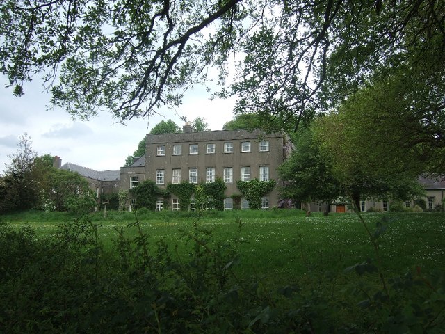
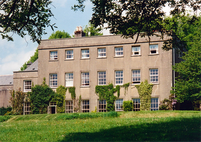
Denbury boasts a rich history, dating back to ancient times when it was an important Roman settlement. Today, remnants of its past can still be seen through the presence of historical landmarks, including the Grade I listed Denbury Manor, a medieval manor house that dates back to the 13th century.

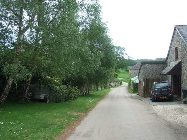
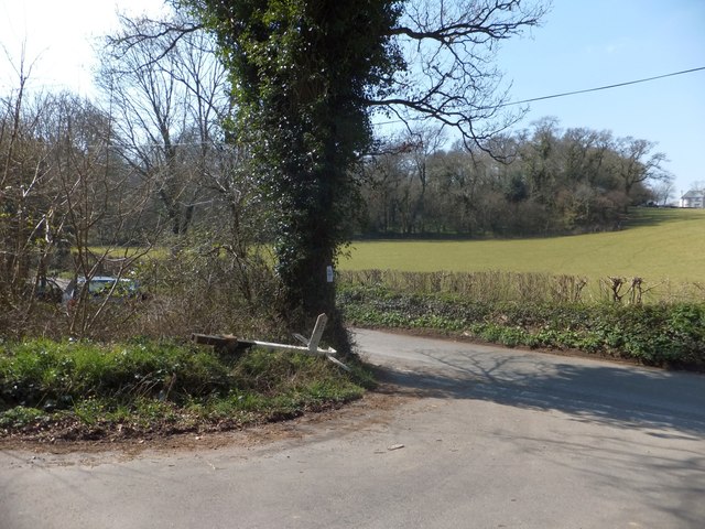
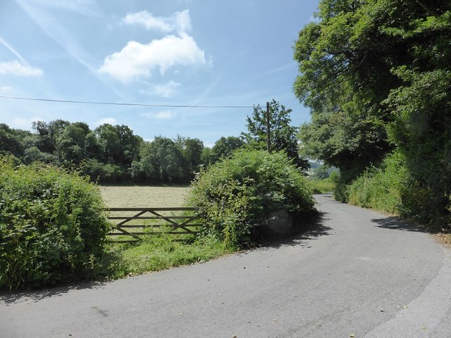
The village itself exudes charm and tranquility, with its traditional thatched cottages, narrow winding lanes, and a peaceful atmosphere. Denbury is home to a close-knit community, with a population of around 500 residents who enjoy a strong sense of community spirit.

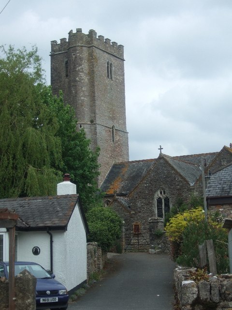
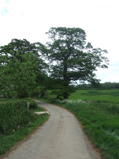
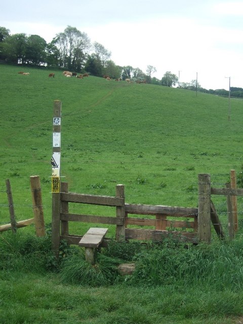
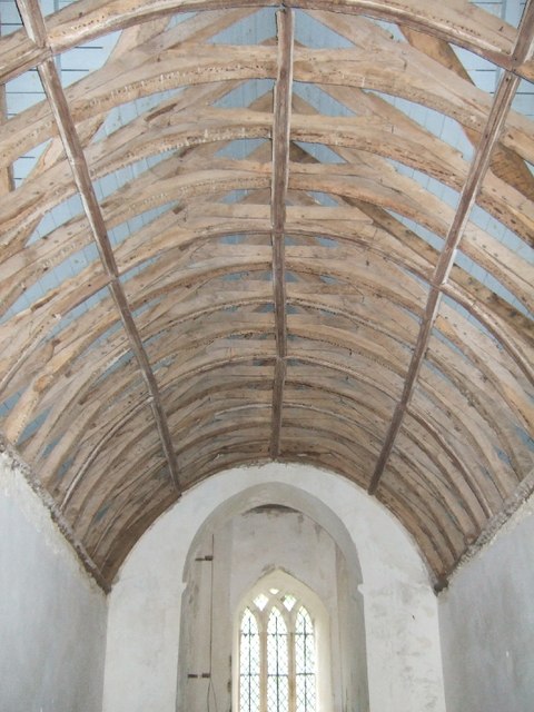
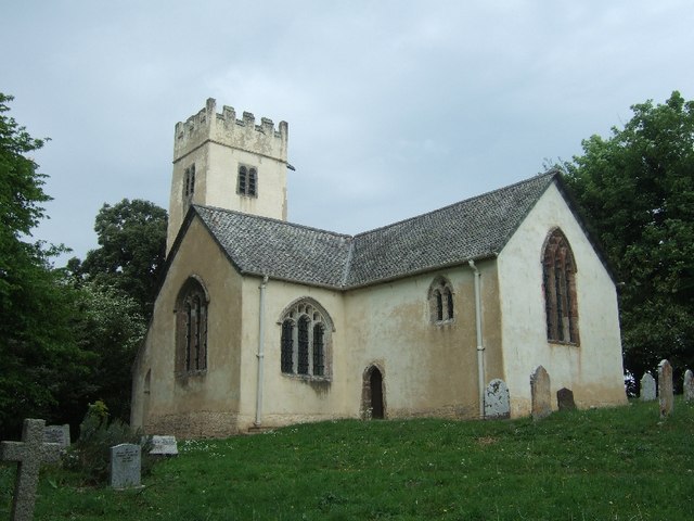
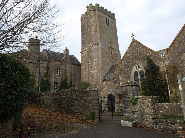
The village offers a range of amenities, including a local pub, a village hall, and a picturesque church, St. Mary's, which showcases beautiful stained glass windows and a striking 14th-century tower. The surrounding area provides ample opportunities for outdoor activities, such as hiking, cycling, and horse riding, with the stunning Dartmoor National Park just a short distance away.

Denbury is well-connected to neighboring towns and cities, with convenient transportation links including regular bus services and easy access to the A38, making it an ideal location for both commuters and those seeking a peaceful countryside lifestyle.

If you have any feedback on the listing, please let us know in the comments section below.
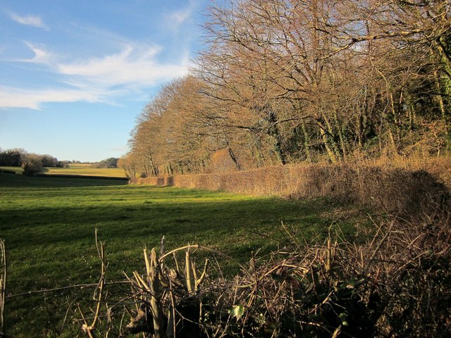
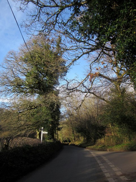
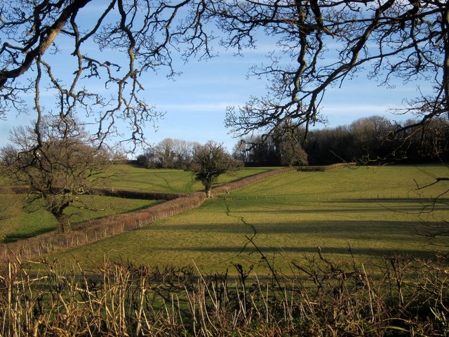
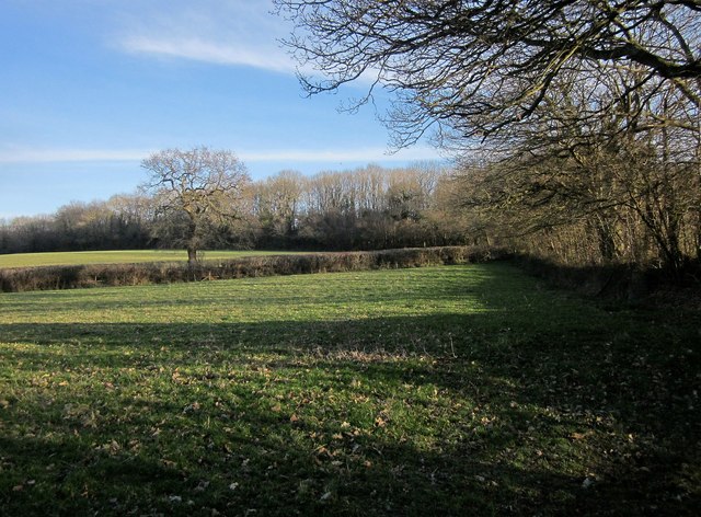
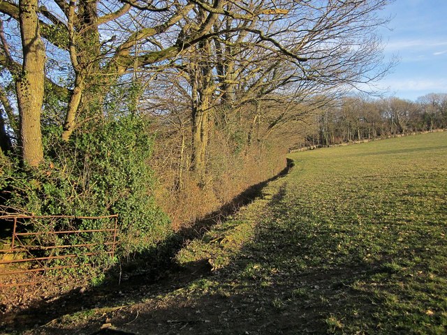
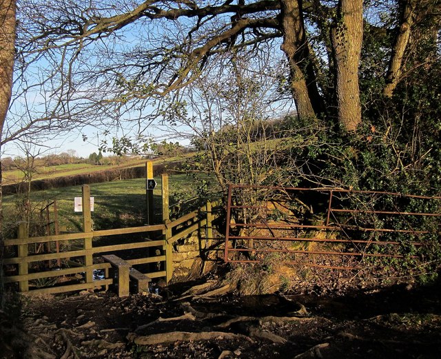
Denbury Images

Images are sourced within 2km of 50.507063/-3.661249 or Grid Reference SX8268. Thanks to Geograph Open Source API. All images are credited.

East Ogwell church  The church is dedicated to St Bartholomew
East Ogwell church
The church is dedicated to St Bartholomew
Minor road leading east from West Ogwell
Stile at start of footpath to Denbury from West Ogwell
West Ogwell
West Ogwell
Part of Gaia House Gaia House is a centre for meditation in the Buddhist tradition
Part of Gaia House
Gaia House is a centre for meditation in the Buddhist tradition
Inside West Ogwell church The church is grade 1 listed, but no  longer in use. (<span class="nowrap"><a title="http://en.wikipedia.org/wiki/West_Ogwell_Church)" rel="nofollow ugc noopener" href="http://en.wikipedia.org/wiki/West_Ogwell_Church)">Link</a><img style="margin-left:2px;" alt="External link" title="External link - shift click to open in new window" src="https://s1.geograph.org.uk/img/external.png" width="10" height="10"/></span>
Inside West Ogwell church
The church is grade 1 listed, but no longer in use. (LinkExternal link
West Ogwell church The church is preserved by the Churches Conservation Trust
West Ogwell church
The church is preserved by the Churches Conservation Trust
St  Bartholomew's Church - reredos The existence of an active and productive (East) Ogwell quarry <a href="https://www.geograph.org.uk/photo/2919925">SX8570 : Tower of St Mary's Church Wolborough</a> in the area in Victorian times, probably gave rise to the creation of this wonderful reredos. Built with all the skill the masons possessed and with the local natural "Devonshire Marble", the marble columns and the inserted marble panels are set in what appears to be Beer stone from the quarries just outside the east Devon coastal village of Beer.

There are other examples in the church of the use of marble from the South Devon area ... it is worth looking around to see what can be found, but none so wonderful as the marble in the reredos at St. Bartholomew's Church at East Ogwell.
St Bartholomew's Church - reredos
The existence of an active and productive (East) Ogwell quarry SX8570 : Tower of St Mary's Church Wolborough in the area in Victorian times, probably gave rise to the creation of this wonderful reredos. Built with all the skill the masons possessed and with the local natural "Devonshire Marble", the marble columns and the inserted marble panels are set in what appears to be Beer stone from the quarries just outside the east Devon coastal village of Beer. There are other examples in the church of the use of marble from the South Devon area ... it is worth looking around to see what can be found, but none so wonderful as the marble in the reredos at St. Bartholomew's Church at East Ogwell.
Manor House, West Ogwell A remarkably severe, almost institutional, facade. The render doesn't help. Built 1790 for Pierce Joseph Taylor. Was he an ascetic or guilty about having a big house? Grade II listed.
It now appears to go by the name Gaia House and serves as a Buddhist retreat.
Manor House, West Ogwell
A remarkably severe, almost institutional, facade. The render doesn't help. Built 1790 for Pierce Joseph Taylor. Was he an ascetic or guilty about having a big house? Grade II listed. It now appears to go by the name Gaia House and serves as a Buddhist retreat.
This sign needs repair Fortunately, this is a T-junction, and all the arms of the sign are intact, so one can deduce which way to go from the shape of the signpost.
This sign needs repair
Fortunately, this is a T-junction, and all the arms of the sign are intact, so one can deduce which way to go from the shape of the signpost.
East Ogwell church and Manor House
The road past Greenawell Park
Piebald Copse The lane from West Ogwell Cross to Chercombe Bridge runs alongside this wood, one of many small woods in the area.
Piebald Copse
The lane from West Ogwell Cross to Chercombe Bridge runs alongside this wood, one of many small woods in the area.
Junction near Witheridge Brake Chercombe Bridge Road continues ahead, down through woods to the River Lemon. The right turn is Croft Road, to East Ogwell. The fallen signpost shown in <a href="https://www.geograph.org.uk/photo/3398701">SX8370 : This sign needs repair</a> has been resurrected.
Junction near Witheridge Brake
Chercombe Bridge Road continues ahead, down through woods to the River Lemon. The right turn is Croft Road, to East Ogwell. The fallen signpost shown in SX8370 : This sign needs repair has been resurrected.
Pasture near Witheridge Farm Hedges as field boundaries on the southern slopes of the Barham's Brook valley.
Pasture near Witheridge Farm
Hedges as field boundaries on the southern slopes of the Barham's Brook valley.
Farmland near West Ogwell From Ogwell Footpath 7 at the southeast corner of Great Marsh Copse. See also <a href="https://www.geograph.org.uk/photo/4383351">SX8270 : Stile by Great Marsh Copse</a> and <a href="https://www.geograph.org.uk/photo/4383333">SX8270 : Field near West Ogwell</a>.
Farmland near West Ogwell
From Ogwell Footpath 7 at the southeast corner of Great Marsh Copse. See also SX8270 : Stile by Great Marsh Copse and SX8270 : Field near West Ogwell.
Field near West Ogwell Taken on the other side of a stile <a href="https://www.geograph.org.uk/photo/4383351">SX8270 : Stile by Great Marsh Copse</a> across the field boundary on the right of <a href="https://www.geograph.org.uk/photo/4383306">SX8270 : Farmland near West Ogwell</a>, and the left of this; Great Marsh Copse is directly behind the camera. The wood at the top of the field is unnamed on maps.
Field near West Ogwell
Taken on the other side of a stile SX8270 : Stile by Great Marsh Copse across the field boundary on the right of SX8270 : Farmland near West Ogwell, and the left of this; Great Marsh Copse is directly behind the camera. The wood at the top of the field is unnamed on maps.
Stile by Great Marsh Copse The stile on Ogwell Footpath 7 that separates the positions from which <a href="https://www.geograph.org.uk/photo/4383306">SX8270 : Farmland near West Ogwell</a> and <a href="https://www.geograph.org.uk/photo/4383333">SX8270 : Field near West Ogwell</a> were taken.
Stile by Great Marsh Copse
The stile on Ogwell Footpath 7 that separates the positions from which SX8270 : Farmland near West Ogwell and SX8270 : Field near West Ogwell were taken.
Show me another place!

Denbury is located at Grid Ref: SX8268 (Lat: 50.507063, Lng: -3.661249)

Administrative County: Devon

District: Teignbridge

Police Authority: Devon and Cornwall

What 3 Words

///intent.persuade.hypocrite. Near Ipplepen, Devon

Related Wikis

Denbury

Denbury is a village and former civil parish, now in the parish of Denbury and Torbryan, in Teignbridge district of Devon, England. The village is situated...

HM Prison Channings Wood

HM Prison Channings Wood is a Category C men's prison, located in the parish of Ogwell (near Newton Abbot) in Devon, England. The prison is operated by...

Denbury Hill

Denbury Hill (also known as Denbury Camp and Denbury Down) is the name of an Iron Age hill fort near the village of Denbury in Devon, England. The fort...

West Ogwell Church

West Ogwell Church in Ogwell, Devon, England was built in the 13th century. It is recorded in the National Heritage List for England as a designated Grade...

Nearby Amenities

Located within 500m of 50.507063,-3.661249
Denbury
Is In: Devon, England, UK
Place: village
Source: npe
Lat/Long: 50.5075946/-3.6602809
Denbury Down Cross
Place: locality
Lat/Long: 50.5077749/-3.6671612
Peartree Cross
Place: locality
Lat/Long: 50.510824/-3.6626745
Generator Method: photovoltaic
Generator Output Electricity: yes
Generator Source: solar
Generator Type: solar_photovoltaic_panel
Location: roof
Power: generator
Lat/Long: 50.5101495/-3.6584946
Generator Method: photovoltaic
Generator Output Electricity: yes
Generator Source: solar
Generator Type: solar_photovoltaic_panel
Location: roof
Power: generator
Lat/Long: 50.5101478/-3.6587091
Generator Method: photovoltaic
Generator Output Electricity: yes
Generator Source: solar
Generator Type: solar_photovoltaic_panel
Location: roof
Power: generator
Lat/Long: 50.5100113/-3.6598786
Generator Method: photovoltaic
Generator Output Electricity: yes
Generator Source: solar
Generator Type: solar_photovoltaic_panel
Location: roof
Power: generator
Lat/Long: 50.5100506/-3.6593985
Generator Method: photovoltaic
Generator Output Electricity: yes
Generator Source: solar
Generator Type: solar_photovoltaic_panel
Location: roof
Power: generator
Lat/Long: 50.5092454/-3.6599805
Generator Method: photovoltaic
Generator Output Electricity: yes
Generator Source: solar
Generator Type: solar_photovoltaic_panel
Location: roof
Power: generator
Lat/Long: 50.5095064/-3.6587386
Generator Method: photovoltaic
Generator Output Electricity: yes
Generator Source: solar
Generator Type: solar_photovoltaic_panel
Location: roof
Power: generator
Lat/Long: 50.5085503/-3.6578253
Generator Method: photovoltaic
Generator Output Electricity: yes
Generator Source: solar
Generator Type: solar_photovoltaic_panel
Location: roof
Power: generator
Lat/Long: 50.5081222/-3.6611406
Generator Method: photovoltaic
Generator Output Electricity: yes
Generator Source: solar
Generator Type: solar_photovoltaic_panel
Location: roof
Power: generator
Lat/Long: 50.5078075/-3.6624146
Generator Method: photovoltaic
Generator Output Electricity: yes
Generator Source: solar
Generator Type: solar_photovoltaic_panel
Location: roof
Power: generator
Lat/Long: 50.5079226/-3.6626158
Generator Method: photovoltaic
Generator Output Electricity: yes
Generator Source: solar
Generator Type: solar_photovoltaic_panel
Location: roof
Power: generator
Lat/Long: 50.5081444/-3.6619989
Generator Method: photovoltaic
Generator Output Electricity: yes
Generator Source: solar
Generator Type: solar_photovoltaic_panel
Location: roof
Power: generator
Lat/Long: 50.5083849/-3.6612505
Generator Method: photovoltaic
Generator Output Electricity: yes
Generator Source: solar
Generator Type: solar_photovoltaic_panel
Location: roof
Power: generator
Lat/Long: 50.5083171/-3.6611466
Generator Method: photovoltaic
Generator Output Electricity: yes
Generator Source: solar
Generator Type: solar_photovoltaic_panel
Location: roof
Power: generator
Lat/Long: 50.5066961/-3.6608066
Generator Method: photovoltaic
Generator Output Electricity: yes
Generator Source: solar
Generator Type: solar_photovoltaic_panel
Location: roof
Power: generator
Lat/Long: 50.5067166/-3.6621236
Generator Method: photovoltaic
Generator Output Electricity: yes
Generator Source: solar
Generator Type: solar_photovoltaic_panel
Location: roof
Power: generator
Lat/Long: 50.5061861/-3.6623113
Generator Method: photovoltaic
Generator Output Electricity: yes
Generator Source: solar
Generator Type: solar_photovoltaic_panel
Location: roof
Power: generator
Lat/Long: 50.5060394/-3.6626922
Generator Method: photovoltaic
Generator Output Electricity: yes
Generator Source: solar
Generator Type: solar_photovoltaic_panel
Location: roof
Power: generator
Lat/Long: 50.5081051/-3.6642238
Generator Method: photovoltaic
Generator Output Electricity: yes
Generator Source: solar
Generator Type: solar_photovoltaic_panel
Location: roof
Power: generator
Lat/Long: 50.508187/-3.6643525
Generator Method: photovoltaic
Generator Output Electricity: yes
Generator Source: solar
Generator Type: solar_photovoltaic_panel
Location: roof
Power: generator
Lat/Long: 50.5074672/-3.6653852
Generator Method: photovoltaic
Generator Output Electricity: yes
Generator Source: solar
Generator Type: solar_photovoltaic_panel
Location: roof
Power: generator
Lat/Long: 50.5083729/-3.6660101
Generator Method: photovoltaic
Generator Output Electricity: yes
Generator Source: solar
Generator Type: solar_photovoltaic_panel
Location: roof
Power: generator
Lat/Long: 50.5044554/-3.6601253
Power: pole
Lat/Long: 50.5084084/-3.6573717
Power: pole
Lat/Long: 50.5080808/-3.6558844
Power: pole
Lat/Long: 50.5077329/-3.6542979
Post Office
Denbury Post Office
Addr City: Denbury
Addr Housename: Denbury Church Cottage
Addr Postcode: TQ12 6DH
Addr Street: East Street
Opening Hours: Tu 09:00-11:00
Ref Pol Id: 141462
Source: pol_branch_list_2020‑11‑13
Lat/Long: 50.5077635/-3.6604681
Post Box
Brand: Royal Mail
Brand Wikidata: Q638098
Brand Wikipedia: en:Royal Mail
Collection Times: Mo-Fr 16:45; Sa 11:45; Su off
Operator: Royal Mail
Operator Wikidata: Q638098
Post Box Design: type_b
Post Box Mounting: building
Post Box Type: wall
Ref: TQ12 266
Royal Cypher: GR
Royal Cypher Wikidata: Q33102273
Source: survey;streetlevel imagery;aerial imagery
Lat/Long: 50.5084191/-3.6614783
Telephone
Booth: K6
Covered: booth
Listed Status: Grade II
Man Made: telephone_box
Lat/Long: 50.5066774/-3.6599316
Post Box
Post Box Type: lamp
Royal Cypher: EIIR
Royal Cypher Wikidata: Q33102113
Lat/Long: 50.5067275/-3.6599673
The data included in this document is from www.openstreetmap.org. The data is made available under ODbL.

Have you been to Denbury?

Leave your review of Denbury below (or comments, questions and feedback).