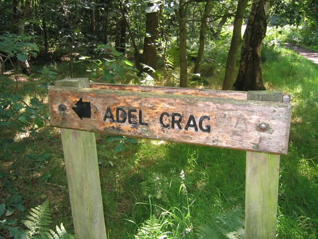
The Orchard

Wood, Forest in Yorkshire

England

The Orchard

Cookridge Methodist Church, Tinshill Road, Cookridge, Leeds The church is near the junction of Tinshill Road and Otley Old Road. This is the view from Tinshill Road looking south-east
Cookridge Methodist Church, Tinshill Road, Cookridge, Leeds Credit: Rich Tea

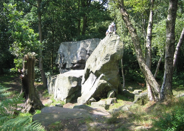
The Orchard is a picturesque woodland area located in Yorkshire, England. Situated in the heart of the region, this enchanting forest offers a serene and idyllic escape from the hustle and bustle of everyday life. Spanning over a vast area, The Orchard is characterized by its dense canopy of trees, including oak, beech, and birch, creating a rich and diverse ecosystem.

Visitors to The Orchard are greeted with a tranquil atmosphere and a sense of serenity. The forest floor is carpeted with a lush bed of moss and ferns, providing a soft and inviting path for explorers to follow. As one ventures deeper into the woods, they will discover a hidden world of wildlife, including squirrels, rabbits, and an array of bird species.

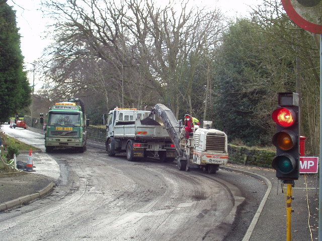
The Orchard is not only a haven for nature enthusiasts but also a popular destination for walking and hiking enthusiasts. With a network of well-maintained trails, visitors can immerse themselves in the beauty of the forest while enjoying a leisurely stroll or a more challenging hike.

In addition to its natural beauty, The Orchard is also home to a variety of historical and cultural landmarks. Ancient stone walls and remnants of old buildings can be found scattered throughout the forest, offering a glimpse into the region's rich history.

Overall, The Orchard in Yorkshire is a captivating woodland oasis that captivates visitors with its natural beauty, diverse wildlife, and historical significance. Whether seeking a peaceful retreat or an adventurous exploration, this forest is sure to leave a lasting impression on all who visit.

If you have any feedback on the listing, please let us know in the comments section below.
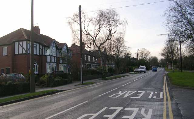
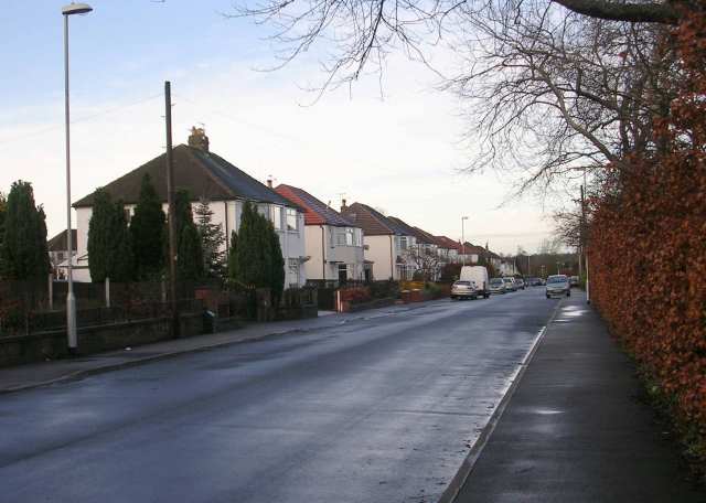
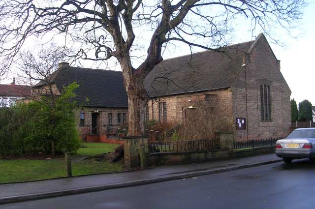
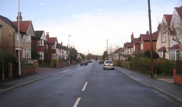
The Orchard Images

Images are sourced within 2km of 53.845726/-1.5964885 or Grid Reference SE2638. Thanks to Geograph Open Source API. All images are credited.
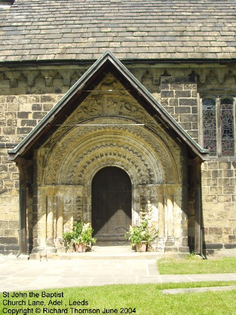
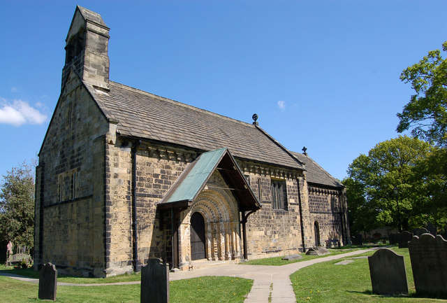
Cookridge Methodist Church, Tinshill Road, Cookridge, Leeds The church is near the junction of Tinshill Road and Otley Old Road. This is the view from Tinshill Road looking south-east
Cookridge Methodist Church, Tinshill Road, Cookridge, Leeds
The church is near the junction of Tinshill Road and Otley Old Road. This is the view from Tinshill Road looking south-east
St John The Baptist Church, Church Lane, Adel, Leeds This is one of the oldest churches in the Leeds area, dating back to Norman times (11th-12th century). Unusually for such an old church, it was not developed, enlarged or extended in Victorian times.
St John The Baptist Church, Church Lane, Adel, Leeds
This is one of the oldest churches in the Leeds area, dating back to Norman times (11th-12th century). Unusually for such an old church, it was not developed, enlarged or extended in Victorian times.
Adel Methodist Church, Holt Lane, Adel, Leeds
St John the Baptist Church, Church Lane, Adel, Leeds This church has a lovely Norman doorway.
St John the Baptist Church, Church Lane, Adel, Leeds
This church has a lovely Norman doorway.
Road repairs, Long Causeway, Adel, Leeds At the north end of Long Causeway, by its junction with Stairfoot Lane and Back Church Lane
Road repairs, Long Causeway, Adel, Leeds
At the north end of Long Causeway, by its junction with Stairfoot Lane and Back Church Lane
Adel Crag This famous rock outcrop in Adel Woods is a magnet for boys of all ages.
Adel Crag
This famous rock outcrop in Adel Woods is a magnet for boys of all ages.
Sunrise at Holt Park. Even urban sprawl can have its charm given the right light.
Sunrise at Holt Park.
Even urban sprawl can have its charm given the right light.
Adel, St John the Baptist Norman Door Ring (1963) The original Norman bronze piece shown was stolen in 2002 and was replaced in replica. The handle is in the form of a monster’s head, probably a lion, with a mouth swallowing a man. 

Acknowledgements.

1. Nikolaus Pevsner. The Buildings of England. Yorkshire: The West Riding. 1959.

2. Leeds / Susan Wrathmell with John Minnis / and contributions by Janet Douglas ... [et al.] 2005.

3. Leodis - a photographic archive of Leeds. <span class="nowrap"><a title="http://www.leodis.net" rel="nofollow ugc noopener" href="http://www.leodis.net">Link</a><img style="margin-left:2px;" alt="External link" title="External link - shift click to open in new window" src="https://s1.geograph.org.uk/img/external.png" width="10" height="10"/></span>
Adel, St John the Baptist Norman Door Ring (1963)
The original Norman bronze piece shown was stolen in 2002 and was replaced in replica. The handle is in the form of a monster’s head, probably a lion, with a mouth swallowing a man. Acknowledgements. 1. Nikolaus Pevsner. The Buildings of England. Yorkshire: The West Riding. 1959. 2. Leeds / Susan Wrathmell with John Minnis / and contributions by Janet Douglas ... [et al.] 2005. 3. Leodis - a photographic archive of Leeds. LinkExternal link
Adel Church St John the Baptist Church, Adel. Built 1170 on a prehistoric trade route between the East and West Ridings.
Pevsner wrote that this is the most complete Norman church in Yorkshire.  Apart from its celebrated Norman archway now protected by the porch structure shown here, an unusual feature of this church are the corbels.These are decorated in a similar grotesque style to that of the gargoyles at Ripon Cathedral which it seems they must pre-date.
Adel Church
St John the Baptist Church, Adel. Built 1170 on a prehistoric trade route between the East and West Ridings. Pevsner wrote that this is the most complete Norman church in Yorkshire. Apart from its celebrated Norman archway now protected by the porch structure shown here, an unusual feature of this church are the corbels.These are decorated in a similar grotesque style to that of the gargoyles at Ripon Cathedral which it seems they must pre-date.
Signpost to Adel Crag This signpost, at the side of the Dales way through Adel Woods, indicates the way to the famous Adel Crag.  See <a href="https://www.geograph.org.uk/photo/280853">SE2840 : Adel Crag</a>.
Signpost to Adel Crag
This signpost, at the side of the Dales way through Adel Woods, indicates the way to the famous Adel Crag. See SE2840 : Adel Crag.
Manor Farm This house farm is less than 50 m from the last suburban houses of North Leeds.
Manor Farm
This house farm is less than 50 m from the last suburban houses of North Leeds.
Holt Park District Centre The central aisle of the centre is between the Leisure Centre on the left, and shops on the right. It was never beautiful, but it used to have more activity than it does now. I remember 20 years ago, there was a newsagents, a greengrocers, a travel agent and a large chemists shop. Now ASDA occupies most of the shops, and the 2 shops remaining down this end are the opticians and a smaller chemist.
Redevelopment is planned, but I don't know how soon.
Holt Park District Centre
The central aisle of the centre is between the Leisure Centre on the left, and shops on the right. It was never beautiful, but it used to have more activity than it does now. I remember 20 years ago, there was a newsagents, a greengrocers, a travel agent and a large chemists shop. Now ASDA occupies most of the shops, and the 2 shops remaining down this end are the opticians and a smaller chemist. Redevelopment is planned, but I don't know how soon.
The Lawnswood Arms - Otley Road
Gainsbro Avenue
Gainsbro Avenue
Adel Methodist Church Hall - Gainsbro Avenue
Adel Methodist Church - Holt Lane
Gainsbro Drive - Holt Lane
Show me another place!

The Orchard is located at Grid Ref: SE2638 (Lat: 53.845726, Lng: -1.5964885)

Division: West Riding

Unitary Authority: Leeds

Police Authority: West Yorkshire

What 3 Words

///noisy.serves.tinsel. Near Horsforth, West Yorkshire

Related Wikis

Ireland Wood

Ireland Wood is a small residential area in north-west Leeds, West Yorkshire, England named after the Woodland Trust wood which it contains. It is approximately...

Lawnswood High School

Lawnswood High School was a girls' grammar school in Lawnswood, north Leeds, West Yorkshire, England, close to the A660. == History == In 1854 the Leeds...

Lawnswood

Lawnswood is a small suburb in the north west of the city of Leeds in West Yorkshire, England. As such it is north north east of the West Yorkshire Urban...

Leeds North West (UK Parliament constituency)

Leeds North West is a constituency in the City of Leeds which has been represented in the House of Commons of the UK Parliament since 2017 by Alex Sobel...

Nearby Amenities

Located within 500m of 53.845726,-1.5964885
Lawnswood
Is In: Leeds, West Yorkshire, United Kingdom
Place: suburb
Wikidata: Q6503716
Wikipedia: en:Lawnswood
Lat/Long: 53.8473339/-1.5971117
Bus Stop
Leeds St Helens Lane
Bench: yes
Bin: yes
Bus: yes
Local Ref: 45010499
Naptan AtcoCode: 450010499
Naptan Bearing: S
Naptan CommonName: Leeds St Helens Lane
Naptan Crossing: St Helens Lane
Naptan Indicator: Stop 45010499
Naptan PlusbusZoneRef: LEEDS
Naptan ShortCommonName: St. Helens Lane
Naptan Street: Otley Road
Naptan Verified: no
Public Transport: platform
Shelter: yes
Source: naptan_import
Towards: leeds
Lat/Long: 53.8495091/-1.5924187
Bus Stop
Otley Road Lawnswood
Bench: yes
Bus: yes
Local Ref: 45010500
Naptan AtcoCode: 450010500
Naptan Bearing: S
Naptan CommonName: Otley Road Lawnswood
Naptan Crossing: Twixt St Helens Lane & Otley Old Road
Naptan Indicator: Stop 45010500
Naptan Landmark: Adj Lawnswood Cemetery
Naptan PlusbusZoneRef: LEEDS
Naptan ShortCommonName: Lawnswood Cemetery
Naptan Street: Otley Road
Naptan Verified: no
Public Transport: platform
Shelter: yes
Source: naptan_import
Lat/Long: 53.846067/-1.5925434
Bus Stop
Leeds Spen Lane
Bay: yes
Bus: yes
Local Ref: 45010746
Naptan AtcoCode: 450010746
Naptan Bearing: SE
Naptan CommonName: Leeds Spen Lane
Naptan Crossing: New Adel Lane
Naptan Indicator: Stop 45010746
Naptan PlusbusZoneRef: LEEDS
Naptan ShortCommonName: New Adel Lane
Naptan Street: Otley Old Road
Naptan Verified: no
Public Transport: platform
Shelter: yes
Source: naptan_import
Lat/Long: 53.8457619/-1.6007085
Bus Stop
Otley Old Road New Adel Road
Bench: no
Bus: yes
Local Ref: 45011549
Naptan AtcoCode: 450011549
Naptan Bearing: NW
Naptan CommonName: Otley Old Road New Adel Road
Naptan Crossing: New Adel Lane
Naptan Indicator: Stop 45011549
Naptan PlusbusZoneRef: LEEDS
Naptan ShortCommonName: New Adel Lane
Naptan Street: Otley Old Road
Naptan Verified: no
Public Transport: platform
Shelter: no
Source: naptan_import
Lat/Long: 53.8459171/-1.6014214
Bus Stop
Otley Old Road Spennithorpe Drive
Bench: no
Bus: yes
Local Ref: 45011569
Naptan AtcoCode: 450011569
Naptan Bearing: SE
Naptan CommonName: Otley Old Road Spennithorpe Drive
Naptan Crossing: Spennithorne Drive
Naptan Indicator: Stop 45011569
Naptan PlusbusZoneRef: LEEDS
Naptan ShortCommonName: Spennithorne Drive
Naptan Street: Otley Old Road
Naptan Verified: no
Public Transport: platform
Shelter: no
Source: naptan_import
Lat/Long: 53.8429993/-1.5970567
Bus Stop
Otley Old Road Spennithorpe Drive
Bench: no
Bus: yes
Local Ref: 45011570
Naptan AtcoCode: 450011570
Naptan Bearing: NW
Naptan CommonName: Otley Old Road Spennithorpe Drive
Naptan Crossing: Spennithorne Drive
Naptan Indicator: Stop 45011570
Naptan PlusbusZoneRef: LEEDS
Naptan ShortCommonName: Spennithorne Drive
Naptan Street: Otley Old Road
Naptan Verified: no
Public Transport: platform
Shelter: no
Source: naptan_import
Lat/Long: 53.843072/-1.597284
Bus Stop
Otley Road Lawnswood Crematorium
Bench: no
Bin: yes
Bus: yes
Local Ref: 45011741
Naptan AtcoCode: 450011741
Naptan Bearing: N
Naptan CommonName: Otley Road Lawnswood Crematorium
Naptan Crossing: Twixt Otley Old Road & New Adel Lane
Naptan Indicator: Stop 45011741
Naptan Landmark: Lawnswood Crematorium
Naptan PlusbusZoneRef: LEEDS
Naptan ShortCommonName: Lawnswood
Naptan Street: Otley Road
Naptan Verified: no
Public Transport: platform
Shelter: no
Source: naptan_import
Tactile Paving: no
Timetable: yes
Lat/Long: 53.8460148/-1.5930454
Bus Stop
Otley Road Lawnswood Sports Club
Bench: no
Bin: yes
Bus: yes
Local Ref: 45011742
Naptan AtcoCode: 450011742
Naptan Bearing: N
Naptan CommonName: Otley Road Lawnswood Sports Club
Naptan Crossing: Twixt Otley Old Road & New Adel Lane
Naptan Indicator: Stop 45011742
Naptan Landmark: Bodington Hall Lawnswood Sports Club
Naptan PlusbusZoneRef: LEEDS
Naptan ShortCommonName: Lawnswood
Naptan Street: Otley Road
Naptan Verified: no
Public Transport: platform
Shelter: no
Source: naptan_import
Lat/Long: 53.8440307/-1.5937334
Bus Stop
Otley Road Lawns Hall Close
Bench: yes
Bus: yes
Local Ref: 45011743
Naptan AtcoCode: 450011743
Naptan Bearing: N
Naptan CommonName: Otley Road Lawns Hall Close
Naptan Crossing: Lawns Hall Close
Naptan Indicator: Stop 45011743
Naptan Landmark: Lawnswood Crematorium
Naptan PlusbusZoneRef: LEEDS
Naptan ShortCommonName: Lawns Hall Close
Naptan Street: Otley Road
Naptan Verified: no
Public Transport: platform
Shelter: no
Source: naptan_import
Timetable: yes
Lat/Long: 53.8481891/-1.5928116
Bus Stop
Otley Road Lawnswood Sports Club
Bus: yes
Local Ref: 45011747
Naptan AtcoCode: 450011747
Naptan Bearing: S
Naptan CommonName: Otley Road Lawnswood Sports Club
Naptan Crossing: Nr-Opp Otley Old Road
Naptan Indicator: Stop 45011747
Naptan Landmark: Bodington Hall - Opp Lawnswood Sports Club
Naptan PlusbusZoneRef: LEEDS
Naptan ShortCommonName: Lawnswood
Naptan Street: Otley Road
Naptan Verified: no
Public Transport: platform
Source: naptan_import
Lat/Long: 53.8429342/-1.5937441
Bus Stop
Spen Lane Iveson Drive
Bus: yes
Local Ref: 45024478
Naptan AtcoCode: 450024478
Naptan Bearing: S
Naptan CommonName: Spen Lane Iveson Drive
Naptan Crossing: Iveson Drive
Naptan Indicator: Stop 45024478
Naptan PlusbusZoneRef: LEEDS
Naptan ShortCommonName: Iveson Drive
Naptan Street: Spen Lane
Naptan Verified: no
Public Transport: platform
Source: naptan_import
Lat/Long: 53.8422401/-1.6011828
Bus Stop
Spen Lane Spennithorpe Avenue
Bus: yes
Local Ref: 45025179
Naptan AtcoCode: 450025179
Naptan Bearing: N
Naptan CommonName: Spen Lane Spennithorpe Avenue
Naptan Crossing: Spennithorpe Avenue
Naptan Indicator: Stop 45025179
Naptan PlusbusZoneRef: LEEDS
Naptan ShortCommonName: Spennithorpe Lane
Naptan Street: Spen Lane
Naptan Verified: no
Public Transport: platform
Source: naptan_import
Lat/Long: 53.8441626/-1.6009061
Bus Stop
Spen Lane Iveson Drive
Bus: yes
Local Ref: 45024769
Naptan AtcoCode: 450024769
Naptan Bearing: N
Naptan CommonName: Spen Lane Iveson Drive
Naptan Crossing: Iveson Drive
Naptan Indicator: Stop 45024769
Naptan PlusbusZoneRef: LEEDS
Naptan ShortCommonName: Iveson Drive
Naptan Street: Spen Lane
Naptan Verified: no
Public Transport: platform
Source: naptan_import
Lat/Long: 53.8422944/-1.6013038
Bus Stop
Spen Lane Spennithorpe Avenue
Bus: yes
Local Ref: 45024770
Naptan AtcoCode: 450024770
Naptan Bearing: S
Naptan CommonName: Spen Lane Spennithorpe Avenue
Naptan Crossing: Spennithorne Avenue
Naptan Indicator: Stop 45024770
Naptan PlusbusZoneRef: LEEDS
Naptan ShortCommonName: Spennithorne Avenue
Naptan Street: Spen Lane
Naptan Verified: no
Public Transport: platform
Shelter: no
Source: naptan_import
Lat/Long: 53.8441801/-1.6007539
New Adel Lane
Naptan AtcoCode: 450028265
Naptan Bearing: N
Naptan BusStopType: CUS
Naptan CommonName: New Adel Lane
Naptan Crossing: The Drive
Naptan Landmark: Unknown
Naptan PlusbusZoneRef: LEEDS
Naptan ShortCommonName: New Adel Lane
Naptan Street: New Adel Lane
Naptan Verified: no
Source: naptan_import
Lat/Long: 53.8479026/-1.6011745
New Adel Lane South
Naptan AtcoCode: 450028266
Naptan Bearing: S
Naptan BusStopType: CUS
Naptan CommonName: New Adel Lane South
Naptan Crossing: The Drive
Naptan Landmark: Unknown
Naptan PlusbusZoneRef: LEEDS
Naptan ShortCommonName: New Adel Lane Sth
Naptan Street: New Adel Lane
Naptan Verified: no
Source: naptan_import
Lat/Long: 53.8477224/-1.6010395
Turning Circle
Lat/Long: 53.8476515/-1.6018914
Turning Circle
Lat/Long: 53.845282/-1.6021101
Post Box
Brand: Royal Mail
Brand Wikidata: Q638098
Brand Wikipedia: en:Royal Mail
Operator: Royal Mail
Operator Wikidata: Q638098
Post Box Type: lamp
Ref: LS16 968
Royal Cypher: EIIR
Royal Cypher Wikidata: Q33102113
Lat/Long: 53.8455748/-1.6008617
Kerb: raised
Lat/Long: 53.8454422/-1.6006078
Traffic Signals
Crossing: traffic_signals
Crossing Ref: pelican
Kerb: flush
Lat/Long: 53.8467557/-1.5927851
Traffic Signals
Crossing: traffic_signals
Crossing Ref: pelican
Kerb: flush
Lat/Long: 53.8467244/-1.5929397
Cafe
Lawnswood Tea Room
Addr City: Leeds
Addr Postcode: LS16 6AH
Addr Street: Otley Road
Addr Suburb: Adel
Lat/Long: 53.847359/-1.5945786
Fixme: only an approximate position. Can't find on aerial imagery
Man Made: mast
Source: survey
Tower Type: communication
Lat/Long: 53.8432004/-1.5942621
Fixme: only an approximate position. Can't find on aerial imagery
Man Made: mast
Source: survey
Tower Type: communication
Lat/Long: 53.8473242/-1.5924221
Generator Method: photovoltaic
Generator Output Electricity: small_installation
Generator Source: solar
Generator Type: solar_photovoltaic_panel
Location: rooftop
Power: generator
Lat/Long: 53.8487315/-1.5923078
Fast Food
Greggs
Addr City: Leeds
Addr Housename: Lawnswood Service Station
Addr Postcode: LS16 8AA
Addr Street: Otley Road
Addr Suburb: Adel
Brand: Greggs
Brand Wikidata: Q3403981
Brand Wikipedia: en:Greggs
Contact Website: https://www.greggs.co.uk/shop-finder?shop-code=3640
Cuisine: sandwich;bakery
Fhrs Id: 1202678
Takeaway: yes
Lat/Long: 53.8487301/-1.5922786
Fast Food
Subway
Addr City: Leeds
Addr Housename: Lawnswood Service Station
Addr Postcode: LS16 8AA
Addr Street: Otley Road
Addr Suburb: Adel
Brand: Subway
Brand Wikidata: Q244457
Brand Wikipedia: en:Subway (restaurant)
Contact Website: https://restaurants.subway.com/united-kingdom/en/leeds/esso-lawnswoodotley-road
Cuisine: sandwich
Fhrs Id: 1202671
Takeaway: yes
Lat/Long: 53.8487317/-1.5923376
Waste Basket
Collection Times: Mo-Fr
Ref UK Leedscc Bin: 5103
Lat/Long: 53.841267/-1.595618
Waste Basket
Collection Times: Mo-Fr
Ref UK Leedscc Bin: 5102
Lat/Long: 53.841825/-1.596144
Waste Basket
Collection Times: Mo; Fr
Ref UK Leedscc Bin: 2445
Lat/Long: 53.844298/-1.593726
Waste Basket
Collection Times: Mo-Fr
Ref UK Leedscc Bin: 2403
Lat/Long: 53.843269/-1.5976
Waste Basket
Collection Times: Mo; Fr
Ref UK Leedscc Bin: 2428
Lat/Long: 53.846426/-1.59305
Waste Basket
Collection Times: Mo; Fr
Ref UK Leedscc Bin: 2446
Lat/Long: 53.846989/-1.593042
Waste Basket
Collection Times: Mo; Fr
Ref UK Leedscc Bin: 2429
Lat/Long: 53.848357/-1.592829
Waste Basket
Collection Times: Mo-Fr
Ref UK Leedscc Bin: 5099
Lat/Long: 53.845878/-1.600617
Otley Old Road Spennithorpe Drive
Bus: yes
Local Ref: 45011569
Public Transport: stop_position
Lat/Long: 53.8429843/-1.5971052
Otley Old Road Spennithorpe Drive
Bus: yes
Public Transport: stop_position
Lat/Long: 53.8430968/-1.5972252
Otley Old Road New Adel Road
Bus: yes
Public Transport: stop_position
Lat/Long: 53.8459564/-1.6013957
Leeds Spen Lane
Bus: yes
Local Ref: 45010746
Public Transport: stop_position
Lat/Long: 53.8457306/-1.6007439
Otley Road Lawnswood Sports Club
Bus: yes
Public Transport: stop_position
Lat/Long: 53.8429439/-1.593833
Otley Road Lawnswood Sports Club
Bus: yes
Public Transport: stop_position
Lat/Long: 53.8440137/-1.5936375
Generator Method: photovoltaic
Generator Output Electricity: yes
Generator Source: solar
Generator Type: solar_photovoltaic_panel
Power: generator
Lat/Long: 53.8444336/-1.5956619
Otley Road Lawnswood Crematorium
Bus: yes
Public Transport: stop_position
Lat/Long: 53.8460172/-1.5929994
Otley Road Lawnswood
Bus: yes
Public Transport: stop_position
Lat/Long: 53.8460772/-1.5926786
Crossing
Crossing: unmarked
Crossing Island: no
Crossing Markings: no
Tactile Paving: yes
Lat/Long: 53.8452842/-1.5928758
Crossing
Crossing: unmarked
Crossing Island: no
Crossing Markings: no
Tactile Paving: yes
Lat/Long: 53.8453732/-1.5931453
Otley Road Lawns Hall Close
Bus: yes
Public Transport: stop_position
Lat/Long: 53.8481907/-1.5927278
Leeds St Helens Lane
Bus: yes
Public Transport: stop_position
Lat/Long: 53.8495198/-1.5926083
Recycling
Recycling Glass: no
Recycling Glass Bottles: yes
Recycling Type: container
Lat/Long: 53.8456342/-1.600918
Recycling
Recycling Glass: no
Recycling Glass Bottles: yes
Recycling Type: container
Lat/Long: 53.8456204/-1.6009356
Recycling
Recycling Glass: no
Recycling Glass Bottles: yes
Recycling Type: container
Lat/Long: 53.8456504/-1.6008999
Crossing
Lat/Long: 53.8471612/-1.5925281
Crossing
Lat/Long: 53.846627/-1.592583
Crossing
Lat/Long: 53.8451823/-1.5927854
Give Way
Lat/Long: 53.8466226/-1.592814
Crossing
Lat/Long: 53.8471607/-1.5927209
Crossing
Lat/Long: 53.8477495/-1.5927102
Crossing
Lat/Long: 53.8483942/-1.6012347
Crossing
Lat/Long: 53.8469636/-1.6013507
Crossing
Crossing: unmarked
Crossing Island: yes
Crossing Markings: no
Lat/Long: 53.846899/-1.5930149
Crossing
Lat/Long: 53.8429834/-1.593685
Crossing
Lat/Long: 53.8420143/-1.5932928
Dentist
Lawnswood Dental Care
Healthcare: dentist
Lat/Long: 53.8456218/-1.6015953
Entrance: yes
Lat/Long: 53.8473491/-1.6031121
The data included in this document is from www.openstreetmap.org. The data is made available under ODbL.

Have you been to The Orchard?

Leave your review of The Orchard below (or comments, questions and feedback).