Arnish

Settlement in Inverness-shire

Scotland

Arnish

Stony Hill near Brochel A bare lump of conglomerate rock. See also <a href="https://www.geograph.org.uk/photo/5760926">NG5846 : Mysterious Conglomerate</a> for geological details.
From a print, date approximate.
Stony Hill near Brochel Credit: Des Blenkinsopp

Arnish is a small village located in the county of Inverness-shire, in the Scottish Highlands. Situated near the shores of Loch Arnish, the village is known for its stunning natural beauty and peaceful surroundings.

The village is home to a small population of around 200 residents, many of whom are involved in traditional industries such as fishing and agriculture. The local economy is largely dependent on these industries, as well as tourism, with visitors drawn to Arnish for its picturesque landscapes and outdoor recreational opportunities.

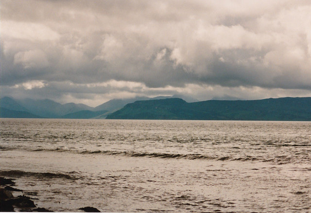
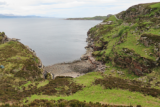
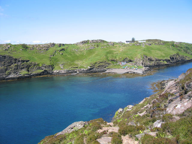
Arnish is surrounded by rolling hills and lush greenery, making it a popular destination for hikers and nature enthusiasts. The nearby Loch Arnish offers opportunities for fishing and boating, while the surrounding forests and moors provide ample space for wildlife watching and birdwatching.

In terms of amenities, Arnish has a few small shops and cafes, as well as a primary school and community center. The village is well-connected to the rest of Inverness-shire by road, making it easy to access the larger towns and cities in the region. Overall, Arnish is a charming and idyllic village that offers a peaceful retreat from the hustle and bustle of urban life.

If you have any feedback on the listing, please let us know in the comments section below.

Arnish Images

Images are sourced within 2km of 57.458711/-6.012777 or Grid Reference NG5948. Thanks to Geograph Open Source API. All images are credited.

Stony Hill near Brochel A bare lump of conglomerate rock. See also <a href="https://www.geograph.org.uk/photo/5760926">NG5846 : Mysterious Conglomerate</a> for geological details.
From a print, date approximate.
Stony Hill near Brochel
A bare lump of conglomerate rock. See also NG5846 : Mysterious Conglomerate for geological details. From a print, date approximate.
Loch Beag, Raasay A small loch towards the northern end of the island.
Loch Beag, Raasay
A small loch towards the northern end of the island.
View to Raasay From the edge of the sandy beach at Sand looking across the water towards Raasay and beyond to Skye.
View to Raasay
From the edge of the sandy beach at Sand looking across the water towards Raasay and beyond to Skye.
Kyle of Rona Footpath on the Isle of Raasay View along the footpath from Arnish to the Kyle of Rona at the northern end of the Isle of Raasay.  The view here is facing east along the path from the saddle point just the south of Beinn na h-Iolaire, the hill of the eagle.  The land across the water is mainland Britain.
Kyle of Rona Footpath on the Isle of Raasay
View along the footpath from Arnish to the Kyle of Rona at the northern end of the Isle of Raasay. The view here is facing east along the path from the saddle point just the south of Beinn na h-Iolaire, the hill of the eagle. The land across the water is mainland Britain.
The coast east of Arnish with the mainland in the background
The coast  north east of Arnish
The coast north east of Arnish
Raasay in the Mists Taken from the Leac Tressirnish viewpoint at the East coast of Trotternish peninsula (A855) on an overcast morning. View over the Sound of Raasay to the namesake island. The view is centred at Loch Arnish (<a href="https://www.geograph.org.uk/gridref/NG5848">NG5848</a>), which is surrounded by those portions of Raasay which come out clearest from the surrounding mist.
Raasay in the Mists
Taken from the Leac Tressirnish viewpoint at the East coast of Trotternish peninsula (A855) on an overcast morning. View over the Sound of Raasay to the namesake island. The view is centred at Loch Arnish (NG5848), which is surrounded by those portions of Raasay which come out clearest from the surrounding mist.
Footpath from Arnish to the north of Raasay This footpath starts from the end of the surfaced road to Arnish, and goes to the north of Raasay.

<a href="https://www.geograph.org.uk/photo/2836137">NG5948 : End of the public road at Arnish, Raasay</a>.
Footpath from Arnish to the north of Raasay
This footpath starts from the end of the surfaced road to Arnish, and goes to the north of Raasay. NG5948 : End of the public road at Arnish, Raasay.
End of the public road at Arnish, Raasay The public road goes no further than this point. The last section to here was dug out by one man, before the Council surfaced it, and it is commonly known as Calum's Road, in tribute to him. The great irony is that, by the time that was done, Calum and his wife were the only people still living here. There are a very few cottages nearby, which may now be lived in permanently, but more likely are holiday cottages. On the left is the start of the footpath to the north of the island.

<a href="https://www.geograph.org.uk/photo/2836062">NG5948 : Footpath from Arnish to the north of Raasay</a>.
End of the public road at Arnish, Raasay
The public road goes no further than this point. The last section to here was dug out by one man, before the Council surfaced it, and it is commonly known as Calum's Road, in tribute to him. The great irony is that, by the time that was done, Calum and his wife were the only people still living here. There are a very few cottages nearby, which may now be lived in permanently, but more likely are holiday cottages. On the left is the start of the footpath to the north of the island. NG5948 : Footpath from Arnish to the north of Raasay.
Signpost at Arnish, Raasay Located at the beginning of the footpath to the north of the island, and giving distances to various places.

<a href="https://www.geograph.org.uk/photo/2836137">NG5948 : End of the public road at Arnish, Raasay</a>.
Signpost at Arnish, Raasay
Located at the beginning of the footpath to the north of the island, and giving distances to various places. NG5948 : End of the public road at Arnish, Raasay.
The road south from Arnish, Raasay This is the only road in this part of the island. It goes a few kilometres south from Arnish, through rugged terrain, providing a link to both the ferry at Clachan and the main centre of population at Inverarish, passing through Brochel on its way. On the right is part of the small parking area at Arnish. Cars can go no further north, but it is a useful place to leave your vehicle and explore the north of the island by foot.
The road south from Arnish, Raasay
This is the only road in this part of the island. It goes a few kilometres south from Arnish, through rugged terrain, providing a link to both the ferry at Clachan and the main centre of population at Inverarish, passing through Brochel on its way. On the right is part of the small parking area at Arnish. Cars can go no further north, but it is a useful place to leave your vehicle and explore the north of the island by foot.
The southern end of Calum's Road Sometime in the four years since <a href="https://www.geograph.org.uk/photo/922972">NG5846 : Calum's Road</a> a wheelbarrow (an icon of the road's story) has been placed below the sign.
The southern end of Calum's Road
Sometime in the four years since NG5846 : Calum's Road a wheelbarrow (an icon of the road's story) has been placed below the sign.
Rock formation at Brochel
Calum MacLeod's Road, Raasay Calum and his brother, Charles, constructed the track from Torran to Fladda (Eilean Fladday), over three winters from 1949-1952. For this, they were each paid £35 a year by the local council. 
After decades of unsuccessful campaigning by the inhabitants of the north end of Raasay for a road, and several failed grant applications, Calum decided to build the road himself. Purchasing Thomas Aitken's manual Road Making & Maintenance: A Practical Treatise for Engineers, Surveyors and Others (London, 1900), for half a crown, he started work replacing the old narrow footpath. Over a period of about ten years (1964-1974), he constructed one and three quarter miles of road between Brochel Castle and Arnish using little more than a shovel, a pick and a wheelbarrow. Initial blasting work was carried out and funded, to the sum of £1,900, by the Department of Agriculture's Engineering Department, who supplied a compressor, explosives, driller, blaster, and men. 
Several years after its completion, the road was finally adopted and surfaced by the local council. By then Calum and his wife, Lexie, were the last inhabitants of Arnish
Calum MacLeod's Road, Raasay
Calum and his brother, Charles, constructed the track from Torran to Fladda (Eilean Fladday), over three winters from 1949-1952. For this, they were each paid £35 a year by the local council. After decades of unsuccessful campaigning by the inhabitants of the north end of Raasay for a road, and several failed grant applications, Calum decided to build the road himself. Purchasing Thomas Aitken's manual Road Making & Maintenance: A Practical Treatise for Engineers, Surveyors and Others (London, 1900), for half a crown, he started work replacing the old narrow footpath. Over a period of about ten years (1964-1974), he constructed one and three quarter miles of road between Brochel Castle and Arnish using little more than a shovel, a pick and a wheelbarrow. Initial blasting work was carried out and funded, to the sum of £1,900, by the Department of Agriculture's Engineering Department, who supplied a compressor, explosives, driller, blaster, and men. Several years after its completion, the road was finally adopted and surfaced by the local council. By then Calum and his wife, Lexie, were the last inhabitants of Arnish
Fisherman's hut, Brochel
Junction of Paths This is where the path to Fladda splits off to the left from the main path between Torran and Caol Rona
Junction of Paths
This is where the path to Fladda splits off to the left from the main path between Torran and Caol Rona
Tairbeart The name occurs, with spelling variations, all over Scotland. It means a narrow isthmus. The rocks here are Lewisian Gneiss, the oldest rocks in Scotland and some of the oldest anywhere on Earth, with ages going up to three and a half thousand million years.
Tairbeart
The name occurs, with spelling variations, all over Scotland. It means a narrow isthmus. The rocks here are Lewisian Gneiss, the oldest rocks in Scotland and some of the oldest anywhere on Earth, with ages going up to three and a half thousand million years.
Lewisian Gneiss These rocks are typical of the Lewisian Gneiss that underlies most of Scotland. The pink rocks have been extensively metamorphosed, deformed, partly melted and recrystallised since their formation over 3,500 million years ago, and they have been intruded by black igneous rocks at various times since then, resulting in a very complicated rock.
Lewisian Gneiss
These rocks are typical of the Lewisian Gneiss that underlies most of Scotland. The pink rocks have been extensively metamorphosed, deformed, partly melted and recrystallised since their formation over 3,500 million years ago, and they have been intruded by black igneous rocks at various times since then, resulting in a very complicated rock.
Show me another place!

Arnish is located at Grid Ref: NG5948 (Lat: 57.458711, Lng: -6.012777)

Unitary Authority: Highland

Police Authority: Highlands and Islands

What 3 Words

///enchanted.collected.issued. Near Portree, Highland

Nearby Locations

Arnish Rubha Crion

Related Wikis

Eilean Fladday

Eilean Fladday (also Fladda; Scottish Gaelic: Eilean Fladaigh) is a previously populated tidal island off Raasay, near the Isle of Skye, Scotland. ��2...

Eilean Tigh

Eilean Tigh (Scottish Gaelic: Eilean Taighe) is a tidal island in the Sound of Raasay of Scotland, that lies between Rona and Raasay. Approximately 54...

Sound of Raasay

The Sound of Raasay (Scottish Gaelic: Linne Ratharsair) is the sound between the islands of Raasay and Skye. == See also == Inner Sound, Scotland Isle...

Raasay

Raasay (; Scottish Gaelic: Ratharsair) or the Isle of Raasay is an island between the Isle of Skye and the mainland of Scotland. It is separated from Skye...

Nearby Amenities

Located within 500m of 57.458711,-6.012777
Source: PGS
Lat/Long: 57.4563057/-6.018525
Source: PGS
Lat/Long: 57.4565753/-6.0185765
Source: PGS
Lat/Long: 57.4570318/-6.0184896
Source: PGS
Lat/Long: 57.4572782/-6.0185797
Source: PGS
Lat/Long: 57.4576666/-6.0184145
Source: PGS
Lat/Long: 57.4580048/-6.0187664
Source: PGS
Lat/Long: 57.4581826/-6.0187042
Source: PGS
Lat/Long: 57.4584209/-6.0177923
Source: PGS
Lat/Long: 57.4587196/-6.017089
Source: PGS
Lat/Long: 57.4591839/-6.017258
Source: PGS
Lat/Long: 57.4598359/-6.0167299
Created By: dmgroom_coastlines
Source: PGS
Lat/Long: 57.46005/-6.01619
Source: PGS
Lat/Long: 57.4601993/-6.0158573
Source: PGS
Lat/Long: 57.4602642/-6.0152269
Source: PGS
Lat/Long: 57.4609392/-6.0147625
Source: PGS
Lat/Long: 57.461325/-6.0141671
Source: PGS
Lat/Long: 57.4617169/-6.0134934
Created By: dmgroom_coastlines
Source: PGS
Lat/Long: 57.46202/-6.01317
Created By: dmgroom_coastlines
Source: PGS
Lat/Long: 57.46278/-6.01263
Arnish
Name En: Arnish
Name Gd: Àrnais
Place: hamlet
Lat/Long: 57.4584059/-6.0115216
Ford: yes
Lat/Long: 57.4601214/-6.0134942
An Rubha Crìon
Natural: cape
Lat/Long: 57.4581201/-6.0185764
The data included in this document is from www.openstreetmap.org. The data is made available under ODbL.

Have you been to Arnish?

Leave your review of Arnish below (or comments, questions and feedback).