Deanend

Settlement in Dorset

England

Deanend

Path, Great Shaftesbury Coppice Approaching the forest edge shown in <a href="https://www.geograph.org.uk/photo/4544846">ST9718 : Little Shaftesbury Coppice</a>.
Path, Great Shaftesbury Coppice Credit: Derek Harper

Deanend is a small village located in the county of Dorset, England. Situated on the outskirts of the town of Blandford Forum, Deanend is nestled amidst picturesque countryside, offering residents and visitors a tranquil and serene setting.

The village is known for its charming and idyllic atmosphere, with a population of around 300 inhabitants. It boasts a close-knit community, where neighbors are familiar with each other and a sense of camaraderie is evident.

Deanend is primarily a residential area, with a mix of traditional cottages and modern houses. The architecture reflects the village's rich history, with some buildings dating back several centuries. The village is surrounded by lush green fields, providing a stunning backdrop and ample opportunities for outdoor activities such as walking, cycling, and picnicking.

Although small in size, Deanend offers essential amenities to its residents, including a local convenience store, a village hall, and a primary school. For more extensive shopping and entertainment options, the nearby town of Blandford Forum is easily accessible.

The village is well-connected by road networks, making it convenient for commuters. Additionally, public transportation links provide access to surrounding areas and larger towns.

Deanend is renowned for its community events and activities, with annual festivities that bring the villagers together. These include summer fairs, Christmas markets, and various sports tournaments, fostering a strong sense of community spirit.

Overall, Deanend offers a peaceful and scenic environment, making it an ideal place for those seeking a rural lifestyle with close proximity to essential amenities and a vibrant community.

If you have any feedback on the listing, please let us know in the comments section below.
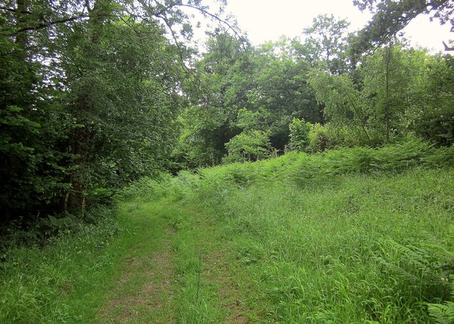
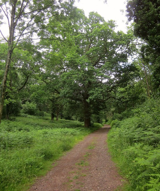
Deanend Images

Images are sourced within 2km of 50.954701/-2.0381323 or Grid Reference ST9717. Thanks to Geograph Open Source API. All images are credited.

Path, Great Shaftesbury Coppice Approaching the forest edge shown in <a href="https://www.geograph.org.uk/photo/4544846">ST9718 : Little Shaftesbury Coppice</a>.
Path, Great Shaftesbury Coppice
Approaching the forest edge shown in ST9718 : Little Shaftesbury Coppice.
Track by Great Shaftesbury Coppice Bridleway E52 23 runs alongside the edge of Chase Woods. This looks in the other direction from the same spot as <a href="https://www.geograph.org.uk/photo/4544846">ST9718 : Little Shaftesbury Coppice</a>.
Track by Great Shaftesbury Coppice
Bridleway E52 23 runs alongside the edge of Chase Woods. This looks in the other direction from the same spot as ST9718 : Little Shaftesbury Coppice.
Shire Rack The path follows the county boundary between Dorset and Wiltshire.
Shire Rack
The path follows the county boundary between Dorset and Wiltshire.
Shire Rack The path follows the county boundary between Dorset and Wiltshire, although since it is a Dorset path (E52 30) the boundary must be on the left side.
Shire Rack
The path follows the county boundary between Dorset and Wiltshire, although since it is a Dorset path (E52 30) the boundary must be on the left side.
Longcroft Road The track is followed here by footpath E52 26 as it begins to near Newtown, traversing Chase Woods for about three kilometres.
Longcroft Road
The track is followed here by footpath E52 26 as it begins to near Newtown, traversing Chase Woods for about three kilometres.
Parkland east of Oakley Lane Part of Rushmore Park.
Parkland east of Oakley Lane
Part of Rushmore Park.
B3081 looking east Heading towards Sixpenny Handley.
B3081 looking east
Heading towards Sixpenny Handley.
Rushmore Park, avenue The remains of a once fine avenue of beech trees, at the southern entrance to the estate.
Rushmore Park, avenue
The remains of a once fine avenue of beech trees, at the southern entrance to the estate.
Rushmore Park, avenue A once fine avenue of beech trees leading from South Lodge. Several have disappeared or are in poor condition.
Rushmore Park, avenue
A once fine avenue of beech trees leading from South Lodge. Several have disappeared or are in poor condition.
Rushmore Park, platform Possibly used for watching equestrian events.
Rushmore Park, platform
Possibly used for watching equestrian events.
Rushmore Park, gate Entering Pollards Wood, on the path to Shermel Gate.
Rushmore Park, gate
Entering Pollards Wood, on the path to Shermel Gate.
Rushmore Park, footpath Through Pollards Wood, on the way to Shermel Gate; part of Hardy Way.
Rushmore Park, footpath
Through Pollards Wood, on the way to Shermel Gate; part of Hardy Way.
Rushmore Park, bluebells Wild bluebells under, unusually, a screen of conifers in Uddens Coppice.
Rushmore Park, bluebells
Wild bluebells under, unusually, a screen of conifers in Uddens Coppice.
Rushmore Park, marker On the path through Uddens Coppice towards Shermel Gate; on Hardy Way.
Rushmore Park, marker
On the path through Uddens Coppice towards Shermel Gate; on Hardy Way.
Rushmore Park, bluebell wood Wild bluebells in Brookes Coppice.
Rushmore Park, bluebell wood
Wild bluebells in Brookes Coppice.
Rushmore Park, golf course Part of an extensive 18-hole course: <span class="nowrap"><a title="http://www.rushmoregolfclub.co.uk/cms/" rel="nofollow ugc noopener" href="http://www.rushmoregolfclub.co.uk/cms/">Link</a><img style="margin-left:2px;" alt="External link" title="External link - shift click to open in new window" src="https://s1.geograph.org.uk/img/external.png" width="10" height="10"/></span>
Rushmore Park, golf course
Part of an extensive 18-hole course: LinkExternal link
Rushmore Park, dewpond Used by the local sheep.
Rushmore Park, dewpond
Used by the local sheep.
Rushmore Park, bluebells Wild bluebells next to the golf course.
Rushmore Park, bluebells
Wild bluebells next to the golf course.
Show me another place!

Deanend is located at Grid Ref: ST9717 (Lat: 50.954701, Lng: -2.0381323)

Unitary Authority: Dorset

Police Authority: Dorset

Also known as: Dean End

What 3 Words

///nourished.workbook.tenses. Near Bower Chalke, Wiltshire

Related Wikis

Woodcutts

Woodcutts is a hamlet within the parish of Sixpenny Handley and is located in the north of Dorset, near to the Wiltshire border. Originally named "Woodcotes...

Cranborne Chase and West Wiltshire Downs

Cranborne Chase and West Wiltshire Downs is an Area of Outstanding Natural Beauty (AONB) covering 379 square miles (980 km2) of Dorset, Hampshire, Somerset...

Cranborne Chase

Cranborne Chase (grid reference ST970180) is an area of central southern England, straddling the counties Dorset, Hampshire and Wiltshire. It is part of...

Woodcutts Settlement

Woodcutts Settlement is an archaeological site of the late Iron Age and Romano-British period on Cranborne Chase, England. It is situated about 1 mile...

South Lodge Camp

South Lodge Camp is an archaeological site of the Bronze Age, about 0.6 miles (1.0 km) south-east of the village of Tollard Royal, in Wiltshire, England...

Sixpenny Handley

Sixpenny Handley or Handley is a village and former civil parish, now in the parish of Sixpenny Handley and Pentridge, in north east Dorset, England,...

Sandroyd School

Sandroyd School is an independent co-educational preparatory school for day and boarding pupils aged 2 to 13 in the south of Wiltshire, England. The school...

Farnham, Dorset

Farnham is a village and civil parish in North Dorset, in the south of England, on Cranborne Chase, seven miles (eleven kilometres) northeast of Blandford...

Nearby Amenities

Located within 500m of 50.954701,-2.0381323
Disused Amenity: place_of_worship
Lat/Long: 50.9548026/-2.0445418
Material: wood
Power: pole
Source: bing
Lat/Long: 50.9507376/-2.039362
Material: wood
Power: pole
Source: bing
Lat/Long: 50.9514304/-2.040003
Material: wood
Power: pole
Source: bing
Lat/Long: 50.9526149/-2.0427858
Material: wood
Power: pole
Source: bing
Lat/Long: 50.952941/-2.0428609
Material: wood
Power: pole
Source: bing
Lat/Long: 50.9531337/-2.042303
Material: wood
Power: pole
Source: bing
Lat/Long: 50.9533567/-2.0417411
Material: wood
Power: pole
Source: bing
Lat/Long: 50.9534632/-2.0413857
Material: wood
Power: pole
Source: bing
Lat/Long: 50.9535916/-2.0410129
Material: wood
Power: pole
Source: bing
Lat/Long: 50.9538923/-2.0422628
Material: wood
Power: pole
Source: bing
Lat/Long: 50.9539075/-2.0400982
Material: wood
Power: pole
Source: bing
Lat/Long: 50.9542404/-2.0391729
Material: wood
Poles: bipole
Power: pole
Source: bing
Transformer: distribution
Lat/Long: 50.9544415/-2.0427751
Material: wood
Power: pole
Source: bing
Lat/Long: 50.9545682/-2.0382636
Deanend Bushes
Place: locality
Lat/Long: 50.9588102/-2.0397412
Chaffinger's Coppice
Place: locality
Lat/Long: 50.9583015/-2.0422482
Deanend
Place: hamlet
Lat/Long: 50.955758/-2.0383448
Greatstone Coppice
Place: locality
Lat/Long: 50.9561925/-2.0345086
Littlestone Coppice
Place: locality
Lat/Long: 50.9541258/-2.0330112
Booth: K6
Covered: booth
Disused Amenity: telephone
Man Made: telephone_box
Lat/Long: 50.9549901/-2.0439437
The data included in this document is from www.openstreetmap.org. The data is made available under ODbL.

Have you been to Deanend?

Leave your review of Deanend below (or comments, questions and feedback).