Brockwell Coppice

Wood, Forest in Dorset

England

Brockwell Coppice

Longcroft Road Footpath BSJO 19 follows this track through Long Croft in Chase Woods.
Longcroft Road Credit: Derek Harper

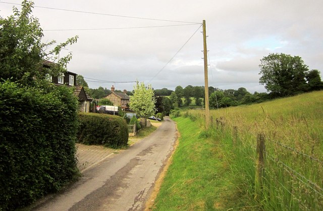
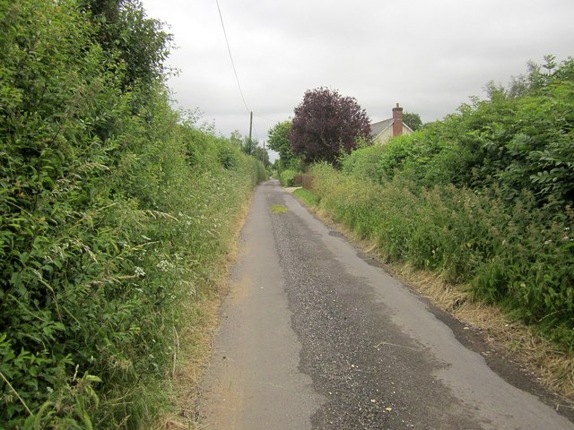
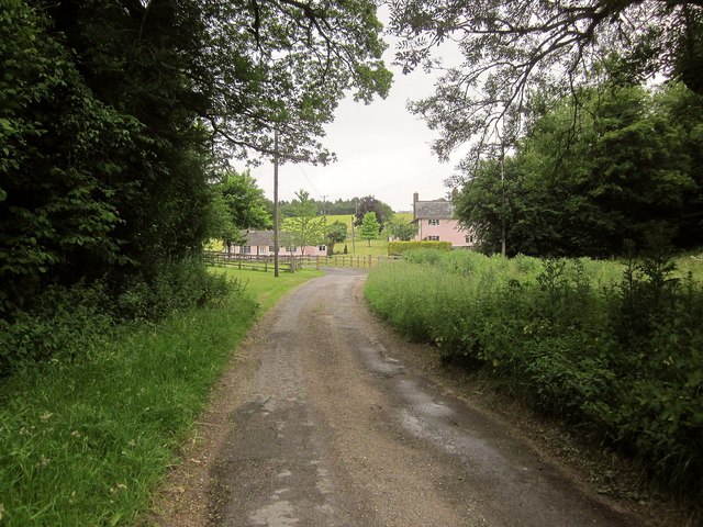
Brockwell Coppice is a picturesque woodland located in the county of Dorset, England. Covering an area of approximately 100 acres, it is a popular destination for nature lovers and outdoor enthusiasts. The coppice is situated near the village of Brockwell and is easily accessible by road.

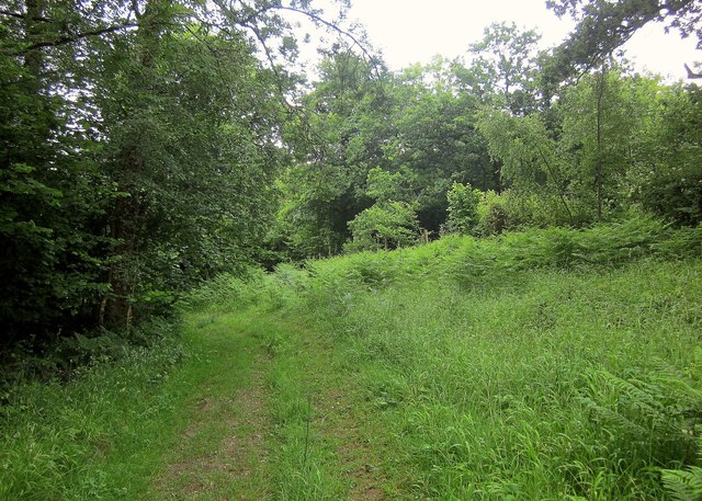
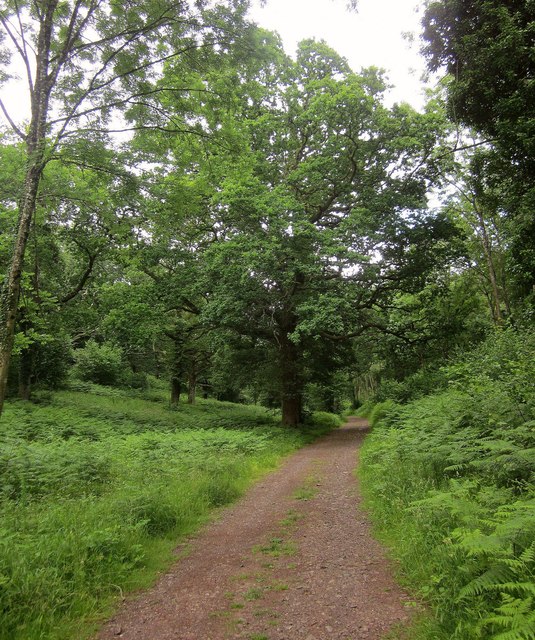
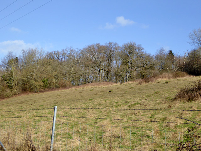
The woodland is predominantly composed of broadleaf trees such as oak, beech, and ash, creating a rich and diverse ecosystem. This variety of tree species provides a habitat for numerous wildlife species, including birds, mammals, and insects. Visitors to Brockwell Coppice can expect to spot a range of bird species, including woodpeckers, nuthatches, and various songbirds. The woodland is also home to small mammals such as squirrels, rabbits, and foxes.

The coppice is crisscrossed by a network of footpaths and trails, allowing visitors to explore its natural beauty at their own pace. These paths are well-maintained and offer an opportunity to discover the different habitats within the woodland, from shady groves to sunlit glades.

Brockwell Coppice is particularly renowned for its vibrant display of wildflowers during the spring and summer months. Bluebells, primroses, and foxgloves carpet the forest floor, creating a striking and colorful scene. This makes it a popular spot for photographers and nature enthusiasts seeking to capture the beauty of Dorset's countryside.

Overall, Brockwell Coppice is a tranquil and enchanting woodland, offering visitors a chance to immerse themselves in the natural wonders of Dorset. Whether it is for a leisurely stroll, birdwatching, or simply enjoying the serenity of nature, this woodland provides a peaceful retreat for all.

If you have any feedback on the listing, please let us know in the comments section below.

Brockwell Coppice Images

Images are sourced within 2km of 50.959782/-2.0362712 or Grid Reference ST9717. Thanks to Geograph Open Source API. All images are credited.

Longcroft Road Footpath BSJO 19 follows this track through Long Croft in Chase Woods.
Longcroft Road
Footpath BSJO 19 follows this track through Long Croft in Chase Woods.
Chase Avenue Crossing Longcroft Road, which I am following. Chase Avenue is one of a pair of beech avenues created by Augustus Pitt Rivers as an extension to his Rushmore estate in the late C19.
Chase Avenue
Crossing Longcroft Road, which I am following. Chase Avenue is one of a pair of beech avenues created by Augustus Pitt Rivers as an extension to his Rushmore estate in the late C19.
Path, Great Shaftesbury Coppice Approaching the forest edge shown in <a href="https://www.geograph.org.uk/photo/4544846">ST9718 : Little Shaftesbury Coppice</a>.
Path, Great Shaftesbury Coppice
Approaching the forest edge shown in ST9718 : Little Shaftesbury Coppice.
Track by Great Shaftesbury Coppice Bridleway E52 23 runs alongside the edge of Chase Woods. This looks in the other direction from the same spot as <a href="https://www.geograph.org.uk/photo/4544846">ST9718 : Little Shaftesbury Coppice</a>.
Track by Great Shaftesbury Coppice
Bridleway E52 23 runs alongside the edge of Chase Woods. This looks in the other direction from the same spot as ST9718 : Little Shaftesbury Coppice.
Shire Rack The path follows the county boundary between Dorset and Wiltshire.
Shire Rack
The path follows the county boundary between Dorset and Wiltshire.
Shire Rack The path follows the county boundary between Dorset and Wiltshire, although since it is a Dorset path (E52 30) the boundary must be on the left side.
Shire Rack
The path follows the county boundary between Dorset and Wiltshire, although since it is a Dorset path (E52 30) the boundary must be on the left side.
Longcroft Road The track is followed here by footpath E52 26 as it begins to near Newtown, traversing Chase Woods for about three kilometres.
Longcroft Road
The track is followed here by footpath E52 26 as it begins to near Newtown, traversing Chase Woods for about three kilometres.
Lane, Newtown Continuing the line of Longcroft road through Chase Woods. <a href="https://www.geograph.org.uk/photo/4545300">ST9818 : Houses at Newtown</a> was taken just a little further along this lane.
Lane, Newtown
Continuing the line of Longcroft road through Chase Woods. ST9818 : Houses at Newtown was taken just a little further along this lane.
Track to Upwood This route from the crossroads at Deanland is followed by bridleway E52 28; footpath E52 29 branches off to the left at the bend ahead.
Track to Upwood
This route from the crossroads at Deanland is followed by bridleway E52 28; footpath E52 29 branches off to the left at the bend ahead.
Dean Lane This no through road is shown looking in the other direction a little nearer its conclusion at <a href="https://www.geograph.org.uk/photo/4545333">ST9919 : Dean Lane</a>.
Dean Lane
This no through road is shown looking in the other direction a little nearer its conclusion at ST9919 : Dean Lane.
Shermel Gate The no through road shown in <a href="https://www.geograph.org.uk/photo/4545333">ST9919 : Dean Lane</a> comes to an end here. But three footpaths, a bridleway, and a byway open to all traffic lead away from it. Shermel Gate was mapped as Shiremill Gate in the C17, and the boundary between the shires of Dorset and Wiltshire crosses the lane here.
Shermel Gate
The no through road shown in ST9919 : Dean Lane comes to an end here. But three footpaths, a bridleway, and a byway open to all traffic lead away from it. Shermel Gate was mapped as Shiremill Gate in the C17, and the boundary between the shires of Dorset and Wiltshire crosses the lane here.
B3081 looking east Heading towards Sixpenny Handley.
B3081 looking east
Heading towards Sixpenny Handley.
Grassland above Dean Lane A lot of anthills.
Grassland above Dean Lane
A lot of anthills.
Rushmore Park, marker On the path through Uddens Coppice towards Shermel Gate; on Hardy Way.
Rushmore Park, marker
On the path through Uddens Coppice towards Shermel Gate; on Hardy Way.
Rushmore Park, bluebell wood Wild bluebells in Brookes Coppice.
Rushmore Park, bluebell wood
Wild bluebells in Brookes Coppice.
Rushmore Park, golf course Part of an extensive 18-hole course: <span class="nowrap"><a title="http://www.rushmoregolfclub.co.uk/cms/" rel="nofollow ugc noopener" href="http://www.rushmoregolfclub.co.uk/cms/">Link</a><img style="margin-left:2px;" alt="External link" title="External link - shift click to open in new window" src="https://s1.geograph.org.uk/img/external.png" width="10" height="10"/></span>
Rushmore Park, golf course
Part of an extensive 18-hole course: LinkExternal link
Rushmore Park, bluebells Wild bluebells next to the golf course.
Rushmore Park, bluebells
Wild bluebells next to the golf course.
Rushmore Park, golf course An extensive 18-hole course: <span class="nowrap"><a title="http://www.rushmoregolfclub.co.uk/cms/" rel="nofollow ugc noopener" href="http://www.rushmoregolfclub.co.uk/cms/">Link</a><img style="margin-left:2px;" alt="External link" title="External link - shift click to open in new window" src="https://s1.geograph.org.uk/img/external.png" width="10" height="10"/></span>
Rushmore Park, golf course
An extensive 18-hole course: LinkExternal link
Show me another place!

Brockwell Coppice is located at Grid Ref: ST9717 (Lat: 50.959782, Lng: -2.0362712)

Unitary Authority: Dorset

Police Authority: Dorset

What 3 Words

///beats.shield.norms. Near Bower Chalke, Wiltshire

Related Wikis

Cranborne Chase and West Wiltshire Downs

Cranborne Chase and West Wiltshire Downs is an Area of Outstanding Natural Beauty (AONB) covering 379 square miles (980 km2) of Dorset, Hampshire, Somerset...

Cranborne Chase

Cranborne Chase (grid reference ST970180) is an area of central southern England, straddling the counties Dorset, Hampshire and Wiltshire. It is part of...

Woodcutts

Woodcutts is a hamlet within the parish of Sixpenny Handley and is located in the north of Dorset, near to the Wiltshire border. Originally named "Woodcotes...

Woodcutts Settlement

Woodcutts Settlement is an archaeological site of the late Iron Age and Romano-British period on Cranborne Chase, England. It is situated about 1 mile...

Nearby Amenities

Located within 500m of 50.959782,-2.0362712
Ridingway
Place: locality
Lat/Long: 50.9632717/-2.0376044
Withywind Coppice
Place: locality
Lat/Long: 50.961502/-2.038126
Brockwell Coppice
Place: locality
Lat/Long: 50.9592553/-2.0364099
Deanend Bushes
Place: locality
Lat/Long: 50.9588102/-2.0397412
Chaffinger's Coppice
Place: locality
Lat/Long: 50.9583015/-2.0422482
Deanend
Place: hamlet
Lat/Long: 50.955758/-2.0383448
Greatstone Coppice
Place: locality
Lat/Long: 50.9561925/-2.0345086
Scrubbity Coppice
Place: locality
Lat/Long: 50.9612583/-2.0422987
The data included in this document is from www.openstreetmap.org. The data is made available under ODbL.

Have you been to Brockwell Coppice?

Leave your review of Brockwell Coppice below (or comments, questions and feedback).