Robin's Wood

Wood, Forest in Durham

England

Robin's Wood

Road junctions below the A1 The roundabout for access to the A1 and the road on the left into Team Valley
Road junctions below the A1 Credit: Eirian Evans

Robin's Wood is a picturesque forest located in the city of Durham, England. Covering an area of approximately 100 acres, it is a delightful natural retreat that offers a serene and tranquil atmosphere for visitors to escape the hustle and bustle of city life.

The wood is primarily composed of mature oak and beech trees, creating a dense canopy that provides shade and shelter for a variety of wildlife. As visitors wander through the wood, they can expect to encounter a rich diversity of flora and fauna, including bluebells, primroses, and ferns, as well as squirrels, foxes, and numerous species of birds.

The woodland features several well-maintained footpaths and trails, allowing visitors to explore its beauty at their own pace. These winding paths provide access to hidden glades, babbling brooks, and charming picnic spots, making it an ideal destination for nature enthusiasts, families, and couples seeking a romantic getaway.

Robin's Wood is also renowned for its historical significance. It is believed to have been named after the legendary outlaw, Robin Hood, who was said to have taken refuge in the area. The wood is dotted with ancient remnants, such as the remains of a medieval charcoal hearth, adding to its mystique and allure.

With its combination of natural beauty, wildlife, and historical charm, Robin's Wood is a popular destination for locals and tourists alike. It offers a serene sanctuary where visitors can immerse themselves in the tranquility of nature, making it a must-visit location in Durham.

If you have any feedback on the listing, please let us know in the comments section below.

Robin's Wood Images

Images are sourced within 2km of 54.922088/-1.6269089 or Grid Reference NZ2458. Thanks to Geograph Open Source API. All images are credited.

Road junctions below the A1 The roundabout for access to the A1 and the road on the left into Team Valley
Road junctions below the A1
The roundabout for access to the A1 and the road on the left into Team Valley
Grace College
Grace College
A corner of the Team Valley Retail Park
Sainsbury's Team Valley A supermarket that has changed hands, now a Sainsbury's just off the A1 next to Team Valley
Sainsbury's Team Valley
A supermarket that has changed hands, now a Sainsbury's just off the A1 next to Team Valley
Team Valley Retail World A view of the retail park with low, dark, swirling cloud
Team Valley Retail World
A view of the retail park with low, dark, swirling cloud
The Joseph Swan College
Silverhills Nursery A view of the farm and the side of the greenhouses of Silverhills Nursery. The farm has cross country biking tracks
Silverhills Nursery
A view of the farm and the side of the greenhouses of Silverhills Nursery. The farm has cross country biking tracks
Old Ravensworth Farm A view of the entrance to the farm with the sprawl of southern Gateshead in the distance.
Old Ravensworth Farm
A view of the entrance to the farm with the sprawl of southern Gateshead in the distance.
Silverhills Newly built farm buildings on the Lamesley-Sunniside road
Silverhills
Newly built farm buildings on the Lamesley-Sunniside road
The Marquis Of Granby The pub is on the Lobley Hill to Sunniside road.
The Marquis Of Granby
The pub is on the Lobley Hill to Sunniside road.
Railway sidings These sidings are on the East Coast Main Line, which runs from London's Kings Cross to Newcastle and beyond. Here you can see a local train travelling to Newcastle.
Railway sidings
These sidings are on the East Coast Main Line, which runs from London's Kings Cross to Newcastle and beyond. Here you can see a local train travelling to Newcastle.
Railway Sidings The end of the railway sidings mainly located in NZ2557. The bridge in the distance is the A1 which, left, skirts round Gateshead and right, goes towards the Angel Of The North.
Railway Sidings
The end of the railway sidings mainly located in NZ2557. The bridge in the distance is the A1 which, left, skirts round Gateshead and right, goes towards the Angel Of The North.
Team Valley Retail World 2 A picture of the retail park with less threatening cloud!
Team Valley Retail World 2
A picture of the retail park with less threatening cloud!
Team Valley Looking north along Kingsway South dual carriageway in Team Valley. Taken from the central reservation across from Eighth Avenue.
Team Valley
Looking north along Kingsway South dual carriageway in Team Valley. Taken from the central reservation across from Eighth Avenue.
Field, looking SE towards Ravensworth Grange ...and beyond!
Field, looking SE towards Ravensworth Grange
...and beyond!
St. Andrew, Lamesley
St. Andrews Lamesley church gates
Coach Road Looking north along the Coach Road that runs between the A1 and Ravensworth Castle
Coach Road
Looking north along the Coach Road that runs between the A1 and Ravensworth Castle
Show me another place!

Robin's Wood is located at Grid Ref: NZ2458 (Lat: 54.922088, Lng: -1.6269089)

Unitary Authority: Gateshead

Police Authority: Northumbria

What 3 Words

///tend.neon.newest. Near Lamesley, Tyne & Wear

Nearby Locations

Robin's Wood Lady Park

Related Wikis

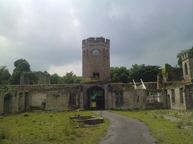
Ravensworth Castle, Lamesley

Ravensworth Castle is a ruinous Grade II* listed building and a Scheduled Ancient Monument situated at Lamesley, Tyne and Wear, England. The building has...

Team Valley

Team Valley is a trading estate located in Gateshead. It is home to the Retail World retail park, with many large, international companies based in the...

Lamesley

Lamesley is a village and civil parish in the Metropolitan Borough of Gateshead, Tyne and Wear, England. The population of the civil parish at the 2011...

Grace College, Gateshead

Grace College (formerly Joseph Swan School, then Joseph Swan Academy) is a mixed secondary school with academy status situated in south Gateshead, England...

Lamesley railway station

Lamesley railway station served the village of Lamesley, Tyne and Wear, England from 1868 to 1959 on the East Coast Main Line. == History == The station...

Low Fell railway station

Low Fell railway station served the Low Fell area of Gateshead between 1868 and 1952. == History == The station was opened by the North Eastern Railway...

Low Fell

Low Fell is a suburb of Gateshead situated in the Metropolitan Borough of Gateshead in Tyne and Wear, England. Built predominantly on sandstone, grindstone...

Kibblesworth

Kibblesworth is a village 2 miles (3.2 km) west of Birtley, Tyne and Wear, England. Kibblesworth was a mainly rural community until the development of...

Nearby Amenities

Located within 500m of 54.922088,-1.6269089
Mini Roundabout
Direction: clockwise
Lat/Long: 54.9229796/-1.6198364
Bus Stop
DUKESWAY-DUKESWAY WEST-S/B
Local Ref: S
Naptan AtcoCode: 410000021905
Naptan Bearing: S
Naptan CommonName: DUKESWAY-DUKESWAY WEST-S/B
Naptan Indicator: S
Naptan Landmark: OUTSIDE AUTOGLASS
Naptan NaptanCode: twrdpjmt
Naptan PlusbusZoneRef: NWCSTLE
Naptan Street: DUKESWAY
Naptan Verified: no
Source: naptan_import
Lat/Long: 54.9249257/-1.6209265
Mini Roundabout
Direction: clockwise
Lat/Long: 54.923606/-1.6215136
Power: pole
Lat/Long: 54.9195544/-1.6212074
Power: pole
Lat/Long: 54.9194753/-1.6212673
Power: pole
Lat/Long: 54.9197625/-1.6243836
Power: pole
Lat/Long: 54.9195732/-1.6228003
Power: pole
Lat/Long: 54.9196767/-1.6243328
Power: pole
Lat/Long: 54.9198482/-1.6272393
Power: pole
Lat/Long: 54.9197998/-1.625793
Crossing
Crossing: unmarked
Crossing Island: no
Crossing Markings: zebra
Lat/Long: 54.9226625/-1.6194427
Crossing
Crossing: unmarked
Crossing Island: no
Crossing Markings: zebra
Lat/Long: 54.9226572/-1.6196199
Barrier: yes
Lat/Long: 54.924161/-1.6242547
Power: pole
Source: Bing
Lat/Long: 54.9198422/-1.630188
Power: pole
Source: Bing
Lat/Long: 54.9199323/-1.6301763
Power: pole
Lat/Long: 54.9196654/-1.6227945
Atm
Wheelchair: yes
Lat/Long: 54.9235851/-1.6198334
Atm
Wheelchair: yes
Lat/Long: 54.9226531/-1.6201528
RS Newcastle
Addr City: Gateshead
Addr Street: Dukesway West
Shop: electronics
Wheelchair: yes
Lat/Long: 54.9252554/-1.6245392
Toilets
Access: customers
Operator: Asda
Wheelchair: yes
Lat/Long: 54.9222165/-1.6203914
Toilets
Access: customers
Changing Table: yes
Changing Table Location: female_toilet;male_toilet
Fee: no
Female: yes
Level: 1
Male: yes
Wheelchair: yes
Lat/Long: 54.9225287/-1.621339
Cafe
M&S Café
Level: 1
Operator: Marks & Spencer PLC
Wheelchair: yes
Lat/Long: 54.9228261/-1.6211003
Crossing
Crossing: unmarked
Crossing Island: yes
Tactile Paving: no
Lat/Long: 54.9238947/-1.6200339
Crossing
Crossing: zebra
Crossing Island: no
Tactile Paving: yes
Lat/Long: 54.9237019/-1.621029
Crossing
Crossing: zebra
Crossing Island: no
Tactile Paving: yes
Lat/Long: 54.9238201/-1.6217117
Crossing
Crossing: zebra
Crossing Island: no
Tactile Paving: yes
Lat/Long: 54.9240847/-1.6218714
Power: pole
Lat/Long: 54.9197588/-1.6272391
Power: pole
Lat/Long: 54.9199249/-1.6331125
Power: pole
Lat/Long: 54.9197175/-1.6257774
Power: pole
Lat/Long: 54.920016/-1.6331009
Crossing
Crossing: uncontrolled
Crossing Island: no
Crossing Markings: zebra
Lat/Long: 54.9228828/-1.6204387
Crossing
Crossing: uncontrolled
Crossing Island: no
Crossing Markings: zebra
Lat/Long: 54.9234485/-1.6213961
Crossing
Crossing: uncontrolled
Crossing Island: no
Crossing Markings: zebra
Lat/Long: 54.9235146/-1.6201494
Crossing
Crossing: uncontrolled
Crossing Island: no
Crossing Markings: zebra
Lat/Long: 54.9231597/-1.6201271
Crossing
Crossing: uncontrolled
Crossing Island: no
Crossing Markings: zebra
Lat/Long: 54.923291/-1.620205
Crossing
Crossing: uncontrolled
Crossing Island: no
Crossing Markings: zebra
Lat/Long: 54.9235615/-1.6203654
Crossing
Crossing: uncontrolled
Crossing Island: no
Crossing Markings: zebra
Lat/Long: 54.9231929/-1.6199624
Crossing
Crossing: uncontrolled
Crossing Island: no
Crossing Markings: zebra
Lat/Long: 54.922949/-1.6206907
Crossing
Crossing: uncontrolled
Crossing Island: no
Crossing Markings: zebra
Lat/Long: 54.9234267/-1.6202855
Crossing
Crossing: uncontrolled
Crossing Island: no
Crossing Markings: zebra
Lat/Long: 54.9232695/-1.6211919
Crossing
Crossing: uncontrolled
Crossing Island: no
Crossing Markings: zebra
Lat/Long: 54.9234019/-1.6212724
Crossing
Crossing: uncontrolled
Crossing Island: no
Crossing Markings: zebra
Lat/Long: 54.9235321/-1.6213517
Crossing
Crossing: uncontrolled
Crossing Island: no
Crossing Markings: zebra
Lat/Long: 54.9231943/-1.6212365
Crossing
Crossing: uncontrolled
Crossing Island: no
Crossing Markings: zebra
Lat/Long: 54.9230358/-1.6208395
Crossing
Crossing: uncontrolled
Crossing Markings: zebra
Lat/Long: 54.9229026/-1.6193364
Crossing
Crossing: uncontrolled
Crossing Markings: zebra
Lat/Long: 54.9228566/-1.6195664
Car Wash
Team Valley Hand Car Wash
Automated: no
Self Service: no
Lat/Long: 54.9242989/-1.6202651
Naylors
Level: 1
Shop: equestrian
Website: https://www.naylors.com/stores/team-valley
Lat/Long: 54.924082/-1.6223723
Fishing Republic
Level: 1
Shop: fishing
Website: https://www.fishingrepublic.co.uk/stores/newcastle
Lat/Long: 54.9242055/-1.622243
The data included in this document is from www.openstreetmap.org. The data is made available under ODbL.

Have you been to Robin's Wood?

Leave your review of Robin's Wood below (or comments, questions and feedback).