Horse Pasture Plantation

Wood, Forest in Yorkshire

England

Horse Pasture Plantation

Robert Craven Memorial Hall Built in 1896, this is the village hall for the village of Bramhope. Built using a legacy of a local farmer, Robert Craven.
Robert Craven Memorial Hall Credit: Graham Firth

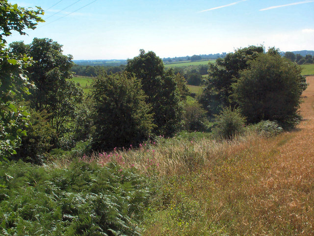
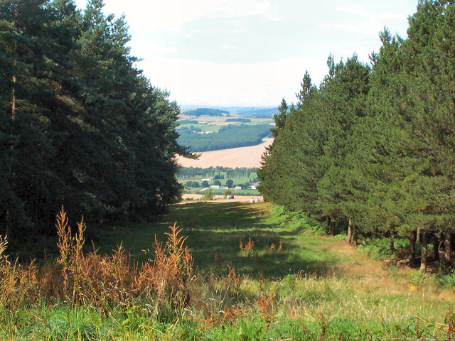
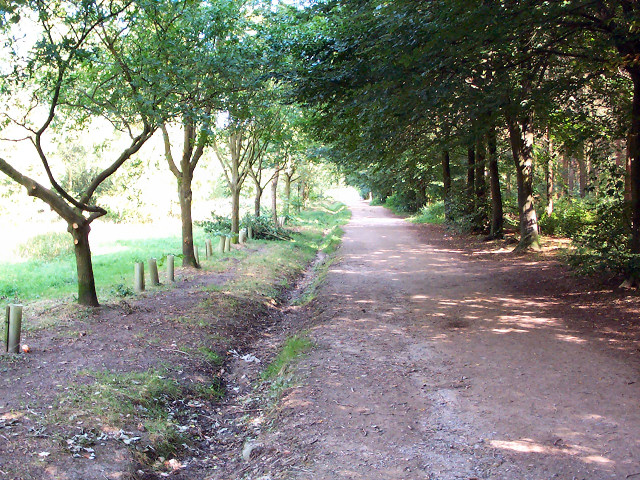
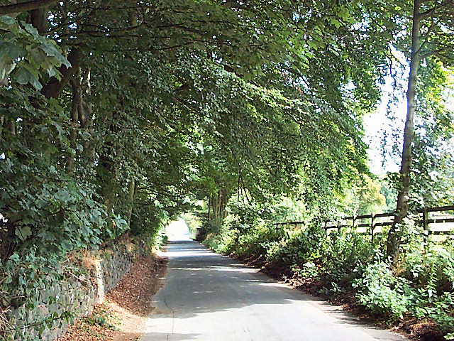
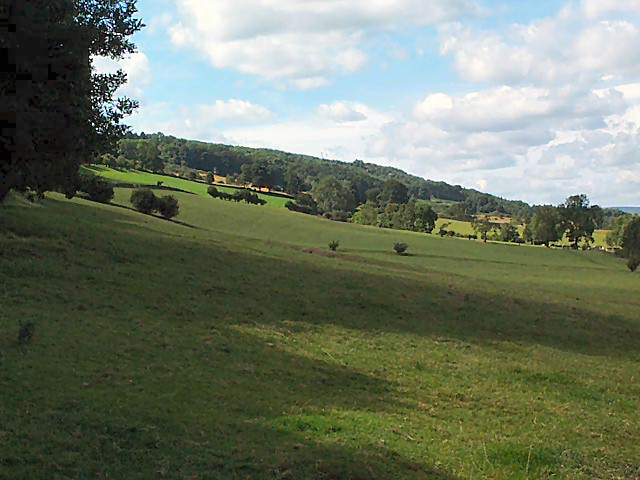
Horse Pasture Plantation is a picturesque woodland located in the heart of Yorkshire, England. Spanning over several acres, this enchanting forest is renowned for its natural beauty and diverse ecosystem. The plantation is characterized by its dense canopy of towering oak, beech, and birch trees, which provide a serene and peaceful atmosphere.

The woodland floor is carpeted with a myriad of wildflowers, including bluebells, primroses, and foxgloves, adding vibrant colors to the landscape during the spring and summer months. Numerous species of ferns and mosses thrive in the damp and shaded areas of the forest, creating a lush and verdant undergrowth.

Horse Pasture Plantation is also home to a variety of wildlife. Visitors may catch glimpses of roe deer gracefully bounding through the trees, while squirrels scamper amongst the branches. The plantation provides an ideal habitat for numerous bird species, such as woodpeckers, owls, and warblers, making it a paradise for birdwatchers.

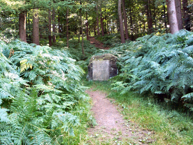
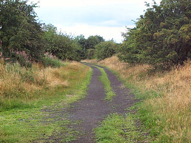
Tranquil walking trails wind their way through the woodland, allowing visitors to explore the plantation at their own pace. The pathways are well-maintained, ensuring that visitors can navigate the forest easily. Information boards are strategically placed throughout the plantation, providing educational insights into the flora and fauna found within.

Whether for leisurely strolls, nature photography, or simply a peaceful retreat from the hustle and bustle of daily life, Horse Pasture Plantation offers a captivating and immersive experience for visitors of all ages. The combination of its breathtaking natural beauty, diverse wildlife, and well-maintained trails make it a must-visit destination for nature enthusiasts and those seeking tranquility amidst the splendor of Yorkshire's woodlands.

If you have any feedback on the listing, please let us know in the comments section below.

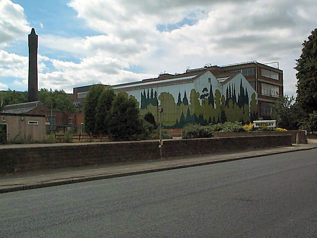
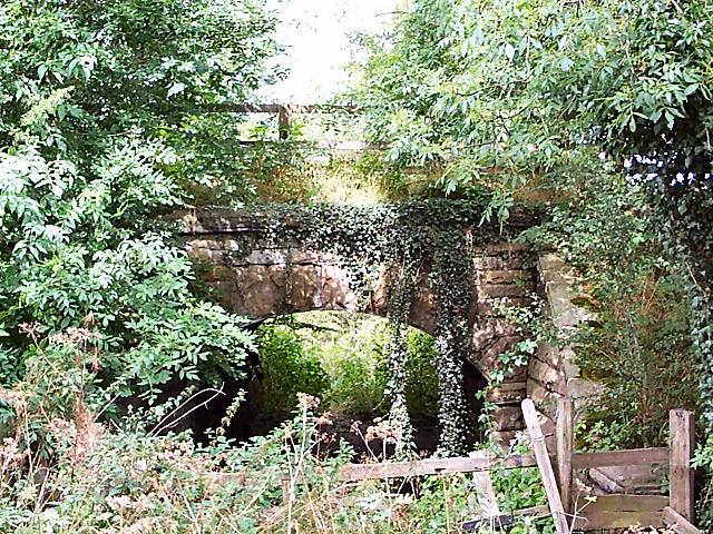
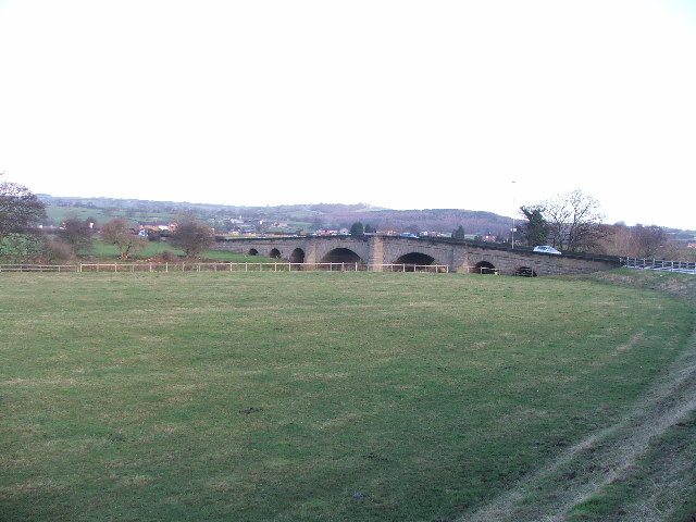
Horse Pasture Plantation Images

Images are sourced within 2km of 53.895611/-1.6395449 or Grid Reference SE2344. Thanks to Geograph Open Source API. All images are credited.

Robert Craven Memorial Hall Built in 1896, this is the village hall for the village of Bramhope. Built using a legacy of a local farmer, Robert Craven.
Robert Craven Memorial Hall
Built in 1896, this is the village hall for the village of Bramhope. Built using a legacy of a local farmer, Robert Craven.
Valley of Bramhope Beck View southeast towards None-go-bye's Hill.
Valley of Bramhope Beck
View southeast towards None-go-bye's Hill.
Chevin Forest Park Looking northwards, through a break in the trees, over the Wharfe valley towards Farnley from the Dales Way Link.
Chevin Forest Park
Looking northwards, through a break in the trees, over the Wharfe valley towards Farnley from the Dales Way Link.
Memorial stone, Chevin Forest Park The rather underwhelming stone reads: REMEMBER / COUNTY ALDERMAN H J BAMBRIDGE OBE JP / COUNCILLOR R T A RENTON JP / ARCHDEACON T J WILLIAMS MC TD MA BD / WHO SERVED / GOD / THEIR COUNTRY / THEIR COUNTY / THIS VALLEY AND TOWNSHIP / 17TH JULY 1960 / THIS PLANTATION OF BRITISH / HARDWOOD TREES WAS THE GIFT OF / MAJOR LE G G W HORTON-FAWKES
Memorial stone, Chevin Forest Park
The rather underwhelming stone reads: REMEMBER / COUNTY ALDERMAN H J BAMBRIDGE OBE JP / COUNCILLOR R T A RENTON JP / ARCHDEACON T J WILLIAMS MC TD MA BD / WHO SERVED / GOD / THEIR COUNTRY / THEIR COUNTY / THIS VALLEY AND TOWNSHIP / 17TH JULY 1960 / THIS PLANTATION OF BRITISH / HARDWOOD TREES WAS THE GIFT OF / MAJOR LE G G W HORTON-FAWKES
Dales Way link, Chevin Forest Park Both the Dales Way link and the Ebor Way are routed east-west through the park. This is a view from the western end of the park, looking eastwards.
Dales Way link, Chevin Forest Park
Both the Dales Way link and the Ebor Way are routed east-west through the park. This is a view from the western end of the park, looking eastwards.
Old Pool Bank The original course of what is now the A658 was down this steep, narrow lane. This is right at the top, looking downwards (northwards).
Old Pool Bank
The original course of what is now the A658 was down this steep, narrow lane. This is right at the top, looking downwards (northwards).
Trees at the top of Pool Bank It's dead Jim. (The one on the right.)
Trees at the top of Pool Bank
It's dead Jim. (The one on the right.)
The Bar House, near Pool Halfway down the old Pool Bank, where it crosses the current A660 from Otley (left) to Leeds (right). Old Pool Bank disappears down to the left of The Bar House.
The Bar House, near Pool
Halfway down the old Pool Bank, where it crosses the current A660 from Otley (left) to Leeds (right). Old Pool Bank disappears down to the left of The Bar House.
Western end of Pool Bank The fields of the western end of Pool Bank.  Taken from Old Pool Bank near the dismantled railway line, looking westwards.
Western end of Pool Bank
The fields of the western end of Pool Bank. Taken from Old Pool Bank near the dismantled railway line, looking westwards.
Pool village Seen at the centre of Pool village are the old stocks, an old-style signpost, and the White Hart pub.
Pool village
Seen at the centre of Pool village are the old stocks, an old-style signpost, and the White Hart pub.
Pool war memorial and church Situated on the southwestern side of the A659 towards Otley.
Pool war memorial and church
Situated on the southwestern side of the A659 towards Otley.
River Wharfe at Pool Seen from Pool bridge, looking westwards (upstream).
River Wharfe at Pool
Seen from Pool bridge, looking westwards (upstream).
Pool paper mill On the southern side of the A659.  Let's not discuss the paint job.
Pool paper mill
On the southern side of the A659. Let's not discuss the paint job.
Bridge on former Otley-Pool railway This was the route of the Otley & Ilkley Railway (Midland and N.E.R. Joint). The line closed in 1965 so this represents just 40 years of vegetation.
Bridge on former Otley-Pool railway
This was the route of the Otley & Ilkley Railway (Midland and N.E.R. Joint). The line closed in 1965 so this represents just 40 years of vegetation.
Trackbed of former Otley-Pool railway Looking westwards. This was the route of the Otley & Ilkley Railway (Midland and N.E.R. Joint), closed in 1965.
Trackbed of former Otley-Pool railway
Looking westwards. This was the route of the Otley & Ilkley Railway (Midland and N.E.R. Joint), closed in 1965.
Pool Bridge. This is where the A658 (Harrogate Rd) crosses over the Wharfe.
Pool Bridge.
This is where the A658 (Harrogate Rd) crosses over the Wharfe.
Bramhope Post Office Diversify to prosper!
Bramhope Post Office
Diversify to prosper!
Arthington House Arthington House is a private residence between Pool and Arthington.
Arthington House
Arthington House is a private residence between Pool and Arthington.
Show me another place!

Horse Pasture Plantation is located at Grid Ref: SE2344 (Lat: 53.895611, Lng: -1.6395449)

Division: West Riding

Unitary Authority: Leeds

Police Authority: West Yorkshire

What 3 Words

///nips.crest.takeover. Near Pool, West Yorkshire

Related Wikis

Pool-in-Wharfedale railway station

Pool-in-Wharfedale railway station was a railway station serving the village of Pool-in-Wharfedale in West Yorkshire, England. It was opened by the North...

Pool-in-Wharfedale

Pool-in-Wharfedale or Pool in Wharfedale, usually abbreviated to Pool, is a village and civil parish in Lower Wharfedale, West Yorkshire, England, 10 miles...
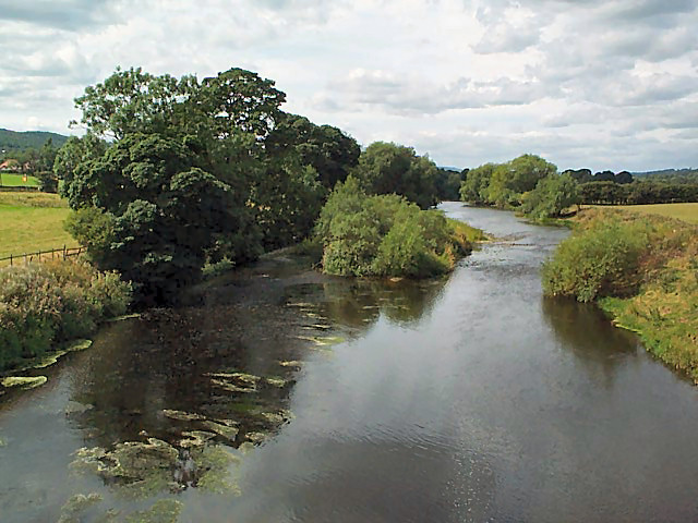
River Washburn

The River Washburn is a river in Yorkshire, England. It originates high in the Yorkshire Dales and ends where it meets the River Wharfe. It lies within...

Bramhope Tunnel

Bramhope Tunnel is on the Harrogate Line between Horsforth station and the Arthington Viaduct in West Yorkshire, England. Services through the railway...

Arthington railway station

Arthington railway station served the village of Arthington in the English county of West Yorkshire, near the North Yorkshire town of Harrogate. ��2...

A658 road

The A658 is a road in Yorkshire, UK. == Route == It runs from Bradford, West Yorkshire (53.7949°N 1.7487°W / 53.7949; -1.7487 (A658 road (southwestern...

Creskeld Hall

Creskeld Hall is a grade II listed Country House located in Arthington, near Otley, West Yorkshire, England. == Etymology == The place-name is first attested...

Carlton, Wharfedale

Carlton is a civil parish in the City of Leeds in West Yorkshire, England. It consists of the villages of East Carlton and West Carlton, and in 2001 had...

Nearby Amenities

Located within 500m of 53.895611,-1.6395449
Otley Road
Bus: yes
Public Transport: stop_position
Lat/Long: 53.892659/-1.6393713
Pool Bank
Place: locality
Source: local_knowledge
Lat/Long: 53.8945902/-1.6377422
Bus Stop
Leeds Road Quarry Road
Bus: yes
Local Ref: 45010487
Naptan AtcoCode: 450010487
Naptan Bearing: W
Naptan CommonName: Leeds Road Quarry Road
Naptan Crossing: Quarry Road
Naptan Indicator: Stop 45010487
Naptan PlusbusZoneRef: LEEDS
Naptan ShortCommonName: Quarry Road
Naptan Street: Leeds Road
Public Transport: platform
Shelter: yes
Source: naptan_import;survey
Lat/Long: 53.8953899/-1.6419774
Bus Stop
Leeds Road Old Pool Bank
Bus: yes
Local Ref: 45010488
Naptan AtcoCode: 450010488
Naptan Bearing: E
Naptan CommonName: Leeds Road Old Pool Bank
Naptan Crossing: Old Pool Bank
Naptan Indicator: Stop 45010488
Naptan PlusbusZoneRef: LEEDS
Naptan ShortCommonName: Old Pool Bank
Naptan Street: Leeds Road
Public Transport: platform
Shelter: yes
Source: naptan_import;survey
Lat/Long: 53.8953332/-1.641131
Bus Stop
Otley Road
Bench: yes
Bin: yes
Bus: yes
Lit: yes
Local Ref: 45014747
Naptan AtcoCode: 450014747
Naptan Bearing: W
Naptan CommonName: Otley Road
Naptan Crossing: Twixt Pool Bank New Road & Old Pool Bank
Naptan Indicator: Stop 45014747
Naptan Landmark: Garage
Naptan PlusbusZoneRef: LEEDS
Naptan ShortCommonName: Leeds Rd Pool Bank
Naptan Street: Otley Road (Leeds Road)
Naptan Verified: no
Public Transport: platform
Shelter: no
Source: naptan_import
Tactile Paving: no
Timetable: yes
Lat/Long: 53.8925959/-1.6393992
Bus Stop
Otley Road
Bench: yes
Bin: no
Bus: yes
Lit: yes
Local Ref: 45014748
Naptan AtcoCode: 450014748
Naptan Bearing: E
Naptan CommonName: Otley Road
Naptan Indicator: Stop 45014748
Naptan Notes: Shelter maintained by Pool Parish Council 12/03/09
Naptan PlusbusZoneRef: LEEDS
Naptan ShortCommonName: Leeds Rd Pool Bank
Naptan Street: Otley Road
Naptan Verified: no
Public Transport: platform
Shelter: yes
Source: naptan_import
Tactile Paving: no
Timetable: yes
Lat/Long: 53.8925797/-1.6388067
Design: two-level
Power: pole
Source: Bing
Lat/Long: 53.8918645/-1.6420305
Barrier: stile
Lat/Long: 53.8943236/-1.6344296
Design: two-level
Power: pole
Source: Bing
Lat/Long: 53.8922299/-1.6441891
Power: pole
Source: Bing
Lat/Long: 53.8998876/-1.6390225
Leeds Road Quarry Road
Bus: yes
Public Transport: stop_position
Lat/Long: 53.8954294/-1.6419669
Access: no
Barrier: stile
Foot: yes
Material: stone_metal
Stile: stepover
Lat/Long: 53.8948702/-1.6400822
Barrier: stile
Lat/Long: 53.8964576/-1.6433613
Power: pole
Lat/Long: 53.8969501/-1.6433653
Power: pole
Lat/Long: 53.897832/-1.6433734
Waste Basket
Collection Times: Tu; Th
Ref UK Leedscc Bin: 1788
Lat/Long: 53.892842/-1.640155
Waste Basket
Collection Times: Tu; Th
Ref UK Leedscc Bin: 1789
Lat/Long: 53.892717/-1.639192
Waste Basket
Collection Times: Tu; Th
Ref UK Leedscc Bin: 1787
Lat/Long: 53.895397/-1.642176
Waste Basket
Collection Times: Tu; Th
Ref UK Leedscc Bin: 1786
Lat/Long: 53.895353/-1.641166
Addr Housename: Cragg View
Addr Housenumber: 1
Source: survey
Lat/Long: 53.89575/-1.6431713
Addr Housename: Cragg View
Addr Housenumber: 6
Source: survey
Lat/Long: 53.8958132/-1.6436273
Power: pole
Lat/Long: 53.8929864/-1.6438027
Power: pole
Lat/Long: 53.8925602/-1.6346098
Power: pole
Lat/Long: 53.8924703/-1.6357052
Power: pole
Lat/Long: 53.8923864/-1.6368049
Power: pole
Lat/Long: 53.8929792/-1.6378062
Power: pole
Lat/Long: 53.8934993/-1.6386865
Power: pole
Lat/Long: 53.8941268/-1.6397652
Generator Method: photovoltaic
Generator Output Electricity: yes
Generator Source: solar
Generator Type: solar_photovoltaic_panel
Power: generator
Lat/Long: 53.8952154/-1.6422658
Otley Road
Bus: yes
Public Transport: stop_position
Lat/Long: 53.8925432/-1.6388235
Leeds Road Old Pool Bank
Bus: yes
Public Transport: stop_position
Lat/Long: 53.8952705/-1.6411703
Design: two-level
Power: pole
Lat/Long: 53.8914803/-1.6396542
The data included in this document is from www.openstreetmap.org. The data is made available under ODbL.

Have you been to Horse Pasture Plantation?

Leave your review of Horse Pasture Plantation below (or comments, questions and feedback).