Park Wood
Wood, Forest in Yorkshire Harrogate
England
Park Wood
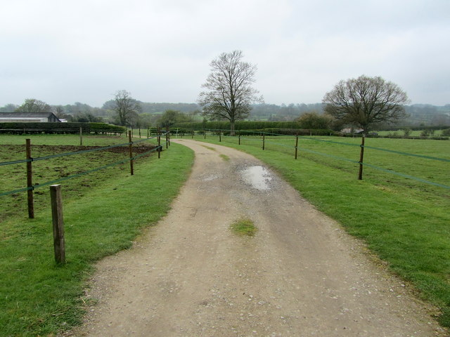
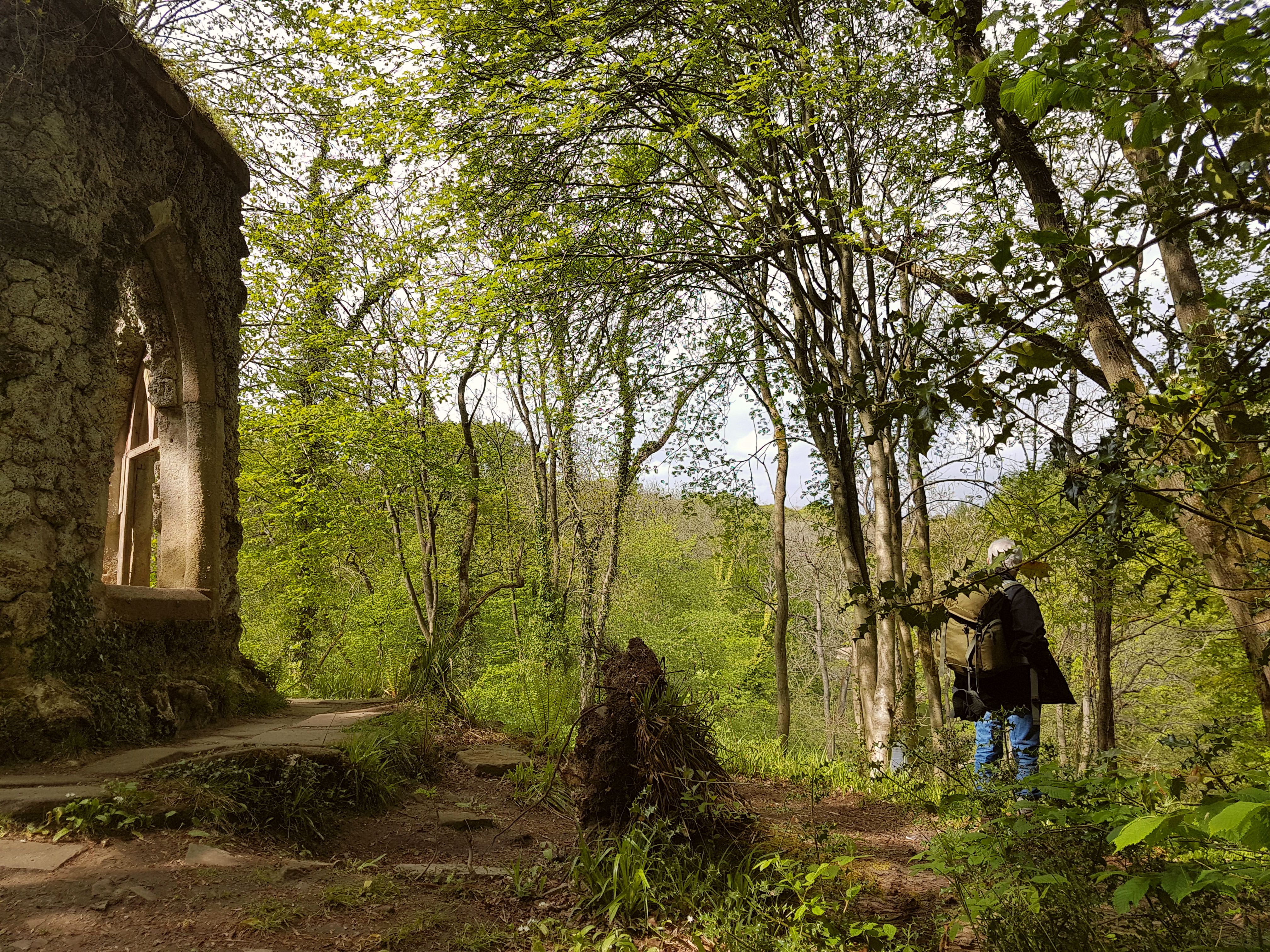
Park Wood is a picturesque woodland located in the county of Yorkshire, England. It covers an area of approximately 50 acres and is renowned for its natural beauty and diverse ecosystem. Nestled within the larger Forest of Bowland, Park Wood is a haven for wildlife and offers visitors a tranquil escape from the hustle and bustle of urban life.
The wood is predominantly composed of broadleaf trees, including oak, beech, and birch, which create a rich and vibrant canopy overhead. Beneath the towering trees, the forest floor is covered with a carpet of ferns, bluebells, and wildflowers, adding to the enchanting atmosphere.
The wood is crisscrossed with a network of well-maintained footpaths, allowing visitors to explore its winding trails and discover the hidden delights within. These paths lead to open clearings, where visitors can rest and soak in the serene surroundings or perhaps enjoy a picnic amidst nature's splendor.
The diversity of wildlife in Park Wood is impressive, with a variety of bird species, including woodpeckers, owls, and thrushes, making it an ideal destination for birdwatching enthusiasts. The wood is also home to small mammals such as squirrels, foxes, and badgers, which can occasionally be spotted during quiet moments.
Park Wood has become a popular destination for nature lovers, walkers, and families seeking a peaceful day out. The management of the wood ensures its conservation and protection, ensuring future generations can continue to enjoy its natural beauty and tranquility.
If you have any feedback on the listing, please let us know in the comments section below.
Park Wood Images
Images are sourced within 2km of 54.166771/-1.6372703 or Grid Reference SE2374. Thanks to Geograph Open Source API. All images are credited.


Park Wood is located at Grid Ref: SE2374 (Lat: 54.166771, Lng: -1.6372703)
Division: West Riding
Administrative County: North Yorkshire
District: Harrogate
Police Authority: North Yorkshire
What 3 Words
///bunks.grub.humans. Near Masham, North Yorkshire
Nearby Locations
Related Wikis

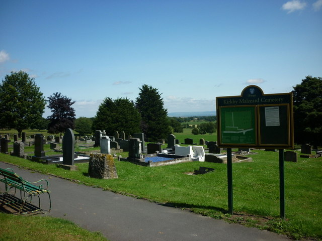
Kirkby Malzeard
Kirkby Malzeard () is a village and civil parish in the Harrogate district of North Yorkshire, England. There has been a creamery in the village making...

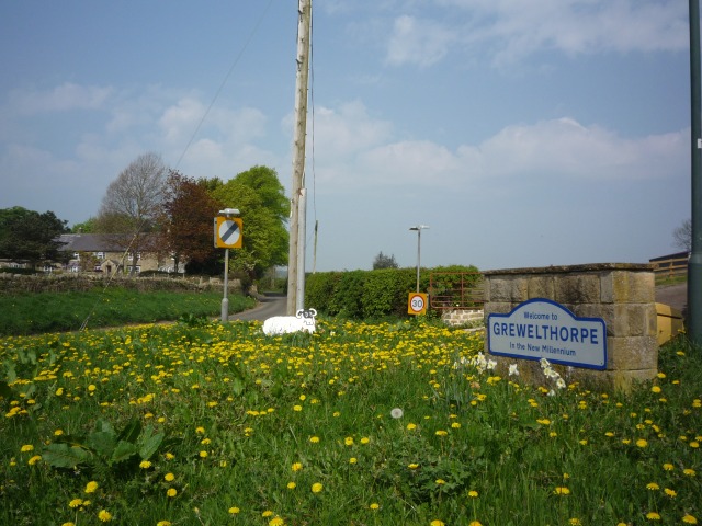
Grewelthorpe
Grewelthorpe is a village and civil parish in the Harrogate district of North Yorkshire, England situated 3 miles (5 km) south of Masham and 6.2 miles...

Laverton, North Yorkshire
Laverton is a village and civil parish in the Harrogate district of North Yorkshire, England, about 7 miles (11 km) west of Ripon. The population of this...

Azerley
Azerley is a village and civil parish in the Harrogate district of North Yorkshire, England. It is about 4 miles (6 km) north-west of Ripon. The civil...

Galphay
Galphay (traditionally pronounced [ˈgɔ:fə] GAW-fə) is a village in North Yorkshire, England. It is situated in the Nidderdale Area of Outstanding Natural...
Hack Fall Wood
Hack Fall Wood, otherwise known as Hackfall, is a Site of Special Scientific Interest, or SSSI, of 44.8687 hectares (0.4487 km2; 0.1732 sq mi), lying north...
Mickley, North Yorkshire
Mickley is a village in the Harrogate District of North Yorkshire, England. The village is on the south bank of the River Ure between Masham and West Tanfield...

Cow Myers (wetland)
Cow Myers is a Site of Special Scientific Interest (SSSI) located in the Nidderdale Area of Outstanding Natural Beauty (AONB), near Ripon, North Yorkshire...
Nearby Amenities
Located within 500m of 54.166771,-1.6372703Have you been to Park Wood?
Leave your review of Park Wood below (or comments, questions and feedback).