Fallcliff Wood
Wood, Forest in Derbyshire Derbyshire Dales
England
Fallcliff Wood
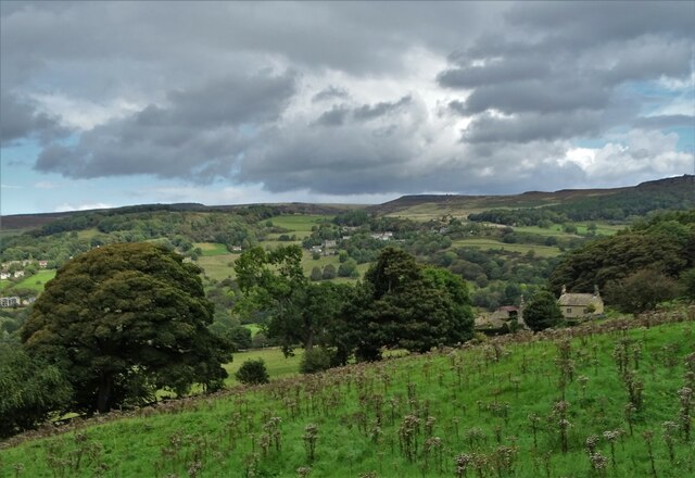
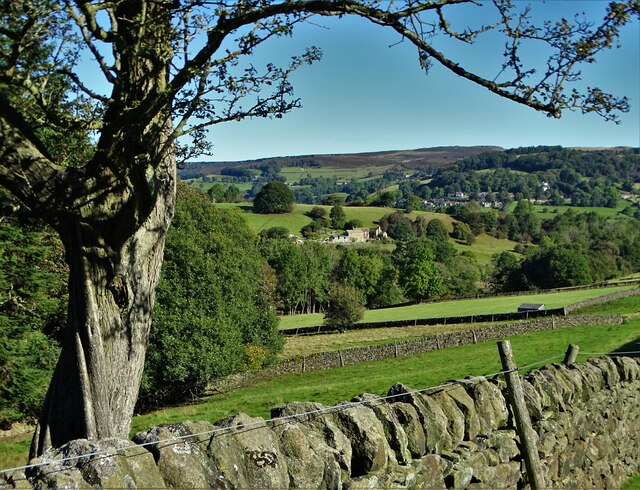
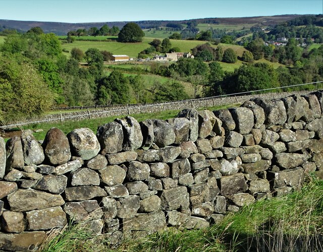
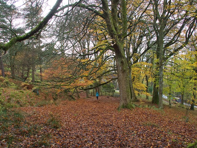
Fallcliff Wood is a charming woodland located in Derbyshire, England. Situated in the heart of the Peak District National Park, this beautiful forest offers visitors a serene and picturesque escape from the hustle and bustle of daily life.
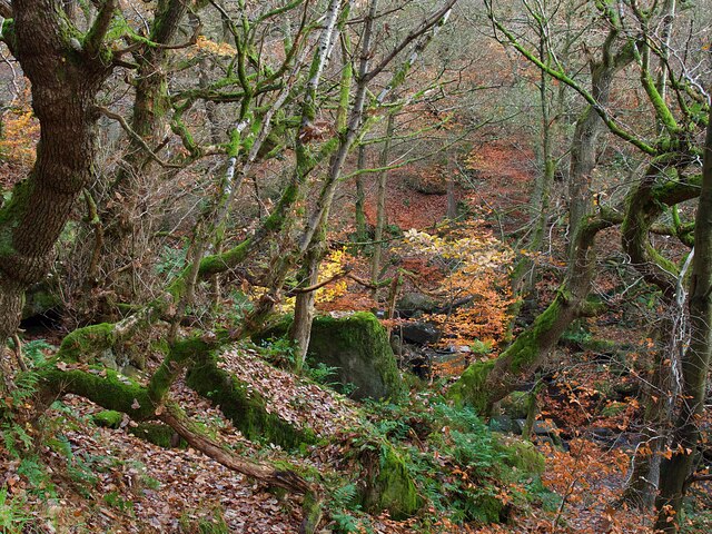
Covering an area of approximately 100 acres, Fallcliff Wood is known for its diverse range of tree species, including oak, birch, beech, and pine. The forest is particularly renowned for its stunning autumn colors, as the leaves transform into vibrant hues of red, orange, and gold, creating a breathtaking spectacle for all who visit during the fall season.
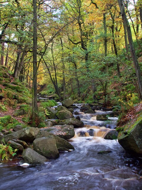
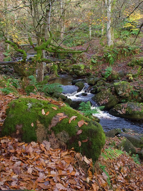
The wood is intersected by several walking trails, allowing nature enthusiasts and hikers to explore its hidden treasures. These trails wind through the forest, offering glimpses of babbling brooks, moss-covered rocks, and a variety of wildlife, including squirrels, deer, and various bird species. The peaceful ambiance of the wood provides an ideal setting for nature photography, with opportunities to capture the beauty of the changing seasons.
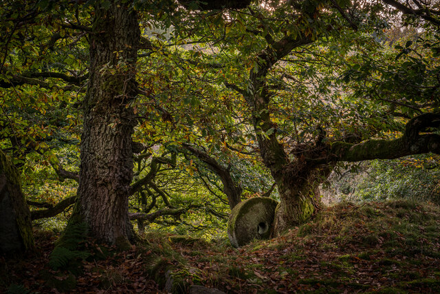
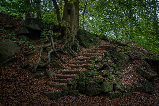
In addition to its natural wonders, Fallcliff Wood also boasts a rich history. The wood was once part of an ancient hunting ground, and remnants of old stone structures can still be found within its depths. These historical elements add an intriguing dimension to the woodland experience, providing a glimpse into its past.
Overall, Fallcliff Wood is a true gem of Derbyshire, offering visitors a chance to connect with nature, immerse themselves in history, and enjoy the tranquility of the surrounding landscape.
If you have any feedback on the listing, please let us know in the comments section below.
Fallcliff Wood Images
Images are sourced within 2km of 53.314256/-1.6454032 or Grid Reference SK2379. Thanks to Geograph Open Source API. All images are credited.


Fallcliff Wood is located at Grid Ref: SK2379 (Lat: 53.314256, Lng: -1.6454032)
Administrative County: Derbyshire
District: Derbyshire Dales
Police Authority: Derbyshire
What 3 Words
///relaxed.cloak.shipyards. Near Hathersage, Derbyshire
Nearby Locations
Related Wikis

Leam, Derbyshire
Leam, or historically Leam Farm, is a hamlet in the English county of Derbyshire. There are a number of buildings, which once formed a single estate. Leam...

Padley Hall
Padley Hall (or Padley Manor) was an Elizabethan great house overlooking the River Derwent near Grindleford, Derbyshire, England. The remains of the hall...

Padley Chapel
Padley Chapel is a building in Grindleford, England, on the site of the former Padley Hall (or Padley Manor). It is a Grade I listed building. == Padley... ==

Master's Edge
Master's Edge is an 18-metre (59 ft) gritstone arête that is a rock climbing route in the "Corners Area" of Millstone Edge quarry, in the Peak District...

Hathersage railway station
Hathersage railway station serves the village of Hathersage in the Derbyshire Peak District, in England. == History == The station was opened on 25 June...

Burbage Brook
Burbage Brook is an upper tributary stream of the River Derwent in the Peak District of England. == Toponymy == The origin of the name is thought to derive...

Wet Withens
Wet Withens is a Bronze Age henge on Eyam Moor in the Derbyshire Peak District, England. The prehistoric circle of 10 upright stones (orthostats) is a...

Bretton Brook
Bretton Brook is a stream flowing through Bretton in the Derbyshire Peak District. The stream is a tributary of the Highlow Brook, which is a direct...
Nearby Amenities
Located within 500m of 53.314256,-1.6454032Have you been to Fallcliff Wood?
Leave your review of Fallcliff Wood below (or comments, questions and feedback).