Leam

Settlement in Derbyshire Derbyshire Dales

England

Leam

Hazelford Hall above The Hope Valley
Hazelford Hall above The Hope Valley Credit: Neil Theasby

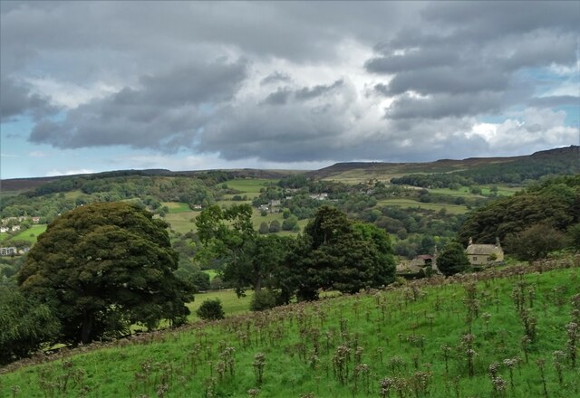
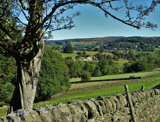
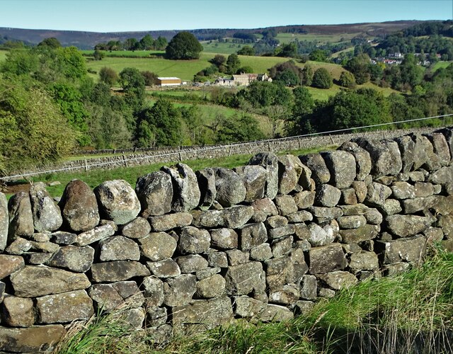
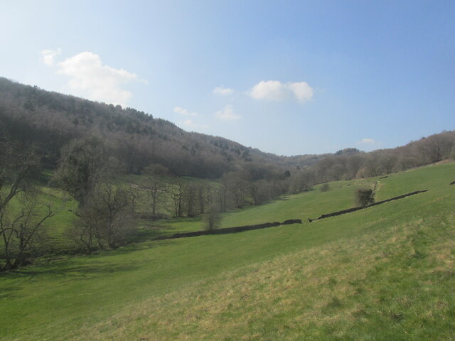
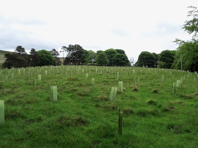
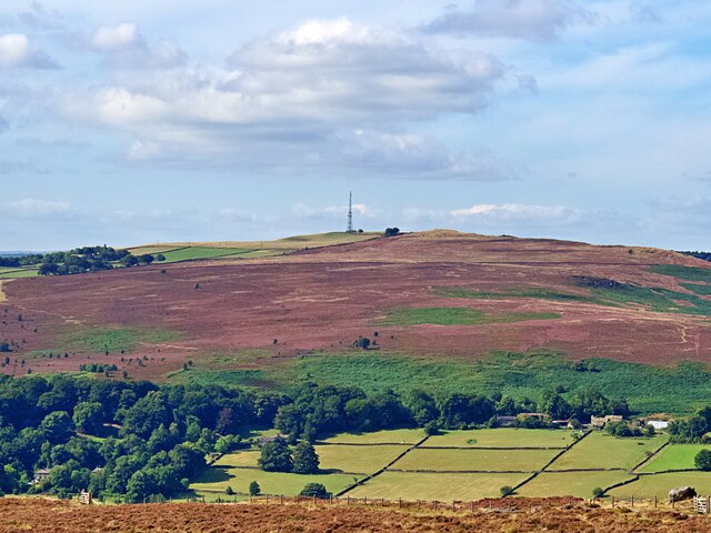
Leam is a small village located in the southern part of Derbyshire, England. Situated in the heart of the picturesque Peak District National Park, Leam is surrounded by stunning natural beauty, making it a popular destination for nature lovers and outdoor enthusiasts.

The village is known for its tranquil and peaceful atmosphere, offering a quiet escape from the hustle and bustle of city life. It is characterized by charming stone houses and a close-knit community that preserves the village's traditional charm. The local economy is primarily based on agriculture and tourism, with several farms in the area producing high-quality produce.

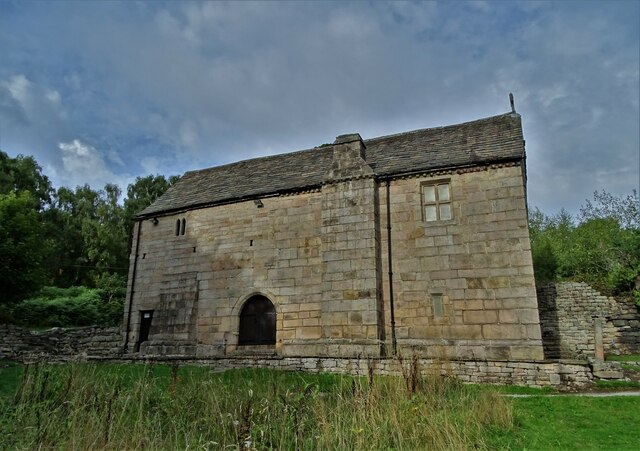
Leam is also home to a number of historical landmarks, including the 13th-century Leam Hall, which stands as a testament to the village's rich heritage. Visitors can explore the hall's well-preserved architecture and learn about the history of the area.

Outdoor activities are abundant in Leam, with numerous walking and cycling trails that showcase the stunning natural landscapes. The village is also close to popular attractions such as the Chatsworth House and Haddon Hall, both of which offer a glimpse into the region's history and culture.

In terms of amenities, Leam has a small convenience store and a traditional pub, providing residents and visitors with essential goods and a place to socialize. Overall, Leam offers a charming and idyllic countryside experience, making it a hidden gem in the heart of Derbyshire.

If you have any feedback on the listing, please let us know in the comments section below.

Leam Images

Images are sourced within 2km of 53.310127/-1.654772 or Grid Reference SK2379. Thanks to Geograph Open Source API. All images are credited.

Hazelford Hall above The Hope Valley
View to Broadhay from Highlow Wood Broadhay is the farm you can see in the centre of this photograph with Hathersage beyond
View to Broadhay from Highlow Wood
Broadhay is the farm you can see in the centre of this photograph with Hathersage beyond
Drystone wall  with view to Broadhay
Drystone wall with view to Broadhay
Footpath to Grindleford. A walk in the Derbyshire dales.
Footpath to Grindleford.
A walk in the Derbyshire dales.
Mag  Clough Quiet, secluded side valley.
Mag Clough
Quiet, secluded side valley.
Spring morning at Grindleford station
Upper Padley Beginning of the path towards Owler Tor.
Upper Padley
Beginning of the path towards Owler Tor.
Bole Hill Woodland at the foot of the quarry.
Bole Hill
Woodland at the foot of the quarry.
Replanting Big Moor Plantation Until recently, "Big Moor Plantation" was a meaningless label for a largely empty field. This has now been rectified with the planting of new saplings.
Replanting Big Moor Plantation
Until recently, "Big Moor Plantation" was a meaningless label for a largely empty field. This has now been rectified with the planting of new saplings.
First Prize at Grindleford Show It was the 71st Grindleford Village Show. In the marquee, this exhibit by Sarah Rockliff came first in  "A Table Centre displayed in a container with a stem" (Category 113). The judge remarked that it was "a really beautifully delicate and balanced exhibit".
First Prize at Grindleford Show
It was the 71st Grindleford Village Show. In the marquee, this exhibit by Sarah Rockliff came first in "A Table Centre displayed in a container with a stem" (Category 113). The judge remarked that it was "a really beautifully delicate and balanced exhibit".
View from Hathersage Moor Looking south west to a heather-clad Eyam Moor and Sir William Hill
View from Hathersage Moor
Looking south west to a heather-clad Eyam Moor and Sir William Hill
Valve House in Bole Hill Wood I deduce that it is connected to the water supply industry. It is well-maintained and almost certainly still in use. It's surprising that since Geograph began, no previous contributors appear to have photographed it.
Valve House in Bole Hill Wood
I deduce that it is connected to the water supply industry. It is well-maintained and almost certainly still in use. It's surprising that since Geograph began, no previous contributors appear to have photographed it.
Moss covered and abandoned millstones In Oxhay Wood. It is said that a day arrived in the early twentieth century when the demand for millstones suddenly dried up.
Moss covered and abandoned millstones
In Oxhay Wood. It is said that a day arrived in the early twentieth century when the demand for millstones suddenly dried up.
Larch woodland near Bole Hill Quarry The quarry was long abandoned and a source of both millstones and massive stone building blocks for use in the construction of the Derwent dams.
Larch woodland near Bole Hill Quarry
The quarry was long abandoned and a source of both millstones and massive stone building blocks for use in the construction of the Derwent dams.
Abandoned millstones by the track to Bolehill Quarry
Stone trough in the woods By the track to Bole Hill Quarry. I last photographed it from a different angle in 2017 <a title="https://www.geograph.org.uk/photo/5464654" href="https://www.geograph.org.uk/photo/5464654">Link</a>
Stone trough in the woods
By the track to Bole Hill Quarry. I last photographed it from a different angle in 2017 Link
Ruin in Bole Hill Wood It looks for all the world like the remains of a Mayan temple but its past use was most certainly more mundane. Probably connected with historical stone quarrying in this vicinity. See image by Graham Hogg <a title="https://www.geograph.org.uk/photo/3199043" href="https://www.geograph.org.uk/photo/3199043">Link</a>
Ruin in Bole Hill Wood
It looks for all the world like the remains of a Mayan temple but its past use was most certainly more mundane. Probably connected with historical stone quarrying in this vicinity. See image by Graham Hogg Link
Upper Padley Chapel Dating back to at least the sixteenth century adjacent to the ruined site of Padley Manor. It is Grade I listed.
Upper Padley Chapel
Dating back to at least the sixteenth century adjacent to the ruined site of Padley Manor. It is Grade I listed.
Show me another place!

Leam is located at Grid Ref: SK2379 (Lat: 53.310127, Lng: -1.654772)

Administrative County: Derbyshire

District: Derbyshire Dales

Police Authority: Derbyshire

What 3 Words

///boating.panning.motivator. Near Hathersage, Derbyshire

Related Wikis

Leam, Derbyshire

Leam, or historically Leam Farm, is a hamlet in the English county of Derbyshire. There are a number of buildings, which once formed a single estate. Leam...

Wet Withens

Wet Withens is a Bronze Age henge on Eyam Moor in the Derbyshire Peak District, England. The prehistoric circle of 10 upright stones (orthostats) is a...

Bretton Brook

Bretton Brook is a stream flowing through Bretton in the Derbyshire Peak District. The stream is a tributary of the Highlow Brook, which is a direct...

Highlow Brook

Highlow Brook is a stream in the civil parish of Highlow in the Derbyshire Peak District. The stream is a tributaries of the River Derwent, flowing southeast...

Highlow

Highlow is a civil parish within the Derbyshire Dales district, in the county of Derbyshire, England. Largely rural, Highlow's population is reported with...

Eyam Moor

Eyam Moor is a plateau-topped hill between the villages of Eyam and Hathersage in Derbyshire, in the Peak District of England. The summit of Sir William...

Burbage Brook

Burbage Brook is an upper tributary stream of the River Derwent in the Peak District of England. == Toponymy == The origin of the name is thought to derive...
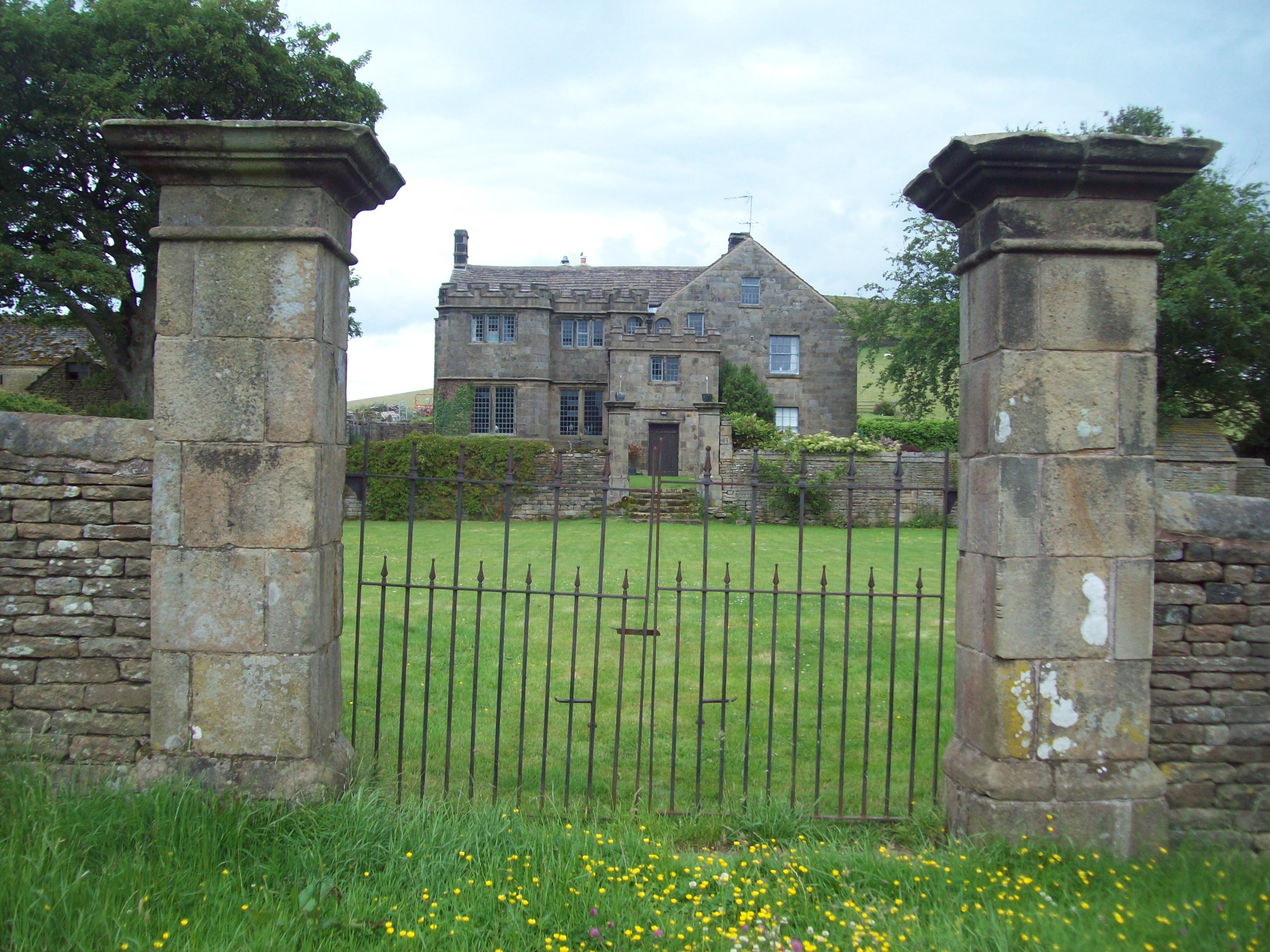
Highlow Hall

Highlow Hall is a historic Elizabethan manor house in Highlow civil parish, near Hathersage, Derbyshire, England. It was owned by the Eyre family from...

Nearby Amenities

Located within 500m of 53.310127,-1.654772
Leam
Place: locality
Source: OS_OpenData_StreetView
Wikidata: Q15058852
Lat/Long: 53.3106314/-1.6535866
Man Made: street_cabinet
Utility: water
Lat/Long: 53.3098962/-1.6539613
Watering Place
Lat/Long: 53.3099098/-1.6539773
The data included in this document is from www.openstreetmap.org. The data is made available under ODbL.

Have you been to Leam?

Leave your review of Leam below (or comments, questions and feedback).